Pageant in the Wilderness: Following in the Footsteps of Friars Dominguez & Escalante
Saturday – Monday, September 19-21, 2026 (August 27 – September 17, 1776)

The Domínguez–Escalante Expedition was a Spanish journey of exploration conducted in 1776 by two Franciscan priests, Atanasio Domínguez and Silvestre Vélez de Escalante, to find an overland route from Santa Fe, New Mexico, to their Roman Catholic mission in Monterey, on the coast of modern day central California. Domínguez, Vélez de Escalante, and Bernardo de Miera y Pacheco, acting as the expedition’s cartographer, traveled with ten men from Santa Fe through many unexplored portions of the American West, including present-day western Colorado, Utah, and northern Arizona. Along part of the journey, they were aided by three indigenous guides of the Timpanogos tribe (Ute people).
The land was harsh and unforgiving, and hardships encountered during travel forced the group to return to Santa Fe before reaching Las Californias. Maps and documentation produced by the expedition aided future travelers. Part of the Domínguez–Escalante route eventually became an early template for the Old Spanish Trail, a trade route from Santa Fe to Pacific Coast settlements.
This year marks the 250th anniversary of the 1776 Dominguez-Escalante Expedition through the southwest and I wanted to do a little something special to celebrate the semiquincentennial of this monumental undertaking in my own little way. Although I would have liked to have been able to follow in the footsteps of Dominguez & Escalante (D&E) for the entirety of their route through New Mexico, Colorado, Utah and Arizona, I just don’t have that kind of free time available to me right now and decided it would be nice to just concentrate on the section of their route that is closest to my home. I planned to pick up their route at the Uncompahgre River in Montrose and then follow in their footsteps as closely as I could over the Grand Mesa and Roan Plateau to the White River, and then finally to the Green River in the Uinta Basin in Utah. I figured that I should be able to cover this part of their route in a weekend, but still, even with this shorter route a weekend would probably be too short for me to see it all and I would be limited on the amount of hiking I would be able to do along the way, sticking mostly to roads that roughly follow their original route.
I was originally planning to start off on this journey after work on Friday, but with all the wet weather we have had in this area over the past week and with more storms predicted into Saturday I decided to take Monday off from work and push my trip back by a day. So instead I headed down to the San Juan Mountains for a high-country hike on Saturday morning and then started following the D&E Expedition route on Saturday afternoon when I drove back through Montrose.
Before I jump right into this Trip Report I wanted to share a few notes about the resources I used to plan the itinerary for this journey that helped me follow the D&E Expedition route as closely as I could at this time.
1. My main research for the route comes from The Route of the Dominguez-Escalante Expedition 1776-77 which was compiled by David Miller in 1976 for the bicentennial of the expedition. It can be downloaded from here:
2. I pulled out all of the relevant information about the segment of the trail I was interested in exploring and compiled it into this PDF document- just in case you are interested in following along. I highlighted all the important places and dates.
3. As far as I know, there are three different translations of the original journals, but the one that I used for the quotes in this Trip Report were taken from Itinerary and diary of Francisco Atanasio Domínguez and Francisco Silvestre Vélez de Escalante by Herbert Bolton in 1950. This translation can be found online here:
In the quotes I used throughout the Trip Report below I have added the current location names in parentheses in blue and have also removed any text from their journal entries that didn’t specifically pertain to their travel and locations to help keep this Trip Report from getting way too long!
4. I also reread Escalante’s Dream by David Roberts shortly before this trip for a refresher of his insight into the route and resources I would be using to plan the trip.
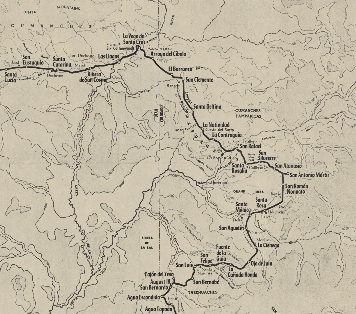
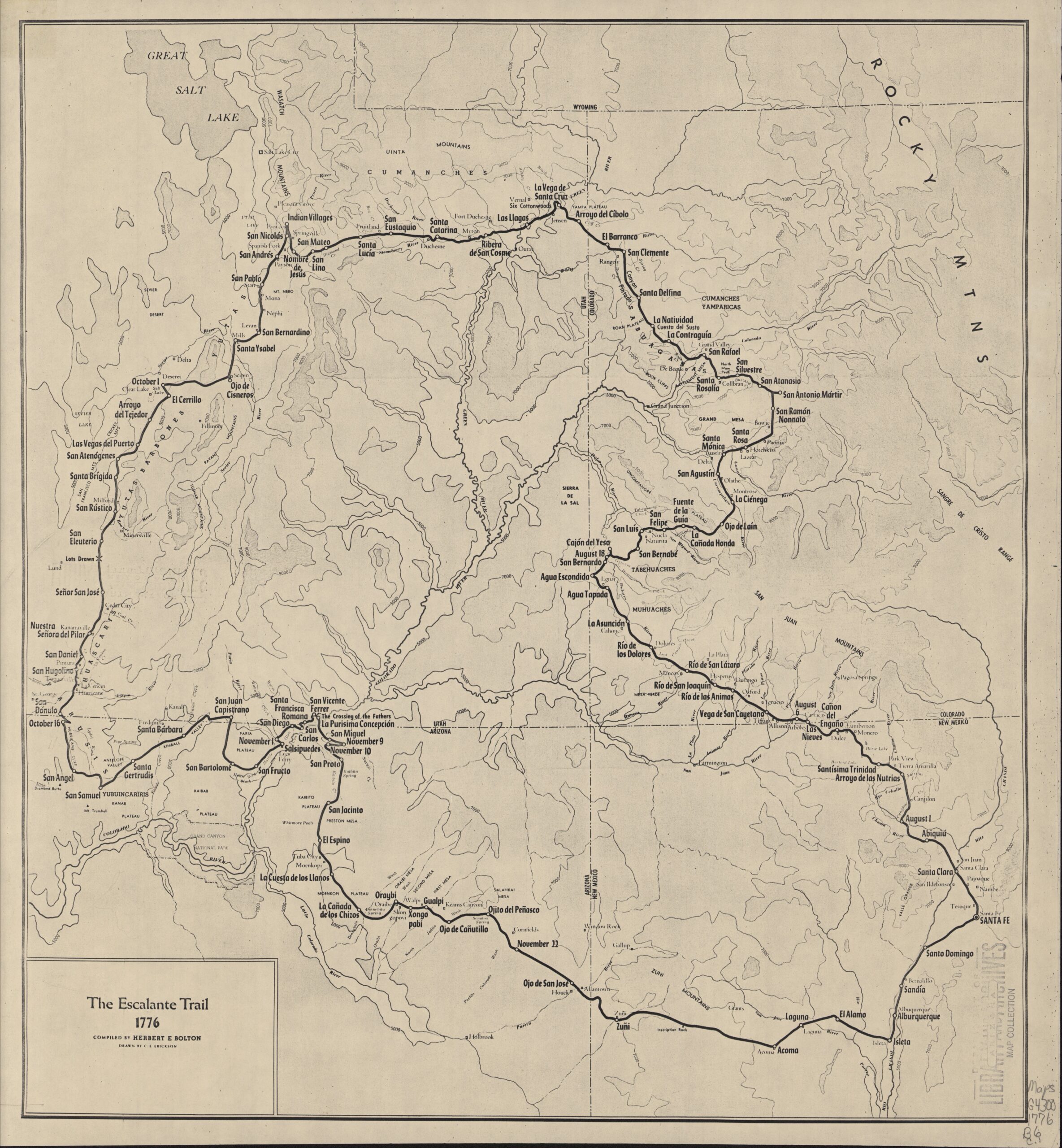
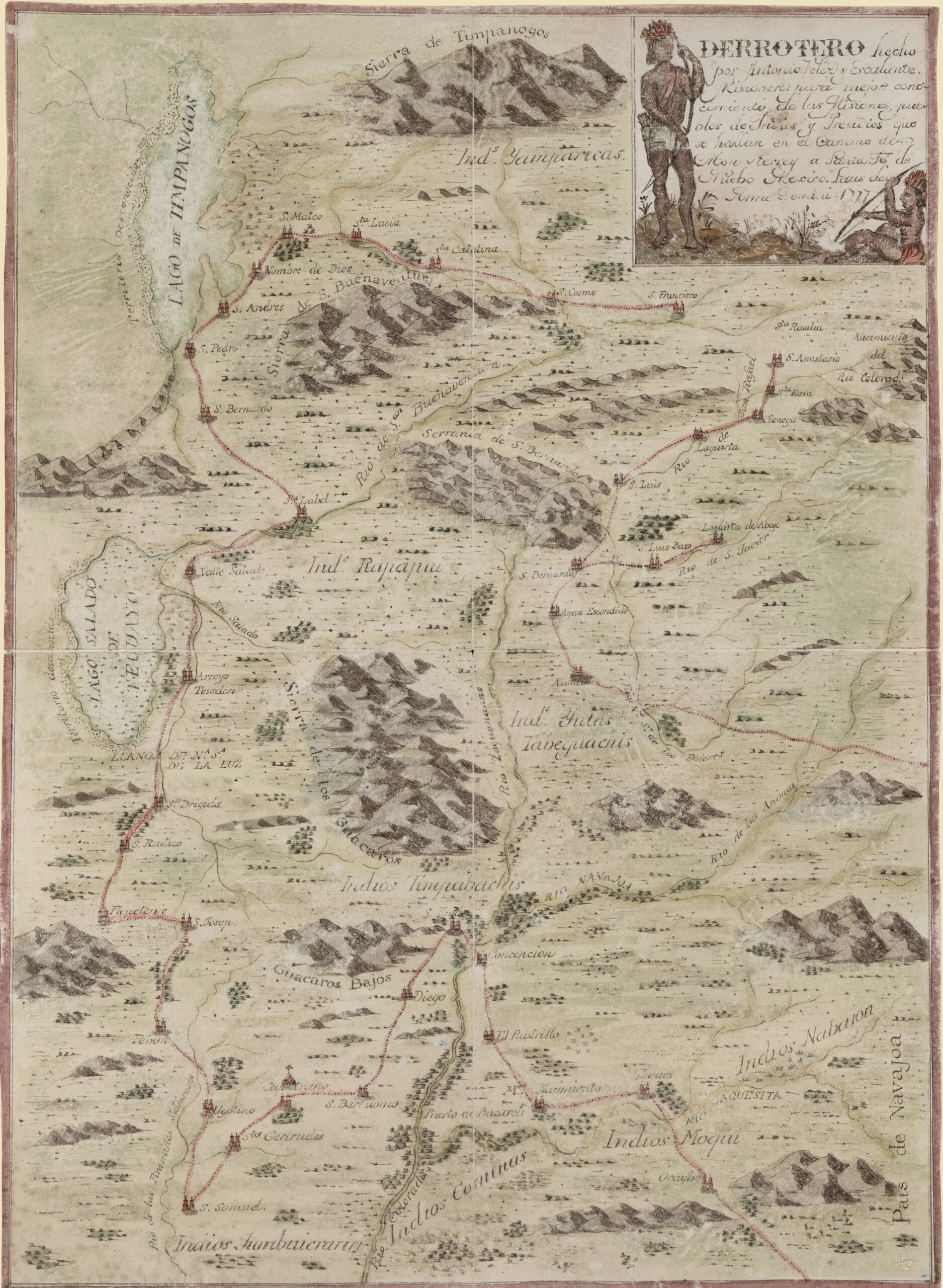
5. This cropped map of The Escalante Trail shows the section of the route that I intended to follow as closely as possible starting from their campsite of La Cienega and continuing to just past their campsite of Las Llagas. The expedition was traveling in a north-northwesterly direction.
Tracing the Route of the Dominguez – Escalante Expedition
From the Uncompahgre River to the Green River
August 27 – September 17, 1776
August 27. We set out from the La Cienega de San Francisco (Uncompahgre River in Montrose) downstream toward the northwest. We continued on our way along the meadow, and having traveled two leagues and a half to the northwest we crossed the river and traveled through the dense and shady grove of cottonwoods and other trees which grow on its banks. Then we ascended a small hill, entered a plain without pasturage but with some small stones, and having traveled downstream altogether three and a half leagues to the northwest we camped in another meadow of the same river which we called San Agustin (Uncompahgre River, two miles north of Olathe).
– Itinerary and diary of Francisco Atanasio Domínguez and Francisco Silvestre Vélez de Escalante
After leaving the San Juan Mountains on Saturday afternoon, I made my way over to the Uncompahgre River and followed it north to the first D&E campsite area that I was going to stop and visit which is right across the street from the Ute Indian Museum in Montrose.
At this location there is a group of four large monuments dedicated to the D&E Expedition.

Here’s a closer look at the carvings that are found on these monuments.


I walked down this boardwalk to the edge of the Uncompahgre River which is in the general area of their La Cienga campsite on August, 26 1776.

On August 27, 1776 the D&E Expedition left this campsite and followed the Uncompahgre River northwest towards Olathe.

I got back on the nearby highway and followed it northwest to Olathe and then continued on to Delta for a late lunch and fuel. Although D&E skipped the Delta area by crossing the badlands to to east of town, that’s mostly all private land these days, so I skipped trying to find a zig-zag route through that area and just followed the current highways around. Plus, there is a mural in Delta that celebrates the D&E Expedition, so I stopped for a quick photo.

August 28. We set out toward the north from the meadow of San Agustin (Uncompahgre River, two miles north of Olathe), leaving the Rio de San Francisco (Uncompahgre River) and having traveled half a league we continued three and a half leagues to the north-northeast, over land which was not stony and arrived at the already mentioned Rio de San Francisco Javier, otherwise known as Rio del Tomichi (Gunnison River). It carries as much water as the Rio del Norte (Rio Grande), runs west, and at the western point of the Sierra del Venado Alazán (Grand Mesa) forms a junction, as we have already said, with the San Francisco (Uncompahgre River). In a bend of the river in which we found some pasturage for the animals, and which we named Santa Monica (Austin, below Smiths Mountain).
– Itinerary and diary of Francisco Atanasio Domínguez and Francisco Silvestre Vélez de Escalante
After following Highway 92 to Austin, I crossed the Gunnison River and entered the Gunnison Gorge National Conservation Area so I could drive up to the top of Smiths Mountain and look down to their August 28, 1776 campsite area, which was most likely near the river at the bend seen below.

I didn’t stay up on Smiths Mountain for very long because there was a fast-moving storm coming my way and the road to the overlook was comprised mostly of clay and I didn’t want to get stuck up there! This photo not only shows the incoming storm, but is also a good overview of the terrain that the D&E Expedition would have travelled across to get here from Olathe.

While driving down from Smiths Mountain I had a nice view of the West Elk Mountains, which is the direction the D&E Expedition would be heading next.

August 30. This afternoon we set out from Santa Monica (Austin, below Smiths Mountain), crossed the Rio de San Javier (Gunnison River), in which the water reached above the shoulder blades of the horses, climbed a hill, and traveled over rough but loose soil without stones, upstream toward the east-northeast for two leagues. Then we went two more leagues to the northeast over land less broken but with some chamise, much small cactus and small volcanic stones, and camped on the bank of a little river which we called Santa Rosa (Leroux Creek near Hotchkiss). It rises in the Sierra del Venado Alazán (Grand Mesa), on whose southern slope we now were, and enters the Rio de San Javier (North Fork Gunnison River).
– Itinerary and diary of Francisco Atanasio Domínguez and Francisco Silvestre Vélez de Escalante
I made it back to the highway before the storm arrived and then continued east on Highway 92 toward Hotchkiss. Along the way I stopped at the D&E Expedition’s August 30, 1776 Santa Rosa campsite area alongside Leroux Creek. The North Fork Historical Society has placed a sign here right next to the road.

August 31. We set out from Rio de Santa Rosa de Lima (Leroux Creek near Hotchkiss) toward the northeast, traveled a league and a half through good country (North Fork Valley), and arrived at another medium-sized river which flows down from the same sierra as the previous one. We named this river Santa Monica, in whose meadows and bends there is everything necessary for the founding and subsistence of two settlements (Paonia). We continued upstream through these meadows and through the groves of trees which are in it, going four leagues and a half to the northeast, and crossing the river once. Then we swung north, again crossed the river, and entered a stony juniper grove which lasted for about three miles. Then we continued climbing the Sierra del Venado Alazán (Grand Mesa) along the slope of a very deep valley (Hubbard Creek), breaking through dense thickets of dwarf oak; and having traveled four leagues also to the north, we camped at a permanent watering place which we called San Ramón Nonnato (Hubbard Creek & Willow Creek).
– Itinerary and diary of Francisco Atanasio Domínguez and Francisco Silvestre Vélez de Escalante
After leaving Leroux Creek I drove through Hotchkiss and then followed Highway 133 to Paonia. Along the road there was another sign that was left by the North Fork Historical Society that states that they erected six markers along the route, but including this one I would only come across three of them.

Mount Lamborn and Landsend Peak dominated the view to the southeast as I drove through the North Fork Valley, which would have been the same for the D&E Expedition.

I took a side trip into Paonia so I could find another mural commemorating the D&E Expedition. As soon as I took this photo the storm caught up with me, the wind picked up and it started to rain heavily!

I left Paonia in the heavy rain and made my way to Bowie where I got off the main highway and followed the road to the mouth of Hubbard Creek. This is where I found the final sign erected by the North Fork Historical Society.

I was hoping to drive up the road into Hubbard Creek until it dead-ended, but even though the rain had ended by now, the road got narrow and muddy shortly after I took this photo, so I had to turn around this time. I will have to come back another time…

The road up Hubbard Creek does not go through any longer, so I was going to have to turn around and drive up onto the Grand Mesa via Stevens Gulch anyway, so that’s where I went to next.
September 1. We set out from San Ramón (Hubbard Creek & Willow Creek) toward the north, and having traveled three leagues through small valleys with abundant pasturage and thick groves of dwarf oak. We entered a very pretty valley (Cow Creek) in which there is a small river having all along its banks an extensive grove of very tall and straight royal pines. Through this valley we traveled a league to the east and arrived at the rancheria, which was populous and must have consisted of about thirty tents. We camped a mile below it on the bank of the river mentioned, naming the campsite San Antonio Mártir (Cow Creek & Fawn Creek).
– Itinerary and diary of Francisco Atanasio Domínguez and Francisco Silvestre Vélez de Escalante
There was a great view of Mount Gunnison as I drove up the Stevens Gulch Road to Hubbard Park, which is where I met back up with the D&E route again.

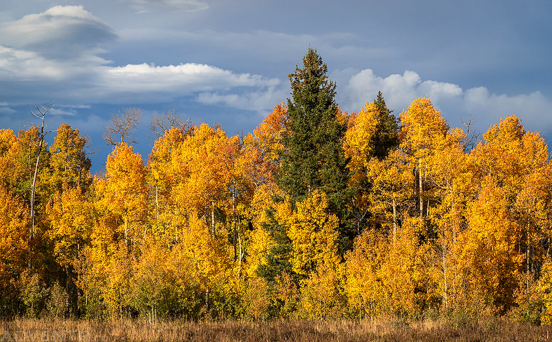
The fall colors were starting to look nice on top of the Grand Mesa.
September 2. Having gone back a league to the west from San Antonio (Cow Creek & Fawn Creek), we took another trail and traveled less than a league and three quarters to the northwest, then more than a quarter of a league to the west-northwest. We camped in a small valley with good pasturage near a little stream of good water which we named San Atanasio (Mule Park).
– Itinerary and diary of Francisco Atanasio Domínguez and Francisco Silvestre Vélez de Escalante
After roughly following the D&E route from Hubbard Park to Cow Creek, I turned left and followed the road to the Overland Reservoir where I hoped to get a view of the Chimney Rocks, which they would have passed below. The Chimney Rocks are barely visible just above the tops of the trees in this view.

I continued to the end of the road where I found the Overland Reservoir almost empty.

After returning to the main road I crossed over Dyke Creek and then looped around to Mule Park. There was a good view of The Raggeds to the east.

The road into Mule Park was a muddy mess, so I stopped at a highpoint and took this photo overlooking their September 2, 1776 campsite which was probably at the far end of this park.

September 3. About eleven o’clock, we set out from San Atanasio (Mule Park) toward the north. Having traveled a quarter of a league we turned northwest and went two and a quarter leagues through a valley with many groves of cottonwood and royal pine and an abundance of water and pasturage. We turned north-northwest for a league then northwest somewhat more than a league and three quarters, over good terrain without stones but with some hills, passing groves of royal pine, cottonwood and clumps of somewhat troublesome dwarf oak. We swung north-northwest a quarter of a league through a low valley (The Meadows – Vega Reservoir) in which runs as much water as two good-sized furrows would hold. Following the bed of an arroyo, we traveled northwest a league and a half and camped in the bed of the arroyo almost at the foot of a hill which the Yutas call Nabuncari (Campbell Mountain). We named the campsite San Silvestre.
– Itinerary and diary of Francisco Atanasio Domínguez and Francisco Silvestre Vélez de Escalante
From this point I would have to leave the main route again and cross over the Buzzard – Muddy Divide into the Buzzard Creek drainage.
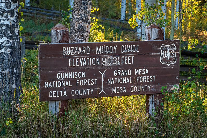
I was hoping to drive into Plateau Park to try and get closer to their route, but again I found a very muddy road and decided not to try it at this time. The storm this afternoon really messed up my plans on the Grand Mesa, so I guess I will have to come back another time to try again when the roads are dry. At this time it was starting to get late and I needed to stop home, so I called it a day and headed back home for the night. I would pick up the D&E Expedition route again in the morning at Vega State Park.
I stopped to take this one photo shortly before sunset as I followed the road off the Grand Mesa into Collbran and then drove home in the dark.

I was up early on Sunday morning and made my way over to the Vega Reservoir at sunrise so I could carry on with my journey. It is believed that the D&E Expedition camped along Plateau Creek just to the west of Campbell Mountain on September 3, 1776.

There was steam fog rising from the mostly-empty Vega Reservoir this morning.

The D&E Expedition would have crossed The Meadows on their way through the area, which are usually hidden beneath the waters of Vega Reservoir, but with it being such a dry year I was able to get a good view of them this time.

There is even a monument for the D&E Expedition near the Vega Reservoir Dam.

September 4. We set out from San Silvestre toward the northwest, following the same arroyo (Plateau Creek). After going a short distance we swung west-northwest, and having traveled two leagues we turned again to the northwest, climbed a low hill, leaving the bed of the arroyo toward the south, and through hills we traveled more than half a league. We descended to another small stream (Buzzard Creek) which enters the arroyo mentioned, crossed it, climbed another hill with some stones and a grove of piñon, and having traveled a quarter of a league almost west-southwest we again passed close to the arroyo. Then on the south side we traveled through a plain of chamise about three-fourths of a league west, and turned to cross the stream again in order to continue on the other side and leave it at the south. Having crossed it we turned west-northwest through a small grove of piñon trees and entered a chamise thicket. We continued on our way, and having traveled a league and a half to the west-northwest from the little river mentioned, we entered a valley or little glen with good pasturage. We turned northwest through the valley (Lugans Basin) for a little more than half a league, swung west-northwest, and having traveled another half league, climbing and descending a somewhat long hill, steep but not stony, we crossed a small stream of very cold water and camped on its bank. We named it and the little valley of good pastures here, Santa Rosalia (Jerry Gulch).
– Itinerary and diary of Francisco Atanasio Domínguez and Francisco Silvestre Vélez de Escalante
I followed the road along Plateau Creek as is descended to The Peninsula and then Collbran.

I continued on to Fuller Bridge and then turned off the highway and drove up onto Hayes Mesa at the foot of Battlement Mesa. While this road was mostly dry already, every wash crossing was very slick and muddy. Although I didn’t have any issues with the crossings, aside from having to move a few large rocks out of the way, my 4Runner got caked in mud which would cause me wheel balance issues at highways speeds for the remainder of the trip.
There was a good view across Lugans Basin to Castle Peak from the road. It is believed that the D&E Expedition crossed this basin, camped in Jerry Gulch and then crossed over the ridge to the east (right) of Castle Peak. I would need to continue around the west end of the ridge to get to the other side because there’s private property on both sides.

The D&E Expedition probably camped somewhere up Jerry Gulch and below Castle Peak on September 4, 1776.

September 5. We set out from Santa Rosalia (Jerry Gulch) toward the northwest, and ascended a hill (Battlement Mesa) without troublesome stones but extremely steep and dangerous to climb because there are turns where the trail is less than a third of a vara wide. The footing is of very loose soft earth, so it is very easy for an animal to slip, and if he should lose his footing he would not be able to stop until he reached the plain below. The ascent must be somewhat more than a quarter of a league counting the distance which we have already covered. We descended it by a long valley (Alkali Creek) which in some places produces nothing but dwarf oak and choke cherry and in other places spruce and white cottonwoods. Having traveled a little more than four leagues to the northwest we entered a little grove of juniper, swung half a league to the north-northwest, and after crossing a small chamise patch we arrived at a river which our people call San Rafael (Colorado River) and which the Yutas call Rio Colorado. We crossed it and halted on its north bank in a meadow with good pasturage and a fair-sized grove of cottonwoods. On this side there is a chain of high mesas (Roan Plateau), whose upper half is of white earth and the lower half evenly streaked with yellow, white, and not very dark colored red earth.
– Itinerary and diary of Francisco Atanasio Domínguez and Francisco Silvestre Vélez de Escalante
After making it around the western end of Horsethief Mountain I descended to De Beque and then followed a road along the southern side of the Colorado River to try to get as closed to Alkali Creek as I could. I followed the road up onto Samson Mesa where I had a good view of the cliffs of the Roan Plateau (chain of high mesas) on the other side.
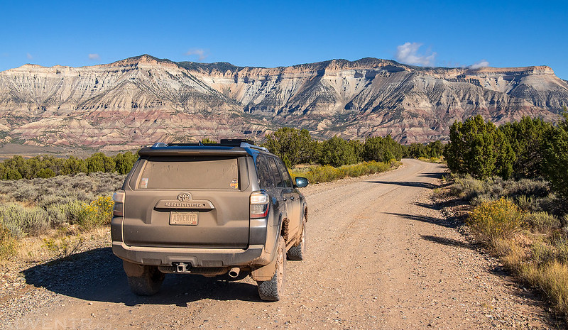
I walked to the edge of Samson Mesa and had a nice view over Alkali Creek to the Expedition’s September 5th campsite area, which was most likely near that grove of cottonwoods just above the center of this photo.

I returned to De Beque and then followed old Highway 50 northeast to Una and tried to get as close to the campsite area as I could, but I couldn’t get a view from the public roads. The D&E Expedition would have crossed the Colorado River somewhere downstream from here, possibly around the next bend.

September 6. We set out toward the west from the river and meadow of San Rafael (which lacks the facilities necessary for a settlement). We traveled downstream half a league, another half through some valleys toward the west-northwest, leaving the river to the south; northwest a quarter of a league and through ravines without stones for a league and a quarter west by west-northwest. To the west-northwest we went about a mile and then having gone nearly two more leagues west over broken ground with some stones and a great deal of small cactus, we descended to a small valley through which a little river of good water runs (Roan Creek). We continued to the west, and having traveled two leagues and crossed another and smaller river we camped on its bank, naming the campsite La Contraguía (Roan Creek & Brush Creek).
– Itinerary and diary of Francisco Atanasio Domínguez and Francisco Silvestre Vélez de Escalante
After leaving the Colorado River, I returned to De Beque again and then started following their route up Roan Creek. As soon as I passed the confluence with Brush Creek I encountered a few mudslides across the road, but they were nothing that stopped me. It is believe that the D&E Expedition camped near the mouth of Brush Creek of September 6, 1776, which would be down in those cottonwoods somewhere.

September 7. We set out from La Contraguia (Roan Creek & Brush Creek) through a wide valley, and having traveled in it a league to the west we came to a meadow with abundant pasturage. We turned to the northwest in the same valley (Carr Creek), and having traveled three leagues we halted for a time so the animals might drink. Afterward we continued in the same direction, and having gone a little more than a quarter of a league we swung to the north-northeast, climbing a grade that was so difficult that we were afraid we could not reach the top, because in addition to being very rugged in places there was not even a trail, and since the soil was very loose the animals could not put their feet down anywhere with safety. The ascent must be about half a league, and at the top there are some benches of very brittle shale where two pack mules lost their footing and rolled down more than twenty varas at the least. We climbed the mountain on foot, suffered much fatigue, and had some very great scares, for which reason we called it Cuesta del Susto (Brush Mountain). Having reached the top of the hill we traveled to the north-northwest half a league, descending into a small valley (Right Fork Lake Creek), and camped by a very scanty spring of water, where there was fair pasturage for the animals. We named the campsite La Natividad de Nuestra Señora.
– Itinerary and diary of Francisco Atanasio Domínguez and Francisco Silvestre Vélez de Escalante
I continued following the road up Roan Creek until I reached the mouth of Carr Creek.

I continued up Carr Creek to see how far I would be able to get today.

Unfortunately, just as the road started climbing out of the canyon it got narrower, muddier and slippery, so I thought it would be best to turn around today. I’m pretty sure there is no way through to East Douglas Creek, so I was probably going to have to turn around at some point anyway.

September 8. We set out from La Natividad de Nuestra Señora (Right Fork Lake Creek) toward the north, traveled half a league, crossing a permanent arroyo of good water, then ascending a hill which was rugged but without ledges or stones, we struck a trail and better terrain than that of yesterday. Having traveled two and a half leagues northwest through gently sloping hills and some cottonwood groves, we arrived at a high ridge (Razorback Ridge) from which the guide Silvestre pointed out to us the sierra (Cliff Ridge). We descended from the summit by an extremely long slope, rugged in places but without stones, and with many groves of dwarf oak and chokecherry, which served to prevent the horses from slipping and rolling. We entered a wide canyon with good terrain (East Douglas Creek), and having traveled a league to the north northwest, counting the descent from the summit, we descended by the same canyon to the north a league and a half, and halted in order that the animals might drink. In the afternoon we continued downstream through the canyon, and having traveled a league to the west-northwest we camped without water, because the arroyo has none, in a glade with good pasturage which we called Santa Delfina (East Douglas Creek).
– Itinerary and diary of Francisco Atanasio Domínguez and Francisco Silvestre Vélez de Escalante
At this point I was going to have to take the long way around to pick up the D&E route again. I returned to De Beque and then hopped on I-70 to get back to the Grand Valley. I stopped for a quick lunch in Fruita and then followed the highway over Douglas Pass into the Douglas Creek drainage on the other side. I picked up the D&E route again when I reached the mouth of East Douglas Creek, but I decided to skip driving up that canyon today since I wanted to give it another day for the roads to dry out. On Monday afternoon when I was making my way back home I did drive up East Douglas Creek to see how much of the D&E route I would be able to follow.
I followed a narrow two-track up an long slope but was turned around by a dead end at private property. Perhaps this is the extremely long slope that the D&E Expedition descended into East Douglas Creek? Even if it’s not the exact same slope, the views of the Cathedral Bluffs would probably be similar to what they saw on their journey.
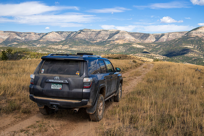
There was a good view into East Douglas Creek from the ridge. I ended up trying two more routes to try to reach the Expedition’s September 7th campsite area in the Right Fork of Lake Creek, but was stopped by locked gates on both of them.
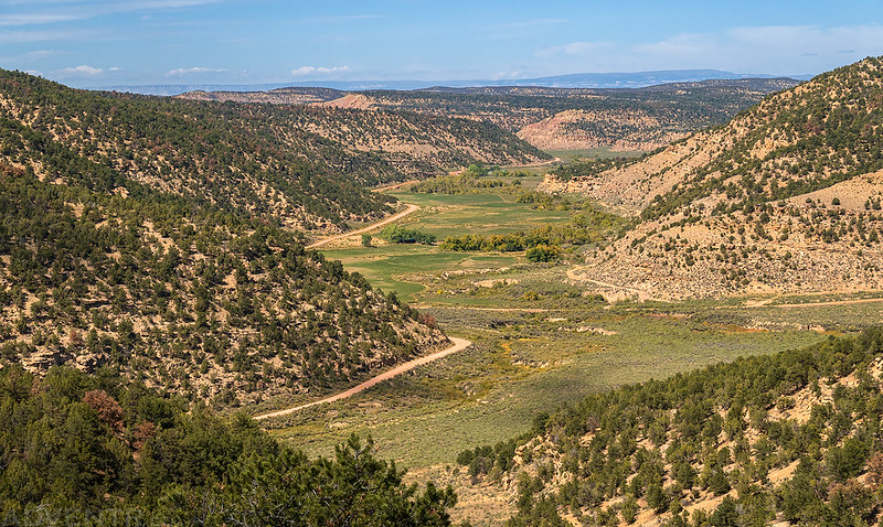
As I drove back down East Douglas Creek I passed through the area they would have camped in on September 8, 1776.

September 9. We set out from the campsite of Santa Delfina (East Douglas Creek) down the same canyon, went half a league northwest, then swung north-northwest. Having traveled in the canyon nine leagues in all in this direction, over a very well beaten trail with only one bad stretch which can be avoided by crossing the arroyo a little sooner. Halfway down this canyon (Douglas Creek) toward the south there is a very high cliff on which we saw crudely painted three shields and the blade of a lance (East Fourmile Draw). Farther down on the north side we saw another painting which crudely represented two men fighting. For this reason we called this valley Cañon Pintado (Canyon Pintado National Historic District). It is the only way by which one can go from the summit mentioned to the nearest river, because the rest of the intervening country is very broken and stony. Having crossed the canyon we traveled half a league to the north-northwest, arrived at a river which we called San Clemente (White River), crossed it and camped on its north bank where there is a fair-sized meadow of good pasturage. This river is medium-sized, along here runs to the west, and the region adjacent to it does not have advantages for settlement (Rangely).
– Itinerary and diary of Francisco Atanasio Domínguez and Francisco Silvestre Vélez de Escalante
Here’s a view looking back up the road into East Douglas Creek as I returned to the Cañon Pintado National Historic District along Douglas Creek.

I stopped to visit the pictographs at the Kokopelli Site which is right next to the road. Although these pictographs do not match up with the location mentioned in the journal, I just can’t imagine that someone in their party didn’t see them as they passed by since it’s such a prominent site!

There’s a sign about the D&E Expedition right below the pictographs.

A little further down the road I stopped to photograph the pictographs that are believed to be the ones that Escalante wrote about in his journal. I wonder how much more vibrant this site was 250 years ago, since they are getting pretty hard to see these days?

I ran the photo through Dstretch to help bring out the images a little better.
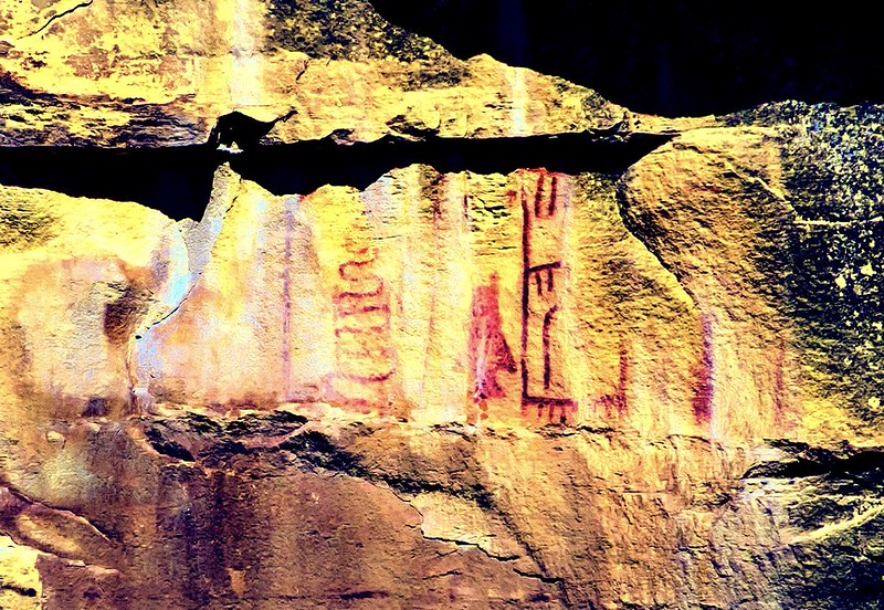
Near these two hoodoos is another pictograph site that Escalante might have mentioned in his journal.

It is believed that these could be the ‘two men fighting’ pictographs.

When I left Douglas Creek and reached Rangely I stopped to visit another D&E Expedition monument near their September 9th crossing of the White River and campsite. Right across the street from this monument is the Rangely Outdoor Museum which is currently supposed to have an exhibit about the D&E Expedition, but unfortunately it was closed when I arrived.
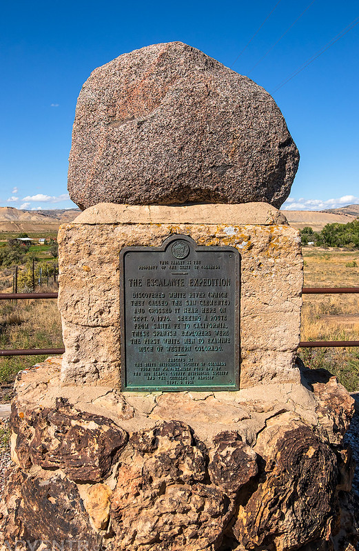
I crossed the White River a little further downstream from the D&E crossing and then drove as close as I could get to their campsite, but there was not a good view from the end of the public road.

September 10. Because the guide declared the next watering place was far distant, and that even if we started early we could not reach it today, we decided to split the journey. And so, after noon we set out from Rio de San Clemente (Rangely) toward the northwest, over hills without stones and small plains without pasturage or trees and of very loose earth (Coal Oil Basin), and having traveled a league we swung west-northwest for two leagues, over terrain almost level but with many dry arroyos and ravines. Because night was now coming on, and in the darkness the terrain was impassable and dangerous, we camped in the bed of an arroyo which we called El Barranco (Stinking Water Creek).
– Itinerary and diary of Francisco Atanasio Domínguez and Francisco Silvestre Vélez de Escalante
After leaving Rangely I entered Coal Oil Basin and turned off onto the Blue Mountain Road which follows Stinking Water Creek.

It is believed that their campsite on September 10th was most likely near Stinking Water Creek, which is right in the heart of the Rangely Oil Field these days.

September 11. As soon as it was daylight we set out from El Barranco (Stinking Water Creek) toward the west-northwest, and having traveled a league and a half through arroyos and ravines, some of them deeper than those of yesterday. We continued west-northwest for a league, climbing to a ridge by a good and not very high ascent (Mellen Hill), and from it traveled three leagues over good country with fair pasturage (Dripping Rock Creek). In the distance we saw a cottonwood grove and asked Silvestre if the watering place to which he was leading us was there. He said “No,” that this was an arroyo, not a river, but that it might have water now. Thereupon we went toward it and found plenty of running water for ourselves and for the animals, which were now very much fatigued from thirst and hunger. To reach the arroyo (Cottonwood Creek) we swung half a league to the north.
– Itinerary and diary of Francisco Atanasio Domínguez and Francisco Silvestre Vélez de Escalante
From Stinking Water Creek I followed a maze of roads across the oil field to the highway and then headed northwest to the pass between Raven Ridge and Mellen Hill, which is likely the ridge the D&E Expedition climbed up to. Then the highway follows Dripping Rock Creek to Dinosaur which is most likely the route the D&E Expedition roughly followed, too.
On my way home on Monday afternoon I drove up to the top of Mellen Hill to take in the views of the landscape that the D&E Expedition would have crossed between Stinking Water Creek and Mellen Hill.

After driving through Dinosaur, I turned left on US 40 and followed the highway to the State line where I turned right and followed a dirt road toward the K Ranch along Cottonwood Creek, which is probably where the D&E Expedition spent the night on September 11th. I stopped at the gate and turned around. There was a better view of the campsite location from the shoulder of the highway where it crosses the Snake John Reef.

September 13. About eleven o’clock in the morning we set out from Arroyo del Cíbolo (Cottonwood Creek) through the plain which lies at the foot of a small sierra which the Yutas and Lagunas call Sabuagari (Cliff Ridge). It extends from east to west and its white cliffs can be seen from the high hills which are reached before Cañon Pintado. Having traveled two leagues and three-quarters to the west, we arrived at the watering place known to the guide. It is a small spring at the foot of the sierra, almost at its western extremity. We continued in the same direction for a quarter of a league along a well beaten trail near which, toward the south, rise two large springs of fine water, a musket shot apart, which we named Las Fuentes de Santa Clara (Musket Shot Springs). From here we traveled a league northwest over the same trail and crossed an arroyo (Cliff Creek) which comes from the plain of Las Fuentes, and in which there were large pools of water. From here downstream there is much good pasturage in its bed, which is wide and level. We again crossed the arroyo, ascended some low hills which were stony in places, and after traveling two leagues to the northwest we arrived at a large river which we called San Buenaventura (Green River).
– Itinerary and diary of Francisco Atanasio Domínguez and Francisco Silvestre Vélez de Escalante
My next stop was at the Musket Shot Springs Overlook where there is a good overview of the terrain that the D&E Expedition would have crossed as they followed Cliff Creek below the Cliff Ridge.

There’s a sign at the overlook that explains why this spot is called Musket Shot Springs.

The route the D&E Expedition followed next was down Cliff Creek. It was starting to get late and I wanted to make it to the Green River before sunset, so I skipped driving that part of the route since I have explored Cliff Creek into the narrows before.

I did return Monday on my way back home and drove up to an overlook above the Cliff Creek Narrows so I could get an overview of their route through this area.

I continued on along US 40 to the Green River, but turned off onto the Escalante Ranch Road and headed north to see how close I could get to their next campsite. There’s a lot of private property in this area, so the fenceline at the edge of this ranch was as close as I was going to get from this side.

I returned to Jensen and then followed the river on the other side for a better look at their September 13th campsite, which was probably near those cottonwoods on the other side of the Green River.

September 16. We set out from the Vega de Santa Cruz on Rio de San Buenaventura (Green River), ascended about a mile toward the north, arrived at the ford, and crossed the river. Then we turned west, and having traveled a league along the north bank and meadow of the river, we crossed another small stream (Brush Creek) which comes down from the northwest and entered it by the same meadow. We swung south-southwest for a league and crossed another small stream (Ashley Creek), a little larger than the first, which descends from the same northwesterly direction and enters the river. We continued to the southwest leaving the river which swings to the south through some hills and ravines which were stony in places. We descended to a dry arroyo by a high and very stony ridge (Asphalt Ridge), whose slope on the other side is not so bad. As soon as we reached the top (Collier Pass) we found a trail, one or two days old, of about a dozen horses and some people on foot. We continued here along the same trail, descended again to the Rio de San Buenaventura (Green River). We continued on the trail through the meadow, crossed some low hills, and camped in another meadow with good pasturage on the bank of the river, naming the campsite Las Llagas de Nuestro Padre San Francisco (Collier Hole).
– Itinerary and diary of Francisco Atanasio Domínguez and Francisco Silvestre Vélez de Escalante
I followed the road a little further and entered Dinosaur National Monument so I could visit the Old Ute Crossing where they would have crossed the Green River.

Shortly before sunset I drove up onto the Sunshine Bench, which the D&E Expedition most likely crossed when they were between Brush Creek and Ashley Creek.

There was a road that I could have taken down from the Sunshine Bench to Ashley Creek, but I could see that there was big muddy area at the bottom, so I decided not to test my luck. I did drive around and then followed Ashley Creek to where the road would have taken me, and was glad I had not tried going that way because I certainly would have gotten stuck!

After my drive along the Ashley Creek it was time to call it a day. I drove over to Vernal for dinner and gas and then tried washing the mud off of my wheels to help with the balance issues I had been having. It helped a little bit, but I wasn’t able to get all the mud out. Then I headed back up onto the Sunshine Bench in the dark and found a place to spend the night. I had gone all the way from Vega Reservoir to Vernal today- it was a long, but very productive day!
On Monday morning I was up early as I drove across the Ashley Valley to Asphalt Ridge and then followed a rough track up to Collier Pass, which is where the D&E Expedition most likely crossed on September 16, 1776. I arrived at dawn and watched the sunrise while looking down Collier Draw, which is probably the route they followed next to reach the Green River again.

Watching the sunrise at Collier Pass.

Asphalt Ridge Morning

Since there is no road down Collier Draw, I returned the way I had come and followed the highway around to the Green River.

Asphalt Ridge

September 17. We set out from the meadow of Las Llagas de Nuestro Padre San Francisco (Collier Hole) toward the southwest, ascended some low hills, and having traveled a league, we left the trail we were following. We crossed a dry arroyo, ascended a hill, and having traveled a league and a half to the west over good terrain, dry and almost level, we came to a high ridge (Silvestre Overlook) from which the guide pointed out to us the junction of the rivers San Clemente (White River) and San Buenaventura (Green River) which, now joined, ran south from this place.
– Itinerary and diary of Francisco Atanasio Domínguez and Francisco Silvestre Vélez de Escalante
When I reached the Green River I stayed on the north side and followed a gravel road to their next campsite area near Collier Hole. While I was here, I took the opportunity to drive out onto Horseshoe Bend. Although the D&E Expedition probably never made their way onto Horseshoe Bend, it is possible they saw part of it from above. Plus, these views of the Green River would have been similar to what they might have seen at camp.
It was a nice calm morning next to the Green River.

Green River Reflection

Following the Horseshoe Bend Road back to Collier Hole. Back in 1776 these cliffs would have prevented travel this way to Horseshoe Bend.

From Collier Hole I followed a road west that would meet up with the Green River. Wherever this road followed or crossed the wash, it was very rough with washouts from the recent storms. Thankfully I was always able to find a way though.

Like I mentioned above, it seems that many roads in the Uinta Basin have taken a beating from recent storms! What you can’t see in this photo is that there is another washout like this on the other side of my 4Runner, too!

After crossing more oil fields and ranch lands, I eventually reached the Silvestre Overlook, which may be the place that their Ute guide pointed out the confluence of the White River and Green River. Although this location doesn’t seem to appear on many maps, it is an official USGS named location.

I thought it would be fitting to end my journey at the Silvestre Overlook since it gave me a nice overview of the next leg of the D&E Expedition route which travels through an area of Utah that I am less familiar with. Even though the fast-moving storm on Saturday afternoon prevented me from getting everywhere I that I wanted to on this journey, I still managed to get to most of the places I wanted to and had a great time trying to follow this segment of the 1776 Dominguez & Escalante Expedition route!
Thanks for sharing this amazing journey with us! Enjoyed it so much. Tom McC, McQueeney, Texas
Thanks Tom! Glad you enjoyed it!
Very cool, I love these sorts of historical trips. One of my buddies once planned out a trip along a segment of the route that Lewis and Clark travelled as they worked their way west, and it was a blast.
Thank you – really love this.