Saturday & Sunday, February 21-22, 2026
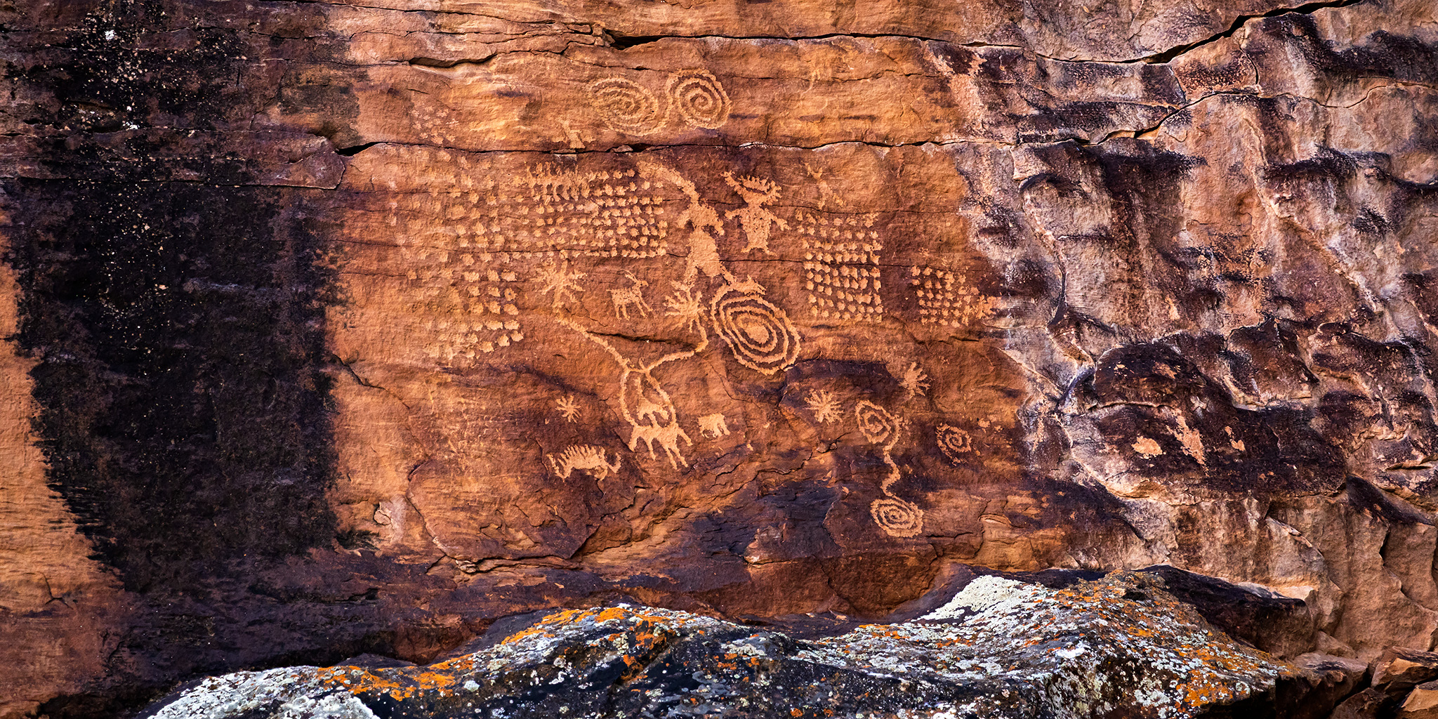
Diane is very glad to almost be done with her Radiation Therapy, and she only has four treatments left this upcoming week, so we were looking for somewhere to get outside this weekend while still being able to take it easy. We decided that searching for rock art in Nine Mile Canyon would be a perfect activity for us and headed up there for our annual pilgrimage. We had actually been thinking about driving up to Nine Mile Canyon the previous weekend for my birthday, but I ended up staying home to work on my 4Runner so that it would be ready for a trip into The Maze later this month. We left home early on Saturday morning and spent the rest of the weekend revisiting sites in the canyon and finding some new ones along the way, too. Although it had snowed in the Grand Valley and all across Southern Utah on Friday, the storm seemed to have mostly missed Price and the surrounding area, so there was only a thin layer of snow on the ground higher up in the canyon and it was pretty dry the lower we went. These are some photos of what we saw this weekend.
1 Comment