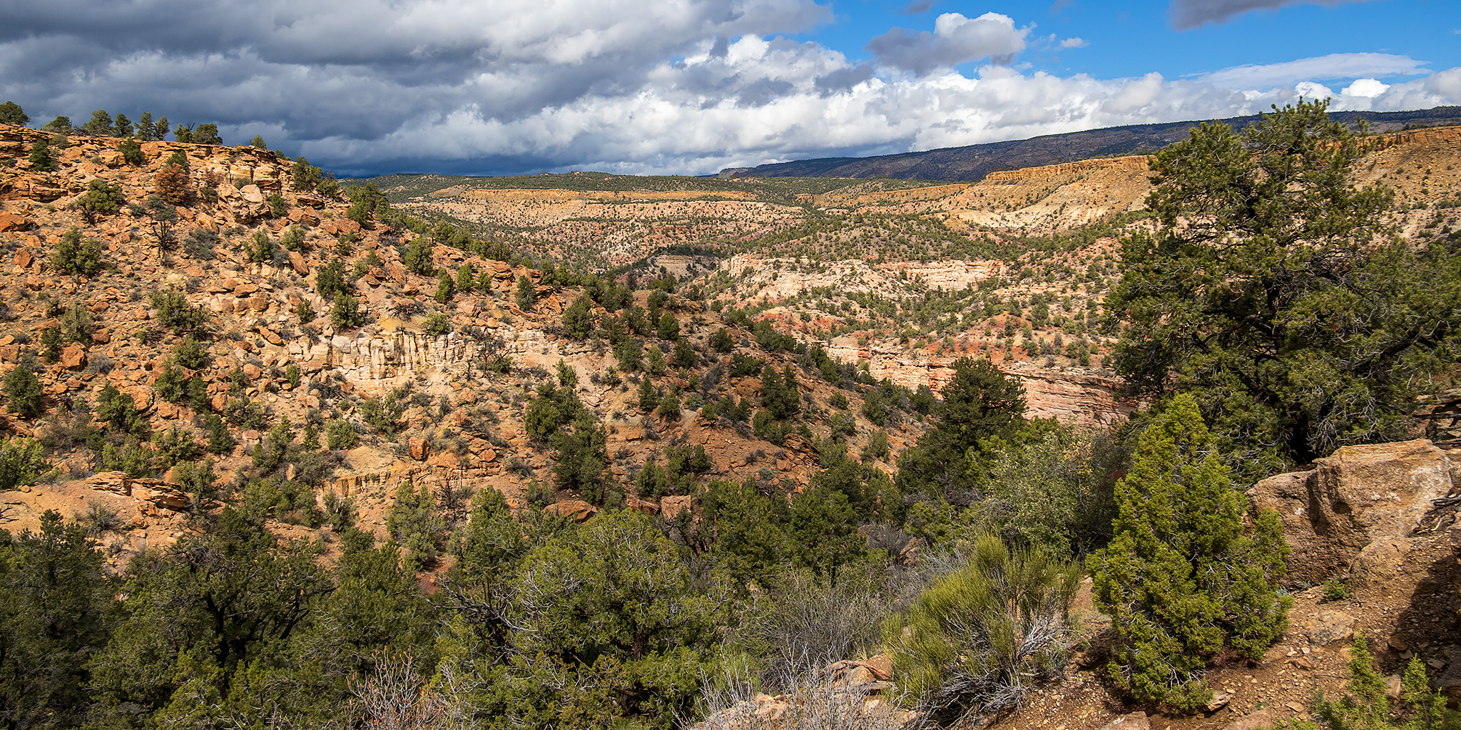
Canyons of the Escalante | Saturday – Monday, October 10-12, 2026
After spending most of the day exploring the interesting sandstone of Concretion Wash on Saturday, the remnants of Tropical Storm Rachel finally arrived and the weather forecast was calling for quite a bit of rain to fall across the landscape over the next few days. We decided that it would probably not be a good idea to drive out to the end of the Hole-in-the-Rock Road until the storm passed, so now we would need to spend the next few days trying to avoid the rain by finding shorter hikes that are closer to good all-weather roads and not located in narrow canyons where flash-flooding is possible. Over the course of the next two days we would stay closer to town and hike a few new trails and routes while also revisiting some places that we hadn’t been back to in quite some time.
After having an early dinner at Escalante Outfitters on Saturday afternoon, the rain stopped for a while so we drove over to Big Flat and followed the rim out to an overlook of the Escalante River Canyon.
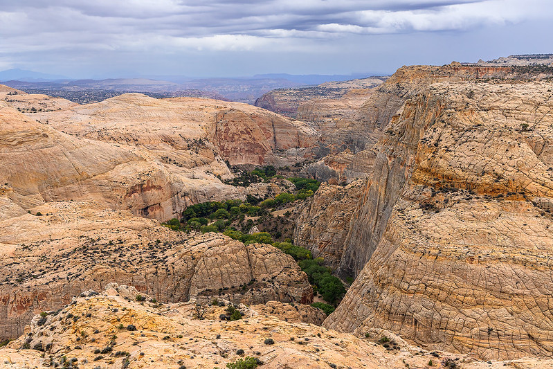
As we followed the rim we spotted this tall and narrow waterfall on the other side of the canyon.
From the end of the trail we could look upstream into the lower end of Death Hollow.

Following the trail back along the rim of the canyon.

Surprisingly, when we returned to our campsite along the Hole-in-the-Rock Road later in the evening it was actually kind of nice out and not raining, so we were able to sit outside for a little while until the next storm arrived. Then we went to bed early after it got dark out. I slept well overnight and it sounded like it had rained quite a bit overnight, which was expected.
With rain in the forecast for all day on Sunday we decided to head over to Kiva Koffeehouse for breakfast while we figured out what to do to try to avoid the rain. After breakfast we decided to continue a short distance down the highway to the Escalante River so we could revisit some popular rock art sites that neither of us had been back to in a long time. Luckily, the rain actually held off the entire time we were there!
Attempted Theft

Two Sheep

Hundred Handprints

The sun even briefly came out and lit up the rim of the canyon a little.

The Hunter Panel
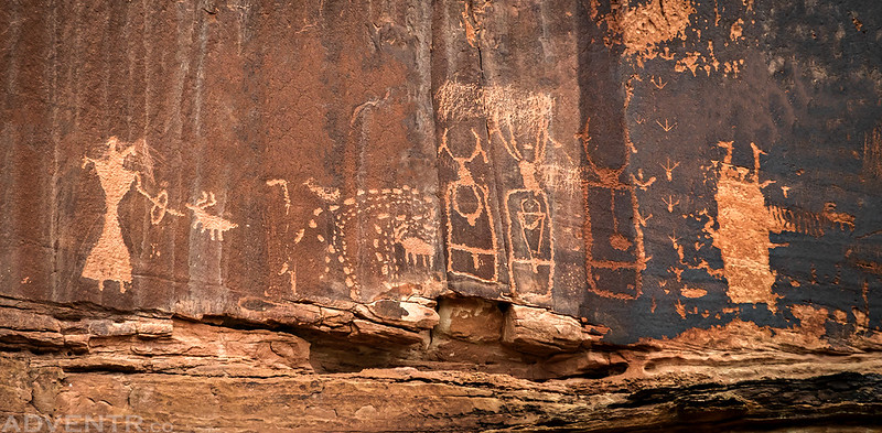
Faint Fremont Figure

Little Faint Pictograph

Alcove Carvings

Although it’s hard to see, I remember searching for this snake petroglyph back in 2011 and not finding it then, so I was happy to finally come across it this time.

After our visit to the rock art sites along the Escalante River, it still wasn’t raining yet but we knew a storm was headed our way, so we decided to try to find the old Cream Cellar Road which was built to haul cream out of the Escalante River pasture bottom. Apparently, the road was so rough that the cream in the crocks would churn to butter along the way.
We had no trouble finding the start of the Cream Cellar Road where it begins its descent from the edge of Big Flat.
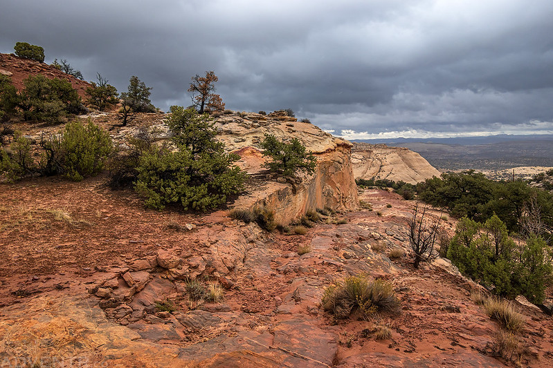
Cream Cellar Road

Even though this historic road is not very far from the current Highway 12 near Head of the Rocks, you can’t really see the highway from the old road cut and vice versa.
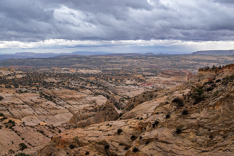
Old road construction for drainage.

We turned around below this point where the old road entered a more sandy area.

Just as we started hiking back up the Cream Cellar Road the storm arrived and it started to rain pretty hard. We got soaked on our way back up to the top!

The rain stopped shortly before we returned to our vehicles at the top of the historic road, so we decided to head over to Escalante Forest State Park to see if we could hike the two trails in the park before the next round of rain arrived.
Welcome to Escalante Petrified Forest State Park.

The sun came out again as we followed the Petrified Forest Trail onto the mesa.

Petrified Logs In A Wash

Black Hills

A view across the mesa top top Griffin Point.

There was some nice colorful petrified wood along the trail, but this small park pales in comparison to Petrified Forest National Park.

We followed the Trail of the Sleeping Rainbows down towards Baileys Wash.
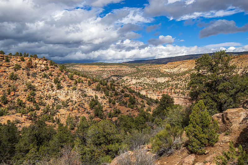
Baileys Wash seemed to be flowing pretty good from the recent rain.

Petrified Log

We followed the loop trail back to the rim and then descended to the trailhead below.

Another storm arrived just as we returned to the trailhead which was great timing, so we went and sat under the nearby shelter out of the rain while we decided what to do for dinner. After dinner in Escalante we returned to the same campsite along the Hole-in-the-Rock Road for another night.
We were hoping that the storms might finally be over when we noticed that we could see lots of stars in the sky overnight, but after getting up in the morning we checked the forecast and saw there was another full day of rain ahead of us. Before the next round of storms arrived we drove a little further down the Hole-in-the-Rock Road to squeeze in a hike around the Devils Garden, which I hadn’t been back to in a long time.
Metate Arch

Wash Spire

Devils Garden Wash

Devils Garden Hoodoos
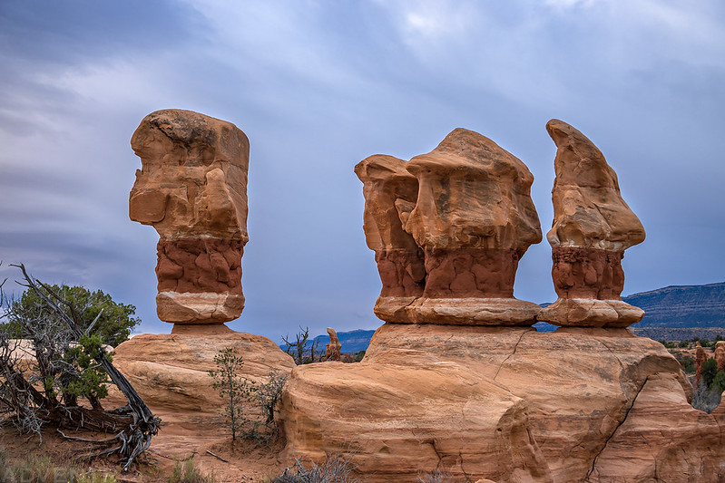
It was nice to wander around the place by ourselves for a while, but it would have been ever nicer with some better light.

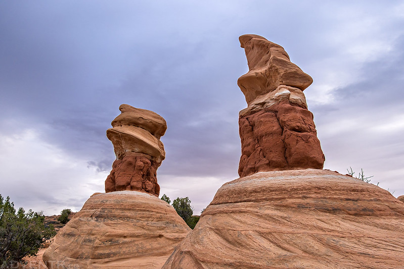
The rain returned as we finished our wander around Devils Garden and then we returned to Escalante for breakfast and to figure out the rest of our day. We decided to make our way over to Anasazi State Park in Boulder to get out of the rain for a bit, but stopped on the Haymaker Bench for a short hike down to Boulder Creek first.
All the potholes along the wash we followed to Boulder Creek were full to the brim.

The wash ended at this overlook of a bend in Boulder Creek.

There were some red handprint on the wall on the other side of the creek, but it was too fast and high to cross today.
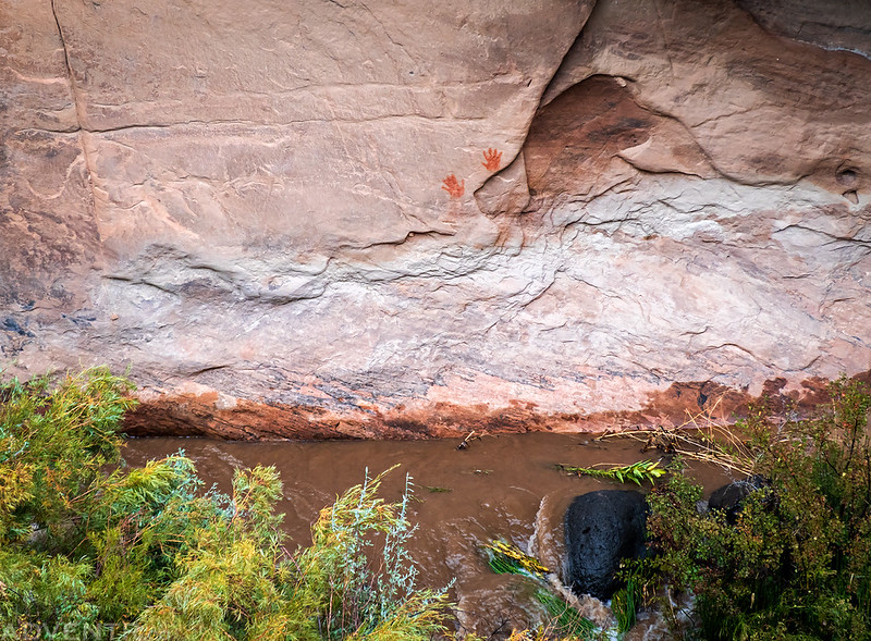
After making it to Boulder we spent some time wandering around the museum at Anasazi State Park, which was the busiest I have ever seen this place! I guess the rain chased everyone else there, too. Before leaving town we had an early dinner at the Burr Trail Grill and then made our way over to the Calf Creek Recreation Area so we could get in a short hike during another break in the rain.
Calf Creek Overlook

We were too early for fall colors in this area, but there were a few nice cottonwoods displaying their colors already.

Calf Creek Canyon

Before returning to Escalante for dinner we made one last stop of revisit a nice rock art panel that we hadn’t been back to in about twelve years. Neither of us actually remembered exactly where the site was, but we had an idea about the general location. I guess I wasn’t as good about keeping track of sites back then as I am now. We didn’t have too much trouble finding the site again.
Barrier Canyon Style Pictographs

Here’s a closer look at the hand and tracks petroglyphs.

These pictographs are found just to the left of the previous panel.

Black Anthropomorph

Fingerprint Anthropomorph
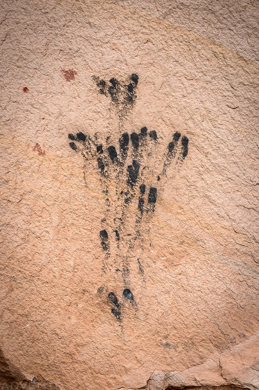
Granary

Faded Petroglyphs

This is one of my favorite pictographs in the area, so I was glad to finally revisit it.

I was really hoping that we would finally be able to drive down the Hole-in-the-Rock Road on Tuesday and then spend the rest of the week down there, so I thought it would be nice to get a hotel room in Escalante for one night to dry off, so we skipped camping this evening.
>> Avoiding Rain Around the Canyons of the Escalante Photo Gallery
Making the most out of a rainy day!
We tried our best!