
Splitting the Tavaputs Plateau in Two: Sand Wash to Swaseys Beach
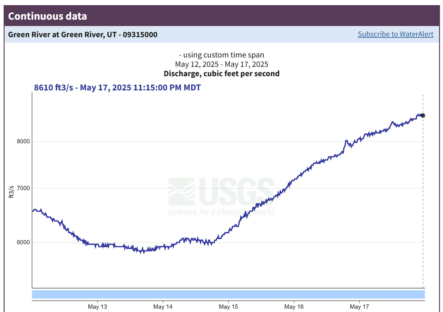
Sunday – Saturday, May 11-17, 2025 | Average CFS: 6,665
After dinner we pass through a region of the wildest desolation. The canyon is very tortuous, the river very rapid, and many lateral canyons enter on either side. We are minded to call this the Canyon of Desolation.
Major John Wesley Powell,
July 8, 1869
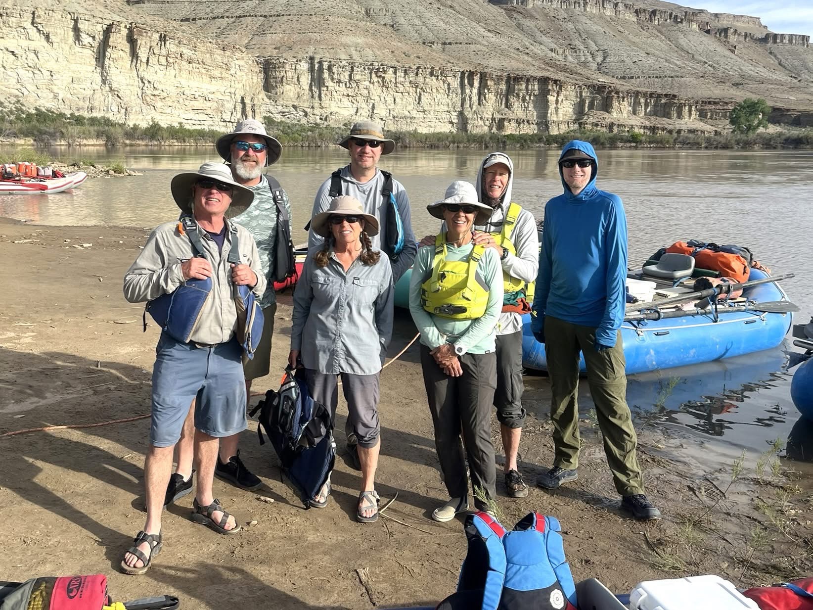
After getting permits for Yampa Canyon and the Canyon of Lodore over the past two years, Jackson’s and my main goal for this year was to try and get a Spring Low-Use Season permit for the Green River through Desolation Canyon and Gray Canyon as we continue to work our way through more sections of the Colorado River and Green River across the Colorado Plateau. Although Jackson and I have still have never actually won a permit in any of the lotteries we have entered over the years we have been lucky enough to grab permits and cancellations during the general releases after the fact, and this time I managed to get us a permit for Desolation Canyon back in mid-March. Once we had the permit we quickly got started on the planning process since the launch date was only about two months away, but we quickly found out that many of our usual river friends were unable to make the trip this spring. Luckily, our friends Bob and Lisa were able to go and they had a few other friends that they were able to invite on the trip with us, two of whom were very familiar with Desolation Canyon and were a great addition to the trip! In the end I enjoyed rafting with everyone who was on this trip and would invite every single one of them back in a heartbeat!
Our main goal when initially trying to pick the dates for this trip was to try to catch the Green River while it was on it’s way up during the Spring runoff and before it started dropping so we would have a little extra current in the flatwater sections and hopefully no mosquitoes. I think we managed to time it just about right this year and we didn’t see a single mosquito during the entire trip!
After hiking to the bottom of the Black Canyon of the Gunnison on Saturday morning, I returned home and loaded up my Jeep with all my river gear so I could pick up Jackson around noon on Sunday afternoon and we could start our drive over to Sand Wash. After grabbing a quick dinner in Vernal we left the highway just past Myton and made our way south towards the Little Desert. Along the way we saw a busted up trailer for a raft along the gravel road and would later learn that the trailer belonged to Lee and Patty who were part of our group. Luckily, they had been travelling with Bob and Lisa and were able to stack their raft on top to get it to Sand Wash.
We arrived at Sand Wash on Sunday afternoon just in time for me to help Bob and Lisa plug a flat tire on their van. The last time I was at Sand Wash was almost 18 years ago and back then I had no idea what rafting even was…

Two of our group’s rafts at the Sand Wash Boat Ramp shortly before sunset.

Sand Wash Evening Light

I was up just in time to watch the first light of the day strike the high cliffs surrounding Sand Wash on Monday morning.

Before I continued to rig my inflatable kayak, I wandered around the campsites to check out the old cabins that were built by Hank Stewart when he operated a ferry at this site.


The sunrise light on the Little Desert cliffs was very nice this morning.

Green River Morning Reflection

Desolation Canyon was added to the National Register of Historic Places in 1969.

Welcome to Sand Wash. Most of the pertinent information can be found here.

Jackson and I had spent the night on the floor of the Bradley Screen Cabin. Even though it was not really necessary this time, at least we didn’t need to set up a tent.

All our rafts, inflatable kayaks and a whitewater canoe are ready for the voyage through Desolation and Gray Canyons.

Ranger Dennis took a group photo after our orientation talk just before we set off down the canyon.
Down the river we go…

We find quiet water to-day, the river sweeping in great and beautiful curves, the canyon walls steadily increasing in altitude. The escarpments formed by the cut edges of the rock are often vertical, sometimes terraced, and in some places the treads of the terraces are sloping. In these quiet curves vast amphitheaters are formed, now in vertical rocks, now in steps.
Major John Wesley Powell,
July 7, 1869


We made about 15 miles on our first day after paddling through some stronger winds for the last few miles and stopped to camp across from Lower Gold Hole in a campsite we hoped might be a little protected from the wind. Spoiler alert- it was not! This was my evening to make dinner and I made Penne with Meatballs and Garlic Bread, which turned out to be a bit of challenge starting with some stove troubles and then strong wind gusts that kept blowing everything off the tables in the kitchen.

I rarely ever post photos of myself on this blog, so here’s one that Lee took of me on the first day of the trip.

Lower Gold Hole seen from camp shortly before sunset.

While most of our trip through Desolation Canyon was an amazing experience, this first night was not and was actually one of my worst nights spent camping. The wind that had been blowing hard all afternoon did not stop at sunset like it usually does and kept up for almost all of the night. The wind was very loud, it constantly flattened my tent onto me throughout the night (permanently bending the poles) and it continually filled my tent with blowing sand during each gust. I did not sleep at all this first night on the river. I’ve camped through many windstorms on the Colorado Plateau, but this was nothing like I have ever experienced before! With no sleep, I was not feeling very well on Tuesday morning when it was time to pack up and get going.
After a quick and easy breakfast we were finishing packing up camp when this bighorn sheep hopped onto a large boulder just above us to see what was going on.

Then I looked up to the notch in the canyon wall above and saw two more.

We were on the river early this morning while it was briefly calm since we knew that wasn’t going to last very long. Not far downstream from camp we spotted a large black bear next to the river, but I was too slow with my camera to get a photo.


This very thin canyon wall caught my attention as Lee and I quickly hiked up Rock House Canyon to see some petroglyphs while the rest of the group waited for us.

Standing Buffalo Panel

Faded Petroglyphs

Dancing Sheep

Sheep in the Corner

Rock House Petroglyphs

Then it was back on the river to try and make a few more miles…


Lee and Patty showed us this Turtle Shell Fossil which was amazing and something we would not have known about without their knowledge of the canyon.

Floating around Peters Point.

The wind annoys us much to-day. The water, rough by reason of the rapids, is made more so by head gales. Wherever a great face of rocks has a southern exposure, the rarefied air rises and the wind rushes in below, either up or down the canyon, or both, causing local currents.
Major John Wesley Powell,
July 8, 1869
By the time we reached Lighthouse Rock the wind was blowing hard again and it had become a struggle just to paddle downstream at this point. The wind was blowing us upstream and creating large waves on the river. We would cut our day a bit short and stop at Jack Creek in order to get out of the wind.

Lighthouse Point

Although I was exhausted from not sleeping the night before, I still found the energy to hike over and see the petroglyphs at Mushroom Rock with Jackson shortly before dinner.

Mushroom Rock Petroglyphs


Hiking across Lunts Horse Pasture on our way back to camp.

It was a lovely evening at Jack Creek Camp.

Shortly after dinner I got into my tent and fell right asleep while it was still light out. I ended up sleeping for about ten hours straight and was feeling much better in the morning and ready for another day in Desolation Canyon!
Our run to-day is through a canyon with ragged, broken walls, many lateral gulches or canyons entering on either side. The river is rough, and occasionally it becomes necessary to use lines in passing rocky places. During the afternoon we come to a rather open canyon valley, stretching up toward the west, its farther end lost in the mountains. From a point to which we climb we obtain a good view of its course, until its angular walls are lost in the vista.
Major John Wesley Powell,
July 9, 1869
Morning light on the point above our campsite at Jack Creek.

Thankfully, the wind had died down overnight and it was a great morning to be well-rested and back on the river!


The views in Desolation Canyon were outstanding this morning!


I’ve long wanted to visit the petroglyphs at Flat Canyon and was excited to finally do that today. They did not disappoint!


After visiting the petroglyphs and getting rained on a little while we were there, it was back on the river under dark clouds until we reached Steer Ridge Rapids, which would be our first tricky rapid of the trip, but none of us had any issues getting through it.


Soon after making it through Steer Ridge Rapids we stopped to hike up to the petroglyphs along Rock Creek.

Rock Creek Petroglyphs


Curly-Horned Sheep

Hiking back down Rock Creek.

We paddled a little bit further downstream before stopping to visit the remains of the old Rock Creek Ranch and then continued on down to the next campsite for the rest of the evening.

Fox Point

Metal Wheels

Little Stone Structure

Rock Creek Ranch Wagon

Rock Creek Ranch Cabin


Stove & Boots

Bed Frame

Stone Homestead at Rock Creek Ranch


This evening Bob and Lisa made a Taco Bar for dinner and then we had our first campfire of the trip. Since I was well-rested the night before, I stayed up until after dark, but still ended up going to bed a bit early.
Wednesday morning turned out to be the coldest of the trip but it was still a nice morning to be on the river.


We went on a short hike into Three Canyon to visit a historic inscription and a few petroglyphs.

1894 Inscription

After the short hike it was back on the river again to run quite a few rapids, including Joe Hutch Rapids, as we made our way to the campsite just above Wire Fence Canyon at the very end of Desolation Canyon.


Above Wire Fence Camp

There was a nice view from camp.

After dinner we walked downstream to scout Wire Fence Rapids and Three Fords Rapids for the following morning.


Scouting Three Fords Rapids

Here’s a short video clip of Three Fords Rapids.
The light was nice on the Three Fords Benches as we returned to camp before sunset.

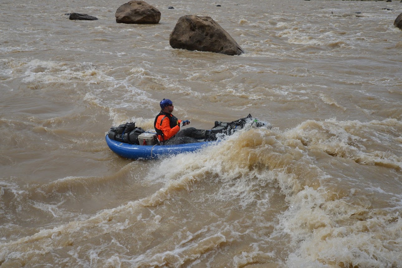
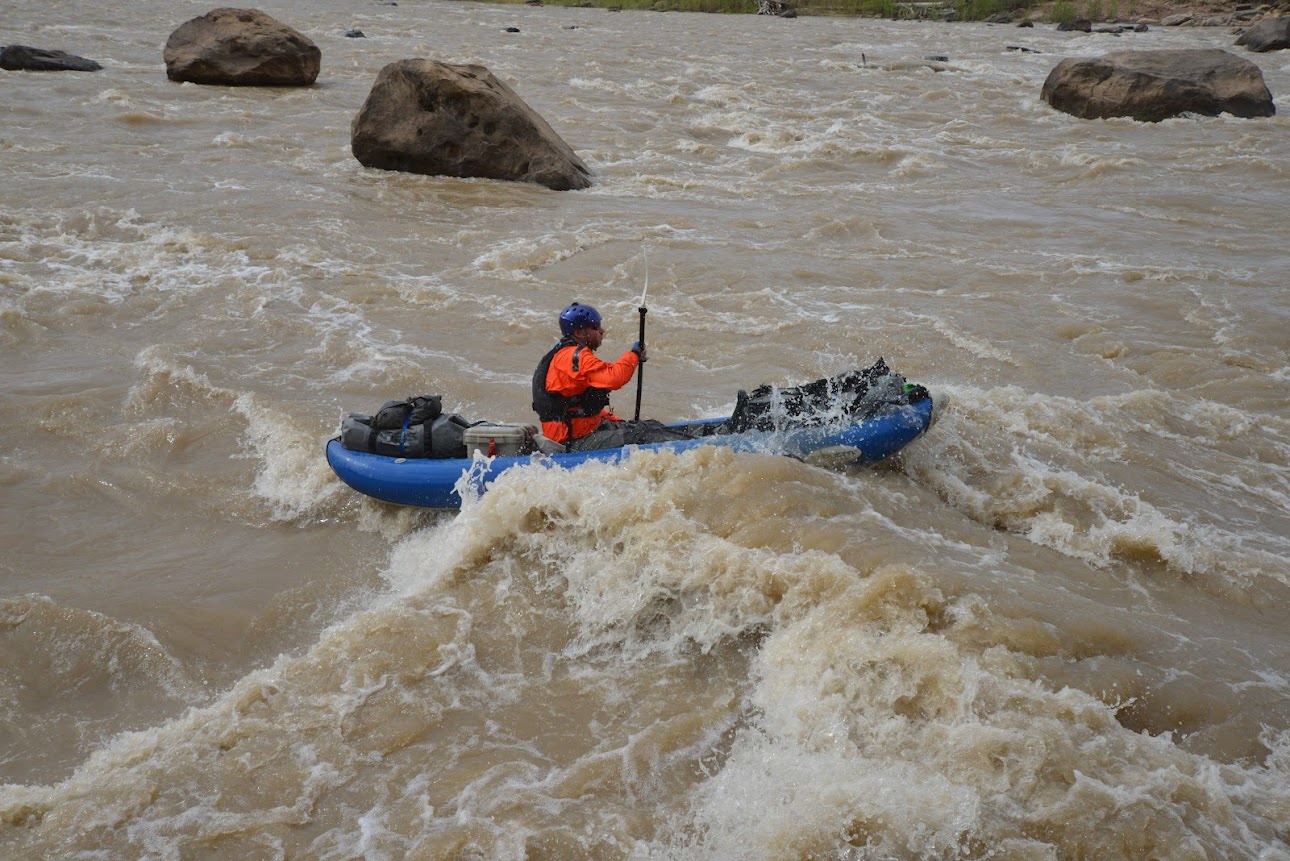
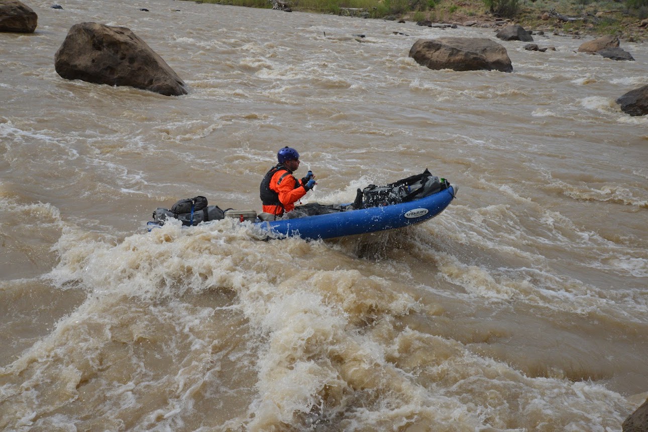
After having an amazing Mountain Man Breakfast made in the Dutch Oven on Friday morning, we packed up camp and I put my drysuit on for the only time this trip since we would be going through two tricky rapids right away. After we all made it through Wire Fence Rapid, Lee got positioned to take photos of us a we went through Three Fords Rapid. These are the series of photos he took of me going through.
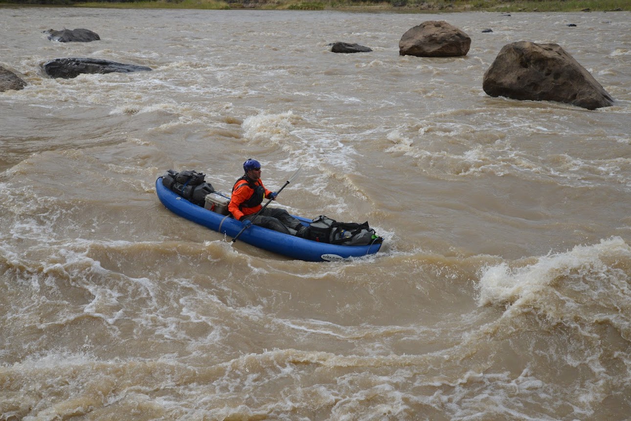
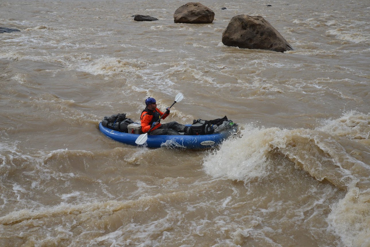
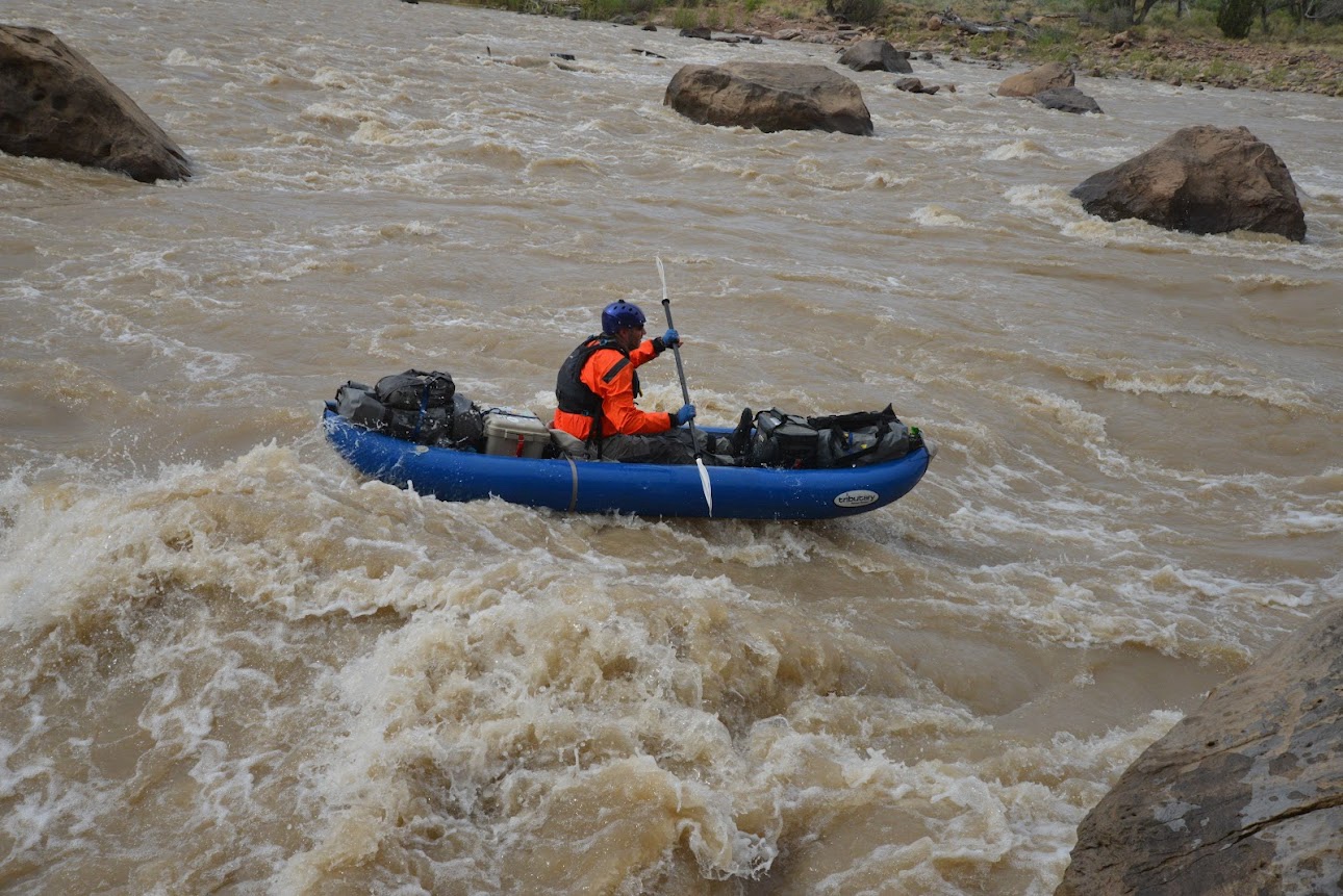
Once I was on the other side of the rapids, I took this series of Lee going through in his canoe.


Brian was the last one to go through, and none of us had any issues.


Just here we emerge from the Canyon of Desolation, as we have named it, into a more open country, which extends for a distance of nearly a mile, when we enter another canyon cut through gray sandstone.
Major John Wesley Powell,
July 12, 1869
It was kind of jarring how abrupt the change from Desolation Canyon to Gray Canyon was.

Three Fords Butte

Looking back after leaving Desolation Canyon.

Although Gray Canyon is certainly nowhere near as dramatic as Desolation, it’s still a nice canyon to float through.


We stopped at the beach at Rabbit Valley for lunch.

Gray Canyon Wall


Our last night of the trip would be spent at the campsite just below Rattlesnake Canyon, and surprisingly this would be the first and only photo of my tent I would take on this trip.

Rattlesnake Canyon Point

There was a nice view down Gray Canyon this evening as we played a game of Kubb and had one last campfire on the beach.

Rattlesnake Beach

This morning we have an exhilarating ride. The river is swift, and there are many smooth rapids. I stand on deck, keeping careful watch ahead, and we glide along, mile after mile, plying strokes, now on the right and then on the left, just sufficient to guide our boats past the rocks into smooth water. At noon we emerge from Gray Canyon, as we have named it, and camp for dinner under a cotton-wood tree standing on the left bank.
Major John Wesley Powell,
July 13, 1869
Saturday morning would be our last day on the river in Gray Canyon. The next two miles would still be brand new to Jackson and I, but after that we would be repeating the Green River Daily that we had floated back in 2012.
Leaving Rattlesnake Camp


Jackson paddling through the reflection.

We stopped at the Nefertiti Boat Launch to revisit the petroglyphs found nearby. This was a bit of a change of pace for us since there were quite a few groups camped in the area.

Our small group floating below Nefertiti Rock.


We made one final stop to visit the petroglyphs next to the Price River.


As soon as the Gunnison Butte came into view we knew that Swaseys Rapid was just around the corner and so was the end of our trip. For the most part, it had been a very good one!

Rock Art & Ruins of Desolation Canyon
Here are a few more photos of random petroglyphs and ruins that we stopped to visit during our float down Desolation Canyon.


Cool shot of the fossilized turtle shell. Loved it!
Thanks Harvey!
Thank you for this beautiful and detailed trip report. No doubt this takes a lot of time – it is appreciated!
Thank you Thomas, although I usually enjoy making these Trip Reports, you are right, they do take a lot of time!