Black Canyon of the Gunnison National Park | Saturday, May 16, 2026
After hiking into the Black Canyon of the Gunnison last year via the Gunnison Route I believe I said that I wouldn’t be interested in hiking any of the other Inner Canyon routes into the canyon, but I guess I lied because earlier this year I had the strange desire to give another of the Inner Canyon routes a try. Currently the only other route that is open from the South Rim is the Warner Route because of the South Rim Fire last summer, so back in early April I grabbed a Wilderness permit on Rec.gov so I could give this one a try. Of course, not only is this route the longest one at about 2.75 miles each way, but it also has the most elevation change at over 2,700 feet! I asked my friend Jackson if he would be interested in joining me this time and thankfully he was up for the challenge! We left home bright and early on Saturday morning and were on the trail from the Warner Point Trailhead shortly after 7:00am.
There was a nice view over Bostwick Park to the Sneffels Range as we followed the Warner Point Trail to the beginning of the wilderness route into the canyon.

It was very humid out this morning which made the hike a bit uncomfortable.

Entering the Black Canyon of the Gunnison Wilderness.

There was a good view over the Black Canyon to the Grand Mesa as we started the descent from Warner Point.

The trail wasn’t too steep until we reached the saddle below.

Once we were below the saddle the route got steep and loose.


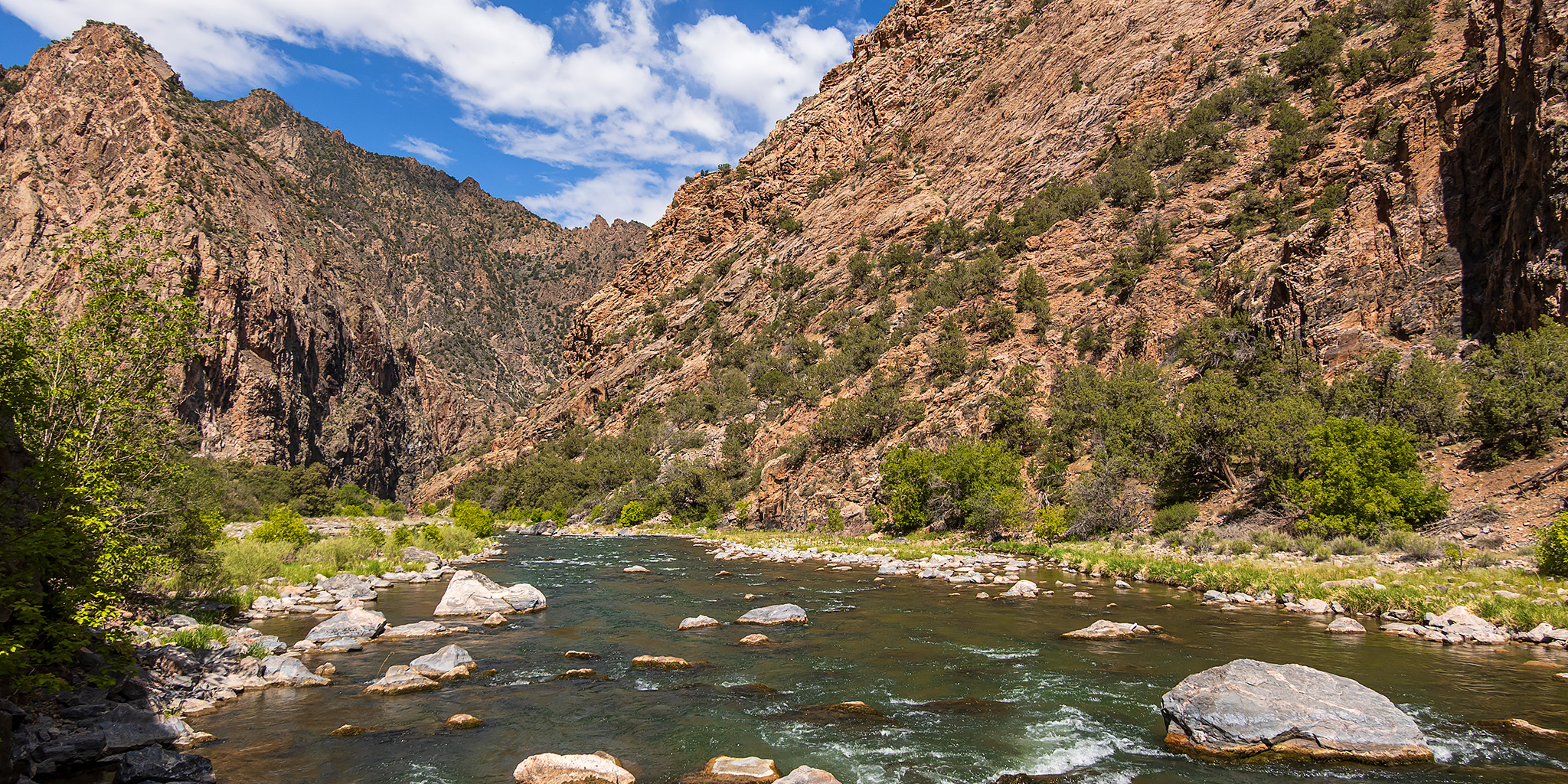
There was a nice view up the Gunnison River as we neared the bottom of the canyon.

Black Canyon

Here’s a look back up the steep chute we had just come down. It took us about two and a half hours to reach the bottom and we didn’t see anyone else on the trail. Although this route was longer and had a lot more elevation loss, it seemed less sketchy than The Gunnison Route to me.

When we reached the bottom we hiked downstream and upstream along the river as far as we could easily go, being careful to avoid the abundant poison ivy found here.


Gunnison River


After sitting down to rest and eat a snack next to the river for a while, we followed the trail back to the bottom of the Warner Route and began the steep climb out.

Warner Route Point

We wet our shirts and hats in the river before starting the climb out to help keep us cool, but that didn’t last long.

Taking a break partway back up the Warner Route. It was slow-going for us this afternoon and we stopped to take many breaks in the limited shade along the way.

Once we were above the saddle the trail got easier, but my legs were very tired at this point.

Warner Point View

Warner Point

Although the hike out was pretty rough and slow for both of us and I certainly wasn’t interested in even thinking about trying another route into the canyon when we finished this hike, as I write this Trip Report over a month later I think I might be interested in checking out a new Inner Canyon route into the Black Canyon next year, but I guess we’ll have to see about that then…