La Plata Mountains & Mesa Verde National Park
Sunday – Monday, July 12-13, 2026
On Monday afternoon I was going to be meeting someone on Cedar Mesa, so I thought it would be nice to spend Sunday afternoon and Monday morning in the La Plata Mountains where I wouldn’t be too far away. A few weeks ago I was actually trying to decide if I wanted to spend this weekend in the Abajo Mountains or the La Plata Mountains, but the Babylon Fire ended up making that decision for me. After spending Saturday in the Gunnison Gorge it was much too late for me to leave that evening, so I went home, slept in, and then took my time getting ready to leave late on Sunday morning. After driving through the Uncompahgre Valley I left the smoky sky behind when I crossed over the Dallas Divide and then drove through a few much-needed rainstorms between Lizard Head Pass and Dolores. I stopped for dinner in Mancos while I waited for the afternoon storms to pass and then headed up Echo Park Road so I could hike to the summit of Helmet Peak, which is the westernmost peak of the La Plata Mountains.
After leaving the highway I followed the Middle Mancos River around the northern side of The Hogback.

Rampart Hills Ridge

A nice view of Helmet Peak over the Middle Mancos River.

Echo Basin Road

I found a place to park above The Hogback and just below the summit of Helmet Peak. I could have driven up some old mining roads a bit further, but I wanted to get some hiking in today.

After waiting out a few more rain showers I started hiking up the old mining road. Shortly after leaving I would have to seek shelter under some trees during one more rainstorm, but it wouldn’t last too long and that would be the last of the rain.

Most of the route followed old mining roads through the trees with limited views, but once I reached the saddle just south of the peak there was an opening with a view over the Mancos Valley to Mesa Verde and Sleeping Ute Mountain.

As I followed the ridge to the summit there was a nice view behind me to Star Peak and Madden Peak over Townsend Basin.

Gibbs Peak was right across the East Mancos River valley to the east.

It wasn’t long until I was following the rocky ridge out of the trees.

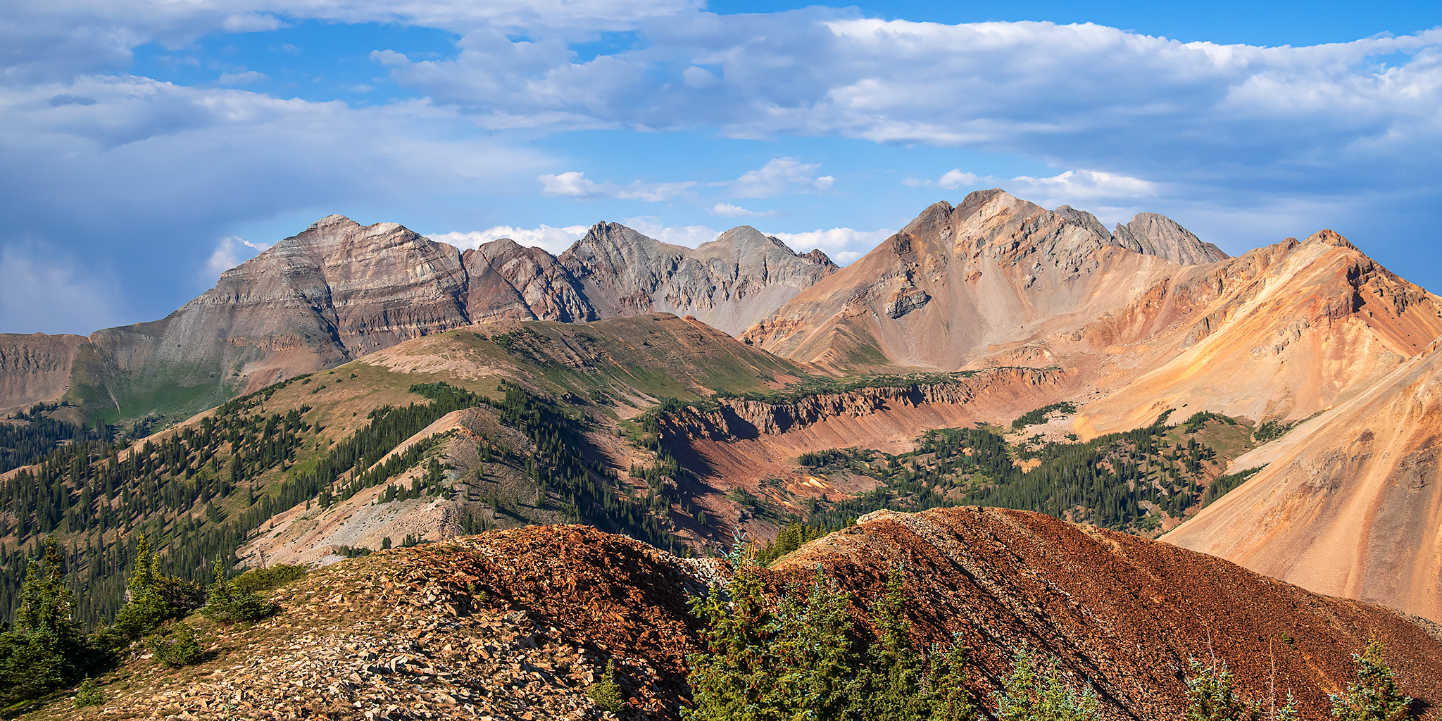
Shortly before reaching the summit I got my first view of the high peaks of the La Plata Mountains.

Following the ridge to the summit…

Helmet Peak Summit (11,978)

This was a new perspective of the La Plata Mountains for me, and the view was spectacular!

Hesperus Mountain

Rush Basin & Spiller Peak

Spiller Peak & Burwell Peak

Here’s one final view down the northeast ridge to the colorful peaks surrounding Rush Basin before I started hiking back down.

Headed back down the south ridge.

This large notch was located just below the summit. The Hogback is straight ahead and if you look closely you might even be able to see my 4Runner parked down there…

I took this shot of Madden Peak because I was planning to hike to the summit in the morning.

As I left the trees and neared my vehicle I took this shot from the road below Helmet Peak.

Helmet Peak Road

Dark clouds moved back in above the peak as I started my drive back down to search for a campsite.

I could see the smoke plume from the Ferris Fire as I drove across T-Down Park.

Since I was planning to hike Madden Peak in the morning, I found a campsite along the Madden Peak Road just before dark.

Unfortunately, I did not sleep very well overnight as I was having some sort of allergic reaction in one of my eyes that was bothering me for most of the night. Still, I woke up before sunrise and was planning to hike Madden Peak as I got ready, even though it was a bit tricky getting my contacts in. However, as I was driving up to the end of the road to start the hike I just wasn’t feeling like it anymore and decided I was going to skip it this time. I stopped at the locked gate for the road that goes up to the top of Caviness Mountain and started hiking there instead. I was hoping there would be a decent view from the end of the road at sunrise, but it was mostly in the trees.
This is the best view I would get from near the summit of Caviness Mountain.

Even though I didn’t feel like hiking a peak this morning, I still wanted to get in an easy hike before heading over to Cedar Mesa, so I drove across the Mancos Valley to Mesa Verde National Park to check out two of the shorter trails from the northern end of Morefield Canyon near the campground. Although I have visited Mesa Verde a number of times before, I have only visited the areas of the park with the popular ancient ruins, so this part of the park would all be new to me.
After driving around the Morefield Campground I stopped to hike the Point Lookout Trail. I was the only vehicle in the parking lot and would have the trail to myself this morning.

Point Lookout Trail

Once the trail reached the top of the ridge there were a few views along the East Rim.

Looking out across the North Rim from Point Lookout.

Looking straight down over the switchbacks of the entrance road.

The sun finally came out from behind a large cloudbank as I hiked back across the top of the ridge.

Looking past Lone Cone to Sleeping Ute Mountain as I descended the trail.

Next up, I started hiking the nearby Knife Edge Trail which used to be part of the main park road until it was finally closed and turned into a hiking trail in 1957 when the Prater – Morefield Tunnel was completed.

Looking up to Prater Ridge.

Knife Edge Trail

The trail was closed by a rockfall shortly before reaching the overlook at the end. It would have been nice if this information had been posted at the trailhead…

After returning to the trailhead I drove around to the Montezuma Overlook on the other side for a view of The Knife Edge.

You couldn’t hike very far along the old road from this side of the ridge…

Before leaving the park I continued to Park Point and walked over to the two overlooks found there.

Montezuma Valley

Of course, I had to take another photo of the Park Point Fire Lookout while I was there.

Here’s one last view looking up at Point Lookout as I left Mesa Verde and started making my way over to Cedar Mesa.

Looks like the new vehicle is working well for you.
It’s no Jeep, but it’s OK.