Press "Enter" to skip to content

Tag: cabin

The Green River: High Water in Labyrinth Canyon

Ruby Ranch to Mineral Bottom | Average CFS: 17,300
Thursday – Sunday, June 2-5, 2022

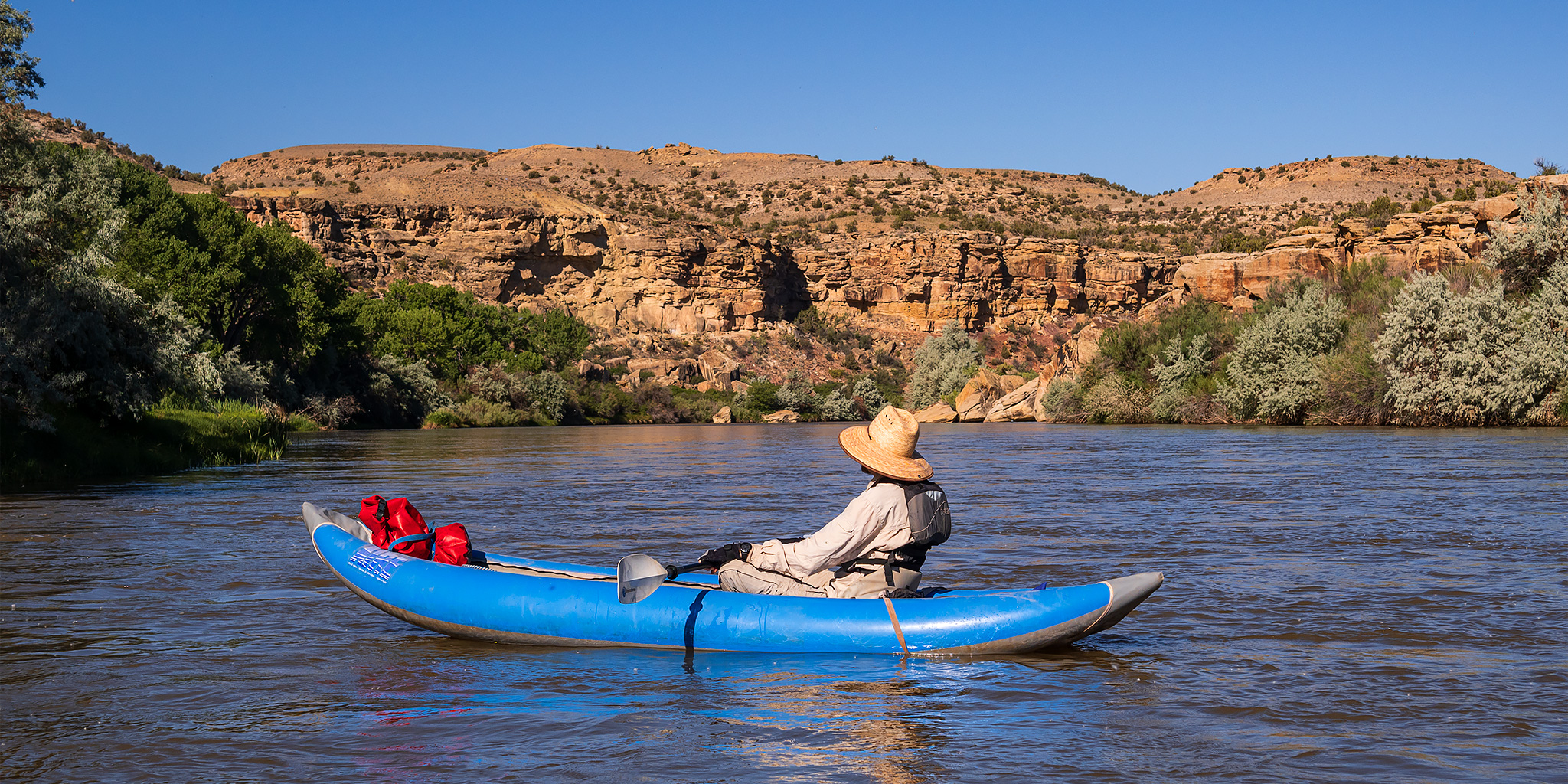
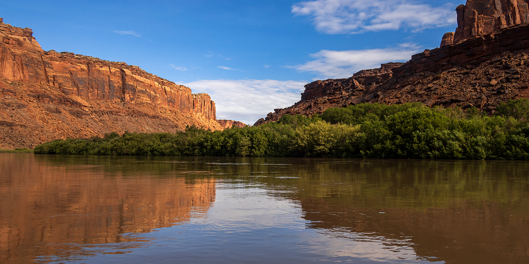
After spending a full week circling around the Colorado Plateau with Diane, then having two days at home to rest and two more days back at work, it was finally time to get back on the river! Although my friends and I had entered a couple river permit lotteries earlier in the year, none of us were successful at getting any, so instead we decided to do another float through Labyrinth Canyon of the Green River from Ruby Ranch to Mineral Bottom. While I typically prefer to float the Green River and Colorado River through the canyonlands region in the late summer when there are plenty of sandbars for camping on, which are some of my absolute favorite places to camp, I figured it would be interesting to see what the river was like at high water, even though I knew that it was going to be a busy place with limited campsites at this time of the year. I knew from the start that I wasn’t going to be doing much hiking and exploring on this trip, so I just planned on a relaxing float down the river with plenty of time spent in camp.

Leave a Comment

The Mogollon Rim to Lyman Lake State Park

Along the Upper Little Colorado River | Alternate Plans: Back on the Four Corners Circuit
Thursday – Friday, May 26-27, 2022

After spending two days in Petrified Forest National Park and then a brief stay in Pinetop, it was time to continue on our loop and start making our way back east and north with an overnight stay at Lyman Lake State Park. We were up and on our way early on Thursday morning as we went on a pleasant drive along the edge of the Mogollon Rim and through the White Mountains to the headwaters of the Little Colorado River. We took a break from driving to search some volcanic cliffs along the Little Colorado River for petroglyphs, and managed to find a couple.

Leave a Comment

Roubideau Creek in the Camel Back Wilderness

The Edge of the Uncompahgre Plateau | Friday & Saturday, April 15-16, 2022

This weekend I needed to stay closer to home to get some work done on my Jeep and around the house, so I turned my attention to the Camel Back Wilderness Study Area at edge of the Uncompahgre Plateau between Delta and Montrose. Last spring I had planned to hike up Roubideau Creek after visiting the Devil’s Thumb, but the water was just too high at the time, so I thought I would give that hike another try on Saturday morning. After leaving work on Friday afternoon I drove to Delta and then followed some Jeep roads to the rim of Roubideau Canyon across from the Camel Back and watched the sunset. Besides having a great view over the canyon, I could also see the Grand Mesa, West Elks and Sneffels Range on the horizons from my vantage point.

2 Comments

Fremont Indian State Park in Clear Creek Canyon

Friday – Sunday, February 11-13, 2022

It’s been over ten years since I last visited Fremont Indian State Park (not counting speeding through on I-70 a couple times each year) and Diane had never stopped there before, so I thought we were overdue for a visit and decided to spend my birthday weekend there this year. It’s funny since the last time I spent a weekend at the park was also over my birthday weekend! Established in 1987, Fremont Indian State Park encompasses 1,200 acres of land within Clear Creek Canyon at the juncture of the Colorado Plateau and the Great Basin and is nestled between the Tushar Mountains to the south and the Pahvant Range to the north. While planning the trip late last year I noticed that the park now has two cabins that are available to reserve in the Sam Stowe Campground, so I booked one of them so we could spend the weekend in a little more comfort than usual. We were looking forward to checking it out as we explored the rock art in the park for the weekend!

3 Comments

Southern Sawatch Saweekend

Friday – Sunday, September 10-12, 2021

This weekend was going to be the last opportunity for me to hike a 14er this summer, and since I have climbed at least one 14er each summer since 2010 I was originally planning to. However, as I started figuring out my weekend plans I just wasn’t feeling like hiking on a busy trail and was looking for a little more solitude, so I decided to skip the 14ers this year and headed to the southern Sawatch Range to hike a few peaks along the Continental Divide instead. I left from work on Friday afternoon and headed to Gunnison, taking the route through Hotchkiss and Crawford since Highway 50 is still closed until 5:30pm on weekdays and I wasn’t sure how quickly I would get to that point. I topped off my fuel tank in Gunnison and then made my way over to Pitkin and started up the road to Hancock Pass. Unfortunately, the road near the top of the pass was much rougher than I remember it being and I wasn’t comfortable driving a section of it in the dark, so I returned all the way back to Highway 50 and drove over Monarch Pass to the Middle Fork of the South Arkansas River and found a place to spend the night shortly before the end of that road. It was pretty late by the time I arrived, so I went right to bed.

Leave a Comment