Adobe Badlands Wilderness Study Area & Roubideau Creek
Friday & Saturday, May 7-8, 2021
Next week Diane actually has a full week off from school between semesters and we are planning on spending that time in northern Arizona and New Mexico so she can get away from studying for a little bit. Since I still have a lot to do around the house to prepare for that trip I didn’t want to stray too far away from home this weekend, so I decided I would just head out for a quick and easy overnight trip to explore the Adobe Badlands and Roubideau Creek near Delta. I left straight from work on Friday, grabbed a quick dinner in Delta and then drove over to the edge of the Adobe Badlands Wilderness Study Area just north of town so I could hike up to the Devil’s Thumb this evening. I notice the Devil’s Thumb every time I drive through Delta and always think to myself that I should make the time to visit it, so this hike has been long overdue. It was about 90 degrees and very windy out when I started hiking, so it was a bit warm but at least the wind made it feel a little cooler and also kept any bugs away!
A view of the Adobe Buttes and the Grand Mesa as I climbed up to the Devil’s Thumb.
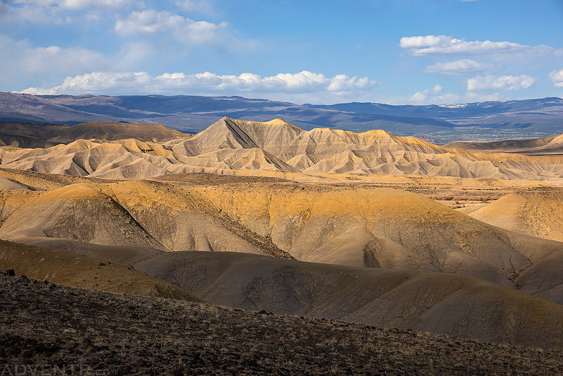
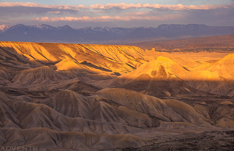
Nice dappled light on the badlands below while looking the other direction to Delta.

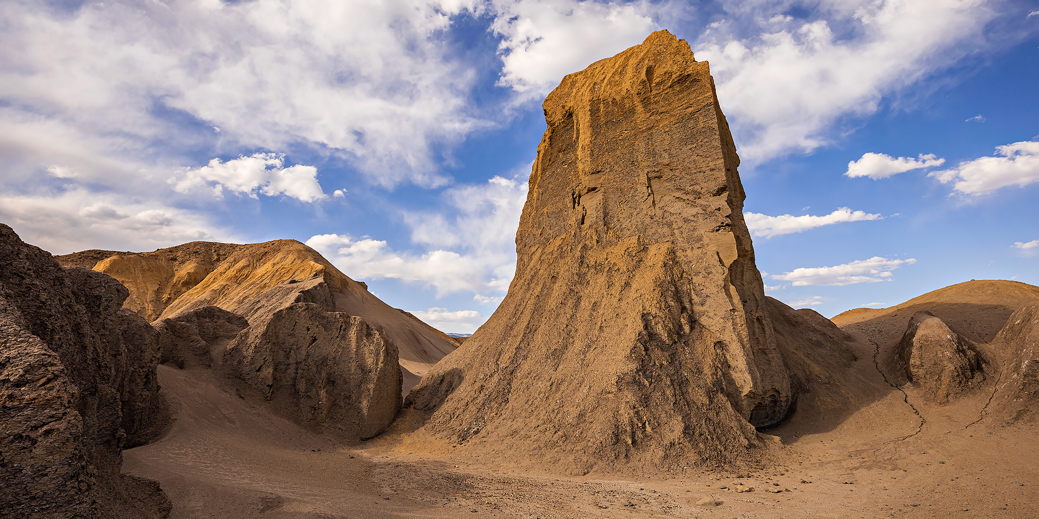
Up close and personal with the Devil’s Thumb.
Adobe Badlands Exploring

Devil’s Thumb Sunstar

Petrie Mesa Ridge

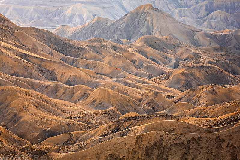
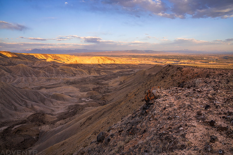
The landscape below the thumb.

The Devil’s Thumb. The clouds and light were looking good this evening!

Badlands Below
A blooming Claret Cup I passed while hiking back to my Jeep. I also scared up a herd of pronghorn along the way.

Shortly before sunset I drove up the Alkali Basin Road toward the base of the Grand Mesa which follows the western edge of the Adobe Badlands WSA.

A hazy evening view of the Sneffels Range in the distance.

I walked from the road to the rim of the canyon to check out the views from the upper reaches of the Adobe Badlands.

The West Elks were visible on the horizon beyond the badlands.

Edge of the ‘Dobies
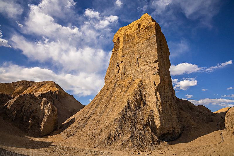
A more distant view of the Devil’s Thumb just before sunset.
Last Light on Petrie Mesa

It was a colorful evening as I headed out in search of a campsite for the night.

I was originally thinking about camping near the Adobe Badlands, but at the last minute I decided to drive to the other side of the valley and find somewhere to camp along Roubideau Creek at the edge of the Uncompahgre Plateau. I’m glad I changed my mind since I found a great campsite right next to Roubideau Creek and was able to fall asleep to the sound of the creek rushing by.
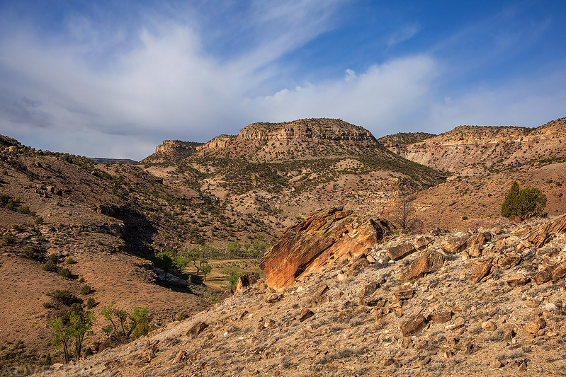
A Morning Along Roubideau Creek
When I woke up before sunrise on Saturday morning I noticed that the sky was overcast so I decided to sleep in a little longer instead of getting up. When I finally got out of my sleeping bag I walked over to the edge of Roubideau Creek and saw that it was flowing much higher and faster than I was anticipating. I had hoped to hike up the creek a few miles this morning, but decided that the water was going to be too high for that today, so I will have to come back to do that another time. I finished driving to Roubideau Creek’s confluence with Potter Canyon and then started hiking up that canyon instead. I wasn’t able to get very far before I was stopped by the water in that canyon, too. Next, I turned around and returned to the campsite I had stayed at since I had noticed there was a nearby hiking trail marked on the map that climbed up to the rim of the canyon and ended at a spot called The Narrows on Twentyfive Mile Mesa. Since I couldn’t hike through the creek today, this trail looked like my best option as a backup plan.
Hiking the upper trail to the top of the rim.

As I was hiking back down from The Narrows the sun actually started to come out and I had a nice view of Winter Mesa between Roubideau Creek and Potter Creek.
Following the trail back down into Roubideau Canyon.

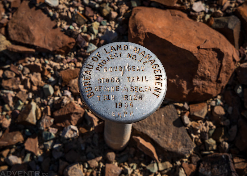
Although the trail I hiked up was on the map, I couldn’t find a name for it anywhere. Luckily, I spotted this marker near the trail shortly before arriving back at my Jeep, so I guess it should be called the Roubideau Stock Trail.
After returning to my Jeep I returned to Delta for a quick breakfast and then headed back home to continue getting prepared for our upcoming trip.