The Edge of the Uncompahgre Plateau | Friday & Saturday, April 15-16, 2022
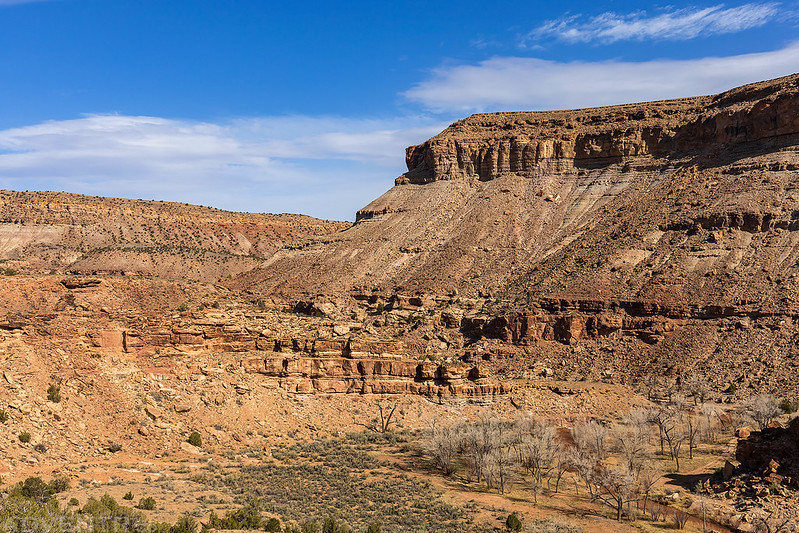
This weekend I needed to stay closer to home to get some work done on my Jeep and around the house, so I turned my attention to the Camel Back Wilderness Study Area at edge of the Uncompahgre Plateau between Delta and Montrose. Last spring I had planned to hike up Roubideau Creek after visiting the Devil’s Thumb, but the water was just too high at the time, so I thought I would give that hike another try on Saturday morning. After leaving work on Friday afternoon I drove to Delta and then followed some Jeep roads to the rim of Roubideau Canyon across from the Camel Back and watched the sunset. Besides having a great view over the canyon, I could also see the Grand Mesa, West Elks and Sneffels Range on the horizons from my vantage point.
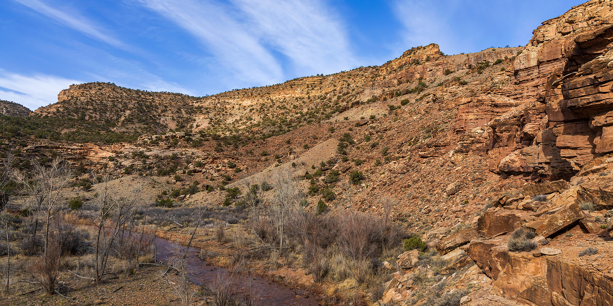
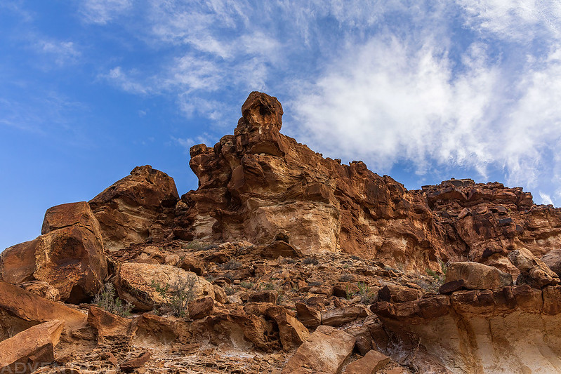
Roubideau Canyon and the Camel Back

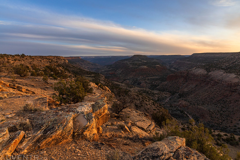
An Evening On the Rim

I was originally planning to spend the night on the rim, but changed my mind once the sun was down.

Roubideau Canyon Rim

A lovely evening at the edge of the Camel Back Wilderness.
After the sun dropped below the horizon I drove down and around into the mouth of Roubideau Canyon and found a campsite right along the creek. I listened to a podcast or two and then went to bed early with the sound of the creek rushing by to help me to sleep.
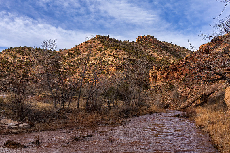
As I woke up with the sunrise on Saturday morning and drove to the confluence with Potter Creek it looked like the light in the canyon was going to be good, but those hopes were quickly dashed when the sun got blocked out by a mostly cloudy sky.

The creek was running high, cold and muddy today, but I thought I’d still give the hike a try and was prepared to get wet. After the first couple of creek crossings my feet started to get pretty cold, so I changed into my neoprene socks and then stayed warm for the rest of the morning.

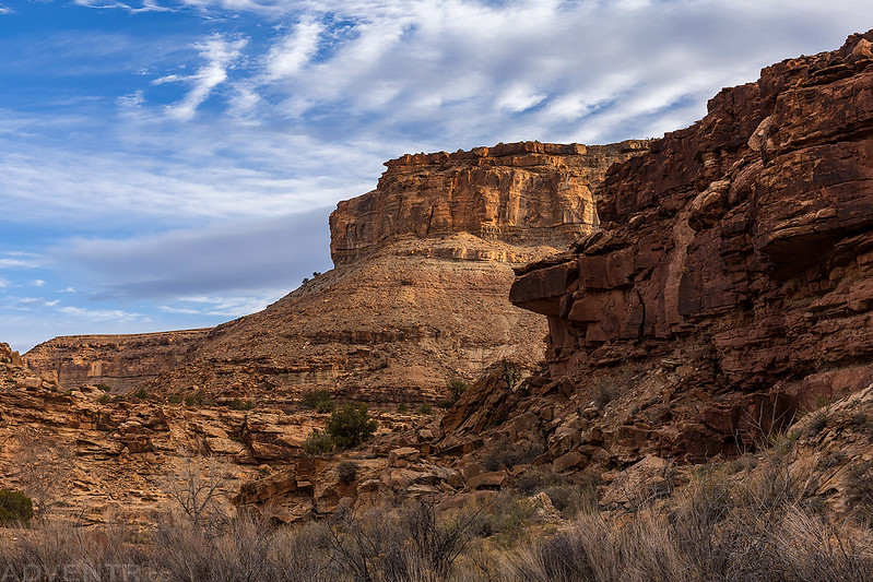
Occasionally the sun would peek out from behind the clouds and light up the canyon walls for a brief moment.
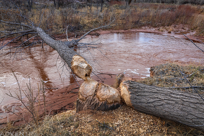
It appears the beavers have been hard at work in this canyon.
Walking along the rocky bank of the creek as the sun started to come out a little more and I started to see more blue sky.

Looking up…
While the creek was running high, most of the crossings had solid rocky bottoms in the middle which made hiking across easier, but along the banks there was a lot of soft quicksand that I had to work to avoid.
After about a dozen crossings of the creek I reached a section that was too deep and full of quicksand, so that’s where I decided to call it a day this time. I climbed up to a higher point nearby for a better view up the canyon before turning around.


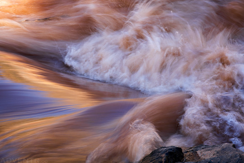
Here’s a short video I took while standing in the middle of one of the crossings.
Moving Water
Headed back downstream in the sunlight.
On the way back I took a little detour and hiked up the Winter Mesa Trail to an overlook of the lower canyon.
The view across to Twentyfive Mile Mesa.

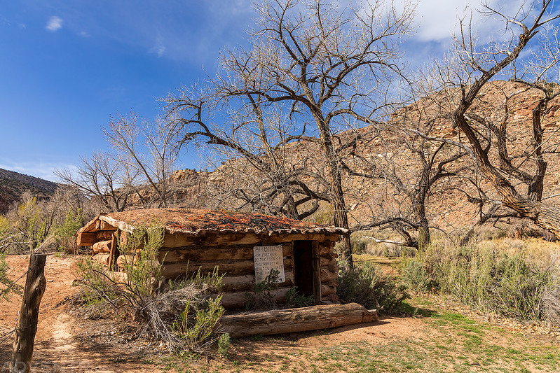
I also stopped to visit this old cabin located near the confluence of the two creeks.
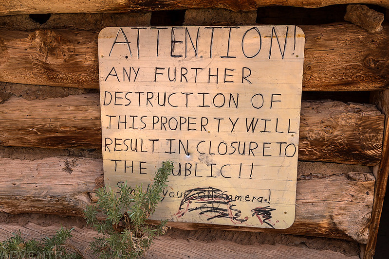
This large warning sign was posted on the front of the cabin.
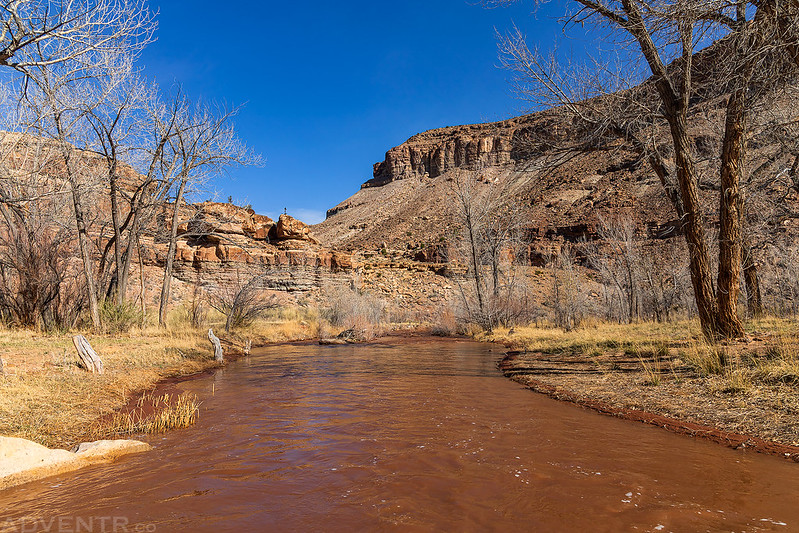
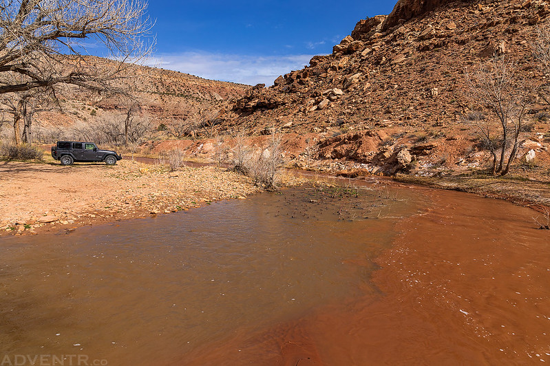
Here’s one last shot of my Jeep at the trailhead across from the confluence of Potter Creek and Roubideau Creek. As you can see, Potter Creek on the left was more of a greenish color while Roubideau Creek on the right was a reddish-brown color where they came together.
Was that Ben Lowe’s Cabin?
I don’t think so. I believe Ben Lowe’s cabin is further up the canyon.