Press "Enter" to skip to content

Tag: hatch point cliffs

Drifting Around Indian Creek Country III

Friday – Sunday, January 26-28, 2024

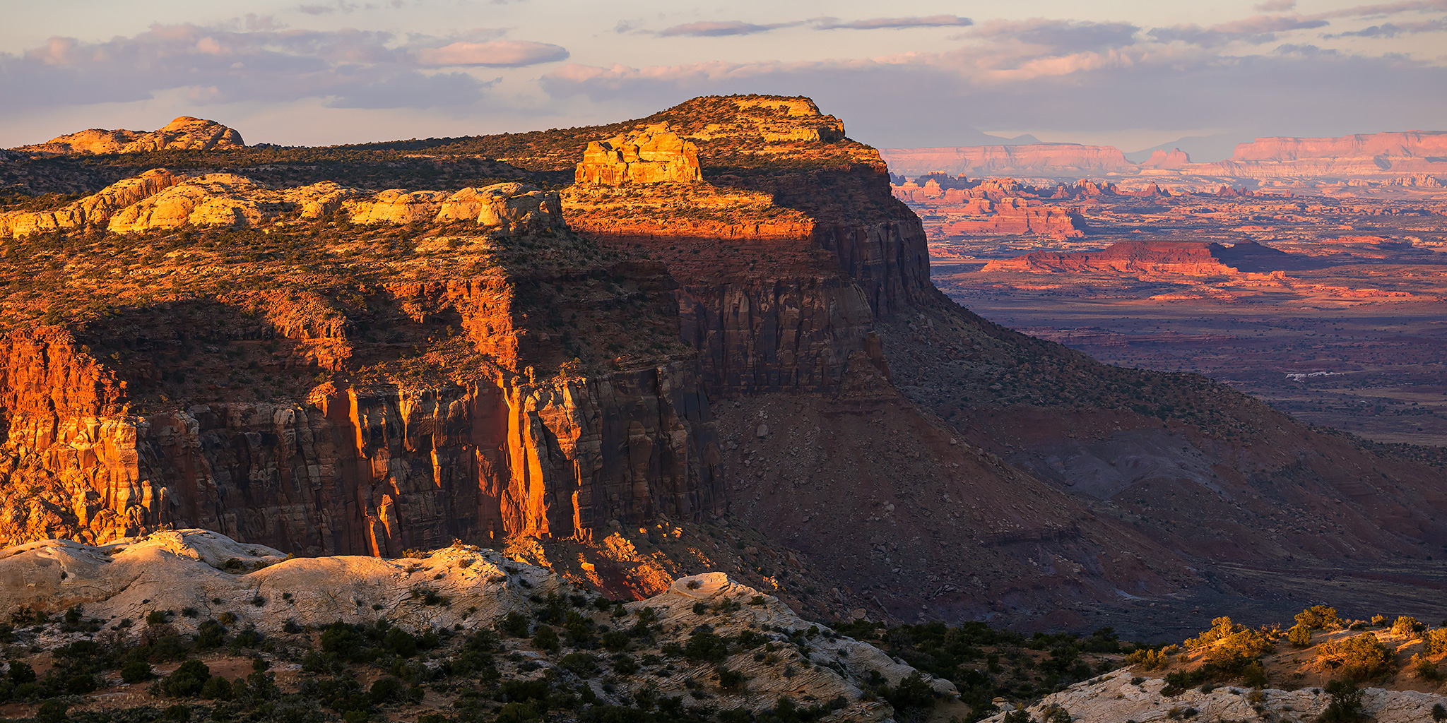
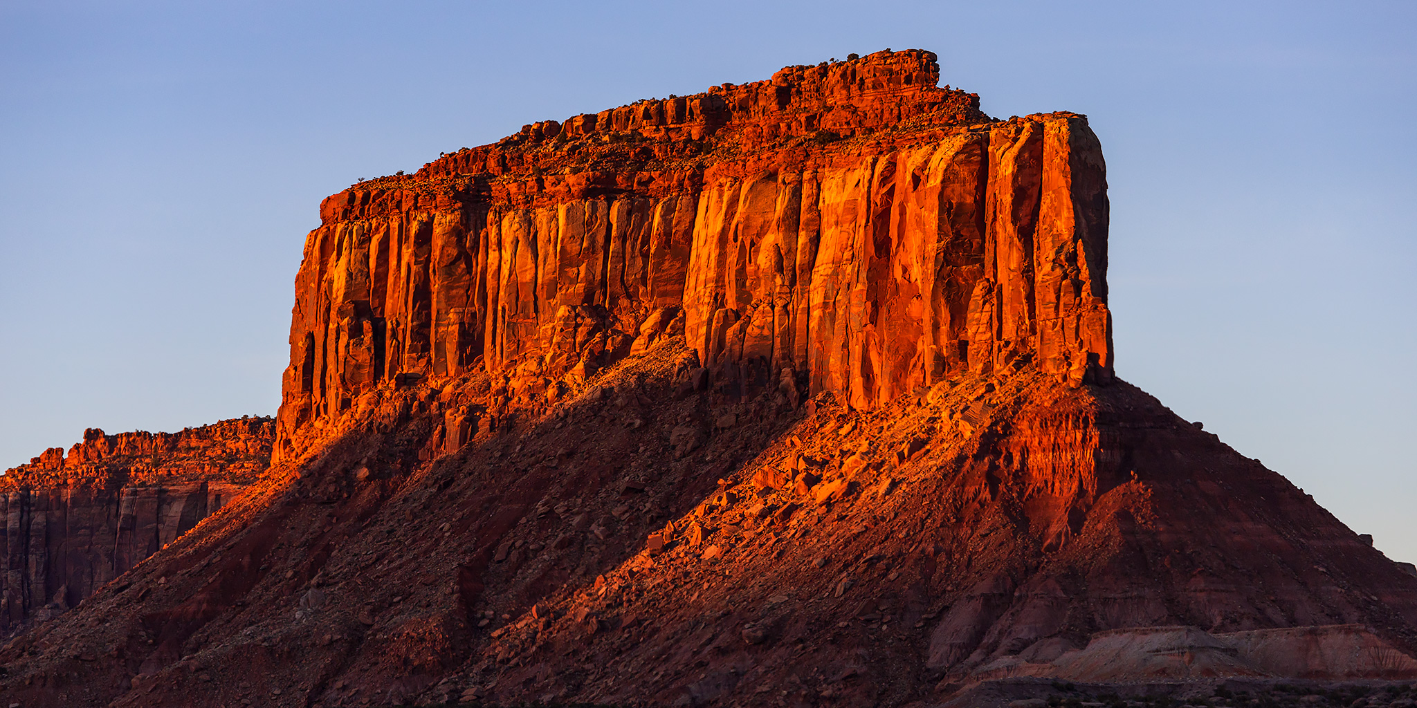
January has kind of been off to a rough start for me and I was really feeling the need to get away for the weekend alone and in a place that I am familiar with and comfortable in; a place that feels like home. So I decided to spend the weekend hiking and camping in Indian Creek Country, which has been one of my favorite places to explore the past couple of years, especially in the winter when there aren’t many other people around. Anyways, if you saw my post from earlier this month, you might have noticed that my Jeep has been out of commission for a few weeks by now, and the good news is that I finally got it back from being repaired earlier this week. One of the camshafts in the engine needed to be replaced, which had been on backorder for a little while, and thankfully the powertrain of my Jeep was still just barely under warranty. Since I had already paid for a rental car through this upcoming Monday, I figured I would leave the Jeep home and take the rental Ford Explorer out this weekend instead. I left from work on Friday afternoon and made my way south through Moab and down the Indian Creek Corridor, where I found a campsite along the road to Lockhart Basin just after sunset. I then spent the remainder of the weekend just wandering around the canyon country to see what I would find along the way. Below are some photos from my wanderings this weekend.

Leave a Comment

Exploring Desert Stone: Harts Draw to Indian Creek

Tracing the Historic Route of the 1859 Macomb Expedition, Part II
Friday – Sunday, October 27-29, 2023

It’s now been almost an entire year since I started my quest to follow and explore the historic route of the 1859 Macomb Expedition, also known as the San Juan Exploring Expedition, which contained a small detachment of men who were quite possibly the first non-native Americans to view and describe what is now Canyonlands National Park. During that trip I followed the Old Spanish Trail across Dry Valley from Cañon Pintado (East Canyon) to Casa Colorado and then steadily climbed up Hatch Point until I was at the edge of the rim overlooking Cañon Colorado (Harts Draw) and the greater Canyonlands region. That point was roughly in the same area where Captain Macomb and his men would have had their first view of the region that would later become known as The Needles and where they would most likely have begun their descent to the canyons below in search of The Confluence of the Green and Grand Rivers. This weekend I set out to continue following their historic route as it descended from the rim of Hatch Point into Harts Draw and then I would continue downstream into Labyrinth Cañon (Indian Creek Canyon). Although I had hoped to follow the route segments in order, except that I had planned to start hiking from the bottom of Harts Draw up to the rim since I thought route-finding would be easier in that direction, but stormy weather on Saturday altered my plans a bit and I ended up hiking the segments out of order.

Leave a Comment