Tracing the Historic Route of the 1859 Macomb Expedition, Part I
Friday – Sunday, November 4-6, 2022
I cannot conceive of a more worthless and impracticable region than the one we now find ourselves in. I doubt not there are repetitions and varieties of it for hundreds of miles down the cañon of the Great Colorado, for I have heard of but one crossing of that river above the vicinity of the Mojave villages, and I have reason to doubt if that one (El Vado de los Padres) is practicable, except with utmost care, even for a pack-mule.
Captain John N. Macomb, Jr.
November 1, 1860
After being sick and stuck at home over the past two weekends I was really ready to get back outdoors again this weekend! Since I haven’t done much hiking in a couple of weeks I wanted to take it easy this weekend and thought this would be a good opportunity for me to finally start on a project that I have been thinking about doing for over a decade. That project would be to follow part of the historic route of the 1859 Macomb Expedition into the Canyonlands region. Members of a small detachment from this expedition were quite possibly the first non-native Americans to view and describe what is now Canyonlands National Park and leave written and graphic records of what they saw. Here is a little background information about Macomb’s 1859 Expedition, which was also known as the San Juan Exploring Expedition:
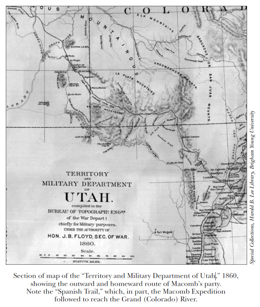
In 1857 and 1858, the troubles that developed between the U.S. Government and the Mormons in the Utah Territory brought new urgency to knowing about these unknown lands. A map titled “Map of Utah Territory Showing the Routes Connecting it with California and the East” published in 1858 by the U.S. Army Corps of Topographical Engineers, bore a note about canyon country: “Region Unexplored Scientifically.”
Thus, according to historian C. Gregory Crampton (1965):
In April 1859, Captain John N. Macomb was ordered to take an expedition directly into the canyon country. He was to determine the course of the San Juan River, to fix the position of the confluence of the Green and Grand (Colorado) Rivers and find the best and most direct route between the Rio Grande and the southern settlements of Utah.
Macomb was in the field from mid July to the end of September 1859. His party, which included John Strong Newberry, followed the well defined Spanish Trail past Mesa Verde, across the Sage Plain to the Ojo Verde, a spring on the route between the La Sal and Abajo Mountains.
While the entire Macomb Expedition started off in Santa Fe and made a large loop into Utah and then back into New Mexico again, I am mostly interested in the segment of the route that branched off from the Old Spanish Trail into the Canyonlands region in search of The Confluence of the Green and Grand Rivers. For this first part of the project my plan was to roughly follow Macomb’s route from East Canyon, where the Old Spanish Trail descended off of the edge of the Great Sage Plain, across Dry Valley and to the rim of Harts Draw where they started their descent to Indian Creek. I would stop to find their campsites, main water sources and other important landmarks along the way.
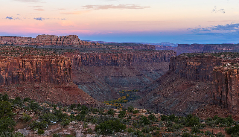
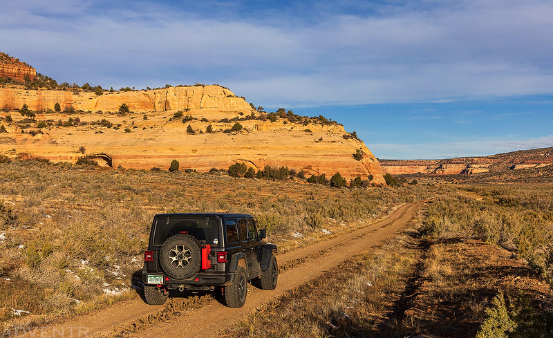
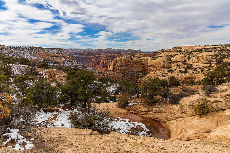
Flat Iron Mesa: Kane Springs Canyon Overlook
I left from work on Friday afternoon, grabbed a quick dinner and then headed over to Moab where I stopped to top off my gas tank. I drove south out of town, which roughly follows the route of the Old Spanish Trail, until I reached the turnoff onto Flat Iron Mesa and decided to take it. Although I have driven most of the Jeep trails around Moab in the distant past, this was one of the few that had eluded me all these years, so I thought it would be nice to at least drive out to the overlook above the confluence of Hatch Wash and Kane Creek so I could watch the sunset and spend the night. It was a good decision since the views were outstanding and I was glad to finally check out this part of canyon country.
The La Sal Mountains at sunset from the edge of Flat Iron Mesa.

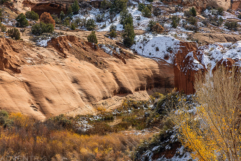
The fall colors were still looking good down below in Kane Springs Canyon.

Flat Iron Mesa Sunset
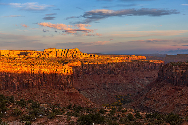
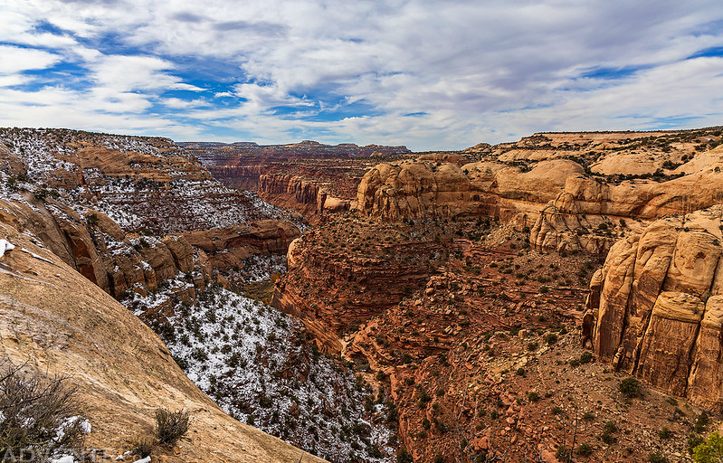
When the light was gone, I read for a while and then went to bed early. I slept pretty well overnight and was up before sunrise on Saturday morning to take a couple more photos from the overlook near my camp before I headed out to start following Macomb’s route.
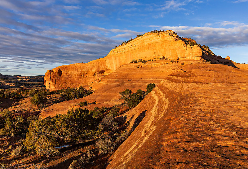
Kane Springs Canyon at Dawn
There were some nice clouds over Hatch Wash.

First light on the sandstone buttes of Hatch Point.

Kane Springs Canyon at Sunrise
Rim light across the Behind the Rocks mesa.

Following the Flat Iron Mesa Road back to the highway.

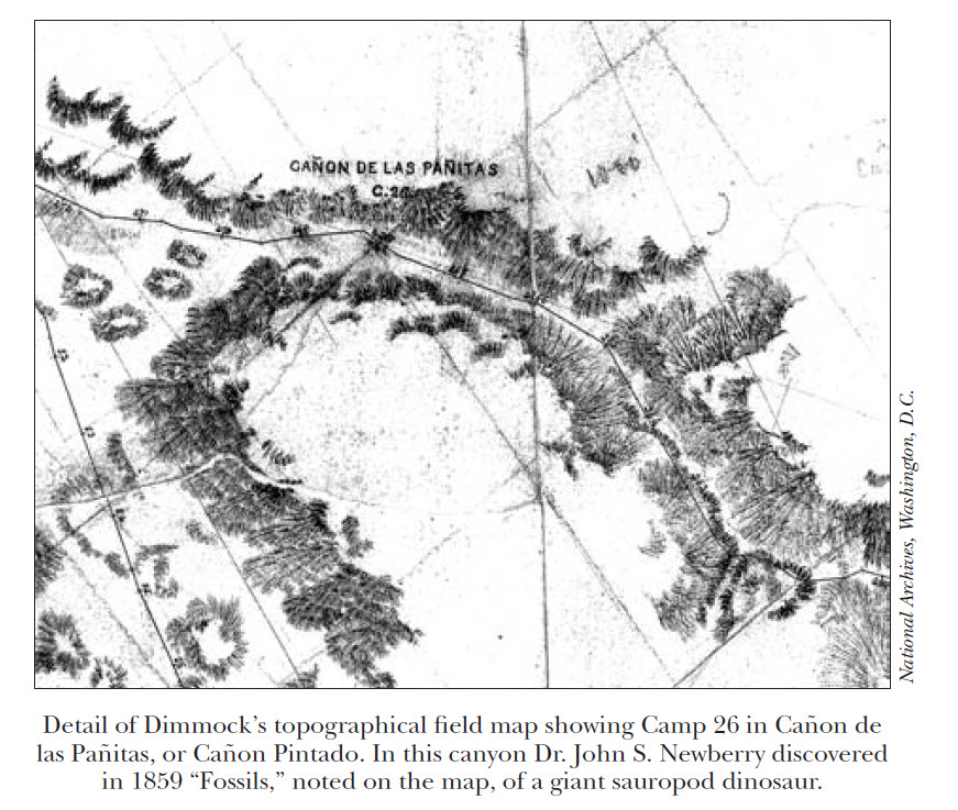
Cañon Pintado (Cañon de la Paritas) & Camp 26
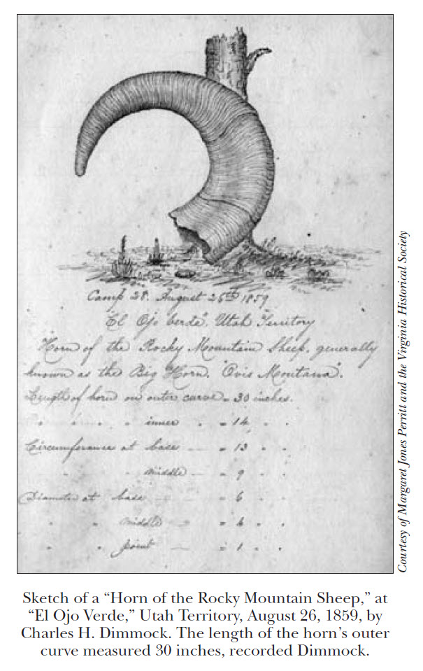
Meeting a deep, precipitous chasm the line descends along its rocky southern slope to the Valley of the Cañon de la Paritas, contracted by almost perpendicular walls – some 600 feet in height – to a width varying from a half to a quarter of a mile & continued past Camp 26 – where in the cliff to North, Saurian fossils of exceeding interest were exhumed…
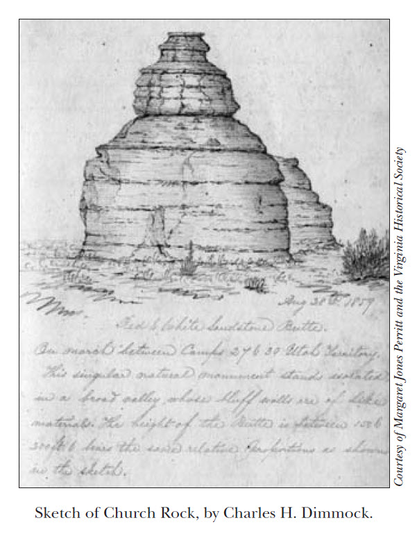
Charles H. Dimmock
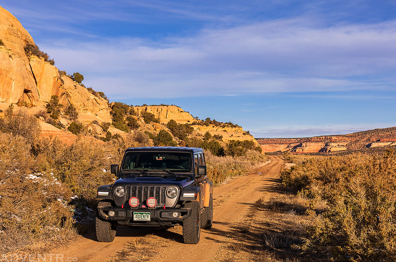
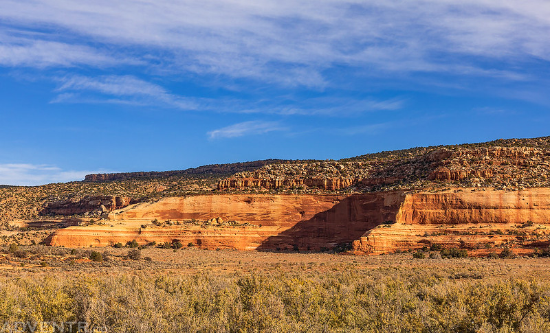
After returning to the highway I drove south through The Gap and then followed the East Canyon Road into East Canyon to the mouth of South Canyon. This is roughly the area that the Old Spanish Trail descended to from the edge of the Great Sage Plain above to the floor of East Canyon.
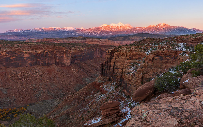
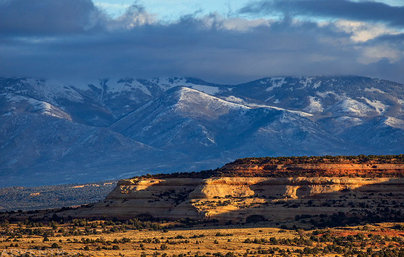
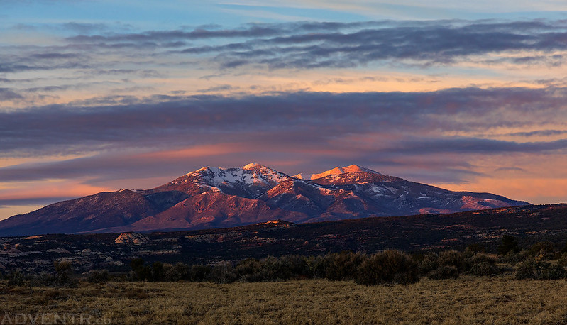
As I made my way into East Canyon the views over the Cameo Cliffs to the La Sal Mountains were looking good.
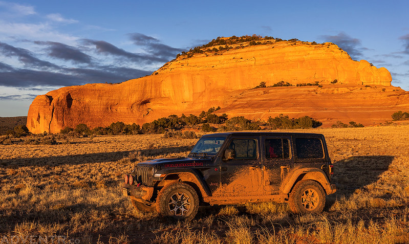
I had a distant view of Casa Colorado Rock, which was an important landmark along the Old Spanish Trail and a place I would be spending plenty of time at later in the day.
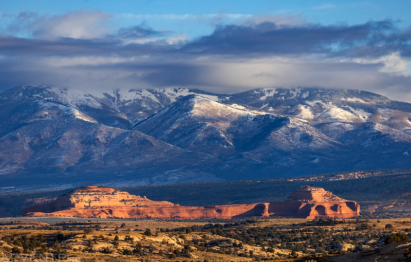
Although I’ve driven by Church Rock countless times over the years, I have never seen it from this side before!
Following the road into East Canyon- Cañon Pintado as Newberry called it, or Cañon de la Paritas as Dimmock called it.
I turned around at the mouth of South Canyon and then officially started following the route of the 1859 Macomb Expedition.

Headed back down East Canyon in search of their Camp 26.
I started following a rough side road that headed towards the area of their Camp 26, but it quickly turned into a single-track route, so I parked and started hiking. Unfortunately, I didn’t make it very far because I needed to cross East Canyon Wash which was full of water from the recent storms, and it was too early and cold out for me to want to get my feet wet. I walked up and down the wash looking for a place I could cross, but never found one.

I did take this photo of the area their Camp 26 was located in, but this was going to be as close as I was going to get to it today.
After giving up on reaching Camp 26 it was time to follow the Old Spanish Trail over to Casa Colorado, but first there was an arch nearby that I wanted to visit.

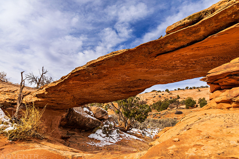
Although named McComb Arch, I think they probably meant Macomb Arch.

I went to walk around to the other side of the arch, but the ledge dropped off into this large alcove.
Here’s a wider view of McComb Arch with the Abajo Mountains visible on the horizon.

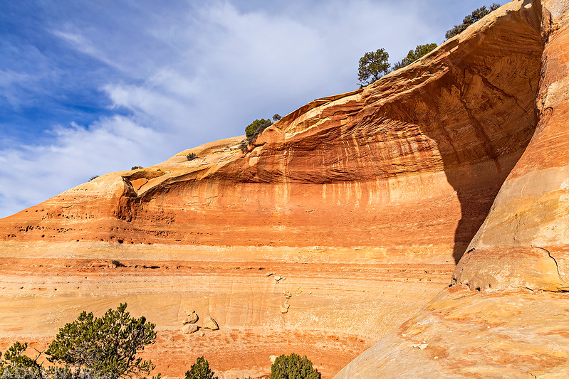
Exploring the colorful alcove.
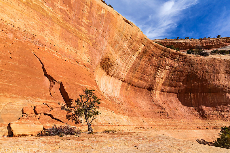
Before returning to the main road I passed by these interesting alcoves.

Casa Colorado, La Tinaja & Camp 27
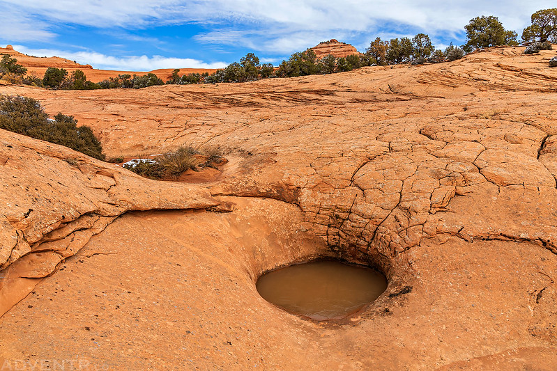
La Tenejal, a deep excavation in red sandstone, which retains so large a quantity of surface water, and for so long a time, as to become an important watering-place on the Spanish Trail. These natural reservoirs are frequently met with in this region, and during the dry season are of vital importance not only to such travelers as may be passing through it, but also to the small number of animals which here make their home.
It is not all uncommon to meet with them even on the summits of the sandstone buttes, which I have described, and it has often happened to me, after a fatiguing climb to the top of some high cliff or pinnacle, to find its smooth-washed summit-rock scooped out in cavities from 2 to 20 feet in diameter, holding sometimes many barrels of the clearest rain-water, and affording me the two rarest possible luxuries in this arid region — a drink of pure water and a cleansing and refreshing bath.
Dr. John S. Newberry
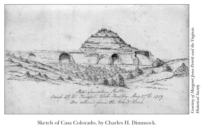
After leaving McComb Arch I returned to the main road and passed by White Rock as I left the mouth of East Canyon and then crossed Big Indian Wash on my way to Casa Colorado Rock. Somewhere on the south side of Casa Colorado is a large pothole that was known as La Tinaja, or La Tenejal as John Newberry spelled it, which was an important water tank along the Old Spanish Trail and the location of their Camp 27. I found a place to park and went out in search of it.
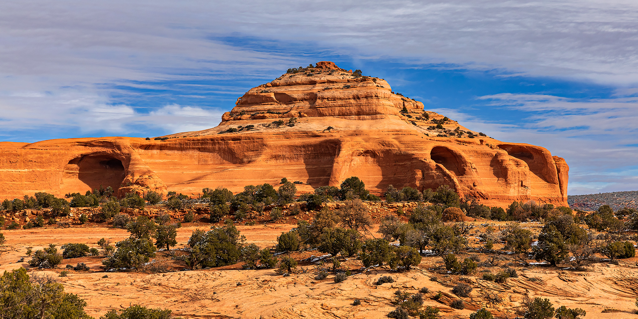
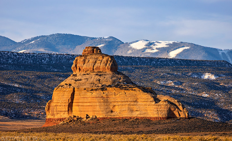
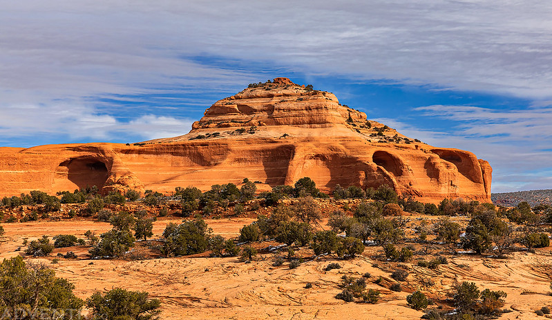
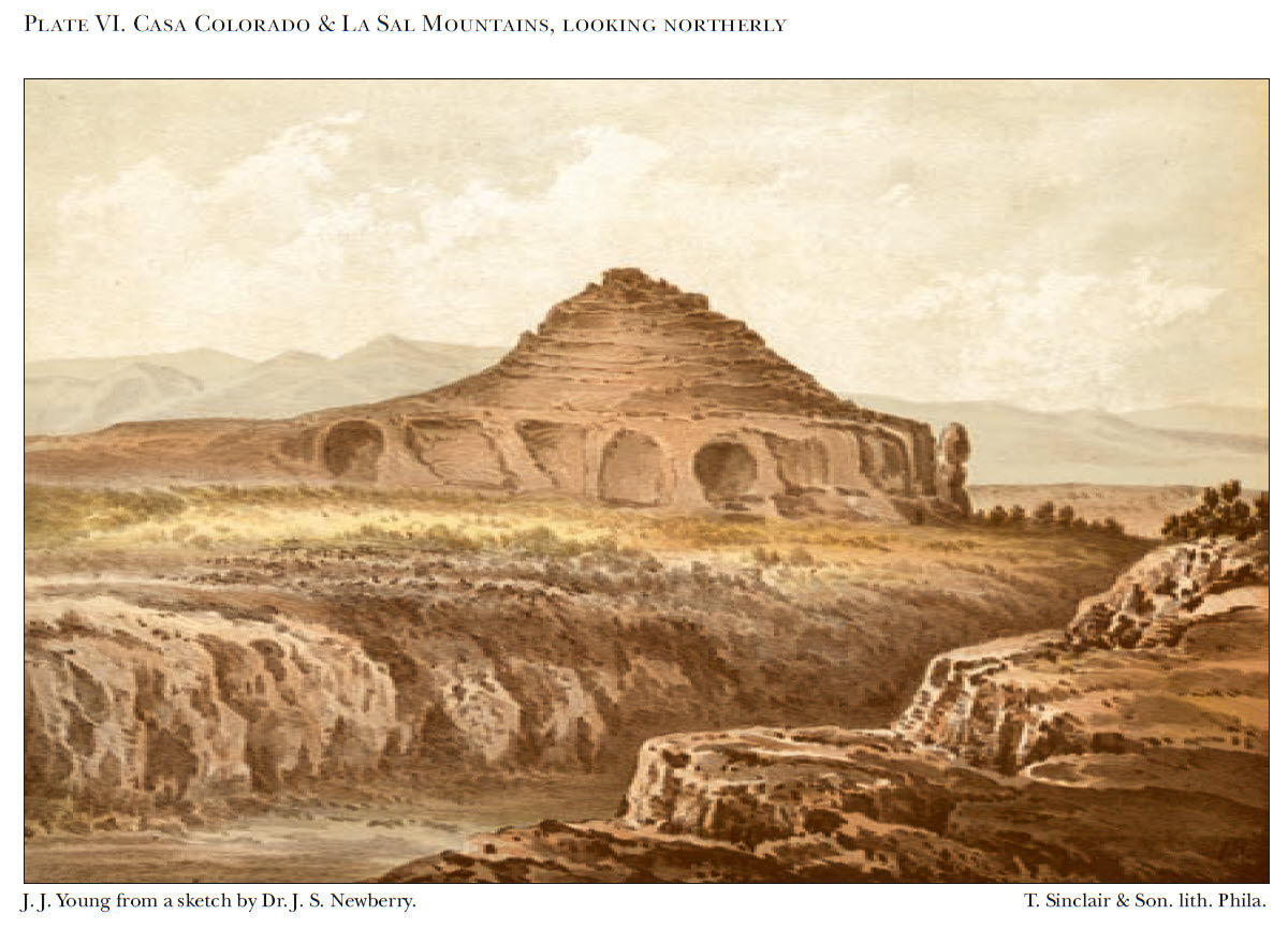
Casa Colorado
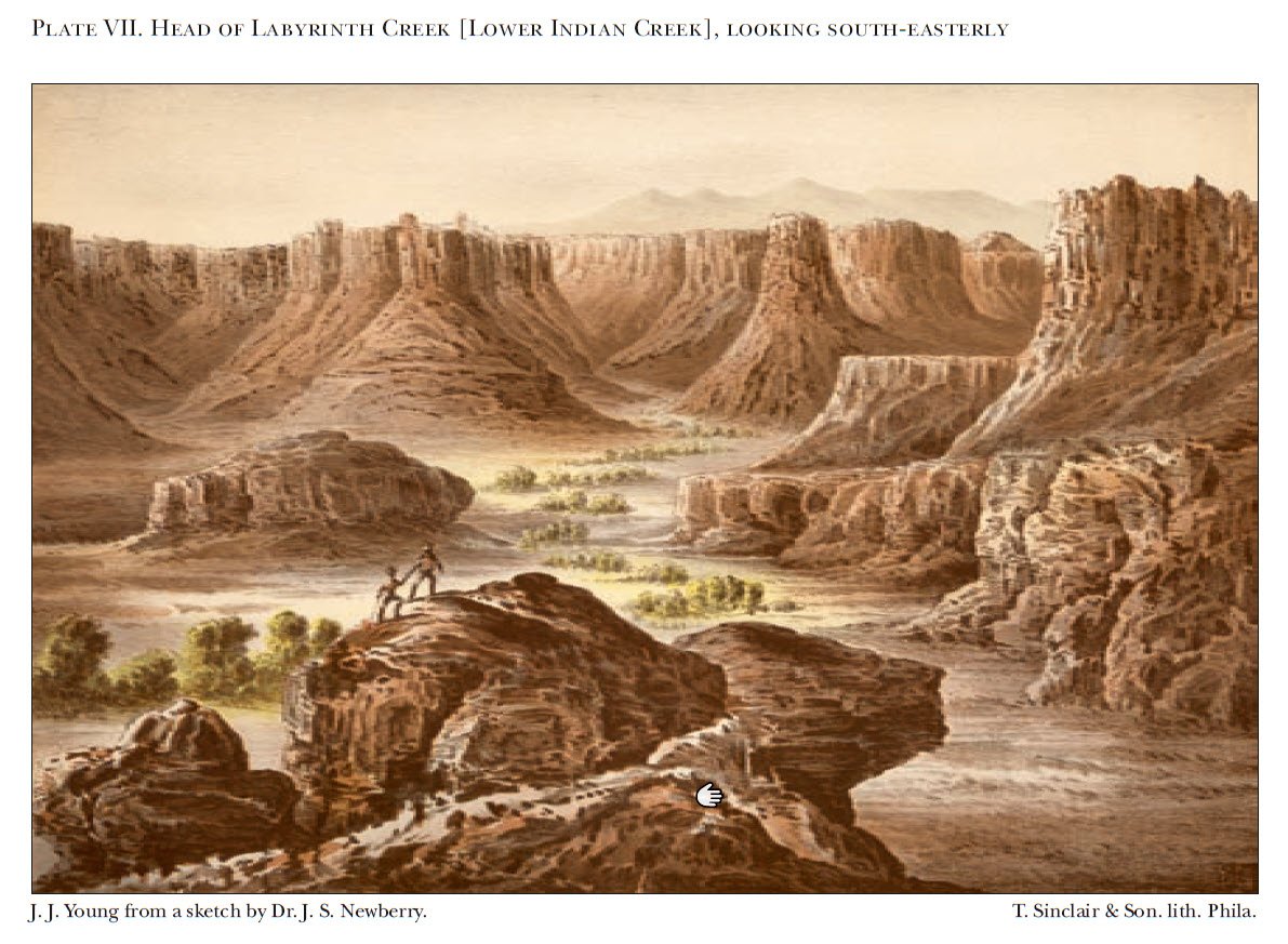
This lithograph was made by J.J. Young from a sketch by John Newberry for the ‘Report of the Exploring Expedition from Santa Fe, New Mexico, to the Junction of the Grand and Green Rivers of the Great Colorado of the West in 1859.’
After wandering a little ways down a sandstone wash, I had no trouble locating La Tinaja and found that it was filled to the brim from the recent rain and snow. Although it doesn’t look very large in this photo, the portion of this pothole that could hold water was measured at 7.5 feet in diameter and about 7 feet deep, which means it could hold more than 2,300 gallons of water when full.
Before leaving the area I hiked over to visit Baird Bridge, which is a very cool natural bridge located in a small nearby drainage.
Before retuning to my Jeep I climbed partway up the west side of Casa Colorado and looked around.
Cañon of the Ojo Verde & Camp 28
From Camp 27 the trail crosses a number of ravines leading into a principal one on the left, passed over about the 297th mile, & slowly diverged from – & encounters four tributary cañons, with their intervening ridges, before entering at right-angles to its course, the almost inaccessible Cañon of the Ojo Verde, debouching upon the leading one two miles to the right.
Charles H. Dimmock
After a short lunch break back at my Jeep it was time to travel across Dry Valley to Hatch Point in the Canyon Rims Recreation Area so I could look for their next Camp 28 which was located at a spring they called Ojo Verde. This spring was located near Hatch Rock in Hatch Ranch Canyon, so I drove over to where Eightmile Road crosses Hatch Ranch Canyon and started hiking down the wash.
There was plenty of water in Hatch Ranch Canyon Wash today.

As I neared the location of Ojo Verde, I had a great view over Hatch Ranch Canyon to the La Sal Mountains.

This is a brief description from Newberry’s field notes of Ojo Verde:
Ojo Verde a beautiful green bottomed canyon with steep rocky banks – fine spring – good grass …
The pool located in the middle of this photo is all that is left of Ojo Verde today. The original Ojo Verde no longer exists as described since it has been destroyed within the last century and a half by massive erosional cutting into the alluvium that once almost filled upper Hatch Wash and its tributary canyons.
I hiked down onto the alluvium for a closer view down Hatch Ranch Canyon.
Here’s a view of Hatch Rock as I hiked back up the wash to my Jeep.

Ojo Verde to Cañon Colorado
On leaving camp we struck southwest, gradually ascending for six miles, when we reached the brink of a magnificent cañon twelve hundred feet in depth, called, from the prevailing color of its walls, Cañon Colorado, into which with great difficulty we descended. The summits of the cliffs are here nearly five hundred feet above the Ojo Verde, composed of the same rock exposed there, at the base of the section in Cañon Pintado.
Dr. John S. Newberry
August 22, 1859
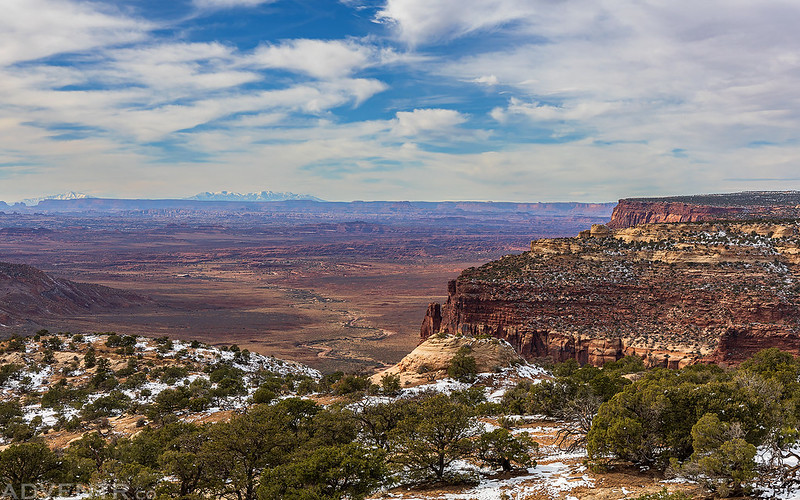
The last part of my journey today would take me from Ojo Verde to the rim of Harts Draw (Cañon Colorado) where the small detachment from the expedition would have had their first views of the region that would later become Canyonland National Park, including The Needles, before they descended down into Harts Draw and Indian Creek.
Here’s a hazy view from the edge of Hatch Point roughly from the area they started their descent.
Although I had no plans to hike down the route today, I did head over to a different overlook of the short side canyon that they used to descend into Harts Draw.
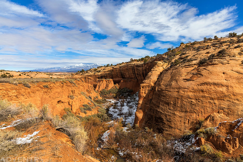
Macomb Canyon Overlook
A large alcove at the head of the canyon.

Now that I have followed the historic route of the 1859 Macomb Expedition from East Canyon to the rim of Harts Draw, I am looking forward to checking out the rest of the route from Harts Draw to lower Indian Creek Canyon in the future. While I have no current plans on when I will do that, I definitely don’t want to wait another decade to get started on Part II of this project, so keep a lookout for that in the future!
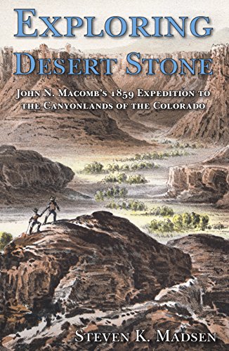
If this Trip Report has piqued your interest in learning more about the 1859 Macomb Expedition, you can download a PDF copy of Steven K. Madsen’s book from this link: Exploring Desert Stone
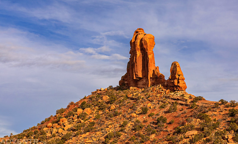
Big Indian Valley & Casa Colorado
After following the Macomb Expedition route from East Canyon to the rim of Harts Draw it was time for some dinner. Afterwards, I had a little time left to go for a scenic drive through Big Indian Valley and then returned to camp at the base of Casa Colorado shortly before sunset.
Big Indian Rock
Shortly before sunset I climbed back up onto Casa Colorado for a few more photos.
The west highpoint of Casa Colorado.
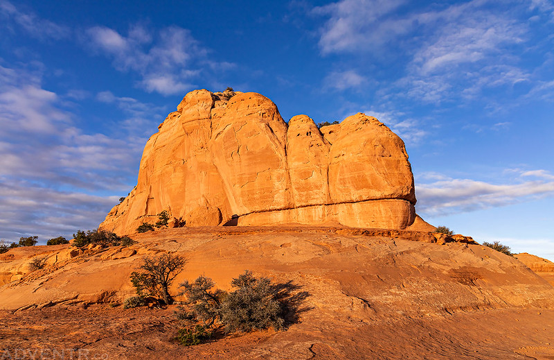
The east highpoint of Casa Colorado.

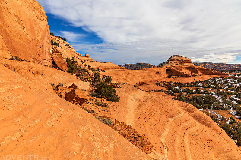
The roads on Hatch Point were a bit muddy this afternoon…
Last light on the La Sal Mountains, viewed from near my campsite.
Since I had completed the part of route I wanted to on Saturday, I really didn’t have any plans left for the rest of the weekend, so when I woke up on Sunday morning and found that the sky was pretty overcast and there wasn’t going to be a sunrise, I decided to head home early since I already had a pretty great weekend!
I always love your posts but this one was more incredibly than usual. Loved seeing the drawing and the history along with you always amazing photographs. Thank you for what you do.
Awesome. Mixing in the history is always so rewarding (I find).
Wonderful post as always with exceptional photography! A big fan of your trips. Would you mind telling me what maps do you find most helpful with your type of travel? Thanking you in advance and please never stop exploring, you will never regret it.
Thanks Boris! I use a lot of different resources when planning trips (see my library of books here), but as far as maps go I usually use USGS Topo, Trails Illustrated and satellite imagery the most. Around Moab I like the Latitude 40 maps for the area. Also, the BLM travel management maps are a must.
Thank you for the info. Your mode of travel (bare bones jeep) tells me tons about your adventures – the best type.
Thanks for the detailed history accompanied by your always great photos!