Friday – Sunday, January 31 – February 2, 2020
Below is the canyon through which the Colorado runs. We can trace its course for miles, and at points catch glimpses of the river. From the northwest comes the Green in a narrow winding gorge. From the northeast comes the Grand [Colorado], through a canyon that seems bottomless from where we stand. Wherever we look there is but a wilderness of rocks, —deep gorges where the rivers are lost below cliffs and towers and pinnacles, and ten thousand strangely carved forms in every direction, and beyond them mountains blending with the clouds.
Major John Wesley Powell,
July 19, 1869
After I finished hiking all of the official trails within the Island in the Sky district of Canyonlands National Park late last year, it was time for me to turn my attention to other parts of the backcountry that I still wanted to explore in this amazing park. While I’ve seen the confluence of the Green and Colorado Rivers from both The Needles and The Maze before, I felt that it was finally time for me to see it from the Island in the Sky! I started planning this trip a few months ago and reserved permits at the White Crack campsite for the first weekend of February hoping that the weather would cooperate and I would be able to drive there on the White Rim Road. I had considered doing the hike to The Confluence as either an overnight backpack trip or a long dayhike, but in the end the long dayhike won out as I thought that would be the best way to do it at this time of the year. I was a little bit concerned about hiking the distance in a day since this would most likely turn out to be the longest dayhike I had ever done, but I felt that I was up for the task. I invited my friend Jared along to join me since I knew he would be interested in a trip like this and would be up for the mileage of this hike.
When the weekend for the trip arrived the weather forecast was looking good with highs in the upper 40’s and lower 50’s and the lows at night only dropping into the lower 30’s. I couldn’t have asked for better weather at this time of the year when I reserved the permits at the beginning of November. I only worked half a day on Friday so we wouldn’t have to drive the White Rim Road entirely in the dark. I left from work before noon and headed straight to Moab where I met Jared and topped off my fuel tank for the weekend. Since the Shafer Trail was currently closed due to snow and ice, we ended up having to take the Potash Road into Canyonlands National Park. We only encountered a couple sections of ice and snow on the road near the beginning of the White Rim Trail where it traversed cliffs on the north-facing side, but after those few sections the rest of the road was completely dry all the way to the White Crack.
After leaving Jared’s car at the Potash Boat Ramp and loading his gear into my Jeep we were soon on our way into Canyonlands via the Potash Road.

We made a quick stop at the popular Thelma & Louise Point below Dead Horse Point for a view over the Colorado River.

Since we have both been on the White Rim Trail plenty of times before, we didn’t stop much this evening, but we did visit Musselman Arch along the way.
The Walking Rocks, United Nations Tablet and Hatch Point.

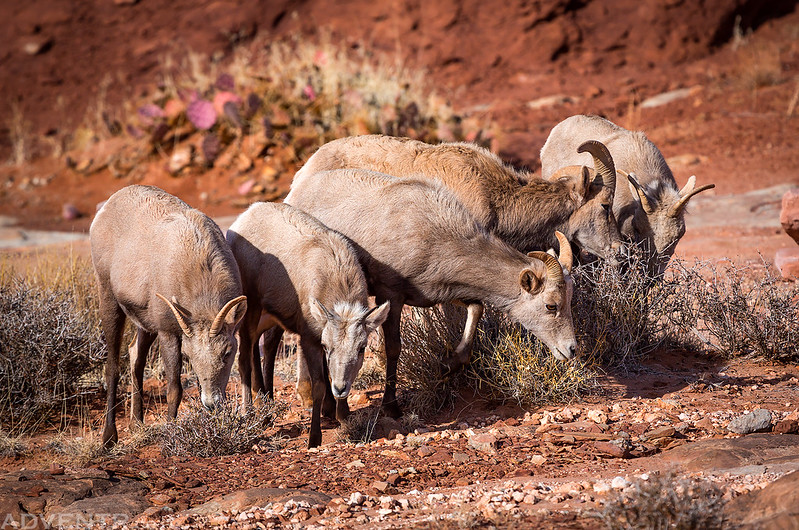
As we were leaving Musselman Arch we ran into a herd of desert bighorn sheep ewes near the road.

I guess it was dinner time…
Then it was back to driving the White Rim Road. We didn’t encounter anyone else along the road in the park this evening and saw no one else camped at any of the sites we passed. It was nice to be out here alone.
Driving below Monster Tower and Washer Woman Arch.

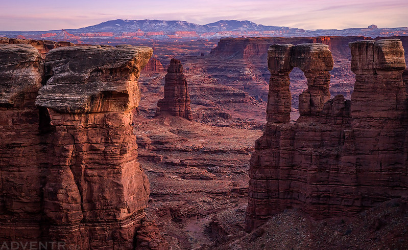
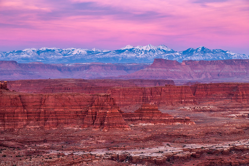
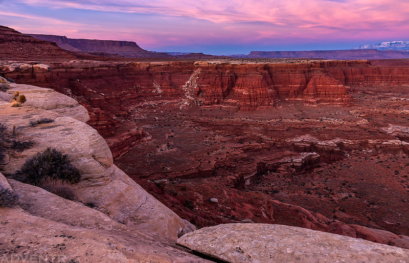
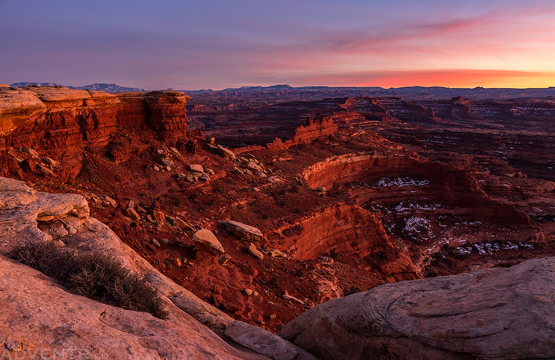
We reached the edge of Monument Basin just as the sun was setting, so of course we stopped for a few photos.
I couldn’t help noticing the Needles Overlook across the way since I had just spent an amazing evening there last weekend!

One more look into Monument Basin and the Totem Pole before we continued on to our campsite.

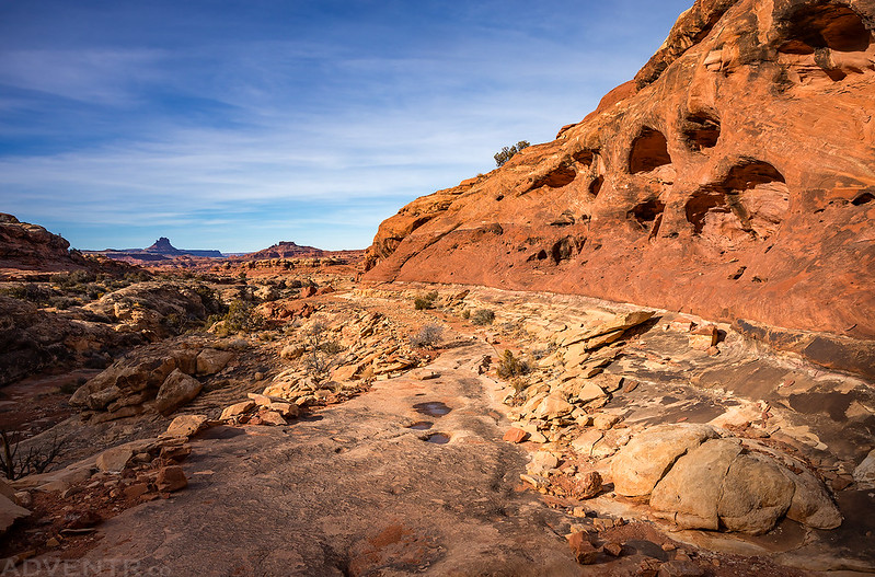
We reached the spur road to the White Crack while the western sky still had a very dim color to it and the sign was lit up by my headlights as we crested the hill. It was just a short drive to our campsite in the dark from here.

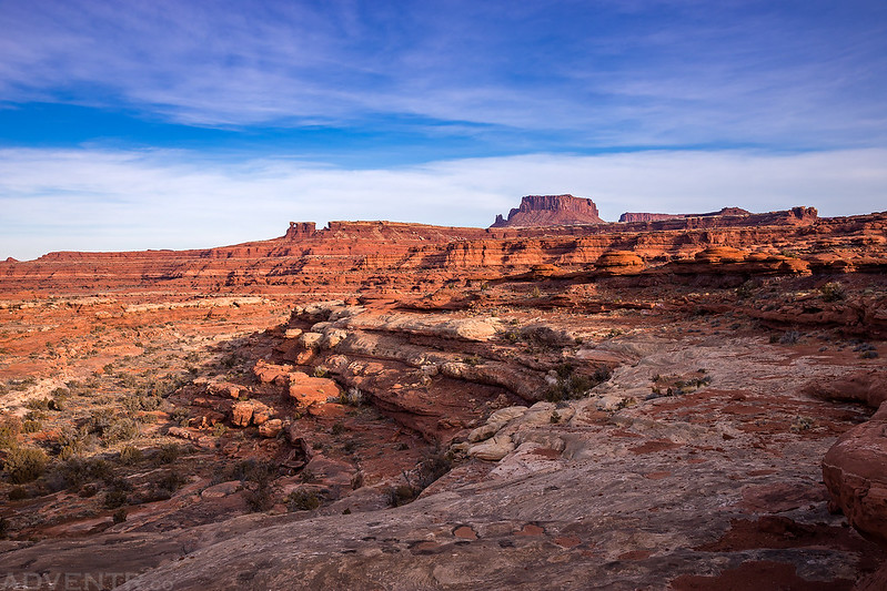
On Saturday morning we woke up at 6:00am so we could get ready and get started hiking about 20 minutes before sunrise when there was enough light to see without needing to use our headlamps. There was a long hike ahead of us and we definitely wanted to start early. Although the overlook above The Confluence was only about 4.5 miles away as the crow flies, we had to navigate around a bunch of fingers of canyons that would make the hike over 10 miles each way. Much of the route follows an old mining track, and while there were some ups and downs along the way, the old road was generally pretty gentle with the elevation gain and loss which made the hiking easier. There were great views all along the route with North Six-Shooter Peak, Ekker Butte, Elaterite Butte and Junction Butte as constant companions on the horizon.
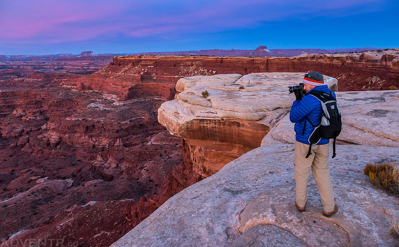
We had a long day ahead of us, but we had to stop for a few photos from the rim before really starting the hike.
It was a nice morning for a long hike.
We started our hike with a descent through the White Crack and we would follow this old road all the way to the mining camp at the end.

Through The Crack
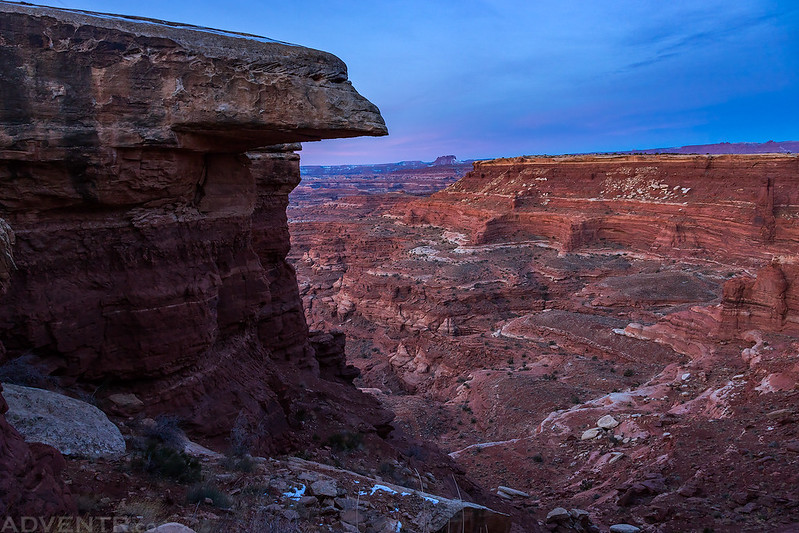
After dropping through the White Crack the road followed a ledge under the rim until it reached this large spire where it switchbacked down.

Watching the morning light across the rugged terrain around us as we followed the old road, which was hard to follow in a few places.

Looking back as Junction Butte came into view above the White Crack.

While the straight-line distance from the White Crack campsite to The Confluence isn’t really that far, the old road had to go around many of these smaller canyon fingers which doubled the distance, at least!

Following an old dugway along the mining track.

Another look back to Junction Butte with Grand View Point now coming into view.
We were happy when we got our first view of the Green River, which meant we were getting close to the old mining camp.
Elaterite Butte over Stillwater Canyon

A short distance later we reached these old bed frames which marked the location of the old mining camp near the end of the road.
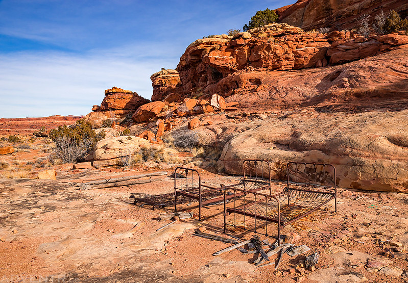
It doesn’t look like a bad place to spend the night! If I were making this an overnight trip, this is probably the area I would spend the night.

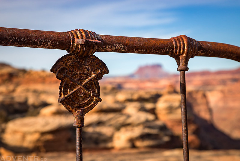
This stove was nearby.

These are not the kind of potsherds that I usually come across…

A closer look at one of the bed frames.
As we left the mining camp we had another nice view over Stove Canyon and the Green River. There is a trail in Stove Canyon that will take you down to the Green River, but we still had a long hike ahead of us so that one will have to wait until I go on a Stillwater Canyon river trip.

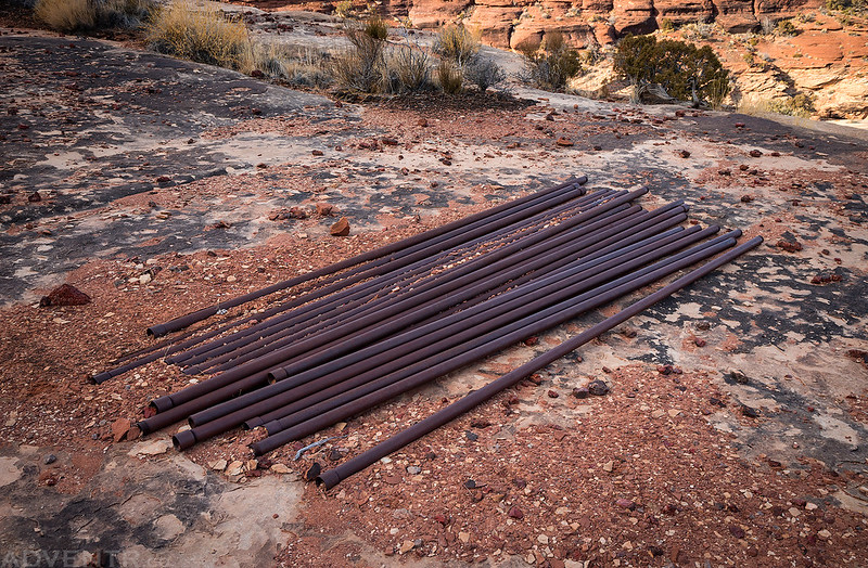
These pipes were near the top of Stove Canyon.
After climbing up the last part of the old mining track to the top of the mesa and then crossing over an old airstrip, we hiked cross-country to the other side of the peninsula so we could see The Confluence. As we neared the end of the peninsula the terrain got a little rougher and required some route-finding to reach the point right above The Confluence.
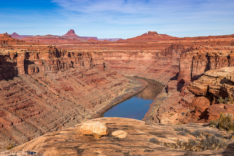
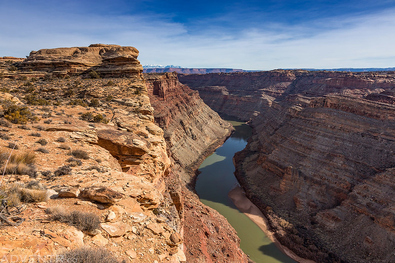
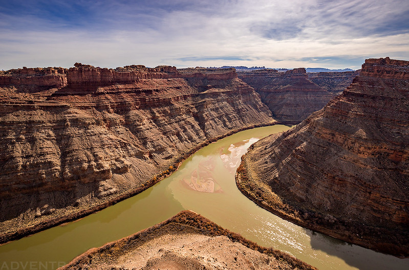
When we reached the other side we had a good view over the Colorado River in Meander Canyon.
Then we followed the convoluted terrain southwest staying as close to the edge as we could.
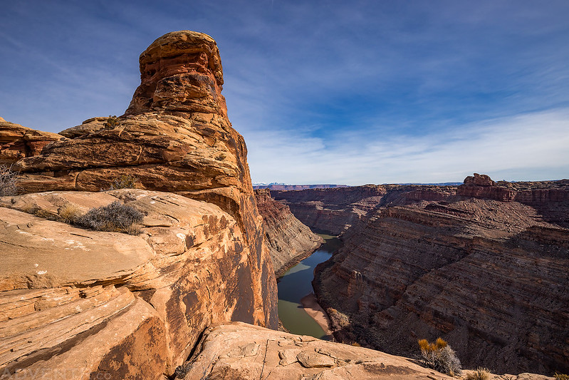
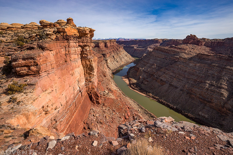
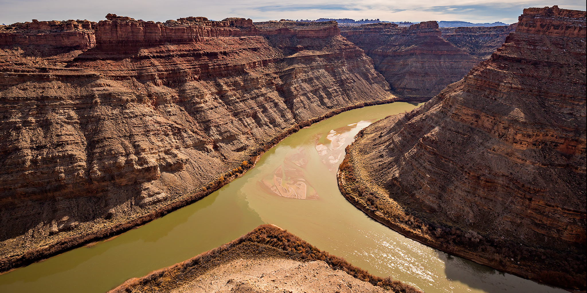
We soon found ourselves looking straight down over the junction of the Green River and Colorado River right below us. I’ve seen The Confluence from both The Needles and The Maze before, but I believe that I saved the best view for last! That’s the Colorado River on the left and the Green River on the right.
Of course, I took a few photos at different angles.

Although both rivers were mostly a greenish color this day, at least they were slightly different colors so you could see the difference where they meet.

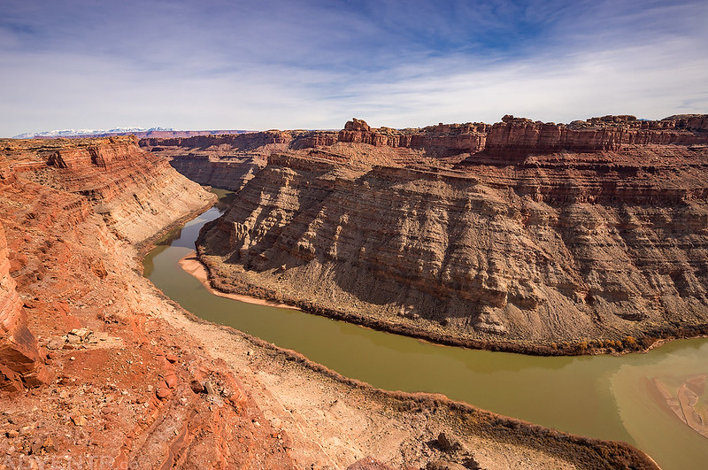
Here’s one last view of The Confluence below. We stopped and rested on this point between the two rivers for about an hour before we started heading back.

Finding our way across the mesa on our way back to the mining camp.
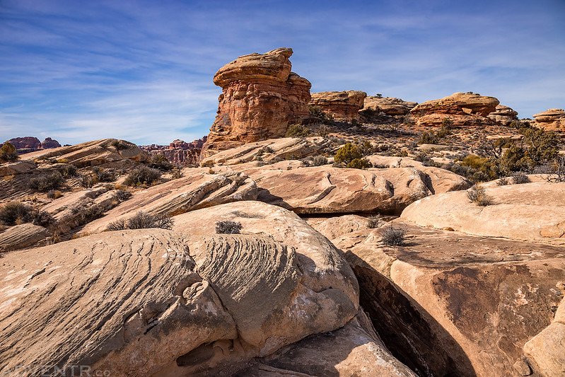
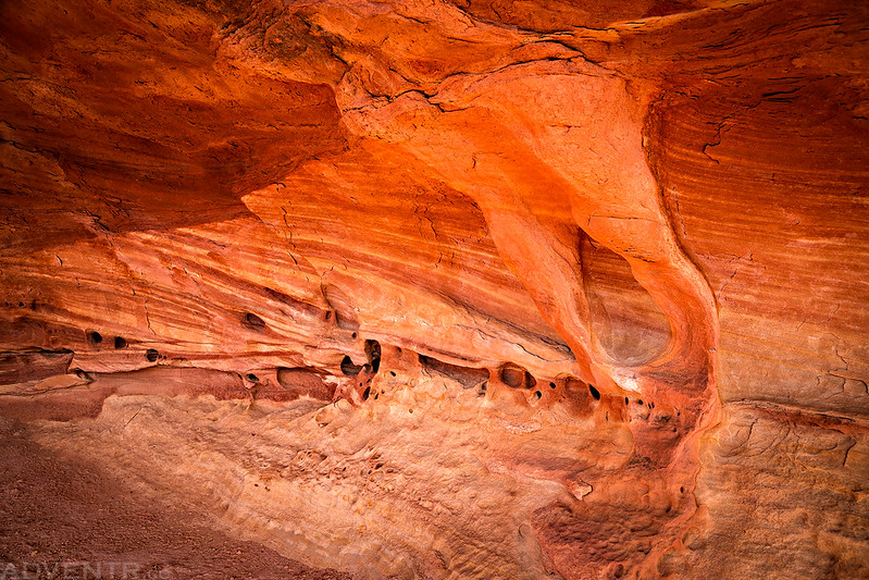
Little Striped Alcove
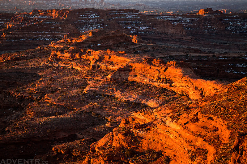
From the mining camp it was easy to follow the old road back to camp, but there was still a long way to go. Throughout much of the hike back we could see the White Crack in the distance and it never really looked too far away, but it seemed like it took forever to get back there with all the twists and turns around the canyons in our way.
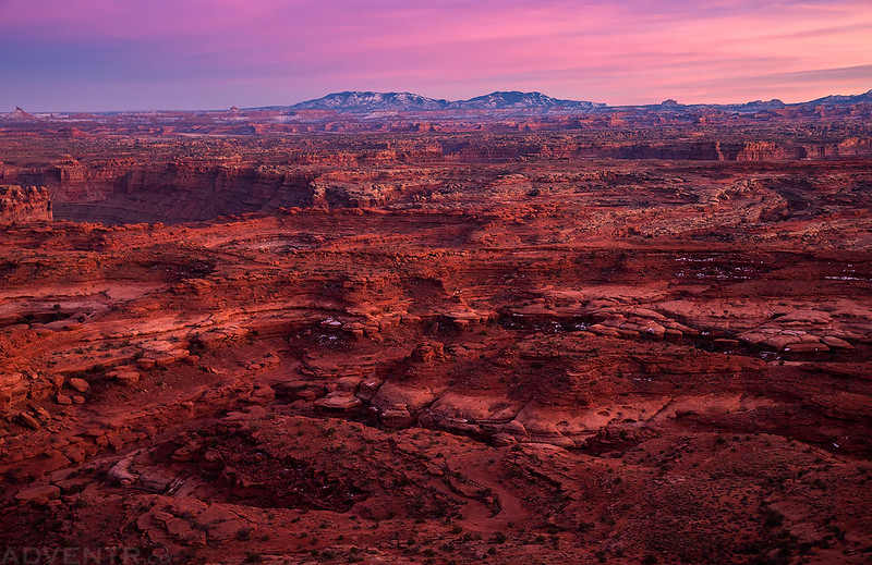
Shortly before sunset I found myself right below the White Crack and hurried up the last long switchback to the top so I could photograph the sunset from above.

One last view from the final 400 foot climb back up onto the White Rim. I arrived to camp about 30 minutes before sunset and started wandering along the rim taking photos until it was dark out!

An evening view of Junction Butte. Look closely and you can see my Jeep and Jared’s tent below.

A lot of the large potholes near the White Crack were full of water.

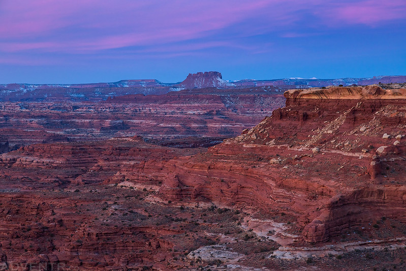
The views from the rim at sunset were pretty spectacular! This one is looking over The Loop to North Six-Shooter Peak.

What an amazing view of The Needles! I can’t wait to get back there next month!

Great light on rugged terrain surrounding Indian Creek below the cliffs of Harts Point.

The La Sal Mountain to the east.
The White Rim at dusk.
A view from the edge.

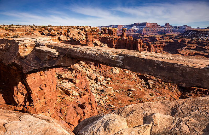
Majestic Canyonlands

The Abajo Mountains
Last Light from the White Crack
I took photos from the rim until the light was completely gone and then returned to camp for dinner. It had been a long day and although this was the longest dayhike I have ever done at just over 21 miles round trip, my legs were actually still feeling good and not tired at all. This surprised me and I probably could have hiked a few more miles if I wanted or needed to. All in all, it was a really good day!
I slept in a little later on Sunday morning, but still made sure I was up in time to photograph one more sunrise from the White Crack before it was time to drive back out.

The light striking the ridge below the point was very nice.
Here’s a morning view to the distant needles.
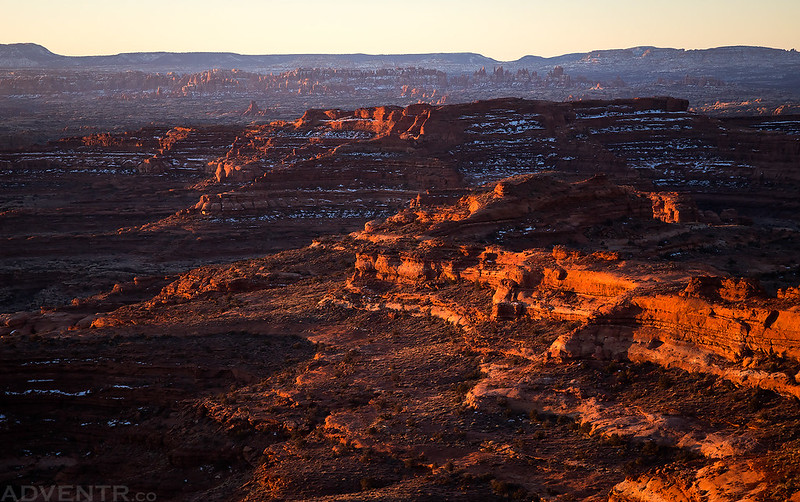
Morning light across the White Rim.

A view below the rim.

Jared was up taking photos at sunrise, too.

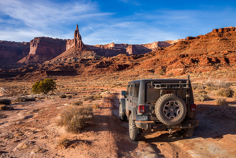
Here’s one last shot of my Jeep and Jared before we got in and started our drive back out.

Since we had stopped a few times on our drive in on Friday evening and were returning the same way, we didn’t make any stops on our way out until we reached Jared’s car near Potash. He transferred his gear back into his car and then we returned to Moab for an early lunch at Pasta Jay’s before we parted ways and I headed back home. This was definitely another amazing weekend in Canyonlands National Park that I won’t soon forget! I just can’t get enough of this piece of the Colorado Plateau!
Just beyond incredible. I can only dream now at this stage of my life but I so love following you and seeing your incredible photos.
Dang, my son & I have searched for the start of this hike 2-3 times and just can’t find it. Can you help?
What part are you having trouble finding? You just follow the old road that’s blasted out of the cliff (aka, the White Crack) all the way.
I saw your picture of the crack. I guess We’ve never noticed it before. So, if I camp at the site, I assume I’ve passed it. How far back up the road?
If you are at the White Crack Campsite, just hike straight south about a tenth of a mile and you will find the White Crack at the edge.
Thanks, I suppose we have seen this but were looking for something else.
Looks awesome! I’m planning on heading from stove canyon to the confluence over look. Do you have a GPX route or some general directions. I am worried about the cross country route turning into a crypto stomping extravaganza.
I have a GPX. Not really sure how these work. Not sure how to share it.
Were you able to get access to the water to filter drinking water from it?
This was just a day hike, so we carried all the water we needed.