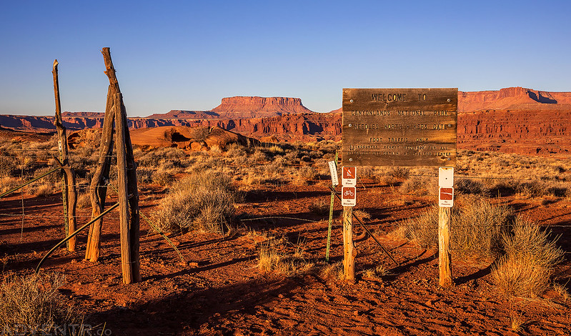
Friday – Sunday, November 20-22, 2020
After spending a great weekend in the Canyon Rims Recreation Area earlier this month, I thought it was time I returned below the rim of Hatch Point to spend some more time along the Lockhart Basin Road between Indian Creek and Lockhart Canyon. I left after work on Friday and decided to drive through Moab this time instead of going through Gateway. As I expected, traffic was backed up outside of town and it took me about forty minutes to get through town and on my way again. I finished the drive in the dark and found a campsite along the road leading to Lockhart Basin. This is usually one of my go-to places to camp when I’m visiting The Needles, and I have never seen so many people camped in this area before! It was crazy busy!
I woke up early on Saturday morning and continued my drive towards Lockhart Canyon exploring a couple of side roads along the way.

There was a nice view over to Airport Tower and the Island in the Sky from the road I was on.

Here’s a view looking the other direction to the United Nations Tablet and Canyonlands Overlook at the end of Hatch Point.

Looking to the south there was a good view of North Six-Shooter Peak over Rustler Canyon.

At the end of the road I was stopped by a fence at the Needles North Hikers Gate. I parked my Jeep and started hiking from here.
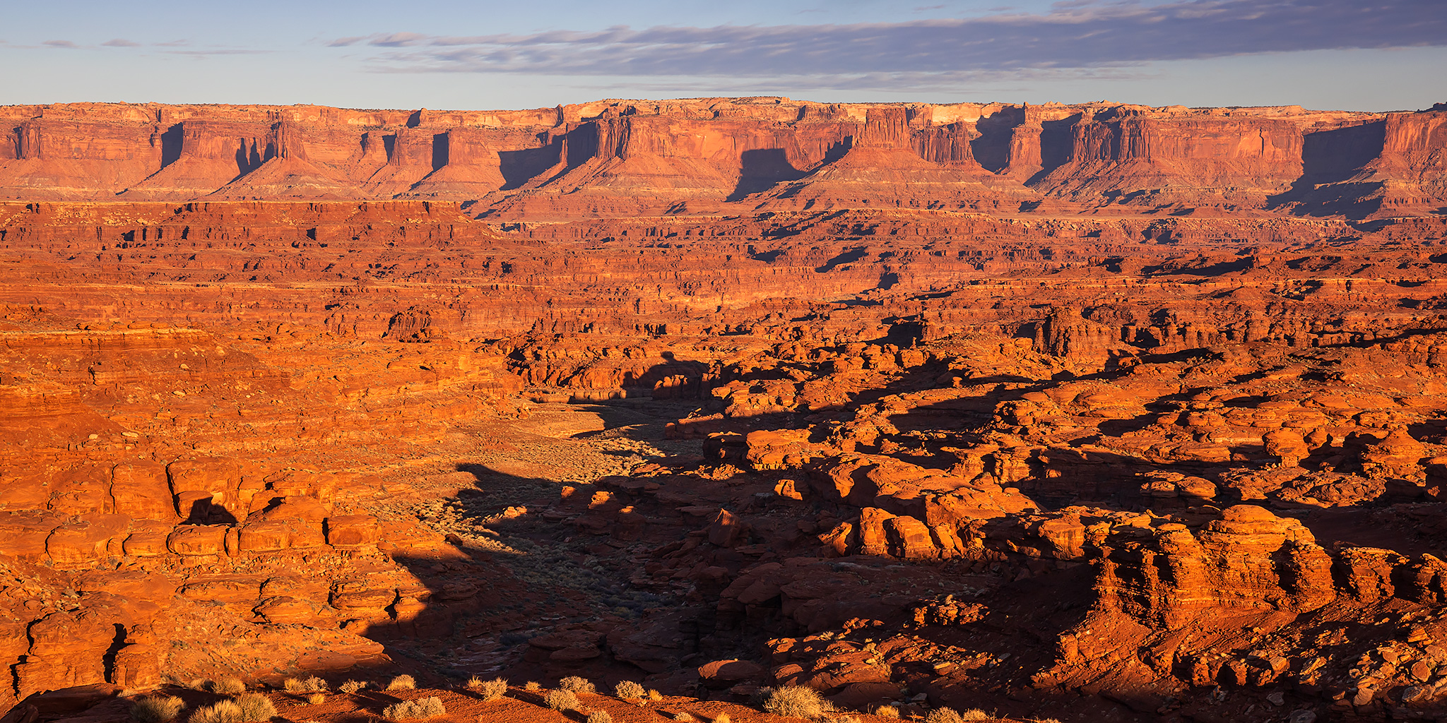
When I reached the rim of the canyon I had a good view of the Colorado River below. During our White Rim Trail trip last month I was actually right across the canyon from here when I went on a hike to the bench above Sheep Bottom. That beach in the shadows below was also where we camped on our second night during our float down Meander Canyon in September. I love being able to see these places from all different vantage points!

Hiking back across the desert to the trailhead.

My Jeep parked at the Needles North Trailhead when I returned.

I hopped in the Jeep and then drove into Lockhart Basin.

I followed the road into Lockhart Canyon and stopped to check out this old truck as I made my way towards the river.

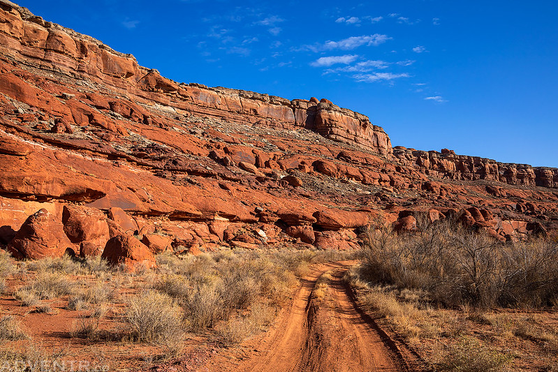
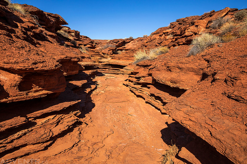
This is the lower Lockhart Canyon Road within the boundary of Canyonlands National Park.
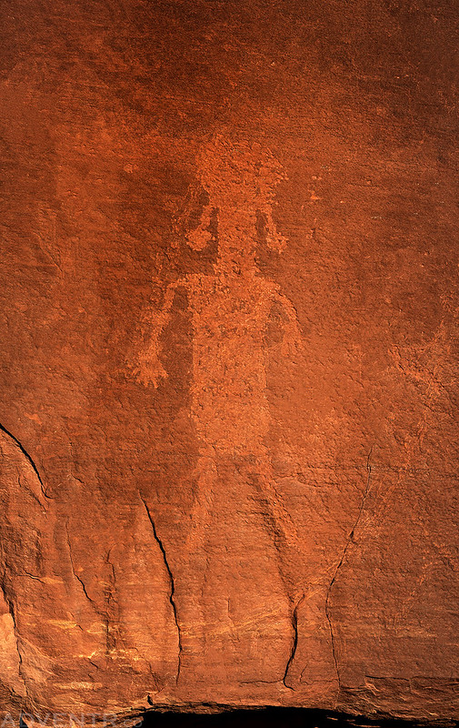
When I reached the end of the road at the mouth of the canyon I went searching for a panel of petroglyphs nearby. They were easy to find but they weren’t that great and there was also a lot of vandalism to them. I’m kind of glad I didn’t stop to check them out during our float through Meander Canyon because I would have been a little disappointed.
There used to be an old cabin located near the end of the road, but it burned down many years ago. Above the site of the old cabin there are a couple of inscriptions, including this large C.S.S. carved into the canyon wall.

Before leaving the area I found a trail through the tamarisk at the mouth of the canyon and walked to the edge of the Colorado River.

The Colorado River. It felt like just yesterday that I was floating through here…

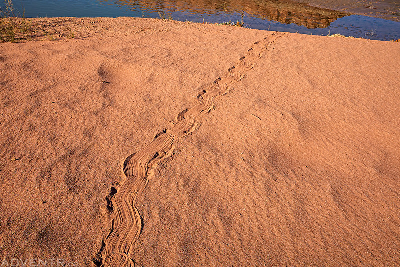
As I was walking along the sandy beach I noticed this track, like something had slithered on it’s belly into the water. Anyone out there know what may have made this? Maybe a North American River Otter?
Here’s view of Hatch Point from the sandy wash of Lockhart Canyon as I drove back out.

The road in Lockhart Canyon was mostly sandy, but there were a few rocky places that would slow you down.

It’s hard to believe that this place would be completely transformed in just a couple of short days when the mysterious obelisk (monolith) was discovered, reported and went viral online. I had driven within a half mile of it on this day and didn’t even know…

After exploring a few more side roads in the area I returned to a shallow fork of Rustler Canyon and decided to go on an afternoon hike into the canyon, which also happens to be part of the Hayduke Trail. I can’t seem to get away from that trail this year! Usually I do most of my hiking in the morning and am back in the early afternoon, but today I decided to change things up a bit by hiking in the late afternoon.
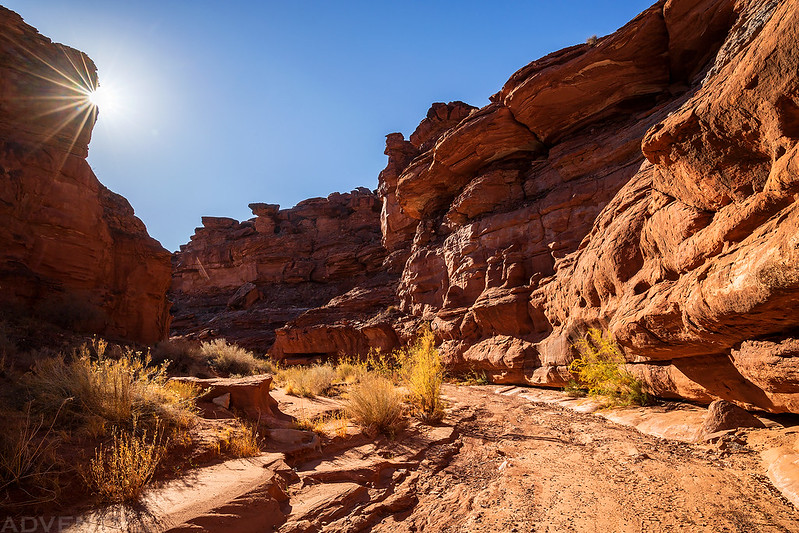
I started out following a shallow side canyon until I reached the broad wash of Rustler Canyon.


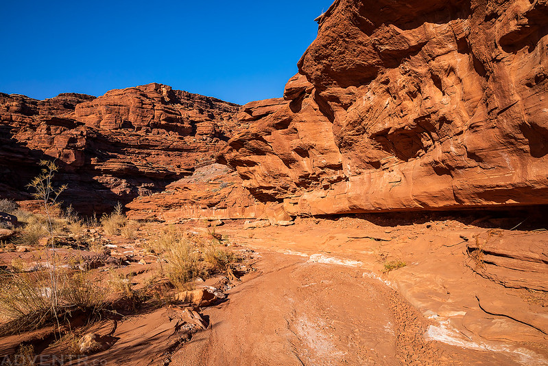
Shortly before reaching the confluence with Indian Creek Canyon I was stopped by this large pourover.
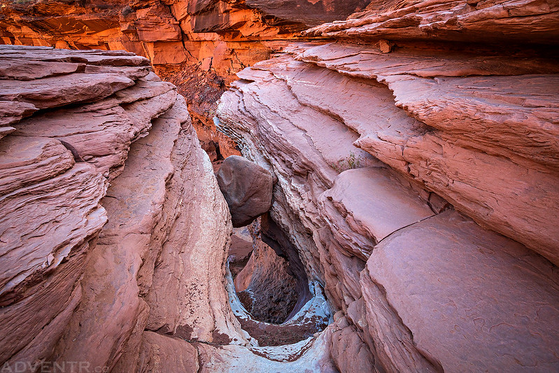
Since I know this is part of the Hayduke Trail, I figured there would be an easy route around the pourover, so I started looking for one. On the left side I found a couple of cairns on a route that looked like I could probably get down, but there was no way I’d be able to get back up on my own! So I went over to the right side and followed the bench around for a while and did eventually manage to find a way down into the bottom of the canyon again.
Hiking through lower Rustler Canyon shortly before reaching Indian Creek.
Once I reached Indian Creek I stopped to rest for a little bit and then started hiking back up Rustler Canyon. It was getting late and I wanted to get out and find a campsite before dark.


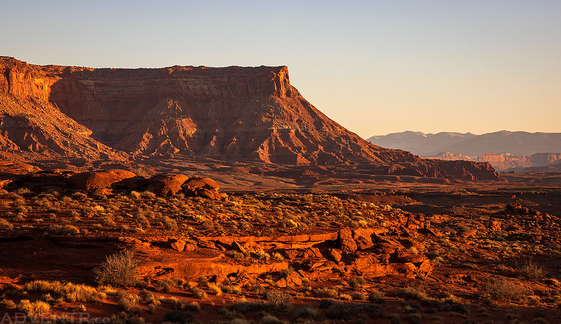
Hatch Point towered above shortly before I made it back to my Jeep.

The Needles Overlook just before sunset.
I had found a couple of nice campsites in the area this morning when I was driving around on the side roads, so I decided to return to one of them and arrived shortly before sunset. I had some dinner, listened to a couple podcasts and then went to bed early.
Since there was an expansive view from the campsite, I woke up just before sunrise on Sunday morning to take a few photos.

I returned to the main Lockhart Basin Road to start my drive back out.

I took one more short detour to photograph Pelican Arch along the way. That’s the Needles Overlook framed through the opening of the arch.

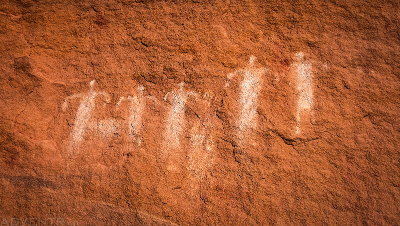
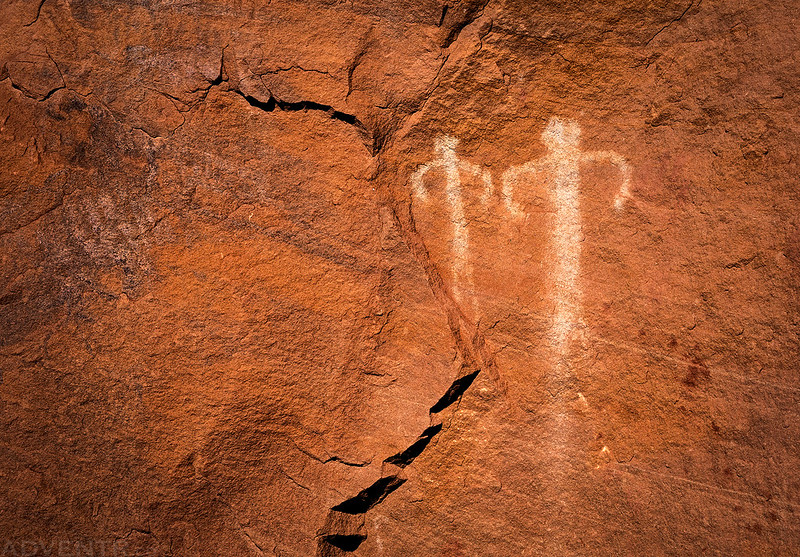
Although I wanted to get home early today, I still had plenty of time to visit some ruins and rock art that I had not been to before. Here are a couple of photos I took at the site before I headed back home. It was yet another great weekend in the Canyonlands!


You can hike right through that pour off. It is not a problem at all. The first time I saw it I was daunted by the view which looked like a MAJOR drop off but once you scramble under that rock you’ll find the vertical a is only about 20′ and there is a gentle path to the left that descends it.