Halloween Weekend Exploring the Canyon Rims Recreation Area Under a Blue Hunter’s Moon
Friday – Sunday, October 31 – November 1, 2020
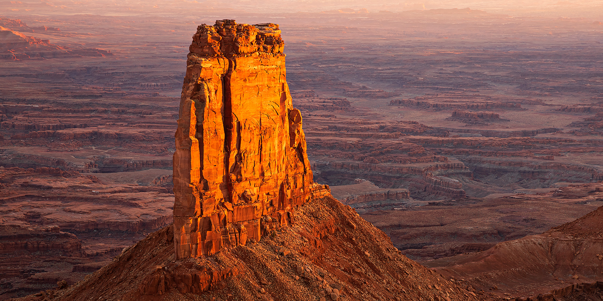
Talk about a stacked weekend! Not only was it Halloween on Saturday, but there was also going to be a Blue Moon along with the Daylight Savings Time change overnight, and I knew that I definitely wanted to spend this weekend exploring the Canyonlands region some more. Aside from a brief but amazing evening at the Needles Overlook in January, it’s been a while since I spent any real time in the Canyon Rims Recreation Area and I thought that it would be fun to spend a full weekend exploring Hatch Point again. Aside from a couple of semi-popular overlooks, I feel like this area which is located just to the east of Canyonlands National Park gets overlooked and I would like to see more of it!
As usual, I left right after I got out of work on Friday and headed to Hatch Point. Just like last weekend, I decided to drive through Gateway to avoid the traffic and road construction in Moab. After a quick stop in Naturita for fuel I backtracked a short distance and drove through Paradox Valley to La Sal Junction instead of going all the way to Dove Creek. As I neared the small town of Old La Sal, I had another close call with a deer, but this time I managed to miss it! When I reached the turnoff for the Canyon Rims Recreation Area I decided to drive all the way to the very end of the road and found a campsite near the Anticline Overlook.
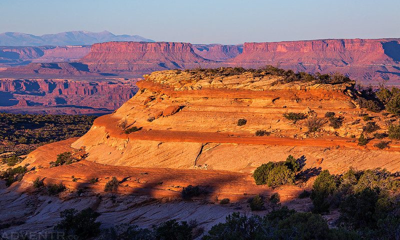
On Saturday morning I got up early and drove over to the Anticline Overlook so I could watch the sunrise from the edge. I think I’ve only ever stopped at this overlook in the middle of the day before, so I thought it would be nice to catch some morning light for a change!
A beautiful view before sunrise from Hatch Point over the Colorado River and Pyramid Butte to Dead Horse Point on the other side.

Looking down to Hurrah Pass and Kane Creek Canyon with Elephant Butte in Arches National Park just below the horizon.

I caught the sun coming up to the south of the La Sal Mountains over Kane Creek Canyon.

Warm morning light on the ridge right below me.

Here’s another view over Hurrah Pass after the sun had come up a little bit.

Leaving the Anticline Overlook on my way to my first hike of the day.

After a brief drive around the Minor Overlook, I stopped and went on a short walk so I could get a closer look at Wine Glass Arch.

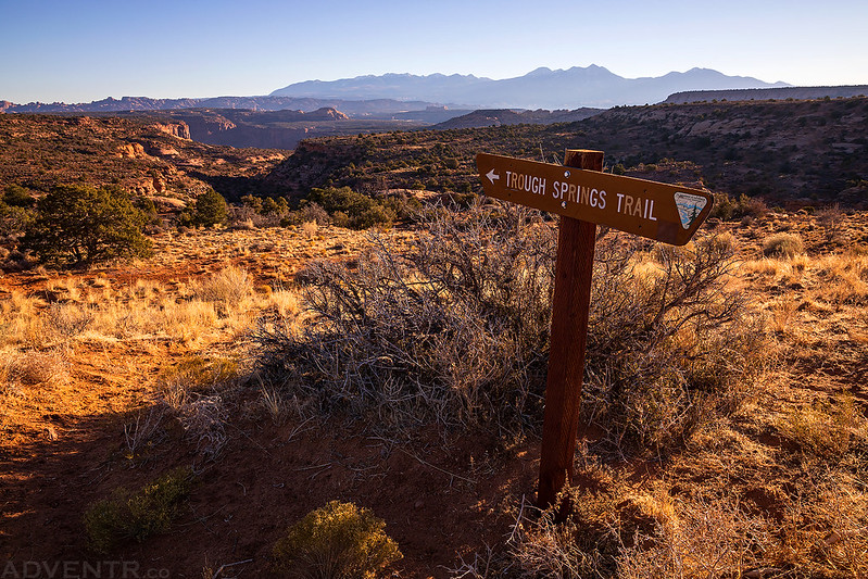
Then I made my way over to the trailhead for the Trough Springs Trail, which seems to be the only official trail on the map in the Canyon Rims Recreation Area.
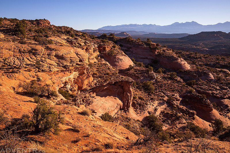
This trail starts out on Hatch Point and then descends about 1,100 feet down into Kane Creek Canyon on an old stock trail, which is similar to many of the trails across the river on the Island in the Sky.
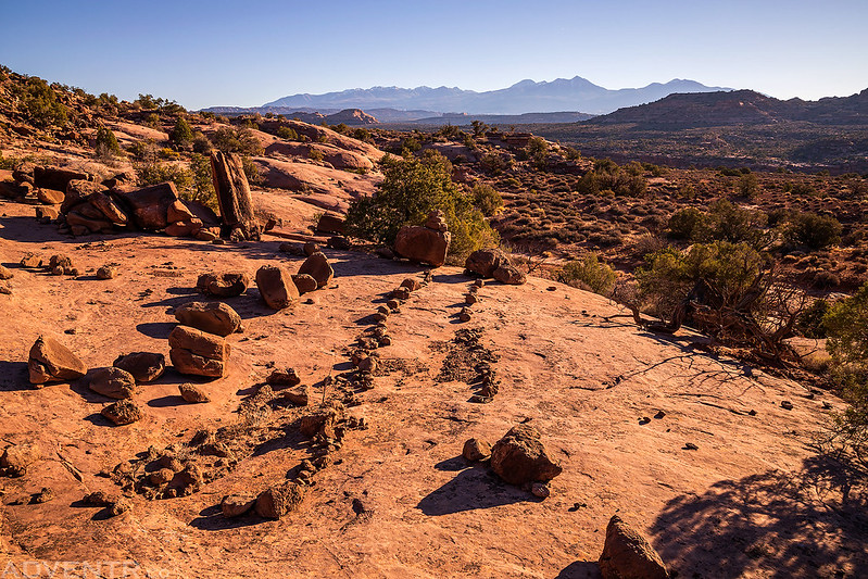
It doesn’t appear that this trail sees too much use and there were just enough cairns to help find the way, but this section of the trail was easy enough to follow.
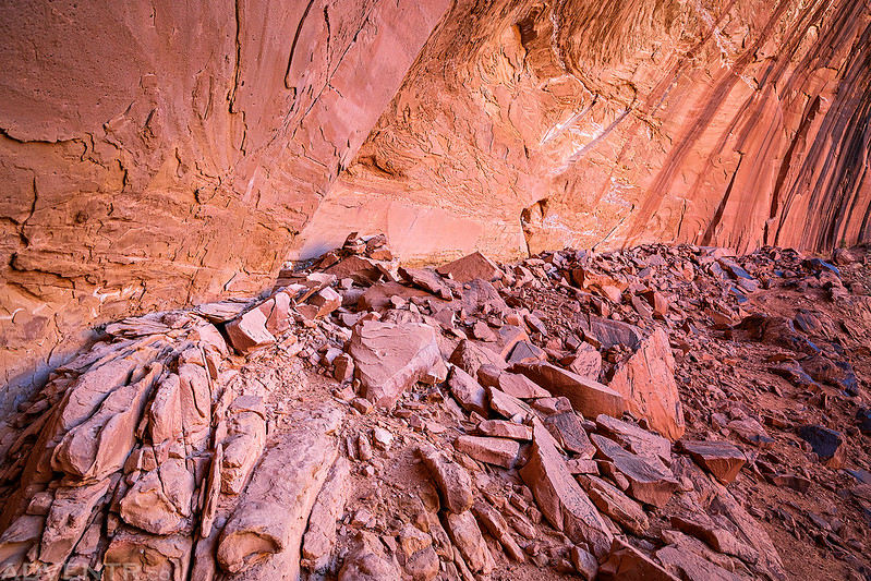
The descent into Trough Springs Canyon.

When I reached the canyon floor there was some water flowing in the wash, but it didn’t last for too long downstream.
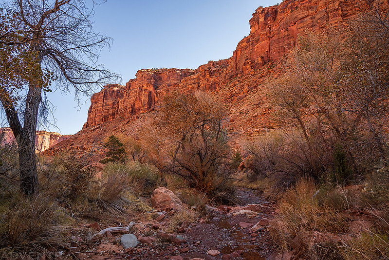
I started out by hiking down the wash but there was a bit of bushwhacking, so I eventually found an old road up on the bench that I followed into Kane Creek Canyon.
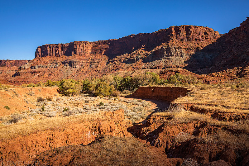
I wasn’t sure if I was going to be able to make it through the dense vegetation along Kane Creek to reach the road on the other side, but I did find a trail through the jungle that got me across the dry creek bed and to the road. It’s been a long time since I was in this part of Kane Creek Canyon!
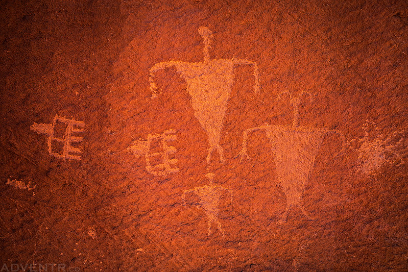
I walked over to a boulder covered with petroglyphs that was right along the road.


After taking a short break near the petroglyphs I started hiking back up the canyon.
Trough Springs Trail

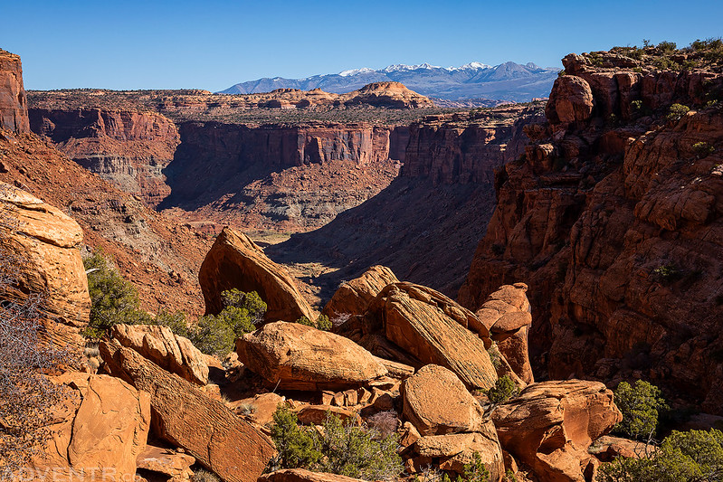
This was the last part of the old cattle trail as I climbed out of the canyon to the top of the mesa.

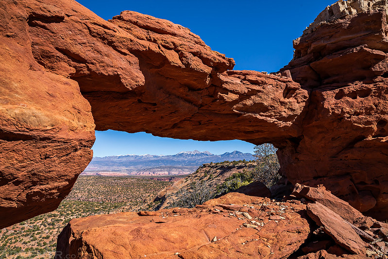
After retuning to my Jeep I went for a little drive on the Boxcar Bridge Trail to see if I could find the arch. It was pretty easy to spot as I got closer to it.
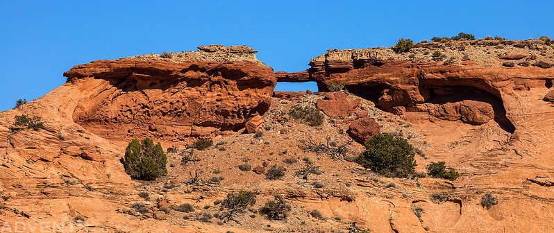
There were a lot of 4×4 roads in this area, so I followed a few of them to get closer to the arch. When I found a spot that was about a half-mile away I parked and hiked over to the arch.
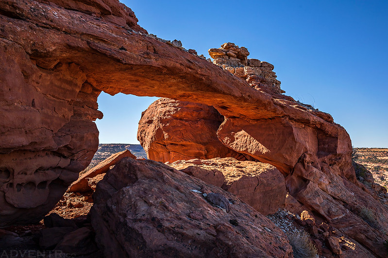
The La Sal Mountains framed by Boxcar Bridge.
It was starting to get later in the day, so next I drove out to the Canyonlands Overlook where I planned to photograph the sunset and spend the night. There were a couple sections of the road out to the overlook that were a little bit rougher than I remembered. When I arrived at the end of the road there was no one else around, so I parked at the spot with the picnic table and fire pit right on the edge and waited for sunset.
This was the view from right behind my campsite as I ate dinner. On the other side of Meander Canyon is Dead Horse Point, where Diane and I plan to spend a full weekend in early December.
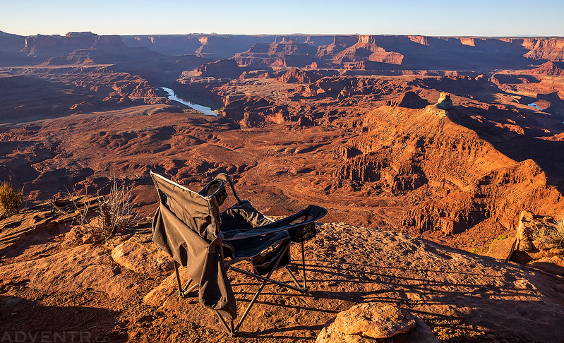
I’ve watched the sunset from here before and it never disappoints!

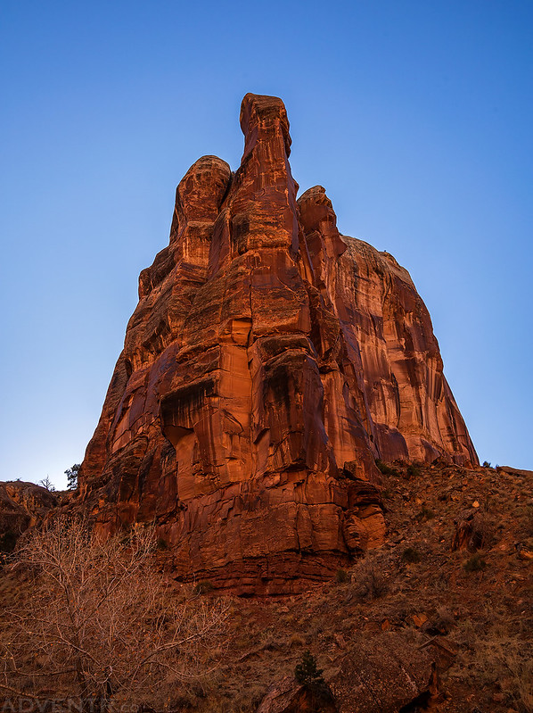
The United Nations Tablet

Last Light on Hatch Point

Once the sun was down and I was back at camp I noticed that there was an intense silence this evening. There was no wind, it was perfectly calm out and the temperature was very comfortable. It was an amazing evening in the Canyonlands region as I watched the Blue Moon come up over the La Sal Mountains to the east.
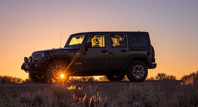
I woke up before sunrise on Sunday morning and left the Canyonlands Overlook in the dark so I could drive to the other side of Hatch Point and hike down another old cattle trail into Harts Draw. I made a couple stops for photos along the way as the sun came up.
I liked the layers in the sandstone here with Junction Butte and Grand View Point in the background, especially since I had just hiked to the saddle between the two very recently.
After taking the previous photo I turned around and saw the sun shining through the wheel of the Jeep, so I had to get a shot!
Next I drove around Windwhistle Rock and found a place to park along the 4WD road so I could follow another old cattle trail into Bobbys Hole Canyon. This was a tough old trail to follow as there were no footprints and only an occasional cairn. After a few wrong turns I did finally figure out the route into the canyon.

Once I reached this massive alcove, I headed inside in search of rock art.

Pictograph Design

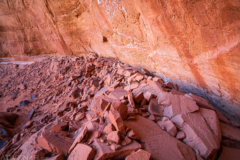
Exploring the back wall of the big alcove.
A big white sheep and a Barrier Canyon Style figure.

Boulder-hopping along this rocky shelf at the back of the alcove.
I almost missed these two small and very hard-to-see sheep pictographs that reminded me of the Split-Twig Figurines.

At this point I was hoping to hike up a side canyon to try to get a view of Aqueduct Arch even though I knew I would get stopped by an impassible pourover just before the arch, but I turned around when the canyon got too rocky and bushwhacky. Instead I did a little more hiking in Harts Draw before heading back up Bobbys Hole Canyon.

A rincon hoodoo in Harts Draw.

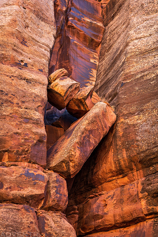
I liked the way these fallen boulders settled in the crack of the canyon wall.
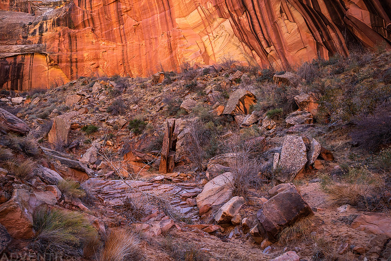
Beautiful scenery in Bobbys Hole Canyon.
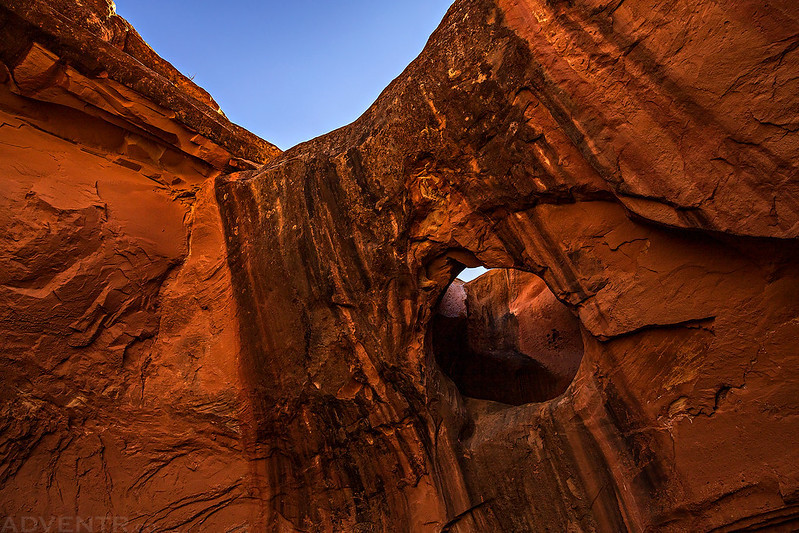
Before hiking back up the cattle trail to my Jeep, I continued up the canyon a little further so I could visit Harts Draw Bridge, which is located above a pool of water just up a side canyon.

Harts Draw Bridge
I was not expecting to run into anyone else on this hike, especially since it was obvious that no one had hiked down the old cattle trail for a long time as I made my way into the canyon earlier in the morning, so I was very surprised to run into two different groups hiking down into the canyon as I hiked back out!
I returned to my Jeep and then started my drive back home. I had an amazing weekend exploring ‘The Other Island in the Sky‘ – Hatch Point!
Awesome pictures!!! Don’t suppose you have route coordinates for your Bobby’s Hole/Harts Draw adventure? I have a pretty good idea, but thought I’d check with somebody who’s actually done it.