Labyrinth Canyon Wilderness | Friday – Sunday, April 18-20, 2025
After spending last week in Arizona and then driving up to Salt Lake City in the middle of this past week to attend a concert on Wednesday evening I had fully intended to take this weekend off to stay home and relax for the first time this year, but Diane was going to be working nights this weekend and she wanted me out of the house so she could get some rest in between shifts. I quickly threw together a last minute itinerary and left after work on Friday afternoon to spend the weekend exploring the Labyrinth Canyon Wilderness on the west side of the Green River where I could go on some hikes that I’ve wanted to do for a long time but have kept putting off. I was hoping this area wouldn’t be too busy over the Easter holiday weekend and thankfully that turned out to be a good bet!
After topping off my gas tank in Green River, I headed south on the Lower San Rafael Road and explored a spur road just south of the San Rafael River that forms the northern boundary of the Labyrinth Canyon Wilderness.

The road ended at the edge of the Green River.

It looked like it might be raining a bit further south.

Before continuing further south I stopped at an overlook of lower Moonshine Wash as I explored a few more spur roads that I had never driven before.

Welcome to the Labyrinth Canyon Wilderness.

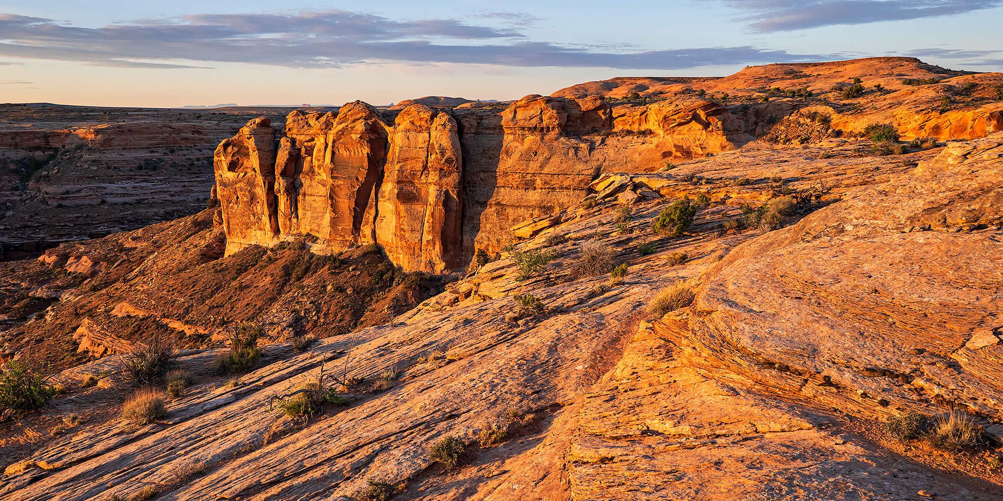
As I made my way out to Keg Point I stopped to go on a short hike to the top of Keg Knoll.

Keg Knoll Summit View

Although I could not find the Keg Knoll Benchmark, I did find two Reference Marks.

I finished driving out to the end of the road and found a place to camp for the night.

I went for a walk on an old closed road near camp and then read for a while before going to bed early.


I was up early and hiking on Saturday morning before sunrise as the remaining clouds in the sky continued to dissapate.

This morning my goal was to find the Frog Trail and descend into the rincon found at the lower end of Horseshoe Canyon.

It didn’t take me long to reach the rim that surrounds The Frog.

I followed the rim south as I searched for a route down to the benches below.

Rincon & Horseshoe Canyon

Looking down Frog Creek from the rim.

After dropping down to the bench below I followed it back north until I found the top of the Frog Trail.

Looking back up the route from the bottom of the Frog Trail.

An upstream view in the rincon.

Frog Creek Overlook

Headed back up the Frog Trail.

Up near the top of the trail I searched for a small overhang than contains some old trail-building tools.

There’s an old box of dynamite which has mostly melted away.

After returning to my Jeep I ate lunch and then drove around to the west side of Keg Spring Canyon so I could explore a few more spur roads and hike along the rim of the canyon.


I found a few petroglyphs during the hikes.

This petroglyph panel is pretty hard to see, but it’s very interesting!

Lichen & Petroglyphs

A closer look at the petroglyphs.


Here’a a closer look at the large and colorful lichen found below the petroglyphs.

Canyon Curves


Exploring a small fork of Keg Spring Canyon.


Keg Spring Canyon seen from the Andy Moore Trail.

After returning to a campsite at the end of the road out to Keg Point I went for an evening walk across the sandstone.

Keg Point Camp

I left camp at dawn on Sunday morning and made my way over to the rim of Twomile Canyon.

There was a sun pillar above the horizon briefly before sunrise.

I passed below Barker Arch.

I reached Little Barker Bridge just at sunrise and was able to catch this reflection in a small pool below.

Sandstone Wilderness

Twomile Canyon Rim

Looking down Twomile Canyon to the Green River in Labyrinth Canyon.


Once I found the top of the Twomile Canyon Trail I started the descent.

The trail initially was pretty steep as it dropped through the notch in the rim, but then it leveled out a bit as it continued to the floor of the canyon.

Below the Rim

Hole in the Boulder

Twomile Canyon Spire

At the bottom of Twomile Canyon.

Once I reached the mouth of the canyon I continued upstream along the bench until I reached the campsite at 61.5 mile just before Oak Bottom. Then I returned the way I had come.

Labyrinth Canyon

After following the Twomile Canyon Trail back up to the rim I returned to my Jeep and started the drive back home.

Great camping out that way!