Gunnison Gorge National Conservation Area | Friday – Sunday, April 25-27, 2025
After going on a last minute trip into the Labyrinth Canyon Wilderness in Utah last weekend, I wanted to stay even closer to home this weekend and thought that this would be a good opportunity for me to return to the Black Canyon of the Gunnison. Although as of last June I have hiked all of the official trails within Black Canyon of the Gunnison National Park, there are still quite a few trails and roads in the Gunnison Gorge National Conservation Area that I have not hiked or driven yet, so I figured I could check out a few more of them as I continue to explore the area more thoroughly. I left from work on Friday afternoon and made my way down to the Gunnison Gorge.
On my way to the Gunnison Gorge I took a short detour and drove to the top of Flat Top, which is a 6,321 foot flat-topped summit that has a lot of antennas and towers on it.

Then I followed the Elephant Skin Road toward the Red Rocks at the southern end of the Gunnison Gorge Wilderness.

Red Rocks

Driving through the Elephant Skin Hills.


Here’s a closer look at part of the Red Rocks.

Eventually I reached the Red Rocks Trailhead where I planned to hike into Black Canyon of the Gunnison National Park to the Red Rock Benchmark.

Following the Red Rocks Trail.

This tall Juniper caught my eye as I followed the route.

Red Rocks Trail View

The route climbs up to this little pass shortly after entering the Black Canyon of the Gunnison Wilderness.

Once I reached the pass I could see the Red Rock highpoint which would be my destination this evening.

I had to hike across this old burned area to reach the ridge.

Then I followed the ridge to the summit where I had better views over the Black Canyon.

Looking across the Black Canyon to the highpoint that is located between two different Green Mountains on the other side.

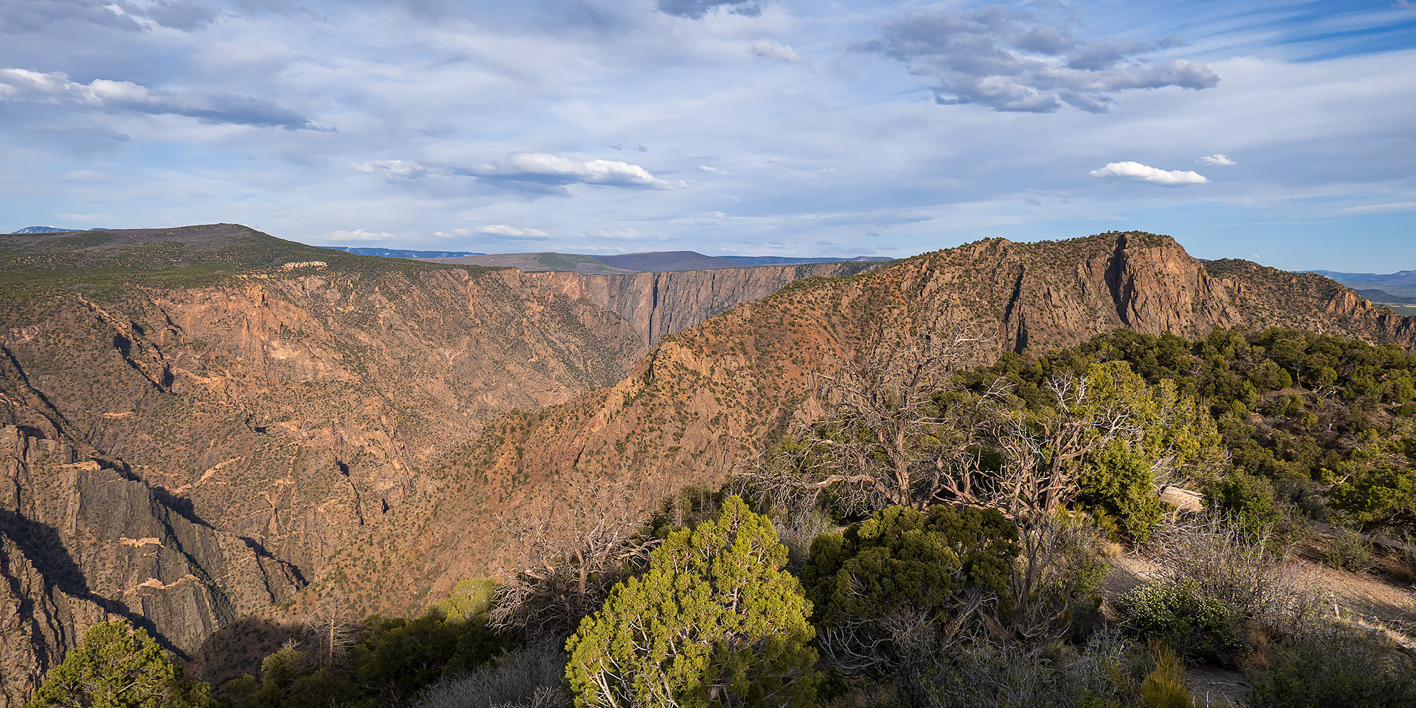
As I neared the top I had a nice view of the Black Canyon from just above where it meets up with Red Rock Canyon.

Red Rock Summit

Red Rock, 1934

There were some great views from the top of this highpoint in the park.

Overlooking Bostwick Park to Storm King and the San Juan Mountains beyond.

I liked the way the light was catching the ridges here.

I headed down the ridge further on my way back so I could enjoy the views a little longer.


I returned back to the trailhead just in time to watch the sunset as I looked for a campsite nearby.

A little light snuck out of a gap on the horizon to light up the Red Rock hills.

There was nice color in the sky above the Uncompahgre Plateau from near my campsite this evening.

The temperature overnight did not drop very low and it was still in the mid-50’s when I got up before sunrise on Saturday morning. There had also been some very strong wind gusts in the middle of the night that had shaken my Jeep pretty good and prevented me from sleeping well. Still, I woke up early on Saturday morning and drove over to the Bobcat Trailhead in the dark and then started hiking up the Red Rocks – Nighthorse Trail to the summit of PT 6604 at dawn.
I watched the sunrise light up the ridge as I followed the trail higher.

I left the trail near PT 6604 and followed the ridge to the summit.

Looking back to PT 7113, which I would visit later in the day.

PT 6604 Summit

There was a nice view of the Sneffels Range over the ridge as I returned to the Bobcat Trailhead.

After returning to the trailhead it was time for me to hike the Bobcat Trail, which is the only route to the river in the Gunnison Gorge that I had not hiked yet. The other routes include the Ute Trail, Duncan Trail and Chukar Trail.
Nice light in the gorge as I began my descent down the Bobcat Trail.

A view from the Bobcat Trail to PT 6604.

The trail got steeper the deeper into the canyon it went.

Near the bottom of the trail I had a good view of the Gunnison River.

Climbing back up a steep rocky chute near the bottom of the route.

Before returning to the trailhead I took a short detour to an overlook along the Bighorn Trail that I had first visited from the Duncan Trail about three years ago.

Looking up to PT 6604 right above the overlook.

Bighorn Overlook

Layers of the Black Canyon looking the opposite direction.

After returning to my Jeep at the trailhead I drove a few of the rougher roads in the area and then headed up the Wave Road so I could go for a short walk to the summit of PT 7113.
From the top of PT 7113 there was a nice view over Pitts Meadow, which is the green slanted mesa in this photo.

I really liked the view from the top of this point and might need to return sometime in better light.

Next up, I drove down the Chukar Road almost to the end and then hiked the unmarked Geologic Trail on an old closed road that enters the Black Canyon of the Gunnison Wilderness.

Geologic Trail Overlook

After getting dinner in Delta I returned to the Gunnison Gorge and drove up the Dinosaur Road for one last short hike to the Ute Benchmark.

There was another nice view of the Gunnison River along the trail to the top.

Ute Benchmark View

I didn’t find the benchmark on the summit, but there was a Reference Mark.

Looking upstream from the top.

This is where the Colorado Plateau meets the Rocky Mountains.

After my final hike I headed over to the South River Road and found a place to camp along the Gunnison River.

On Sunday morning I was up early to hike along the Gunnison River on the West River Trail at sunrise.

West River Trail

The trail passed right by this old stone foundation of a building.

Morning in the Gunnison Gorge

Shortly after entering the Gunnison Gorge Wilderness the trail got cliffed out and I turned around and headed back.

Claret Cups

Looking back upstream as the sunlight reached the bottom of the canyon.

Here’s one last view as I hiked along the river back to Gunnison Forks.
