The Canyons of Navajo Mountain & Rainbow Bridge National Monument
Wednesday – Monday, March 15-20, 2023
This year for our annual spring backpacking trip, Jared, Dave and I were planning to spend an easy four days and three nights hiking down Paria Canyon from the White House Trailhead to Lees Ferry. It’s a trip we have all wanted to do for a long time and were looking forward to, but back in December when I reserved the permit we had no idea what the atmospheric river would have in store for us this winter! A couple of days before our trip was set to begin there was a large flash flood in Buckskin Gulch and the Paria River that unfortunately killed two hikers and resulted in the rescue of about a dozen more. With reports of deep cold water crossings and continued precipitation and cold air temperatures in the forecast, we decided that this was probably not the right time for this hike and started considering different options.
New Plans & The New Wave
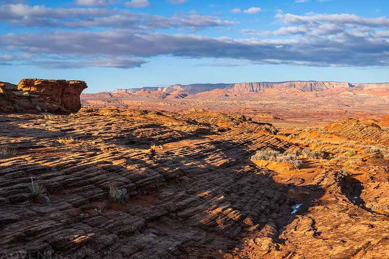
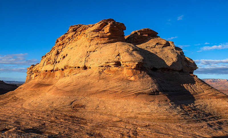
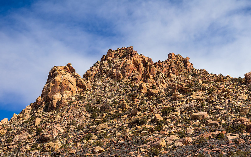
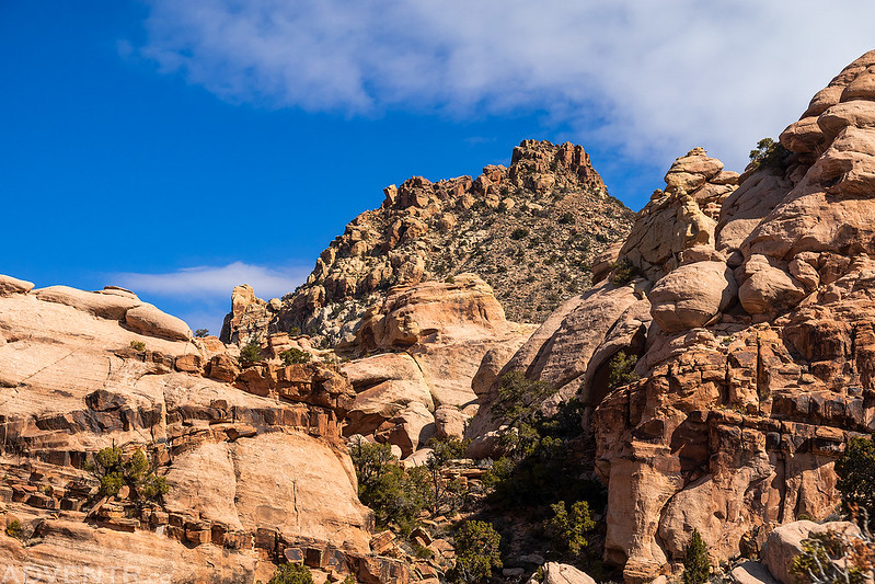
Since I try to be prepared, I already had a backup plan to hike around Navajo Mountain to Rainbow Bridge ready to go in case the weather did not cooperate with us on this Paria Canyon hike, so we decided to try that one instead. We had originally planned this backpacking trip to Rainbow Bridge for early April in 2020 and even had the Navajo Nation permit all lined up for for it- but we all remember what happened with COVID-19 at the time, and that trip ended up being cancelled when the Navajo Nation went into lockdown. Anyway, with our new plans settled we planned to meet up in Big Water on Thursday morning, so I left after work on Wednesday afternoon and headed down that way. I drove through on and off rain the entire way, with the strongest storm hitting as I drove over Marsh Pass just west of Kayenta. I stopped for gas in Page and then found a spot to camp on the East Clark Bench just outside of Big Water. In the morning I met up with Dave and Jared and we went on a short hike along The New Wave Trail just outside of Page since we had some time to kill before the Lake Powell Navajo Tribal Park office opened for the day and we could get the required permit for our trip.
As we hiked around The New Wave Trail there was a good view to the Vermilion Cliffs over Paria Canyon. Unfortunately, this is the closest we would be getting to Paria Canyon this time…
Although it’s nothing like The Wave, this was a nice little morning walk that’s close to town.

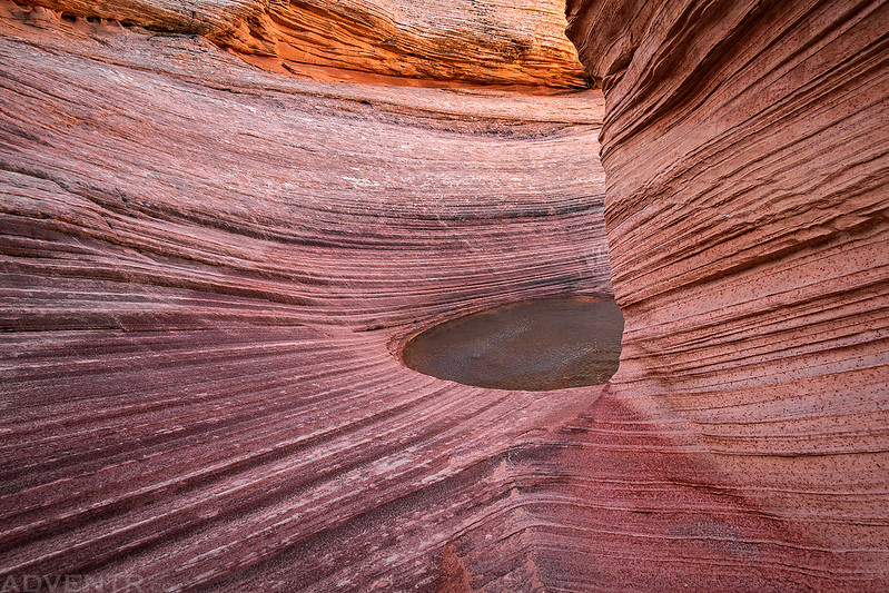
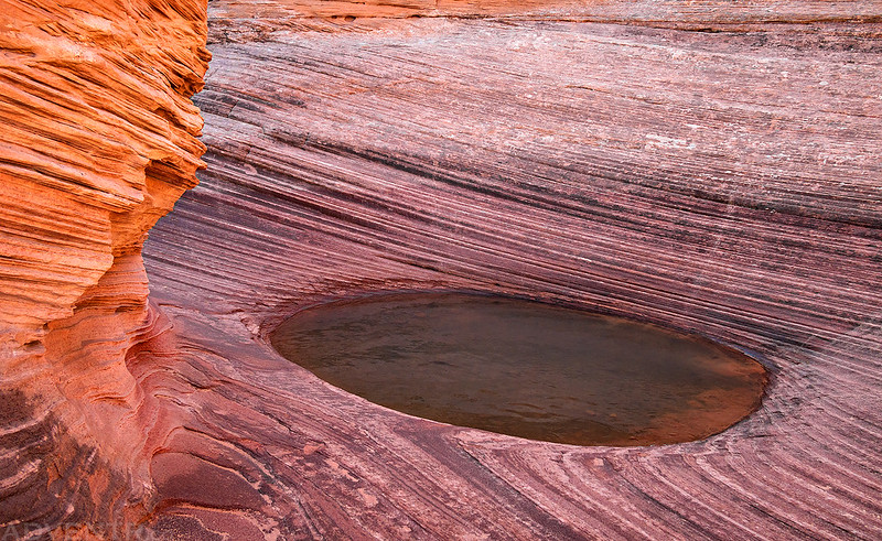
New Wave Pool
After getting our permit at the office in Page, which surprisingly went a lot smoother than I was expecting, we stopped for breakfast in town and then headed over to Navajo National Monument and hiked the Sandal Trail to the Betatakin Overlook since neither Jared or Dave had ever been to this park before and it wasn’t that far out of the way.
There was actually quite a bit of snow on the mesa top from the storm the previous evening, but it was melting fast.
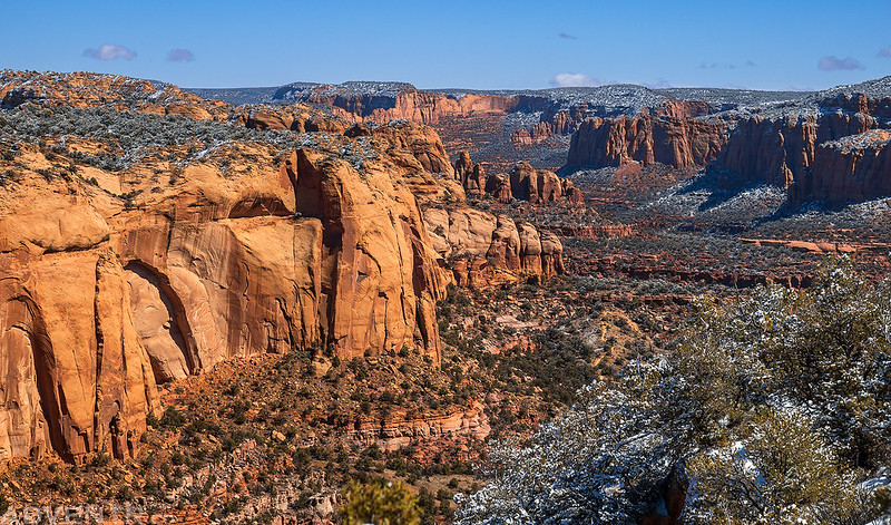
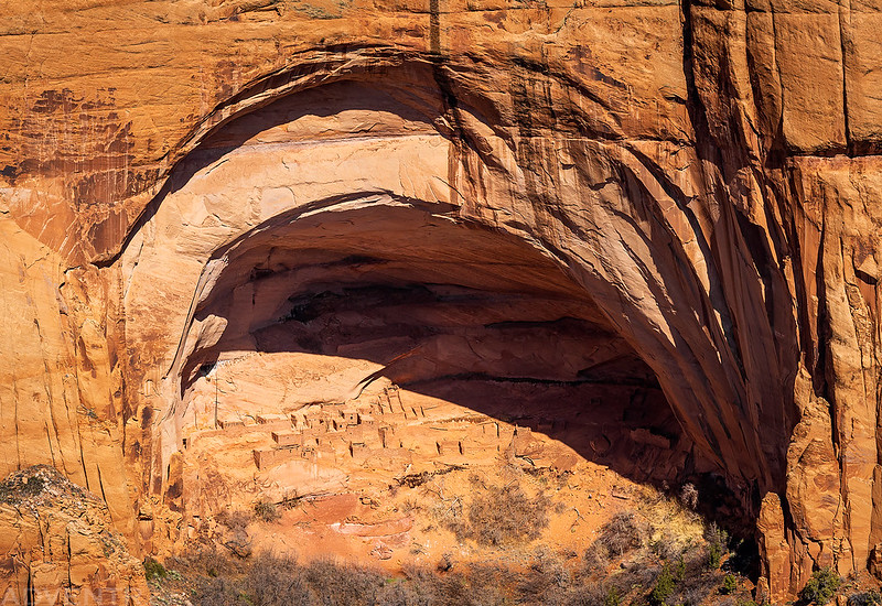
A view of the Betatakin Cliff Dwellings from the overlook.
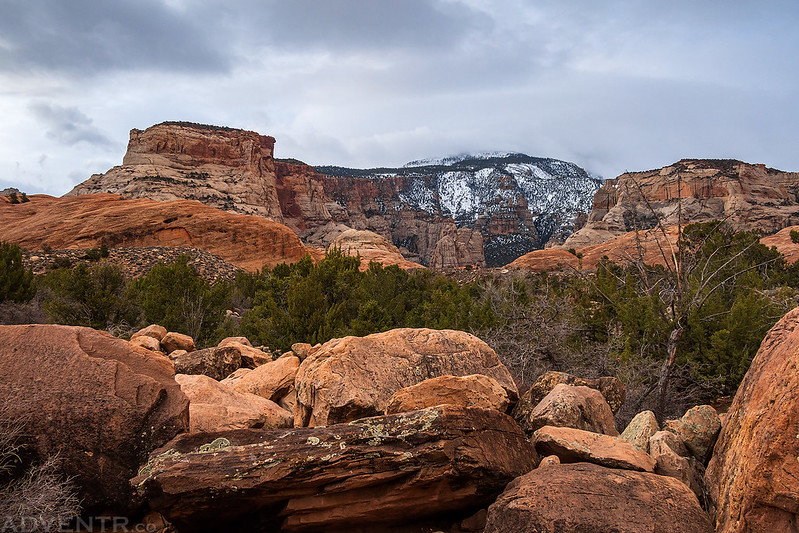
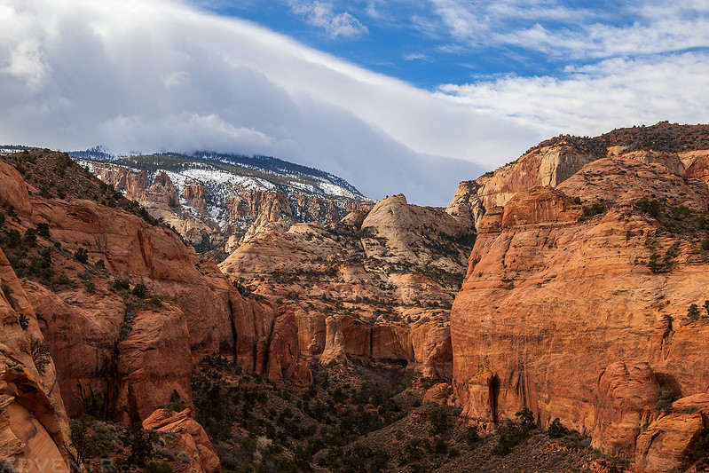
After our brief stop at Navajo National Monument we drove over to the north side of Navajo Mountain where we planned to spend the night at the North Rainbow Trailhead. Once we got off the pavement the roads were pretty muddy and there were some deep pools of standing water, but we were able to make it to the trailhead without any issues.
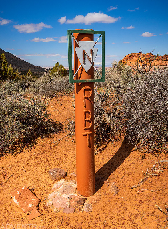
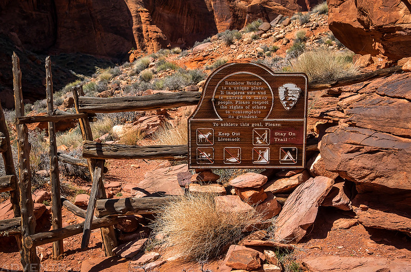
This sign lets you know that you are on the right track to the North Rainbow Bridge Trail.
Here’s a view of Navajo Begay as we drove around the east side of Navajo Mountain on the way to the trailhead.

We reached the North Rainbow Trailhead in the afternoon and had a few hours to relax at camp and prepare for the hike, which we would begin in the morning.
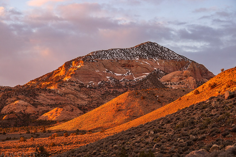
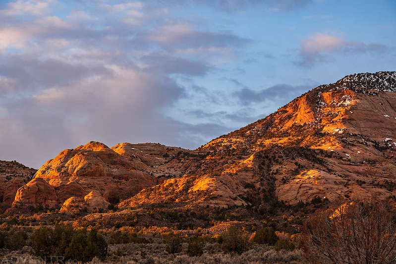
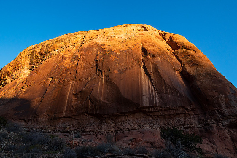
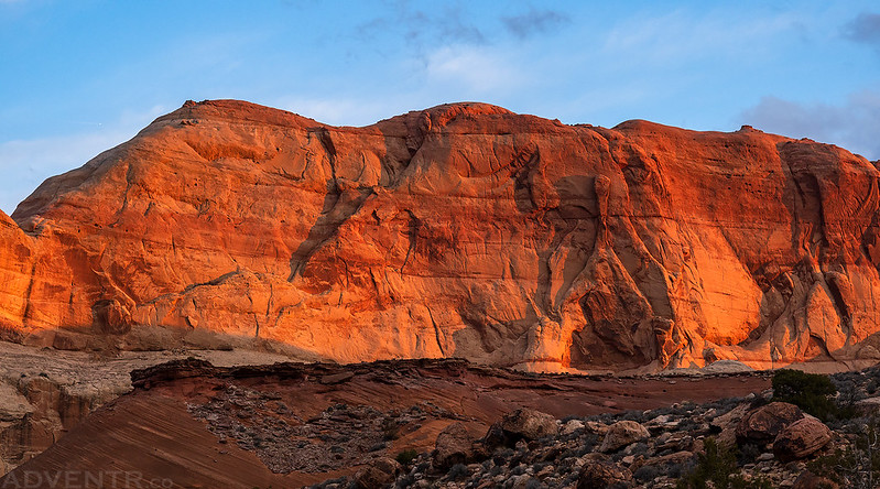
An evening view of Navajo Mountain at sunset from camp.

The Canyons of Navajo Mountain: Rainbow Lodge Trail
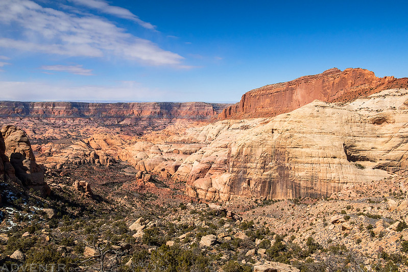
Our plan for the next four days was to leave Dave’s truck at the North Trailhead and then take my Jeep around to the Rainbow Lodge Trailhead and start our hike from there. Then we would finish circumnavigating Navajo Mountain on foot around the west side with a stop in the middle at Rainbow Bridge National Monument. This way we would be able to experience both of the Rainbow Trails and not have to do much backtracking. Since the South Rainbow Trailhead is about 1,000 feet higher than the North, we thought this would be the easier direction to travel, especially since we wouldn’t have to climb back up the steep 1,800 foot slope to Yabut Pass.
We woke up to a lovely sunrise on Friday morning and I took a couple photos as we packed up all our gear into my Jeep and started driving around the east and south sides of Navajo Mountain to the Rainbow Lodge.

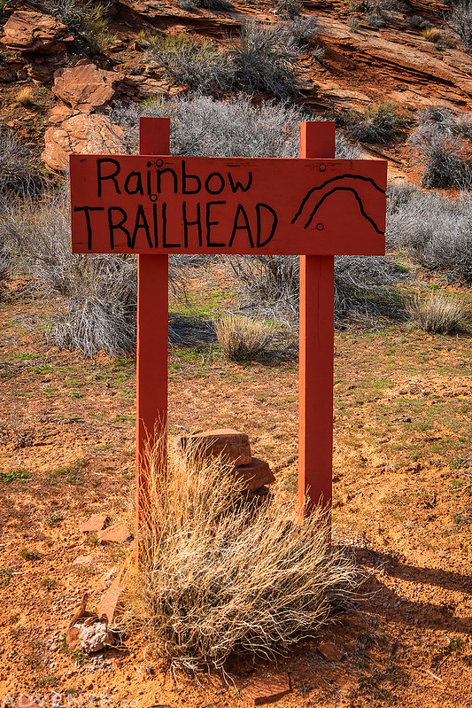
When we reached the Rainbow Lodge Trailhead we took some time to check out the ruins of the historic Rainbow Lodge before we started hiking up the trail.

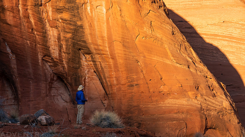
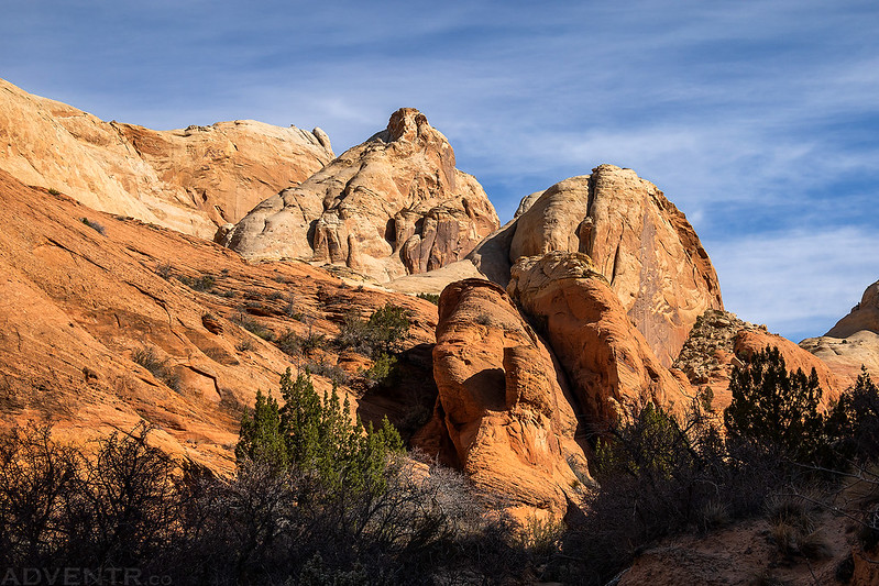
Starting our hike on the Rainbow Lodge Trail, which is also known as the South Rainbow Trail.

The sandstone above the lodge was looking great this morning.

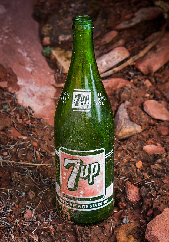
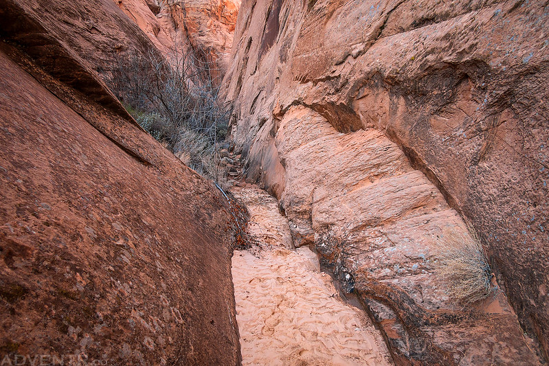
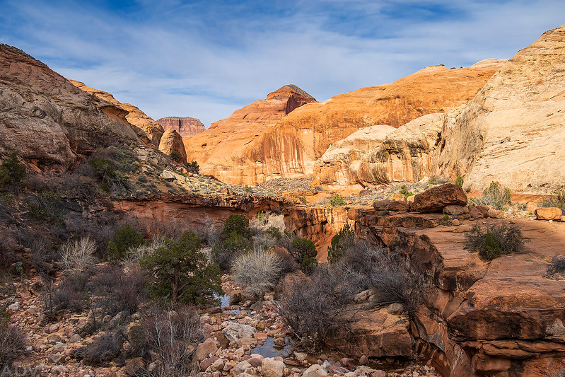
As we crossed our first canyon, which is also named First Canyon, I spotted this 7up bottle sitting under a large boulder.
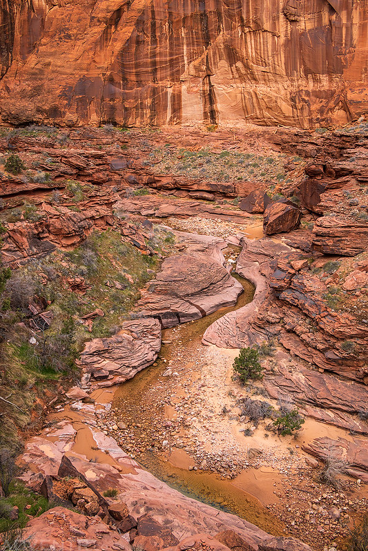
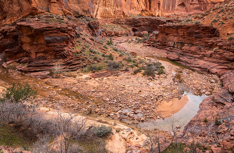
Here’s a view into Upper First Canyon after we crossed to the other side. This would be the first of many canyon crossings over the next couple of days.

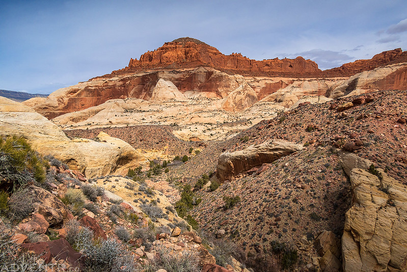
The trail stayed high for the first couple of miles, so we had great views to the west over Aztec Creek to Cummings Mesa.

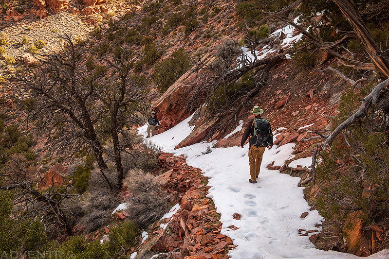
When we reached the descent into Horse Canyon we found the trail covered with snow and ice. It was a little sketchy in places, but we all made it down without issue. I was glad to have brought my hiking poles along.
The views in Horse Canyon were pretty spectacular as we made our way across.


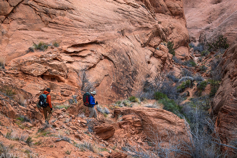
On the other side we hiked out of Horse Canyon up a couple of steep switchbacks.
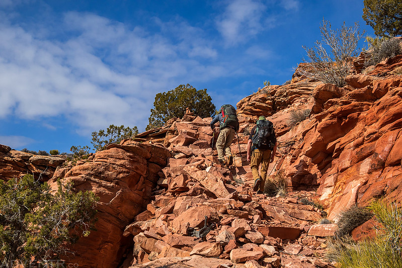
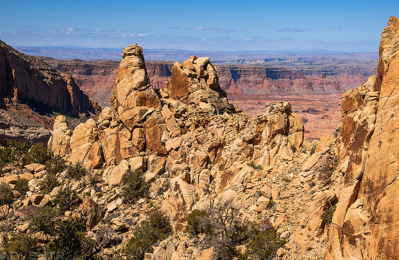
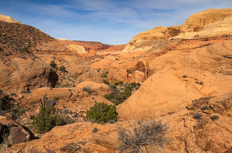
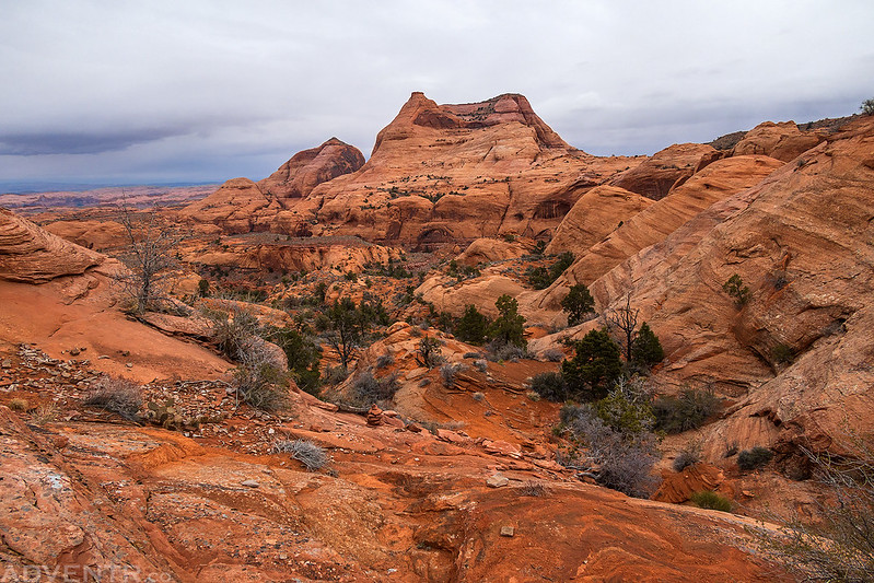
As we neared Yabut Pass the trail and scenery became more rocky. This area actually kind of reminded me of the Cochise Stronghold in the Dragoon Mountains.

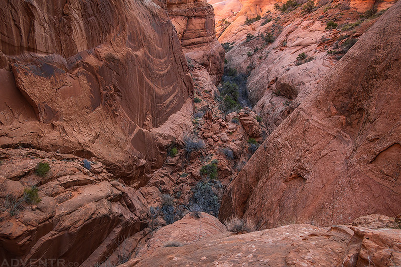
Closer to the pass we could see down into Dome Canyon far below.
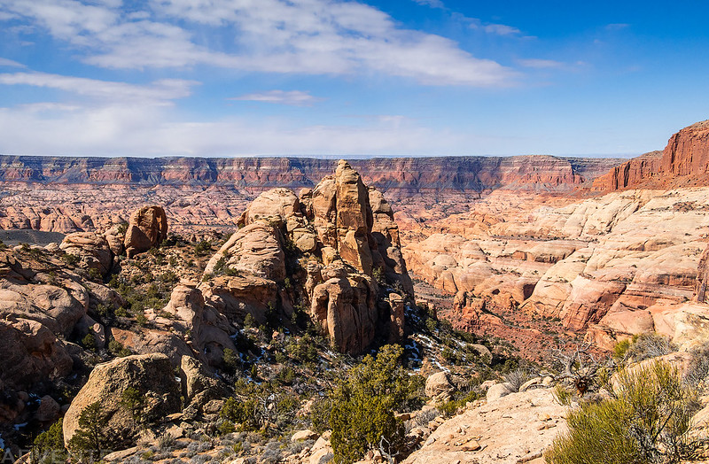

When we rounded this corner of the trail we could finally see Yabut Pass, which is a notch in the jagged sandstone wall straight ahead.
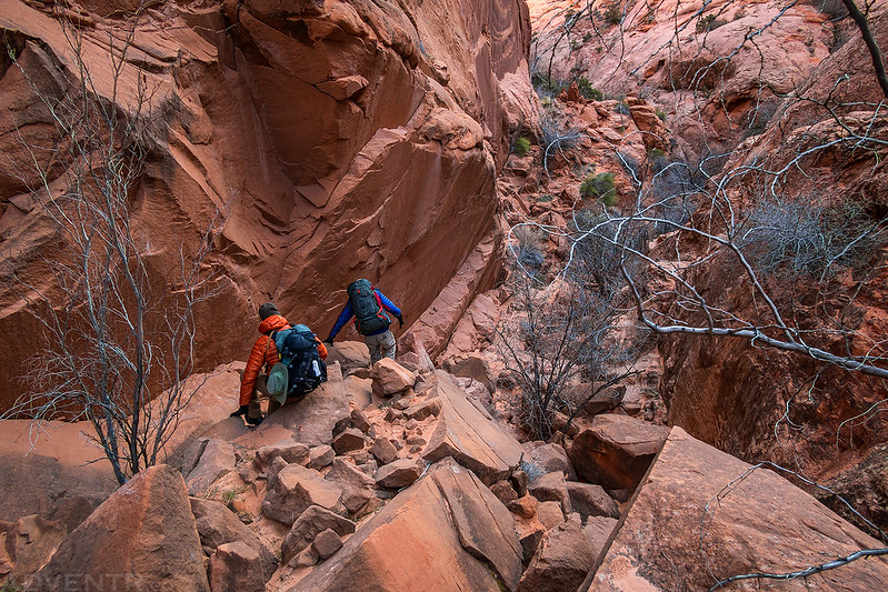
Dave and Jared on their way to Yabut Pass.

Dave admiring the view from Yabut Pass and looking down the steep descent on the other side.

This is the 1,800 foot descent into Cliff Canyon on the other side of the pass. There was some snow and ice on the trail just beyond the pass, but it wasn’t as bad as in Horse Canyon.
Cliffs of Insanity
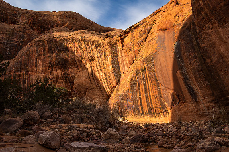
Looking back up Cliff Canyon from near the bottom of our big descent. All our legs were shaking by the time we reached the bottom. I was glad we wouldn’t be going back up this way…

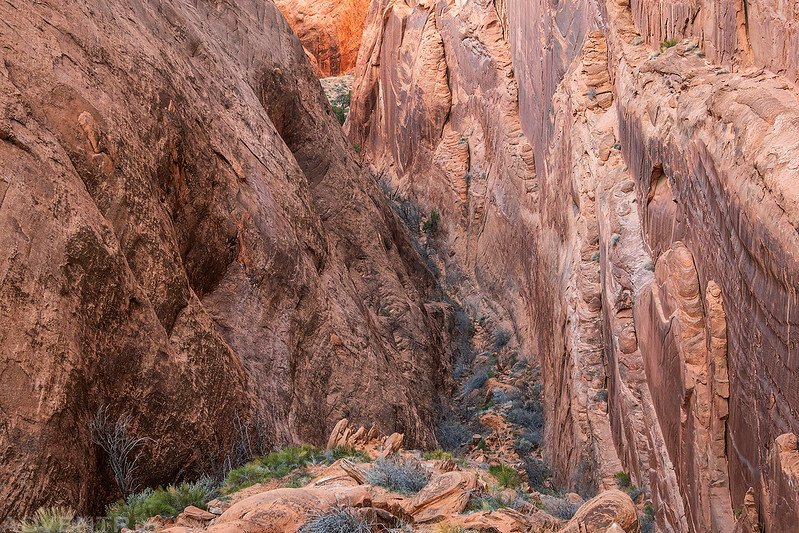
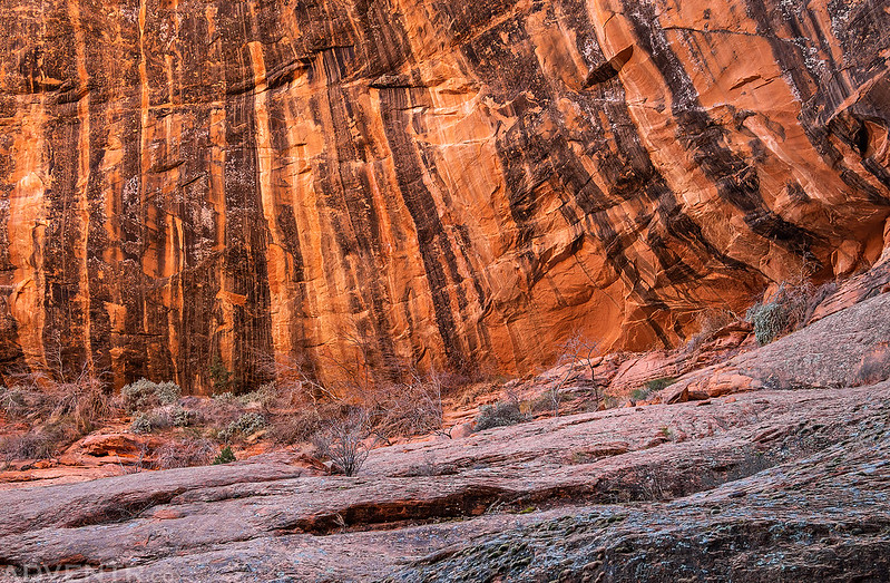
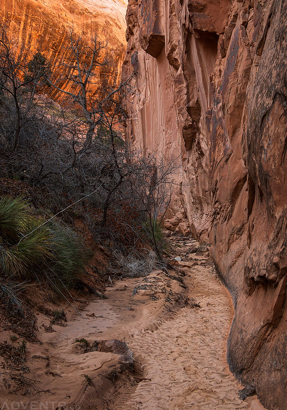
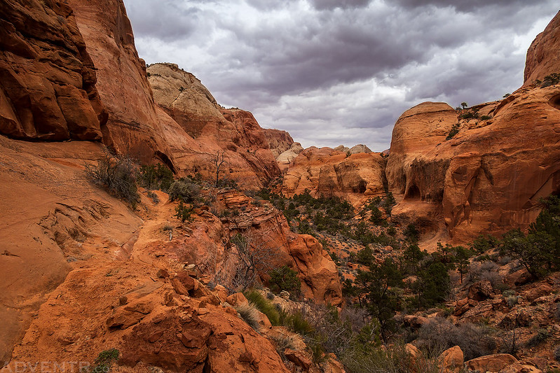
The tall walls in Cliff Canyon were amazing!

Once we were down in the bottom of Cliff Canyon the hiking was a bit easier.

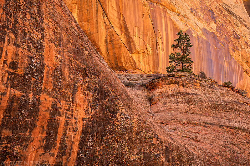
Sandstone & Tree
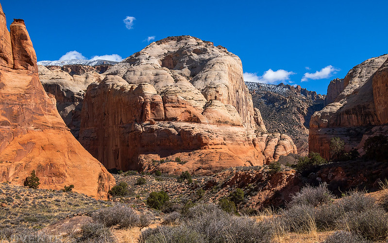
When the canyon first opened up a bit, you could just barely see the top of Navajo Mountain.
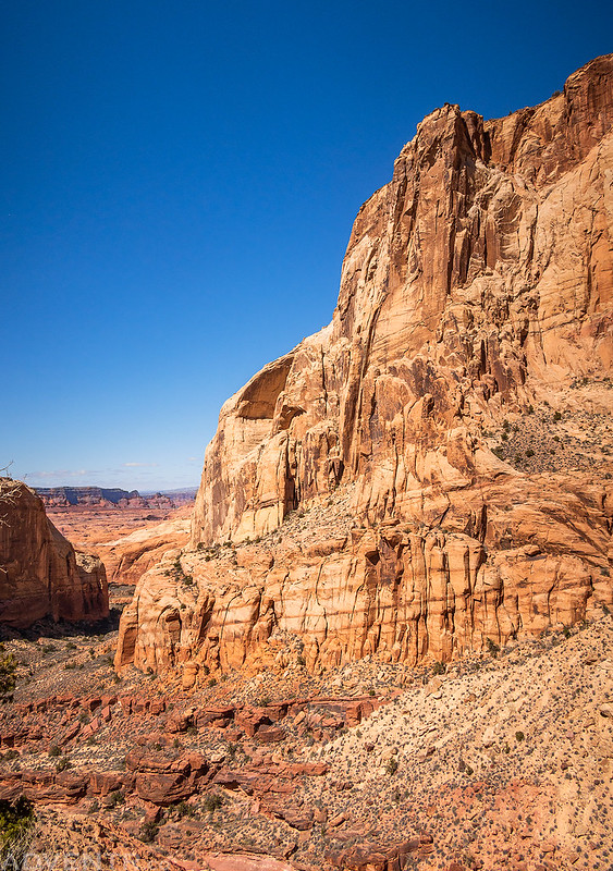
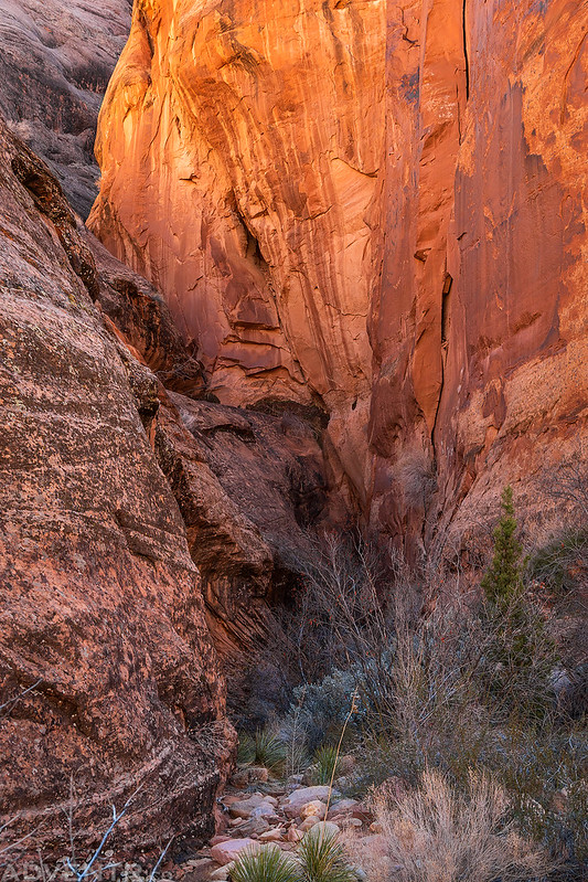
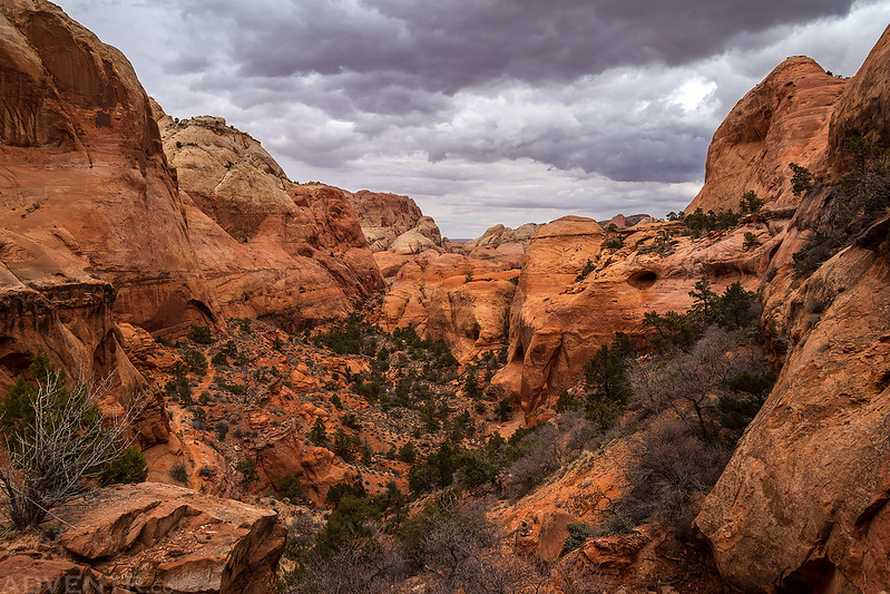
Cliff Canyon was a beautiful place to hike.


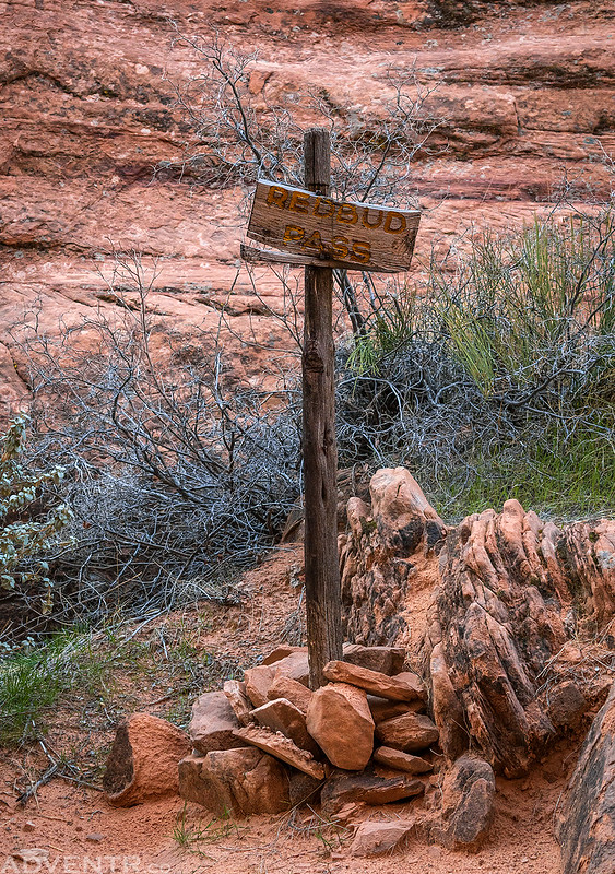
As we neared the junction with the Redbud Pass Trail we were getting pretty tired and started looking for a campsite.

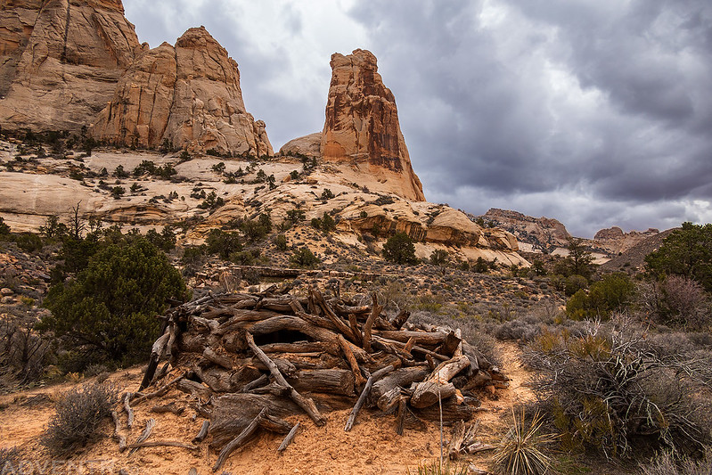
This old Navajo sweat lodge was not too far away from our campsite this evening.

This way…
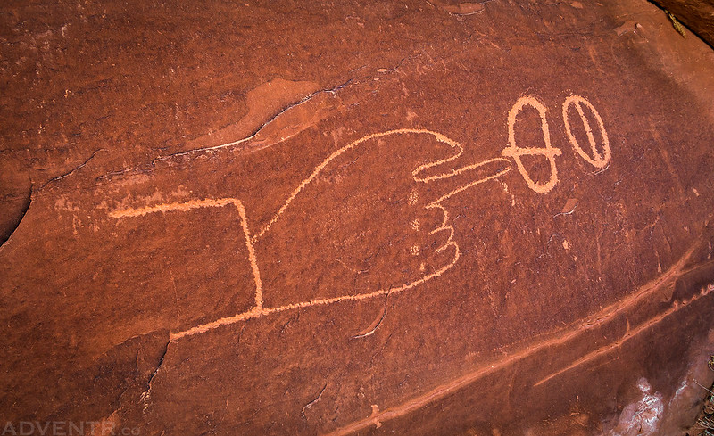
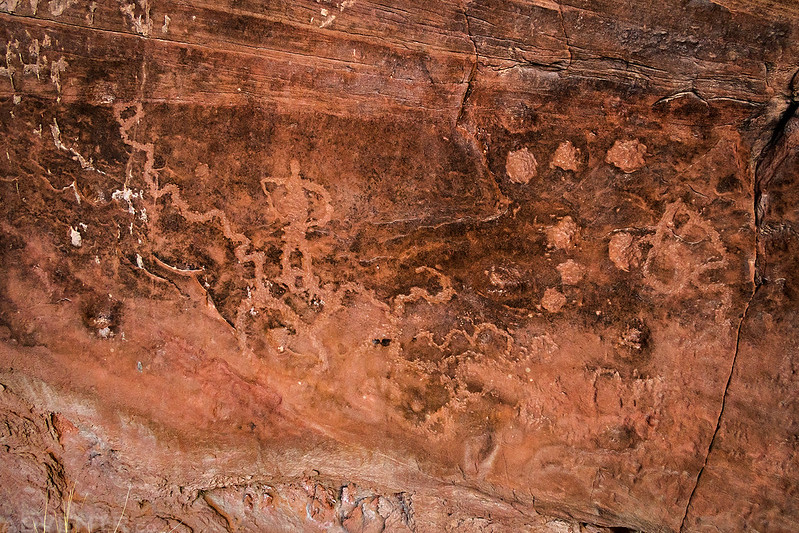
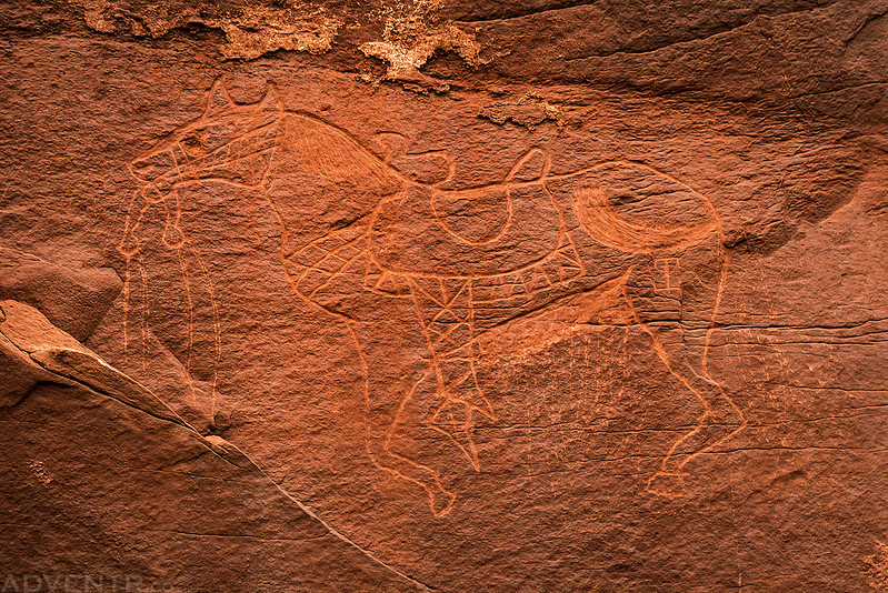
There was a large alcove near camp that contained some pictographs and petroglyphs.

Painted Rock Pictographs


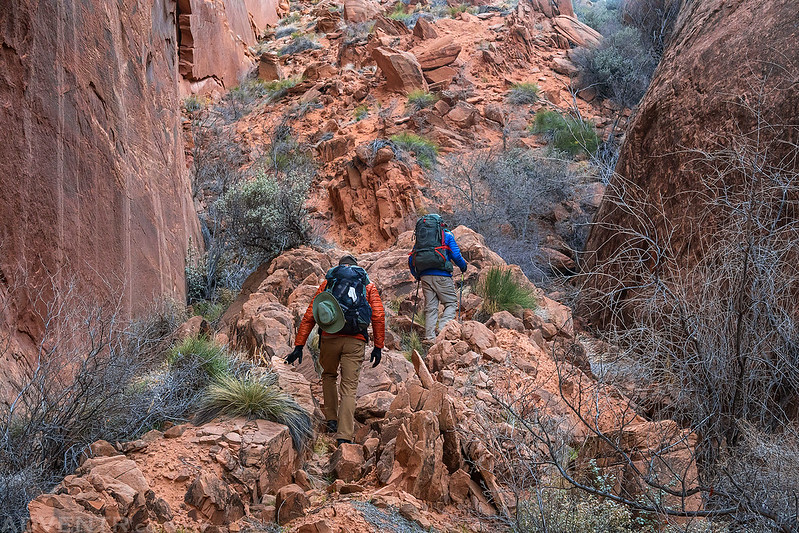
After dinner I went for a short walk up the side-canyon towards Redbud Pass.

No Name Mesa

Painted Rock Camp

It had been a pretty long day and we were tired, so we all went to bed pretty early. It got a bit cold overnight and my sleeping bag was just barely adequate to keep me warm this night, but I still managed to sleep pretty good. On Saturday morning we were up before sunrise, packed up camp and got started hiking early so we could try to warm up. There was a brisk cold wind this morning, so keeping warm down in the shadows of the canyons wasn’t easy.
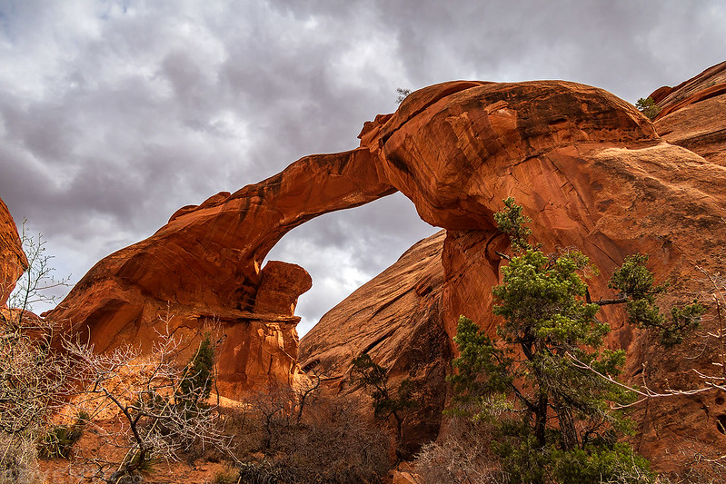
Rainbow Trail Arch

Before we started up the canyon to Redbud Pass, I stopped by the petroglyphs in the large alcove one last time since they seemed to show up better in the morning light.
After hiking up the narrow canyon for a little bit, it wasn’t long until we found ourselves scrambling up the steep and loose trail to Redbud Pass. This helped warm us up quickly!
Looking down the slope we had just climbed up.

Redbud Pass
One last look back down the way we had just come.
Looking ahead from the top of the pass.
Next it was time to start our descent down the other side.
The canyon got a bit narrow in a couple of places.
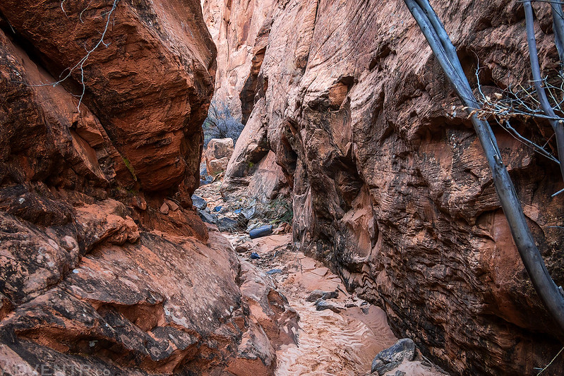
It wasn’t long before we reached another large drop in the canyon.
This time we had to scramble down a couple of ledges.
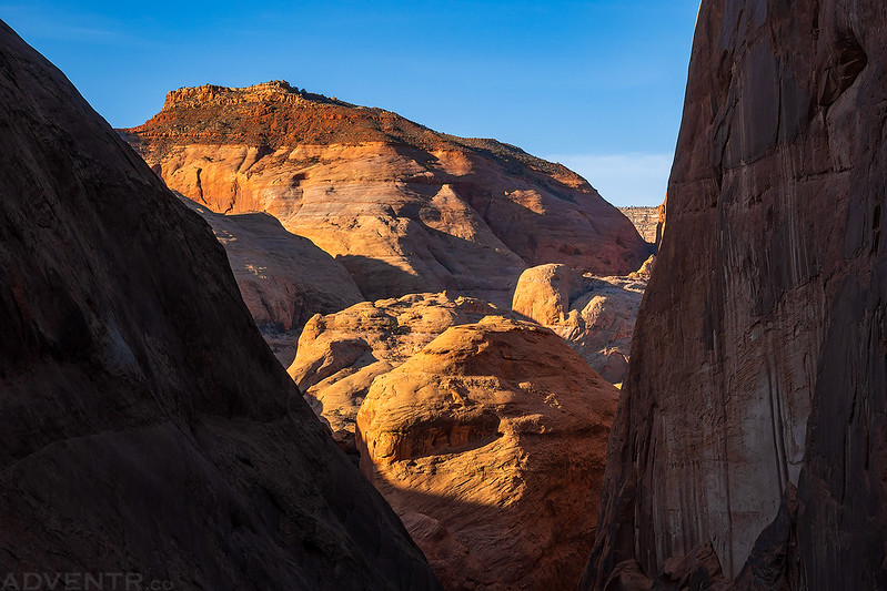
As the canyon began to open up, the views got even better.
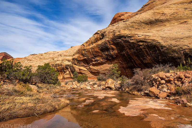
It wasn’t long until we reached Redbud Creek and then started following that canyon downstream.


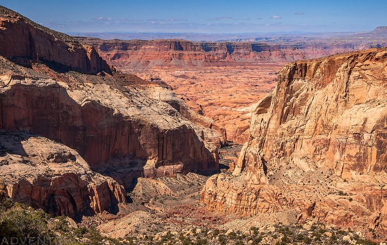
When we reached the confluence with Rainbow Bridge Canyon we turned left and continued downstream on our way to Rainbow Bridge.

Dave and Jared hiking along Bridge Creek.


We followed the trail all the way to the historic Echo Camp, where there are still some old bed frames laying around.
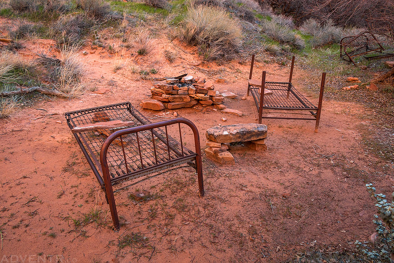
We setup camp in an opening nearby and then rested for a little bit and ate lunch.

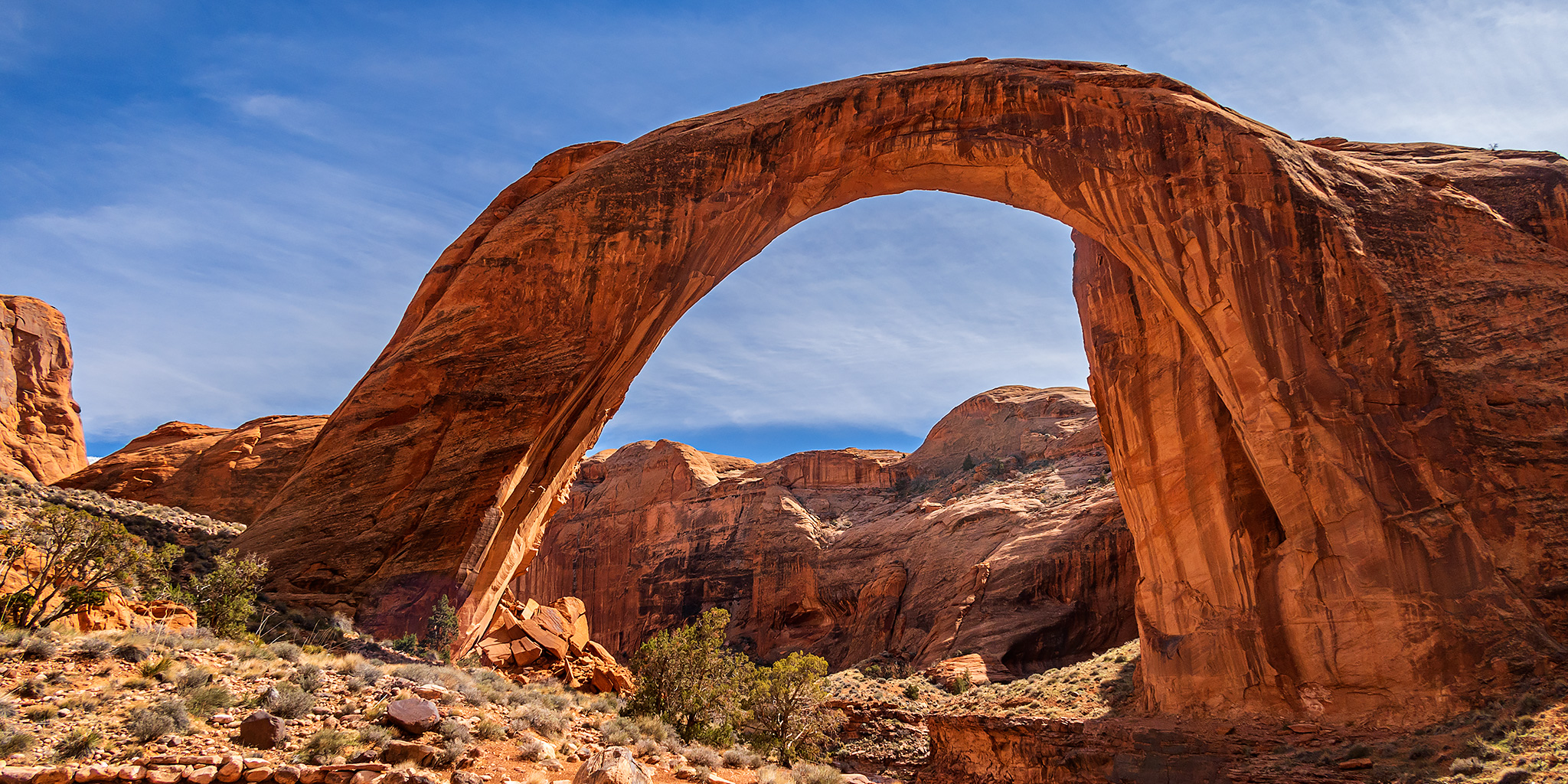
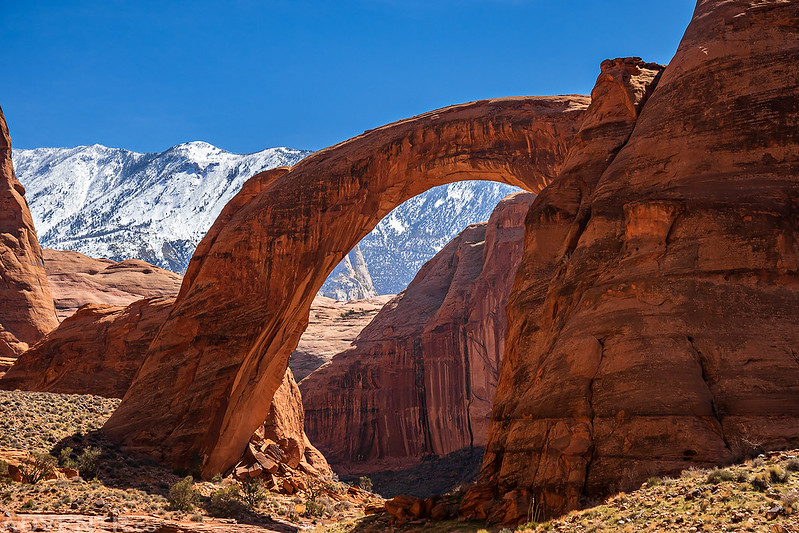
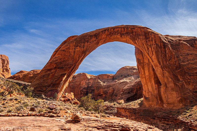
Rainbow of Stone: Rainbow Bridge National Monument
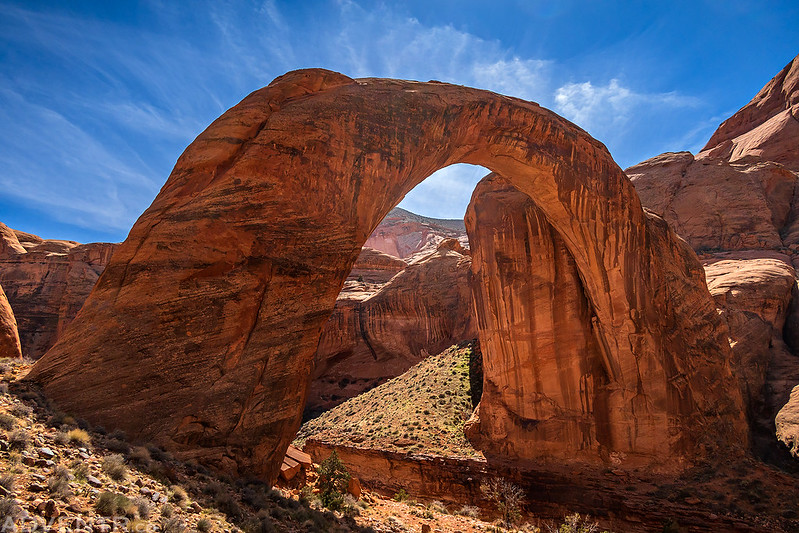
After relaxing around camp for a little bit it was finally time for the main event. Although I’ve visited and photographed many arches and natural bridges over the years and seen many photos of Rainbow Bridge before, nothing could prepare me for actually standing near this massive natural bridge!
It was just a short walk from camp to the boundary of Rainbow Bridge National Monument.
This was our first view of Rainbow Bridge as we came around a bend in the canyon.
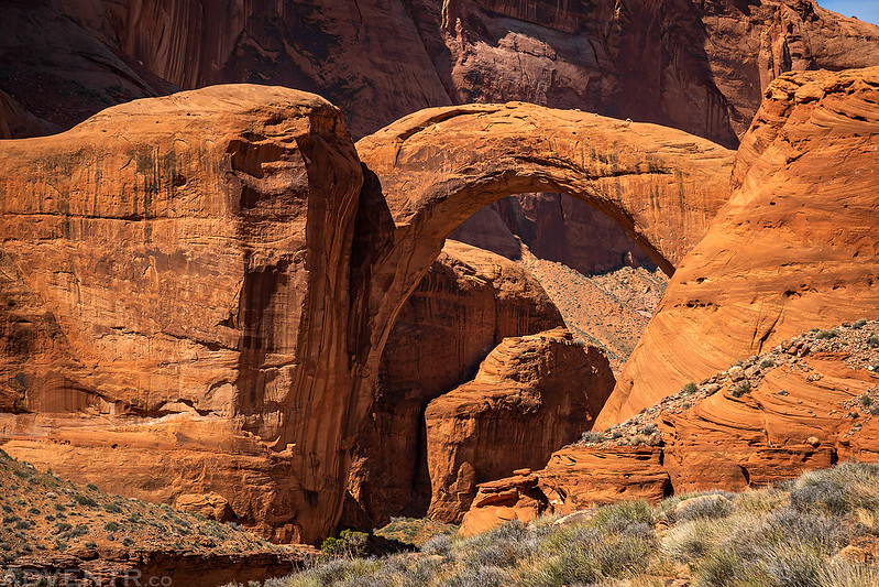
I was awestruck by just how large it really is!

Under The Rainbow
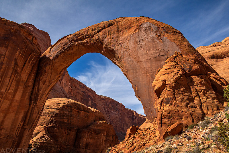
We followed the trail around to the other side for a different view.
Rainbow Bridge & Navajo Mountain
I continued hiking down the trail to the other end of Rainbow Bridge National Monument.

There’s the old dock along the trail that is no longer anywhere near Lake Powell.
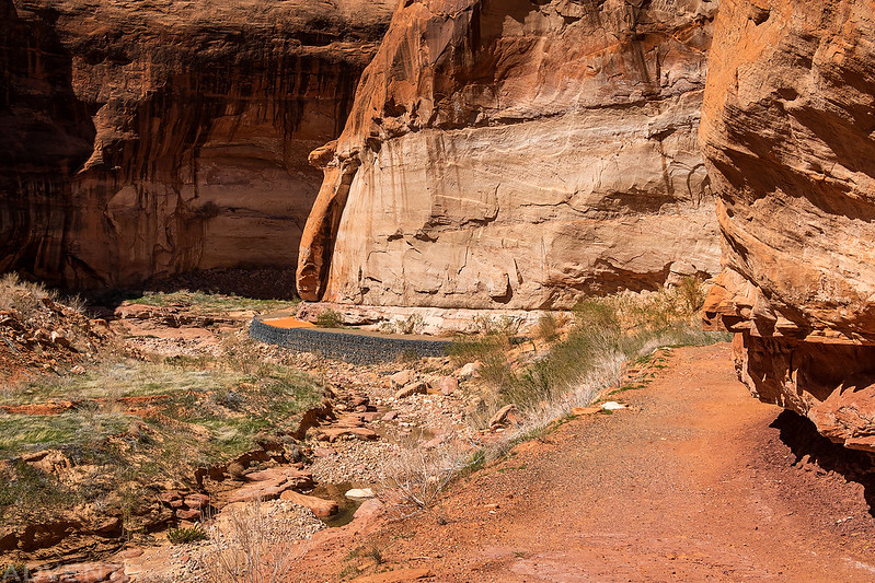
Looking down Rainbow Bridge Canyon. It’s hard to believe the Lake Powell actually used to reach up into this part of the canyon!

We spent the rest of the day just sitting near Rainbow Bridge and watching the light change. I walked back and forth to each side a couple of times. It was a great way to spend the afternoon, and we had the whole place to ourselves.
We returned to Echo Camp later in the evening, had dinner and then got ready to go to bed early.

Jared catching the last light of the day.
The Canyons of Navajo Mountain: North Rainbow Trail
I’m not going to go into the details, but I’m glad I enjoyed Rainbow Bridge all afternoon on Saturday, because I had one of my worst nights while backpacking that night. I wasn’t feeling well at all and I practically got no sleep either. It was pretty terrible, and at times I wasn’t sure if I was even going to be able to hike out on my own. But, about an hour before sunrise I was finally able to lay down and get some rest, although I don’t think I actually ever fell completely asleep. When I got up from that rest I decided to pack up camp, start hiking out on the North Rainbow Trail and see how I felt along the way. I really didn’t have any other choices. I still wasn’t feeling great and it was a pretty miserable hike for me, so I unfortunately did not get to enjoy the scenery along the way as much as I would have liked since it was a very beautiful area. But in the end I did manage to make it to our next campsite in Surprise Valley and finally get some sleep.
A parting shot of Rainbow Bridge as we left Echo Camp and started hiking back up Bridge Creek.

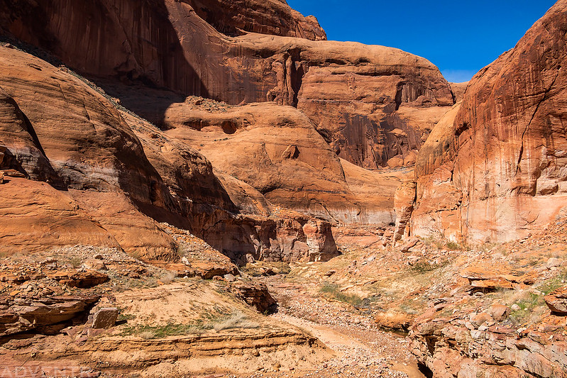
Rainbow Bridge Canyon
Light & Shadow
Upper Rainbow Bridge Canyon was a very beautiful place.
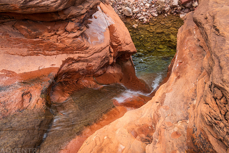
There was even a nice waterfall that might make a good waterslide in warmer temperatures.


Looking back over Rainbow Bridge Canyon as I slowly hiked up steep switchbacks out of the canyon.
Hiking between fins as we made our way to The Furnace.

A nice little sandy cove along the way.
As the canyon between the fins narrowed, the sandstone became more crumbly. I actually had a section of trail break off underneath my feet. Luckily I kept my balance and didn’t fall.

Hiking up through the narrow slot known as ‘The Furnace’
Once we climbed out of the slot it wasn’t long until we reached the edge of Oak Canyon, which was the next canyon we had to cross. During our descent there was a part of the trail that had been washed out which was pretty sketchy, so we had to be very careful on this section.
Dougi Butte

This was the last blue sky we would see for the remainder of the day as storm clouds rolled in.

Here’s an old Navajo hogan that the trail passed by.
Our final climb this day was up to Nasja Pass before we started the descent into Surprise Valley.

Following the narrow trail to the bottom of the canyon.

Shortly before reaching our campsite for the night, we passed underneath Owl Bridge.
We stopped at a great campsite along Nasja Creek, I setup my tent and went to bed early.

When we arrived at camp I still wasn’t feeling great and was beyond tired, so I was able to fall asleep quickly and then slept for about twelve hours. Shortly after sunset it started to rain, and I’m pretty sure that it rained almost continually for most of the night.
The rain stopped shortly before sunrise, and I was hoping for some nice light when I got up and saw this scene, but the clouds quickly rolled back in and blocked the sun again.
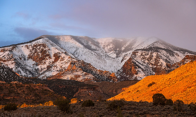
Navajo Mountain in the clouds, seen from our campsite in Surprise Valley.
I still wasn’t feeling the best as we started hiking out of Surprise Valley under cloudy skies, but at least I was now well-rested.

There was some interesting art carved into the rock as we crossed Bald Rock Canyon.

The sun started to come out as we climbed out the other side of Bald Rock Canyon.
Navajo Point

Bald Rock Canyon Trail


Here’s a view over Cha Canyon as we made our final canyon crossing of the trip. There sure were a lot of ups and downs along both trails!

It started to rain just before we reached Dave’s truck at the trailhead, so we ended up driving through another rainstorm as we made our way back around Navajo Mountain to get my Jeep on the other side. I absolutely loved the first half of this trip, and probably would have enjoyed the second half a lot more if I had been feeling better, but it is what it is, and I’m glad I was finally able to hike some of these remote canyons on the Navajo Nation and visit Rainbow Bridge!
>> Canyons of Navajo Mountain & Rainbow Bridge Photo Gallery
Beautiful scenery! I’m beginning to think this might be the only reasonable way to access Rainbow Bridge fairly soon if the water levels keep dropping. It is already a bit tough to get a boat charter to the bridge.
Yeah, it might be. This was really the only way I wanted to experience visiting Rainbow Bridge, though…..I could have taken a boat there years ago, but I always wanted to hike there.
I lean towards wanting to hike it as I’m not a fan of boats, so your post was great to give an idea of what the hike would be like!
Great! And a good thing with the lake being low, is there aren’t many other people visiting the bridge now, so it’s a great experience!
True on both counts. Most companies aren’t going there anymore, though we were able to charter a private boat for a trip in a few weeks. But it’s rather pricey: ~$350/person, and it sounds like the “hike” in is going to start in a whole buncha mud. But for the folks going—who simply can’t make an overland trek—it may be their last opportunity to visit the national monument (everyone going is trying to visit all the national park units).
Very cool trip and something to aspire to. I’ve been to rainbow bridge a couple of different times years ago when the water level was high and we could drive our boat right up to it. I’d love to visit it the way you did. Thanks for sharing your trip. Hope you are feeling better.
Gorgeous photos! I love reading your detailed trip report on this loop you guys accomplished. Sorry to hear the second half was rough for you. I have read online that you need a money order or cashier’s check to pay by mail for your NN permit if you don’t go in person. Were you able to pay cash when you got your permit? Additionally, I would be going around the same time of year – did you have any issues finding water to filter along the southern trail?
I’m pretty sure we paid in cash when we got our permits in person in Page.
As far as water goes, we didn’t need any until we were down in Cliff Canyon, but I don’t remember seeing any before then, aside from snow on the trail. After that point all the creeks had plenty of water.
Great to know, thanks again! We have had a mild winter so far, so hopefully the creeks will be recharged soon.