Rambling Around Robbers Roost IV | Saturday, March 25, 2023
After a rough ending to a backpacking trip earlier in the week, I thought it might be a good idea for me to stay a little closer to home and take it a bit easier this weekend. I left home early on Saturday morning and headed west to Robbers Roost country in Utah so I could hike into another section of upper Horseshoe Canyon that I had not been to before. I parked near an old corral at the end of a short spur road and then followed an old closed road to Trail Spring where I was able to get down into the canyon and follow it to it’s juncture with Horseshoe Canyon. I wandered down the main canyon for a few miles and then returned the way I had come. I ended up hiking about 13 miles with almost 1,800 feet of elevation gain, so I guess I didn’t take it as easy as I thought I was going to, but I was still feeling pretty good at the end of the hike. Here are a couple photos from the hike.
Following the remains of the old road toward Trail Spring and Horseshoe Canyon.

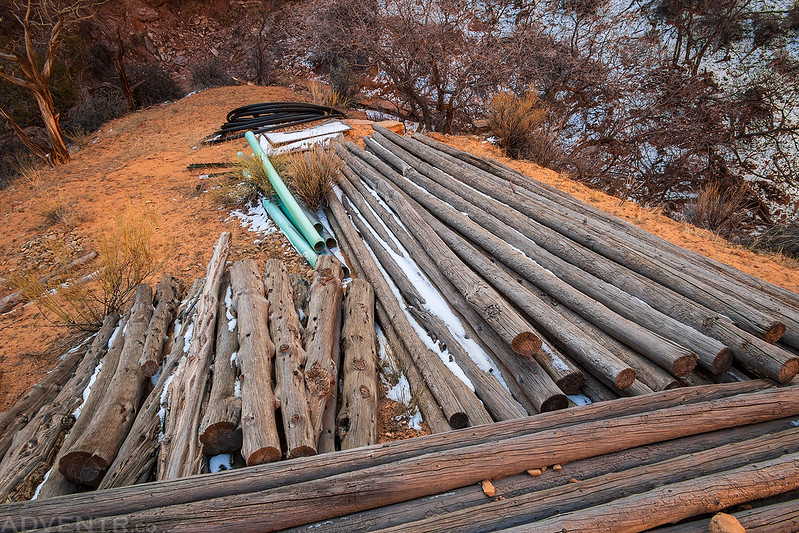
When I reached Trail Spring I found a bunch of old supplies laying on the ground that were not used. It looks like there were plans to develop the spring further that never happened.
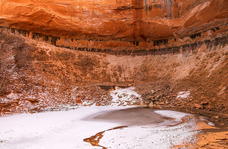
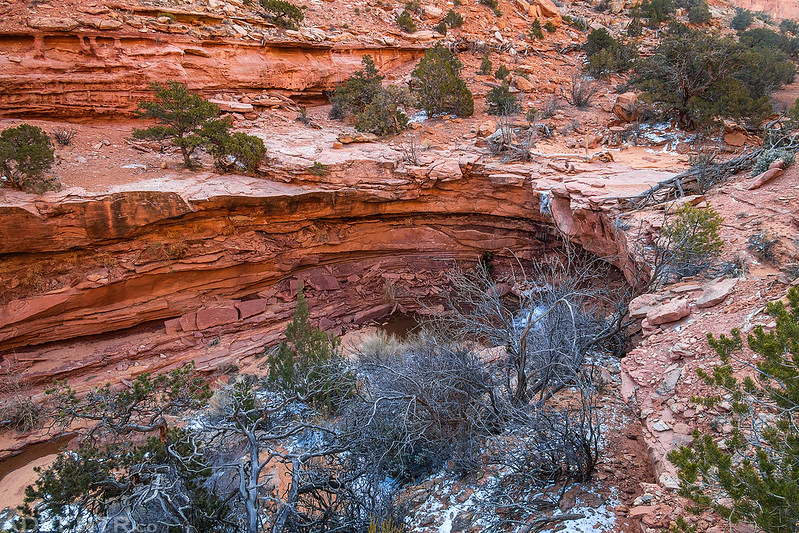
Trail Spring Alcove
It looks like there was a bit of a landslide onto the old trough at Trail Spring.

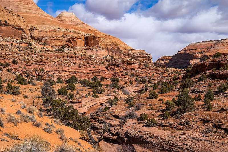
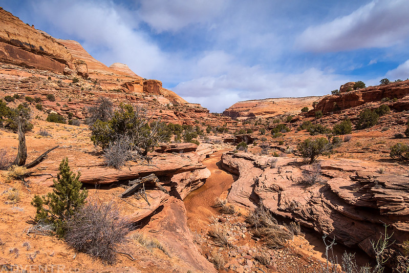
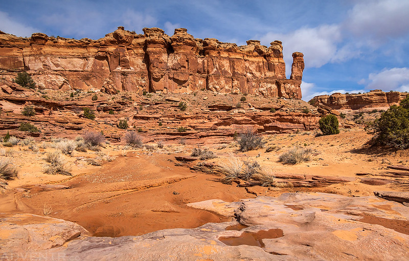
It was a beautiful walk through Trail Spring Fork.

Please Use Ladder

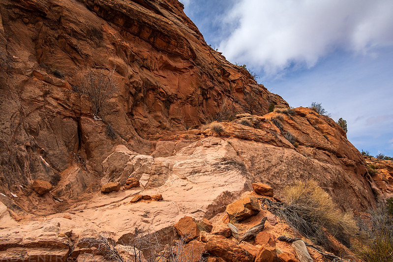
This was the only large pourover in the canyon and there was a good trail around it.
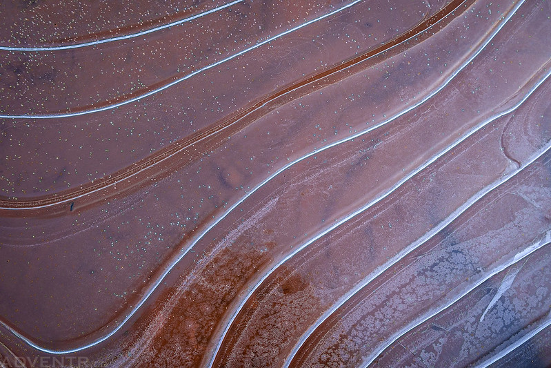
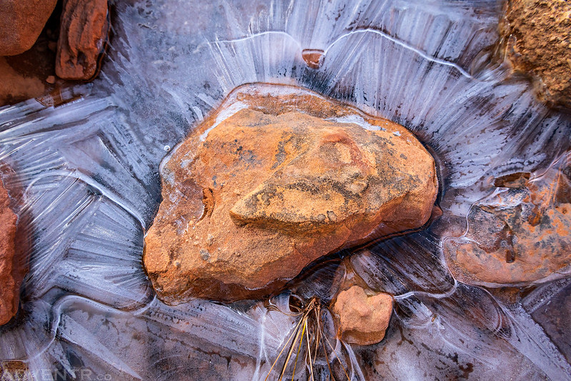
Water was flowing in Trail Spring Fork, and there was plenty of ice around this morning.
Rocks In Ice
Puffy white clouds started to fill the sky as I hiked down Horseshoe Canyon.
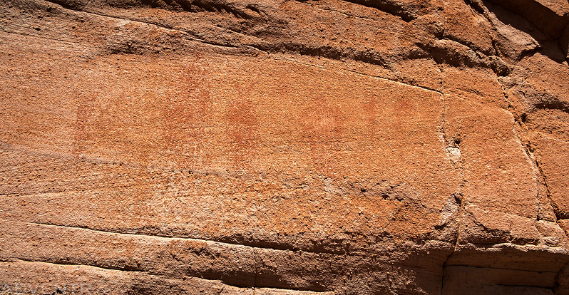
I didn’t find much in the way of rock art today, but I did spot these three little petroglyphs.

Then I found some faint Barrier Canyon Style pictographs. They are very hard to see.

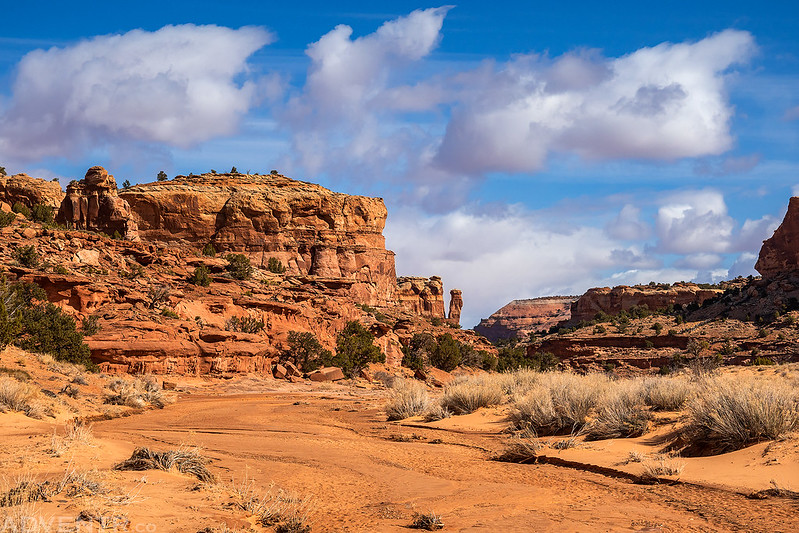
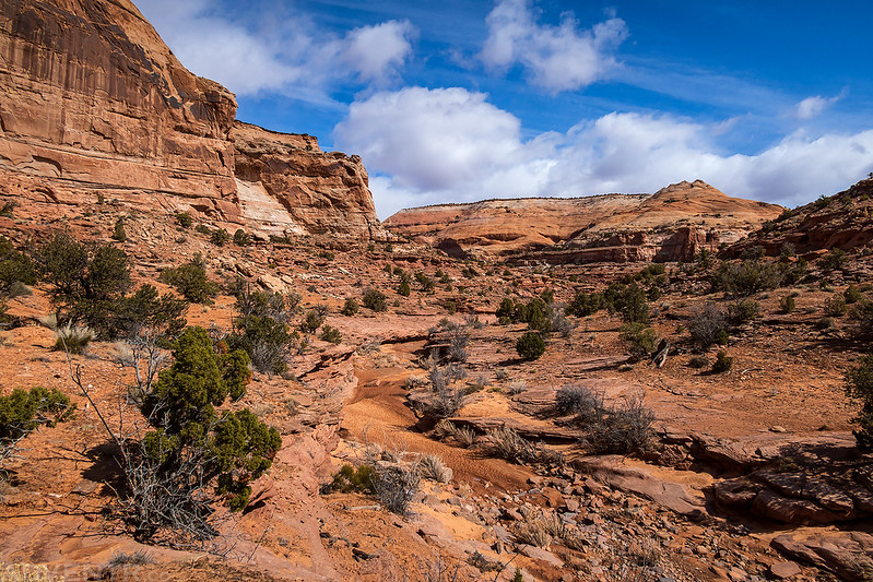
The scenery in Horseshoe Canyon was grand, and it was a pleasant walk, too.
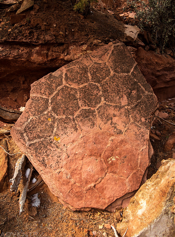
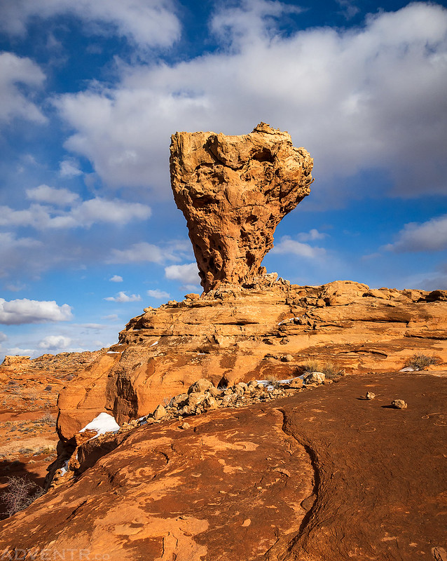
I thought this rock was very interesting. I’m calling it ‘Soccer Ball Rock’
Going back up the trail that was blasted down to Trail Spring.
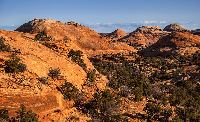
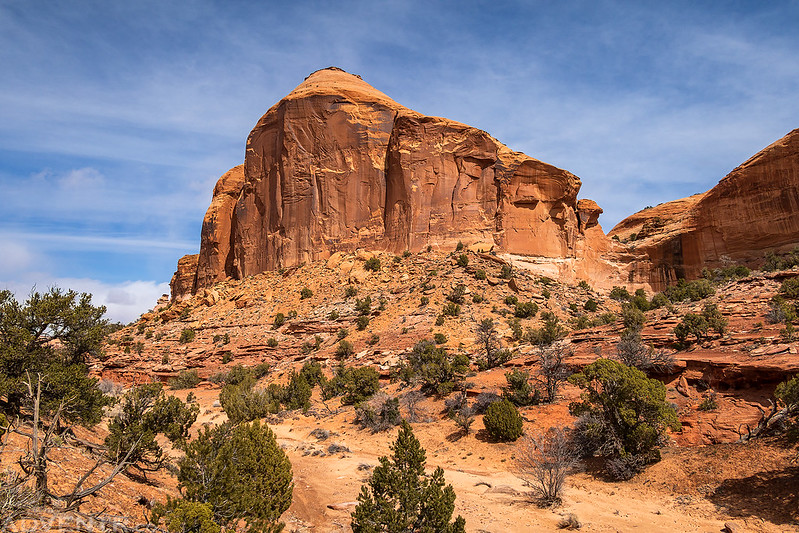
Trail Fork Dome

An old wooden trough I passed during my hike back across the mesa to my Jeep.

Since I finished my hike before the Hans Flat Ranger Station closed for the day, which wasn’t far away, and I have a backpacking permit for The Maze the following weekend, I decided to head over there to talk to the ranger about road and water conditions. As I expected, I found out that the Flint Trail is still covered with snow and ice, but also that there should be plenty of water in the canyons. While I was there I asked if I could pickup my permit early since I would have to drive into The Maze via Hite the following weekend and stopping by Ranger Station would be way out of the way. Thankfully, I was able to get it today. After a nice chat with the Park Ranger I headed out to Hanksville and grabbed a burger from Stan’s for dinner before driving out to Burr Point so I could enjoy the sunset before heading home.
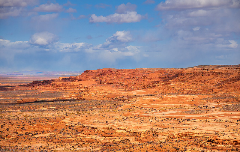
Driving past the Sweetwater Reef on my way to Hanksville.
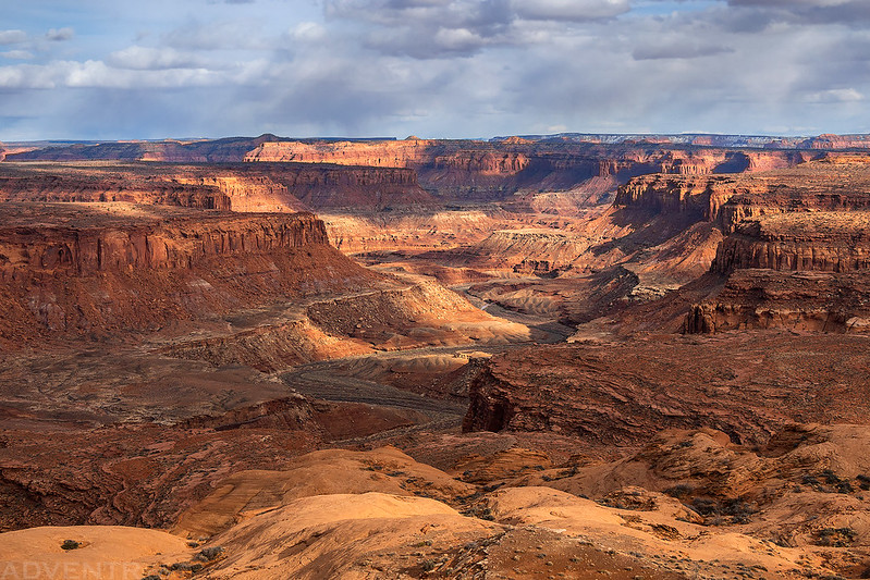
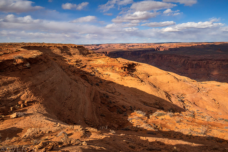
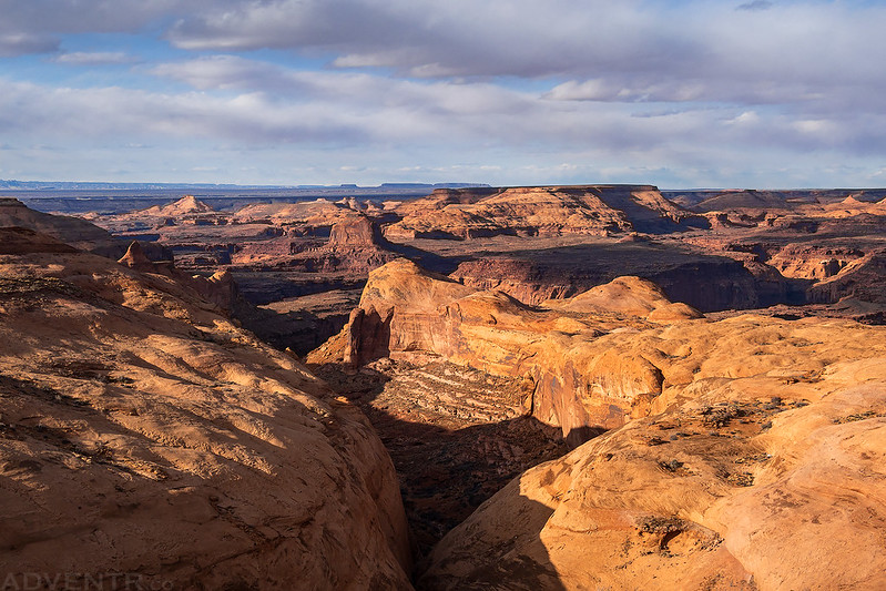
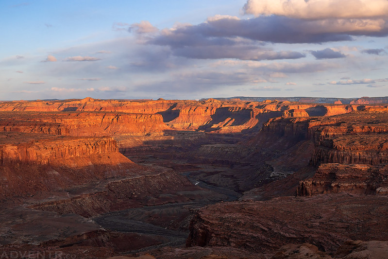
By the time I made it out to Burr Point the light was looking good, and I stopped at a couple overlooks along the edge above the Dirty Devil River. I recently realized that I had not been back out to Burr Point since 2010, so it was nice to finally revisit.


When the light was gone, I headed back to the highway and then started my drive back home. When I had left home in the morning I wasn’t sure if I was going to spend the night or just do a day trip, but at this point I had had a nice day and was ready to go home.
Last light on Mount Hillers, seen from the Burr Desert.
