Chiricahua National Monument to the Pedregosa Mountains and Dragoon Mountains
Arizona Winter Loop | Monday – Wednesday, January 30 – February 1, 2023
After a brief stopover in Petrified Forest National Park we continued south through Arizona on our way to the Sky Islands of the Chihuahuan Desert in the southeast corner of the state. A Sky Island is a mountain range that is separated from other mountain ranges by distance and by surrounding lowlands of a dramatically different environment. The result is a habitat island- such as a forest surrounded by desert. After leaving Holbrook we would cross the canyon of the Salt River and then follow the Gila Valley until we reached Safford and eventually Willcox later in the evening. Since I knew we would be arriving late I had booked a hotel room in town to stay at before we continued on to Chiricahua National Monument first thing in the morning.
A Wonderland of Rocks: Chiricahua National Monument
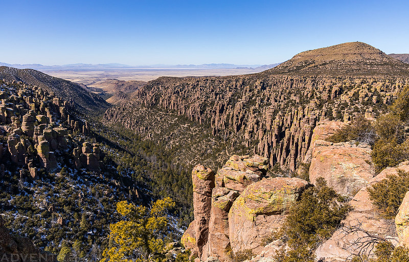
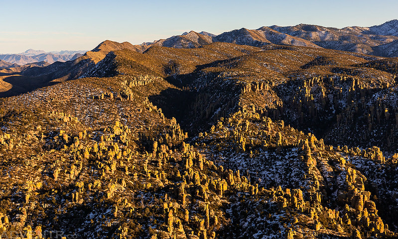
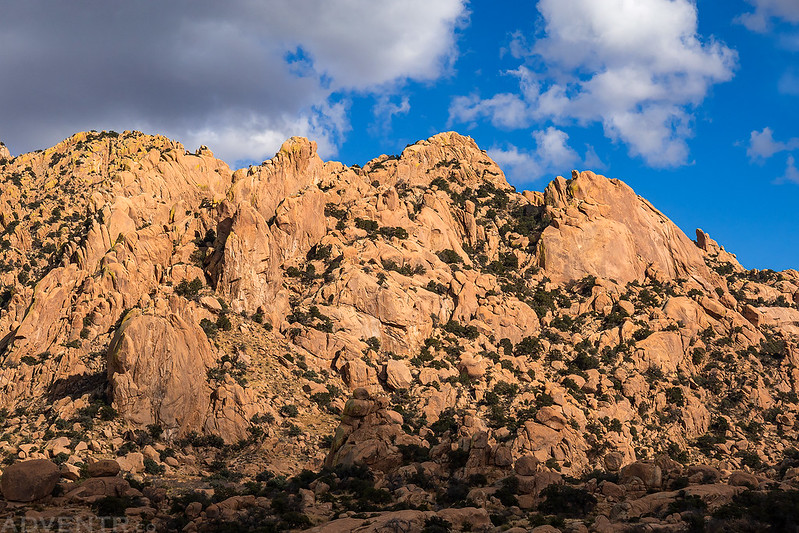
On Monday morning we were up early and headed southeast along the edge of the Sulphur Springs Valley and Dos Cabezas Mountains as we made our way over to Chiricahua National Monument. Once inside the park, we followed the scenic road up Bonita Canyon and watched the sunrise as we topped out on the dead-end road.
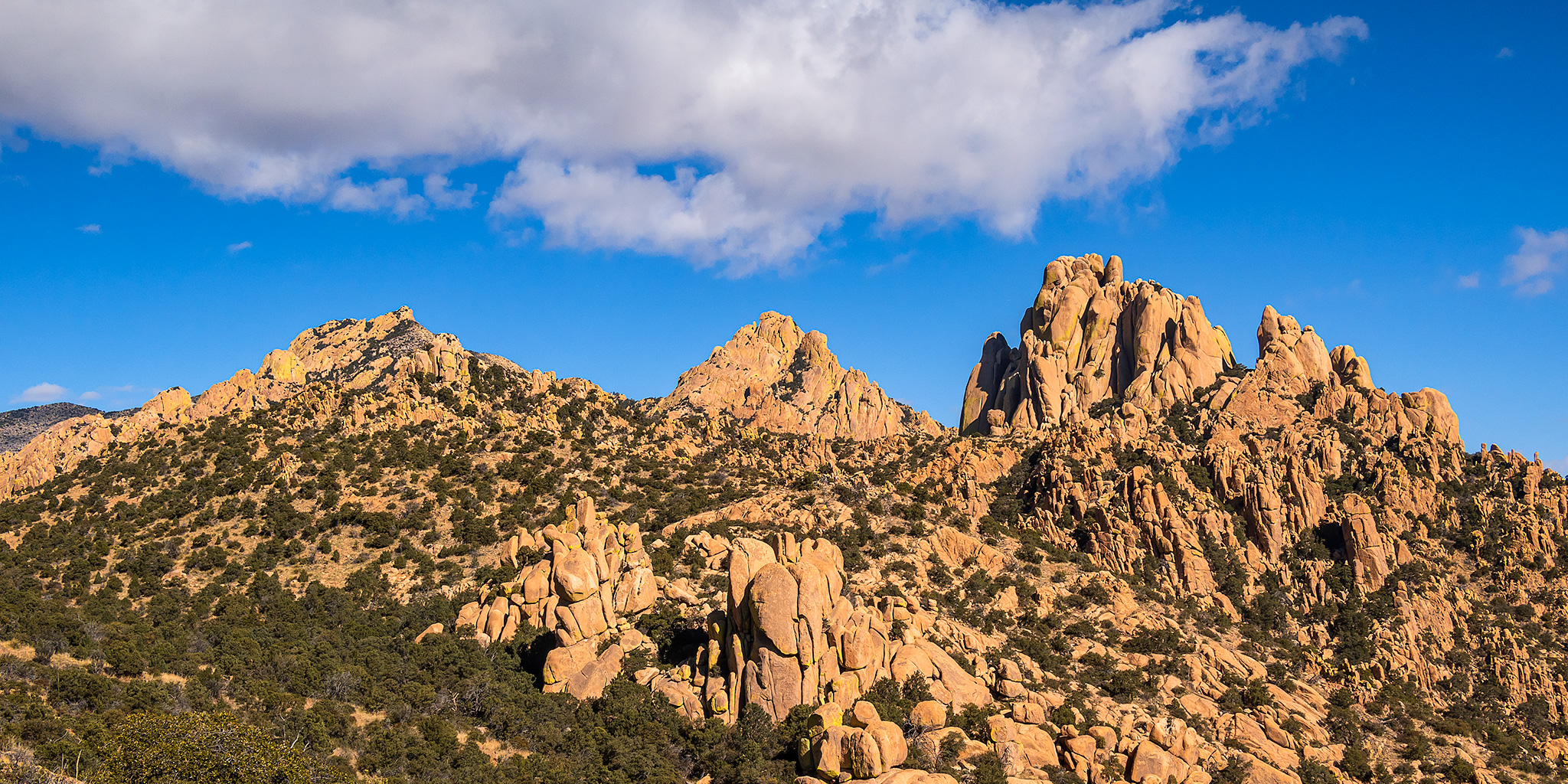
We watched the sun light up the Dragoon Mountains across the valley from Massai Point before returning to the Echo Canyon Trailhead for our first hike in the park.
Sugarloaf Mountain at sunrise.
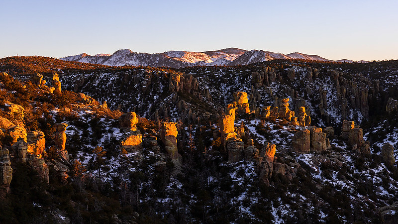
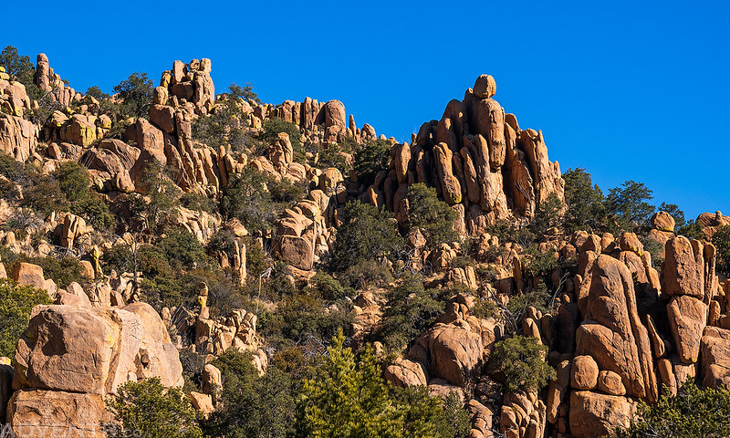
Chiricahua Mountains at Sunrise
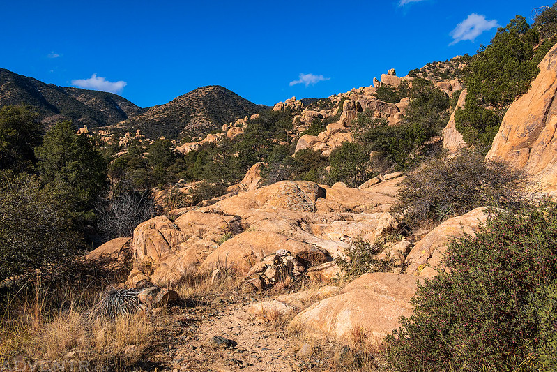
Today we planned to hike The Big Loop trail as an introduction to the park since it is comprised of a number of shorter trails in the area, so we left the trailhead and started down the Echo Canyon Trail.

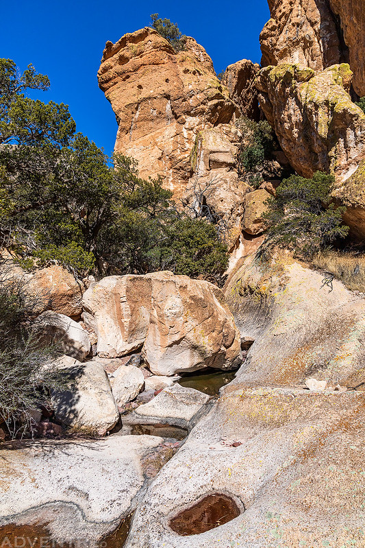
We had fun scrambling around and exploring this area known as The Grottoes.
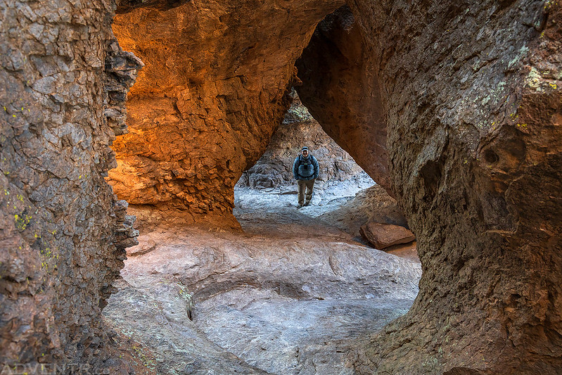


Continuing down the Echo Canyon Trail.

Light & Shadow
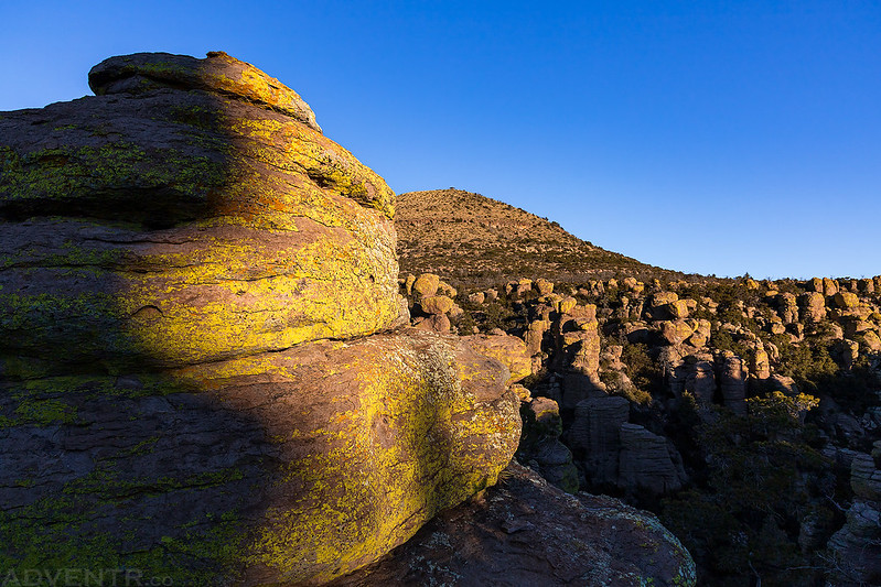
Although the rocky spires were not as colorful, this upper area reminded me of Bryce Canyon a bit.


There’s even a spot that’s known as Wall Street.


Echo Canyon Walls

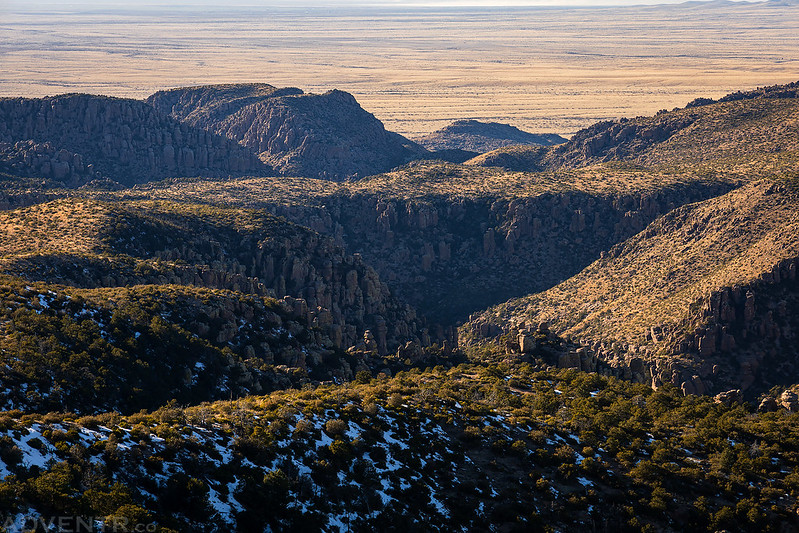
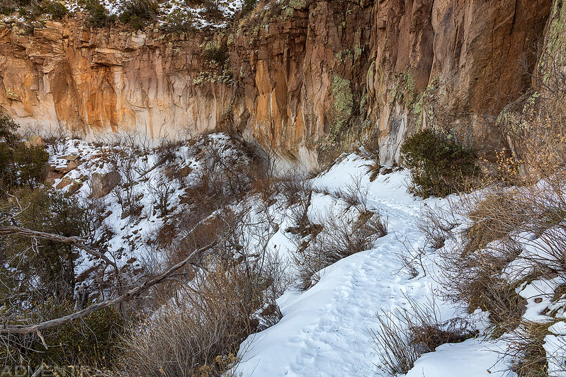
After reaching the junction with the Hailstone Trail we continued further down the trail into Rhyolite Canyon.

The next part of the Big Loop crossed Rhyolite Canyon and then climbed up Sarah Deming Canyon until it reached the Heart of Rocks. This part of the trail had the least amount of views since you were stuck down in the trees, plus it was north-facing so the trail was covered with snow and ice. We were glad to have brought along our microspikes on this hike!

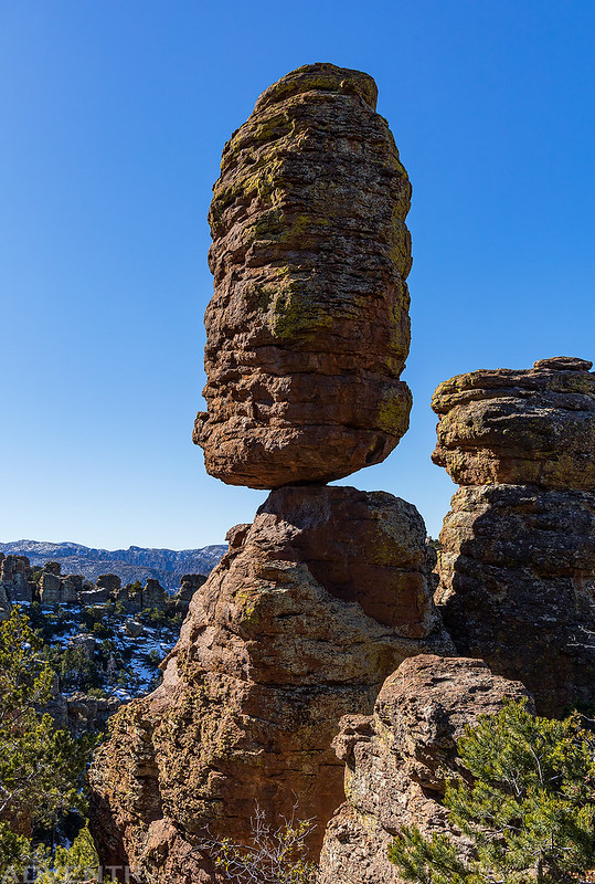
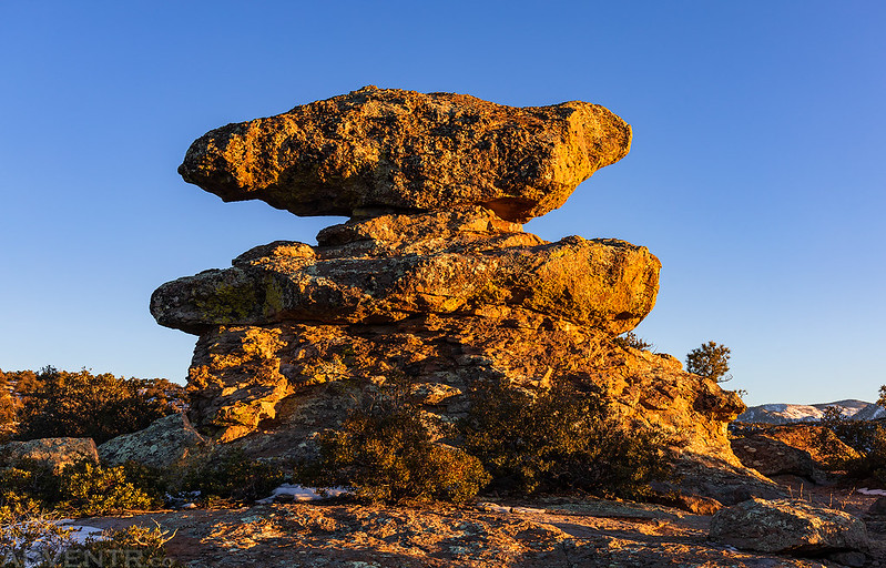
Once we climbed out of Sarah Deming Canyon into the Heart of Rocks we had a good view of Big Balanced Rock.

As we hiked around the Heart of Rocks Loop we passed a number of other interesting formations, including Pinnacle Balanced Rock. This was another area we were glad to have our microspikes for since parts of the route were sheer ice.
Cochise Head on the horizon.
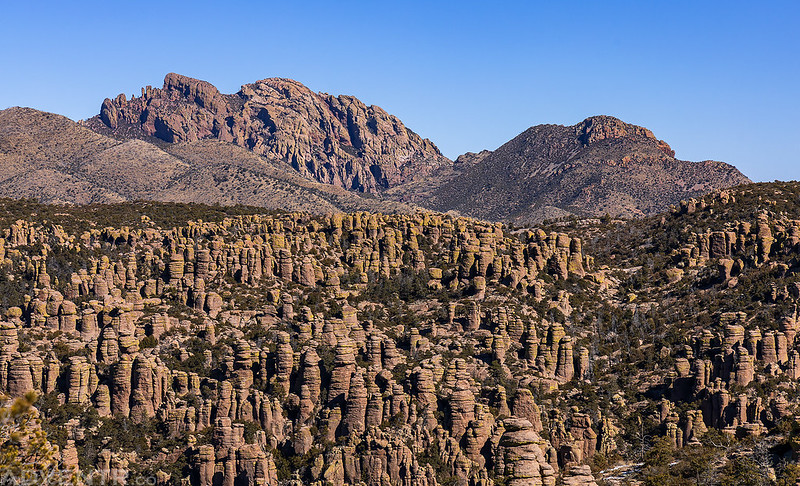
Looking out across a rock wonderland.

Duck On a Rock

When we reached the Inspiration Point Trail junction, Diane stopped to rest while I hiked out to the overlook and back. There was a pretty nice view over Rhyolite Canyon from the end!
Walking through a wonderland of rocks as we made our way back to the trailhead.

After our hike of the Big Loop, we drove down to the Visitor Center so Diane could get a new magnet and then we headed over to our reserved campsite in the Bonita Canyon Campground and set up our tent. We rested and stayed warm in the sun, but later in the afternoon I was ready to go on another hike. Diane had had enough for the day, so she waited for me while I hiked to the Fire Lookout on the summit of Sugarloaf Mountain.
The trail was covered with snow, slick and narrow on the north side of Sugarloaf Mountain. I definitely would not have done this one without microspikes.

The trail went through this tunnel carved into the side of the mountain.

Looking north over Bonita Canyon.

A view from the trail to the Sulphur Springs Valley below.
Once I reached the west side of the mountain there wasn’t as much snow left.
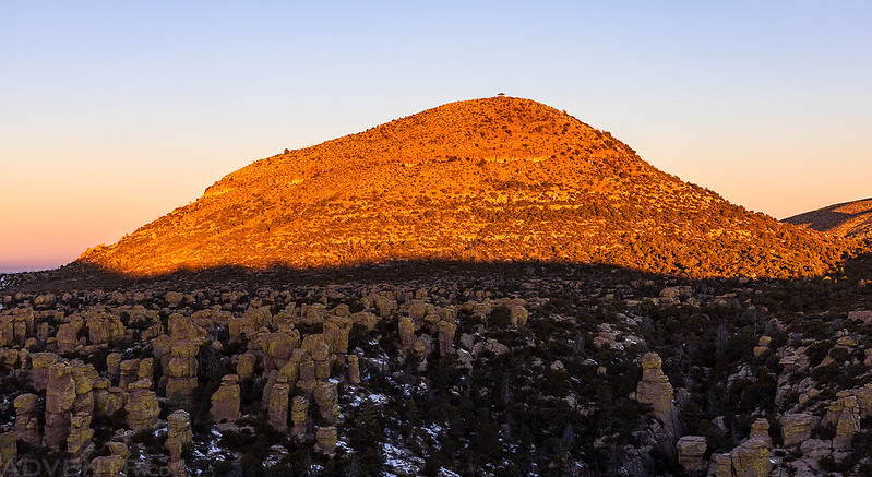
The Fire Lookout on the summit of Sugarloaf Mountain (7,310).

A view from the summit of Sugarloaf Mountain. As of now, this is the southernmost peak that I have summited and Fire Lookout that I have visited.
Sugarloaf Mountain Fire Lookout


The Chiricahua Mountains at Sunset

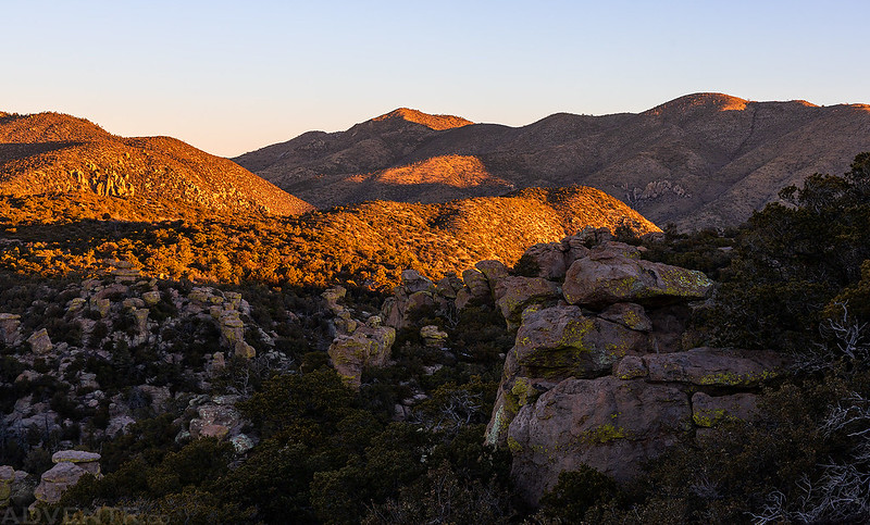
I headed back down the trail shortly before sunset with the Dos Cabezas Mountains in view. If you look closely you can see dust blowing off the Willcox Playa in the distance since it had been very windy all day.

Back down the Sugarloaf Trail…
We returned to the campground around sunset and got into our sleeping bags early. It had been a great day exploring Chiricahua National Monument for the first time!

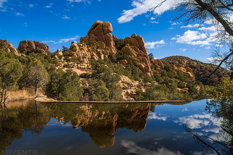
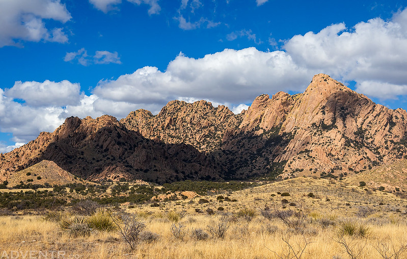
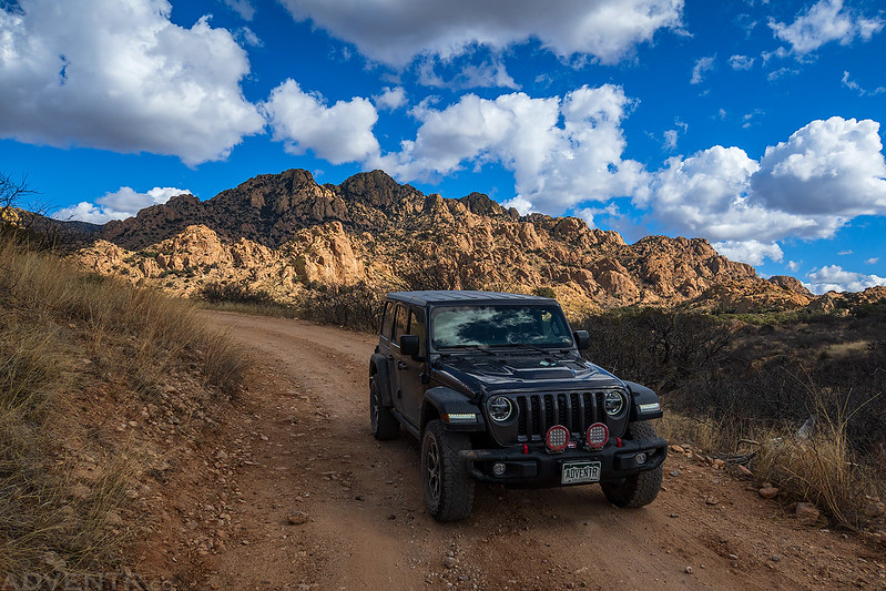
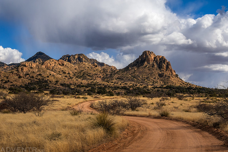
The Pedregosa Mountains & Chiricahua Mountains
On Tuesday morning we were up early again, but this time we left the park so we could explore parts of the Pedregosa Mountains and other parts of the Chiricahua Mountains. We went searching for some pictographs but came up empty handed this time, although I do now have a better appreciation for bushwhacking on the Colorado Plateau since it seems that bushwhacking in the Chihuahuan Desert can be quite a bit worse. Everything is so sharp and pointy!
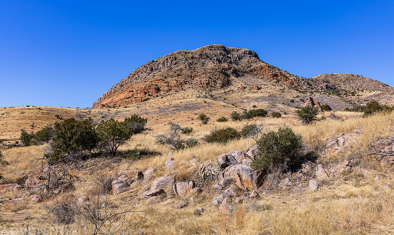
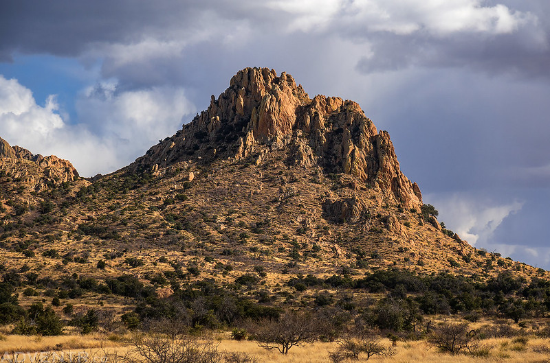
Packsaddle Mountain

We spent a couple hours exploring Tom Ketchum Canyon.

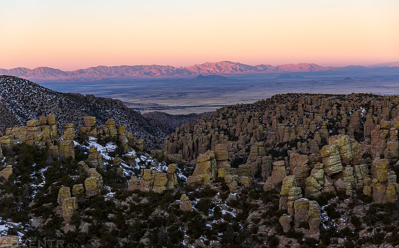
After leaving the Pedregosa Mountains we took a scenic drive up Rucker Canyon to what’s left of Rucker Lake. I didn’t take any photos during this drive but we did see a Coati cross the road in front of us, which was pretty cool. Afterwards, we returned to Massai Point in Chiricahua National Monument to catch the sunset.
A hazy view of the distant Dragoon Mountains.

We wandered over to this high rock and watched the sunset before returning to our campsite.

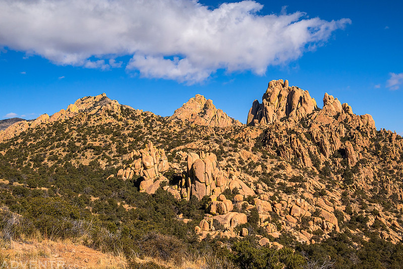
Cochise Stronghold in the Dragoon Mountains
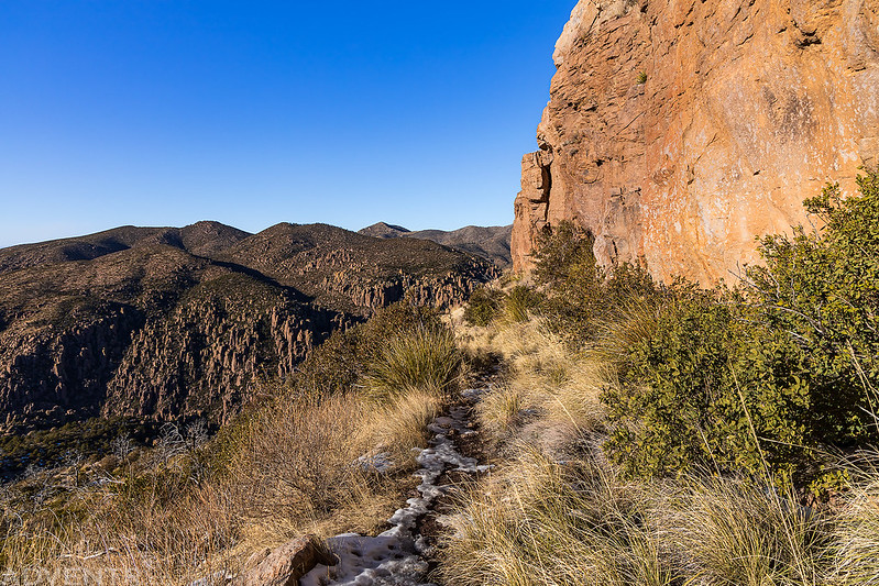
On Wednesday morning we were up before sunrise and packed up camp in the cold so we could leave Chiricahua National Monument and drive across the Sulphur Springs Valley to the Cochise Stronghold in the Dragoon Mountains. We stopped to top off the gas tank in Sunizona and then made our way over to the Cochise Stronghold Trailhead.
Once we made it to the trailhead we started up the Cochise Trail on our way to the Stronghold Divide.

Entering the Cochise Stronghold…
Halfmoon Tank was full of water.

Cochise Stronghold Overlook


Once I made it to the Cochise Divide we turned around and headed back down.


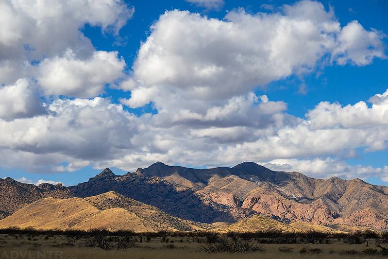
The sky was looking nice today over the Dragoon Mountains because we finally saw our first clouds since we left home on Saturday morning.

Once we returned to the trailhead we drove a little further south and then headed over Middlemarch Pass to get to the other side of the Dragoon Mountains.
These National Forests signs are a bit different from the ones I am used to seeing.

A view from the top of Middlemarch Pass.

The views of the rugged mountains were very nice on the west side.
Looking up Stronghold Canyon West as we made our way over to the Council Rocks.

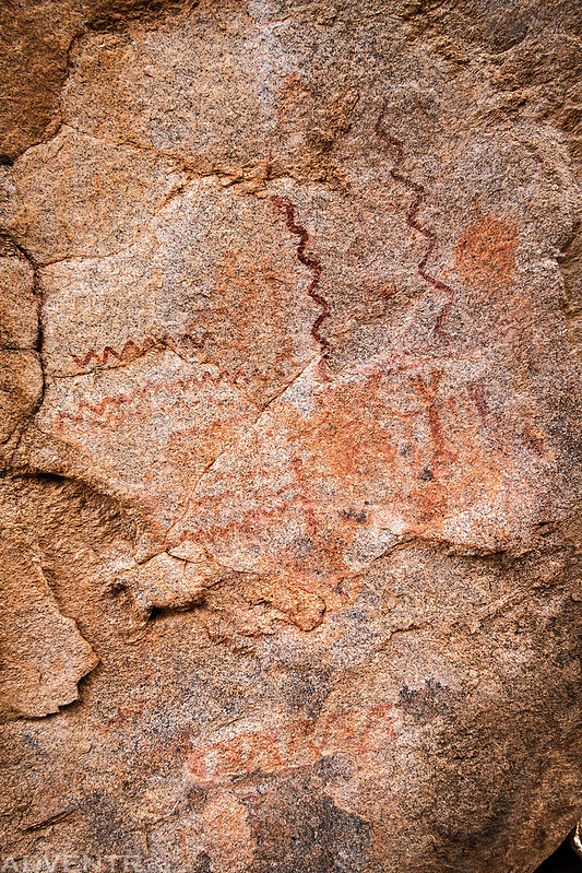
We wandered around the Council Rocks for a bit and found a couple pictograph panels.

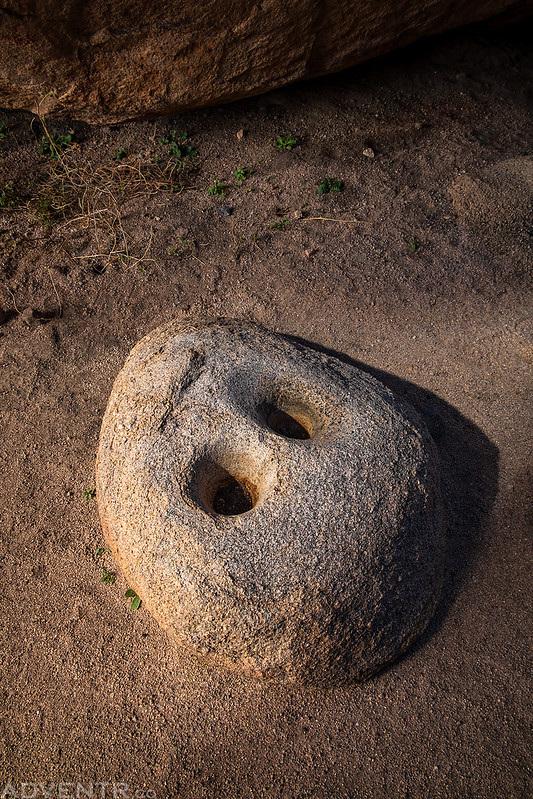
There were a number of cupules around, too.
Council Rocks

After driving to the trailhead at the west end of the Cochise Trail we headed back out to the of the Dragoon Mountains and down into the San Pedro Valley.
When we reached the highway we were very close to the town on Tombstone, so we took a quick drive through town and then headed north to the Tucson Mountain Park so we could spend a little time in Saguaro National Park on Thursday.
Another excellent series touching on some areas that I know very little about! I have to ask- what does “we drove down to the Visitor Center so Diane could get a new magnet” refer to?
Diane gets a magnet from each National Park or Monument that we visit for our fridge.
Such Great photos and details of your travels, I feel I am with you at times. Thank you so much for sharing, some of us who ever make it there !
Thank you Ann!
Really nice post, this is an awesome area. I visited back in November and did a writeup of the Chiricahua Big Loop: https://liveandlethike.com/2023/02/11/chiricahua-big-loop-chiricahua-national-monument-az/. I am envious of your photo quality, which is much better than mine! Next time I’ll try to check out the Dragoons, which seem really neat.
Thanks for sharing your writeup, Andrew. I didn’t come across it when I was researching this trip, but I know I have come across your site when researching trips to Capitol Reef in the past.