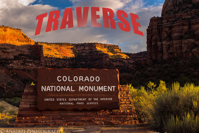
The Face of the Monument | West to East
Saturday, April 12, 2014
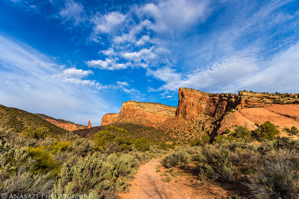
Years ago I had the idea of hiking across the face of the Colorado National Monument from one entrance to the other but never seemed to get around to planning the route and following through on the hike because I was usually heading elsewhere for my weekends. A few weeks ago I told Diane about this idea and she was interested in joining me, so I finally got determined to follow through and started planning the route. Much of the route follows existing trails that I have hiked many times in the past, but there were a few segments that I needed to check out and find a few connecting off-trail routes between them. Over the past few weeks I have gone out a few times after work and scouted these segments to come up with the complete route. I’m sure there have been other’s who have done this hike in one shot before, but I had been unable to find any info about a complete route during my research, so I’m going to include as much info on the route as I can. Please feel free to ask any questions in the comments below if you would like to attempt this hike.
After figuring out the complete route we decided on April 12 as the day we would attempt the hike. It turned out to be a good choice since the temperature was in the low 70’s and overall the weather was very nice. In the morning there was a nice sunrise and then some nice clouds in the early morning light, but as the day grew older more clouds moved in and the second half of the hike was under mostly overcast skies. We left the trailhead shortly before sunrise at Dead Man’s Curve around 6:45am and finished the traverse at the Devil’s Kitchen parking lot in No Thoroughfare Canyon shortly after 1:45pm. We took our time and didn’t rush the hike which took us just over 7 hours and was just a little over 12 miles total.
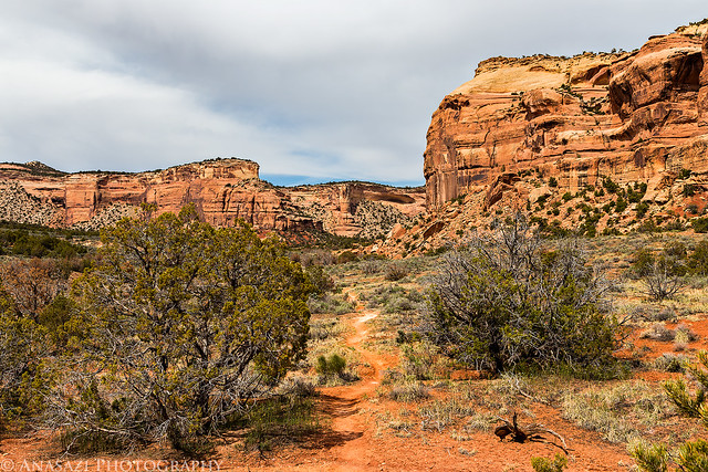
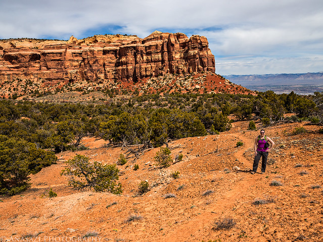
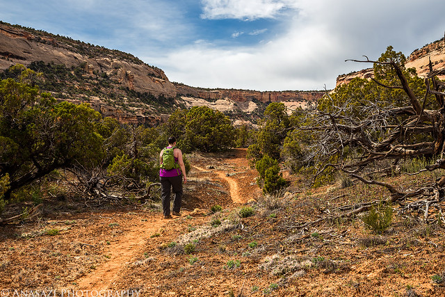
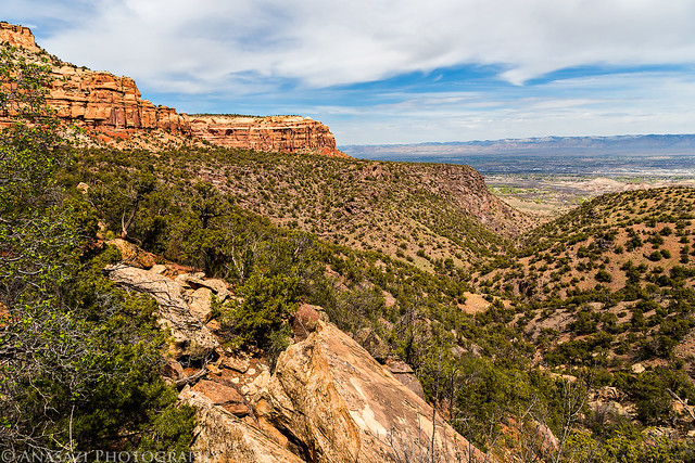
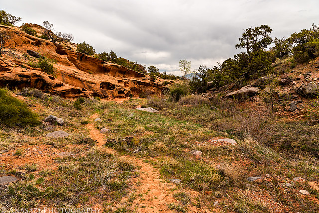
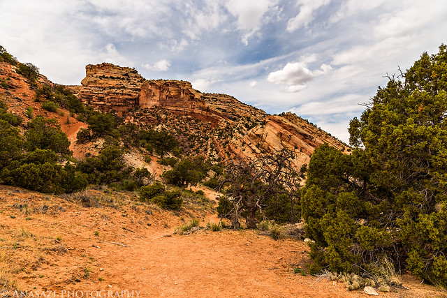
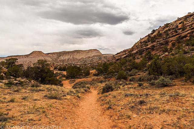
After leaving early from my house, we left Diane’s car in the Devil’s Kitchen parking lot (since the picnic area’s lot was closed) and then drove my Jeep over to the Fruita entrance and parked at a pull-out in Dead Man’s Curve where we descended a steep talus slope to connect to an old road grade into Lizard Canyon. We followed the Lizard Canyon trail to the Wedding Canyon Trail and then connected to the Monument Canyon Trail. We had considered going up Wedding Canyon to Independence Monument and then down Monument Canyon, but we wanted to stay closer to the face of the Monument and didn’t want to add too much more elevation gain on our first attempt. That segment would make a nice alternate route in the future. When we reached Monument Canyon we left the trail and followed the wash a short ways until we reached a smaller wash that would take us up behind the Little Island and then on to the Precambrian Bench. This would be our first off-trail section of the day and the steepest climb all day, too. Once on the bench we would follow this mostly-level hike all the way to Red Canyon, which would take us around Gold Star Canyon and a few other small unnamed side canyons. We passed Bench Trail Arch at around the half-way point of the traverse and then reached the popular Liberty Cap Trail which was where we would run into other people for the first and only time on the hike. We soon left them behind as we continued up the Ute Canyon Trail and then turned off on another little-used path that would take us over to Red Canyon. This section of the trail was washed out in a few places, but is still passable. Once we reached the top of Red Canyon we would come to the most difficult section of the hike; another off-trail route that we would need to descend into Red Canyon. A few weeks back I had scouted this area to try and find a way down but had cliffed out a few times. I eventually found a very steep and loose route that would take us to the bottom of the canyon. Once in the wash we followed it towards the park boundary and then followed a few more faint trails past an old historic structure and then to the Devil’s Kitchen Picnic Area. From there we followed a short section of the Serpent’s Trail back to our vehicle.
I don’t normally include maps and GPS tracks in my trip reports, but I am going to include that information here in case anyone else out there would like to give this route a try and could benefit from my research and experience. This traverse is a great way to see a lot of what the Colorado National Monument has to offer including wildlife, beautiful desert scenery, solitude, petroglyphs and even some history.
Now that the logistics and overview of the trip are out of the way, here are plenty of photos with a little narrative from the traverse.
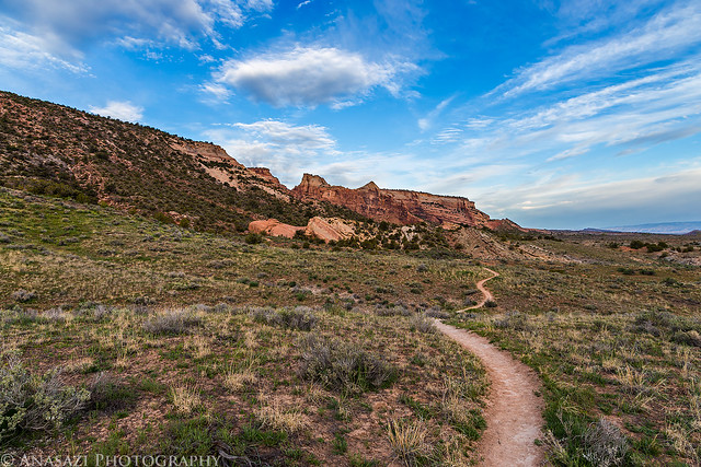
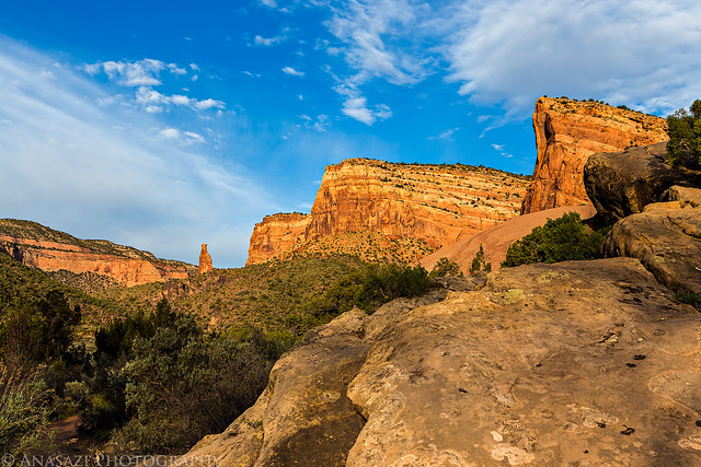
The start of the long hike from Dead Man’s Curve shortly before the sun came up.
Dead Man’s Curve by IntrepidXJ, on Flickr
Looking back towards my Jeep before we start the descent into Lizard Canyon.
The Beginning by IntrepidXJ, on Flickr
The old road grade into Lizard Canyon.
Old Road by IntrepidXJ, on Flickr
Sunrise from the bottom of Lizard Canyon.
Lizard Canyon Sunrise by IntrepidXJ, on Flickr
Sunlight peeking out through a small hole in the clouds above Mount Garfield and the Book Cliffs.
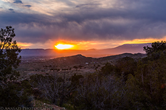
Sunrise by IntrepidXJ, on Flickr
Diane descending down the trail into Wedding Canyon.
Coming Down by IntrepidXJ, on Flickr
There was a lot of Evening Primrose along this first stretch of the trail.
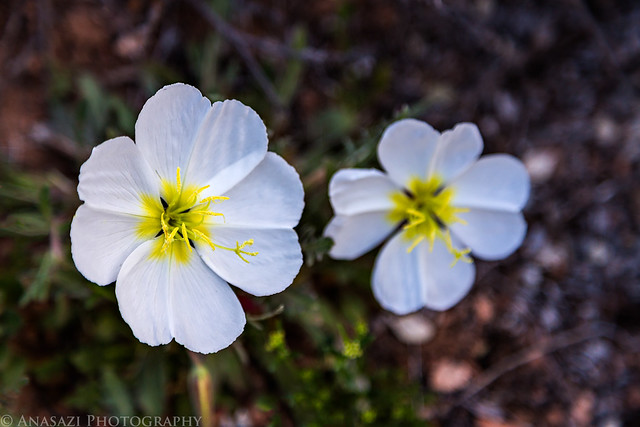
Evening Primrose by IntrepidXJ, on Flickr
One more look back as we follow the trail past Wedding Canyon.
Wedding Canyon Trail by IntrepidXJ, on Flickr
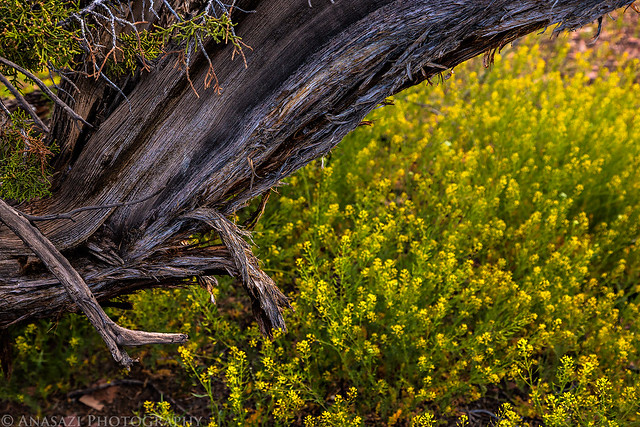
Juniper & Wildflowers by IntrepidXJ, on Flickr
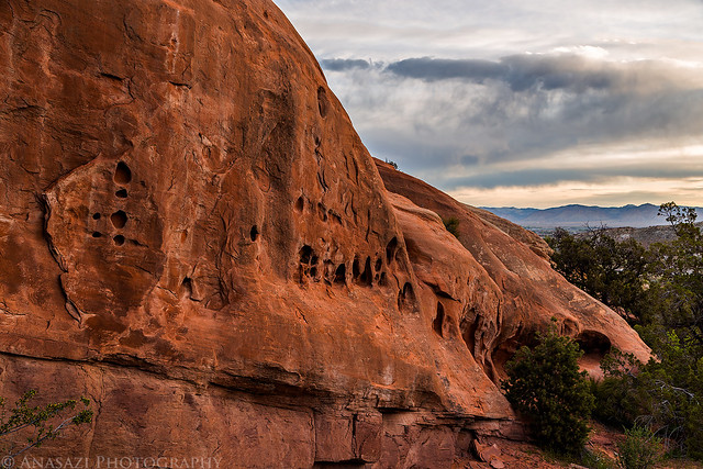
Morning Sandstone by IntrepidXJ, on Flickr

Interesting Clouds by IntrepidXJ, on Flickr
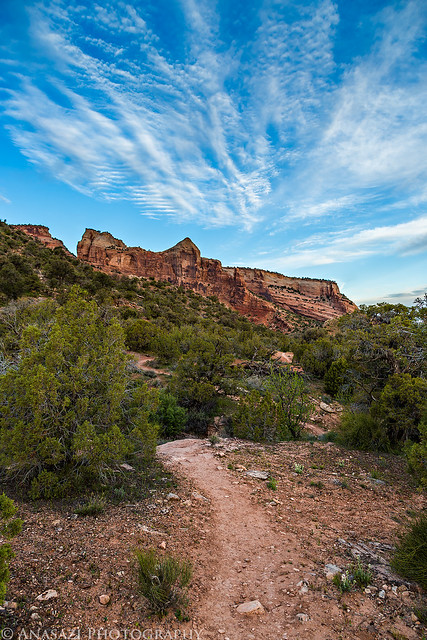
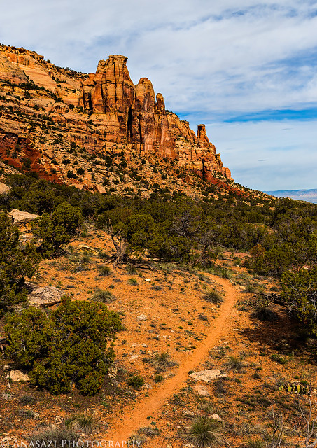
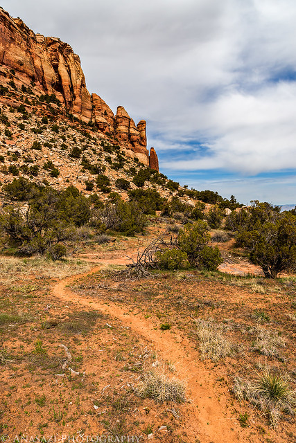
The Wedding Canyon trail along the face of the Monument skirts around The Island.
Trail by IntrepidXJ, on Flickr
Soon we reached the superhighway, I mean trail that leads into Monument Canyon. Nice morning light on the cliffs of Monument Mesa.
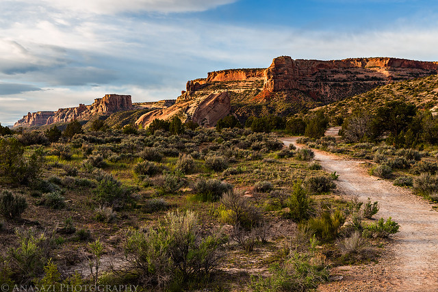
Monument Canyon Trail by IntrepidXJ, on Flickr
That gap between the Little Island and Monument Mesa would be our route up onto the Precambrian Bench.
Little Island Gap by IntrepidXJ, on Flickr
Tilted sandstone at the base of The Island

Island Sandstone by IntrepidXJ, on Flickr
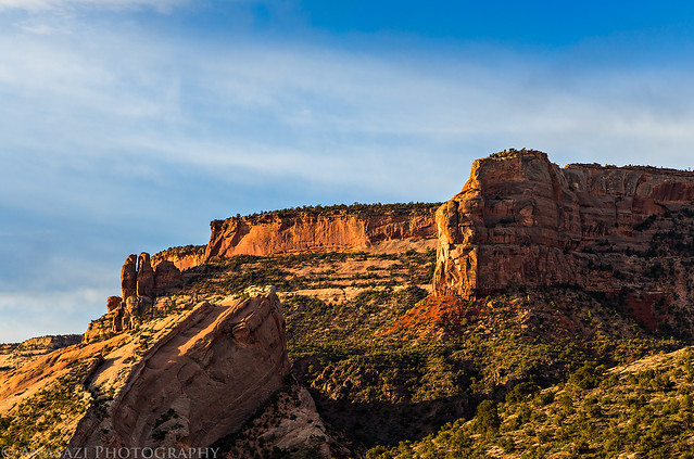
Beautiful scene as we entered Monument Canyon. We had the best light of the day for photos when we hiked through Monument Canyon and up past the Little Island.
East Entrance by IntrepidXJ, on Flickr
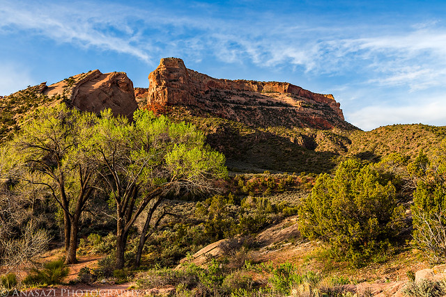
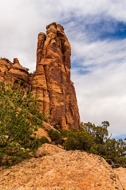
Independence Monument comes into view as we enter the canyon.
Independence View by IntrepidXJ, on Flickr
We took a short side trip to visit a few petroglyphs.
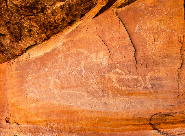
Petroglyphs by IntrepidXJ, on Flickr
Nice light on the cliffs of The Island and Independence Monument.

Lower Monument Canyon by IntrepidXJ, on Flickr
Hiking up the wash for a short distance.
Monument Canyon Wash by IntrepidXJ, on Flickr
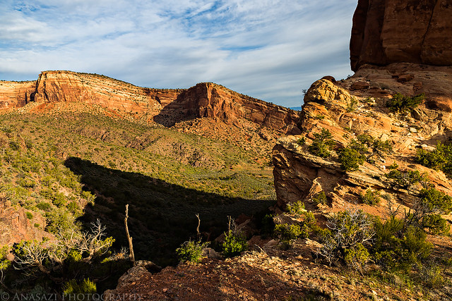
Great view from the pass between Monument Mesa and the Little Island.
Little Island Shadow by IntrepidXJ, on Flickr
The remains of an old cattle fence can be seen in the shadow of the Little Island in this photo. There are a lot of historic relics that can be found along this route.
Little Island Fence by IntrepidXJ, on Flickr
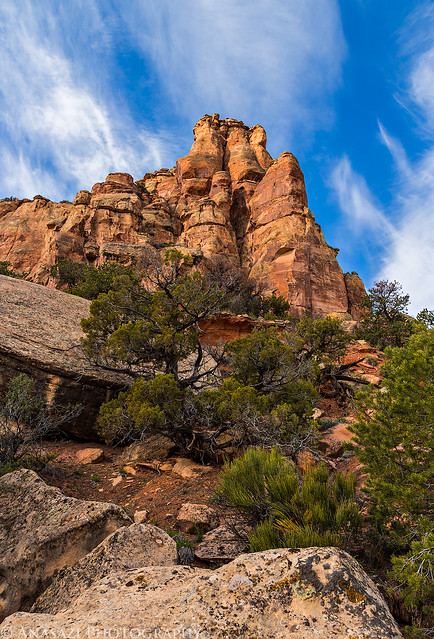
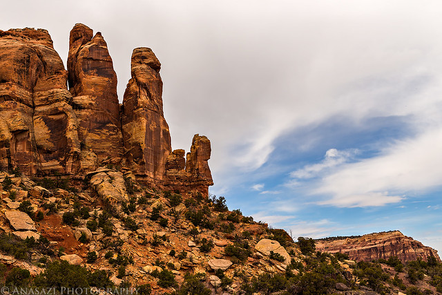
A nice view of Mushroom Rock as we finish the ascent onto the Precambrian Bench.
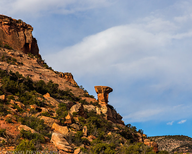
Mushroom Rock by IntrepidXJ, on Flickr
A wider view with the point of Monument Mesa above.
Bench View by IntrepidXJ, on Flickr
Looking up at the point.
Monument Mesa Point by IntrepidXJ, on Flickr
There were plenty of wildflowers along the trail.
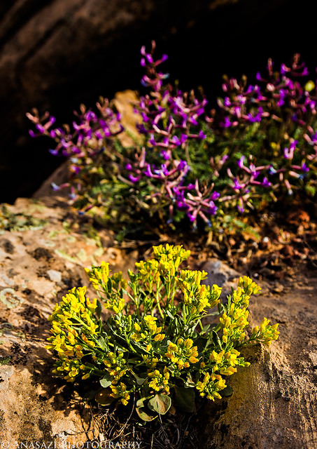
Yellow & Purple by IntrepidXJ, on Flickr
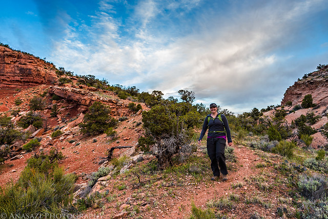
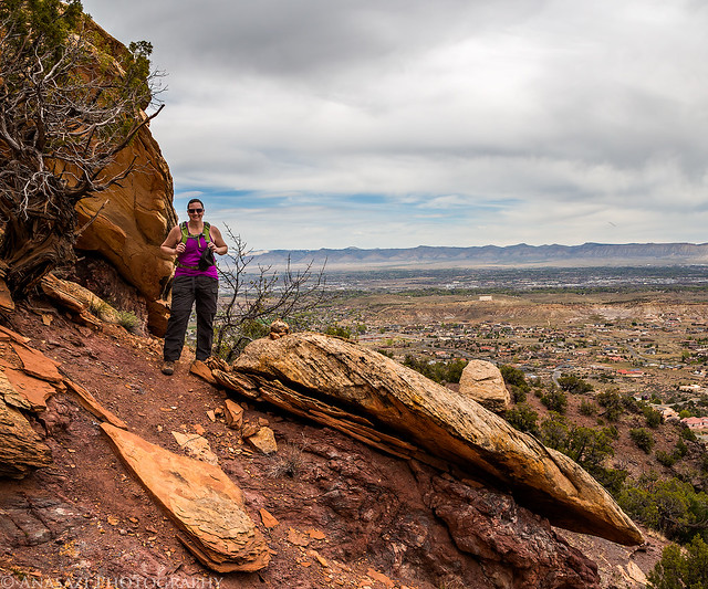
Diane coming around the bend.
On the Trail by IntrepidXJ, on Flickr
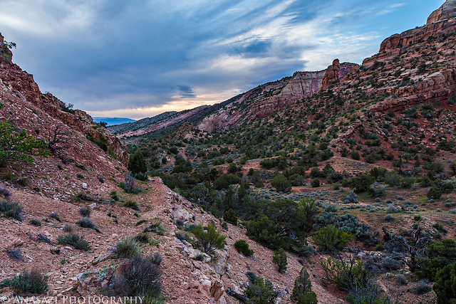
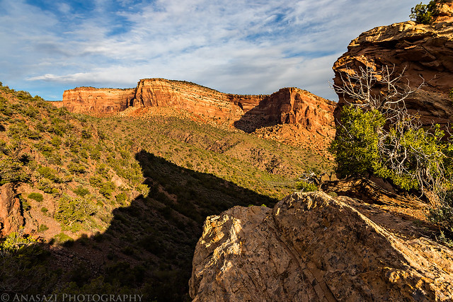
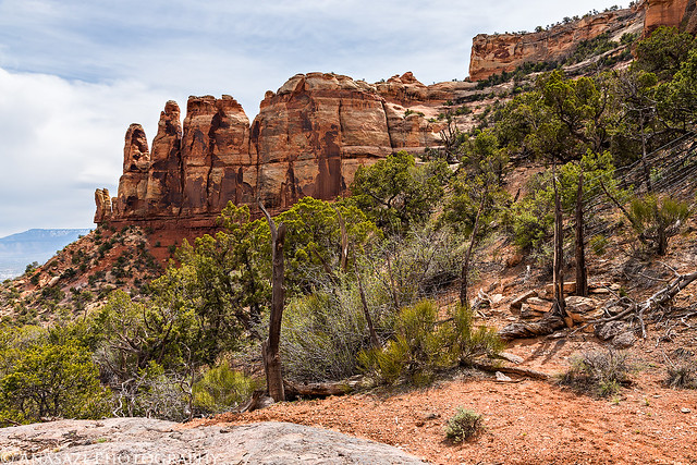
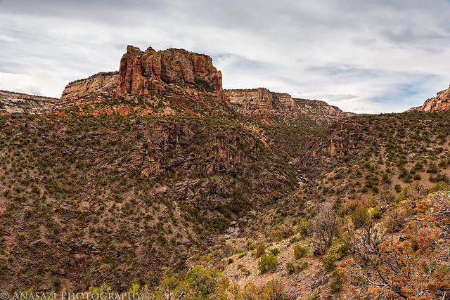
Great scenery as we circled around the amphitheater containing Gold Star Canyon.
Gold Star by IntrepidXJ, on Flickr
The light was hitting these flowers just right.

In the Light by IntrepidXJ, on Flickr
Looking towards Otto’s Staircase. Trust me, it’s there!
Upper Gold Star by IntrepidXJ, on Flickr
Gold Star Canyon wash. This is the only segment of the route that I had not hiked before, so it figures that I missed a turn and followed the wash a little too far before figuring out my error and having to backtrack a little bit. Once we found the trail again it was smooth sailing the rest of the day.

Gold Star Wash by IntrepidXJ, on Flickr
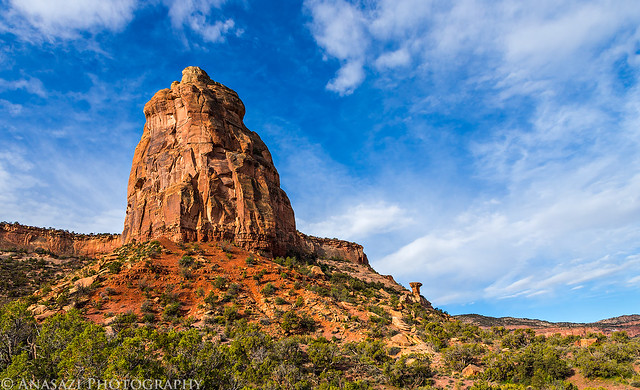
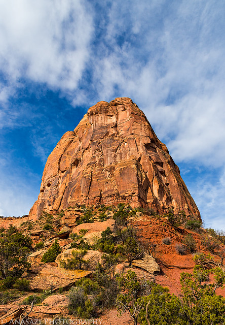
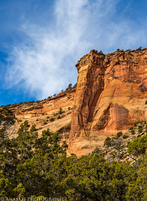
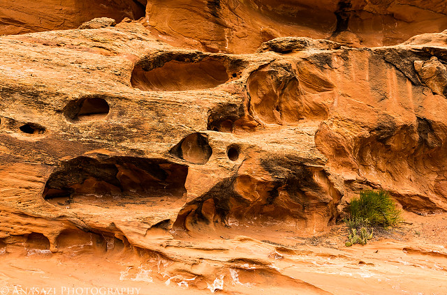
There’s no shortage of beautiful sandstone monoliths towering above the Bench Trail.
Looking Up by IntrepidXJ, on Flickr
We also saw plenty of Indian Paintbrush on the bench.
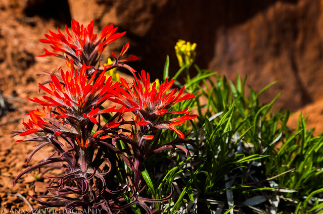
Indian Paintbrush by IntrepidXJ, on Flickr
I was hoping to see my first Collared Lizard of the year on this hike, and I wasn’t disappointed.
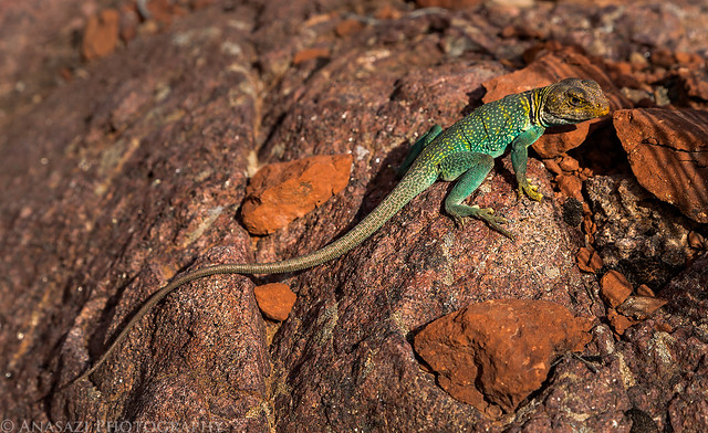
Collared Lizard by IntrepidXJ, on Flickr
Posing for the camera!
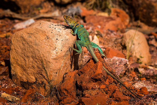
Climbing by IntrepidXJ, on Flickr
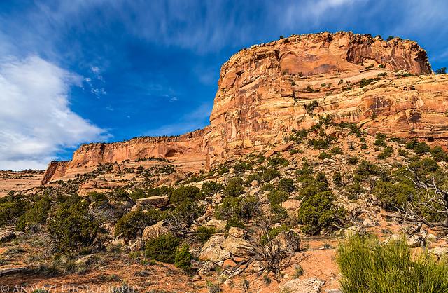
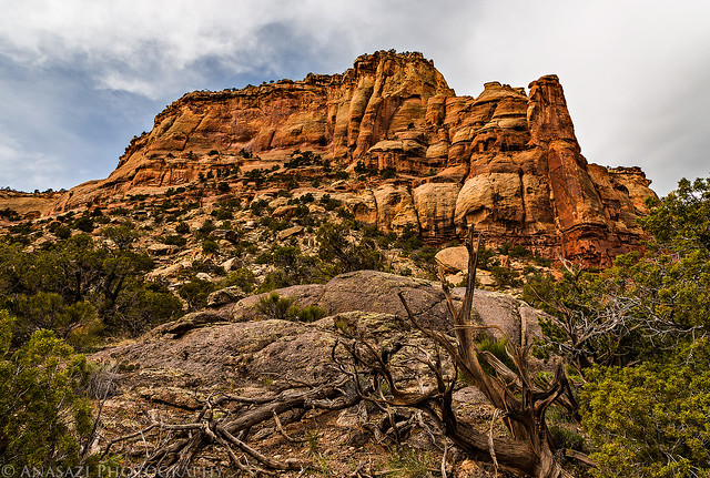
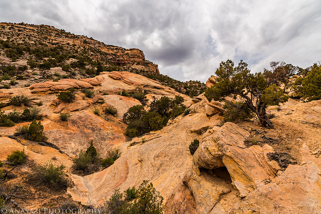
More scenery along the Bench Trail.
Bench Trail by IntrepidXJ, on Flickr
A Golden Eagle soars above us. There was a second one not in this photo.
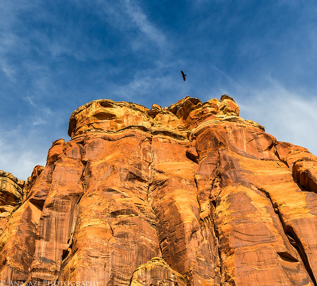
Soaring Above by IntrepidXJ, on Flickr
This view of Bench Trail Arch marked the halfway point of the traverse.
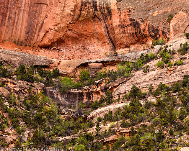
Bench Trail Arch by IntrepidXJ, on Flickr
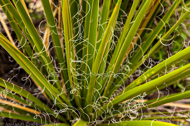
Yucca by IntrepidXJ, on Flickr
Twisted by IntrepidXJ, on Flickr
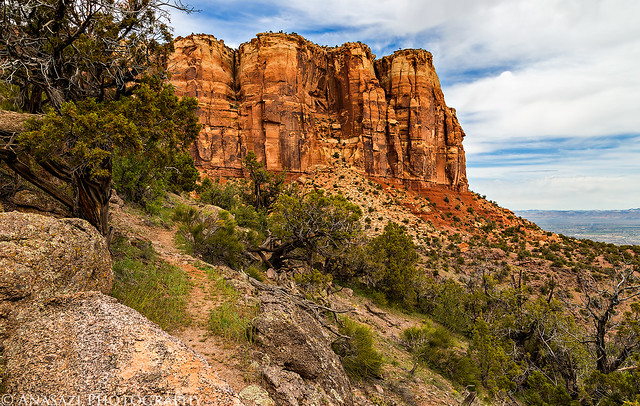
More great views as we neared the popular and busy Liberty Cap Trail. The only time we would see anyone else during our traverse was when we followed a short section of the Liberty Cap Trail.
Tower by IntrepidXJ, on Flickr
Hiking the Bench by IntrepidXJ, on Flickr
Sandstone Above by IntrepidXJ, on Flickr
Bench Trail II by IntrepidXJ, on Flickr
We passed a few more historic relics between the Liberty Cap Trail and Corkscrew Trail.
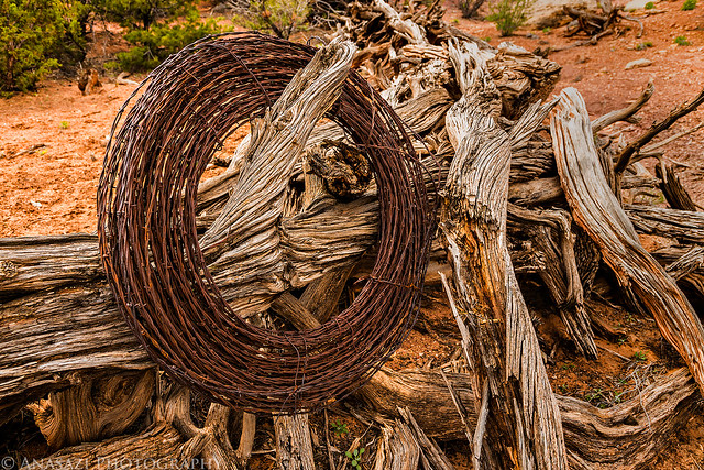
Barbed Wire by IntrepidXJ, on Flickr
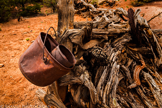
Rusty by IntrepidXJ, on Flickr
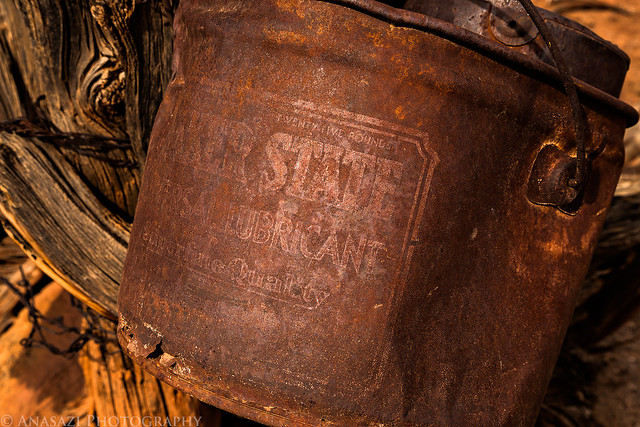
Quaker State by IntrepidXJ, on Flickr
The view up Ute Canyon as we got off the main trail and continued to follow a little-used path towards Red Canyon.
Ute Canyon Trail by IntrepidXJ, on Flickr
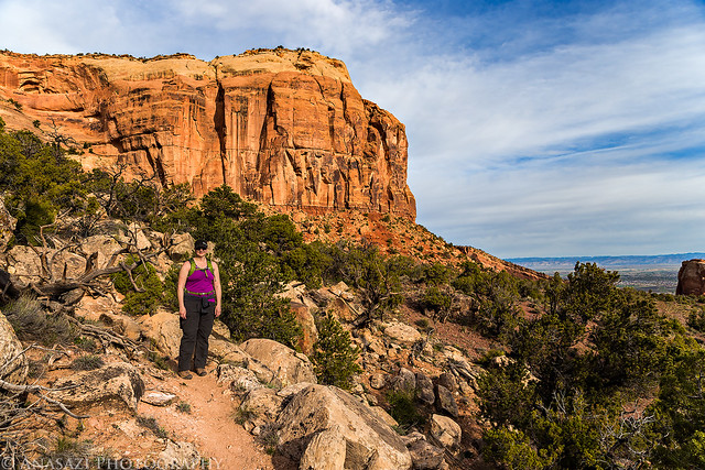
Diane on the trail with Liberty Cap above.
Past Liberty Cap by IntrepidXJ, on Flickr
Continuing on…
Follow the Trail by IntrepidXJ, on Flickr
Another old fence we passed through.
Fenceline by IntrepidXJ, on Flickr
View back towards Liberty Cap over a short unnamed canyon.
Unnamed Canyon by IntrepidXJ, on Flickr
Fingers by IntrepidXJ, on Flickr
Rounding the corner to Red Canyon.
Around the Corner by IntrepidXJ, on Flickr
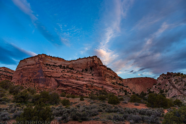
View up Red Canyon before our steep descent.
Red Canyon by IntrepidXJ, on Flickr
Diane was hoping all day that we would see some bighorn sheep on this hike and by this point I figured we wouldn’t be seeing any. Lucky for us, we came across two of them as we climbed down into Red Canyon. They didn’t stick around long once we spotted them, so I was only able to get this quick shot of their backs.
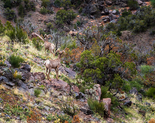
Bighorn Sheep by IntrepidXJ, on Flickr
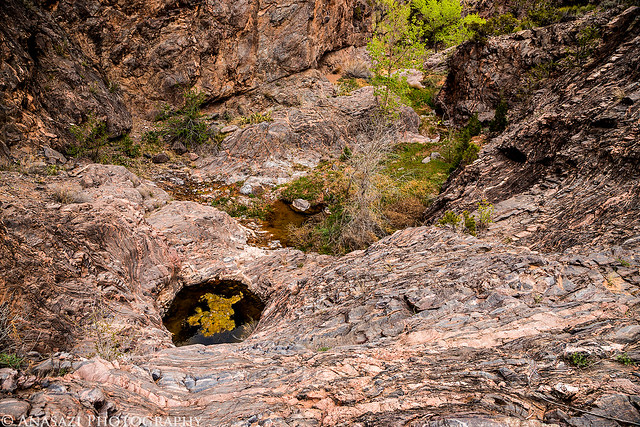
A small pool in the wash where we reached the bottom of the canyon. We were happy to be back on flatter terrain again.
Red Canyon Pool by IntrepidXJ, on Flickr
A pour-over we bypassed right before the confluence with Columbus Canyon.
Pourover by IntrepidXJ, on Flickr
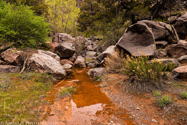
Red Canyon is a beautiful hike in the spring with running water.
Red Canyon Creek by IntrepidXJ, on Flickr
Nearing the end of Red Canyon.
Red Canyon Trail by IntrepidXJ, on Flickr
Cool sandstone wall.
Sandstone by IntrepidXJ, on Flickr
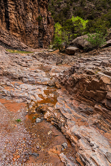
Following the trail over slickrock near the Monument’s boundary.
Sandstone Hiking by IntrepidXJ, on Flickr
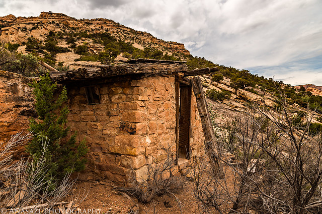
We passed this old historic structure along the way. I have not been able to find any information about it’s history, so if anyone out there has any information I’d love to hear about it in the comments below.
Historic Structure by IntrepidXJ, on Flickr
Devil’s Kitchen Picnic Area by IntrepidXJ, on Flickr
The final stretch of trail leading the way to the Devil’s Kitchen Picnic Area.
Final Stretch by IntrepidXJ, on Flickr
Hi Randy, I enjoyed your photos as always!
The structure you passed between Redlands Wash and the Devils Kitchen Picnic Area is known as Butterfly Springs. It is believed to have been used by John Otto for shelter but was not built by him.
Also, if you look at your own KML, you will see that there is actually a well-worn traversing trail and much much easier descent than the steep drop you took into Red Canyon if you had turned north right at the boundary fence rather than gone through it.
The bench trail is one of my favorites with all its history. Perhaps you came across the telegraph wire right next to the trail that John Otto used to hang an American flag across Gold Star Canyon or, very shortly after that, the concrete water holding tank that the CCC built for the buffalo?
I always enjoy coming across your posts, thanks!!
Thanks for the info Steve! I’ll have to check on that alternate and less-steep route out sometime, but I really do think going through Red Canyon was a nice part of the trip, even with the steep descent…it added a bit of adventure to the hike 🙂
Hi Randy and Steve — it is 6 years later and I’m intrigued by the history of Butterfly Springs behind that structure you mention… We came across some inscriptions in rock and sandstone further up that little canyon and it’s hard to decipher the writing but it says 1914 and 1915. Surprised there isn’t much out there about this. Steve where did you learn it was called Butterfly Springs? I do see what looks like Butterfly carved into the rock .. there are more structures behind it too higher up… thanks for sharing any other info- history buff here !