Following Another Segment of the Historic Halls Road
Friday – Sunday, May 8-10, 2020
This weekend Diane and I headed into the Glen Canyon National Recreation Area so that we could continue my Canyons of the Escalante series by hiking down Silver Falls Creek to the Escalante River and back. With warmer temperatures in the desert lately, I was looking for an easy overnight backpacking trip where we could camp near water to cool off during the heat of the day. Plus, with seemingly more people out on our public lands right now, I was also looking for a more out-of-the-way location that’s not very popular where we would hopefully not run into many other people in the backcountry. Silver Falls Creek seemed to fit the bill perfectly. I had actually planned on hiking down Silver Falls Creek Canyon last October with Jared after we hiked through Little Death Hollow and Wolverine Canyon, but after that hike we decided to end our week-long trip a day early and instead went on a short hike along Pleasant Creek in Capitol Reef National Park, so I was looking forward to finally visiting this canyon. As an added bonus, this would be another segment of the historic Halls Road that we would be able to check out after hiking down Lower Muley Twist Canyon back in March.
To supply the new isolated community of Bluff, Charles Hall was chosen to find a different, more practical route. The trail he pioneered in 1881 diverted from the original Hole-in-the-Rock passage at Harris Wash. From there, wagons were to cross the Escalante River, go up Silver Falls Canyon, cross the mostly open Circle Cliffs region, and then proceed down a steep, rocky slope into Muley Twist Canyon. Once through the Waterpocket Fold, the trail went down Halls Creek to the Colorado River. Hall set up a ferry there and built his house and garden a few miles up the creek. As one would suspect, this rough, isolated supply route did not see a lot of travelers. Within three years, wagon roads connected with the new rail lines serving Durango and Green River, eliminating the need for a ferry. Never significant in numbers served or length of service, the Halls Crossing Trail did establish the only wagon and truck road through the southern Waterpocket Fold until the 1950s.
– Bradford J. Frye // From Barrier to Crossroads
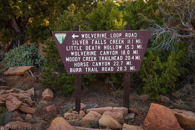
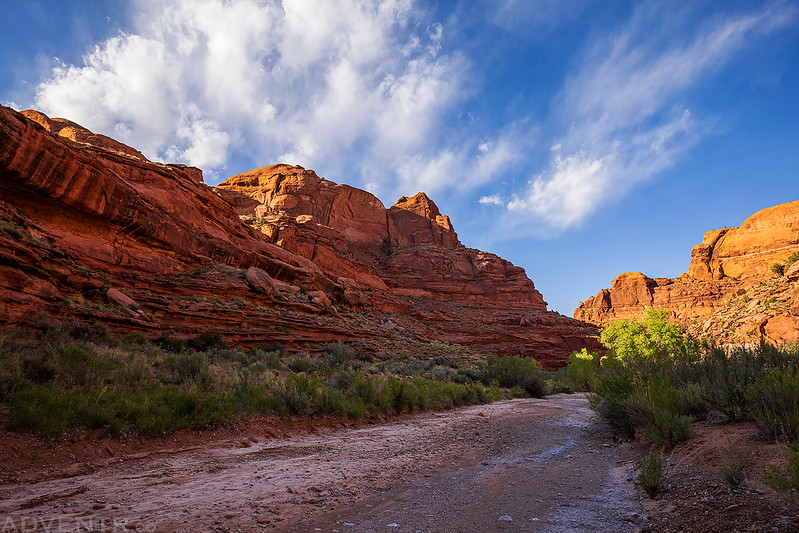
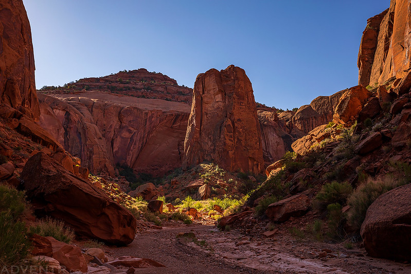
There were only eleven miles left to Silver Falls Creek when we reached the turnoff for the Wolverine Loop Road along the Burr Trail.
Diane didn’t work on Friday and I got out of work a few hours early, so we left earlier than usual and made our way west into Utah. After driving through the Waterpocket Fold on the Burr Trail, I took the Wolverine Loop Road and then the Moody Canyon Road until we found a nice campsite above Moody Creek just a few miles before we reached the trailhead for Silver Falls Creek. We arrived in time to get our tent setup and watch the sunset before we got into our sleeping bags for the night. The weather this weekend was supposed to be nice during the days and nights, so we ditched the rainfly and watched the almost-full moon rise as we went to sleep. It was a little breezy at sunset, but afterwards the wind calmed down and it stayed that way for most of the night.
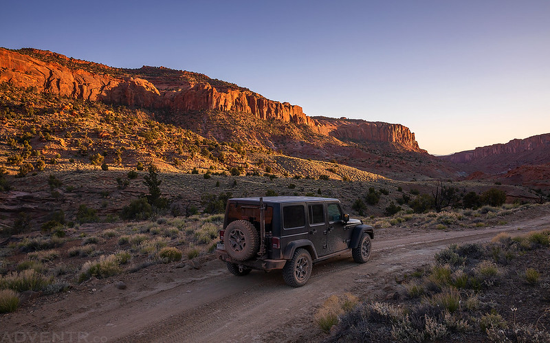
Driving through the Circle Cliffs along Silver Falls Creek in the late evening.
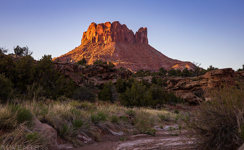
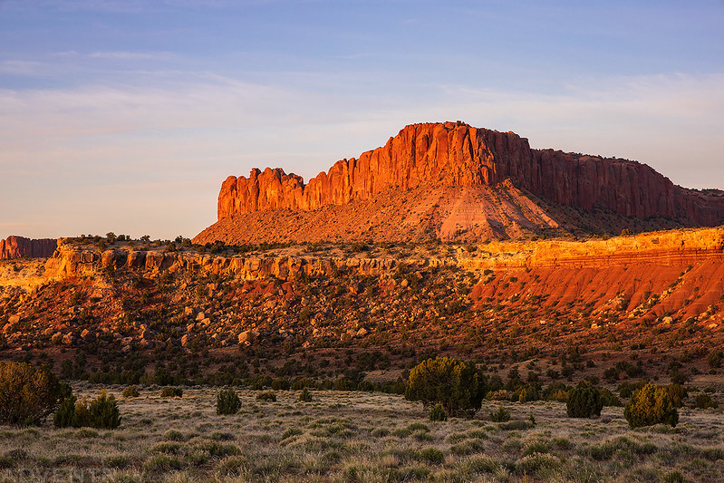
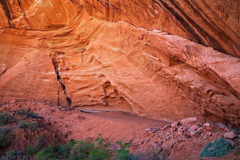
This little butte near the head of Silver Falls Canyon looked nice in the warm evening light.
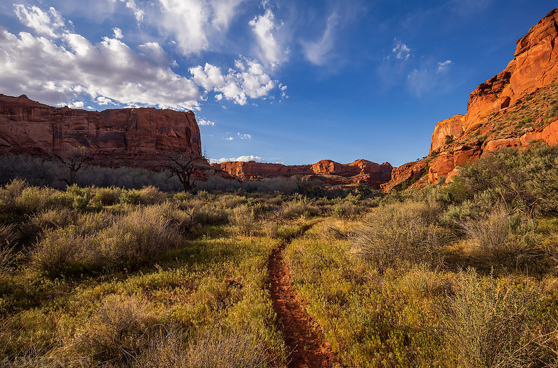
The temperature overnight was perfect and mostly calm, aside from a short time when the wind picked up in the very early morning. My Jeep said it was 57 degrees out when we got up at sunrise. After taking a few photos, we packed up camp and then finished the drive to the end of the Silver Falls Road at the Glen Canyon National Recreation Area boundary. We finished packing our backpacks and started off hiking down the canyon. Like our last couple of overnight trips, we decided to carry all the water we would need and went stoveless since it was going to be a pretty easy hike. Even though we would be camping near the Escalante River where water would be plentiful, I was worried that the water might be too silty to filter like our last trip into Coyote Gulch, and wanted to be safe and not sorry. The hiking was pretty easy all the way to the Escalante River, first following an old road and then continuing down the hard-packed wash through the narrowing canyon.
The morning view from our campsite above Moody Creek on Saturday morning.

Morning light strikes the Silver Falls Bench.
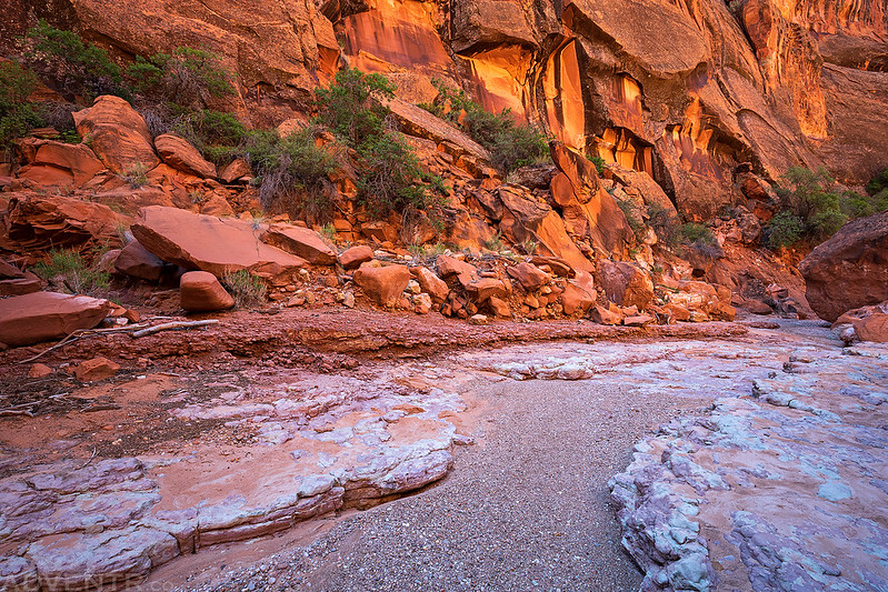
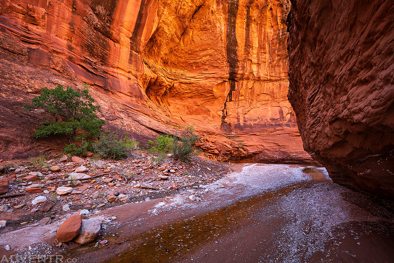
The hike started out in the broad hard-packed wash of Silver Falls Creek.

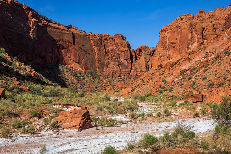
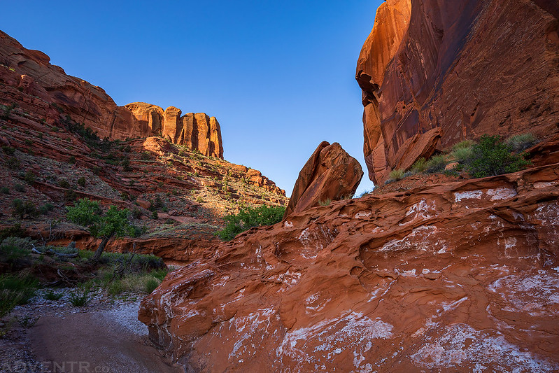
After passing the North Fork of Silver Falls Creek the canyon started to narrow up a little bit.
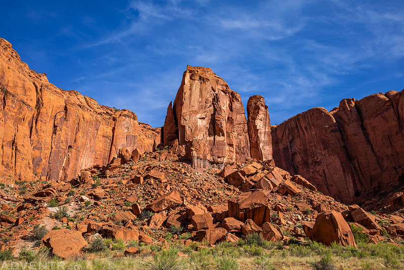
We passed this first tower in the middle of a rincon after hiking down the wash for a couple of miles.
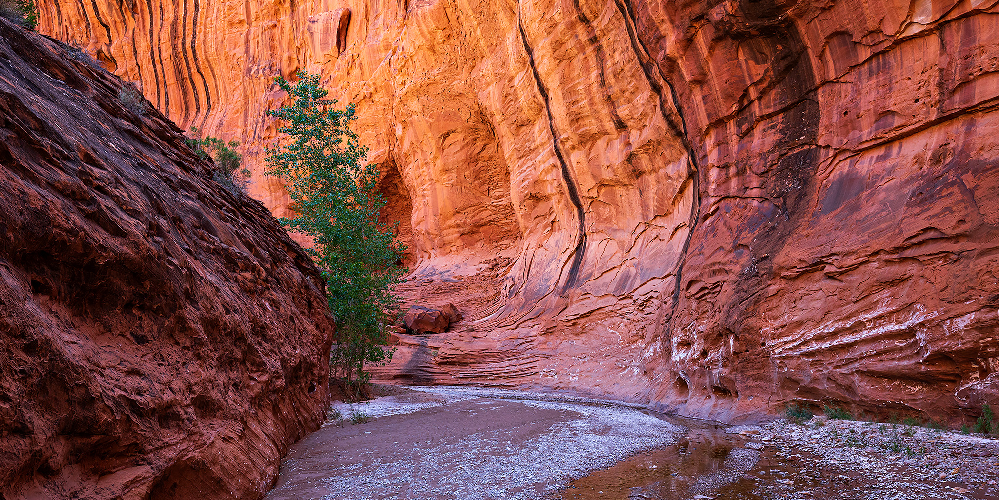
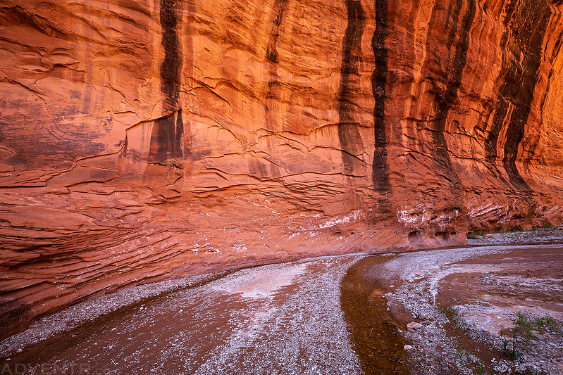
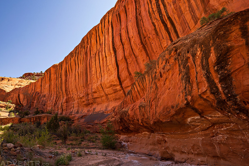
Towering Canyon Walls
We saw a lot of petrified wood scattered throughout the canyon.

When we reached the next rincon that contains Emigrant Spring, we hiked around the tower in the middle and visited a huge alcove in the back. While I was climbing up into the alcove, I knocked some loose rocks down the slope which made a rattlesnake start to rattle just below me. Although I never saw the snake, it was somewhere close to where I had just climbed up! Diane decided to come up a different way.
There were a number of historic inscriptions found at the base of the tower near Emigrant Spring, including this one left by Vern Lyman in 1921.

Since there was another inscription left by C.A. Harp, I’m guessing this one was also carved by him.

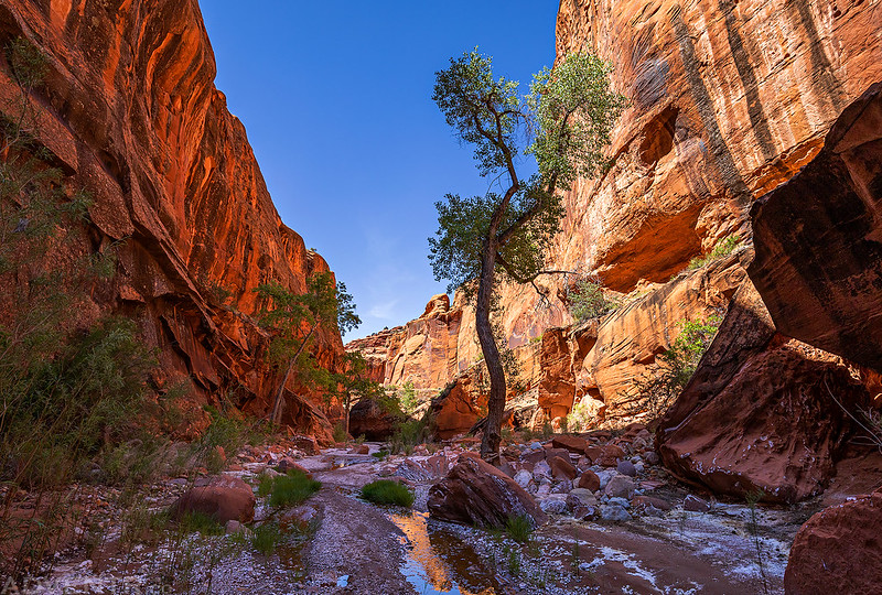
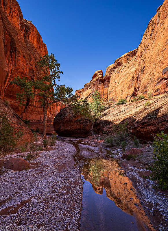
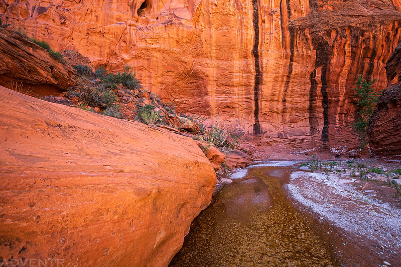
After passing Emigrant Spring, the reflected light in the bends of the canyon got better and better!

The scenery and light were just amazing as we continued further down the canyon.

Although the temperature was getting pretty warm in the sun, it was still very pleasant in the shade.

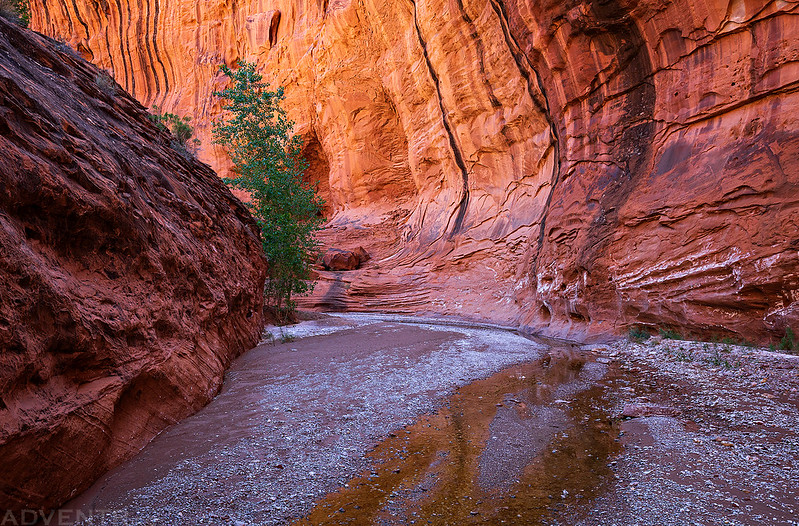
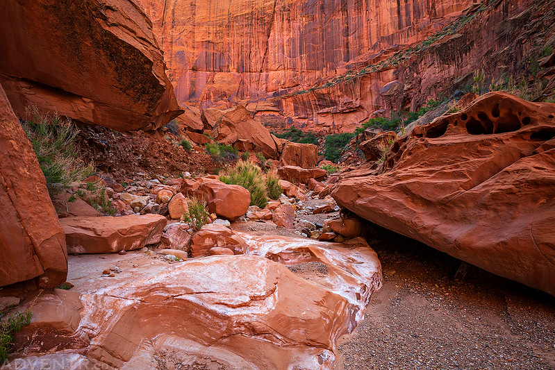
Soon there was a little running water in the previously dry creek bed which added to the scene.
I liked this little arch on the inside of a particularly nice bend in the canyon.

Did I mention that the reflected light was pretty intense and amazing?
We passed a few more inscriptions along the way, including this one left by Rodney Baker in 1917.


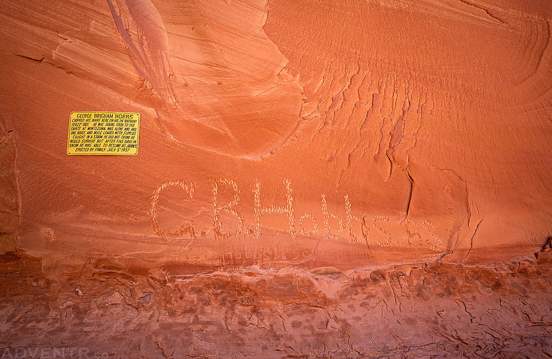
Soon we came to the most famous historic inscription in the canyon. This one was left by G.B. Hobbs in 1883. His family put up the plaque in 1957 which says:
GEORGE BRIGHAM HOBBS
CHOPPED HIS NAME HERE ON HIS 24th BIRTHDAY
FEB. 22nd 1883. HE WAS TAKING FOOD TO THE
SAINTS AT MONTEZUMA, WAS ALONE AND HAD
ONE HORSE AND MULE LOADED WITH SUPPLIES
CAUGHT IN A STORM HE DID NOT THINK HE
WOULD SURVIVE BUT AFTER FIVE DAYS IN
SNOW HE WAS ABLE TO RESUME HIS JOURNEY.
ERECTED BY FAMILY JULY 5th 1957
Walking through the Hobbs Amphitheater.

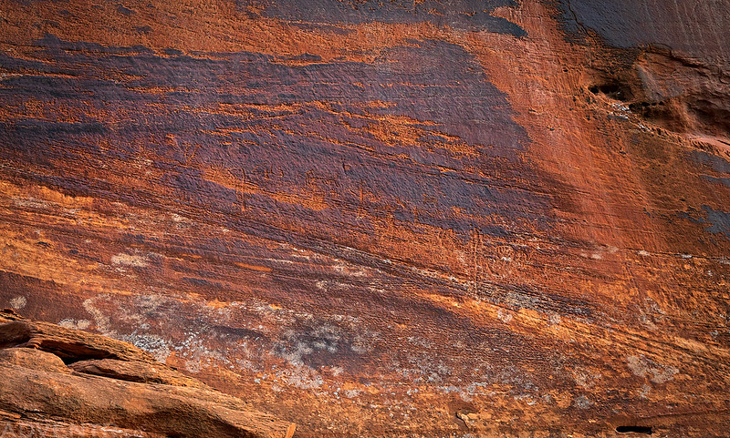
I absolutely loved the massive striped walls found in this canyon!


When we reached the Escalante River we found a great campsite right at the mouth of the canyon and set up our tent. As a side note, there were moth sacks (at least I think that’s what they are?) in many of the cottonwood trees throughout the canyon and caterpillars were all over the place! It reminded me of my last visit to Grand Gulch a few years ago.
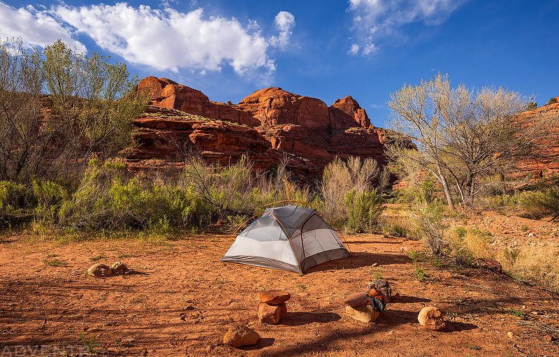
We spent the remainder of the afternoon cooling off in the river near camp. There was nice little sandy beach right at the mouth of the canyon and an island right in the middle of the river with some rocks to sit on. The no-see-ums and mosquitoes were pretty bad today, but they didn’t seem to bother us much while we were sitting in the river, which was a bonus!

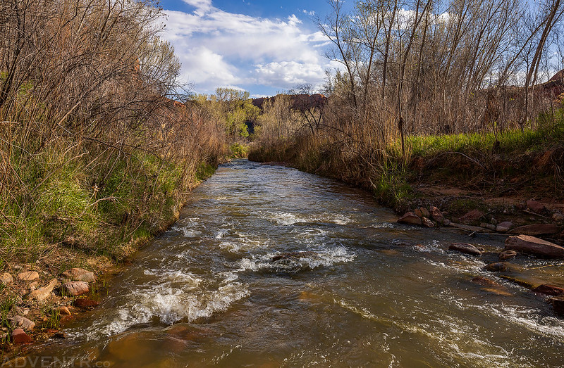
The Escalante River
Shortly before sunset I wandered around the area to take a few more photos.
I followed the trail along the Escalante River to the mouth of Harris Wash and had thought about crossing the river to hike up that canyon a little ways, but I decided to save that for when I eventually come back to hike down Harris Wash another time.
We skipped the rainfly for a second night and got into the tent right after sunset to get away from the bugs that were out. It had been a long and warm day, so we were pretty tired and went right to bed. I think our time in the desert this spring is quickly coming to an end and we will soon need to start heading up into the higher country.
Just like the previous night, it stayed nice and calm out and I slept very well. On Sunday morning we woke up about a half hour before sunrise so we could pack up and get started hiking up the canyon before the temperature warmed up later in the day, especially since the upper canyon is more open and exposed to the sun.
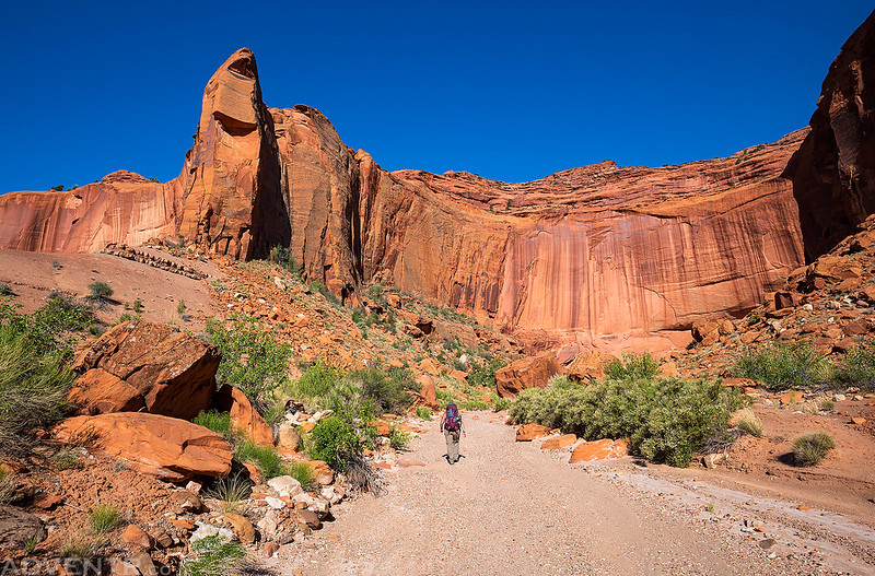
Hiking back out of the canyon as the sun got higher in the sky and started to illuminate the walls.
During our hike into the canyon we had searched for a possible panel of petroglyphs without any success. We kept our eyes open on our way back today and managed to spot them. They are very hard to see, so it’s no surprise we missed them when they were in the bright sunlight on Saturday. Look closely at this photo and maybe you’ll be able to see them?
It’s always fun trying to catch a nice sunstar while hiking through a beautiful canyon.

Just another sunstar…

A morning view of Emigrant Tower as we hiked past it on the way back.
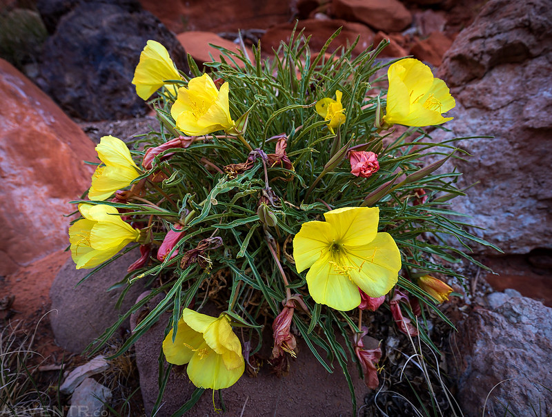
We saw plenty of desert wildflowers in the canyon, but this was the only one I stopped to take a photo of.

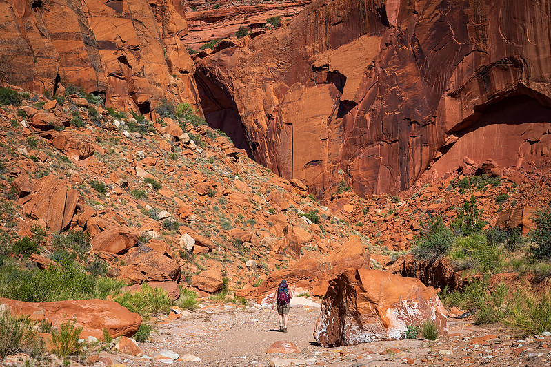
Leaving the narrowest parts of the canyon to start hiking in the hotter sun.

Diane hikes ahead of me as we continue our way up the wash and back to my Jeep.
We returned to my Jeep around 10:30am and it was definitely getting pretty warm out in the sun by then, so we were glad that we got an early start. I really enjoyed hiking through this beautiful canyon and my plan to avoid other people (extreme social distancing) worked out very well since we didn’t see another person in the canyon all weekend! It was another good time within the Canyons of the Escalante!
A fine report as always. You mention bugs- would you say that is more or less normal for that time of year in the greater Escalante area?
It’s normal for the cedar gnats to start coming out around this time all across the Colorado Plateau. When they start coming out is when I usually stop going to the desert and start heading up into the high country.
Did you come up north on the burr trail? How was the road? I’m hoping to head over to LDH and maybe check out silver falls creek too. Trying to decide which vehicle to take. Did you need 4WD? Thanks. Love the post and the photography as usual.
I came up the Burr Trail Switchbacks from the east and then the Wolverine Road. You probably don’t need 4WD, but probably would want a vehicle with some clearance.