Friday – Sunday, March 27-29, 2020
This weekend Diane and I headed over to Capitol Reef National Park so we could get in one last backpacking trip before Colorado and Utah were both completely shut down and only open to local residents due to the current COVID-19 pandemic. At this point in time it was still OK to visit and camp within Wayne and Garfield Counties in Utah, plus Capitol Reef National Park was still open, so the trip was a go! We knew that this was probably going to be our last backpacking trip into Utah for a while, so we decided to visit Lower Muley Twist Canyon since it’s a canyon I’ve wanted to explore for a long time and I thought it would be a great place to practice social distancing. It turned out to be a great choice since we would only briefly see one other person the entire weekend, plus the scenery was spectacular!
The weather in Grand Junction and most of the Colorado Plateau had been unsettled for most of the day on Friday, with rain, snow, wind, hail and even thundersnow! However, while watching the radar throughout the day, it appeared that Capitol Reef National Park and the surrounding areas had been spared by this storm system. After work I stopped home to pick up Diane and then we headed west into Utah as we drove through even more wind, snow and rain on I-70. Had Capitol Reef been operating normally right now, we would have needed to wait until Saturday morning when the Visitor Center was open to pick up a backcountry permit for our weekend trip. However, with the Visitor Center currently closed, they had placed a self-serve permit box outside where you could obtain your own permits. This actually worked out quite well for us since it meant we could grab our permit late on Friday evening and then find a place to camp closer to the trailhead for an early start on Saturday morning. They should really do this all the time!
There was a great sunset as we were driving between Hanksville and Capitol Reef along the Fremont River, so I pulled over to stop for a photo or two along the way.

A touch of alpenglow on the cliffs encircling an abandoned meander of the Fremont River as we drove to the Visitor Center to get our backcountry permit.
After grabbing our permit from the box in front of the Visitor Center we returned to the Notom-Bullfrog Road to find a campsite for the night. Along the first few miles of the road we saw a few groups camped, but as we drove further and neared the boundary of the National Park we didn’t see anyone else around and found a good place to spend the night. Although it was still pretty windy out when we first arrived at the campsite, by the time we started setting up our tent the wind had finally begun to die down. We went right to bed since it was getting late and I’m really glad we didn’t have another windy night like we did along Trachyte Creek.
On Saturday morning I woke up at sunrise and climbed to the top of a ridge next to our campsite so I could take a few photos before we packed up camp and finished driving to The Post Trailhead. When we arrived there was a van that appeared to have been camped there illegally overnight, but they left quickly after we arrived. We finished getting our backpacks ready and then started our hike. I had read reports about the water along this route not being good, and since we definitely did not want a repeat of our Chimney Canyon trip, we decided to carry all the water we would need for the weekend. Plus, we went stoveless so we wouldn’t need water for cooking dinner and could save a little extra weight. It figures that we would find plenty of water along the route that looked good to drink, so we probably would have been fine if we hadn’t carried all our water.
We woke up at sunrise on Saturday morning and got the first view of our surroundings. It certainly wasn’t a bad view to wake up to!

A morning view from the top of the ridge near our campsite.

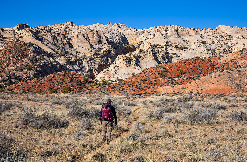
The temperature on Saturday was a little cool out because of the cold front that had passed through on Friday, but it was very comfortable for hiking in. One thing we both noticed during our hike this weekend was the lack of planes in the sky.
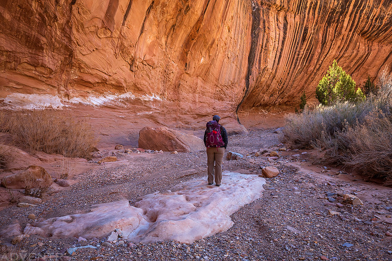
Diane hikes ahead of me on The Post Cutoff Trail as we made our way to the foot of the Waterpocket Fold. We decided to hike the loop in a counter-clockwise direction so we could climb the steepest part of the route first.
The trail followed the edge of this steep red ledge up the face of the sandstone reef.
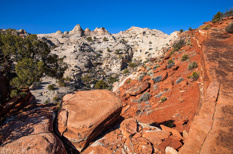
Climbing higher as we made our way across the Waterpocket Fold.
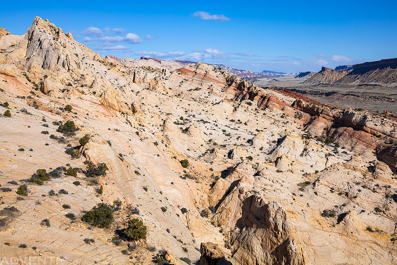
The sandstone in this area kind of reminded me of Yellow Rock.
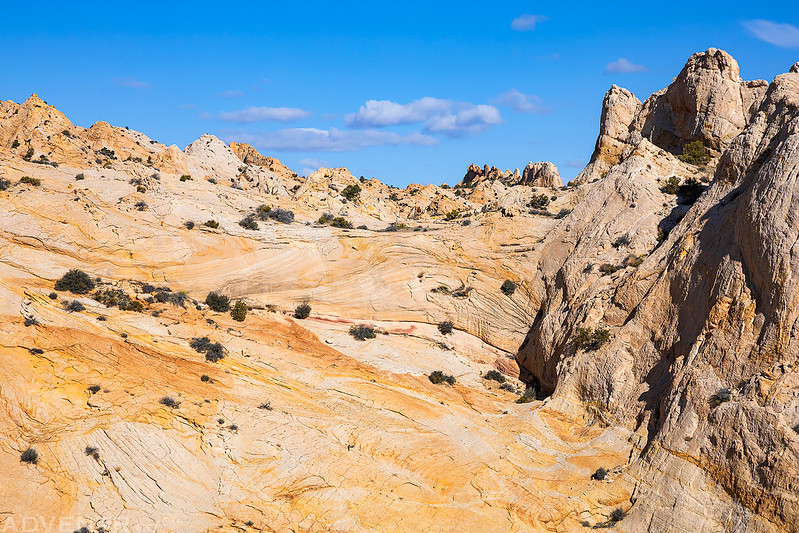

After crossing over the reef we followed a short side canyon down into Lower Muley Twist Canyon.

There were a couple of signs marking the junction at the bottom of the trail.

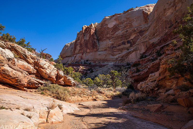
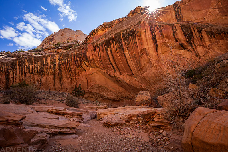
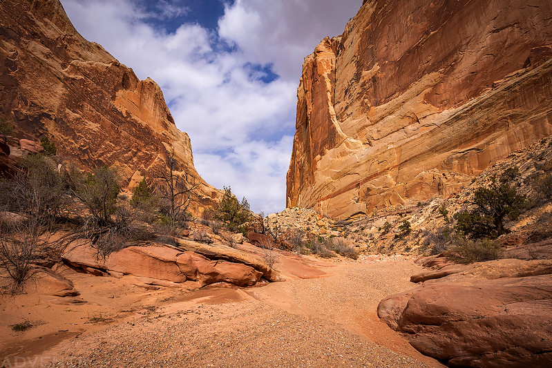
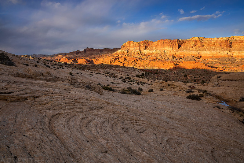
Beginning our hike through Lower Muley Twist Canyon.

The canyon scenery was spectacular right off the bat!

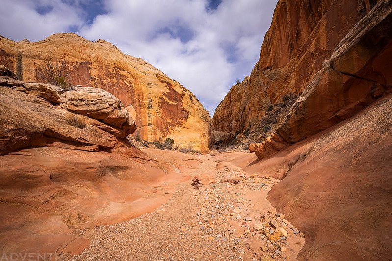
We took our time hiking and enjoying Lower Muley Twist Canyon since we have no idea when we will be able to get out and enjoy the canyons of Utah again!

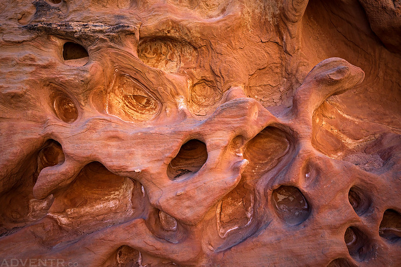
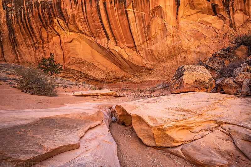
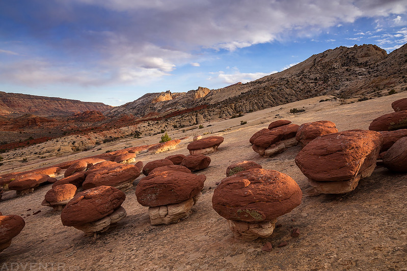
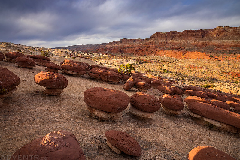
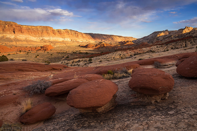
Boulder Tafoni

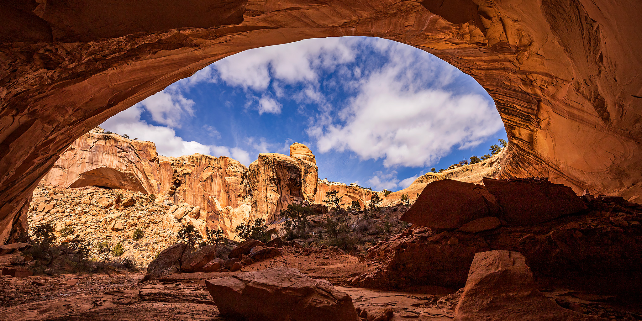
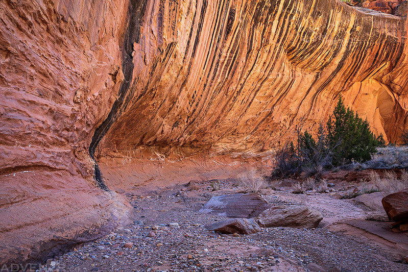
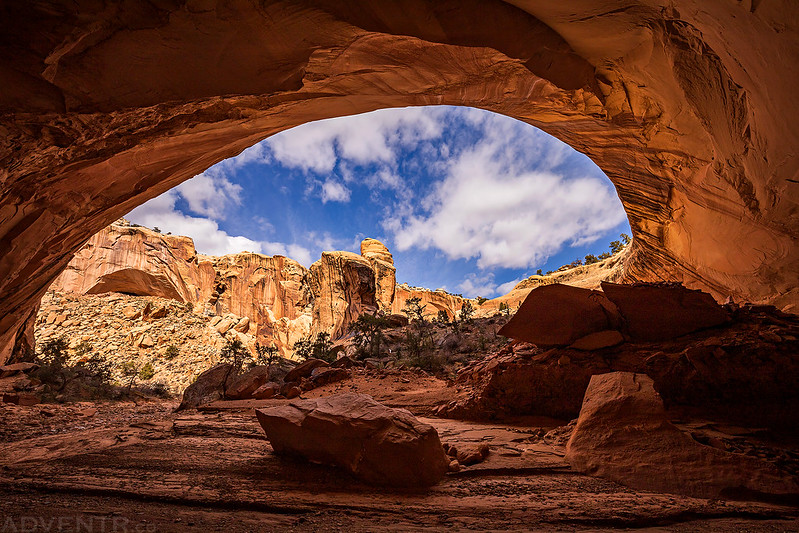
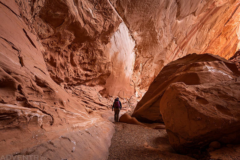
Soon we reached the entrance of what would be my favorite large alcove of the entire hike.
The dark stripes and reflected light in this huge alcove were amazing as we hiked through!
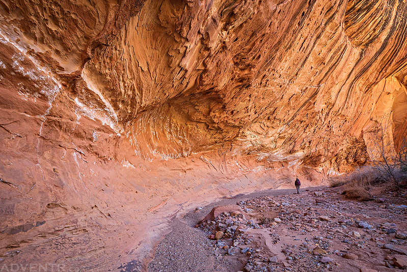
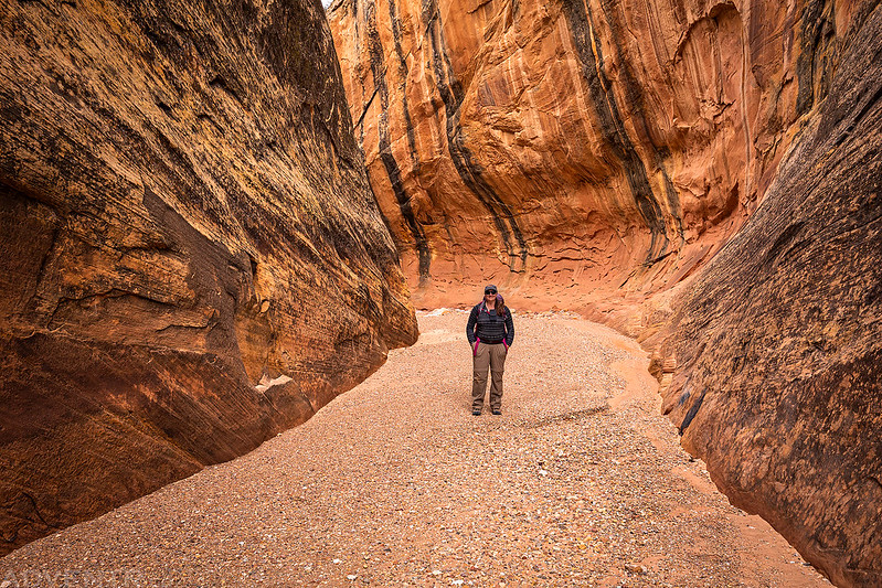
Diane hikes ahead and helps to give a sense of scale to this large alcove.
Looking back after coming out the other side.
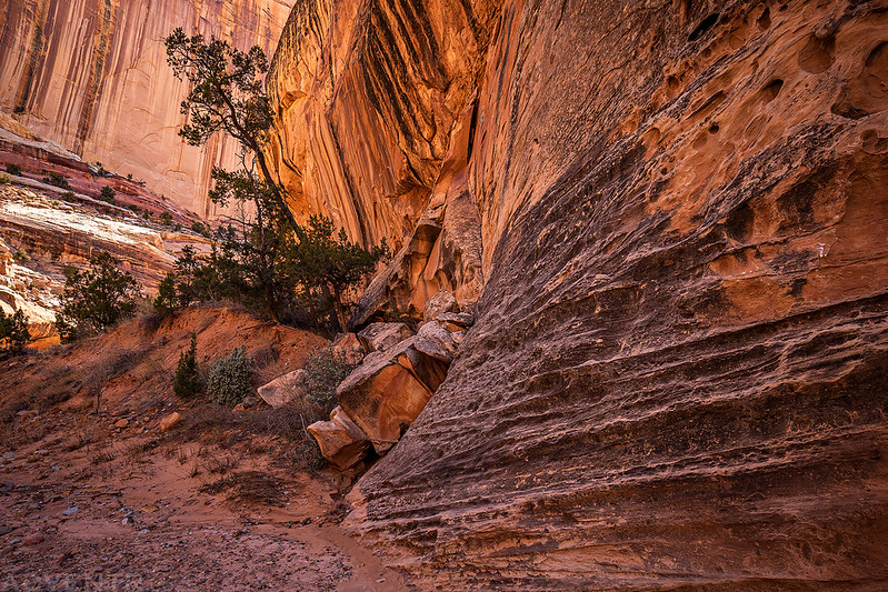
Twisted Canyon
Next we arrived at the largest alcove we would walk through this weekend. This large sand dune was located underneath near the entrance. It kind of reminded me of the sand dune in the alcove at Coyote Buttes North.

Here’s Diane walking through the beginning of the alcove for scale. This one reminded me of the large alcove in Mee Canyon.

An overview of the huge alcove from underneath.
Walking through the large boulders at the back of the alcove.
We passed by another shallow alcove with nice desert varnish stripes.
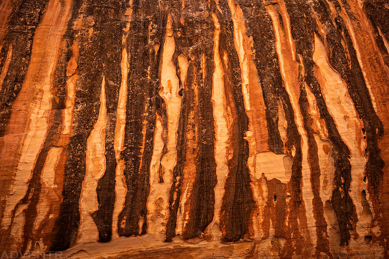
Here’s an overview of the stripes above the alcove.
I spotted this inscription left by L. Harris in 1894. I assume this was probably inscribed by Llewellyn Harris for which Harris Wash near Escalante was most likely named after.

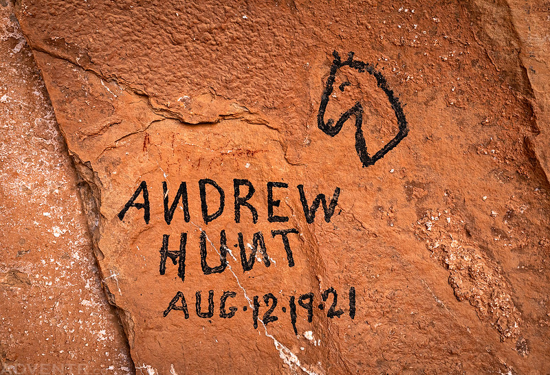
The last of the largest alcoves we would walk through contained an old cowboy camp with historic inscriptions from the early 1920’s on the back wall.

I guess this was a portrait of Red Clark.

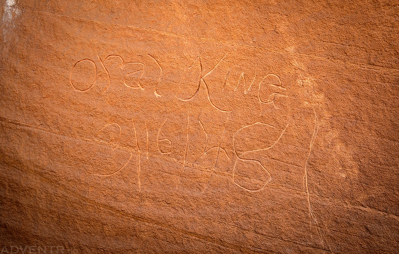
Andrew Hunt, 1921
Leaving the Cowboy Cave Alcove

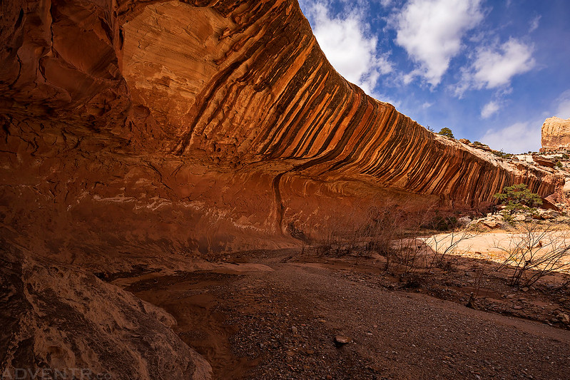
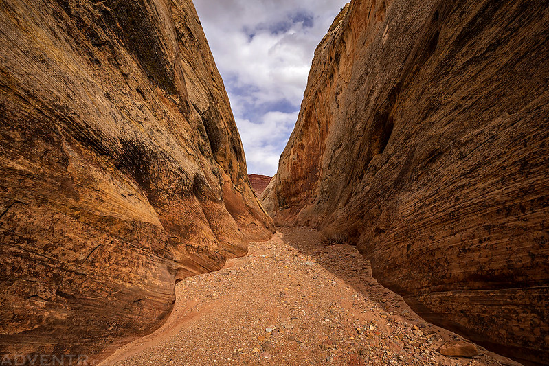
Soon the canyon started to cut through the Waterpocket Fold on its way to meet up with Halls Creek.
It started to get narrower…
Leaving The Fold
The narrows of Lower Muley Twist Canyon before the canyon opened up into Grand Gulch.
After leaving the canyon we followed the Halls Creek Trail to the Muley Tanks. I liked the lettering on this sign.

We found a spot to setup camp not far from the Muley Tanks and this was the only place we would see another person all weekend. Shortly after we got our tent setup, a hiker on the Hayduke Trail walked by and stopped to talk for a few minutes. Surprisingly, we had run into this very same hiker when we were in Salt Creek Canyon two weeks prior!

Not a bad view from camp!

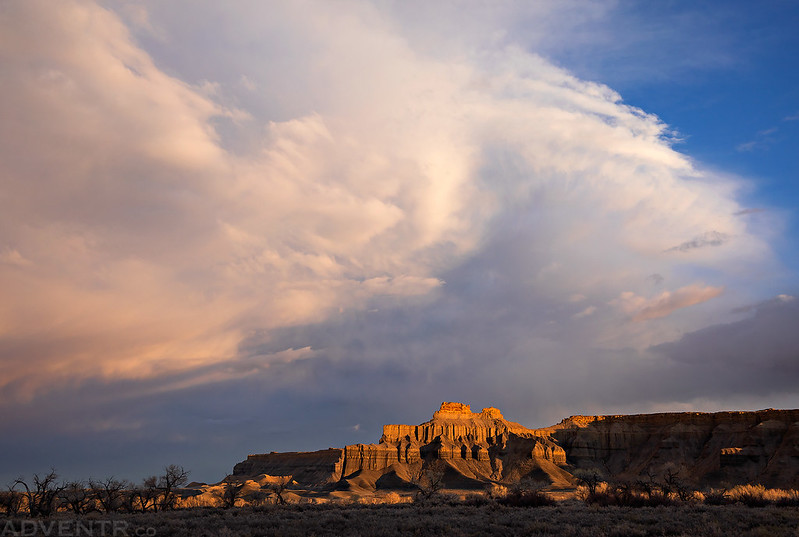
After having dinner we hiked over to the Hamburger Rocks and then I wandered around this part of the Waterpocket Fold until sunset.
The views were amazing!
Light & Shadow

The light and clouds were pretty nice this evening, too!


One last amazing view to end the day!

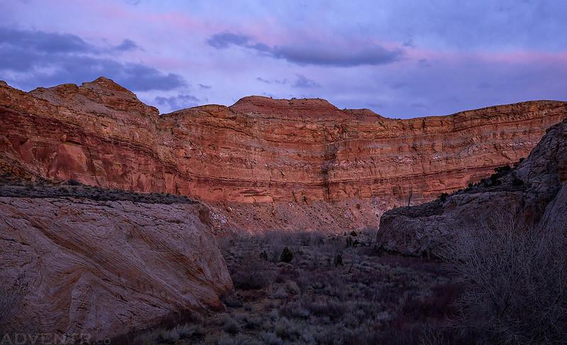
When the light faded I returned to camp and we went right to bed. It had been a long but exciting day and we were exhausted! The temperature overnight was much warmer than the previous night and I slept very well again.
Part of the reason I wanted to camp near the Muley Tanks instead of in Lower Muley Twist Canyon (besides visiting Hamburger Rocks) was so that we would have a nice view at sunrise in the morning. Unfortunately, that did not work out very well since it was completely overcast in the morning and there was no sunrise. Instead of getting up at sunrise like usual, we stayed in our sleeping bags a little later to sleep in. We did eventually get up and pack up camp so we could hike back to the trailhead along Halls Creek in Grand Gulch.
On our way back we took a short detour to visit the Cottonwood Tanks.

I did a little more wandering around on the Waterpocket Fold again.

I found this inscription nearby…
Diane hiking through Grand Gulch on the old wagon road along Halls Creek.

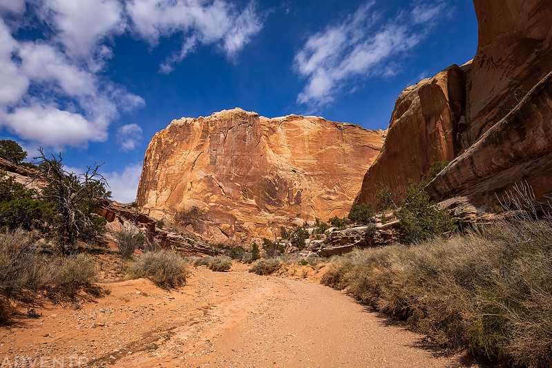
Near the end of our hike we had a good view to where the start of our hike climbed over the Waterpocket Fold.

Here is one last view of the Waterpocket Fold shortly before we returned to the trailhead.

Goodbye Capitol Reef. It was fun! Until next time…

Beautiful scenes. Colors really popped. So much soul food. Stay healthy.