Thursday, April 8, 2010
Late last year I finally decided to put together a trip that has been on my to-do list for way too long. I needed to finish driving the Hole-in-the-Rock Expedition (San Juan Mission) Route by driving the Hole-in-the-Rock Trail. I had driven pretty much all of the other sections of the route that are drivable except for this one. This was planned as a three day trip so that we could take our time and also get in some hiking along the trail. My adventure started on Thursday, which was the day before we were supposed to meet at the trail. I wanted to take my time driving to the trail near Hall’s Crossing and also make a few stops along the way.
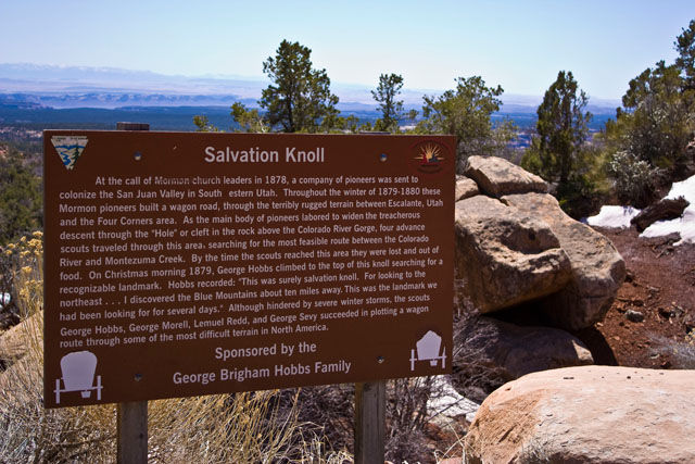
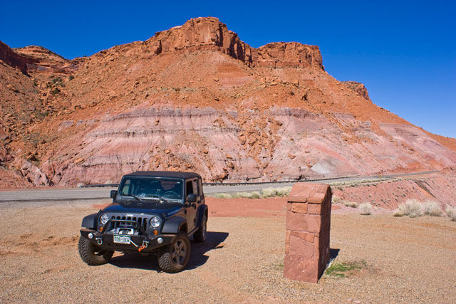
After stopping at Back of Beyond Books in Moab and filling up my gas tank in Blanding, I set off west on UT-95. Of course I had to stop at ‘Salvation Knoll’ since it was an important landmark to George Hobbs and the Hole-in-the-Rock Expedition.
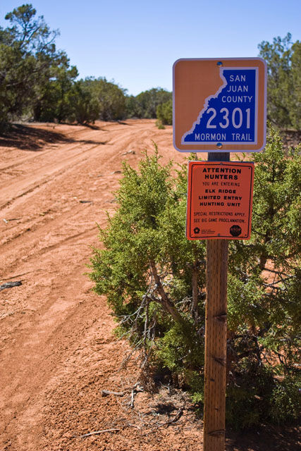
From Salvation Knoll I made my way further west to my first trail of the trip. On my maps, I noticed there was a segment of the Hole-in-the-Rock trail that I had not driven that connected UT-95 and UT-276. After some research into the route, I found that it is still a valid route that is open to motorized travel, so I figured I would give it a try.
When I reached the turnoff from the highway, I was greeted with a well maintained county road. The sign even marked it as part of the Mormon Trail
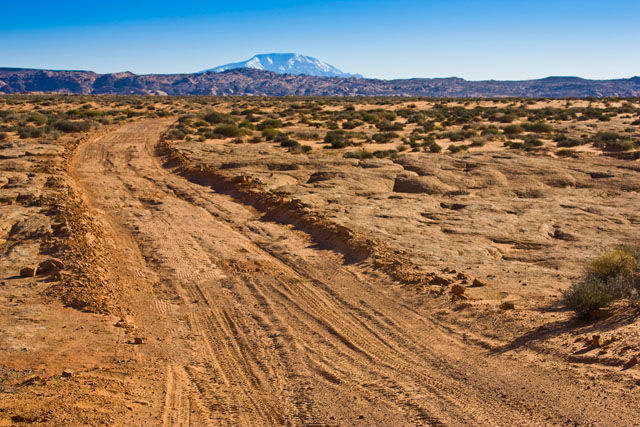
After a mile or two of the easy pretty well maintained road, it got a little rougher and crossed some slickrock sections
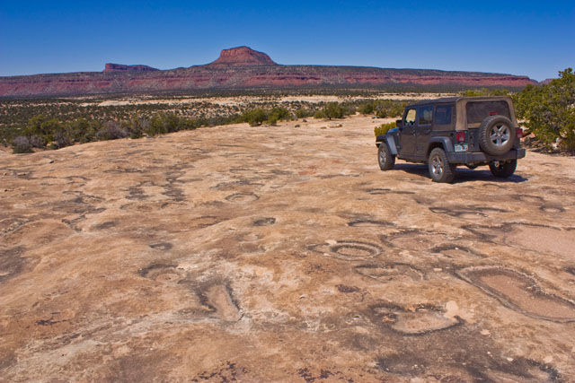
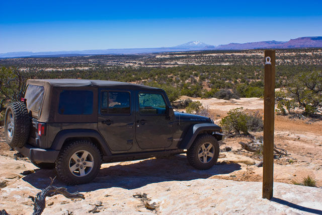
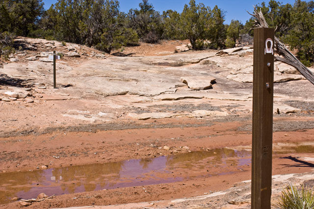
Eventually I reached a large section of slickrock that dropped off into a small canyon. I didn’t immediately find a way down, so I parked the Jeep and hiked around for a while until I picked up the trail again. From this point on, the well maintained county road was left behind and the much rougher and narrower trail continued. It was hard to follow in many places and required that I hike ahead first, but there were enough signs along the way to reassure myself that I was on the right track.
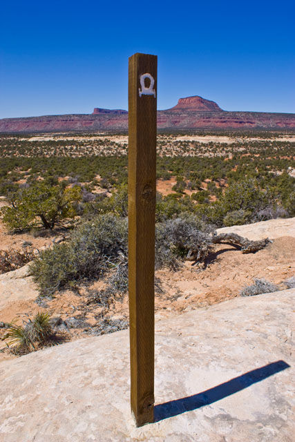
Marker along the route indicating this was part of the Hole-in-the-Rock Expedition
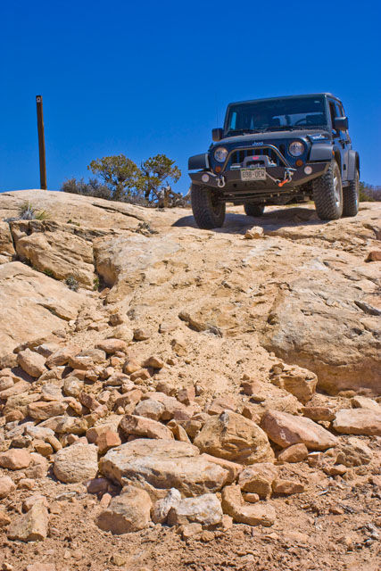
Dropping down

Dripping Springs Canyon with more markers
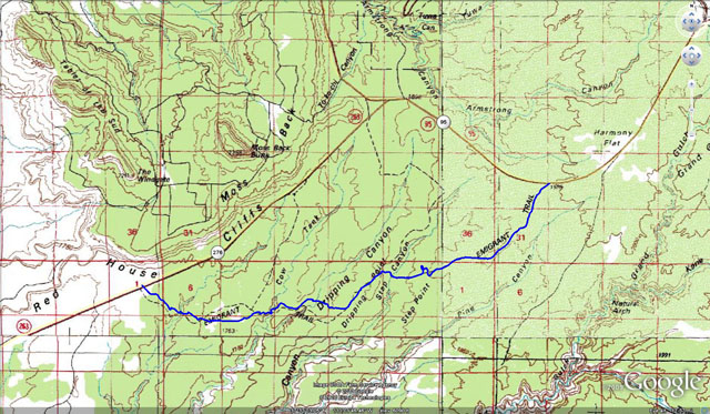
After using my navigations skills to keep on track, I eventually reached UT-276 and was back on the pavement again. Here is the route I drove, marked in blue.
My next destination was to take the Clay Hills Crossing Road all the way to the San Juan River. During the original expedition, there was a side reconnaissance this direction over the Whirlwind Bench to the Clay Crossing. This is an easy maintained county road that is used as a take-out by rafters on the San Juan. While the road is not difficult, the scenery along the Red House Cliffs is nice.
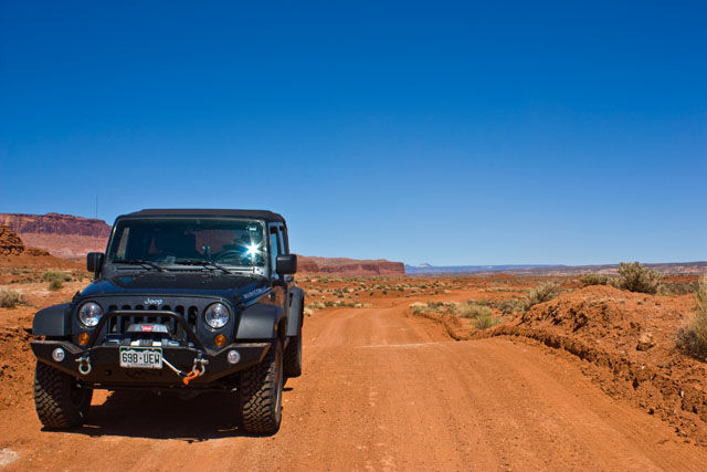
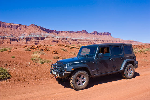
This was a nice high-speed road, so I was back at the highway in no time 😉
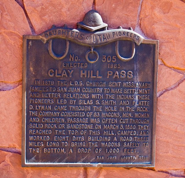
My next stop was along the highway at the plaque marking Clay Hill Pass. This was another major obstacle for the original expedition, which spent eight days building a road down to the bottom for their wagons.
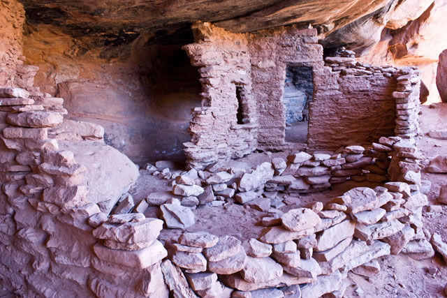
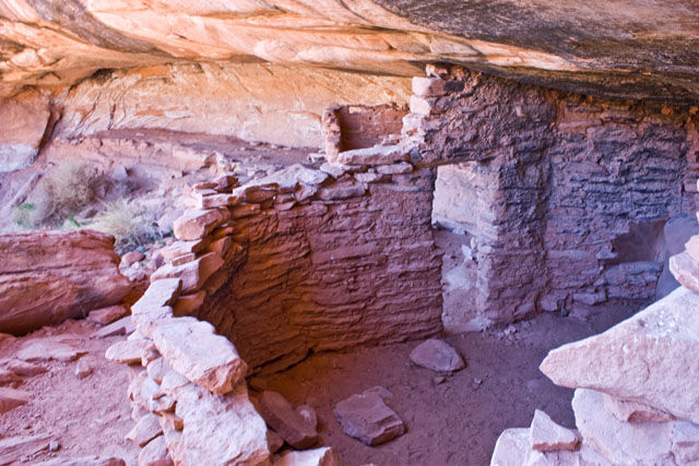
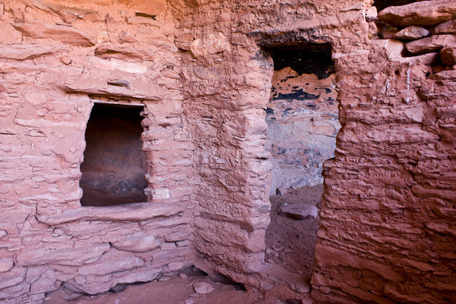
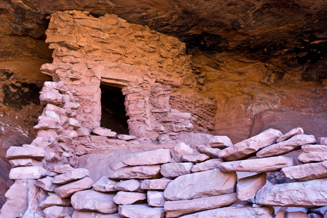
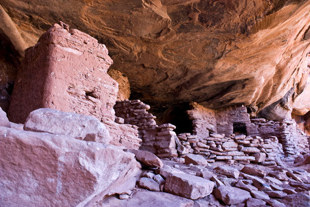
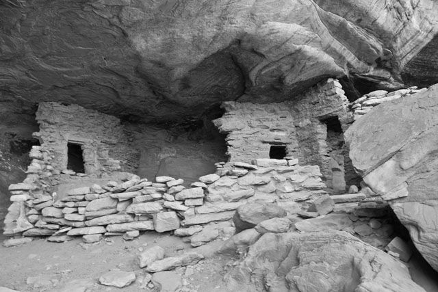
A little further down the highway, I made yet another stop. This time it was to check out the Castle Ruin. George Hobbs of the Hole-in-the-Rock Expedition spoke of these ‘Cliff Dweller’ ruins in his account of the trip.
After my visit to Castle Ruin, I made my way to Hall’s Crossing where I met a few people from our group at the campground. I was not planning on camping there, I so made my way over to Cal Black Airport and fueled up before heading to Lake Canyon.
Navajo Mountain in the distance
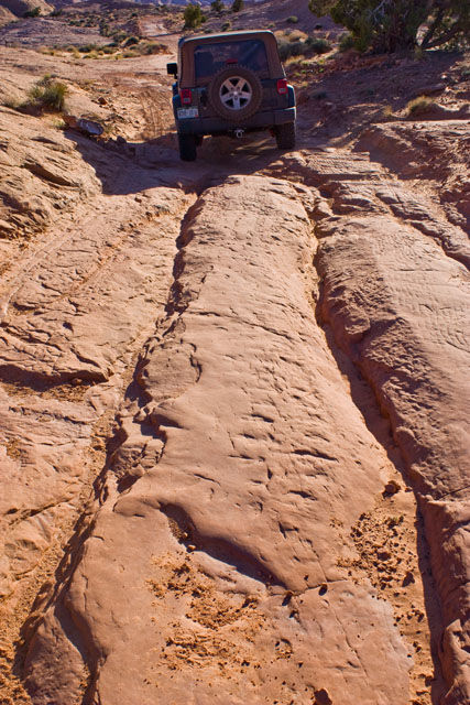
On my way to Lake Canyon, I got to check out some of the old wagon tracks from the expedition which had carved grooves into the slickrock.
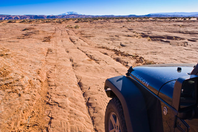
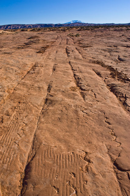
Deep wagon tracks
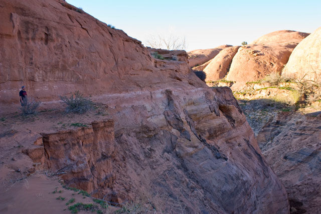
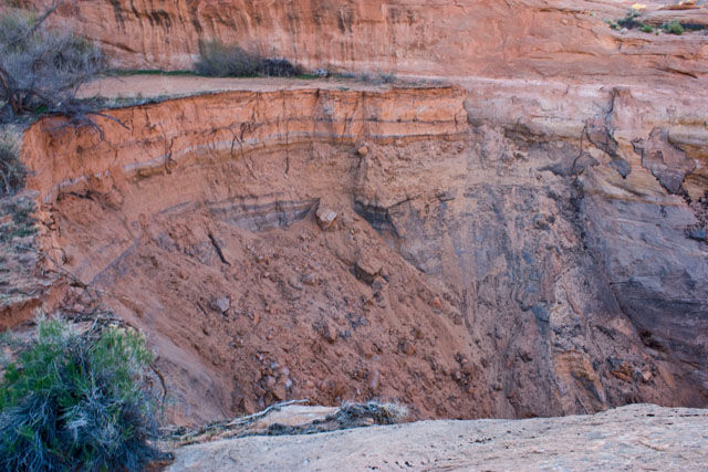
When I reached the East Fork of Lake Canyon, I met up with Dave, Rob and Jared and we headed out to the washout of the Lake Canyon portion of the trail.
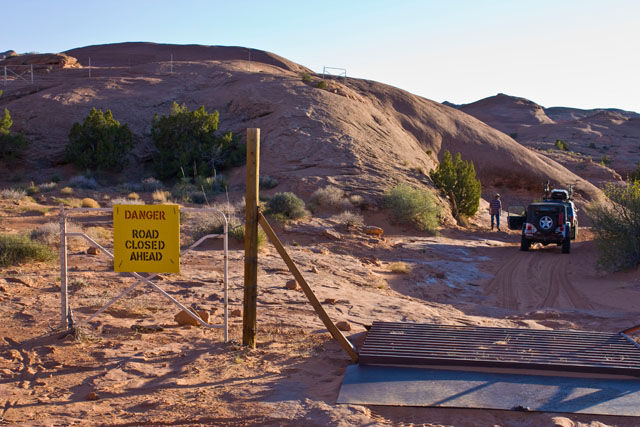
The original Hole-in-the-Rock Jeep Trail used to drop into Lake Canyon and then cross to the other side. A few years ago, the sand that fills the canyon (remnants of Lake Pagahrit) where the trail crossed the canyon was washed out by flash flooding. The lighting wasn’t ideal, but you can see the washout of the sand in the bottom of the canyon below.
From the washout, we headed back up canyon a little ways and setup camp for the night. It was a great start to a great trip!
Stay tuned for photos from the next four days…..I took a lot of pictures and it’s going to take some time for me to go through them all!