Grand Gulch Finale
Friday – Tuesday, April 20 – 24, 2018
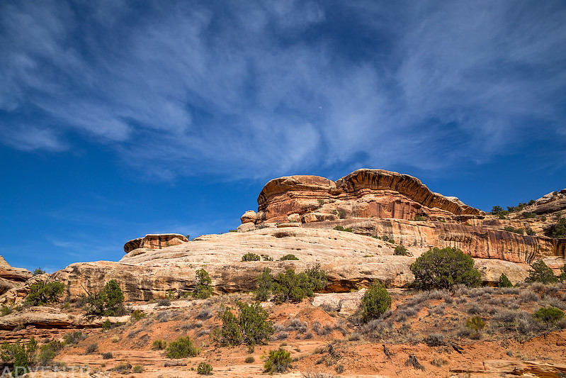
Last year I had to skip my annual spring backpacking trip with Dave and Jared since I didn’t have any free time left after my wedding and Honeymoon Adventure in March. This year we decided to resume the tradition and go on a four day backpacking trip into the middle section of Grand Gulch between Bullet Canyon and the Government Trail. This is pretty much the final section of Grand Gulch (starting from under the Bears Ears near Highways 95 all the way to the San Juan River) that I have not hiked yet, so I was really looking forward to checking it out. The funny thing is, this section was supposed to be my very first backpacking trip into Grand Gulch about five years ago, but I missed out on that trip because I came down with strep throat a few days before and Dave and Jared went without me. I’m glad they were willing to repeat this section of the canyon with me this year! If you are interested, you can check out my previous backpacking trips into Grand Gulch at the following links:
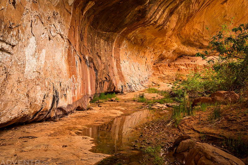
I left right after work on Friday and started my drive down to Cedar Mesa where I would be meeting up with Dave and Jared. Unfortunately, the drive would not go as smoothly as it usually does. There was a wildfire, nicknamed the Skipper Island Fire, burning along the Colorado River near Fruita which had closed I-70 for part of the day on Thursday, so I made sure to keep an eye on road conditions before I left. All day the interstate had been open to traffic and COtrip said it was open the last time I checked before heading out. Unfortunately, when I arrived at the Fruita exit I found that the interstate was in fact closed and I would have to take a detour around the closure. This slowed me down a bit. I was slowed down even more when I reached Moab because there was a lot of traffic in town. I’m glad that I had no plans to stop in Moab this evening! Once I was finally south of Moab I would not run into any other issues. I arrived at our predetermined campsite and meeting spot where I met up with Dave and Jared after dark. We sat around the fire for a little while and then went to bed early.
Dave and Jared ready to start our hike down Bullet Canyon and into Grand Gulch on Saturday.
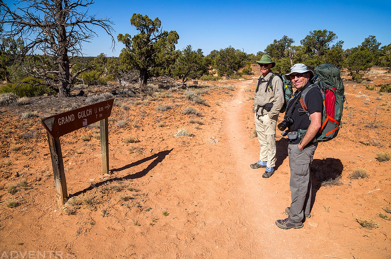
On Saturday morning we got up early and had a little breakfast before heading over to the Kane Gulch Ranger Station to pick up our permit. When we pulled up into the parking lot I was surprised to see so many people waiting for the Ranger Station to open. I had never seen so many people here before! I assumed that many of them would be wanting to get permits for the Moon House Ruins, but when the doors opened I found out that I was wrong and almost everyone was there for overnight permits. It was standing room only to watch the required video this morning! I guess this is a preview of what’s to come since this area was put on the radar last year when Bears Ears National Monument was created and then shrunk down in size earlier this year. I fear that it will only continue to get busier, especially with all the media attention on the fight over this area. It kind of makes me glad that this is my final section of Grand Gulch to explore, since I may not be returning again during the busy season. I was happy to leave the crowds behind and get started with the trip. After leaving Kane Gulch we drove over to the Government Trail Trailhead, left my Jeep there and then took Dave’s truck back to the Bullet Canyon Trailhead where we would start our hike into Grand Gulch.
Jared coming down a sandstone chute in Bullet Canyon.

Since we have all been up and down Bullet Canyon a few times before, we didn’t make any stops until we reached Perfect Kiva.

There was a nice glow at the back of the alcove.

A nicely painted potsherd we found.

Not-so-perfect pictographs at the back of the large alcove.
Of course, we took turns climbing down into the stabilized kiva.

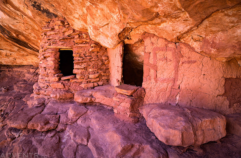
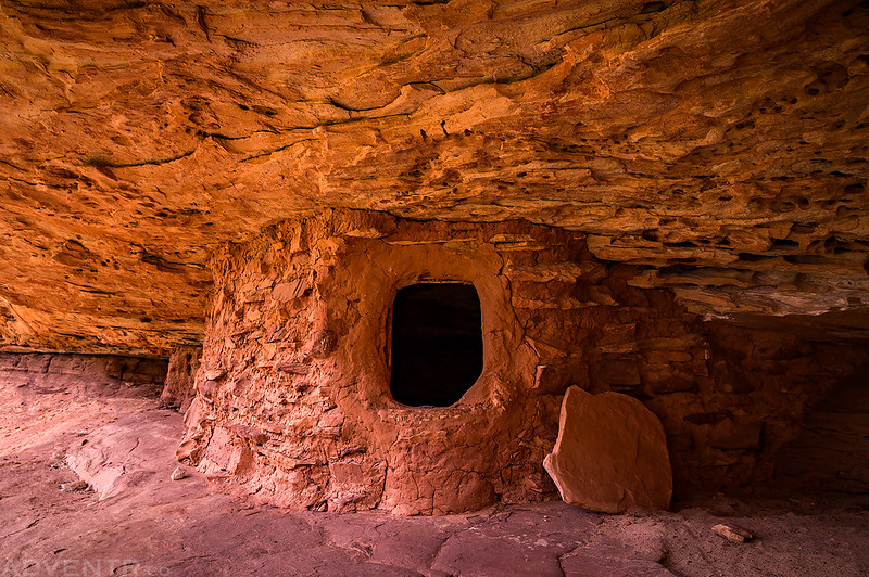
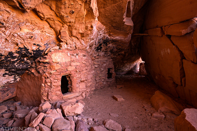
Next we followed the sandstone bench around to the Jailhouse Ruins.
The reason these are known as the Jailhouse Ruins.

A couple nice petroglyphs that I had missed on previous visits.

Dave and I climbed up to an alcove that contained a large painted snake on the wall. The length of this red snake was at least twenty feet.

A pair of nice granaries we found in a beautiful alcove.

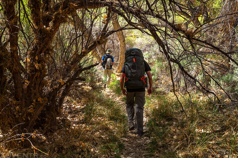
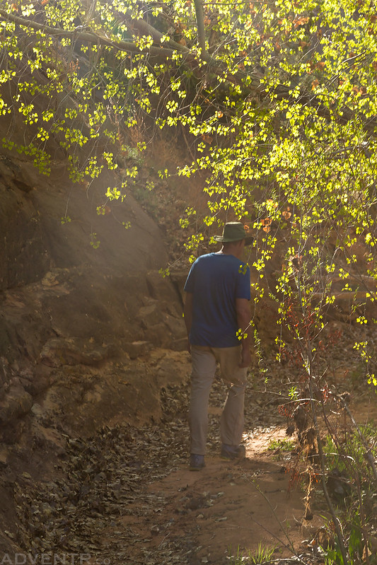
Jared and Dave hike ahead of me under a canopy of tree branches.
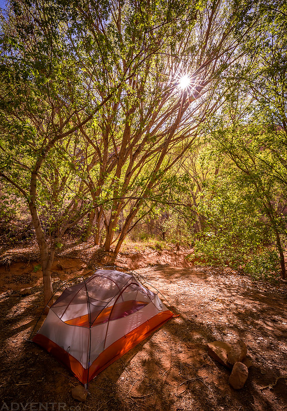
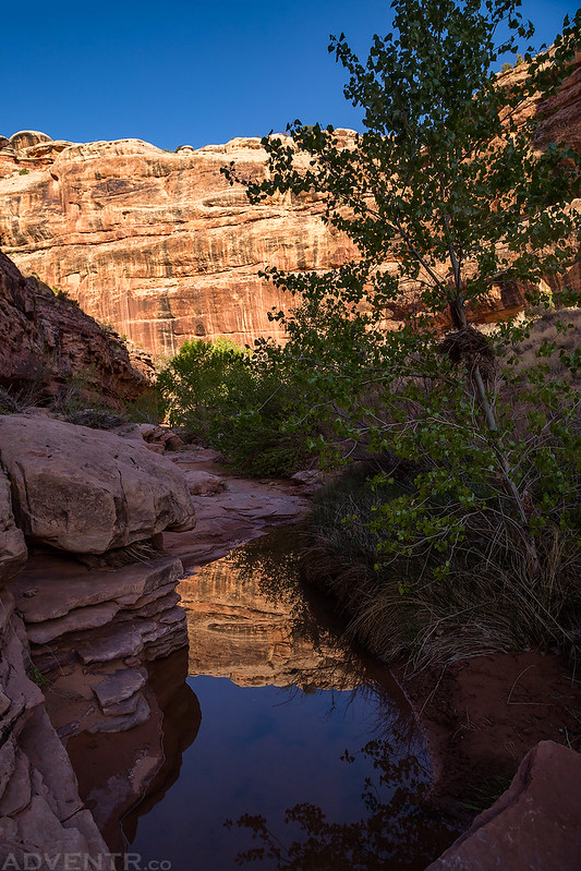
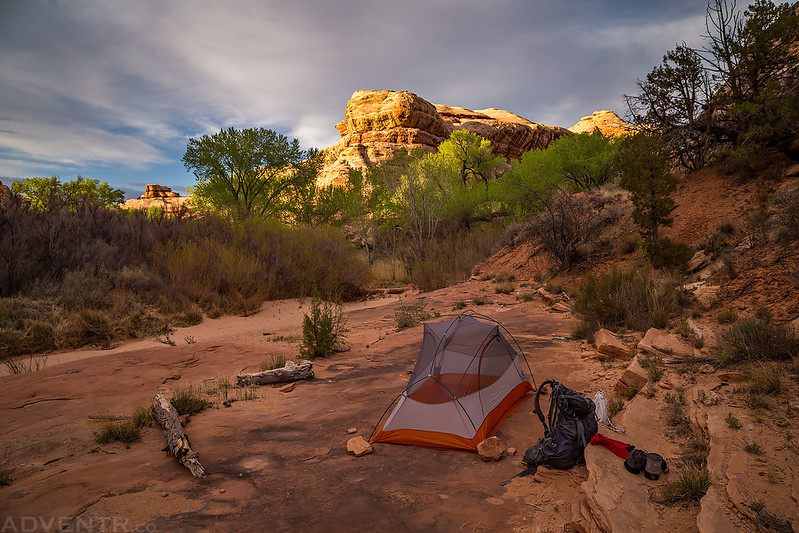
We setup camp at the confluence with Grand Gulch in the same spot I camped with Diane a few years ago. On that trip there was water nearby, but this time the spring was completely dry. Jared and I had carried enough water from the trailhead that we didn’t need to worry about finding water until the next day and Dave had filled up at Jailhouse Spring earlier in the day.
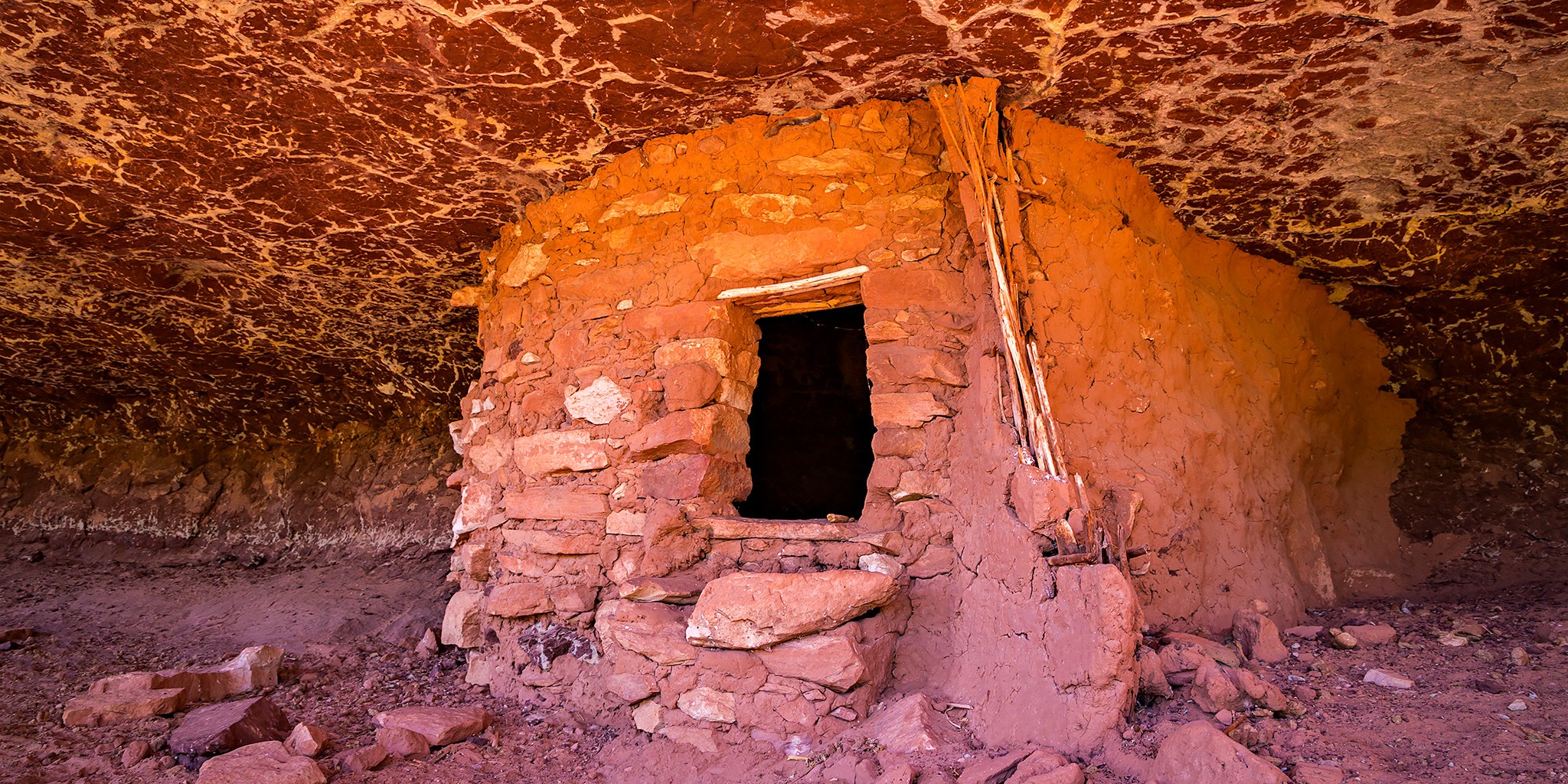
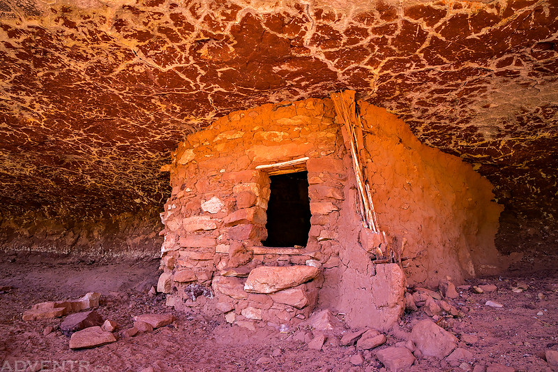
After setting up camp we walked over to the Castle Ruins and explored them for a little while since I hadn’t really climbed up to them on my last hike through the canyon because we were pretty tired at that point.
This was a cool little ruin hidden behind a large slab of sandstone.

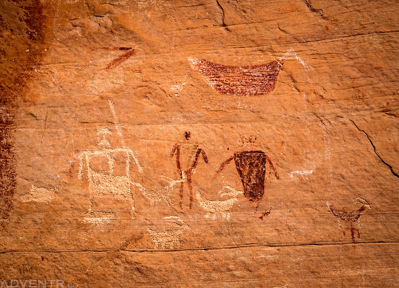
A very nice ruin with a few pictographs located on the upper ledge.
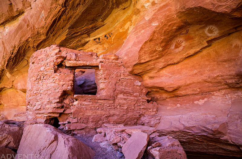
If you look closely above the ruin in the previous photo, you can see these green or blue reverse handprints. I don’t think I’ve ever seen any in this color before?

White pictographs along the same ledge.
The doorway on this ruin reminds me of the Horse Collar Ruins in Natural Bridges National Monument.

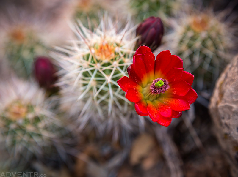
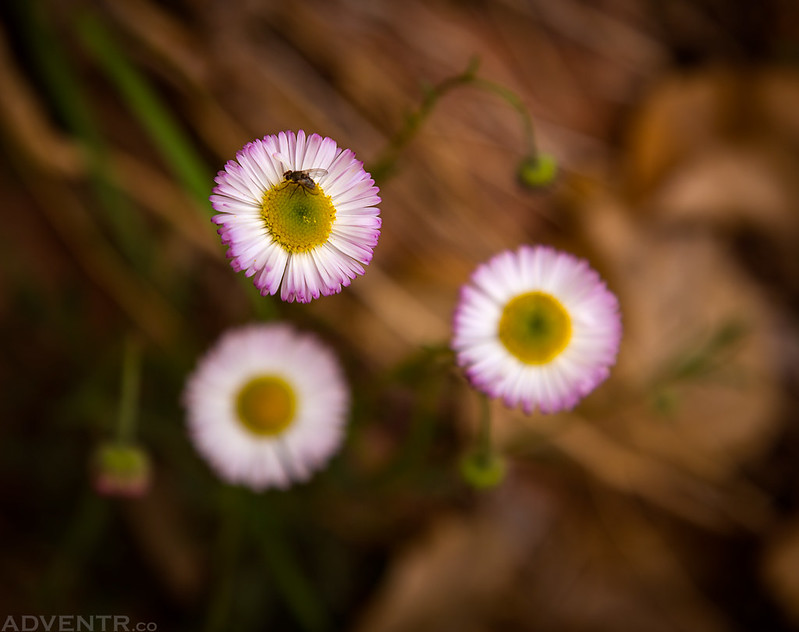
There were plenty of wildflowers in the canyon during our trip, including Claret Cups.
Following Dave back to camp.
Back when I hiked the Kane Gulch to Bullet Canyon Loop with Diane a few years ago, we had camped in the same spot and I spent the evening exploring the area around the confluence. I had taken a photo at sunset from across the canyon and didn’t realize there were ruins in it until I was looking at the photos of my computer back at home.
I made sure to visit those ruins on this trip and photograph them at sunset, except from a little closer up this time!

Looking down on the confluence of Bullet Canyon and Grand Gulch. Our campsite is located in those trees.

One more photo of a Claret Cup Cactus found near camp.

On Sunday morning we woke up with the sun after having a really good night of sleep. The temperature overnight was pretty nice since it only dropped down to about 40 degrees, which would be the coolest temperature we would see during the entire trip. After packing up camp we continued our hike down Grand Gulch while keeping our eyes open for ruins and rock art along the way. We would see plenty today!
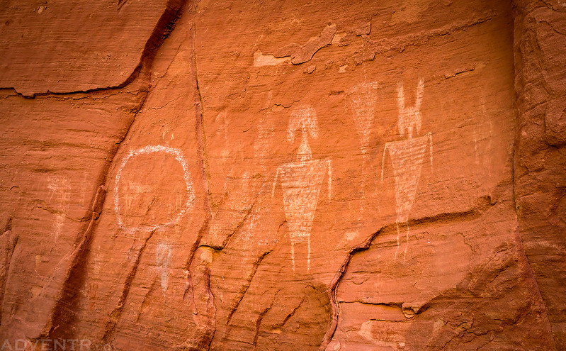
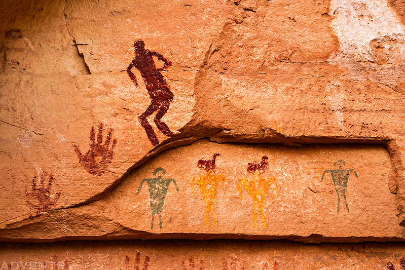
We spotted this anthropomorph on the canyon wall through the trees.
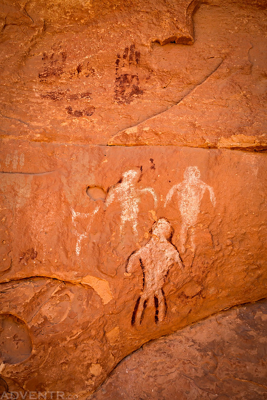
We climbed up a steep and sandy hill to a pretty nice panel of pictographs that included many handprints, a few anthropomorphs and even a few atlatls.

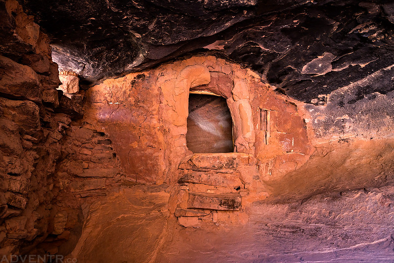
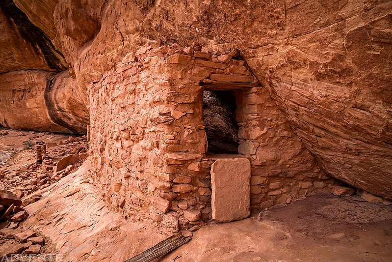
Pretty soon we had reached Green House Canyon and I was finally able to see the amazing Green House Ruin.

There were two smaller granaries nearby, too.

By this time we were all getting pretty low on water and needed to find some soon. We had hoped to find some in Green House Canyon since that’s where Dave and Jared had found some on the previous trip, so after hiking up the canyon a little further we did come across plenty of water.
We stopped to fill up on water here and had a little lunch in the shade while we were stopped. We weren’t sure how far it would be until we found water again, so we had to fill up completely. We certainly ended up carrying more water than I would have liked for much of this trip.
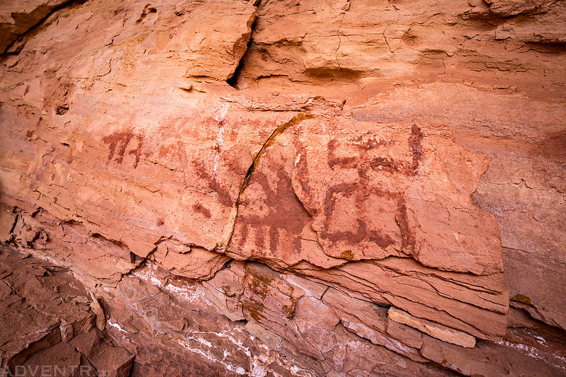
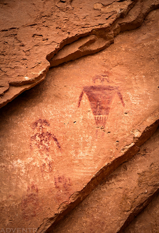
Another ruin near the junction of the canyon that we climbed up to. We found a faded red pictograph on the wall inside.
Here are some very unusual pictographs above the remains of a broken down ruin that I spotted across the canyon.

Hiking down the wash in Grand Gulch.

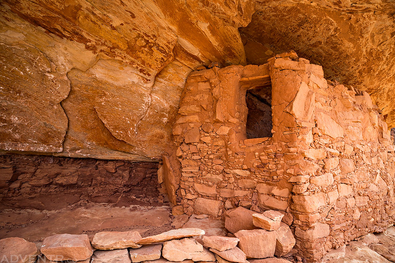
We made sure to climb up and visit Two Story Ruin.

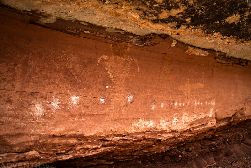
The white dots on this pictograph panel reminded me of many similar panels I have come across in the Needles District of Canyonlands National Park.
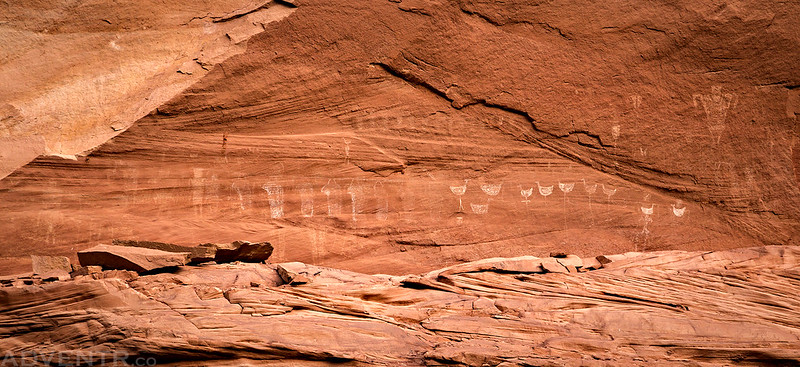
When we reached the mouth of Step Canyon I was pretty excited to finally see The Quail Panel. This colorful panel of pictographs has been on my radar for many years, and was the main reason I originally wanted this to be the first section of Grand Gulch that I backpacked.

A closer look at some of the colorful pictographs found here.
This painted face is also found along the same wall.

A couple more pictographs found nearby.
After spending a lot of time examining The Quail Panel, we headed off in search of The Necklace petroglyph panel. During our search Jared spotted these ruins above us.

Then we finally found The Necklace Panel. It was much bigger than I was expecting and in great shape. An amazing panel of petroglyphs!
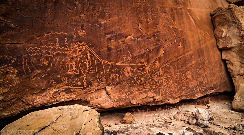
Seriously, this is one of the better petroglyph panels I have seen in Grand Gulch!

A closer look at The Necklace.

By this time it was starting to get late and we needed to figure out where we were going to spend the night. According to the volunteers at the Kane Gulch Ranger Station, our next possible source of water was supposed to be in Dripping Canyon, so we decided to camp near the mouth of that canyon and we hoped that their information was accurate since we would definitely need water in the morning. On our way to Dripping Canyon we tried to climb up to one more set of ruins known as the Great Wall Ruins, but it was a little too sketchy for Jared and I to climb, so we waited to see if Dave could make it up. He did get up to them and said they were pretty interesting. I guess I’ll have to try to visit them another time when I’m not so exhausted from carrying so much water!
A few more wildflowers along the trail.
We ended up finding a nice small campsite across the canyon from the mouth of Dripping Canyon. Thankfully we were able to stay away from the cottonwood trees in this area since they were filled with a ton of caterpillars and it was raining caterpillar frass everywhere!

Since it had been a long and exhausting day, so we quickly got camp setup, had a little dinner and went to bed early.
It was another beautiful night and the temperature never dropped below 50 degrees. We woke up with the sun again and I quickly hiked over to a nearby pictograph panel so I could photograph it while it was still in the shade. I thought I might be able to climb up to it for a closer look, but I was wrong and had to settle for some shots from below.
Part of the large white pictograph panel I visited near camp.
After we got our camp packed up it was time to take a hike up Dripping Canyon and see if there was any water to be found. Thankfully, after hiking almost a mile up the canyon we did come across a few nice pools of water and we stopped to fill up our containers for the rest of the day. It really sucked having to carry an extra four to five liters of water for most of our trip, but it was absolutely necessary.
One of the pools of water we found in Dripping Canyon.
With plenty of water in our backpacks, it was time to continue hiking down Grand Gulch. Our first stop of the day was at a few rock art panels in Cow Tank Canyon.

Then we hiked below the Bird Parade Panel. There were a lot of other pictographs of birds found in this massive alcove, too.

From a distance, this target pictograph really looked like a Chicago Cubs logo.

A few nice pictographs found at Long House Ruins.
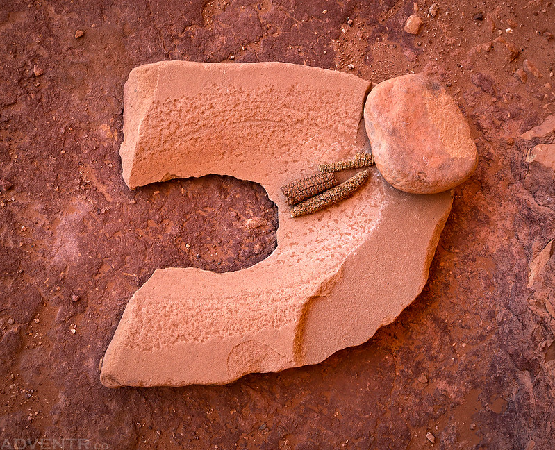
A cache of ancient relics including a well-used metate with a mano.
This was definitely one of the most photogenic ruins we would see during the entire trip.
They are hard to see in this photo, but there are some very large yellow pictographs on the wall.

Another falling man pictograph!

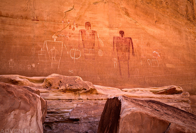
Pretty soon we arrived at the popular Big Man Panel. We have all been to this panel a few times before, so Jared elected to stay down in the wash while Dave and I hiked up to the pictograph panel again so we could lay down in the shade and get out of the sun for a while. This was definitely the hottest day of the trip and this is a great spot to relax and cool down!
From the Big Man Panel we hiked down the canyon a little further until we were just below the Government Trail and Pollys Island. By now the heat was starting to get to us so we found some shade near a large pothole containing water and just relaxed for the rest of the afternoon.
While we were resting in the shade the moon started to come up above the canyon rim.

Then a few clouds moved into the sky.
This was the only water we could find in this area. We had hiked a short distance up Pollys Canyon earlier in the day and found it completely dry.

Once the bottom of the canyon was in the shade, we setup camp on a flat sandstone bench just above the bottom of the wash. This would be our last campsite of the trip.
On Tuesday morning Jared and I were awake shortly before the sunrise. Dave was not feeling very well this morning and he slept in a little later and took his time getting packed up.
After getting our camp packed up, Jared and I revisited the Slab Ruins before leaving Grand Gulch.
When we returned to our campsite it was time to hike up the Government Trail back to my Jeep. We didn’t do much stopping along the way and kept moving until we were back at the trailhead, arriving shortly before 10:00am. I dropped Jared and Dave off at their vehicle at the Bullet Canyon Trailhead and then continued on back home. I finished off the great trip by grabbing lunch at Pasta Jays in Moab!
A great trip. I loved seeing Green House as I have never seen a photo of it before. Plus, I like the granaries since they are still pretty intact. The rock art was fantastic. You truly made a memorable trip for us armchair travelers. I won’t get into that area because I just can’t carry a pack and all that water. Thanks so much for sharing your adventure with us.
Thanks Dianne!
Looks like an amazing trip! I’ve only gotten a chance to backpack in Grand Gulch once, but I shoot for a spring trip every year. Loved the The Quail Panel and the granary tucked behind the slab. Will definitely need to add this stretch to my list.
It’s definitely a great place to explore!
Very Nice, Appreciate your blog, hope some day to make this hike.
Thanks Randy
Great pics. I have never (yet) made time for extensive hiking in there. Last time I was in that area, after Canyonlands, I got too busy on Cedar Mesa to do more than putz-around in the Gulch, before going to my brother’s in Farmington. Thanks again.
You are an amazing adventurer! I love reading your posts and my only hope is that all others that do care about the environment as much as you do.
Thanks Natalie!
Hi–really enjoying your writeups about Grand Gulch. Thank you. My friends and I are planning a GG backpacking trip for late April/early May. Since you have seen most of GG, do you have any favorite trails, ruins, or rock art that you would recommend? Also, regarding your Bullet/Government trip, do you recall how long it took you to do the shuttle? And what was the condition of the road to the Govt TH? Thanks very much.
I was intending to do Kane Gulch to Bullet Canyon, but the permits filled up before I got to my computer this AM, so I booked from Bullet Canyon. I’ve done this route before 15 years ago, and want to do it with my wife and kids, but I need to do it in reverse which got me pondering. The three of them are never evers and wondering if Bullet to Kane or Bullet to Gov’t. Which does anyone recommend? Thank you.
I would choose to do Bullet to Government over Bullet to Kane.
Great! New territory for me. This winter has been wet but are there any concerns with water last week of April usually?
It was very dry when we did it, but we managed to find some water, although we carried a lot more than I would have preferred. Definitely check with the rangers to see what they know before you start.
What resource do you use for finding these panels and ruins? Currently trying to plan a trip to Grand Gulch and trying to find good archeological maps of the region.
Try the Kelsey book for the Colorado Plateau.