Floating Across Dinosaur National Monument | Friday – Tuesday, May 5-9, 2023
For years, Jackson and I have wanted to float the lower section of the wild and scenic Yampa River that carves its way through Dinosaur National Monument, so we have been entering the lottery each winter for a chance to obtain that hard-to-get permit hoping that maybe we would eventually get lucky. This year after we were unsuccessful in the lottery yet again, we decided it was time to actively try harder to get a permit and Jackson was able to secure a Low-Use Season permit for early May just a few days before the High-Use season would begin. This was actually great timing for me since I have been spending the first weekend of May in Dinosaurland these past couple of years and now I could look forward to spending that same timeframe floating across Dinosaur National Monument on the Yampa River this year!
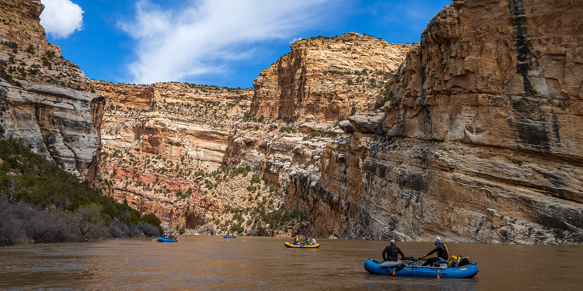
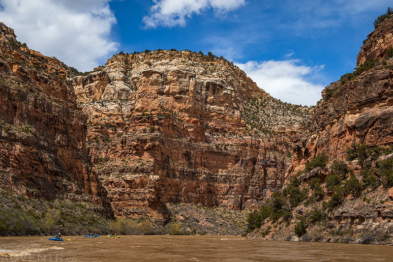
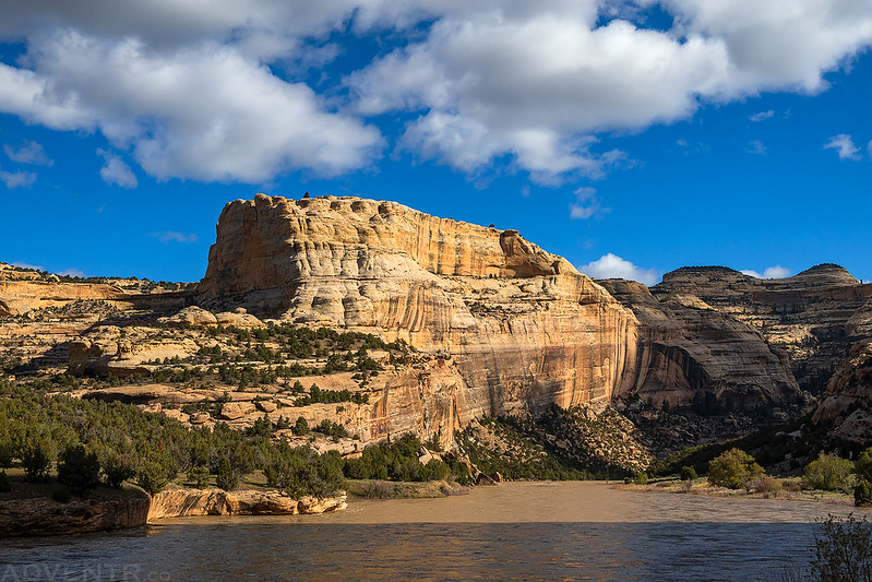
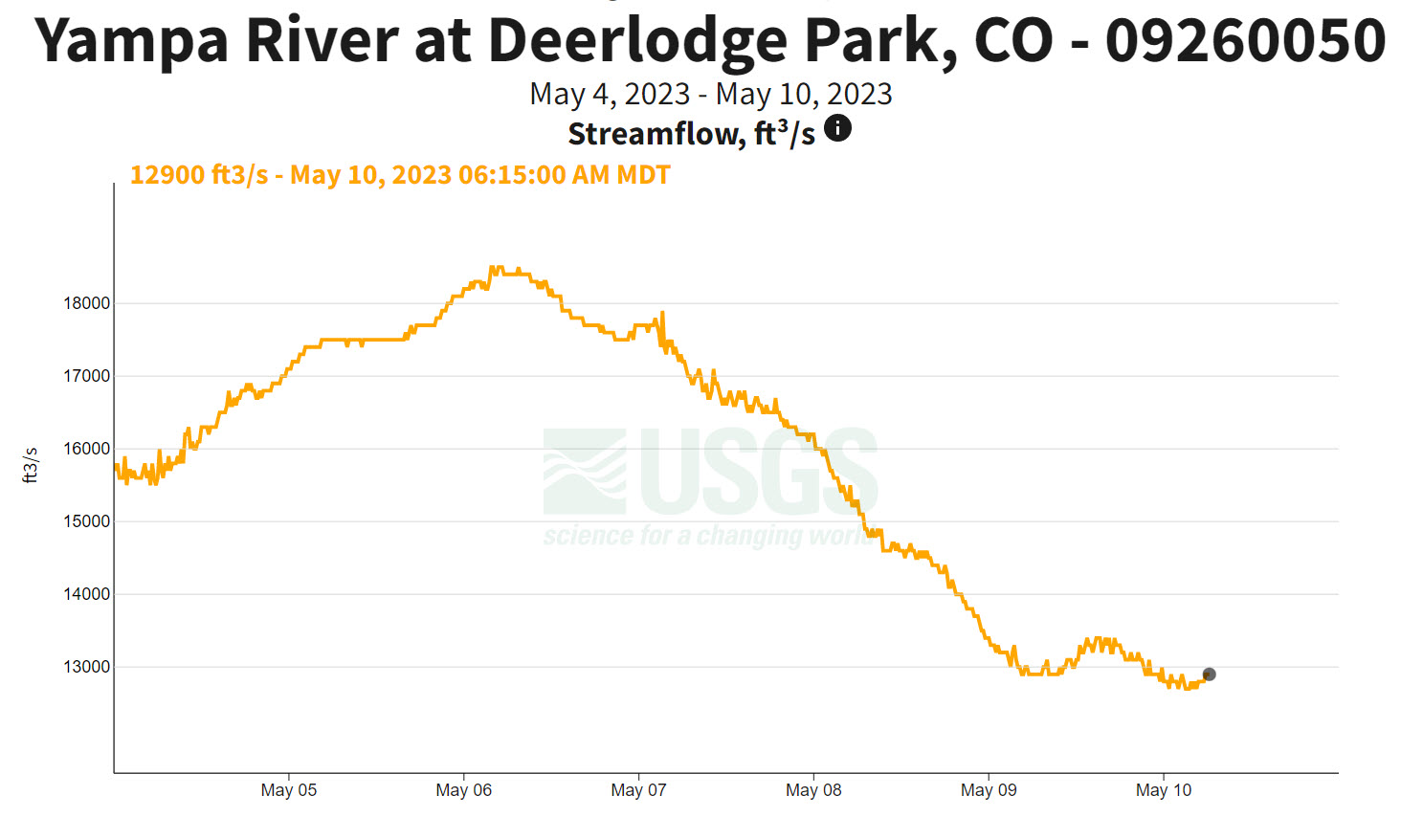
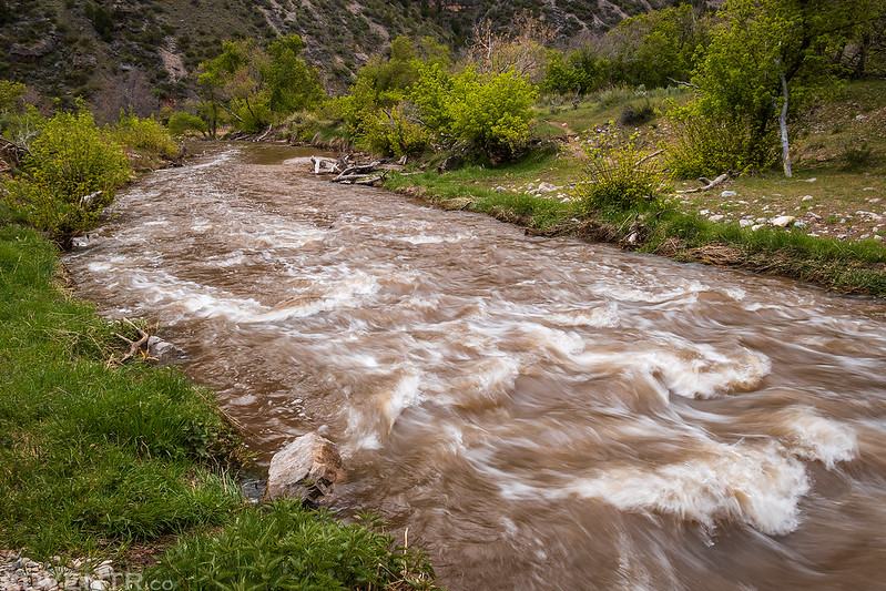
High Water on the Yampa River: Deerlodge Park to Steamboat Rock
High CFS: 18,500 // Low CFS: 14,600
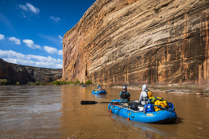
With a permit now in hand, we contacted our friend Steve who helped us put together a small but very experienced group for this trip down the Yampa. When we initially got the permit we had no idea how high the water was going to be after a big snow year in the mountains, since the Yampa is typically not very high at this time of the year. Of course, this year was different and with the water level already over 18,000 CFS and forecasted to keep getting higher, the day before we left I decided it would probably be best to leave my inflatable kayak (IK) behind and hop on a raft for this trip, even though I already had my IK and gear packed into the Jeep ready to go. I’d like to offer a big Thank You to Harold who let me ride on his raft the entire way! One added benefit of riding on a raft was that I had more opportunities to take photos while on the water instead of concentrating on paddling my own boat.
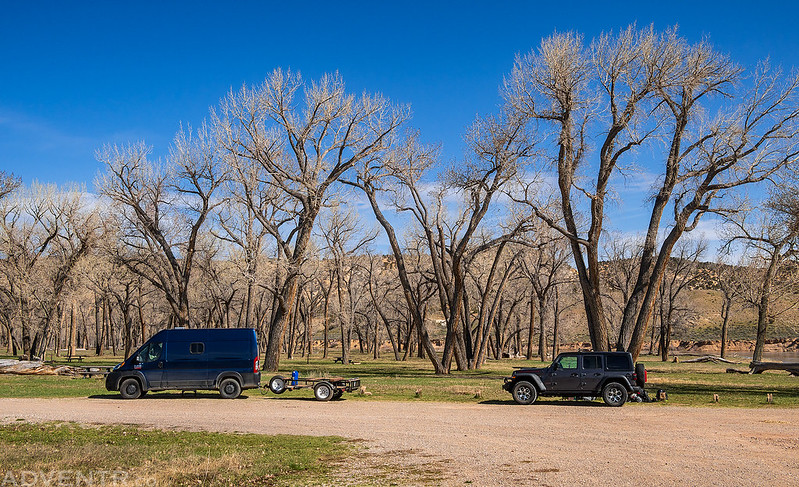
Early on Friday morning I picked up Jackson from home and we headed over Douglas Pass through the Book Cliffs on our way to the boat ramp at Deerlodge Park located at the eastern edge of Dinosaur National Monument.
At Deerlodge Park we met up with Bob and Lisa, who had spent the night in the campground, and got our gear together as the rest of our group arrived shortly thereafter.
After getting the rafts rigged and checking in with the Ranger, we had a little pre-game meeting before getting on the river.

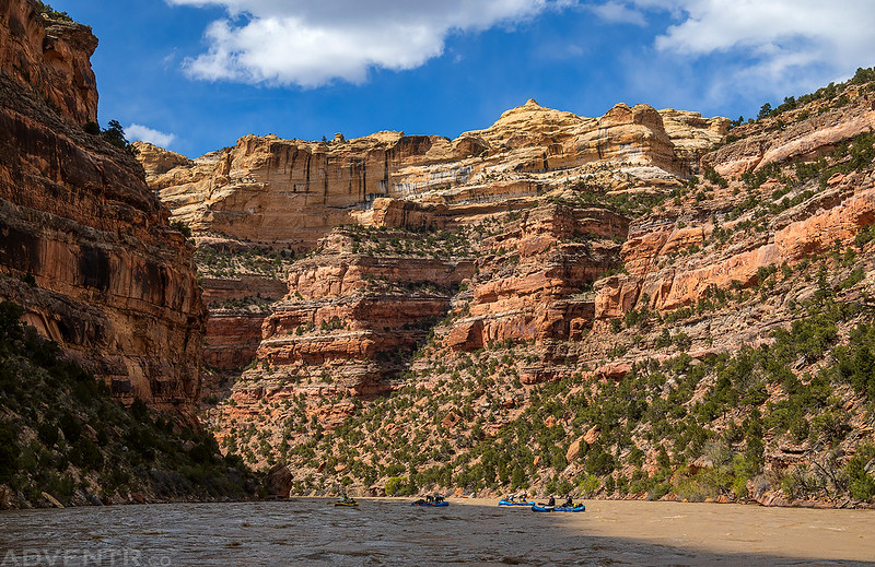
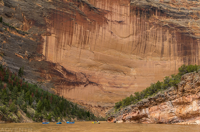
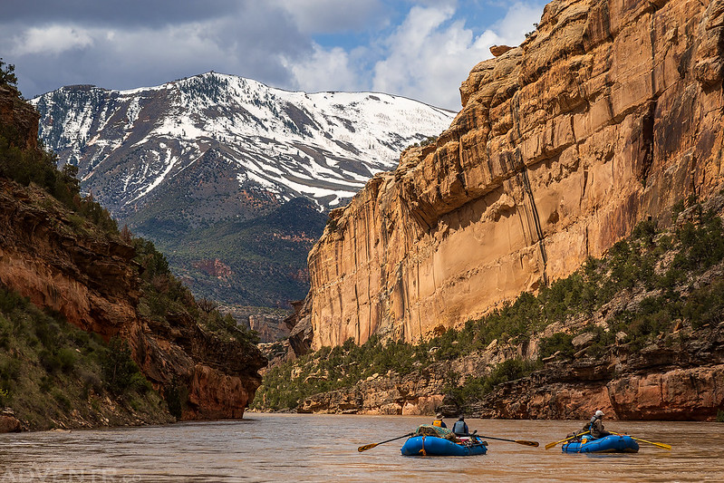
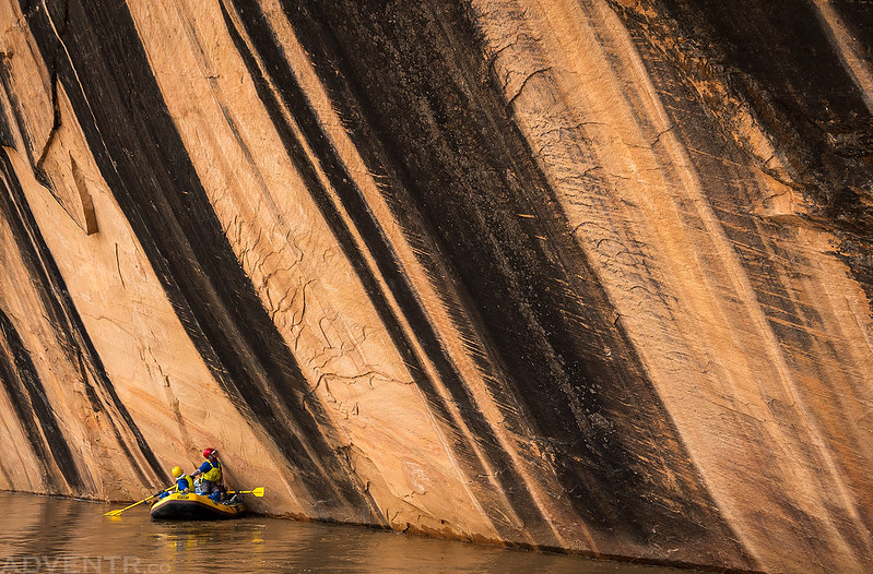
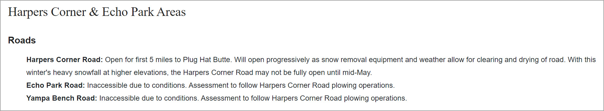
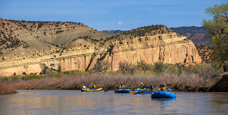
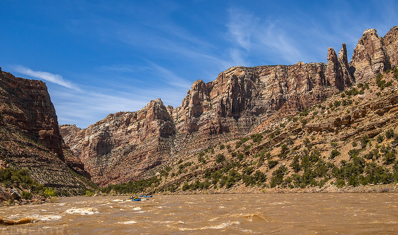
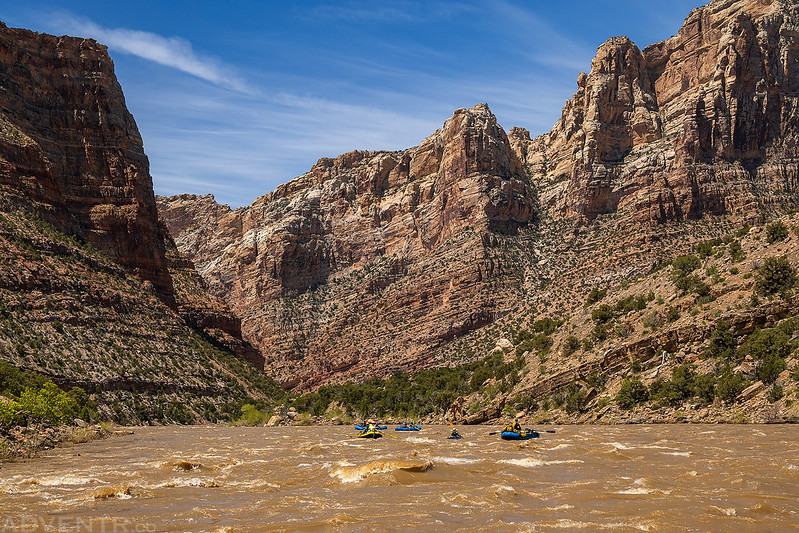
We were on the river shortly before noon. It was a bit windy and cold today and I would soon regret not wearing my drysuit every time the sun was hidden behind the clouds, which was frequently!
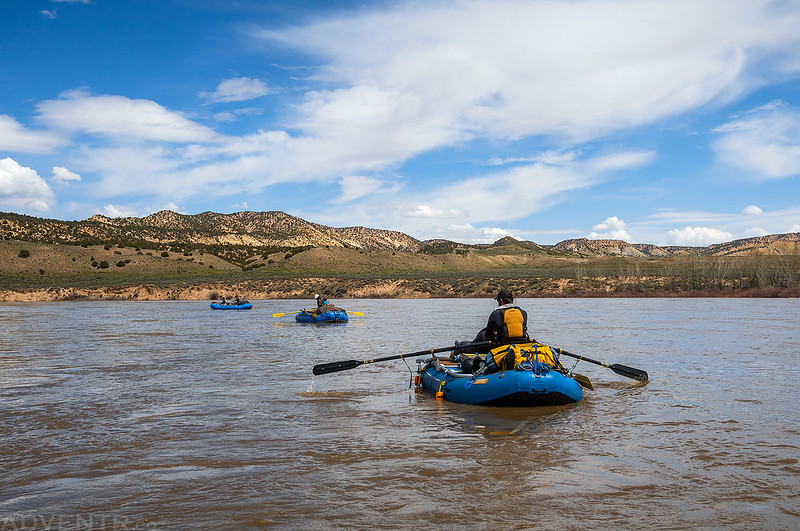
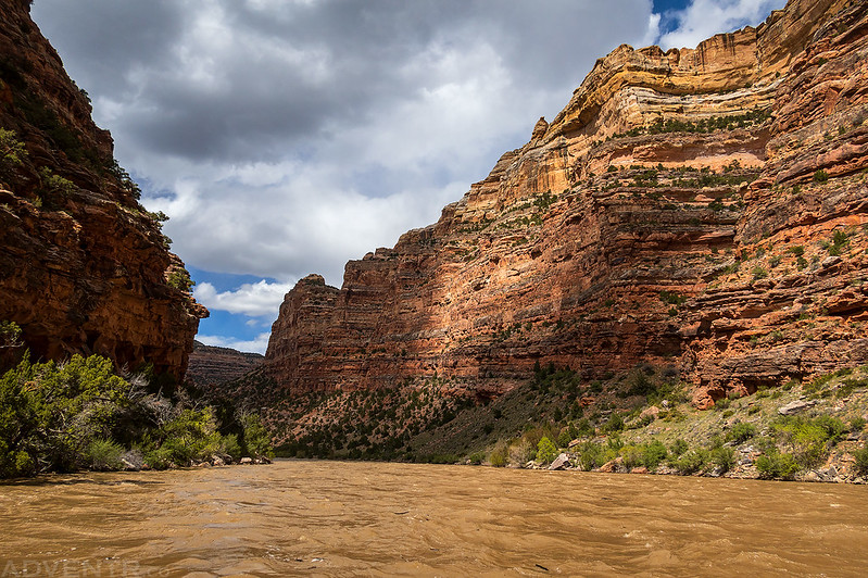
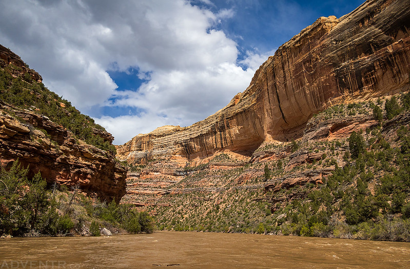
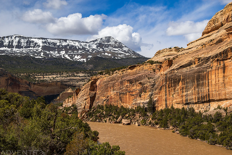
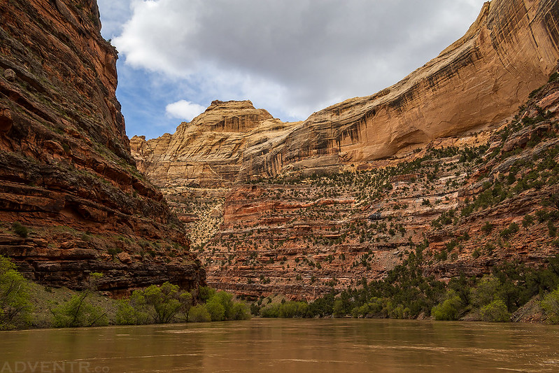
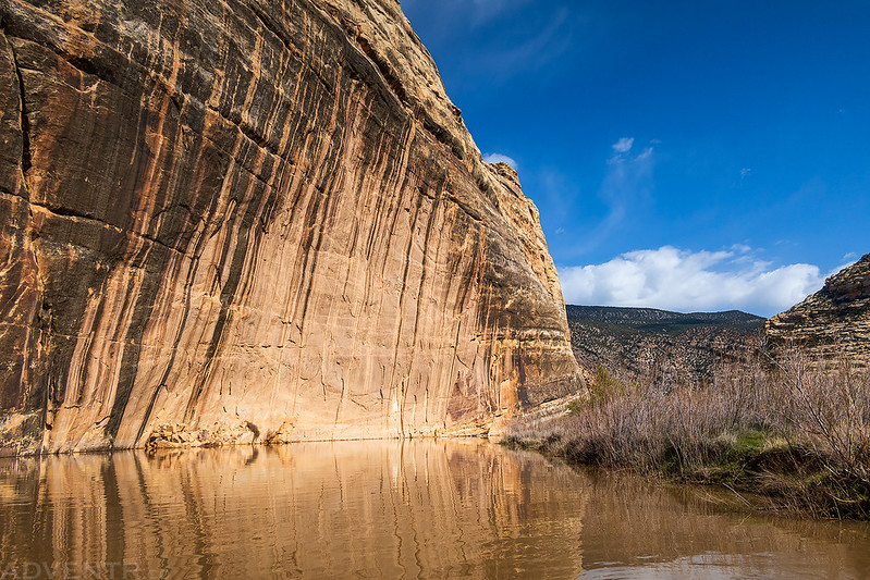
Shortly after floating past The Steps and the Vale of Tears we entered the portal into Yampa Canyon.

I’ve peered down into Yampa Canyon from many different viewpoints over the years and have even hiked down into the canyon in a few places before, but it was an exiting experience to finally be entering the canyon via the river.

When the sun was out it wasn’t too cold, but when the sun was hidden behind the ample clouds in the sky it got pretty chilly, especially with the splashy water the first couple of miles into the canyon. We had originally planned to spend the first night at Ponderosa or Tepee Hole, but after the Ranger told us there was no launch scheduled for the following day we decided to go all the way down to Harding Hole and then layover one night. Of course, we didn’t make the final decision until we were on the water and closer to the first couple of campsites, because if we had decided that before getting on the river, I might have put on my drysuit for the longer day…

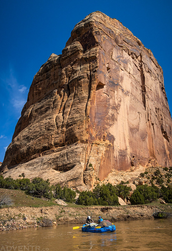
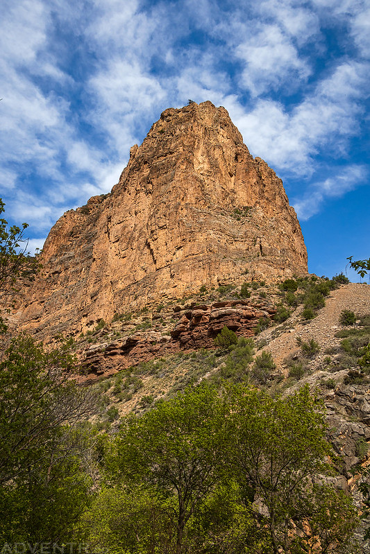
Three Pinnacles

Bob & Lisa
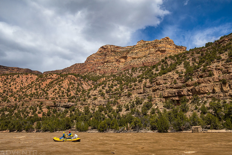
Although I was initially a little disappointed that I was not going to be taking my inflatable kayak, this first day made me realize I had probably made the right choice. Besides some big waves and holes that might have given me some problems, the wind was very strong and gusty at times, which would not have been fun in my smaller boat.

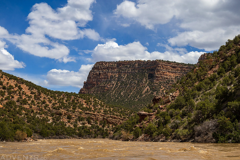
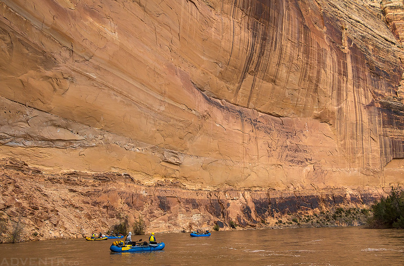
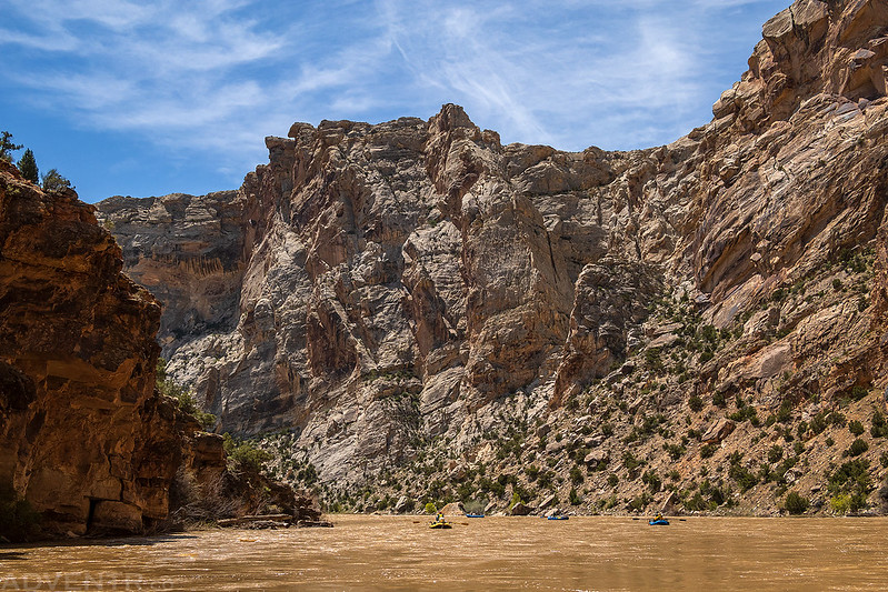
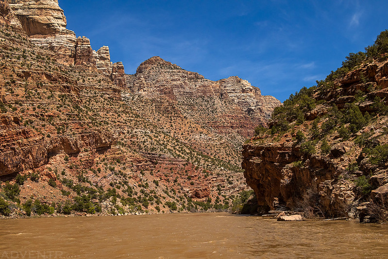
Even though I was getting cold at times, I was still in awe at the beautiful scenery of this canyon and took plenty of photos with the changing light and clouds!

Jackson & Steve

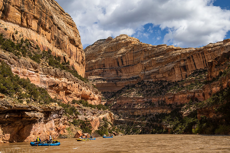
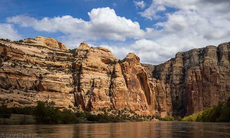
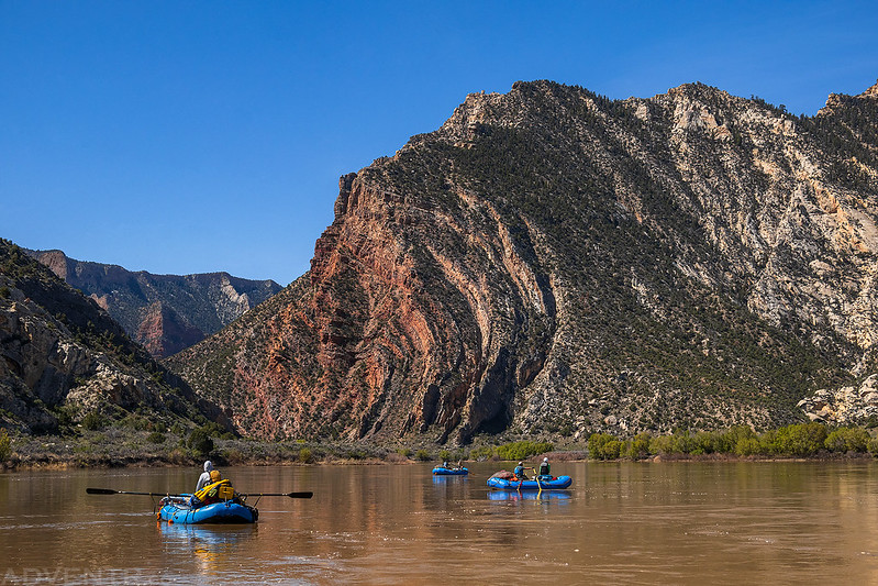
As we neared the campsites at Harding Hole, the snow covered mountains came into view.

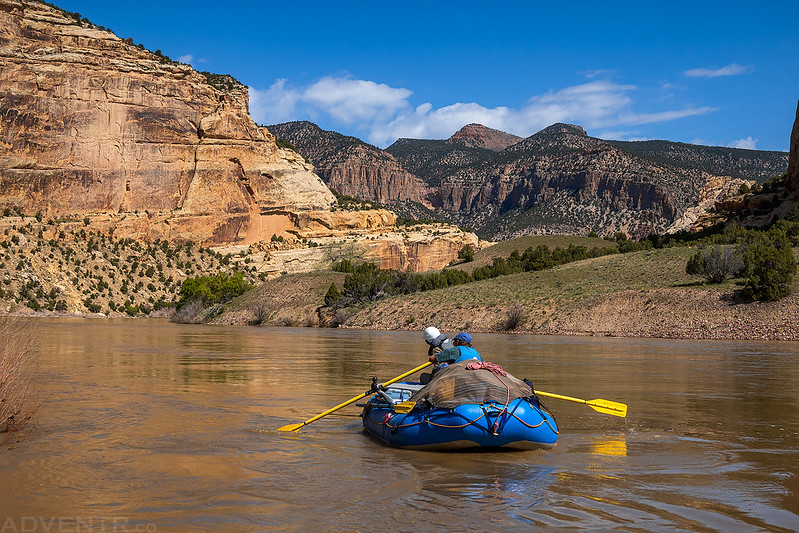
After about 26 miles on the river we stopped at Harding Hole Campsite #2 to spend the next two nights there.
The rafts at Harding Hole.
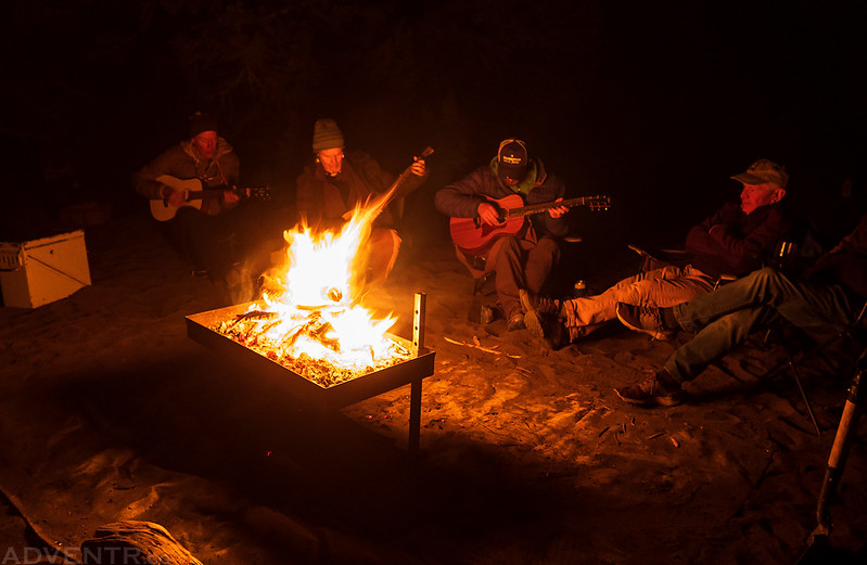
After camp was setup, we had fajitas for dinner and then sat around the campfire until 10PM or so. I think this night would be the latest any of us would stay up for the remainder of the trip, mainly because we could sleep in on Saturday since it was a layover day.
On Saturday morning I slept in until after sunrise, which is a bit late for me.
After having some breakfast, Jackson and I headed out on a hike to see if we could get upstream into Johnson Canyon.

Lucky for us, we found a trail that went most of the way to the canyon, so the hiking was pretty easy.
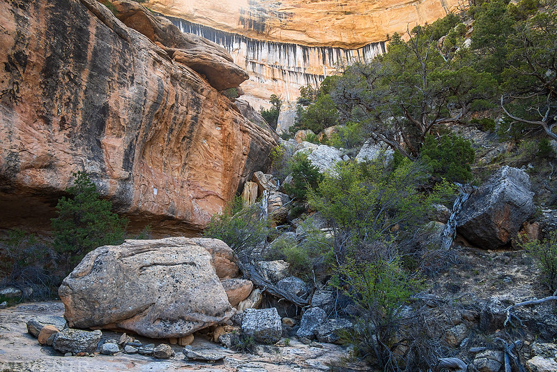
Here we were following a trail on a bench above the Yampa River. There was an old constructed cattle trail that took us down into Johnson Canyon from this point.

Once in the canyon we hiked around a bit to explore the lower section.
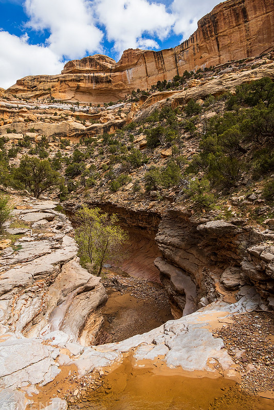
There was another constructed trail in the canyon that bypassed this pourover.
We had a great view of Marthas Peak as we made our way back toward camp.
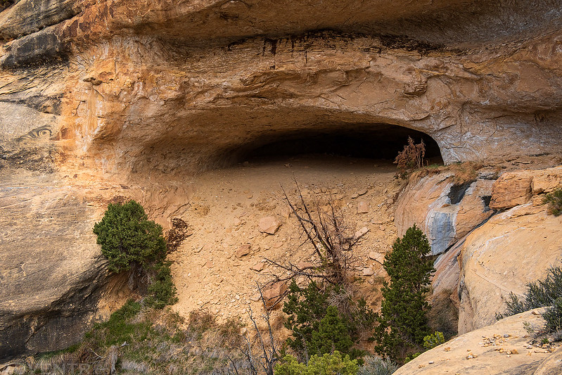
Before returning to camp we ran into a couple other members of our group that had gone out exploring and found a very large alcove nearby, so we decided to check it out, too.
I wasn’t expecting too much, but it turned out to be a much larger alcove than I was expecting and pretty cool area to explore.
It actually kind of reminded me of a smaller version of the Mee Canyon Alcove closer to home.

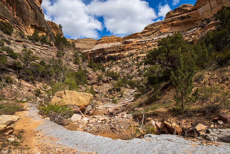
After relaxing around camp for a while in the afternoon, eating lunch and playing a couple games of Kubb, a couple of us decided to hike up Bull Canyon to Wagon Wheel Point so we could get to an overlook high above camp.
I had hiked this trail from the top a couple of years ago, so I was surprised when we came to this sign at the beginning of the trail. There were a couple sections of trail that were completely gone and missing, but we managed to find ways around them and make it out of the canyon.

Devon explores a short slot in Bull Canyon.
Looking out over Bull Canyon as we neared the top.

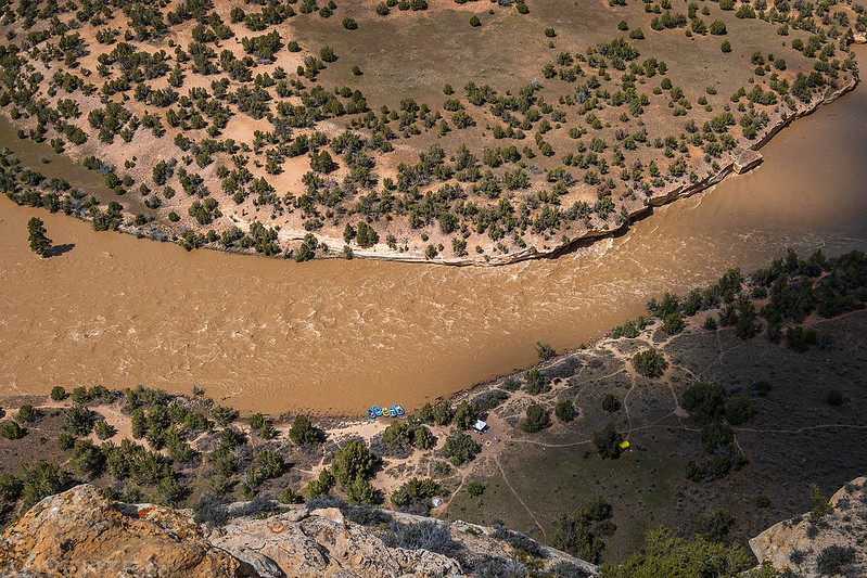
Jackson looks over the edge about 600 feet above our campsite.
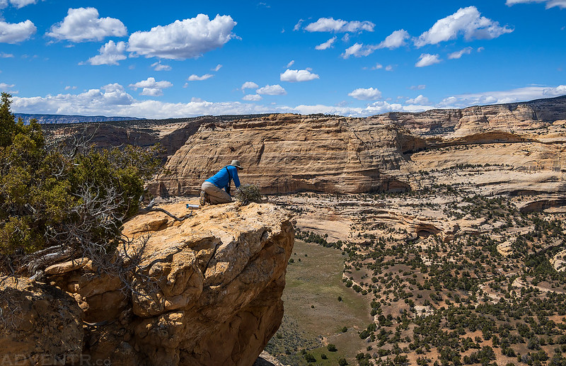
Here’s the view looking straight down to our camp from Wagon Wheel Point.
There is a great view of the canyon from up here.

Heading back down into Bull Canyon.

On our way back down Bull Canyon we made a short detour up West Serviceberry Draw.
We returned to camp and spent the rest of the evening relaxing around the campfire after have tamales and tacos for dinner.

There was music around the campfire each night.
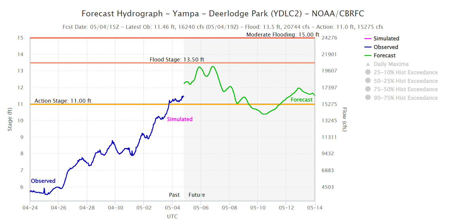
On Sunday morning it was time to pack up camp after breakfast and then start floating down the river again. The water level had appeared to be dropping a little bit, even though it had been forecasted to rise before we started the trip.
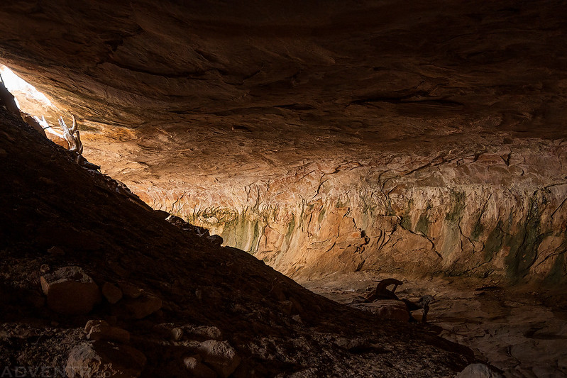
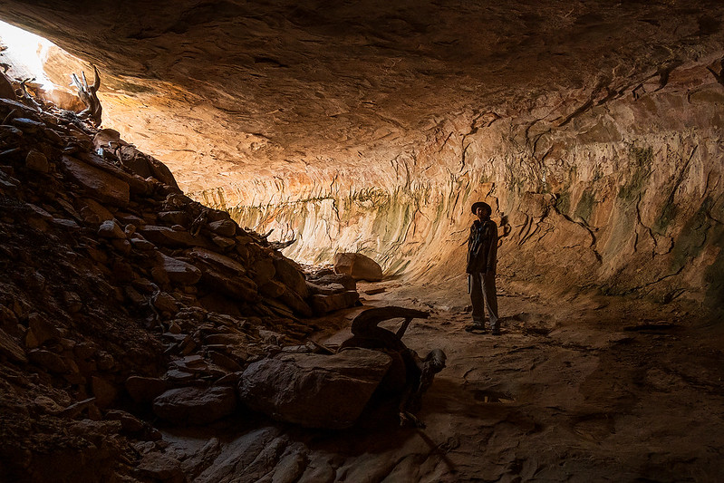
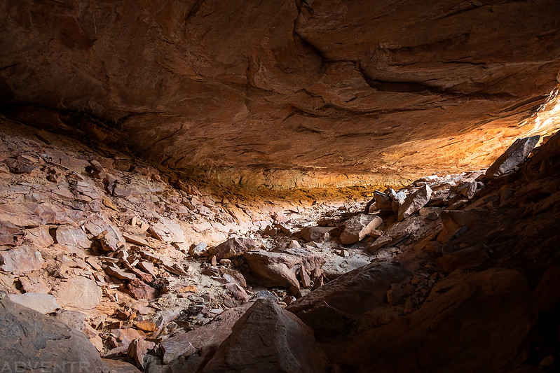
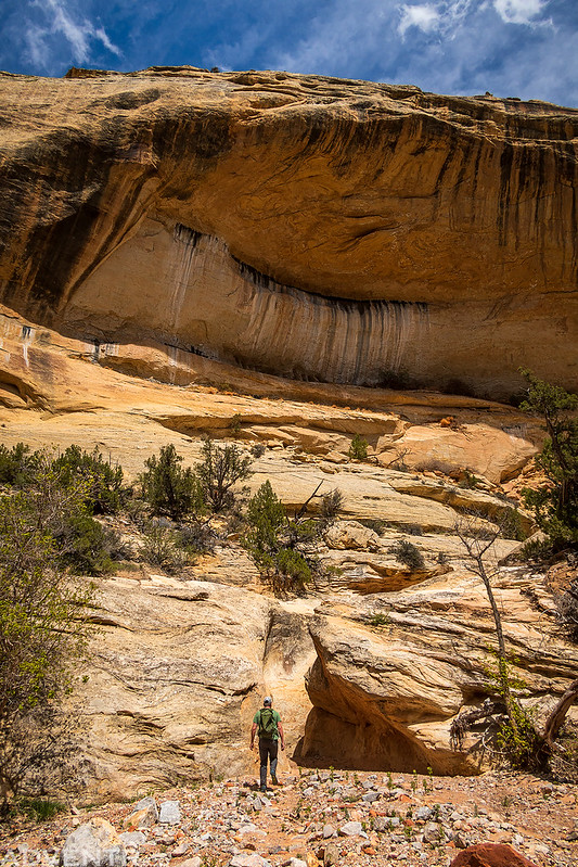
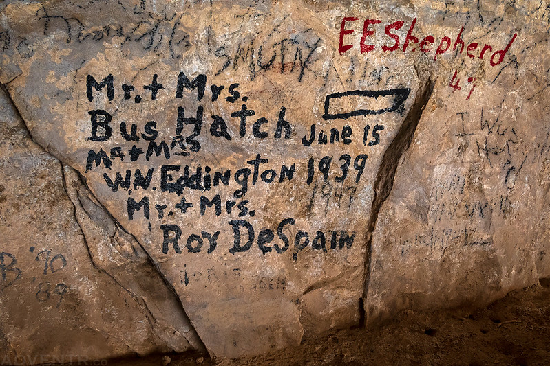
After leaving camp we were only on the water a short time before we stopped to hike up into Signature Cave.
Signature Cave
Bus Hatch, the founder of Hatch River Expeditions left his name here in 1939.
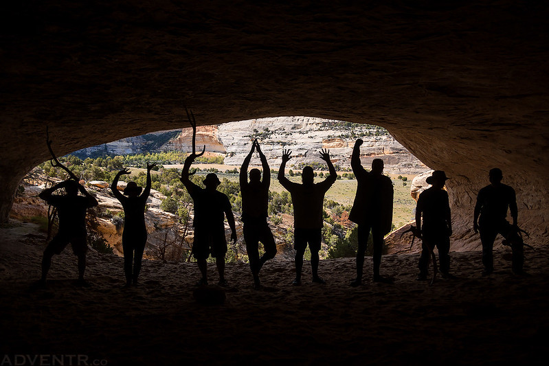
Of course we had to take the obligatory silhouette photo while we were in the cave…
It was a lovely morning for a float once we hiked down from the cave and were back on the water.

Adam & Lisa


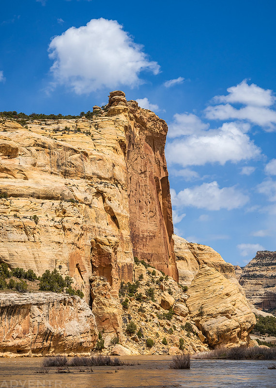
After floating around a couple bends in the river we passed below the Grand Overhang.
Underneath the Grand Overhang
I just can’t get enough of these sandstone canyon and snow-capped mountain views from the river.

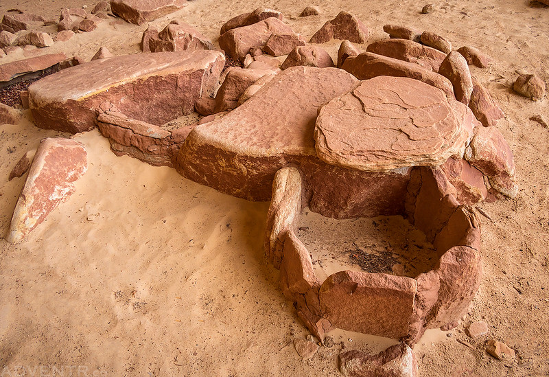
Our next stop was a short walk up into Mantle Cave. I have tried unsuccessfully to hike here from above before, so it was nice to finally be able to visit.

Little granaries in Mantle Cave.
After our short hike to Mantle Cave we were back on the water.
It wasn’t long until we reached the Tiger Wall.

Kissing the Tiger Wall for good luck in Warm Springs Rapid.
The Tiger Wall

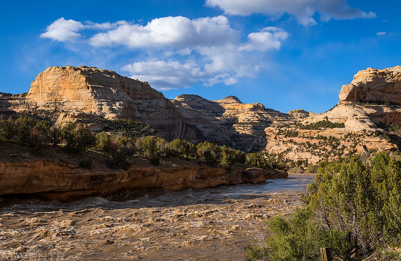
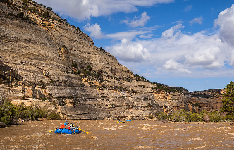
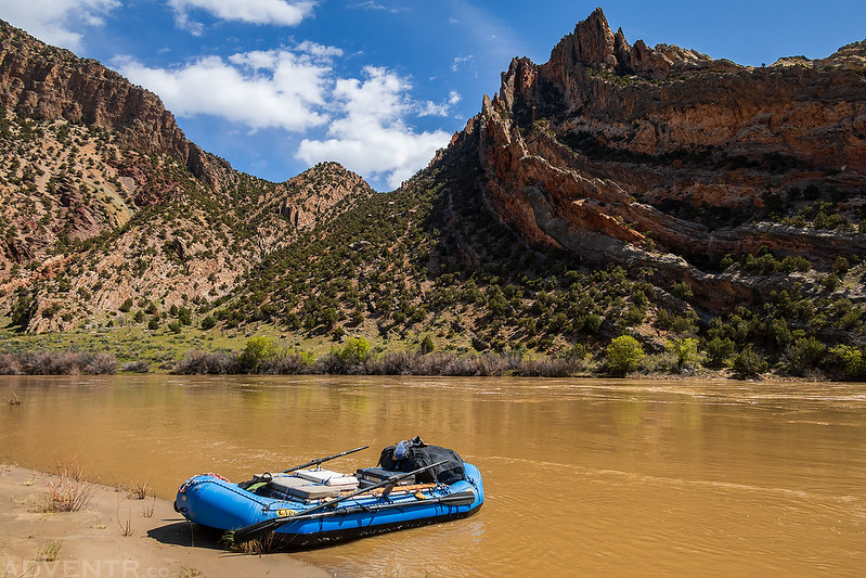
There were just a couple more bends and miles in the river until we reached the crux of the trip- Warm Springs Rapid.

We all got out to scout Warm Springs Rapid which was loud and pretty intimidating at this level.

Harold and I were the first raft to go though Warm Springs Rapid, and Jackson got this short video of our run. No boat in our group had any troubles getting through right side up. After getting home from the trip it appears that the Yampa River was at around 17,000 CFS when we ran it.
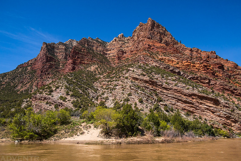
Just downstream from Warm Springs Rapid was this large recent rockfall on the left side of the canyon.
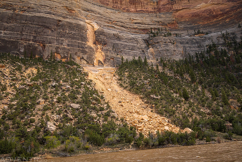
Looking back to the large rockfall as we continued down the river.

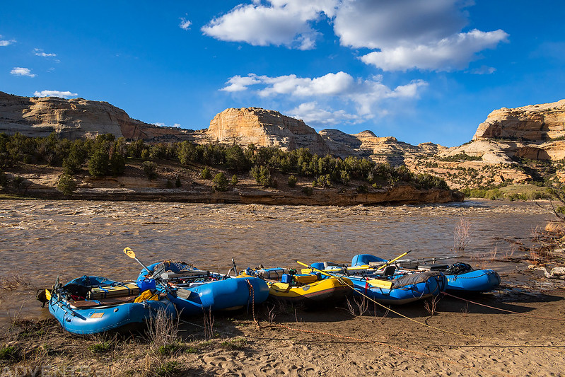
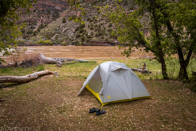
This evening we stopped at Box Elder Campsite #3 for the night.

After setting up my tent and eating dinner I went on a walk through the other two campsites to the other end of Box Elder Park just to check out the area.

To-day, Howland, Bradley, and I take the “Emma Dean” and start up the Yampa River. The stream is much swollen, the current swift, and we are able to make but slow progress against it. The canyon in this part of the course of the Yampa is cut through light gray sandstone. The river is very winding, and the swifter water is usually found on the outside of the curve, sweeping against vertical cliffs often a thousand feet high. In the center of these curves, in many places, the rock above overhangs the river. On the opposite side the walls are broken, craggy, and sloping, and occasionally side canyons enter. When we have rowed until we are quite tired we stop and take advantage of one of these broken places to climb out of the canyon. When above, we can look up the Yampa for a distance of several miles.
Major John Wesley Powell,
June 19, 1869
On Monday morning I was up with the sunrise, we had bagels for breakfast and were packed up and back on the river by 10:00am so we could float the last two miles of the Yampa River to it’s confluence with the Green River at Steamboat Rock.
Our last morning on the Yampa River.

It wasn’t long before Harpers Corner came into view high above the canyon walls.

Just before joining the Green River, Sand Canyon and Jenny Lind Rock came into view on the left.

Steamboat Rock, straight ahead!

Before I continue on with the rest of the trip down the Green River, I just wanted to stop and say that the Yampa River is an amazingly beautiful place and I’m glad that I finally had the opportunity to float down this section of the river. Not only couldn’t I have asked for a better group of people to be with on this trip with, but we were also lucky enough to have the whole experience to ourselves. We never saw another person or boat while we were on the Yampa River (we actually wouldn’t see anyone else until we passed by the Rainbow Park Boat Ramp) and we had our pick of campsites along the way. It was an amazing experience full of solitude, which is exactly the way I prefer to visit these places!
Here’s a chart of what the Yampa River actually did while we were on it from May 5th until the morning of May 8th.
The Green River: Whirlpool Canyon & Split Mountain Canyon
Average CFS: 15,160
Once we reached Steamboat Rock, the rest of the journey would be down the Green River as we floated through Whirlpool Canyon, Island Park, Rainbow Park and Split Mountain Canyon.
Floating along Steamboat Rock as we joined the Green River.
Looking back up the Green River from the confluence.
Jackson and Steve below Steamboat Rock.
We made a brief stop at Echo Park and were expecting to run into other people for the first time while we were there, but I guess the road to Harpers Corner and Echo Park were both still closed and we didn’t see anyone else there.
After the brief stop at Echo Park we carried on down the river toward the Mitten Park Fault and Whirlpool Canyon.


While we were stopped at Mitten Park I took a shot of Harold’s raft with the Mitten Park Fault. Since I was riding along on the front of his raft for the entire trip, I wasn’t able to get any photos of it on the water.
From Mitten Park we floated a few more splashy miles down Whirlpool Canyon, crossed the state line into Utah, and then stopped for our final camp at Jones Hole #1.

At night we camp at the mouth of a small creek, which affords us a good supper of trout. In camp to-night we discuss the propriety of several different names for this canyon. At the falls encountered at noon its characteristics change suddenly. Above, it is very narrow, and the walls are almost vertical; below, the canyon is much wider and more flaring, and high up on the sides crags, pinnacles, and towers are seen. A number of wild and narrow side canyons enter, and the walls are much broken. After many suggestions our choice rests between two names; Whirlpool Canyon and Craggy Canyon, neither of which is strictly appropriate for both parts of it; so we leave the discussion at this point, with the understanding that it is best, before finally deciding on a name, to wait until we see what the character of the canyon is below.
Major John Wesley Powell,
June 21, 1869
Jones Hole Creek was running fast, high and dirty with spring runoff while we were there. Every other time I’ve hiked along Jones Hole Creek it was crystal clear, so it was unusual to see it so brown this time.
There were about eight or so deer hanging out in camp that didn’t seem to be too bothered that we were around.

Jones Hole #1 Campsite
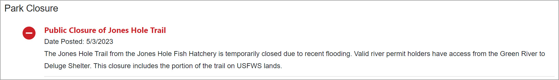
Although we knew we wouldn’t be running into any day-hikers this time since the Jones Hole Trail was currently closed from the Fish Hatchery down, we did expect to see some other river campers show up from the Canyon of Lodore, and were very surprised when no other groups even floated by this evening. We still had not seen another person or boat on this trip!
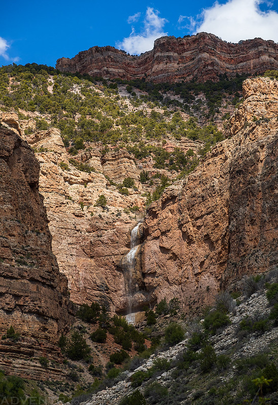
Before dinner a couple of us hiked up the canyon to visit Ely Creek Falls and the Deluge Shelter.

Along the way we spotted this large waterfall high up near the top of the canyon that I had never seen before. It must only be around when there’s a lot of snow melting off of Wild Mountain?
Here’s a short video of Lisa under the Ely Creek Falls, or Butt Stop Falls as it is known to some.
Looking up to the point above our campsite.
Here’s one final view up Whirlpool Canyon to Harpers Corner.

After our hike up the canyon I helped Harold make dinner this evening, which was an enchilada lasagna cooked in a Dutch Oven that turned out very good. Then we spent one more night around the campfire and went to bed a bit early. As I was walking to my tent in the dark I noticed some reflections from my headlamp which turned out to be a bunch of eyes looking back at me. That’s when I realized the deer that had been hanging around camp all afternoon had bedded down about 50 feet beyond my tent near the river!
I woke up before everyone else on Tuesday morning since I was in charge of breakfast and coffee, and found that the deer were still bedded down near my tent and had not moved. They finally got up and started to move as I began to take down my tent and pack up my gear.

After eating breakfast and packing up camp for the final time we were back on the Green River with a clear blue sky above.

An hour or two before sunset I cross to the mainland and climb a point of rocks where I can overlook the park and its surroundings. On the east it is bounded by a high mountain ridge. A semicircle of naked hills bounds it on the north, west, and south. The broad, deep river meanders through the park, interrupted by many wooded islands; so I name it Island Park, and decide to call the canyon above, Whirlpool Canyon.
Major John Wesley Powell,
June 22, 1869
When we reached Island Park the river slowed down for the first time on this trip, although it was still moving a couple miles an hour. That tan cliff in the background is featured in one of my favorite photos I have taken at Dinosaur National Monument.
After the flat water of Island and Rainbow Parks we reached Split Mountain where things would speed up and get a little more splashy again.
There is a long spur running out from the Uinta Mountains toward the south, and the river runs lengthwise through it. Coming down Lodore and Whirlpool canyons, we cut through the southern slope of the Uinta Mountains; and the lower end of this latter canyon runs into the spur, but, instead of splitting it the whole length, the river wheels to the right at the foot of Whirlpool Canyon in a great curve to the northwest through Island Park. At the lower end of the park, the river turns again to the southeast and cuts into the mountain to its center and then makes a detour to the southwest, splitting the mountain ridge for a distance of six miles nearly to its foot, and then turns out of it to the left. All this we can see where we stand on the summit of Mount Hawkins, and so we name the gorge below, Split Mountain Canyon.
Major John Wesley Powell,
June 24, 1869
This morning we enter Split Mountain Canyon, sailing in through a broad, flaring, brilliant gateway. We run two or three rapids, after they have been carefully examined. Then we have a series of six or eight, over which we are compelled to pass by letting the boats down with lines.
Major John Wesley Powell,
June 25, 1869
It was a pretty quick ride through Split Mountain Canyon and we soon found ourselves at the Split Mountain Boat Ramp where our vehicles were waiting for us thanks to River Runners’ Transport.

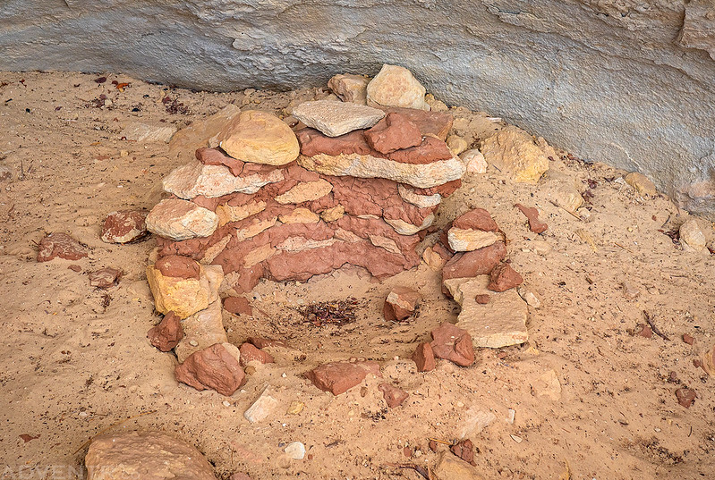
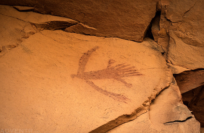
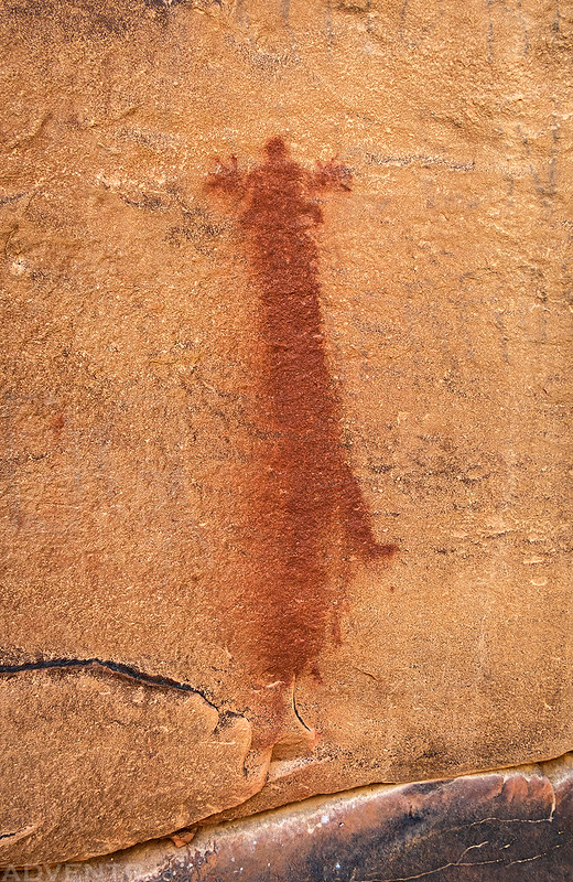
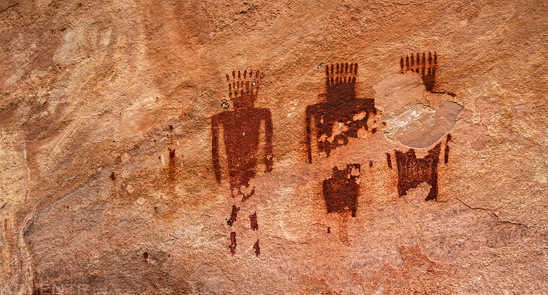
Rock Art of Dinosaur National Monument
Below are a couple photos of the rock art we found along the rivers during the past five days. I wasn’t able to stop at or find everything that I was looking for, but I guess that just means I’ll just have to come back another time, hopefully at lower water and with my own boat!
Here’s an unusual pictograph we came across. FYI- I cleaned up some of the graffiti in this photo to highlight the pictograph.

Here’s a shot with the historic graffiti still in place. I wonder if John Harding, who left his name in 1884, is where the name ‘Harding Hole’ comes from, since it is nearby? I tried to find the answer, but have had no luck, so if you know please leave a comment below!

This is a pretty cool pictograph of a bird in flight!
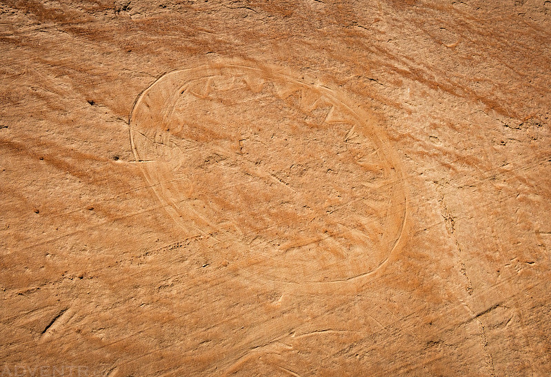
Running Paint Pictograph
Here are a couple of the many pictographs found at the Deluge Shelter.
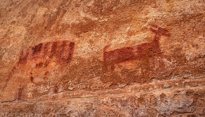


A very large petroglyph of a bison that was hiding in the shadow of a tree.

This hard-to-see ‘sun-shield’ is located right next to the bison.
Your posts are always great to look at, but this one is outstanding, both your experience and the photographs you use to document it.
Thank you Robert! It was an amazing trip so I tried my best to document it!
You did an incredible job capturing this trip! Thanks for the excellent photos and commentary!
Thanks Adam! It was really great meeting you on this trip and hopefully our paths will cross again in the future!
Really enjoyed your pictures and narrative, Randy. What a great high-water Yampa run.
Bob
Thank you Bob! It was great going on another river trip with you, and thanks for sharing all of your geologic knowledge along the way!
Awesome that you were able to get so many while on the water! Making lemonade from lemons as they say. 11 years ago we spent a grreat couple of days camping at Echo Park, with the whole place to ourseleves, so it was nice to revisit that a bit.
Thanks Steve! It’s always nice to spend some time in Echo Park!