Memorial Day Weekend | Friday – Monday, May 28-31, 2021 | Book Cliffs Rock Art VI
Last year Diane and I completely skipped going anywhere over the Memorial Day weekend because we didn’t want to deal with the massive COVID-crowds that were out and about at the time, but this year I wanted to get out somewhere close to home while still avoiding the crowds. After poring over maps I decided that the best place for me to go this year would be up into the Book Cliffs. Not only are the Book Cliffs close to home, but I don’t think they are a place that crowds usually flock to and I was hoping to find plenty of solitude. It’s actually been quite a while since I spent much time in the Book Cliffs so this would be a good opportunity for me to revisit some places I haven’t been to in a while and also explore some new ones! I knew it would probably be pretty warm out this weekend, so I was planning to take it easy by mostly exploring the backroads with my Jeep and only going on short hikes along the way.
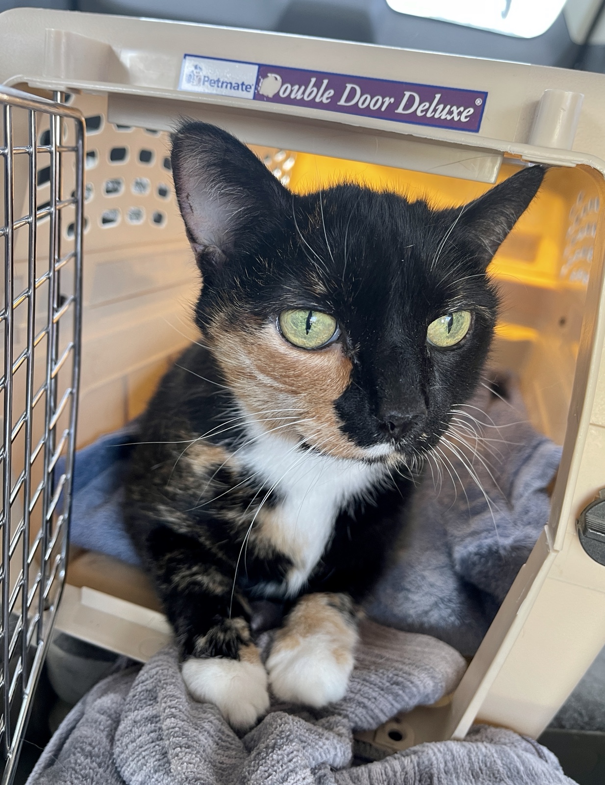
Unfortunately, earlier in the week we noticed that our cat Rico (Tellico) was not acting like herself. She seemed to be having trouble walking and was mostly staying underneath our bed all day. I wasn’t able to schedule an appointment with the Vet until Friday afternoon and was very worried about her since she is getting pretty old for a cat at almost 16 years. I’m not going to lie, based on her age and how she was acting, I was expecting the worst. Depending on what the Vet found, I was ready to cancel my weekend in the Book Cliffs to stay home with her. At the appointment the Vet didn’t find anything wrong with her in the exam aside from some pain in one of her rear legs, but did find an elevated white blood cell count in her bloodwork. We were given pain medication to help with her walking and antibiotics to help fight off a possible infection that was causing the high white blood cell count. Thankfully, it wasn’t as bad as I expected and she is doing a little better now, although not completely back to herself. Anyway, with the diagnosis from the Vet, I decided I was OK to continue on with my trip into the Book Cliffs, and if things went downhill again Diane would contact me and I could be back home in a couple of hours.
Here’s a photo I took of Rico in the cat carrier while we were waiting for the Vet to see her.
Baxter Pass: The Crookedest Railroad in the West
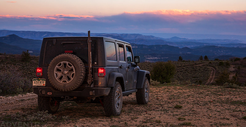
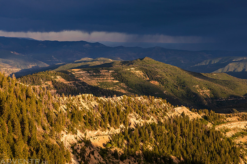
After I found out that Rico was doing OK and I felt better about leaving for the weekend, I grabbed a quick dinner in town and then headed north into the Book Cliffs for the rest of the long holiday weekend. The Vet appointment caused me to leave later than I normally would have liked, but I guess it didn’t matter too much since I wasn’t travelling far from home this weekend and had plenty of time to reach my first destination; Baxter Pass. It’s been over ten years since I drove over Baxter Pass last, and to be honest, I don’t really remember much about it, so I was looking forward to returning. Baxter Pass was part of the Uintah Railroad which hauled Gilsonite from Dragon to Mack from 1904 – 1939 and was referred to as The Crookedest Railroad in the West. After passing through Mack I followed the old railroad grade to Baxter Pass and found a place to camp up high on one of the nearby ridges. From the ridge I could see all the way to the La Sal Mountains to the south and watched an amazing sunset to end the day.
The views this evening were pretty nice as I followed the road along West Salt Creek deeper into the Book Cliffs.
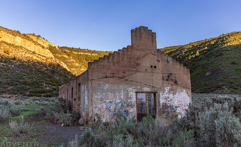
I passed by the old Machine Shop, which is the only remaining structure standing in the ghost town of Atchee.
After turning up Railroad Canyon I followed the switchbacks up to Baxter Pass.

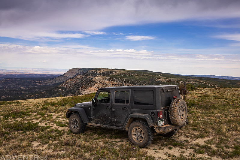
Baxter Pass Road

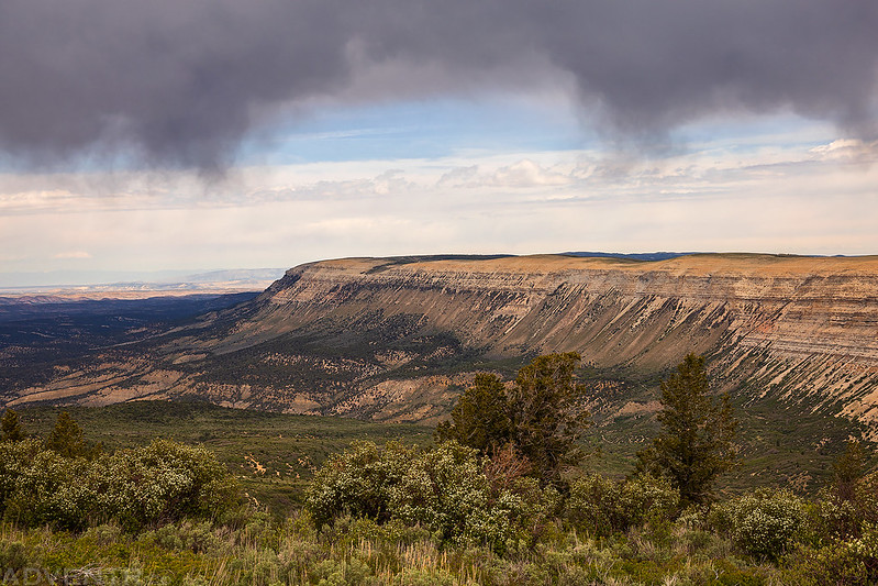
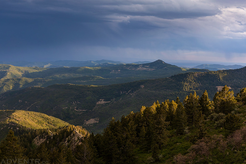
The clouds were looking eerie when I reached the top of the ridge.
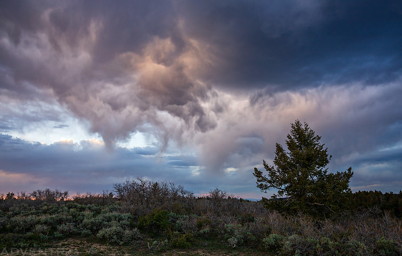
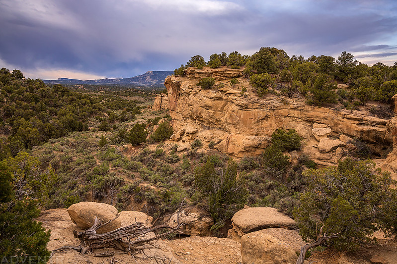
Top of the Book Cliffs
I love the warm and cool tones in this scene.
Fenceline Light

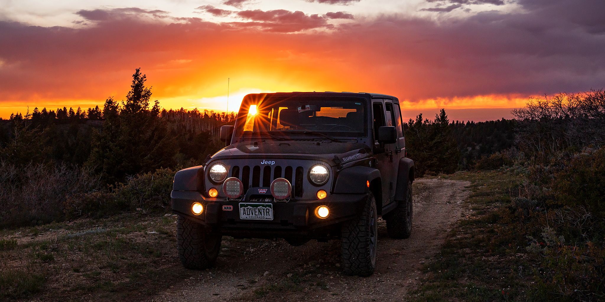
Hey look, I caught a sunstar through my windshield!

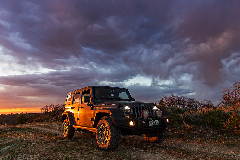
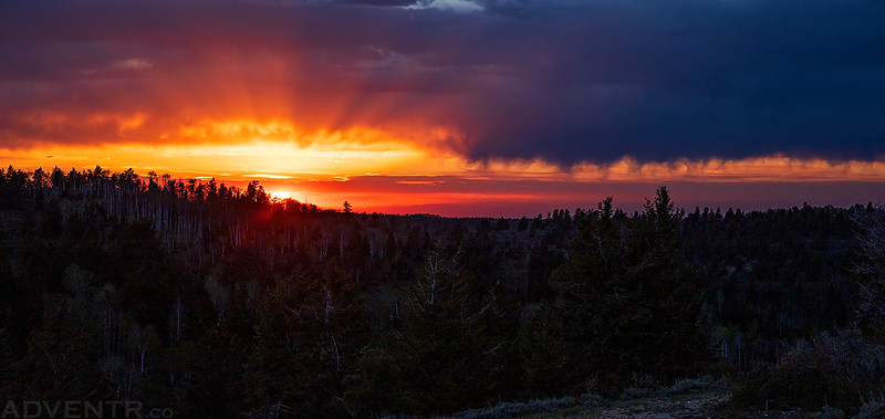
Just a colorful sunset from the top of the Book Cliffs.
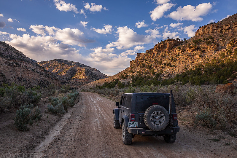
On Saturday morning I drove back down to Baxter Pass and then continued on down West Evacuation Creek on the other side for further explorations in the Book Cliffs…

The Cathedral Bluffs Trail & Douglas Pass
On Sunday morning I set out to drive the Cathedral Bluffs Trail which is listed in my old Backcountry Adventures Colorado guidebook. Back before I got into hiking and backpacking I was really into four-wheeling and this book was my bible. At the time I was working to drive all the trails listed in this book, but this trail was one of the few that I never got around to. Now that I planned to do more exploring by Jeep this weekend, I thought it would be the perfect opportunity to dust off the old book and finally check out this trail!
I stopped to take a photo over the White River on my way to the trail and these birds all started flying towards me as a snapped the photo.

Although the weather forecast wasn’t calling for a possibility of rain until later in the afternoon, these clouds worried me a little bit since I would be travelling into an area with roads that could get very slick and impassible when wet. I continued on and took my chances…

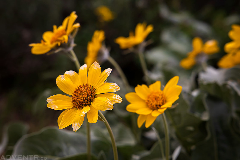
Roadside Wildflowers
Clyde Dillon lost his life on this ridge in a storm in 1941.

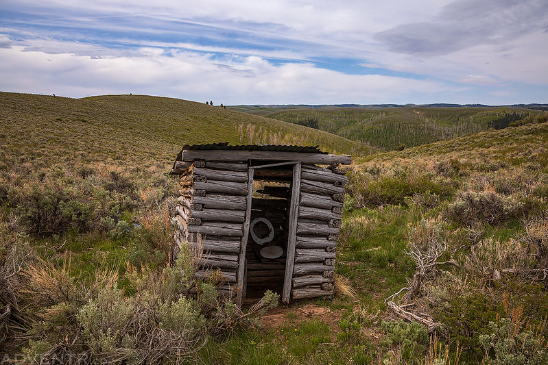
An old cabin I passed by.

The outhouse behind the cabin.
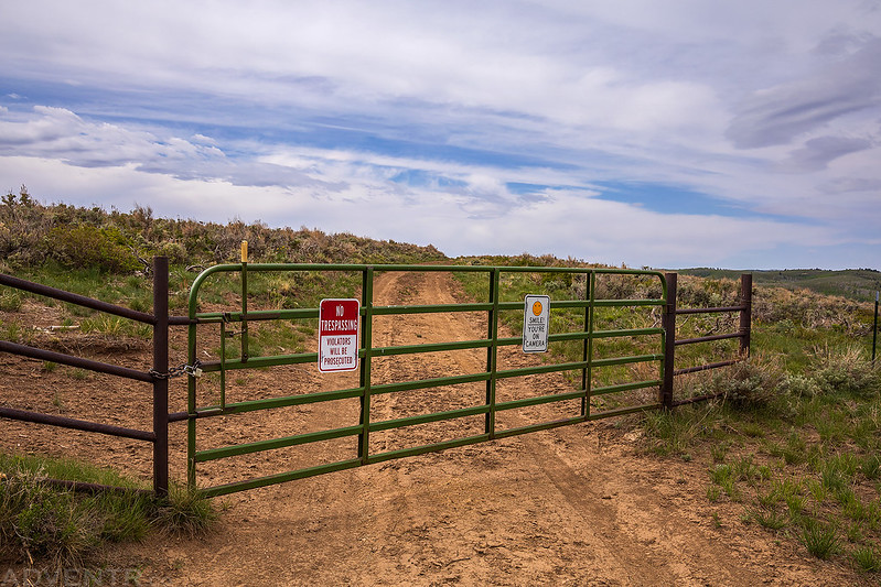
The trail ended at private property and this locked gate, so I turned around and headed back the way I had come.
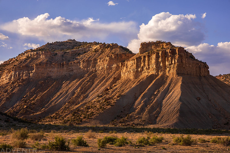
The Cathedral Bluffs
The clouds seemed to be hanging low in the sky during my drive back…

The road follows along the top of the Cathedral Bluffs, but never really gets close to the edge.

I followed a faint two-track that I thought might get me closer to the edge, but the road ended about here.
Headed back down from the top of the ridge.

On my way to Douglas Pass I took a detour up East Douglas Creek and Cathedral Creek so that I could get a look at the Cathedral Bluffs from below.

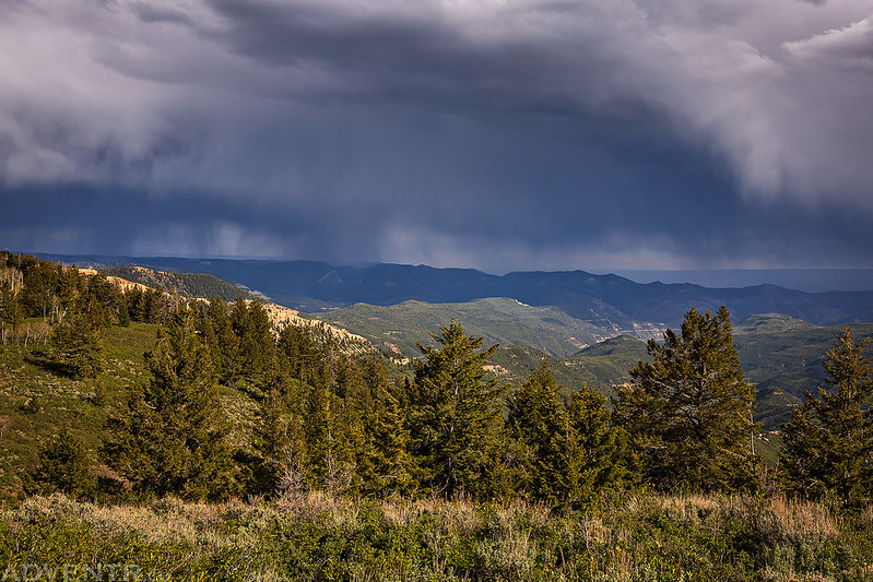
I spent a little time rockhounding for fossils up near Douglas Pass until I was chased off the mountain by a lightning storm. I did find this one fossil of a leaf, though.

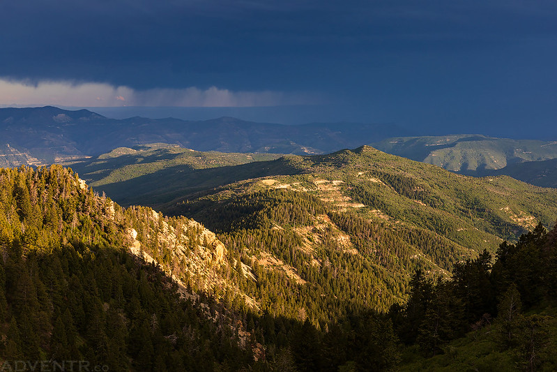
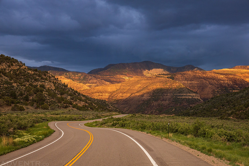
The stormy weather and evening light made for some nice scenes from the high ridges surrounding Douglas Pass.

Following Douglas Pass Road back to Loma for gas.
I spotted this rainbow as I drove down into the Grand Valley just before sunset.

This was my view of the Book Cliffs on Monday morning from near camp.
This hazy view of the Book Cliffs at the edge of the Grand Valley reminded me of waves as I descended from a high ridge and then headed back home.

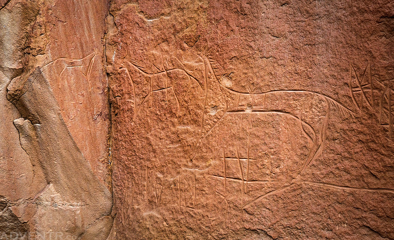
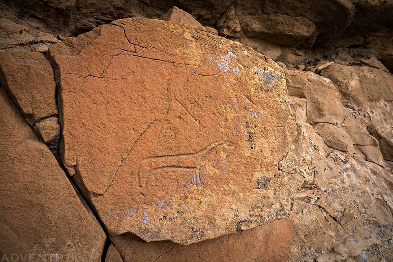
Rock Art of the Book Cliffs & Cañon Pintado
Throughout the weekend I stopped at a number of different rock art sites in the Book Cliffs and Cañon Pintado. Some of the sites I have been to before and some of them were brand new to me. These are all of my photos of rock art from the weekend. Enjoy!
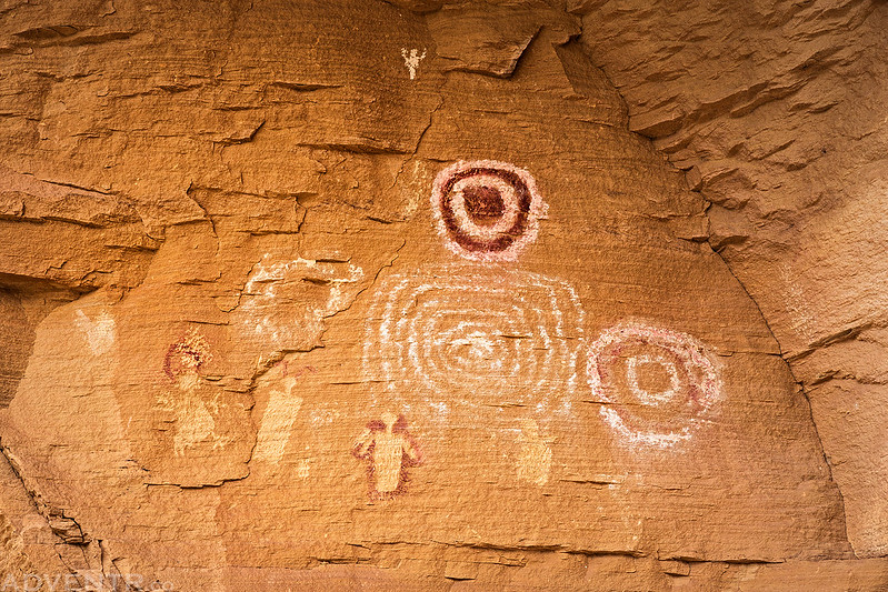
This is a Barrier Canyon Style pictograph panel I have known about for a long time, but never visited before because it is kind of out-of-the-way. I happened to drive right by it on this trip, so I finally had the opportunity to check it out. Extensive vandalism has been digitally repaired in this photo.

Boulder Petroglyphs

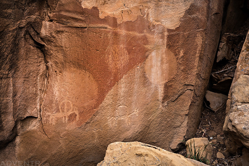
Covered-Up Panel

Faded Fremont Figures

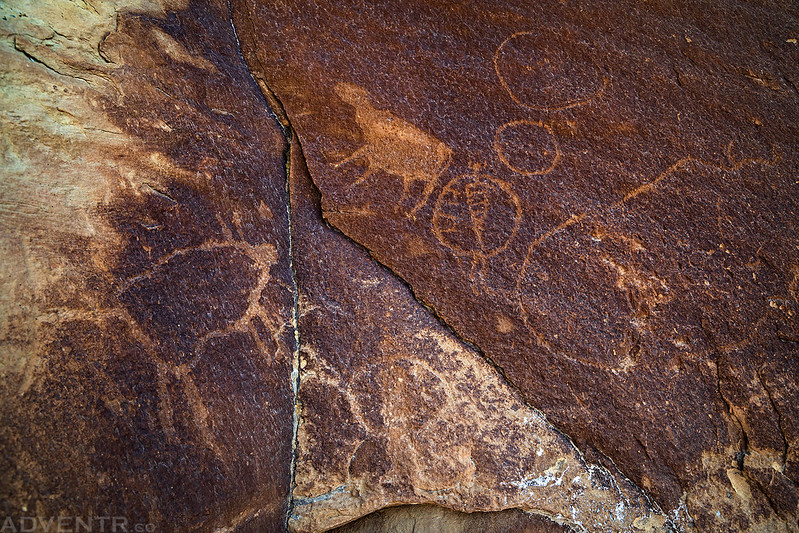
Circles Panel
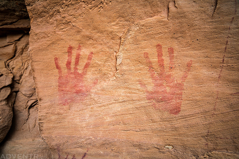
Faded Red Handprints
I saw many Ute petroglyphs this weekend.

This one was interesting because of the smoothed out circles on the canyon wall.


I spent a little time on Fremont Ridge just before sunset since I was camped nearby.

Fremont Ridge Petroglyphs

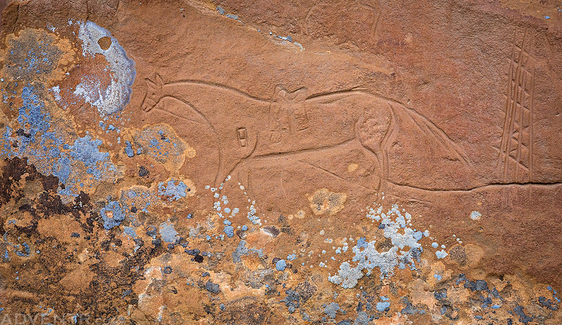
Crooks Brand Horse
Ute Horses
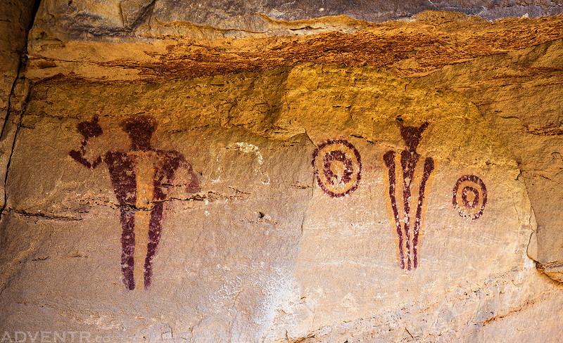
I’ve visited the Carrot Man Pictographs a couple times before, but I had to stop yet again since I was passing by…
Carrot Man Panel

Reservoir Site Petroglyphs

Horse & Teepee
Roadside Rock Art
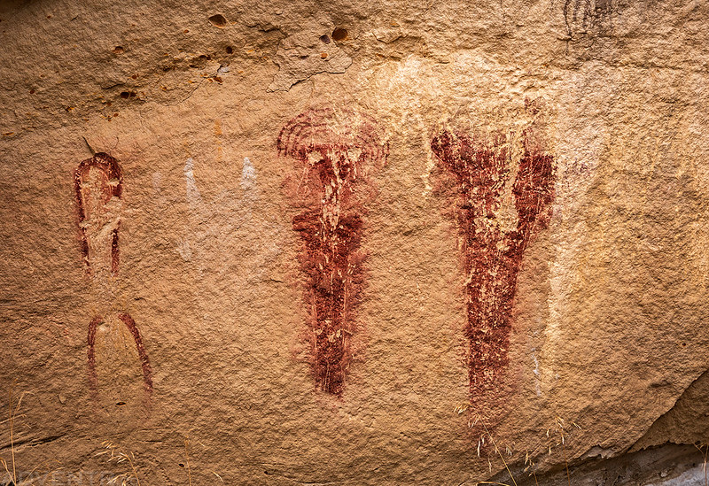
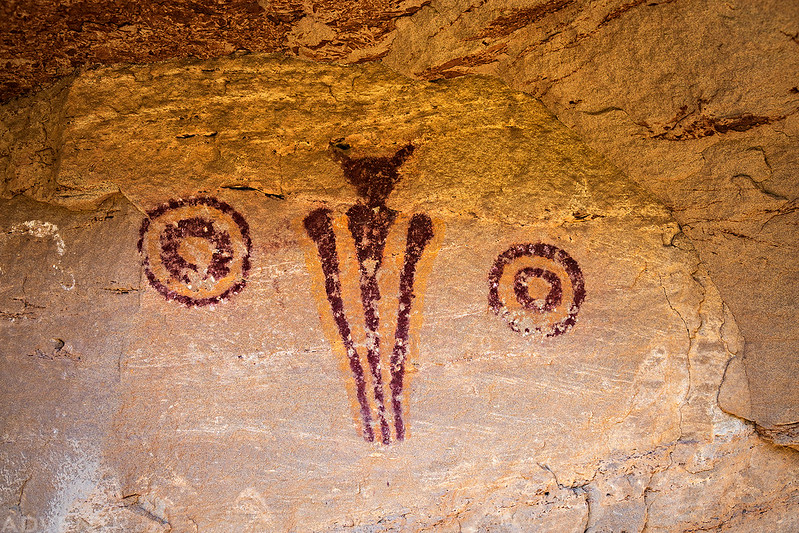
Sun Dagger Site

A closer look at the Sun Dagger Pictographs
East Four Mile Draw Petroglyphs

I’m not sure how I spotted these faint petroglyphs, but I was pretty amazed by them when I hiked in for a closer look at this unusual panel.

Visiting this interesting pictograph panel was certainly a highlight of the weekend for me.


yay glad Tellico is doing good!
Outstanding trip log !
Hello, awesome pictures. I would love to know where in the Book Cliffs you found all these petroglyphs? Are they all on the Colorado side? and where in Colorado.
There are some from both Utah and Colorado. Check out Cañon Pintado if you have never been there.