Curecanti National Recreation Area | Saturday, May 13, 2023
After spending last weekend on the Yampa River, Jackson and I had already planned another river trip for this Sunday on the Colorado River near home, so today I wanted to find something a little more local to do. While looking over my maps trying to decide where to go, I eventually settled on hiking a couple of shorter trails in the Curecanti National Recreation Area (NRA) that are all located within the upper end of the Black Canyon of the Gunnison. Aside from an overnight backpacking trip down the Hermits Rest Trail a couple years ago, I have done no other hiking in the NRA even though I drive through it frequently in the summer. There are really only a handful of trails in Curecanti, so I thought this would be a good opportunity to start hiking them all.
Pioneer Lookout Point & Curecanti Creek Trail
I woke up extra early on Saturday morning and headed over to the Curecanti National Recreation Area with a quick stop in Montrose for breakfast. I made my way over the Blue Mesa Dam to Pioneer Lookout Point for my first hike of the day on the Curecanti Creek Trail. It was a little chilly this morning when I arrived at the overlook, coming is just above freezing, but it would warm up quickly as I started hiking.
Before hiking down the trail into the canyon, I stopped to check out the different overlooks from Pioneer Point.

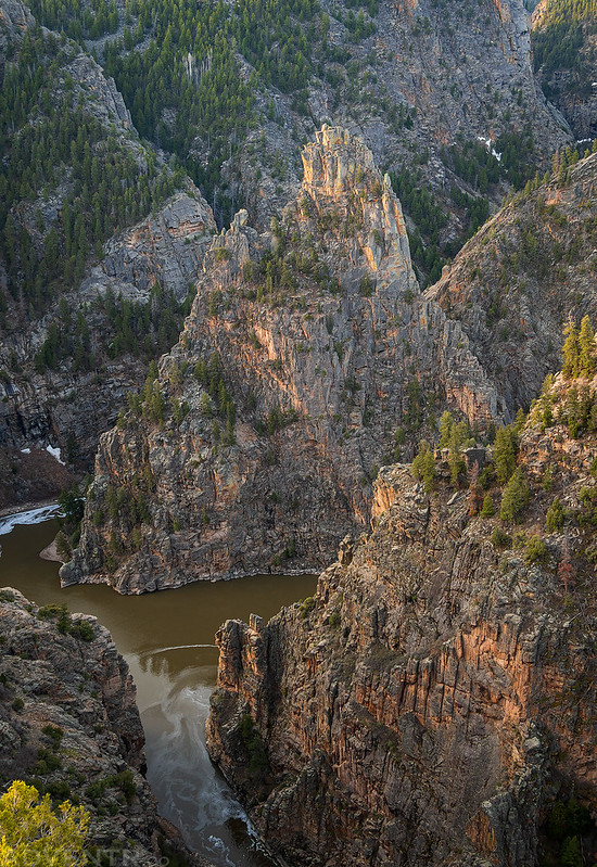
Looking straight down from the overlook across the Black Canyon there was a nice view of the Curecanti Needle.

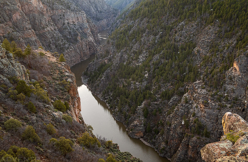
Here’s a view straight down to Curecanti Creek. The trail would be taking me down there shortly…

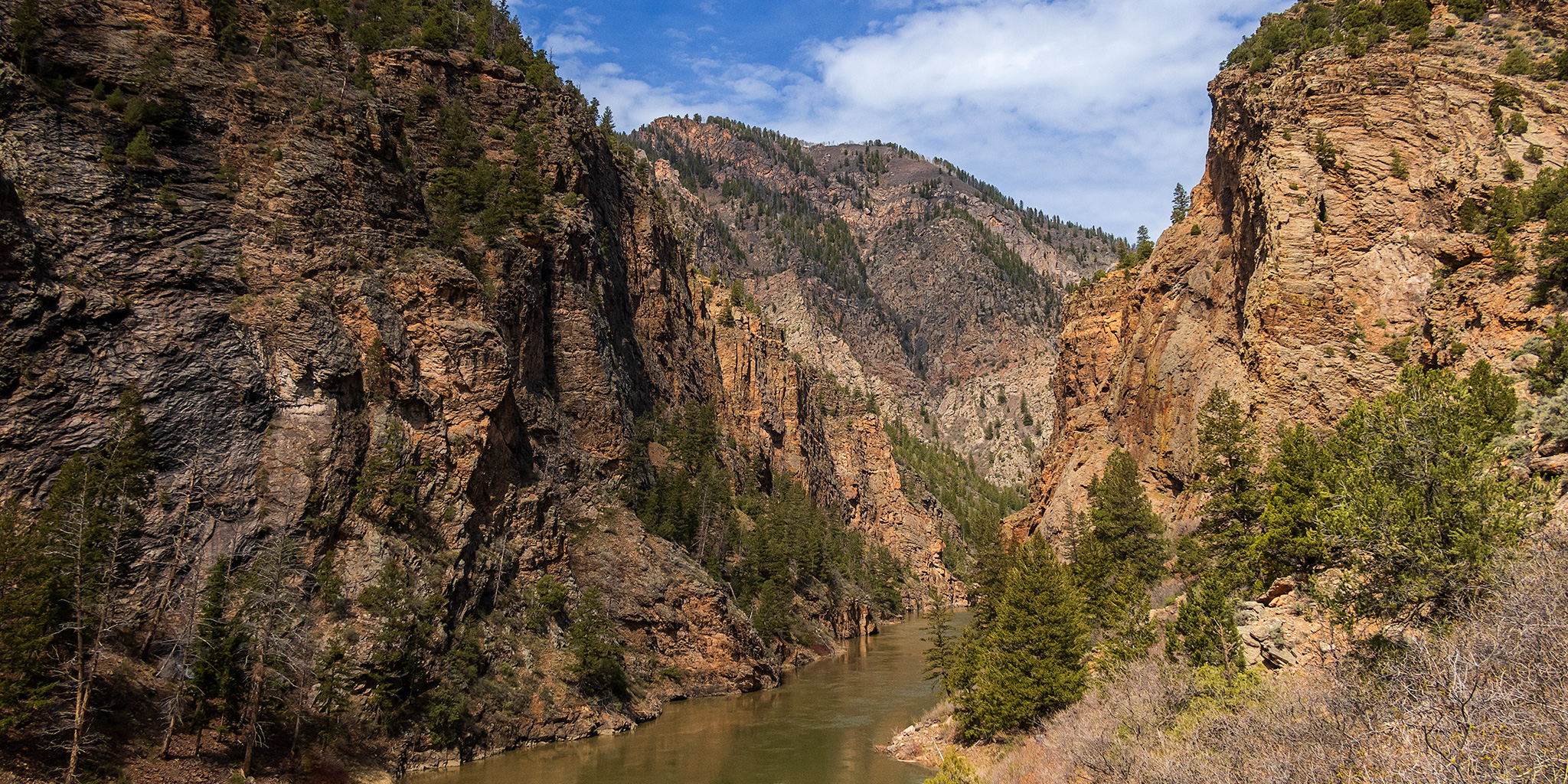
Morning at the Black Canyon.
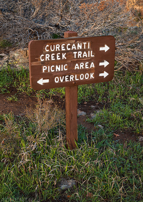
Curecanti Creek Trail Sign
There was one more overlook along the trail with a different view of the Curecanti Needles across from the mouth of Curecanti Creek.
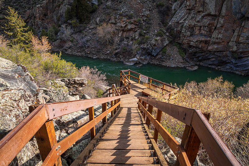
After descending a couple hundred feet down switchbacks into the canyon I reached the first of two bridges across the creek.

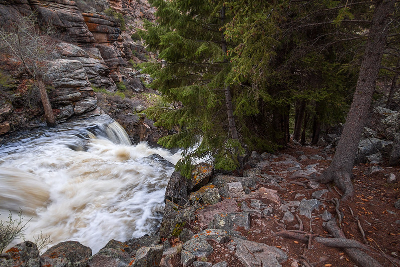
Once on the other side of the creek the trail started following it downhill.

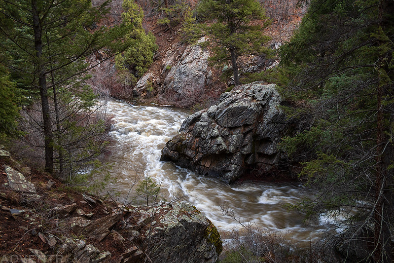
Hiking down the steep trail next to a waterfall.
The roar of the creek was loud in the canyon. Here are two short video clips of the sound and rushing water of Curecanti Creek.
Soon I crossed back to the other side of the creek on the second bridge.
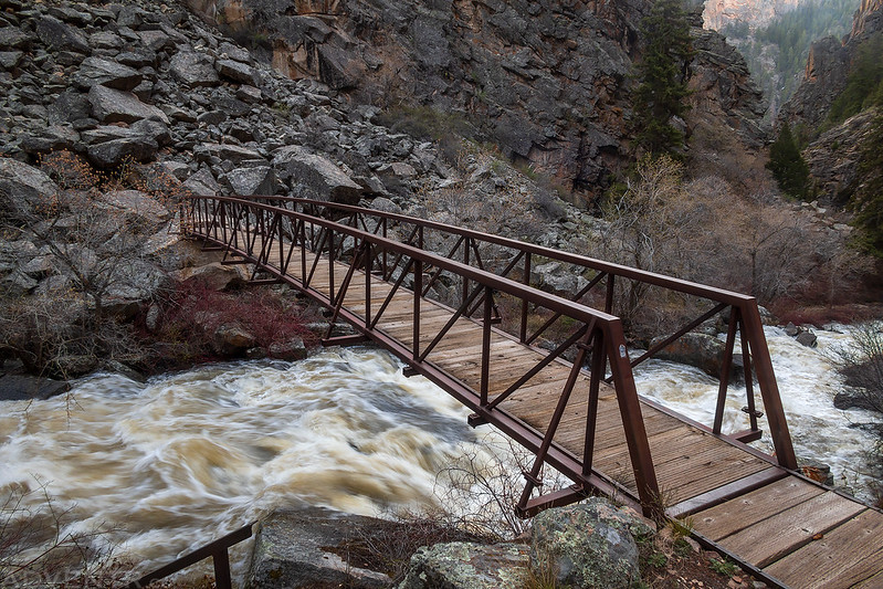
Looking down Curecanti Creek Canyon from the bridge.

After crossing over the second bridge, I started to come across sections of the trail that had water flowing down them where the creek had jumped the bank.

Those rocks on the right with water flowing down them are the trail.
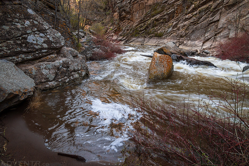
That’s not the creek, that’s the trail. I bypassed this section by scrambling over the large boulders on the left.

I guess my bypass route didn’t do me much good since I was soon stopped by this pool that covered the trail. I decided to stop here since the water was cold and moving quickly, and I didn’t really want to get my feet wet today. I wasn’t that far from the end of the trail.
I liked the colored stipes on this wall and took a photo as I hiked back up the trail and out of the canyon.

Pine Creek Trail
After returning to my Jeep at the trailhead I drove back across the Blue Mesa Dam to the other side of the Black Canyon so I could hike down the Pine Creek Trail next.
The Pine Creek Trail is a shorter trail that descends some steps along Pine Creek and then follows the Gunnison River along an old railroad grade.
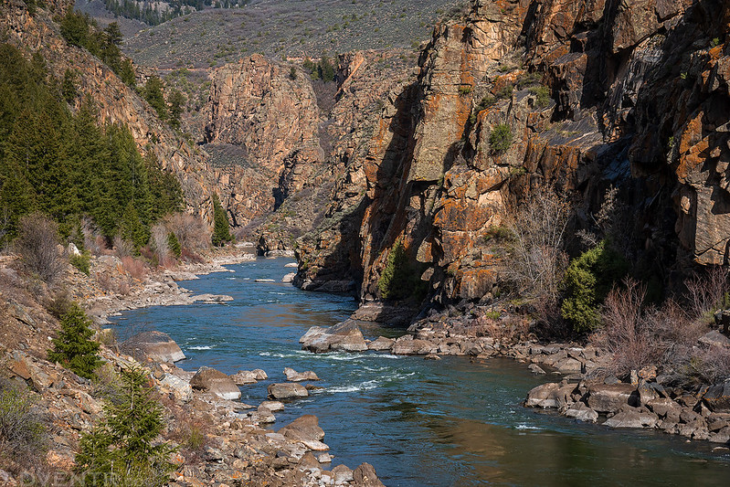
Hiking along the Gunnison River at the upper end of the Black Canyon.
In the 1950s and 60s, the railroad bed was used for motor vehicles. Called ‘The Trout Highway’ the road was popular with sightseers and anglers.

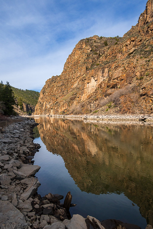
The views of the Black Canyon from the trail were very nice.

There was even a good reflection as I hiked back to the trailhead.
Mesa Creek Trail
When I returned to the trailhead I got in my Jeep and hopped back onto US50 to drive to Cimarron and the Mesa Creek Trailhead, which is located just downstream of the Morrow Point Dam. Next I would be hiking the Mesa Creek Trail which would be my final hike of the morning before heading back home.
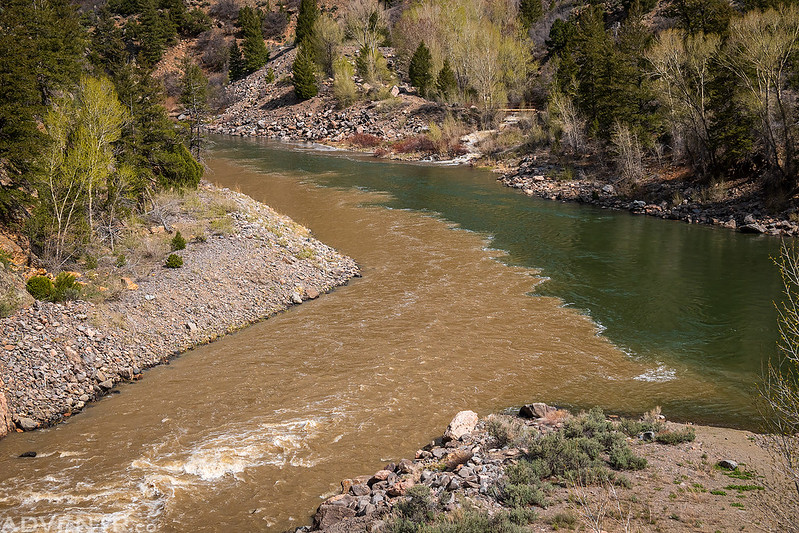
As I started down the trail I could see that the Cimarron River was brown-colored while the Gunnison River was a nice emerald green.

I’m not sure why, but I love seeing the point where two different colored rivers come together.
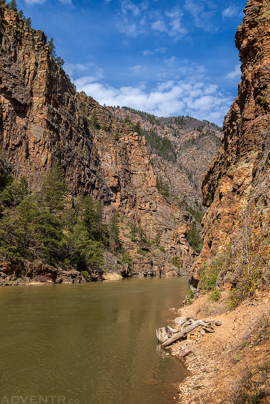
Looking down the Black Canyon as I hiked along the river.

The Black Canyon
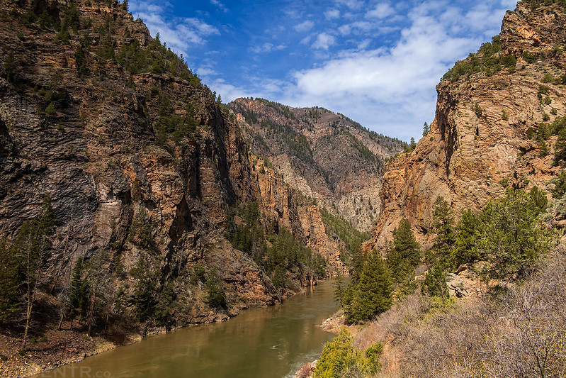
The trail ended at a steep and loose hillside that dropped down into the water.
Making my way across the bridge and back to the trailhead. I had hiked three new trails in the Curecanti National Recreation Area this morning and still made it home before noon!
