Sunday, August 1, 2021
This was one of those rare weekends when my plans just didn’t work out at all. I was originally planning to spend most of the weekend trying to hike around the strong monsoon weather in the San Juan Mountains around Silverton, but after leaving work on Friday afternoon and almost making it to Red Mountain Pass, I was stopped by a mudslide that wasn’t going to be cleaned up for a while. I ended up driving back to Ouray to figure out my next move, but with mudslides and road closures already common throughout the mountains and strong storms predicted for the rest of the weekend, I decided it was finally time for me to take a weekend off, so I headed back home.
Here’s a photo I took with my phone of the mudslide that had come down McIntyre Gulch and blocked the Million Dollar Highway near Red Mountain Pass. I know it doesn’t look bad in this photo, but further up the road the mud is at least three feet deep and very soft and soupy.
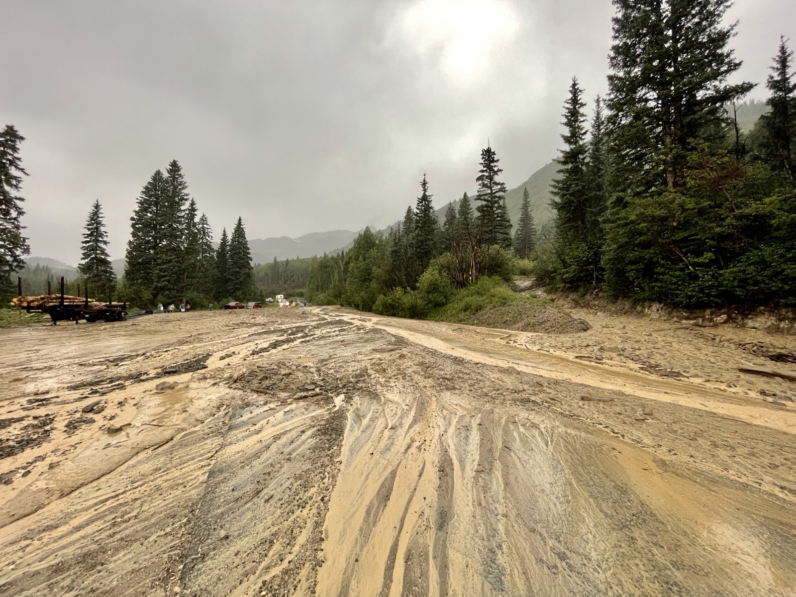
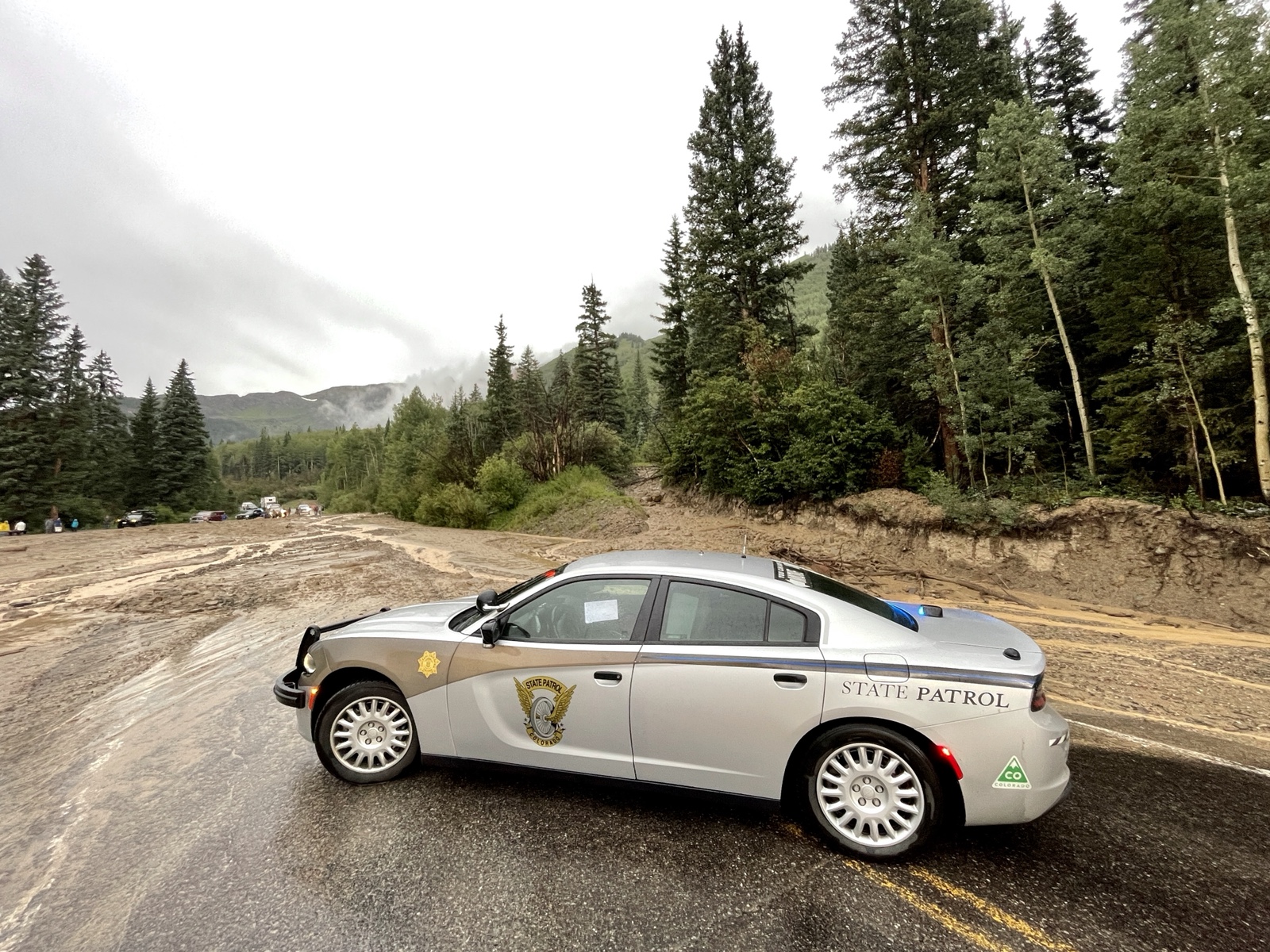
Just as another Jeep found a way through the mud around a trailer on the far left side, a State Trooper showed up and wouldn’t let anyone else go through. That was my cue to turn around and head back down, especially since CDOT said the road wouldn’t be reopening again until the morning.
Backbone of the Grand Mesa: Crag Crest
I guess I’m just not one to stick around the house all weekend, because after getting stuff done around the yard on Saturday morning and then taking a nap in the afternoon, I was ready to get back outdoors again! I decided I would head up onto the Grand Mesa later in the evening so I could hike the Crag Crest Trail first thing in the morning. Although I’ve hiked the top portion of the Crag Crest Trail a couple of times before, I had never hiked the complete loop, so I thought it was finally time to do that. After watching a movie with Diane I left home and made my way to the top of the Grand Mesa in the dark. I found a spot to spend the night not far from the trailhead and got into my sleeping bag around 10:00pm. It had rained on and off during the drive and was still raining lightly when I went to bed. I wasn’t exactly sure what the weather was going to in the morning, but I was close enough to home that if it wasn’t looking good it wouldn’t be a big deal to skip the hike and come back another time.
When I woke up before sunrise I found that the weather was looking good, so I drove over to the trailhead and started hiking so I could watch the sunrise along the way.

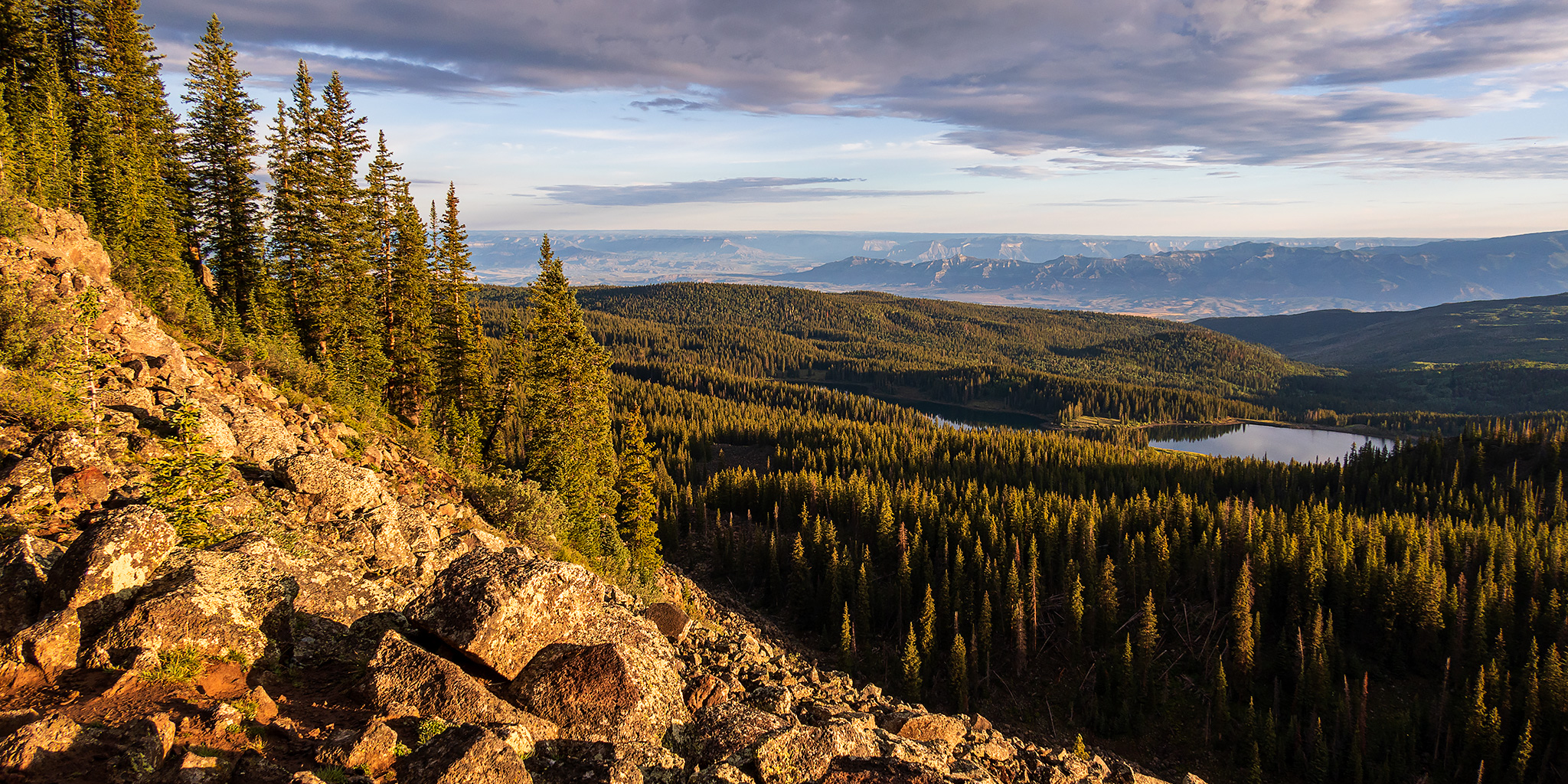
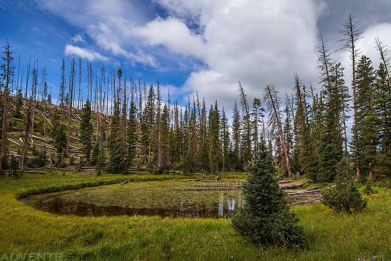
A nice view as I followed the trail up toward the crest.

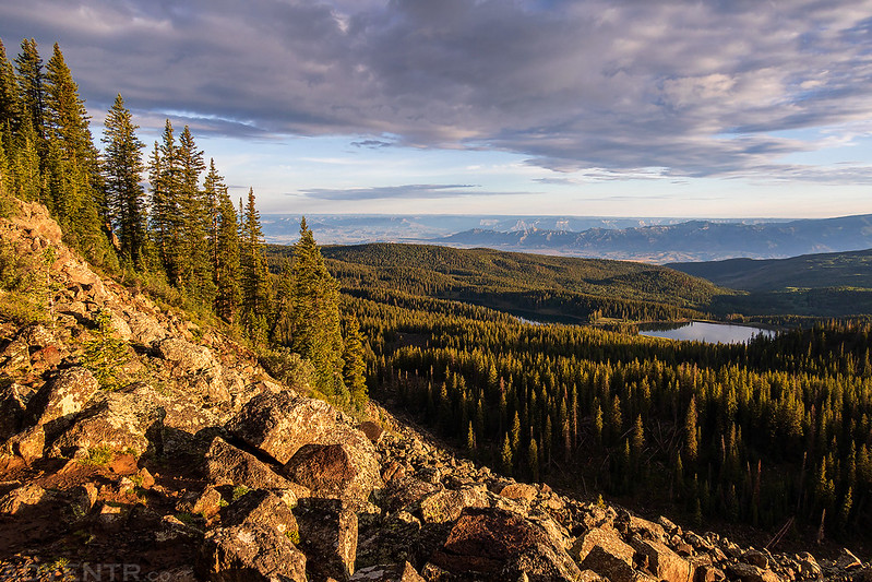
I followed a couple short side trails to overlooks along the edge. This one was the best!

Hiking toward the sun…

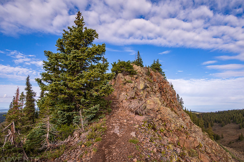
Just before reaching the narrow crest I walked over to the edge one more time.
Although the sun would be blocked by clouds to the east for much of my hike, sunlight did peek out a couple of times.


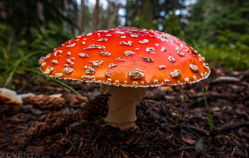
I passed quite a few mushrooms along the trail today.


Overlooking lakes scattered across the Grand Mesa to the Gunnison River Valley near Delta beyond.

Looking down to the west end of Butts Lake.

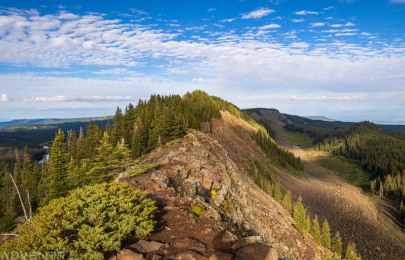
Walking along the narrow ridge is a lot of fun with great views all around.

From the crest I could see parts of the West Elks, Mount Sopris and even the tops of the La Sal Mountains, depending on which direction I was looking.
The Crag Crest Trail

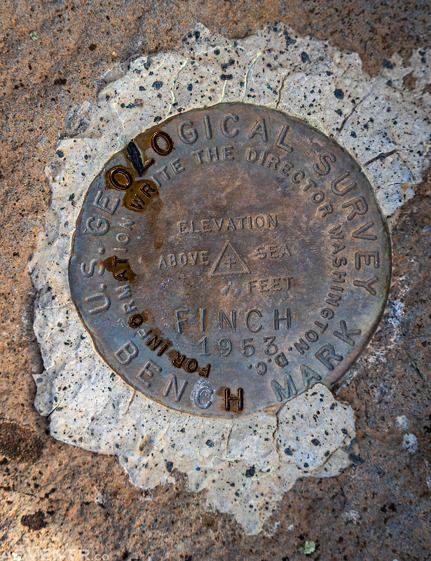
Before descending to the lower loop, I got off the trail and hiked over to the Finch Benchmark.

View from the Finch Benchmark summit.

Finch Benchmark
The dappled light across the rocky terrain was nice as I made my way back to the trail.

Another view of Butts Lake as I followed the trail off the ridge.

Soon I passed by Upper Eggleston Lake.

Just another of the many mushrooms I saw along the way.
I was surprised by how many ups and downs there were along the lower loop. There turned out to be a lot more elevation gain than I was expecting from this part of the trail!
The last two miles of the trail were pretty spectacular since much of the hillside was blanketed in wildflowers! The sky opened up and it started to lightly rain during this last part of the hike.

Trail through the wildflowers.

Soon I found myself back in the forest as I neared the end of the loop.

Returning to the trailhead at the end of the hike.

As I approached the trailhead I started to hear rumbles of thunder from the sky above. I had finished the hike just in time and had a great morning on the Grand Mesa!