Friday – Sunday, August 6-8, 2021
I spent most of Friday in Redstone, Colorado attending the GIS Colorado Summer Meeting at the Redstone Inn along the Crystal River, so I figured this would be the perfect opportunity for me to stick around the area for the rest of the weekend. I haven’t spent any time in the Elk Mountains since our visit to the Conundrum Hot Springs last summer so I was looking forward to hiking among these rugged peaks again, even if the smoke was predicted to be bad over the weekend. When the meeting ended in the early afternoon I hopped into my Jeep and headed over to area surrounding Marble so I could try to get in a short hike before sunset.
Raggeds Wilderness: Anthracite Pass & Marble Peak
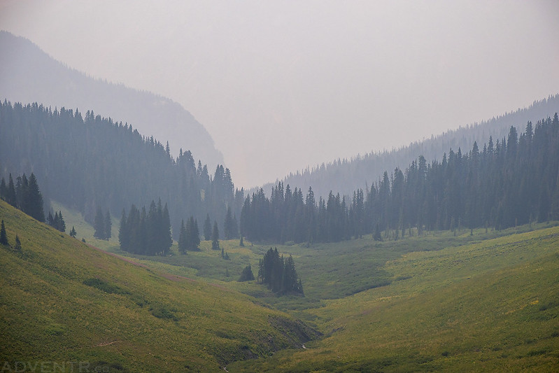
When I reached Marble I followed the road along Yule Creek almost all the way to the Yule Marble Quarry, but stopped just short at the Yule Creek Trailhead so I could hike up to Anthracite Pass and Marble Peak. Although there were clouds in the sky and it was a bit windy out, they didn’t appear very threatening at this time, so I carried on with the hike and kept an eye on the sky, but I wasn’t too worried since most of the hike would be in the trees.
The trail climbed steeply up the shoulder of The Raggeds and entered the Raggeds Wilderness.

The trees were thick through this area and the views were limited.

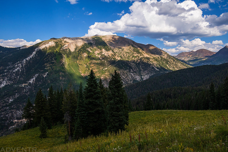
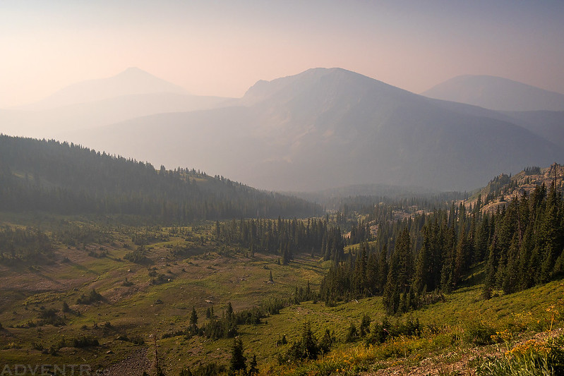
Once I finally started to get above most of the trees I had a good view across the Yule Creek Valley to Treasure Mountain.
Looking up the Yule Creek to Purple Mountain.

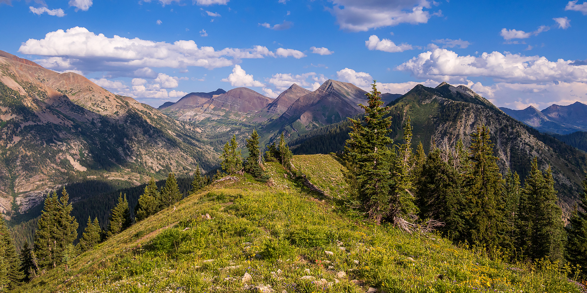
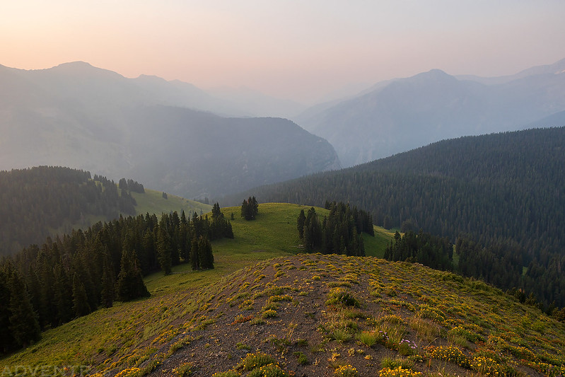
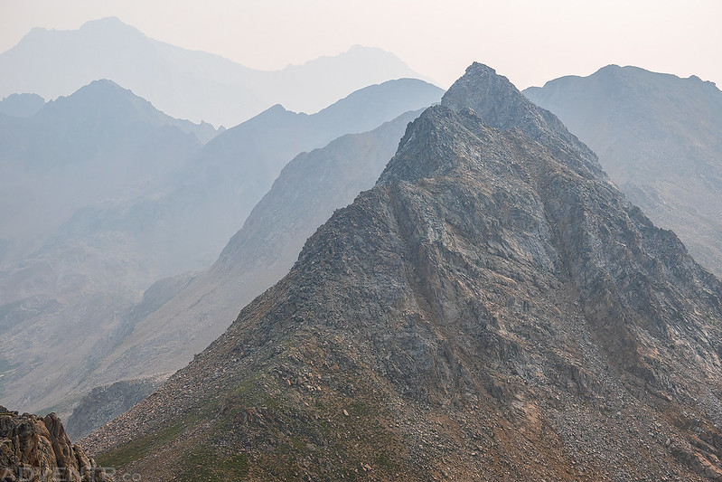
The scenery got even better as I followed the ridge to the summit.
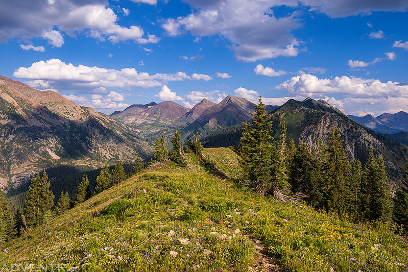

Here’s the view from the summit of Marble Peak. I knew this wasn’t going to be a long hike when I started, but I didn’t really pay attention to the elevation change and it ended up being about 2,300 feet of gain.

After taking in the view for a bit, I followed the ridge down the other side and caught up with the trail again. This is looking back at the summit of Marble Peak.

Overlooking North Anthracite Creek and Dark Canyon to the West Elks.

Looking the other direction past Whitehouse Mountain to Hagerman Peak and Snowmass Peak, which dominate the horizon.

Here’s a different view of East Beckwith Mountain than I am used to seeing, since I am usually passing by below on Kebler Pass Road.

Mount Owen and the Ruby Range

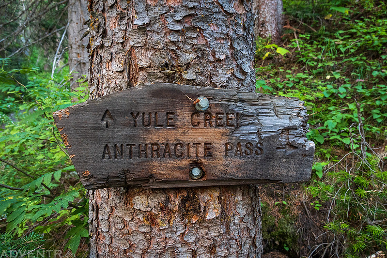
An old sign along the Yule Creek Trail that I passed on my way back down to the trailhead.
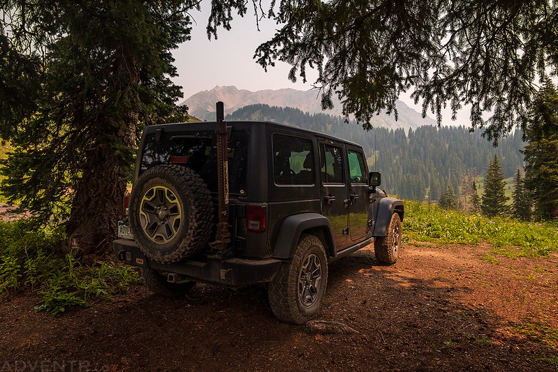
The hike back down was much quicker than the hike up and I was back at my Jeep in less than an hour. I still had some time before sunset and needed to find a campsite for the night, so I headed back through Marble and then took the Lead King Basin Loop Road and found a spot just below Arkansas Mountain, which was perfect since I planned to hike that peak first thing in the morning.
The reflection was looking nice as I drove past Beaver Lake.

Good looking clouds over the Crystal River as I followed the Lead King Basin Loop.

Silver Creek Pass: Arkansas Mountain & PT 12670
After a good night of sleep I woke up before sunrise and could immediately smell the smoke in the air, even though it was still too dark to see it. I had a quick breakfast, got ready and then started hiking up the south ridge of Arkansas Mountain before sunrise- right from my campsite.
As it started to get lighter out I could see how thick the smoke was this morning…

The only good thing about smoke in the air are the colorful sunrises and sunsets that come with it.

A smoky view over Crystal Canyon.

I watched as the sun started to come up over the spine of the Elk Mountains.

Looking back down the ridge I was hiking up.
The sun was a red and yellow disc in the sky this morning.

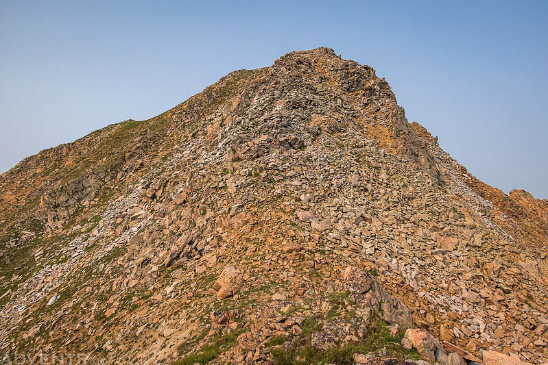
The hike up the ridge to the summit was an easy walk.

As I neared the top I had a good smoky view of Mount Daly to the northwest.

Here’s the view from the summit of Arkansas Mountain. My next destination would be that pass to the right of the pointed peak in the middle of the photo.

When I looked down the west ridge there were a couple deer just hanging out.

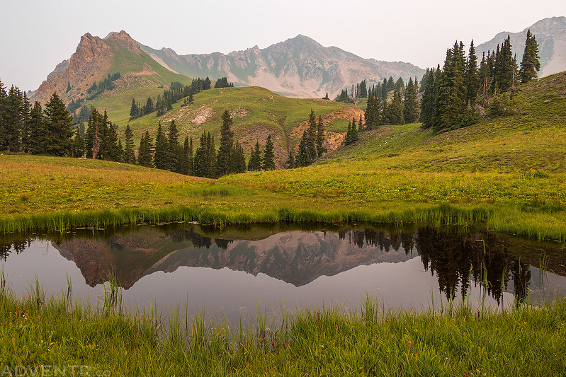
From the summit I descended down the north ridge and caught up with the Silver Creek Trail on the other side. I passed this small tarn on my way to the insignificant Silver Creek Pass and then continued on to the much higher East Fork Divide.
Looking up to the East Fork Divide as I followed the trail to the pass.

I passed this curious marmot along the way.

Looking back through the smoke to Arkansas Mountain.

The trail up to the pass was much better than I was expecting and a very pleasant hike. I was taking my time today since there were no chances for storms in the forecast.

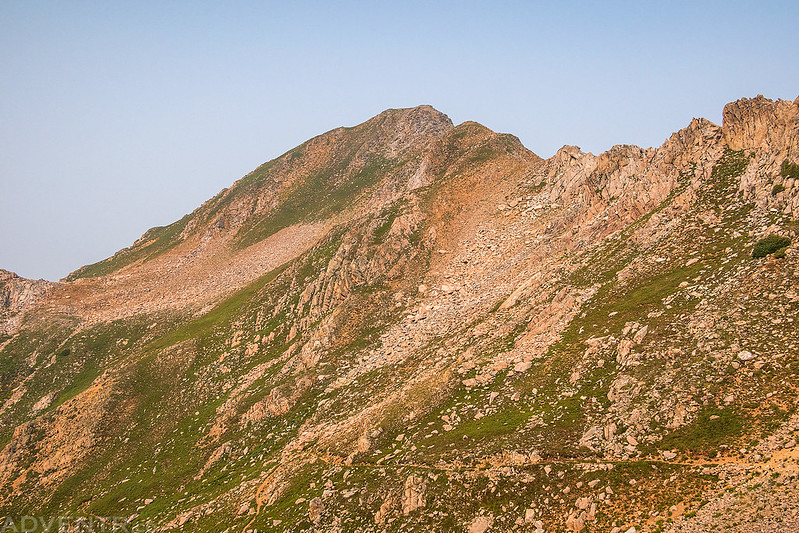
Here’s a look at PT 12670, which would be my next destination. I was hoping to get there by following the ridge from the pass, but I wasn’t sure if it would be too technical for me. It looked pretty rugged from below.
Almost to the pass…

Once I reached the pass the view to the north opened up and I could barely see Capitol Peak through the smoke, even though it was only 3.5 miles away. I’m sure this vantage point would offer amazing views of Capitol Peak in better conditions.

I did like the look of this rugged ridge- Mount Richey.

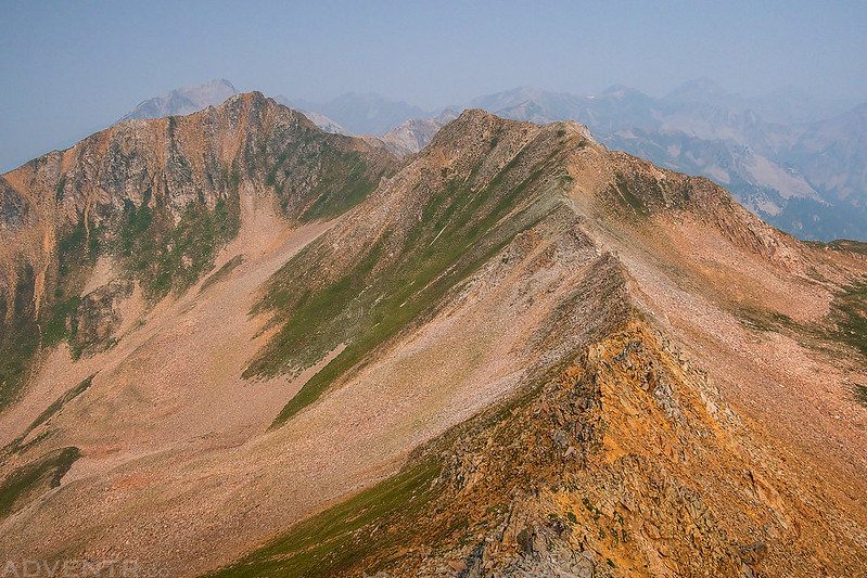
Once I started following the ridge towards the summit I realized it was going to be easier than I thought.

The Other Side
Looking east down the ridge to Meadow Mountain.

Smoky rugged peaks.
The final steep climb to the summit.
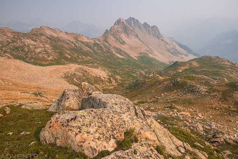
On the summit of PT 12670 and overlooking the East Fork Divide. Although this peak has no official name, it was a fun little scramble from the pass.

The Ridge Below
Mount Richey

Looking down the south ridge to Arkansas Mountain and Sheep Mountain.
Following the rocky ridge back down to the pass.

After returning to the pass I hiked down the Silver Creek Trail and followed it back to the trailhead.
Then I road-walked back to my Jeep.
I was originally planning to stick around the area and climb another peak or two on Sunday morning, but as I started driving to find my next campsite I encountered way too much traffic for these narrow and rough roads which made getting around frustrating and difficult since there were few places to pass. After having to back up one too many times for passing vehicles I decided to just leave the area completely and head over to Kebler Pass to find something else to hike on Sunday morning.
Elk Creek to Copley Lake & Evans Basin
After finally reaching Marble again, I left the area and drove up to McClure Pass for lunch and to figure out my next move. After looking over maps I decided that I would hike up through Elk Basin to Gunsight Pass and the summit of Mount Emmons, also known as the Red Lady. When I was done eating lunch I drove over to the Kebler Pass Road and made my way towards the trailhead near Crested Butte.
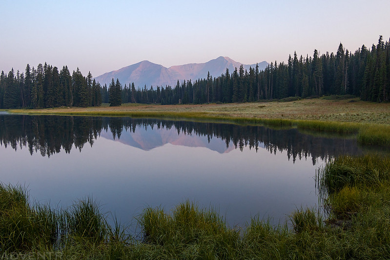
I found a spot to spend the night in Splains Gulch and watched the red disc of a sun move through the smoky sky before sunset.

As I started following the old mining road along Elk Creek early on Sunday morning, I was hopeful that the smoke wasn’t as bad today since I couldn’t smell it, but maybe I was just used to the smell by now…

Before heading up into Elk Basin, I made a short detour to visit Copley Lake.
A reflection of the Ruby Range in the calm waters of Copley Lake.

I took a short walk along the shore before heading back to Elk Creek.

Yep, it was still very smoky out today…
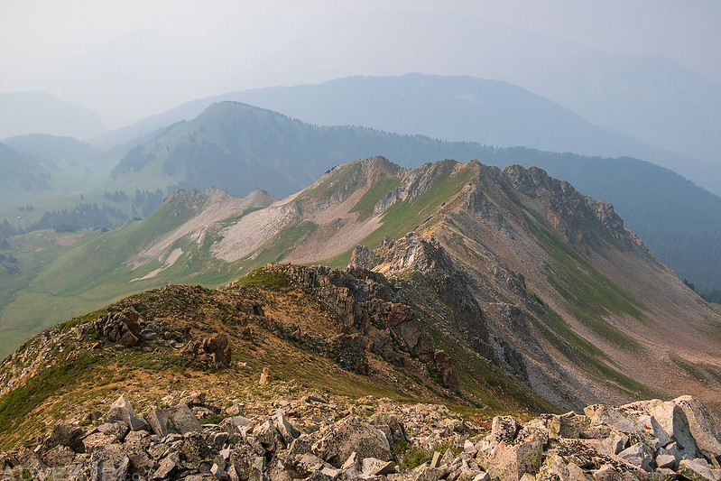
The Anthracite Range, including Ohio Peak, was barely visible through the thick smoke.

After leaving Elk Basin and crossing over into Evans Basin, I had a view of the rest of the trail leading up to Gunsight Pass and Mount Emmons.

A view over Evans Basin with Mount Axtell, Whetstone Mountain, and Carbon Peak hidden in the smoke.
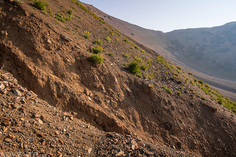
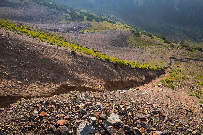
As I hiked up the old mining road I noticed that it was very washed out in a couple of places, so I wasn’t completely surprised when I came across this big washout that was over ten feet deep and stopped me in my tracks. I looked for a safe way to get across, but could not find one, so this would be my turnaround point for the day.
Looking down the deep drainage chute that stopped me. I guess I will have to hike up to Gunsight Pass from the other side another time.
Evans Basin

Following the old road back down.

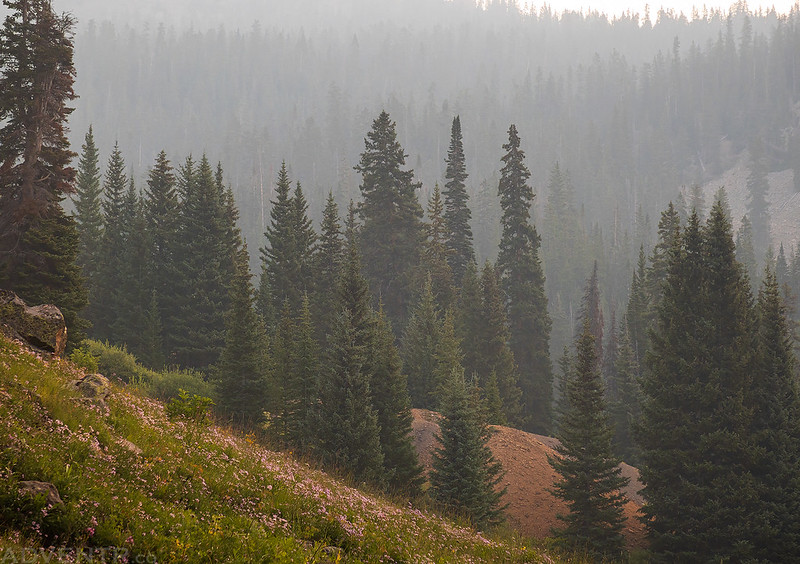
Smoky Trees

Hiking back down along Elk Creek. When I reached my Jeep I started the drive back home.

Some nice images despite the smoke. Always good to dial things back a bit when solo!