Upper Cascade Falls & Baldy Peak
Saturday & Sunday, June 21-22, 2014
This weekend for the summer solstice, Diane and I headed down to Ouray to get in a little hiking in the San Juan Mountains. Since there’s still a lot of snow up high and it would be our first time really hiking in the mountains this year, we decided to start with some lower elevation hikes close to town between 8,000 and 10,000 feet. When we arrived, we setup camp just above town in the Amphitheater Campground and then got started on our first hike up to the Upper Cascade Creek Falls and Chief Ouray Mine. The hike started out easy, but soon it quickly climbed over 1,000 feet up a series of switchbacks. First we reached the Upper Cascade Falls and took a few photos and then we crossed the creek and continued on to the remains of the Chief Ouray Mine located high above town.
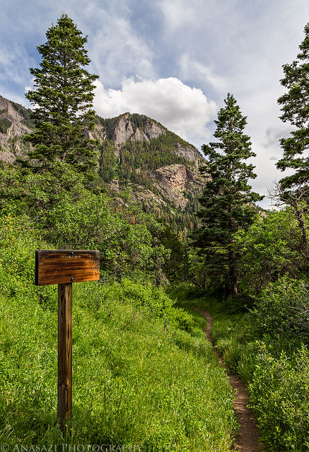
Near the beginning of the trail shortly after leaving the Amphitheater Campground.
Upper Cascade Falls 213 by IntrepidXJ, on Flickr
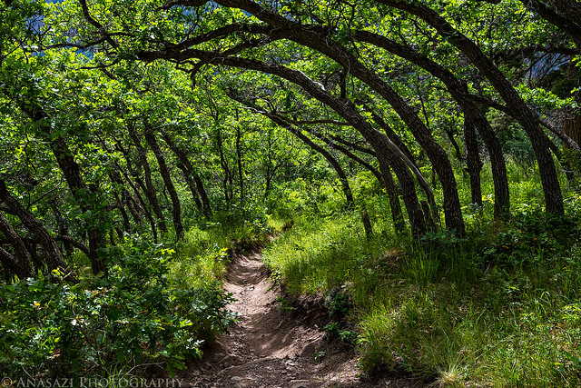
Hiking under a canopy of curved trees.
Trail Arch by IntrepidXJ, on Flickr
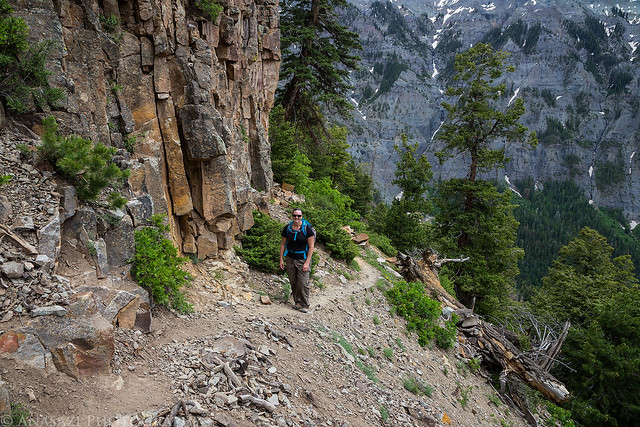
Diane on an upper section of the trail after climbing up many steep switchbacks.
Upper Trail by IntrepidXJ, on Flickr
First view of the falls from the trail.
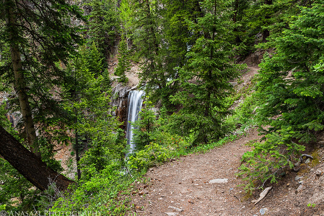
Trail to the Falls by IntrepidXJ, on Flickr
The rocky waterfall above the crossing of Cascade Creek.
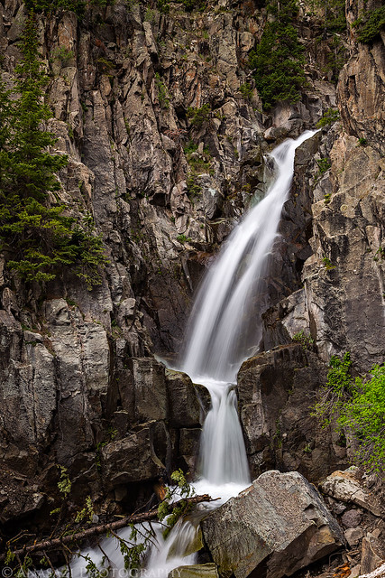
Rocky Waterfall by IntrepidXJ, on Flickr
The taller waterfall below the trail.
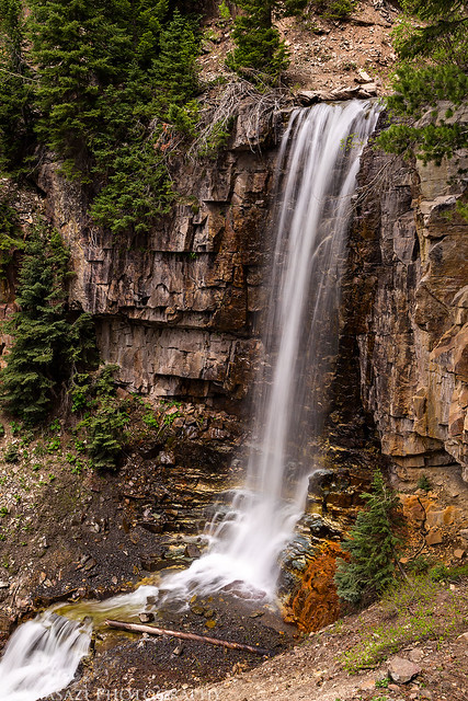
Upper Cascade Falls by IntrepidXJ, on Flickr

Cascade Creek Waterfall by IntrepidXJ, on Flickr
Looking over the top.
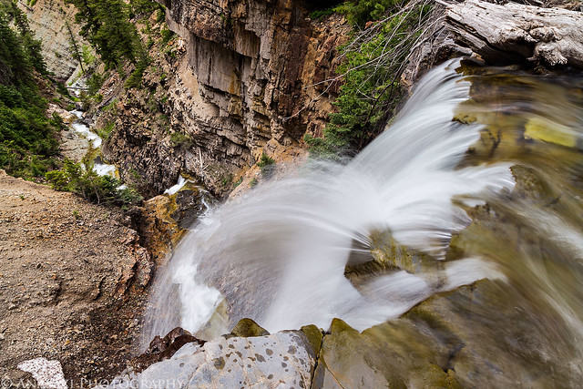
Cascade Creek by IntrepidXJ, on Flickr
After crossing the creek, we continued on to the Chief Ouray Mine. The trail went through this building and continued on the other side. Unfortunately, many people have felt the need to leave their name behind…
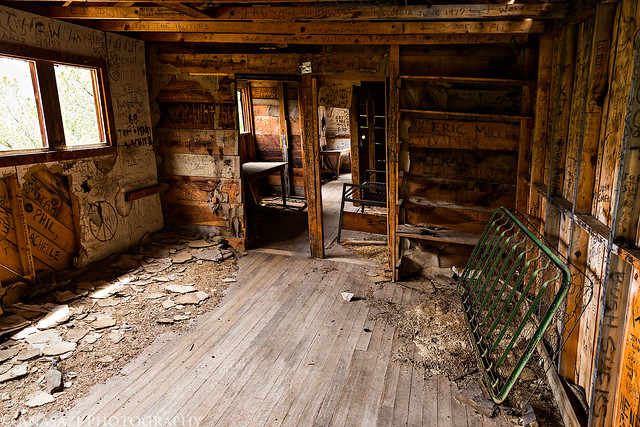
Inside by IntrepidXJ, on Flickr
A view over the second building we came across, looking down over Ouray.
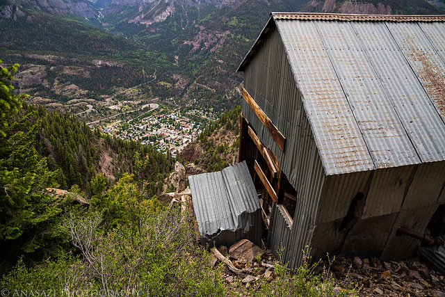
Above Ouray by IntrepidXJ, on Flickr
There was some old mining machinery inside.
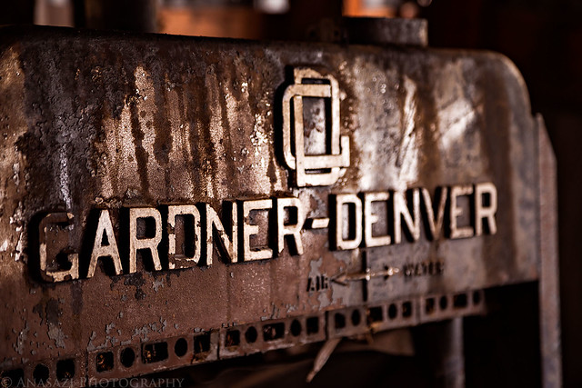
Gardner – Denver by IntrepidXJ, on Flickr
Looking out the window of the first building on our way back.
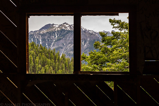
Out the Window by IntrepidXJ, on Flickr
A view up the Uncompahgre Gorge towards the Red Mountains as we hiked back down.
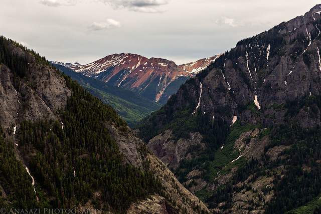
Uncompahgre Gorge by IntrepidXJ, on Flickr
After finishing the hike we stopped in town for dinner at the Ouray Brewery and then took a drive up to Owl Creek Pass for sunset.
Mount Abrams over Ouray as we left town and drove to the start of Owl Creek Pass near Ridgway.
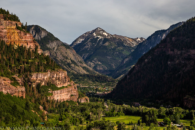
Ouray by IntrepidXJ, on Flickr
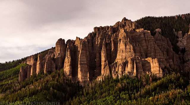
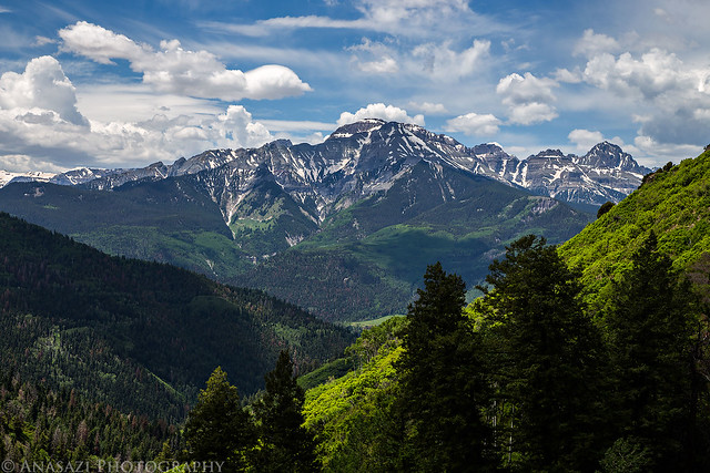
Cimarron Ridge in the summer. Much different than the view I had last fall!
Summer View by IntrepidXJ, on Flickr
Cimarron Ridge by IntrepidXJ, on Flickr
This guy was really interested in us when we spotted him near Owl Creek Pass.
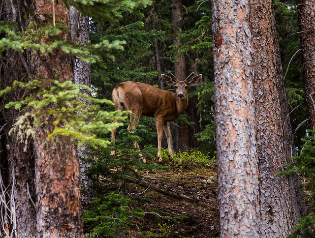
Interested by IntrepidXJ, on Flickr
Nice evening light on the ridges above.
Evening Ridge by IntrepidXJ, on Flickr
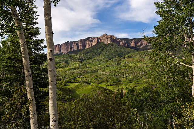
Chimney Rock and Courthouse Mountain shortly before sunset.
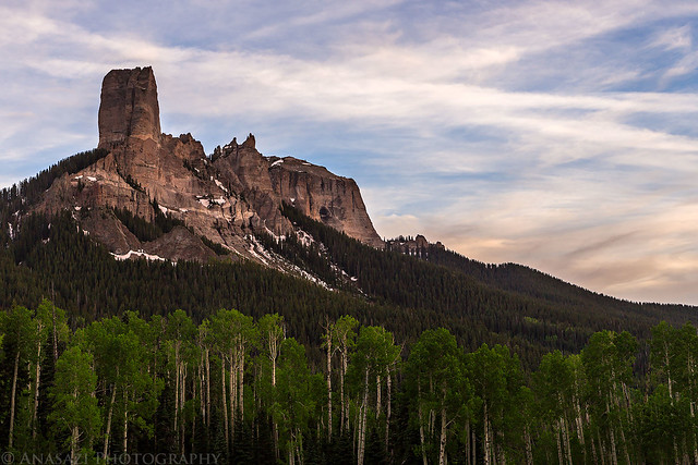
Chimney Rock by IntrepidXJ, on Flickr
Beautiful color to the west as we drove back down from the pass.
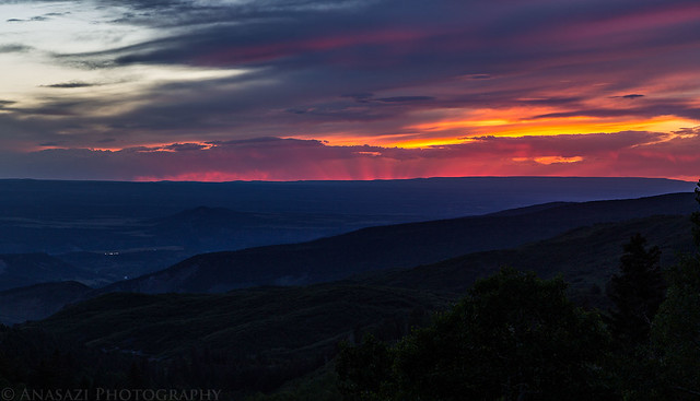
Pink Rays by IntrepidXJ, on Flickr
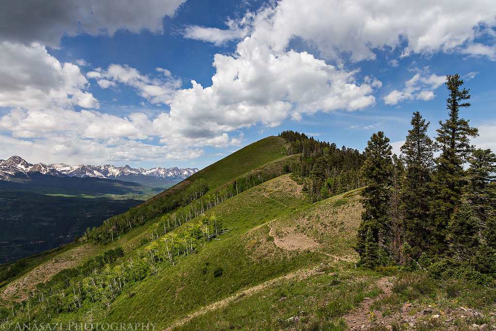
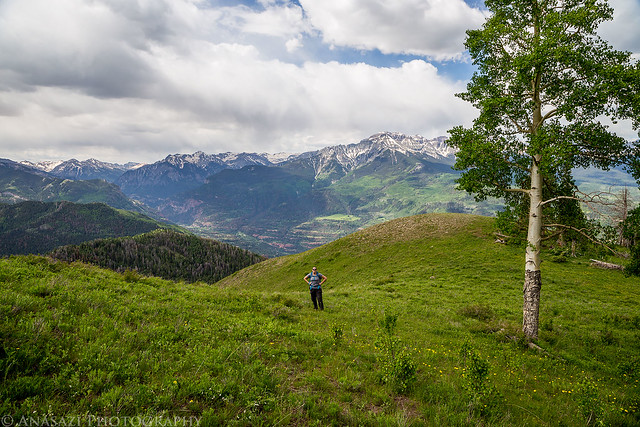
On Sunday morning we woke up early, packed up camp and then started our hike up Baldy Peak. Even though this peak is only just over 10,000 feet, there were plenty of great views of the surrounding mountains from this trail once we got out of the trees. After reaching the summit we hiked back across the ridge and took the Storm Gulch trail back down creating a nice loop. We didn’t see anyone else all day on the trail and the solitude was very nice. It turned out to be a great lower elevation mountain hike.
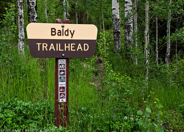
Baldy Trailhead by IntrepidXJ, on Flickr
There were plenty of wildflowers starting to bloom at these elevations.
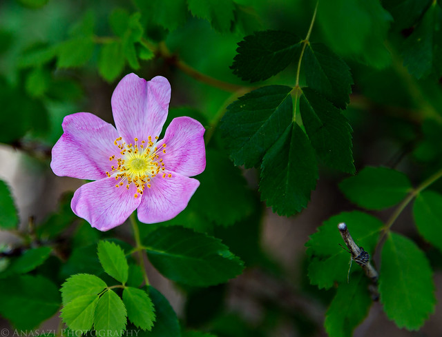
Woods Rose by IntrepidXJ, on Flickr
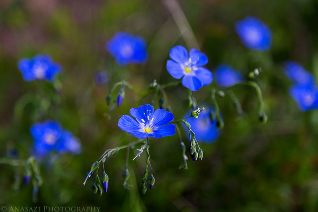
Wildflowers by IntrepidXJ, on Flickr
Sun rays filtering through the clouds over the ridge.
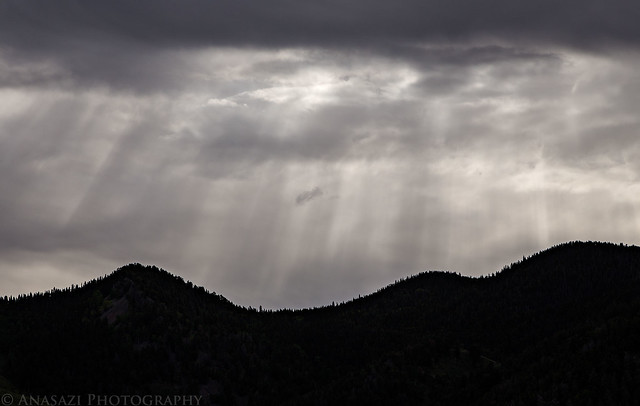
Rays by IntrepidXJ, on Flickr
Light on the mountainside.
Ridge Light by IntrepidXJ, on Flickr
Following the trail to the ridge above. Great views all around!
Baldy Trail by IntrepidXJ, on Flickr
As I was hiking along the trail this female Dusky Grouse got startled and almost flew right into me. Then it walked in a complete circle around both of us and flew up onto this branch. I took this quick photo and then moved on so we wouldn’t agitate it further.
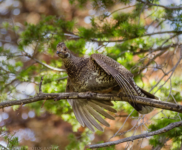
Female Dusky Grouse by IntrepidXJ, on Flickr
A view of Baldy Peak as we traversed the ridge to the summit.

Baldy Peak by IntrepidXJ, on Flickr
Diane on the final stretch to the summit.
Final Climb by IntrepidXJ, on Flickr
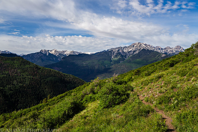
Great view from the top towards the Sneffels Range.
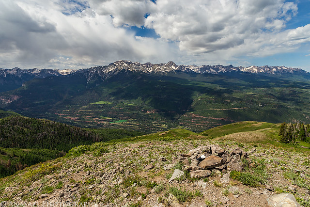
Summit by IntrepidXJ, on Flickr
USGS benchmark at 10,603 feet
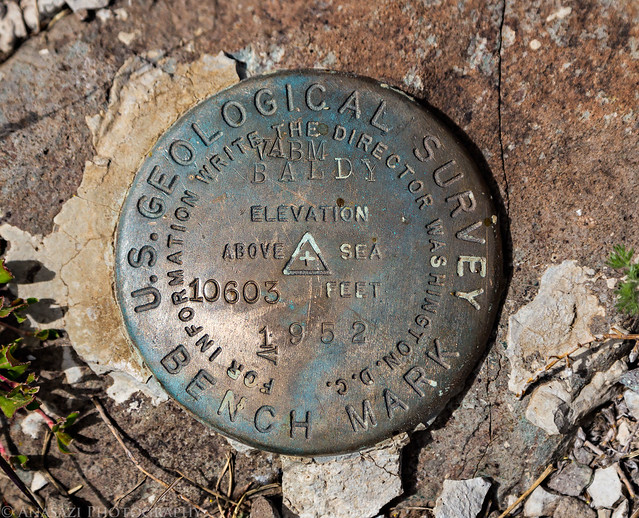
Baldy 10,603 by IntrepidXJ, on Flickr
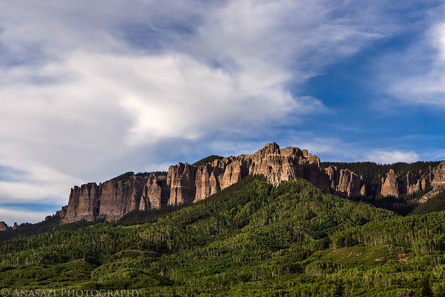
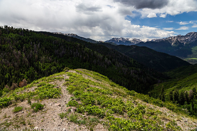
Looking the other direction with another view of Chimney Rock and Courthouse Mountain as we started the descent from the top.
Baldy Ridge by IntrepidXJ, on Flickr
There were some nice clouds above Mount Sneffels and the rest of the Sneffels Range.
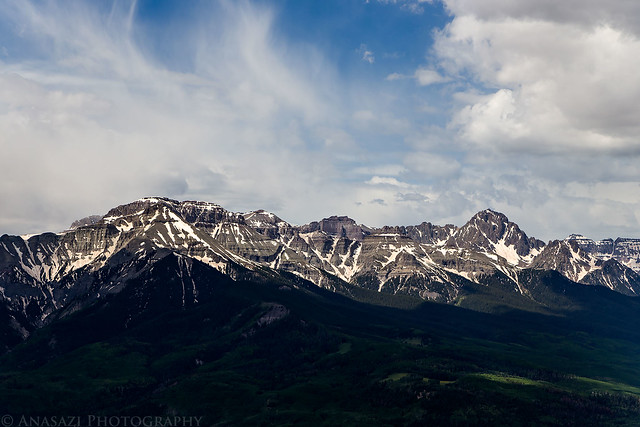
Sneffels Range by IntrepidXJ, on Flickr
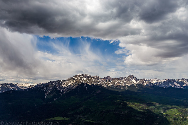
Sneffels Clouds by IntrepidXJ, on Flickr
A lot of dandelions along the ridge as we hiked around to Storm Gulch.
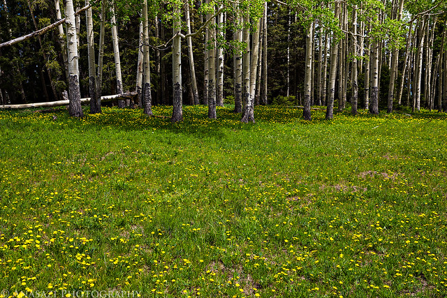
Dandelions by IntrepidXJ, on Flickr
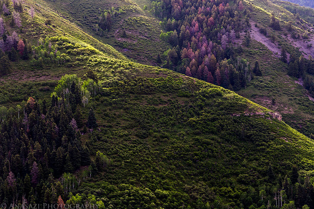
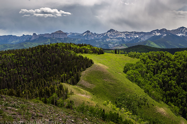
While the initial trail down Storm Gulch was in the trees without much of a view, the trail did eventually break free of the trees for some nice views across the valley.
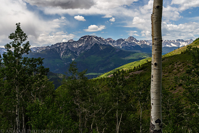
Descending View by IntrepidXJ, on Flickr
Storm Gulch Trail by IntrepidXJ, on Flickr
Whitehouse Mountain by IntrepidXJ, on Flickr
According to my GPS, the loop ended up being around 7 miles in length with over 3,000 feet of elevation gain. We made a quick stop at Mouses in Ouray for a Mocha Shake and then headed back home. We had a nice weekend in the mountains and I’m looking forward to many more this summer!