Press "Enter" to skip to content

Tag: lightning

High Mesas and Plateaus of Western Colorado

Flat Top Mountain, Blair Mountain and the Roan Plateau
Friday – Sunday, June 24-26, 2022

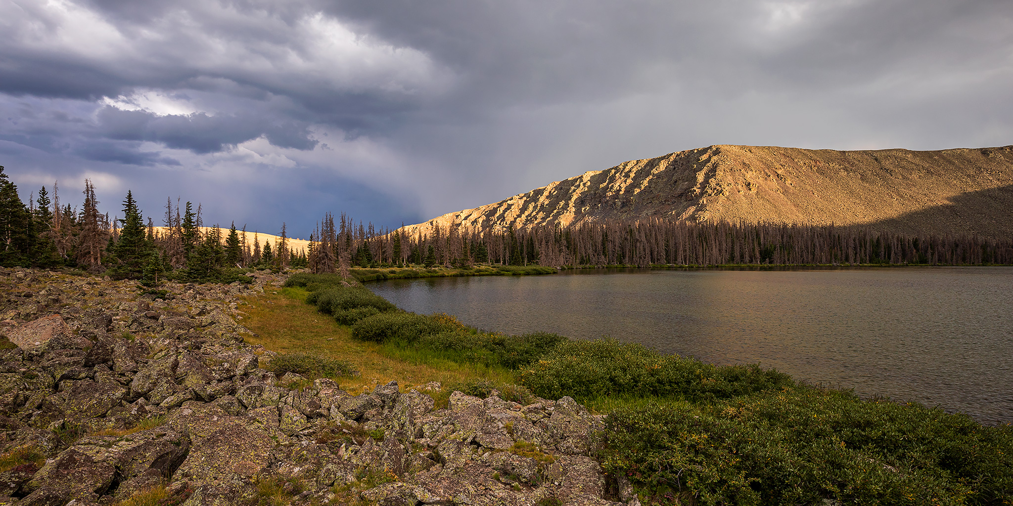
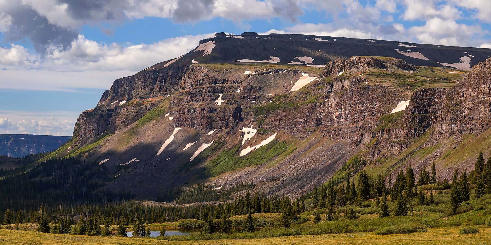
This weekend I planned to spend my time hiking and driving to a couple highpoints of the high mesas and plateaus of Western Colorado, starting with a hike I’ve been looking forward to for a while into the Flat Tops Wilderness on Saturday morning. I left after work on Friday afternoon, grabbed a quick dinner in Glenwood Springs and then followed the Colorado River to Dotsero and McCoy and then took Highway 131 north to Yampa. There were storms in the area this afternoon and I was a little worried that Glenwood Canyon might get closed by Flash Flood Warnings, which has been common lately, but thankfully that did not happen. Once I reached Yampa I started following the Bear River on my way to the Stillwater Reservoir, and turned off to take a side road up to Gardner Park to find a spot to camp for the night. I watched the sunset from the edge of the Gardner Park Reservoir and then went to bed early so I could get an early start on Saturday.

Leave a Comment

The Crest of the Henry Mountains: Mount Ellen

Henry Mountains Peak Bagging | Friday – Sunday, June 17-19, 2022

After spending the last two weekends on the river, it was time for me to start off my summer season up in the mountains since it’s been getting pretty warm down in the desert. For the past couple of years I have started my mountain season in the La Sal Mountains, but this time I decided to change things up and spend the weekend in the Henry Mountains instead since I haven’t spent any real time in that range for quite some time and I’ve been wanting to get back. This time I invited my friend Jared along, and even though I warned him I would probably be hiking very slow this weekend since I haven’t done much real hiking lately- especially at elevation, he still wanted to come along, so we planned to meet at Wickiup Pass after work on Friday evening.

3 Comments

Southern Sawatch Saweekend

Friday – Sunday, September 10-12, 2021

This weekend was going to be the last opportunity for me to hike a 14er this summer, and since I have climbed at least one 14er each summer since 2010 I was originally planning to. However, as I started figuring out my weekend plans I just wasn’t feeling like hiking on a busy trail and was looking for a little more solitude, so I decided to skip the 14ers this year and headed to the southern Sawatch Range to hike a few peaks along the Continental Divide instead. I left from work on Friday afternoon and headed to Gunnison, taking the route through Hotchkiss and Crawford since Highway 50 is still closed until 5:30pm on weekdays and I wasn’t sure how quickly I would get to that point. I topped off my fuel tank in Gunnison and then made my way over to Pitkin and started up the road to Hancock Pass. Unfortunately, the road near the top of the pass was much rougher than I remember it being and I wasn’t comfortable driving a section of it in the dark, so I returned all the way back to Highway 50 and drove over Monarch Pass to the Middle Fork of the South Arkansas River and found a place to spend the night shortly before the end of that road. It was pretty late by the time I arrived, so I went right to bed.

Leave a Comment

Carved from Calf Creek Plateau: Powderhorn Lakes

An Introduction to the Powderhorn Wilderness & Cannibal Point
Saturday & Sunday, August 14-15, 2021

On Friday Diane finished another semester of school and finally had a full week off before she starts back up again. We had made plans to spend a couple of days in the Wind Rivers later in the week, but since she hasn’t been able to get out hiking much lately we thought it would be a good idea to get out on a quick overnight backpacking trip this weekend. As I looked over my maps of the San Juan Mountains for an easier overnight trip that wouldn’t be too far away from home, I thought it would be interesting to finally check out the Powderhorn Wilderness near Lake City with a hike up to the Powderhorn Lakes. The Powderhorn Wilderness is jointly managed by the BLM and the Gunnison National Forest and contains two huge plateaus over 12,000ft that make up the largest relatively flat expanse of alpine tundra in the lower 48 states, and I hoped to hike to the highpoint of the Calf Creek Plateau while we were up there. I also figured this area wouldn’t be very busy since it’s not a popular spot with the kind of high rugged peaks that seem to attract people.

4 Comments

Spencer Basin to Sugarloaf

Friday & Saturday, July 23-24, 2021

This weekend I needed to stay closer to home since Diane and I had another concert to go to on Saturday night and I wanted to be home early enough in the afternoon so I could rest for a little bit first. I was originally trying to find an easier summit close to Ouray since I was a little worried about all the mudslides we’ve been having in the mountains lately, and I really didn’t want to get stuck anywhere and miss out on the concert, but in the end I decided to head over Red Mountain Pass to Silverton so I could hike to the summit of Sugarloaf from Spencer Basin. Here’s a fun fact: There are at least 28 different Sugarloafs in Colorado (including peaks, mountains, rocks, etc…), but the one located above Spencer Basin along the edge of the Weminuche Wilderness is the highest one in the state at 12,754 feet.

1 Comment