An Introduction to the Powderhorn Wilderness & Cannibal Point
Saturday & Sunday, August 14-15, 2021
On Friday Diane finished another semester of school and finally had a full week off before she starts back up again. We had made plans to spend a couple of days in the Wind Rivers later in the week, but since she hasn’t been able to get out hiking much lately we thought it would be a good idea to get out on a quick overnight backpacking trip this weekend. As I looked over my maps of the San Juan Mountains for an easier overnight trip that wouldn’t be too far away from home, I thought it would be interesting to finally check out the Powderhorn Wilderness near Lake City with a hike up to the Powderhorn Lakes. The Powderhorn Wilderness is jointly managed by the BLM and the Gunnison National Forest and contains two huge plateaus over 12,000ft that make up the largest relatively flat expanse of alpine tundra in the lower 48 states, and I hoped to hike to the highpoint of the Calf Creek Plateau while we were up there. I also figured this area wouldn’t be very busy since it’s not a popular spot with the kind of high rugged peaks that seem to attract people.
We left home early on Saturday morning and made our way over to the Powderhorn Lakes Trailhead at the end of the Indian Creek Road. We made sure we had everything we needed in our packs and were on the trail by 10:00am. Thankfully, there was much less smoke in the air today than there has been around the area lately.
Diane was happy to forget about school this weekend and was ready to start hiking up the Powderhorn Lakes Trail.

Hiking around the lower lake as we made our way to the larger upper lake.

We found a nice campsite not far from the outlet of the upper lake and got our tent setup.

After resting in camp for a little bit I got started on my climb to the top of the Calf Creek Plateau. As I neared the top I got my first views of the La Garita Mountains to the southeast.
There was a steep grassy slope that made hiking to the top of the plateau easy enough.

Looking down the West Fork of Powderhorn Creek.
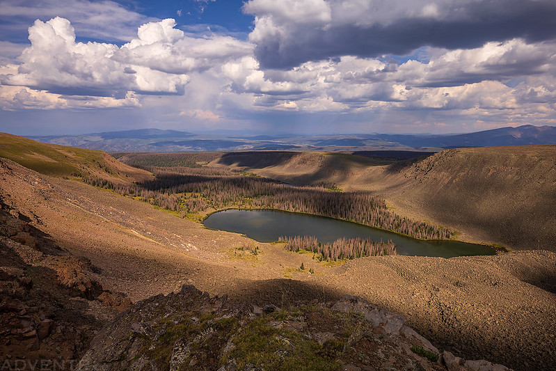
Here’s a view over Upper Powderhorn Lake with Stewart Peak and San Luis Peak on the horizon.

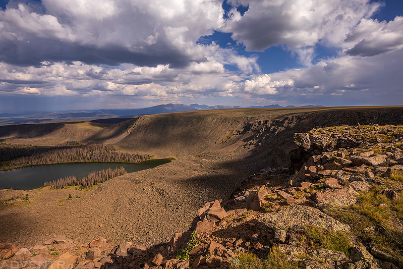
I kept close to the edge as I walked around this huge glacial-chiseled cirque beneath the eastern edge of the Calf Creek Plateau.

Following The Edge

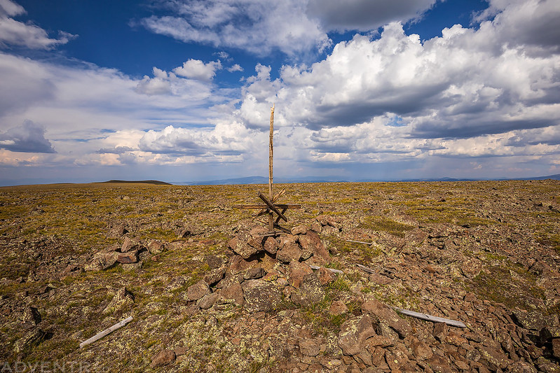
Once on top of the plateau the hike was relatively flat as I made my way to the highest point, which is labeled Cannibal Benchmark on the map. I find it strange that the Cannibal Benchmark is located on the Calf Creek Plateau instead of on the Cannibal Plateau which is the large plateau located to the southwest of here?
To the west I could see Uncompahgre Peak– the giant of the San Juan Mountains.

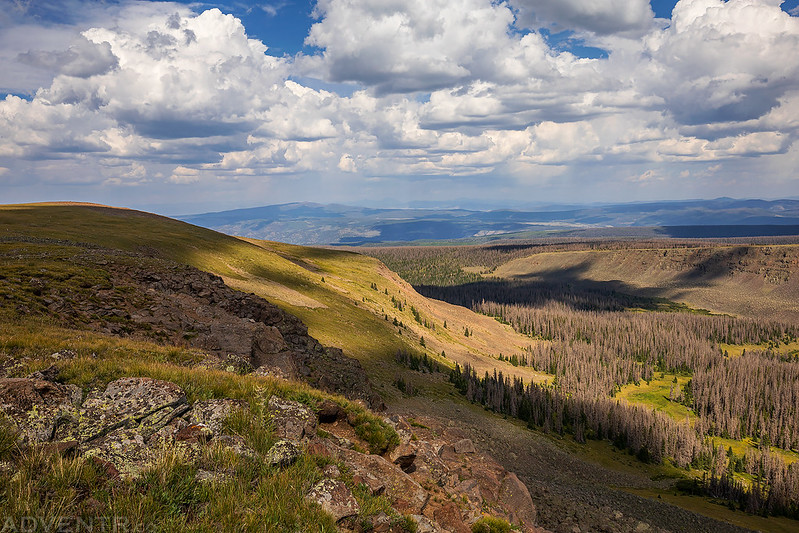
Headed back across the Calf Creek Plateau. Even though the top of the plateau was pretty flat, the hiking wasn’t always easy because of all the rocks and boulders along the way.

I returned to the edge of the cirque to take a few more photos of the Powderhorn Lakes on my way back.
Following The Ridge Back

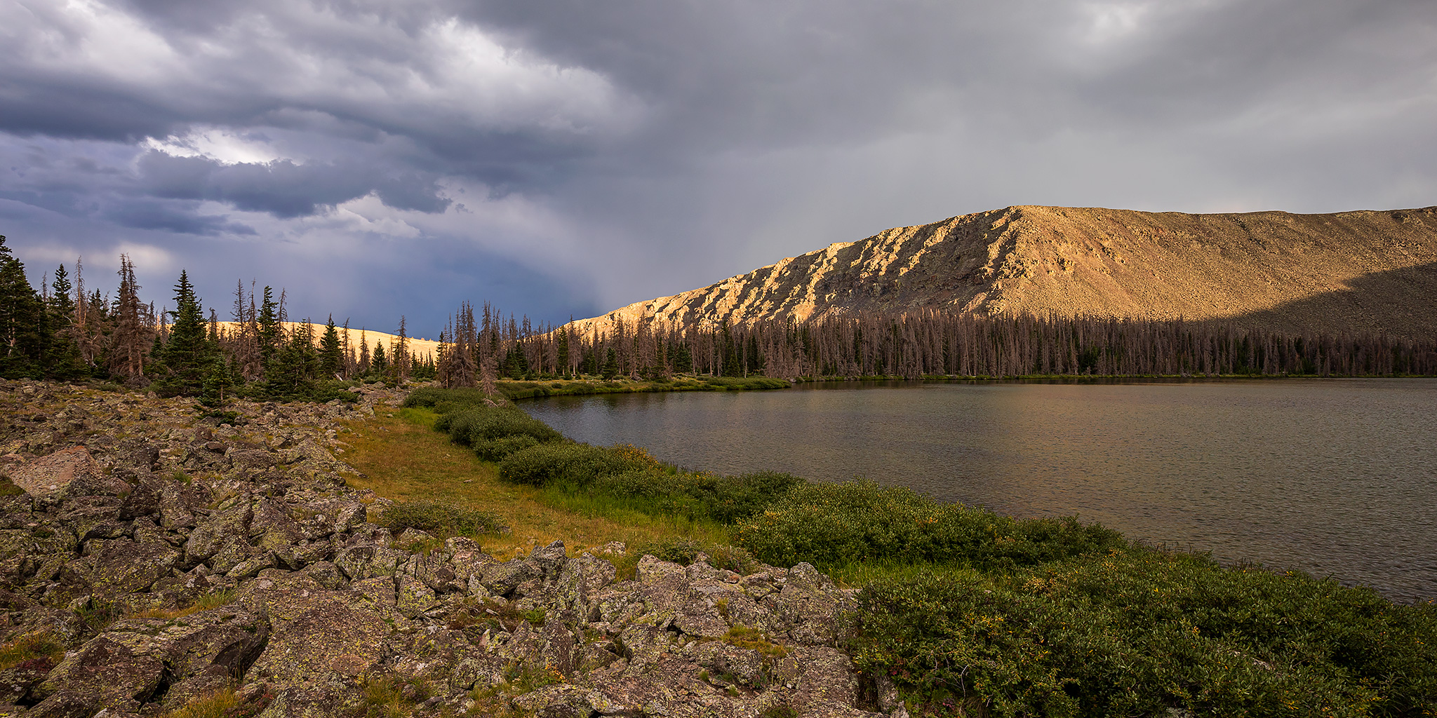
Powderhorn Lakes & La Garita Mountains

Storm clouds started moving into the area shortly after I returned to camp. We had our dinner and then I spent the rest of the evening relaxing and taking photos along the shore. There were a few distant rumbles of thunder and some light rain and even a little graupel.
Dark Clouds Reflected

Powderhorn Lakeshore

An Evening at the Powderhorn Lakes

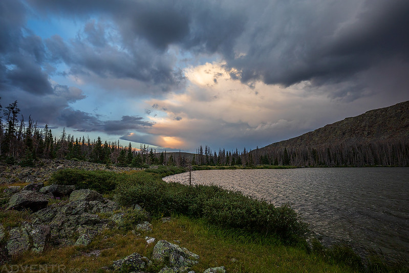
For a brief few moments there was a little color in the sky, but it didn’t stick around for long.

As soon as it started getting dark out I thought the storms were going to be over for the night, but unfortunately they were just beginning! There was a lot of lightning and thunder to the north of us that I thought was going to stay that way and pass us, but as we tried to get to sleep the storm got closer and closer. Pretty soon it was right on top of us and lasted for about an hour and a half. There were some very close lightning strikes with instantaneous thunder, and I’m assuming they stuck the ridge or the top of the plateau above us, but I didn’t get out of our tent to find out. I’m not going to lie, it was probably the scariest experience I have had camping in the wilderness. I am usually pretty good at planning trips around the weather forecast to avoid these situations, but in this case the forecast was completely wrong. Once the storm had finally passed we were able to get to sleep while it rained on and off for the rest of the night.
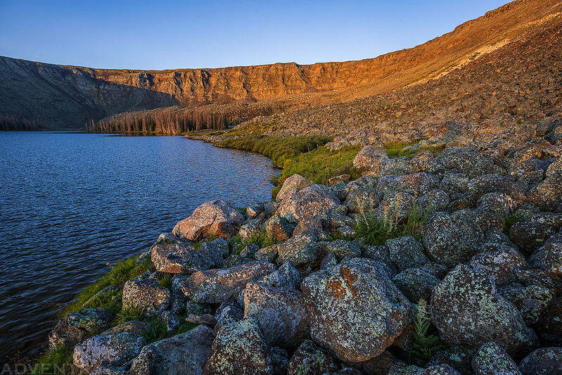
Our campsite on Sunday morning after the storm. Thankfully, none of the nearby lightning strikes ignited the mostly dead forest of trees around the lakes that we were camped in.

Rocky Shore Morning
Once the sun was up, we packed up camp and started hiking back down to the trailhead.

We passed by the Lower Powderhorn Lake again.

I also stopped for a quick photo of Hidden Lake along the trail.

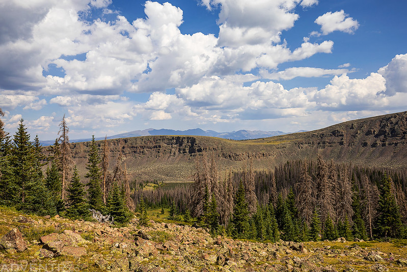
Most of the trail is in the trees, but there is one large meadow crossing that offers some open views.
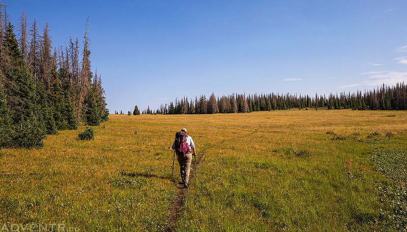
I hiked up to the top of the meadow for a view over the edge.

Leaving the Powderhorn Wilderness and heading back home.

Hi Randy, I have been an avid reader of your writing about your hiking in the South West. I find it fascinating, adventures and most beautiful! You seek places that are avoided by others and thus bring true adventure and show true love and appreciation of nature the way it was met to be appreciated. You find beautiful and wild places by studying maps and avoid the “must see” places that have been destroyed and stripped of their wilderness by tourist crowds who only care about a “selfie”. I truly admire your style of travel your true love of the wilderness. After six decades of hiking and wondering around the world I can tell a lot about your hiking style just looking at your vehicle. I envy your energy and stamina, knowing those days are long gone for me. Although I dream every day of visiting those far of places that are void of crowds that have no clue of what nature and the wilderness have to offer to a human sole. I only have one objection to your love of solitude and adventure. By mentioning the names of the places you explore you invite the mindless crowds to follow your footsteps thus ruining those secret places for those who seek the same beauty and solitude that you (and I) do. A big part of the adventure is the process of finding it and NOT it being handed to you. I realize the insatiable desire to share what ones loves; however the consequences are devastating. Just look at our Nation Parks and what happened to them. You should have seen them when I did in the late fifties and early sixties! Unrecognizable now and ruined for eternity! Oh, I still hike and backpack in my old age but it’s not the same, I was once (in the 50-80″s) like you, but now I’m so jealous of you. Hope you never stop seeking the challenges and wild beauty of mother nature and avoid the crowds at all cost.
Thank you for bringing me such pleasures.
Another great story! We had a similar experience with the lightning a few years ago when we happened to be camped at Point Sublime on the North Rim of the Grand Canyon. Like you, it was one of the scariest experiences I’ve had out there; it’s the unpredictability and complete lack of control, I think.
I much prefer times like this, when we can see the lightning, but it’s a little further away (and still dramatic!)
Keep exploring.
Boris – I understand your point of view (it’s been mentioned to me a time or two as well), and I hope to set you a bit at ease with a bit of the thinking I’ve done on the topic. From my interactions with Randy, I think he largely shares these same points of view – and that they are actually quite similar to yours.
At least in the USA (the only place I’m really familiar with exploring), more and more people are getting out. Often times, as you note, it’s for that “selfie” that they can put up on their favorite social media site.
The thing is, the vast majority of those folks – something over 99% I would suppose – are what I would call “lazy.” That is, they want to know exactly where to go (as in GPS coordinates) and they’d like to get there via car.
Randy does a great job of striking a balance between sharing where he’s been, while making it non-obvious how to get there (without some significant pre-work with a map), and obvious that it takes a lot of work to achieve the locations (because any amount of hiking discourages most). Additionally, I know – first hand – that he doesn’t share – in any way that allows others to find – some of the “more special” places he’s visited, the thrill of discovering/stumbling upon them more valuable than knowing where to go from the outset.
At any rate, I hope that’s something that you can see in his stories, and that can set you at ease a bit.
Adventure safe! Dan
I was introduced to the Powderhorn Wilderness Area over 50 years ago by my dad. My son and I are backpacking there again this weekend. I plan to camp in the same spots I did years ago. Pretty sure no-one has camped there since. Beetle kill is devastating but the new forest floor is spectacular. The trail we use is tougher each year because it is mostly unmanaged and the deadfall creates detours and the low traffic makes the trail sometimes hard to find and follow.
We have been at the PWA many times and hiked in from each of the trailheads. It is a special place that has a strong history in my family. We go there for the fishing, nature and the solitude. I have taken steps on the plateau I am certain no man has walked before. The place is rugged and challenging. But we find ourselves always eager to return.
Thanks Randy for the photos. You only scratched the surface but reading your experience there makes me that much more eager to return.
Terry