Press "Enter" to skip to content

Tag: kml

Little Wild Horse Canyon & Bell Canyon

Saturday, January 30, 2016

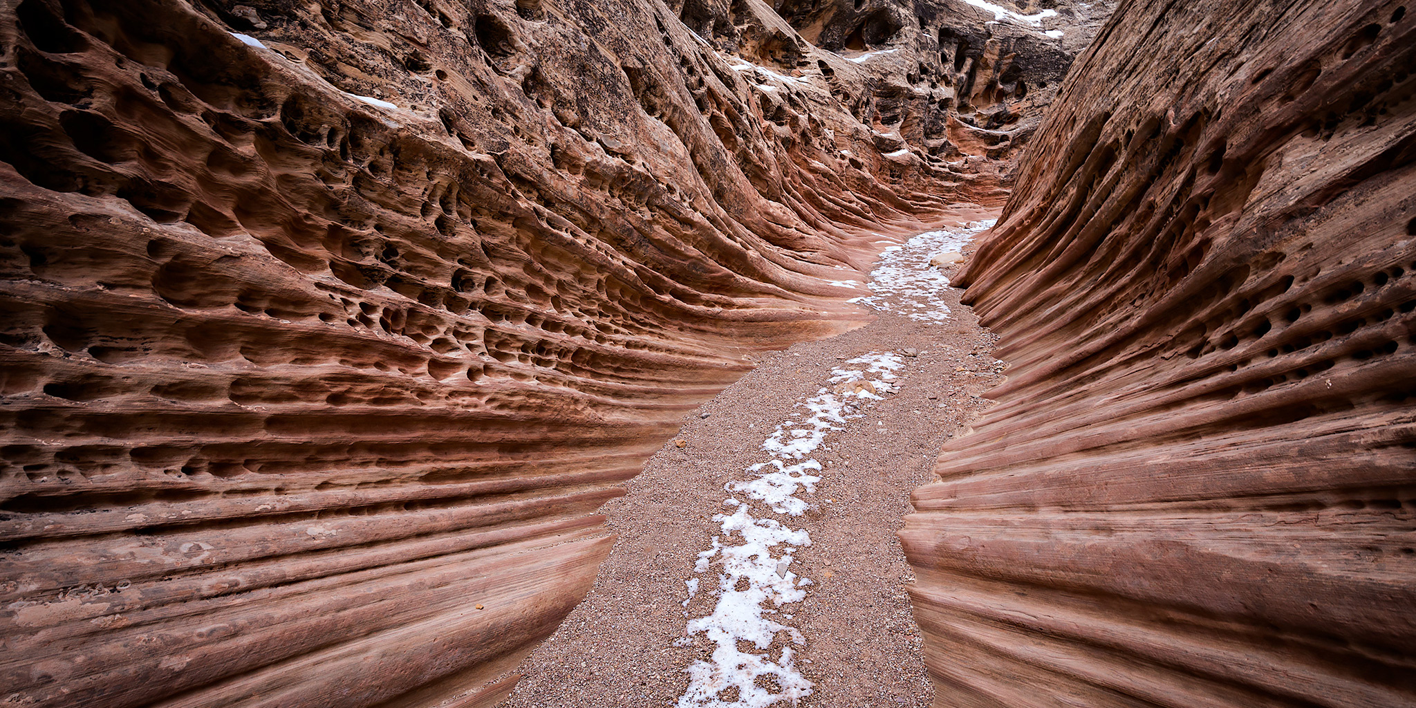
Years ago I tried hiking into Little Wild Horse Canyon and Bell Canyon, which are slot canyons that cut through the San Rafael Reef near Goblin Valley State Park, but I was chased away by thunderstorms that day and have never returned to try again. Since that time the popularity of these slot canyons have exploded, which is part of the reason I had never bothered to return. I finally decided that it was time to head back this weekend to hike these San Rafael Swell classics. I was hoping that we wouldn’t run into the large crowds that these canyons attract since it’s the middle of winter, and we didn’t. We would only pass one single hiker during our entire hike and that happened on the old road used to connect the two canyons together to form a loop.

1 Comment

Devil’s Canyon Finale

Saturday, January 23, 2016

Late this morning Diane and I headed back to the mouth of Devil’s Canyon just outside of Fruita so I could finish hiking a few of the trail segments that I had not been on before. We ended up making a big loop that was about 6.5 miles in length with a stop at a nice overlook into Devil’s Canyon. While most of the trails were still snow-covered, especially higher and on the north side of the cliffs, there were other sections that had melted off entirely. Early in our hike those sections were frozen, but on our way back to the trailhead we encountered a few muddy areas that had started melting in the sun and the above-freezing temperature.

2 Comments

Kodels Canyon Trail System

Saturday, January 16, 2016

We were originally planning to drive down to Ouray this morning for the annual Ice Festival, but Diane wasn’t feeling very well when we got up so we stayed home. Instead, I headed out this afternoon to get a little local hiking in at the McInnis Canyons National Conservation Area trails near Fruita. I have hiked a few of the “K” trails near the mouth of Kodels Canyon in the past but had not been on all of them, so I decided to try and check out the rest. I started from the Kodels Canyon Trailhead along the highway and ended up hiking all of the remaining “K” trails that I had not been on before. The length of the hike ended up being just under 5.5 miles. The temperature outside was a little bit above freezing and I was glad that most of the trails were still covered with a layer of packed snow or I probably would have had to deal with hiking in the mud. Much of the day was overcast and a little gloomy but the sun did show up for a little while and brought a little blue sky, too. I didn’t take many photos on this hike because of the overcast conditions, but I did take a few snapshots along the way when the sun was out.

Leave a Comment

Wedding Canyon Loop

Sunday, January 10, 2016

Our original plan for New Year’s Day was for Diane and I to hike the Wedding Canyon Loop in the Colorado National Monument to celebrate our very first hike together exactly two years ago. However, I was sick all weekend and had to cancel those plans. Now that I am finally feeling better we rescheduled the hike for this afternoon. When we started the hike shortly before noon the sky was pretty overcast and dreary, but after a little while the clouds broke up and let some light through while we were in Wedding Canyon. It turned out to be a nice afternoon for a local hike.

Leave a Comment

Lower Bangs Canyon

Veteran’s Day | Wednesday, November 11, 2015

Since I had Veteran’s Day off from work but Diane still had to go to work and school, I contacted Marty over the weekend to see if he was up for some hiking. He was, so we planned to stay close to home and explore the lower reaches of Bangs Canyon just outside of Grand Junction this morning. After a night of rain and snow we knew it was going to be a wet hike. I met Marty at the trailhead just outside of Whitewater along East Creek at the mouth of Unaweep Canyon about an hour after sunrise.

Leave a Comment