After Work Adventures | Tuesday, June 10, 2025
Although we didn’t get to go backpacking on the Grand Mesa late last month like we had hoped, now that the Lands End Road is open I figured I’d head up after work this afternoon to hike a short loop above Coal Creek Basin from the Switchback Trail to Shirttail Point. Last summer I had hiked down the Palisade Plunge Trail to Otto’s Wall from Shirttail Point but was turned back by an incoming storm, so I was looking forward to returning to this part of the Grand Mesa. This hike turned out to be a nice little 5.5 mile loop with about 900 feet of elevation loss and gain that was perfect for when the temperature in the valley below is just too hot for hiking after work.
It was a bit cloudy as I drove up the switchbacks on the Lands End Road to the top of the Grand Mesa.

I parked at the top of the Switchback Trail and walked over to the edge for a view over the Coal Creek Basin and Kannah Creek drainage.

Then I started my hike over the edge of the Grand Mesa on the Switchback Trail which descends about 900 feet to the Coal Creek Trail in upper Coal Creek Basin.

There were some nice views from the switchbacks at the top of the trail.


Looking across the Kannah Creek drainage to Indian Point.

As the trail dropped further into Coal Creek Basin the views become more limited in the trees.

This was one last opening in the trees along the lower Switchback Trail before I reached the intersection with the Coal Creek Trail.

The Coal Creek Trail was overgrown and hard to follow in a few places with a number of trees down across the trail, plus the mosquitoes were definitely starting to come out down here and I got my first bites of the season.

A short rocky section along the Coal Creek Trail.

This was one of the few views found along this part of the Coal Creek Trail.

The wildflowers are just starting to come out.


Once the trail climbed up onto the ridge just below Shorttail Point the views opened up again.

According to maps of the area, the Coal Creek Trail was supposed to connect to the Palisade Plunge Trail in this area, but I never actually found an intersection with the trail and had to bushwhack a short distance to connect up with the other trail.
After connecting up with the Palisade Plunge Trail I started hiking up towards Shirttail Point.

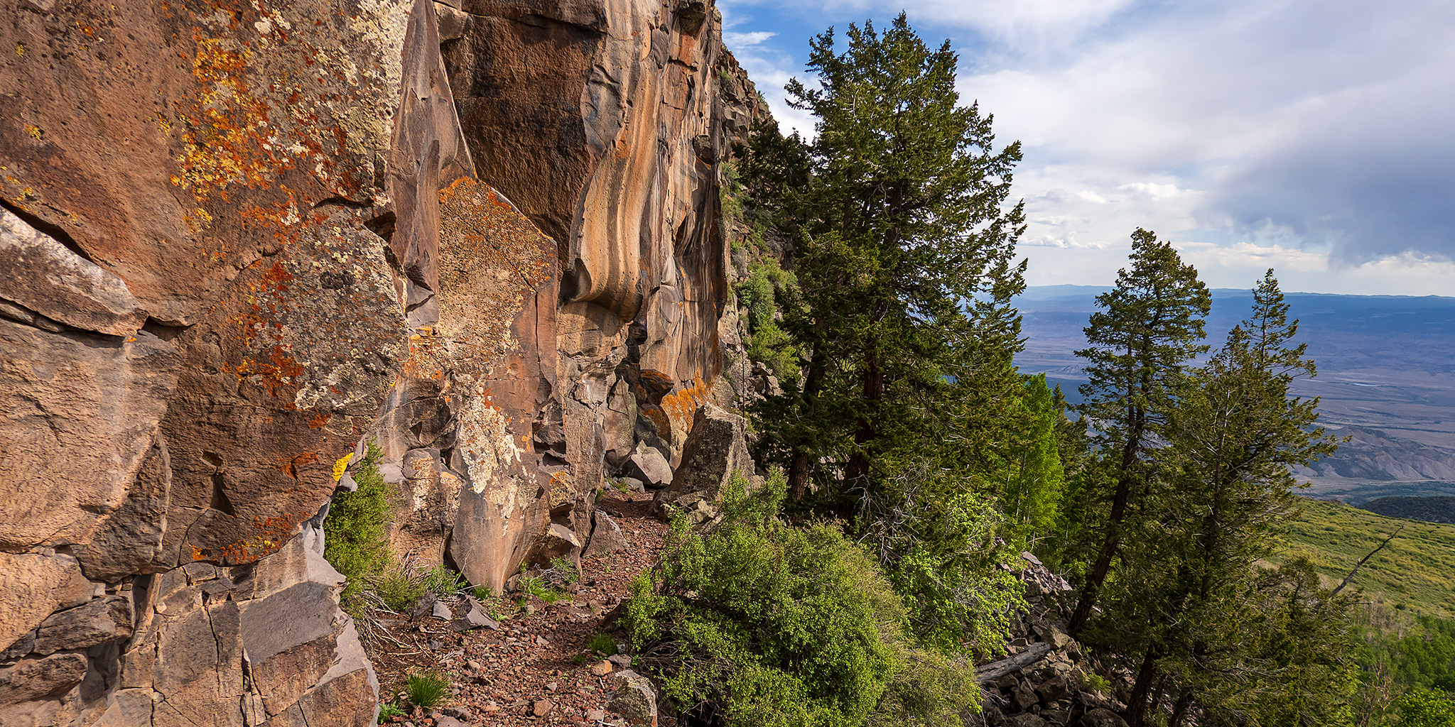
After a few switchbacks I was soon hiking along Otto’s Wall, which is certainly the highlight of this loop.

Otto’s Wall


Following the constructed trail along Otto’s Wall with the switchbacks of Lands End Road visible in the distance.

Otto’s Wall Trail


From the end of Otto’s Wall there were just a few more switchbacks to reach the top of Shirttail Point.

Once I was back on top of the Grand Mesa I followed the rim and road back to my Jeep to close the loop.

Lands End Road

I took a short detour to the rim above Coal Creek to see a waterfall that I have known was here for a long time, but never had stopped to look at before.

Coal Creek Waterfall

Here’s a closer look at the top of the falls.

Coal Creek Rim

Coal Creek above the waterfall.

After returning to my Jeep I drove back down the Lands End Road and headed home. It was a nice afternoon on the Grand Mesa!
