Canyons of the Black Ridge Wilderness | Friday – Sunday, May 2-4, 2025
Since I have another week-long river trip coming up very soon that I need to start getting ready for, I stayed local this weekend and decided to go on a pair of backcountry hikes that are located within the Black Ridge Canyons Wilderness. These are two hikes that I’ve been thinking about doing for a number of years at this point, but I have never made them a priority to get around to before and figured it was finally time to give them a go! The first hike I wanted to try follows an old 4×4 road that shows up on some maps as the Gore Trail and encircles a mesa located between the heads of Knowles Canyon and Jones Canyon. It looked like this loop was going to be around 16 miles in length, which includes a couple miles on BS Road to close the loop, and since I wanted to get an early start on Saturday morning I headed up to Glade Park later on Friday afternoon and spent the night on the edge of Sieber Canyon.
After exploring a few short spur roads on my way to Sieber Canyon I found a nice campsite and went for a walk along the rim.

Sieber Canyon Rim

Sieber Canyon Rim Camp

After reading for a little while I went to bed early and slept pretty well overnight. Then I got up early on Saturday morning and drove about a mile down the road to the starting point for the hike. I started hiking just as it was starting to get light enough out that I didn’t need a headlamp to see where I was going.
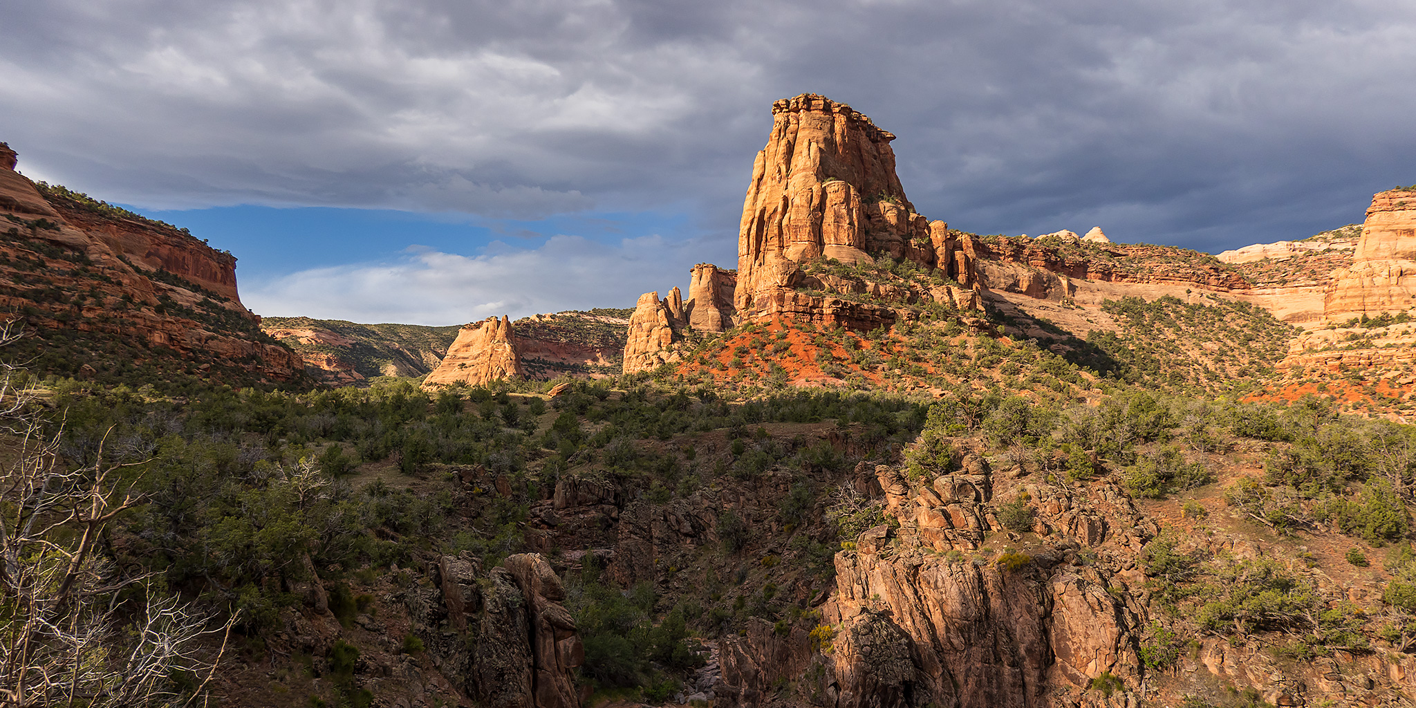
After passing by some historic buildings along the trail, I hiked across a large open flat on the top of the mesa that I would be circling around. It was too dark out to get photos of the buildings, so I figured I could revisit them again at the end of the loop.

It wasn’t long until I reached the edge of the mesa and descended below the rim where the route briefly met up with the Knowles Canyon Trail.

I watched the sun come up and light up the rims surrounding me as I hiked along the old road.

It was a lovely morning on the Gore Trail.

After a few miles I spotted Pentagon Arch from the trail.

I climbed up the steep sandstone into an alcove for a closer look.

Pentagon Arch

Then I walked around for a view from the other side.

As I continued following the old road around the mesa I was treated to nice views overlooking the Black Ridge Canyons Wilderness to the Grand Valley and Book Cliffs beyond.

When I neared the northern end of the loop Long Mesa came into view.

PT 5746 Butte

The southern end of Long Mesa.

The trail went through a pass between the unnamed mesa I was circling and Long Mesa before turning south.

This dead tree along the trail caught my eye.

After returning to the Jones Canyon Trail for a little bit I left the Black Ridge Canyons Wilderness and then followed BS Road for a couple more miles back to my Jeep.

I did make a short detour to revisit the homestead / ranch buildings I had passed earlier in the day.

There were two of these roofs covering large holes in the ground.


I was initially a little worried about going on this hike since I have not done a hike this long in quite a while, but by the time I returned to my Jeep I had hiked about 16 miles in 5.5 hours and my legs were still feeling pretty good, so I guess I didn’t have anything to worry about after all.
On Sunday morning I was up early again, except this time I drove over to the Pollock Bench Trailhead near Fruita so I could hike a loop into the West Fork of Pollock Canyon. Although I have been into the East Fork a few times before, I had never been into the West Fork and was looking forward to finally checking it out. I reached the trailhead at dawn, just as it was getting light enough to see without a headlamp, and then started hiking up and across the Pollock Bench at sunrise.
Flume Creek Canyon at Dawn

Grand Valley Morning

There were briefly some nice colors in the sky this morning.

After hiking across the bench I had a good view into the East Fork of Pollock Canyon.

I could see West Pollock Arch on the opposite rim.

Once I reached the southern end of the bench I dropped below the point and started the descent into the East Fork.

Straight ahead of me was a view of my planned route- a pass between the two forks that I hoped would go…

Descending into the East Fork…

Here’s a better look at the pass I was shooting for. It looked good from this angle.

I briefly stopped at the cabin in the bottom of the canyon and then started climbing up to the pass behind it.

Looking down the East Fork of Pollock Canyon.

I was hoping to find a faint game trail up to the pass, but I never really found any kind of trail at all. Still, the hiking was easy enough on the way up.


This soft dirt hill took me to the top of the pass.

From the top I had a nice view into the West Fork.

I didn’t find any kind of trail down on the other side of the pass either, but again it was pretty easy to get down.

West Pollock Tower

Looking into the upper end of the West Fork.

Instead of dropping down into the canyon at the bottom of the Precambrian rock, which looked like it might be kind of rough, I stayed on top of the bench and headed downcanyon.

The views from up on the bench were pretty nice!


Once I reached the wash below the Precambrian gorge I hiked upstream a little ways.

Muddy Pool

West Fork Narrows

Leaving the Precambrian narrows as I headed back down the canyon to complete the loop.


It wasn’t long until I reached the confluence of the two forks and continued downstream to meet up with the main trail that goes out to the Rattlesnake Canyon Arches.

Pollock Canyon

I hiked back across the Pollock Bench, returned to the trailhead and was back home before 11am.

Flume Creek Canyon & Black Ridge

>> Gore Trail Loop & West Fork of Pollock Canyon Photo Gallery