Liberty Bell Arch
Sunday, May 10, 2015
After spending the last two weekends backpacking in Grand Gulch I needed to spend a more relaxing weekend at home so I could start preparing for an upcoming trip on the San Juan River later this week. It had rained on and off all day on Saturday, but it looked like things might start finally clearing up on Sunday morning and I wanted to get out for at least one local hike this weekend. A few weeks back when I had hiked into the East Fork of Pollock Canyon I had run into Steve Obser, another local hiker, who had mentioned a nice arch in the upper section of the canyon that is known as Liberty Bell Arch (I have recently seen this same arch called Pollock Arch and Picture Window Arch). I thought that this arch might make for a nice destination this morning, so I decided to hike into the upper Pollock Canyon for a little exploring. After looking at my maps, it looked like hiking up the trail through Flume Creek Canyon and then crossing over the saddle at the far end of the Pollock Bench would be the shortest route into the upper canyon, so that’s the way I went. It was a pretty straight-forward hike and got me where I wanted to go, though I’m not really sure if it saved me much distance or elevation gain. I ended up hiking about 9.3 miles round trip this morning.
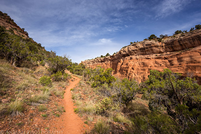
Following the trail into Flume Creek Canyon.
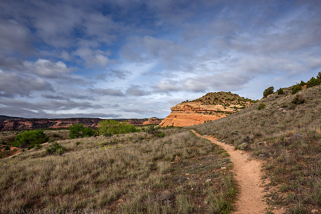
F1 by Randy Langstraat, on Flickr
Entering the Black Ridge Canyons Wilderness area.
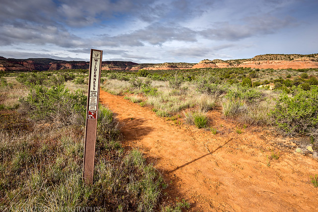
Wilderness by Randy Langstraat, on Flickr
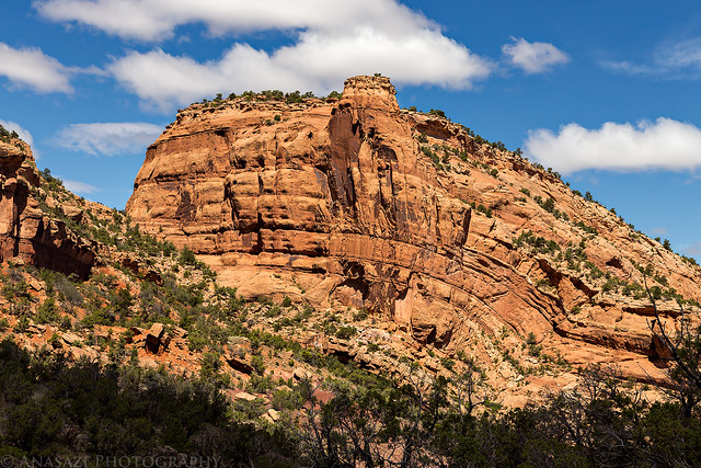
Hiking along the base of the Pollock Bench cliffs.
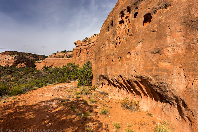
Along the Bench by Randy Langstraat, on Flickr
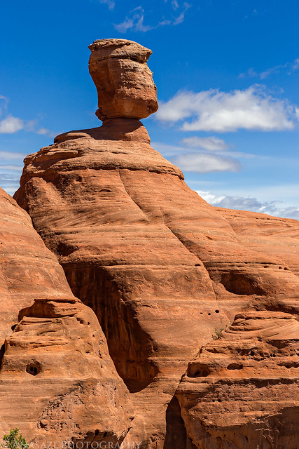
A cool balanced rock on the edge of the Pollok Bench as I climbed to the pass that separates Flume Creek Canyon and Pollock Canyon.
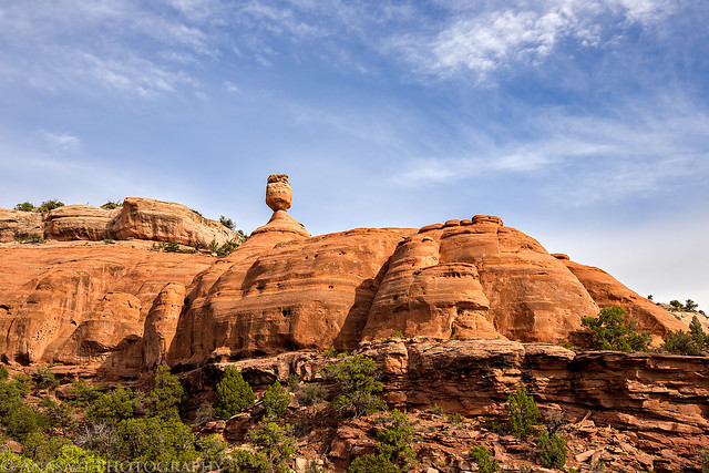
Balance by Randy Langstraat, on Flickr
The trail up to the pass.
Flume Creek Pass by Randy Langstraat, on Flickr
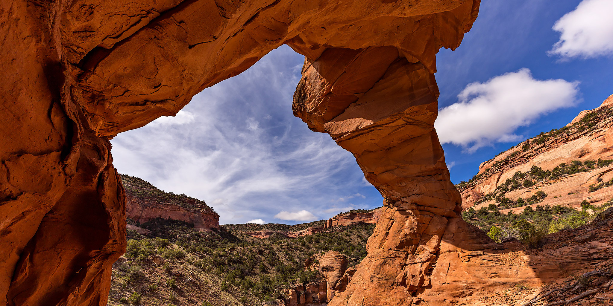
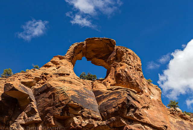
After hiking a short way into upper Pollock Canyon I scrambled up to Liberty Bell Arch for an up close look. This is a cool arch since it stands alone on the edge of the cliff above the wash. I took this photo underneath the arch with my wide-angle lens looking up the canyon.
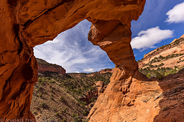
Inside the Arch by Randy Langstraat, on Flickr
Another view of the arch from up near it.
Liberty Bell Sunburst by Randy Langstraat, on Flickr
After checking out the arch from up-close, I hiked around to the other side of the wash for a different view. This photo shows better how it sits at the edge of the cliff above the wash.
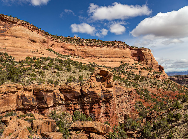
On the Edge by Randy Langstraat, on Flickr
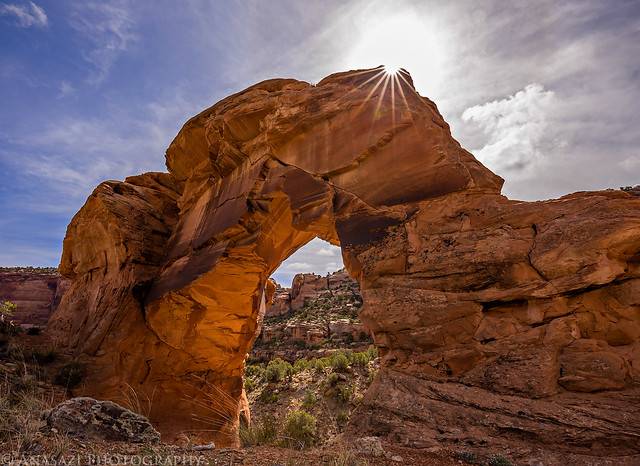
Then I climbed down the steep slope into the wash for a view from below the arch looking up.
Liberty Bell Arch by Randy Langstraat, on Flickr
Nice clouds above as I hiked back down Pollock Canyon. The higher Book Cliffs across the valley had a little snow on them from the recent storm.
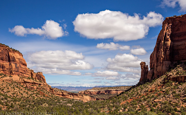
Pollock Canyon Sky by Randy Langstraat, on Flickr
After hiking down-canyon a little way I had a nice view of the Pollock Windows high above the canyon floor in the ridge that separates the East and West Forks of Pollock Canyon.
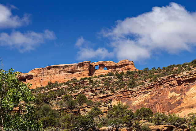
The Pollock Windows by Randy Langstraat, on Flickr
Before leaving the canyon, I made sure to stop at the remains of a stone cabin nearby that Steve had also mentioned to me.
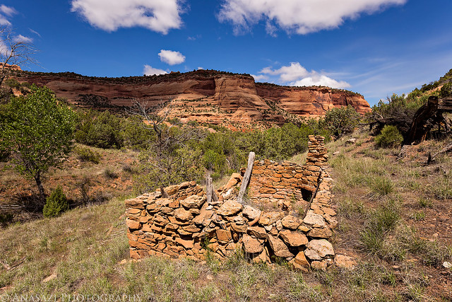
Stone Cabin by Randy Langstraat, on Flickr
A closer look at the chimney inside.
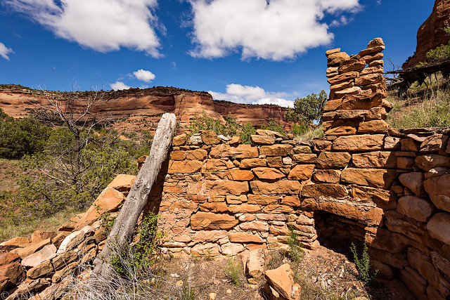
Chimney by Randy Langstraat, on Flickr
I decided to head back the same way I had come. This view is looking across the East Fork of Pollock Canyon from where I climbed back out. There is supposed to be a way into the West Fork somewhere in the gap on the left. Something else to explore another day…
Pollock Gap by Randy Langstraat, on Flickr
An old fenceline at the top of the canyon.
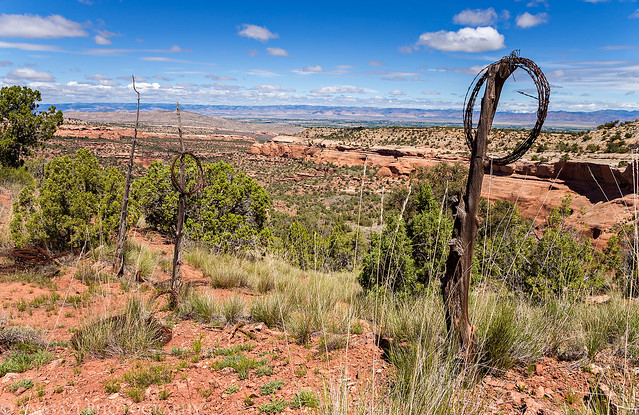
Old Fenceline by Randy Langstraat, on Flickr
One last view of the balanced rock on my way back to the trailhead.
Balanced Rock by Randy Langstraat, on Flickr
I have included a map and GPS track of my hike to Liberty Bell Arch. There is a trail most of the way, but once you cross the wash in upper Pollock Canyon the trail disappears and you are on your own. I followed the wash where possible to avoid the abundant cryptobiotic soil in the area.
Great photos, Randy! Glad you finally made it out there and I hope my tips were helpful. Someday you’ll have to make the 12-mile RT to Pollock Windows from the upper West Fork, then you’ll be able to take a photo of Liberty Bell Arch from ABOVE! Thanks for sharing this trip.
Thanks again for the info, Steve! It was a nice morning hike 🙂
One of these days I will make it over to the Pollock Windows, but I think I will see about reaching them from the Black Ridge Road above when I do.
We’ve hiked Pollock and Flume so many times, but have not been to the arch or the windows. Definitely need to check this out! So enjoy your blogs and beautiful photography.
Thank you Nancy!