Friday – Sunday, July 5-7, 2024
After Diane and I spent Independence Day backpacking in the Flat Tops Wilderness, we returned home early Friday afternoon so she could spend the rest of the weekend with a friend visiting from out of town. While at home I took some time to repack my Jeep for a solo trip and then headed south to spend the rest of the weekend in and around the Rico Mountains. Over the past four years I have been hiking to the summits of the peaks found along the Calico Trail, which follows the crest of the western Rico Mountains, and I only had one final named peak left- Landslip Mountain, which I panned to hike on Saturday morning.
After going on a short walk to the highpoint of Taylor Mesa, I returned to my usual campsite on the mesa where I could see the La Plata Mountains off to the south.

I also had a good view of where I would be hiking the following morning.

On Saturday morning I was up early and started hiking up to the Calico Trail at sunrise. Usually I take the Priest Gulch Trail from this area to meet up with the Calico Trail, but today I decided to try something different and followed some old logging roads that took me up to the top of the ridge. Both routes are about the same distance and in the trees, so neither is more scenic than the other until you reach the top.
Once I reached the Calico Trail I followed the ridge toward Storm Peak.

Looking down into the Wildcat Creek drainage.

Shortly before reaching Storm Peak, I left the Calico Trail and started following the Wildcat Trail towards Landslip Mountain.

A view across Burnett Creek to Anchor Mountain and Expectation Mountain.

I hiked up the southwest ridge to the summit of Landslip Mountain.

Landslip Mountaintop

From the summit of Landslip Mountain I had a good view toward Storm Peak.

Hiking through a little valley on my way back to the Wildcat Trail.

Wildcat Trail

I followed a short section of the Burnett Creek Trail back to the Calico Trail.

I always love hiking atop of the Rico Mountains on the Calico Trail.

The view north to Calico Peak and Dolores Peak.

Following the Calico Trail back to the old logging roads and my Jeep.

After grabbing lunch in Dolores I went for a drive up the road above Roaring Fork Creek and then went on an afternoon hike along a short section of the Colorado Trail.

I was originally thinking about hiking to the summit of Orphan Butte, but it didn’t seem worth the trouble of bushwhacking up since I would still be stuck in the trees on top.

A view from the Colorado Trail.

After returning to my Jeep I drove down Hotel Draw to Hermosa Creek and then followed the road up to Bolam Pass. Shortly before reaching the pass I was flagged down by a RZR driver with a dead battery and I was able to help them get their vehicle to down to the trailhead on the other side of the pass using my emergency jump-start battery pack. Then I returned to Bolam Pass and spent the night nearby.
I passed this little roadside waterfall above Hermosa Creek.

An old cabin near the Graysill Mines.

The view over Tin Can Basin from my campsite was outstanding shortly before sunset.

Grizzly Peak

After a good night of sleep I woke up to watch the first light of the day strike the San Miguel Mountains.

I had a nice view of Hermosa Peak as I drove over to a trailhead near the Colorado Trail, which I found blocked off much earlier than the last time I was here. I noticed that has happened on a couple different roads I drove in this area this weekend…

I followed the Colorado Trail below Hermosa Peak, which I had hoped to hike up this morning.

Here’s a view from the trail overlooking Barlow Creek to Dolores Peak and Lone Cone.

I hiked up to a saddle between Hermosa Peak and PT 12180, but was unable to hike up a sketchy ledge along the ridge to Hermosa Peak and turned around.

There was a nice view over Flattop Mountain to Mount Wilson.

Looking down into the Hermosa Creek drainage from the saddle.

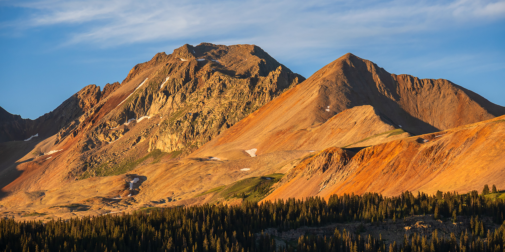
Blackhawk Mountain is the highest peak in the Rico Mountains.

Looking back up the route I had followed to the saddle.

After returning to my Jeep I drove down to the highway and then took a scenic route home across the southern end of the Uncompahgre Plateau starting in Norwood Canyon and then following the Sanborn Park Road and Dave Wood Road back to Montrose.