Independence Day Weekend | Friday – Monday, July 2-5, 2021
I knew the mountains of Colorado were going to be a very busy place over the Independence Day weekend, so I thought it might be a good idea for me head back into the Rico Mountains this year. Located at the western edge of the San Juan Mountains, the Rico Mountains are a small subrange of peaks that surround the old mining town of Rico and the Dolores River valley. I had a very nice time exploring the Rico Mountains last summer and I figured that this area might not be quite as popular as some others, so I was looking forward to getting back again!
Groundhog Stock Driveway Trail & The Calico Trail, Part II
On Friday I left a little early from work, grabbed a quick dinner in Montrose and then made my way to Lizard Head Pass. For some reason the Western Slope was running out of gas this week. When I left Grand Junction there were a bunch of gas stations that were completely out of gas, and when I topped off my tank in Montrose, there were a few stations out of gas there, too. I was a little worried with all the travelers around the state this weekend that I might not be able to find enough fuel to get home on Monday, but I decided to take my chances anyway. After driving over Lizard Head Pass I followed the Dunton Road to The Meadows and found a spot to spend the night. It was still early, so I went for an evening hike along the Groundhog Stock Driveway Trail, which is also known as the Highline Stock Driveway. It was a nice easy hike with great views all around, and it didn’t hurt that the sunset light was nice, too!
Pilot Knob, Golden Horn and Vermilion Peak were looking good as I drove over Lizard Head Pass.

Dunton Road

Groundhog Stock Driveway Trail

Evening Greens

Flattop Mountain

Colorado Columbine

Lizard Head

Sheep Mountain

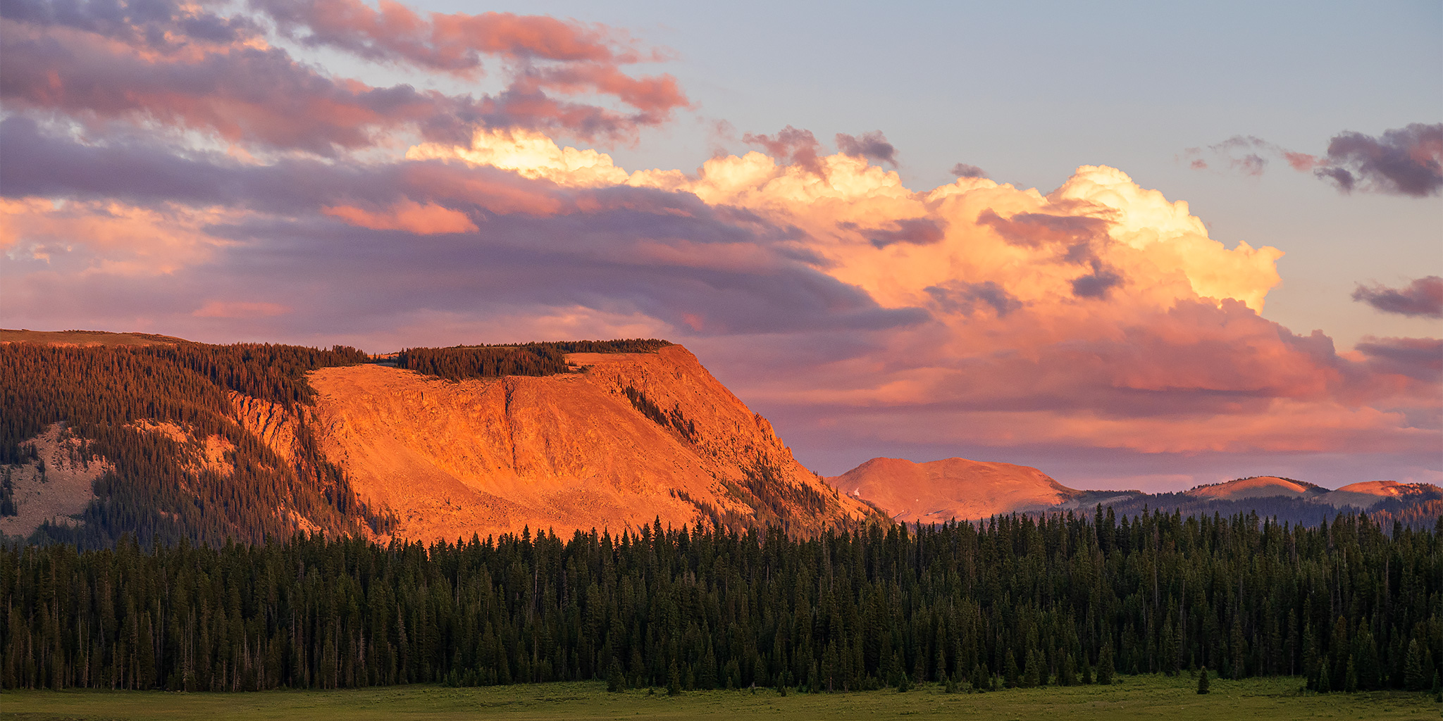
Highline Stock Driveway Sunset

I returned to camp just before it was almost completely dark out and then got in my sleeping bag for the night. I was up early on Saturday morning to drive a couple of miles over to the West Fall Creek Trail and then started hiking up it shortly before sunrise. It was a cool and humid morning, but unfortunately I was stuck in the trees without a view for sunrise. There was also a lot of deadfall across the trail that I needed to climb over and around.
After briefly meeting up with the Calico Trail on the ridge, I left the trail and followed the ridge towards the summit of Johnny Bull Mountain.

Anchor Mountain across the way.
Calico Peak stands out the most among the peaks in this area.

Following the ridge to the summit.

Groundhog Mountain and Lone Cone would be constant companions on the northwestern horizon this weekend.

As I neared the top I had my first view of Eagle Peak, which would be my next destination this morning.

Johnny Bull Mountain Summit

Smoke and haze would also be around for most of the weekend.
After leaving the summit of Johnny Bull Mountain, I descended to the saddle with Calico Peak and caught up with the Calico Trail again.
Junction with the Johnny Bull Trail.

On my way to Eagle Peak…

I left the main trail again and followed the gentle ridge to to the summit.

Eagle Peak Ridge

Overlooking Johnny Bull Creek.

There was a crown of rocks on the false summit.
When I reached the actual summit I had a nice hazy view all the way to Mesa Verde and Sleeping Ute Mountain.

Eagle Benchmark

Looking down the south ridge to the La Plata Mountains.

Following the ridge back down to the Lower Stoner Mesa Trail.

I returned to the Calico Trail and started heading back.

Calico Trail Curve

Calico Peak looks a little more rugged from this side.

The Calico Trail

This was the only opening in the trees as I made my way back down the West Fall Creek Trail.
After returning to my Jeep I drove back down to Rico to see if they had any gas, and thankfully they did, so I topped of my tank before driving up and over Bolam Pass.
I stopped to have a late lunch near Bolam Pass and this was my view.
After descending from Bolam Pass and following Hermosa Creek for a little ways, I turned up the Hotel Draw Road and found a spot to camp on the ridge right next to The Colorado Trail. I spent the rest of the evening relaxing around camp.
Shortly before sunset I went for an evening stroll along The Colorado Trail so I could get a look at my next destination- Blackhawk Mountain.
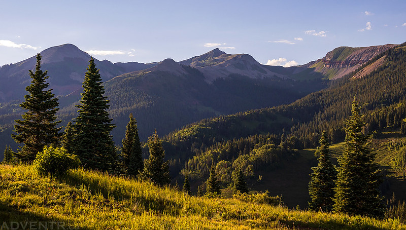
Highpoint of the Rico Mountains: Blackhawk Mountain
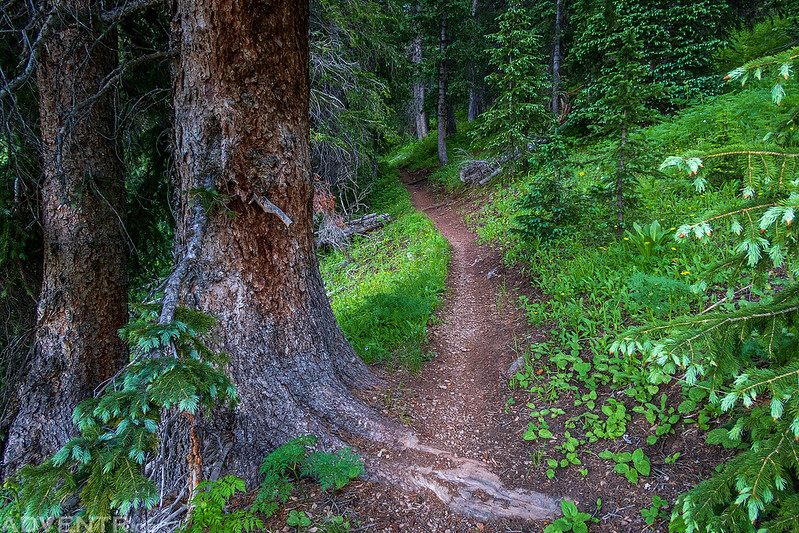
On Sunday morning I was up early and soon hiking along The Colorado Trail on my way to the summit of Blackhawk Mountain, which happens to be the highpoint of the Rico Mountains. I had hoped to hike to this peak with Diane last summer from the Bolam Pass side, but we had to turn around because of weather that morning, so I was looking forward to trying again.
Just like the previous day, the first few miles of the hike were in the trees with limited views.
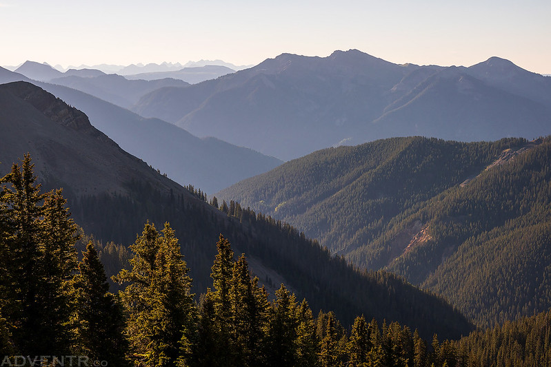
When I got my first view from above the trees I was able to see the La Plata Mountains on the horizon to the south.

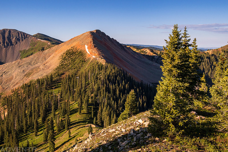
The sun started to strike the surrounding peaks as I climbed up to Blackhawk Pass.

I had a good view of Blackhawk Mountain as I hiked up to the pass.

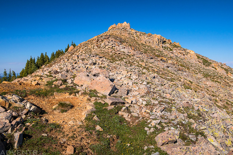
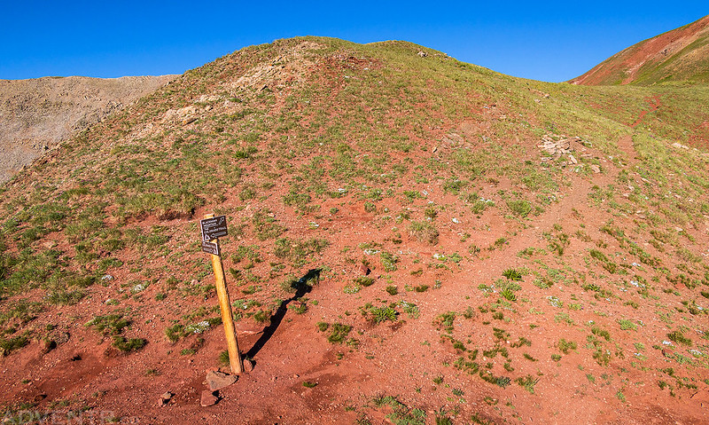
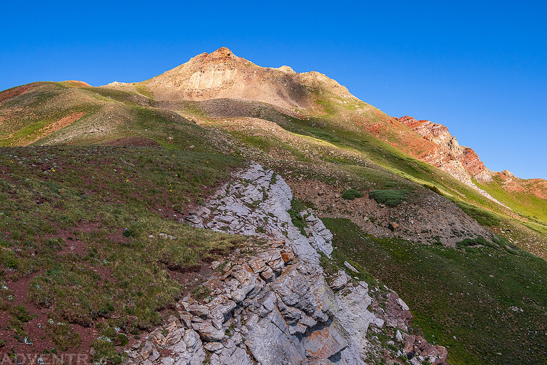
Once I reached the pass I started following the ridge to the summit. There was a trail at first, but it quickly petered out.
A closer look at the rocky summit of Blackhawk Mountain.

Looking down the ridge between Aspen Creek and Straight Creek.

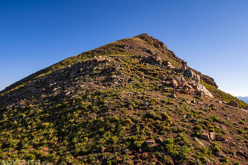
Looking up the final climb to the summit.
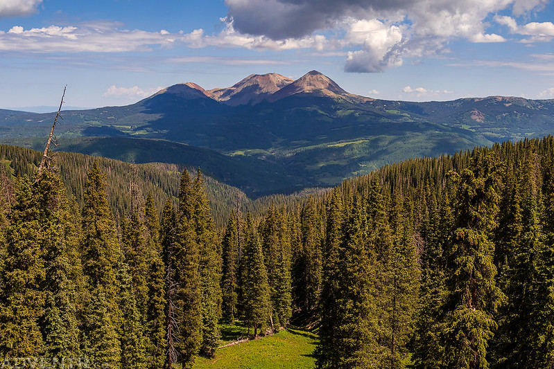
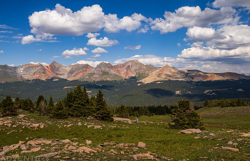
From the summit there were nice views of the San Miguel Mountains, La Plata Mountains and the surrounding Rico Mountains.

Across the valley I could see the peaks I had climbed the previous morning.

Overlooking Harts Peak and Telescope Peak to Little Cone on the horizon.

Whitecap Mountain and Scotch Creek below.
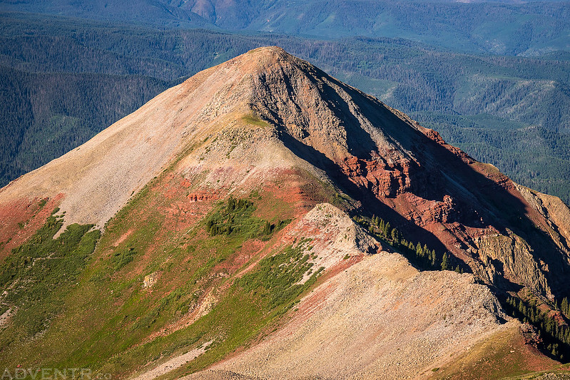
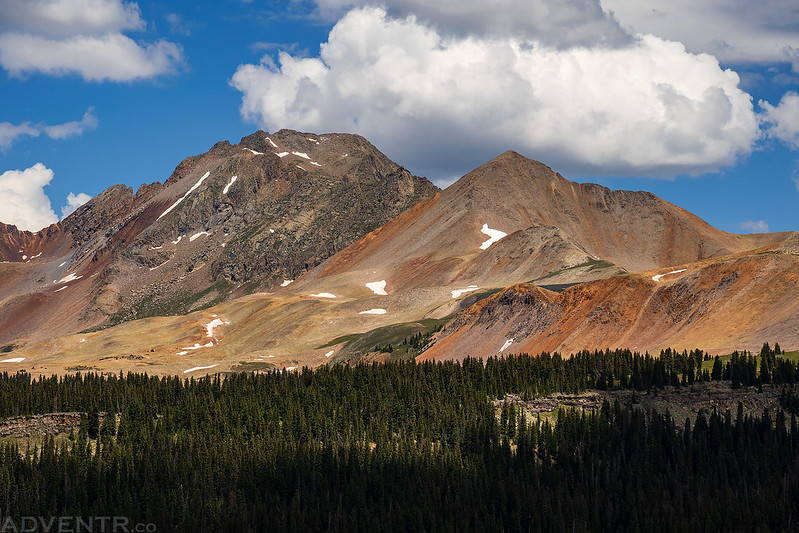
As I was hiking back down to the pass a few clouds moved into the area and created some nice spotlighting on Blackhawk Mountain.
A parting shot of the La Platas before I started descending into the trees again.

Following The Colorado Trail back to my Jeep.

The Colorado Trail Sign

Instead of driving back the way I had come the evening before, I decided to head down the old Scotch Creek Toll Road since it would be a much shorter drive back to Rico. I wasn’t sure how rough this road was going to be, but even though it was narrow in places it wasn’t too bad. I didn’t run into any vehicles coming up the road until I was near the end, but I passed a whole bunch of mountain bikers that were riding up the road.
There was a good view of Whitecap Mountain from the road.

Scotch Creek Toll Road

Scotch Creek Toll Road and Pinkerton Trail
Rico had the mineral wealth, but lack of a reliable transportation route was preventing its development as a mining center. In the late 1870’s the Pinkerton Trail through Scotch Creek to the Animas Valley provided the initial solution. In 1882 it was replaced by the Scotch Creek Toll Road. Even with the new road hauling heavy loads was a slow and difficult undertaking. One freighter recorded that he took 35 days and 22 yoke of oxen to haul two steam boilers from Rockwood to Rico, a distance of only 35 miles. When the Rio Grande Southern Railroad reached Rico in 1891, the Scotch Creek route lost its importance.

Bolam Pass Peaks: Flattop Mountain
After making it down to the highway I returned to Rico to top off my gas tank one more time, which would definitely get me home on Monday. Rico seemed to be having some sort of 4th of July celebration going on since the small community was the busiest I have ever seen it! I just passed through town after topping off my tank and then headed back up the Barlow Creek Road. This time I stopped a few miles short of Bolam Pass. The weather was looking like it was going to be OK this afternoon, so I decided to try hiking to the summit of Flattop Mountain.
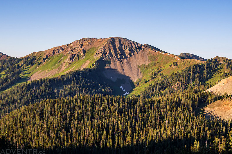
As I started hiking from the road I had a different view of Blackhawk Mountain.

When I reached an open rocky ridge I could see the broad flat summit straight ahead.

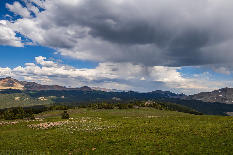
The views from this hike were very nice!

From the summit of Flattop Mountain I could see down to Lizard Head Pass.

With the dark clouds above, I didn’t stick around long…
Hiking back along the rocky ridge.

Flattop Mountain in the light.

Meadow & Clouds

Hermosa Peak was looking good as I made my way down.

After returning to my Jeep I found a campsite with an outstanding view not far away and relaxed there for the rest of the evening.

Grizzly Peak Sunset

I woke up early on Monday morning and was hoping to climb Hermosa Peak before heading home, but as I started to drive to the trailhead I came across a downed tree blocking the road. I had to be home in the afternoon for an appointment and wasn’t sure if I would have time to hike the peak from this point, so I decided to skip the hike this morning and head home instead. I can always come back another time.
I did stick around to watch the sunrise before heading home, though.

Driving down Barlow Creek Road.

I stopped for a quick photo of Wilson Peak before returning to the Society Turn Roundabout and heading home over the Dallas Divide. It was another nice weekend in the Rico Mountains!
