Independence Day Weekend | Friday – Sunday, July 1-3, 2022
This year for the extended Fourth of July holiday weekend I decided to head back to the same area I did last year and returned to the Rico Mountains so I could hike to a couple more twelve-thousand foot peaks along the Calico Trail. I left from work on Friday afternoon and made my way south to the San Juan Mountains via the Dallas Divide and Lizard Head Pass. I drove through a bit of rain on and off from Ridgeway until I reached Lizard Head Pass, where I found the mountain-tops hidden in the clouds. After following the headwaters of the Dolores River for a bit, I turned off onto the Taylor Creek Road and drove up onto Taylor Mesa in search of campsite for the night. I found a pretty nice campsite on the ridge between Stoner Creek and Priest Gulch with a great view of the nearby Rico Mountains and the distant La Plata Mountains, but the mosquitoes were pretty terrible! After a colorful sunset I went to bed early so I could get an early start on Saturday morning.
The mountains were still in the clouds as I drove over Lizard Head Pass.

Driving up the Taylor Creek Road in search of a campsite.

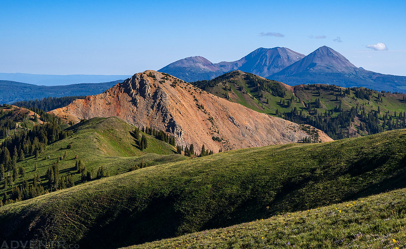
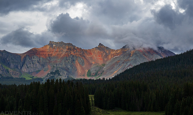
There was a nice view of the Rico Mountains from camp this evening.
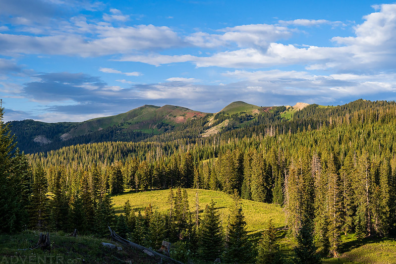
A closer look at Storm Peak and Anchor Mountain, which would be my destinations in the morning.

There was a colorful sunset before I got into my sleeping bag for the night.

Rico Mountains: The Calico Trail, Part III
I was up before sunrise on Saturday morning and headed over to the trailhead in Priest Gulch. I had originally planned to start my hike at a different location to the west of Storm Peak, but had found that road closed the previous evening, so I changed plans and followed the Priest Gulch Trail until it intersected the Calico Trail up on top of the ridge. I followed the ridge to the top of Storm Peak but was almost turned around by some cows and elk that were grazing on the flanks of the mountain, and they didn’t seem to want me there. Thankfully, I was able to stay closer to the edge of the ridge and gave them a wide enough berth to get around. It would have been a little embarrassing if I had to skip the peak because of some cows!
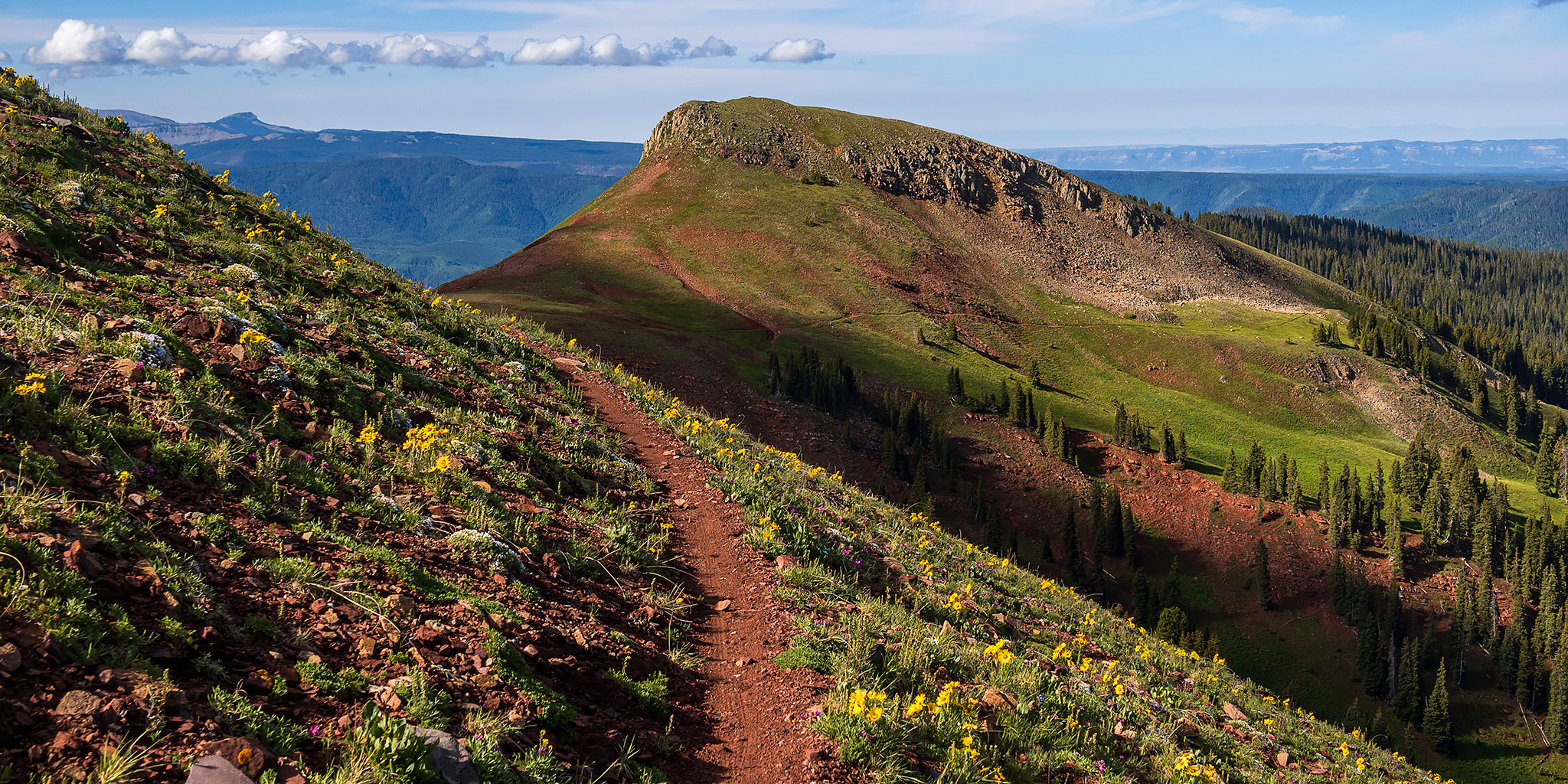
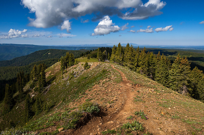
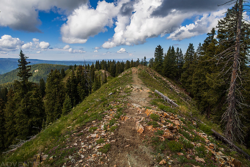
Following the Calico Trail on top of the ridge.

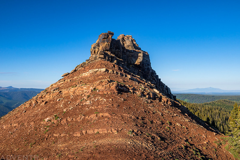
The trail passed below this rocky knob.
Following the grassy ridge to the summit of Storm Peak (12,095). The angry cows were not far off to the left, out of the frame.

On the summit of Storm Peak looking south to the La Plata Mountains.
I descended down the other side of Storm Peak and caught back up with the Calico Trail again on my way to Anchor Mountain.

As I got closer to Anchor Mountain I had a good view of Calico Peak and the western San Miguel Mountains.
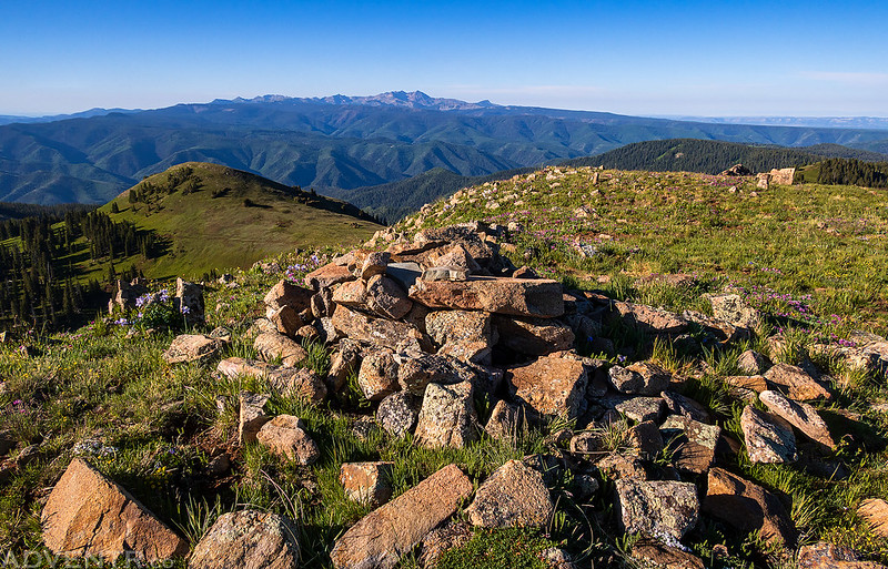
A view from the summit of Anchor Mountain (12,327).
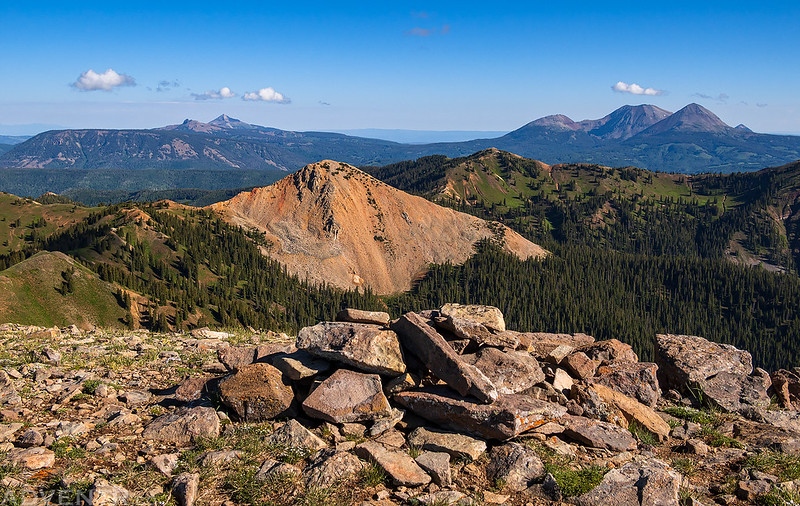
Looking down Horse Creek and Darling Ridge towards Rico.

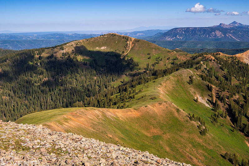
I had hoped to make it over to Expectation Mountain next, but I just wasn’t feeling it today, so I decided it was time to turn around and head back. Here’s a view of Eagle Peak with Groundhog Mountain and Lone Cone in the distance as I started my descent back to the trail.
The Calico Trail & Storm Peak

In order to avoid the cows on the way back, I dropped down to the Burnett Creek Trail and went around the east side of Storm Peak.

Following the top of the ridge on the way back with Mesa Verde and Sleeping Ute Mountain on the horizon.
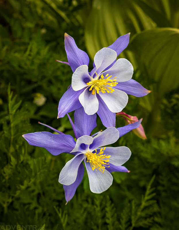
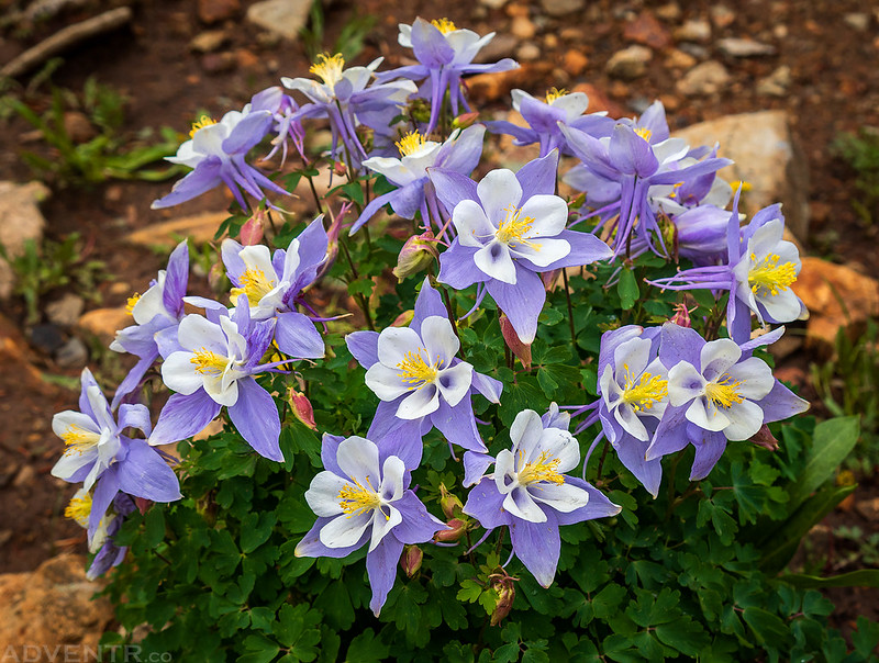
Colorado Columbines
After returning to my Jeep I decided to avoid the afternoon storms by heading into Dolores for gas and food. Then on my way back from town I went for a scenic drive on the Hillside Drive Road above Bear Creek in the rain.

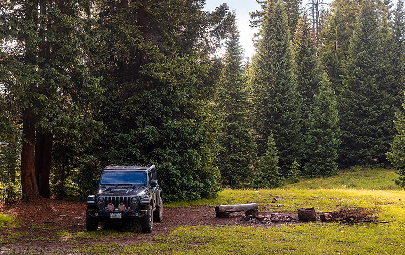
I then headed over to The Meadows at the edge of the Lizard Head Wilderness and relaxed in camp for the rest of the evening.

Well, I didn’t quite relax the entire time since I went for a short hike on the nearby Winter Trail until it started raining.

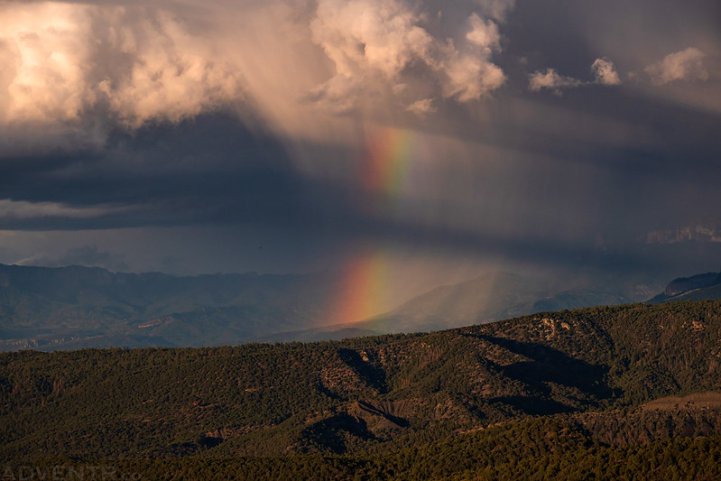
I caught this faint rainbow when I returned from the hike.
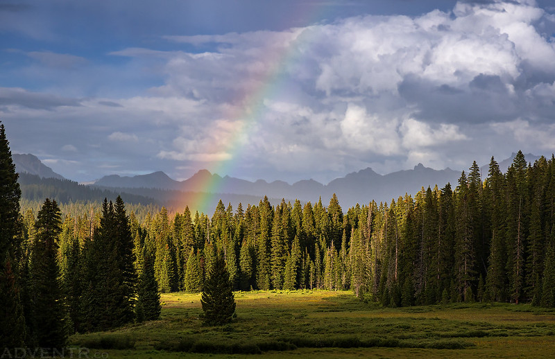
Camp After the Rain
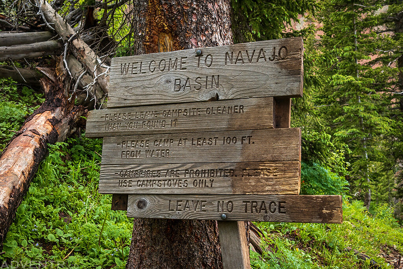
Lizard Head Wilderness: Navajo Basin
The forecast for Sunday was calling for wet and stormy weather to start early in the morning, so I decided to skip the peaks today and hike to Navajo Lake in the Lizard head Wilderness where I would be able to stay in the trees most of the time. It had rained heavily on and off during the night, so the trail was pretty wet and muddy and my pantlegs got soaked as I started hiking from the Navajo Lake Trailhead early this morning.
Welcome to the Lizard Head Wilderness.

Although it was mostly cloudy this morning, there was a little nice light and texture to the clouds at times.

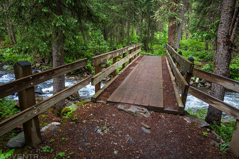
Crossing the West Dolores River.
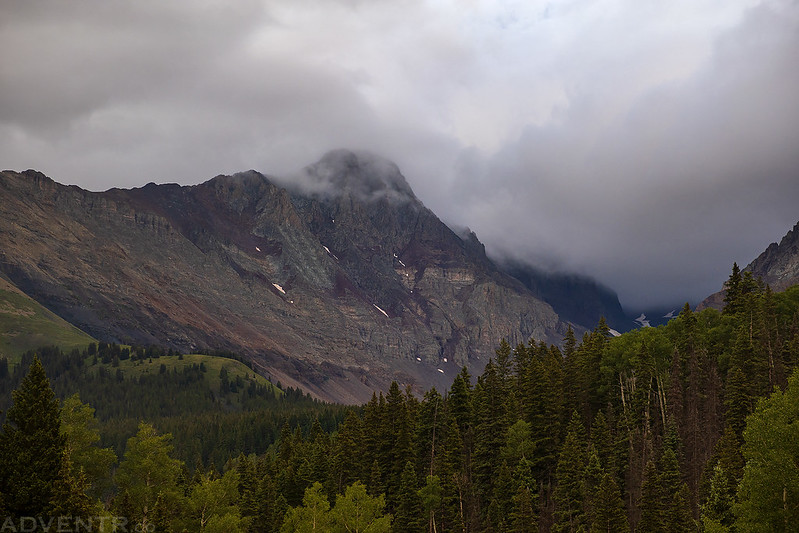
The tops of the San Miguel Mountains were hidden in the clouds.

Looking down the West Dolores River Valley behind me.
El Diente Peak in the clouds.

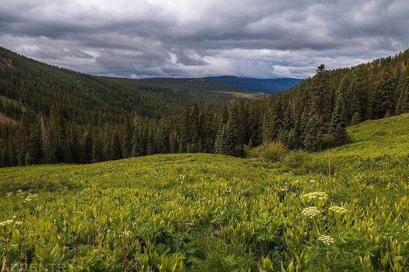
After a steep climb up a couple of switchbacks I entered Navajo Basin.

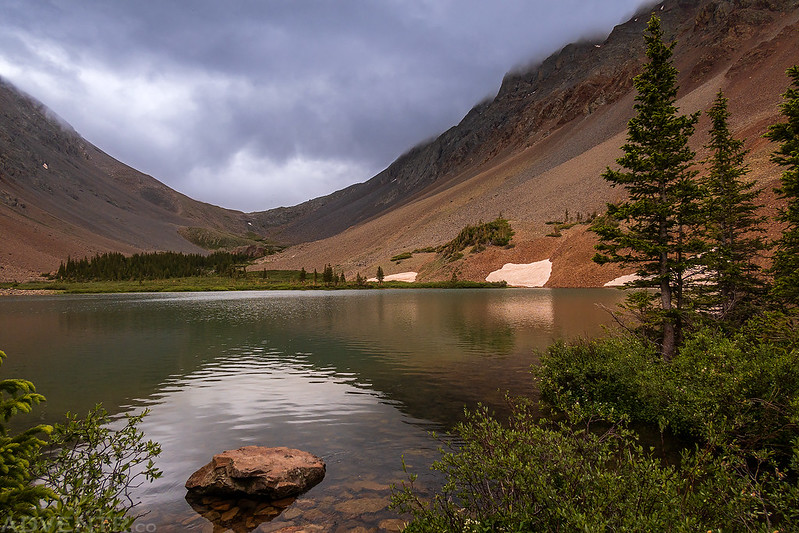
Soon I reached the edge of Navajo Lake.

I could see just a little bit of blue sky to the southwest, but it didn’t stick around long.

This beautiful bouquet of Columbines was near the shore of the lake.
One last shot from near the outlet before I turned around and headed back down.
It seems that I take at least one photo like this each summer, so here you go for 2022…

The clouds were looking dark on my way back down, but I never encountered any rain or lighting during the entire hike.
Next up I headed back over to Lizard Head Pass to drive the Galloping Goose Trail and took this photo of Black Face since I planned to hike it the following morning.

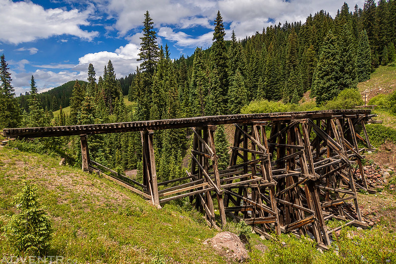
Near the end of the Galloping Goose Trail I stopped to check out the Trout Lake Trestle.

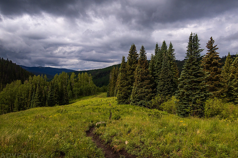
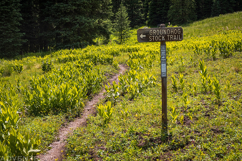
Then I returned to the Cross Mountain Trailhead to hike part of the eastern end of the Groundhog Stock Driveway. This part of the trail wasn’t as scenic as the western end and I was stuck in the trees the entire time without any views of the surrounding mountains.
Center Stock Driveway

I returned to camp early and had planned to stay another night so I could hike Black Face in the morning, but then I started not feeling well. After taking a nap and hoping I would feel better afterwards, I didn’t, so I decided it would be best to head home a day early. I will have to come back for Black Face another day…
A parting shot as I started my drive back home.
The light was looking nice on the rock above Ophir as I drove by.

Mount Sneffels was also looking nice as I drove over the Dallas Divide, so I had to stop for a quick photo just before sunset.

I saw one more rainbow from the Dallas Divide as I made my way down to Ridgway.
Although I ended up cutting this trip a little short, I still managed to have another nice weekend in the Rico Mountains and Lizard Head Wilderness!
>> The Rico Mountains & Lizard Head Wilderness Photo Gallery