Monday – Thursday, May 6-9, 2024
This Trip Report is dedicated to the memory of my cat Moab (Buds), who we had to say our final goodbyes to during the week of this trip. He was the friendliest and sweetest cat I have ever known and will be greatly missed!
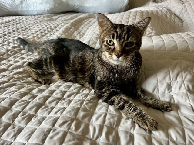
Moab | August 20, 2005 – May 9, 2024
After spending the weekend in Salt Lake City with Diane, we returned home for a normal day of work on Monday and then I drove back up to Price afterwards since I would be spending the rest of the week attending the annual Utah Geographic Information Council (UGIC) Conference, which was being held in the Carbon Corridor this year. Of course, during my drive to Price I took a detour off of the highway into the very northern reaches of the San Rafael Swell so I could go on a short hike and a scenic drive before continuing on to my hotel for the night. There had been a consistent and strong cold wind blowing all day which made the hiking a bit chilly this evening and it offered a preview of what the weather would have in store for the remainder of the week!
Before reaching Wellington I left the highway and followed Cottonwood Creek to the trailhead for the Buried Forest Concretions Trail.

Following the Buried Forest Trail along the rim.

I saw my first concretions embedded in the cliff as I followed the trail below the rim.

The fast-moving clouds and light were looking nice this afternoon, although the wind felt bitterly cold at times.

Looking up at the Buried Forest Concretions.

Although the ‘Buried Forest’ moniker came from a photo taken by George Edward Anderson in 1899, most likely because he thought the round circles were the ends of petrified logs, these round circles in the cliff face are actually the cross sections of large balls of rock commonly known as cannonball concretions which are thought to be the result of mineral deposits that have been glued together by the groundwater that flows through the sandstone.

A closer look at a cannonball concretion.

After hiking the short trail to the Buried Forest Concretions, I explored a few nearby roads around the Mounds Reef and then headed south past Jurassic National Monument and across Lucky Flats to the edge of Humbug Canyon.

Mounds Reef

Here’s a view across Humbug Canyon to the northern end of Cedar Mountain.

Humbug Canyon Rim

The view from the Humbug Canyon Overlook was pretty spectacular!

After enjoying the expansive views from the overlook it was starting to get late, so I turned around and continued my drive north to Price and checked into my hotel to get ready for the conference starting the following day.
Since I am used to getting up early and the conference didn’t begin until later in the morning, I had some extra time on Tuesday morning and noticed that the sunrise was looking nice, so I decided to drive over to the Paint Road to take a couple of photos before heading over to the Carbon County Events Center.


After my class ended on Tuesday afternoon, I headed just west of Helper so I could take a drive through Spring Canyon and encountered a pretty heavy snowstorm as I drove up the road through the canyon.

Mutual Building in a Snowstorm

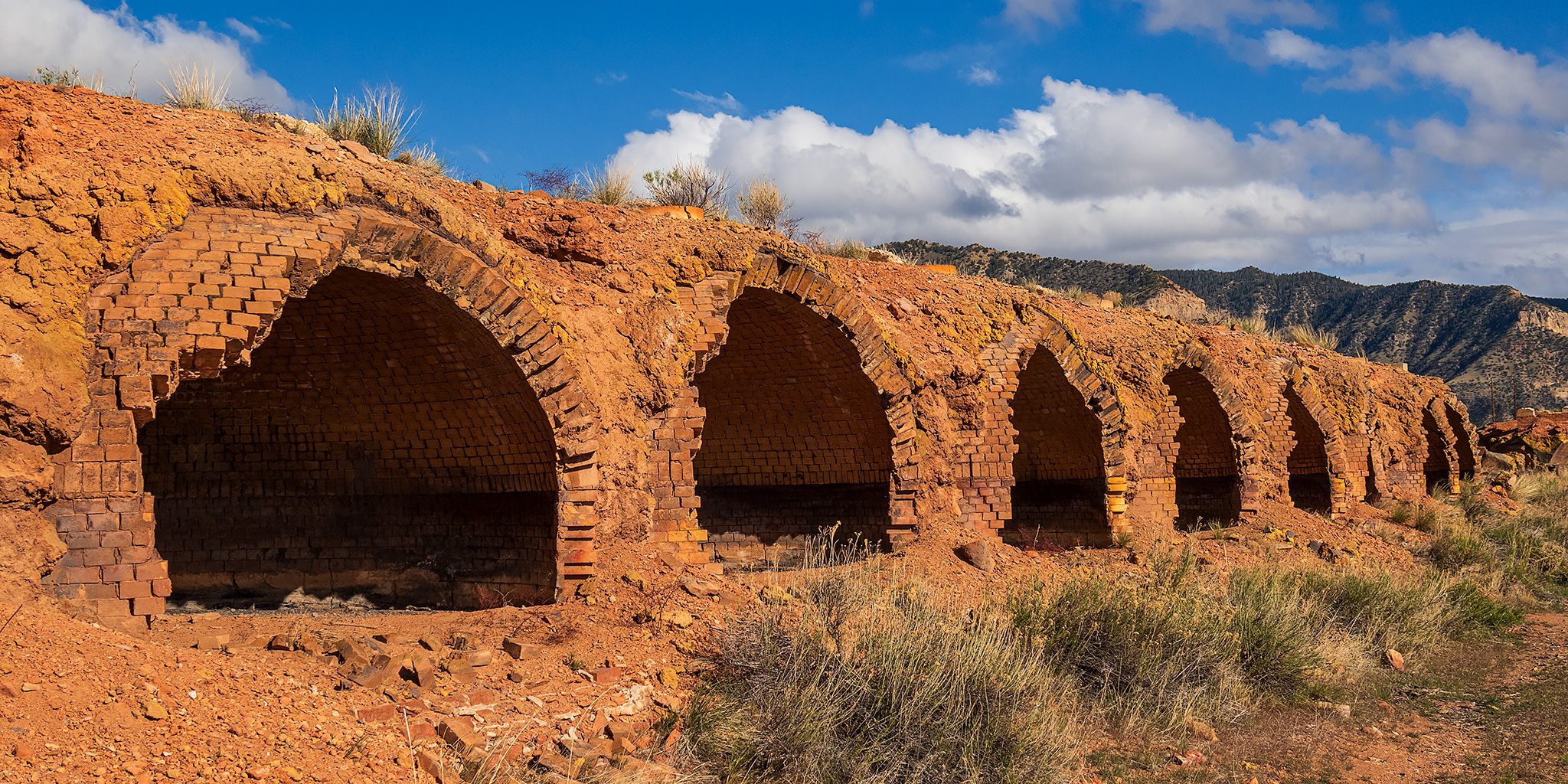
To get away from the snow I headed south to the base of the Book Cliffs near East Carbon so I could visit the long lines of old coke ovens found there.

There were a lot of coke ovens lined up here and I wandered around them for a bit.


Looking inside one of the many coke ovens.


After wandering around the coke ovens for a while, I hopped in my Jeep and followed the old Carbon County Railway Grade to Columbia and then returned the same way.


Before returning to Price for the night I explored a few more roads around the Mounds Reef, and even visited the highpoint.


I spotted many other cannonball concretions along the way.

On my way back to town I stopped at the Paint Road one more time shortly before sunset.

This evening I received a call from Diane who came home from work to find that our cat Moab didn’t appear to be himself and was just laying in the same spot for an extended period of time. She was going to keep a close eye on him and let me know if anything changed. I could hear in her voice that things weren’t looking for our little Moab, but I was hoping for the best.
After the events of the conference on Wednesday afternoon I headed out for a hike along the South Fork of Gordon Creek.

Following the Gordon Creek Trail, which is open to ATV’s during certain times of the year.

Upper Gordon Creek Falls

Summer House Cabin

Hiking back down the South Fork of Gordon Creek.

Shortly before returning to my Jeep I stopped to visit the popular Gordon Creek Falls.


Before I left the area and started driving back to my hotel, I stopped to check out the Utah Railway Trestle that spans Gordon Creek.

Unfortunately, as I was driving back to town Diane called me back and said that Moab still was not able to walk and seemed to be getting worse since he had stopped eating and drinking for an extended period of time. We knew this time was coming since he was almost 19 years old by now, but it still sucks. When I reached the hotel I decided to drive home that night so I could spend the night and morning with him before we had to say our final goodbye, and I’m very glad that I had the opportunity to do that.
On Thursday afternoon I hopped back in my Jeep and drove back to Price so I could attend the last day of the UGIC Conference on Friday and I was hoping to drive up to Bruin Point along the way so I could visit another highpoint of the High Plateaus of Utah.
I followed Horse Canyon Road toward the base of the Book Cliffs.

Unfortunately, by the time I reached Whitmore Canyon it had started to rain pretty heavily, so a visit to Bruin Point would have to wait until another time…

Rock Art Seen Along the Way
Although I did not spend too much time searching for rock art this week, I did cross paths with a few petroglyphs and pictographs along the way.


I’m very sorry for your loss! I know what it feels like. So sad to loose someone you’ve been together with for so long and so close.
Thank you Susanne