The Plateau Provence: Peaks & Plateaus of the Colorado Plateau
Wednesday – Friday, August 30 – September 1, 2023
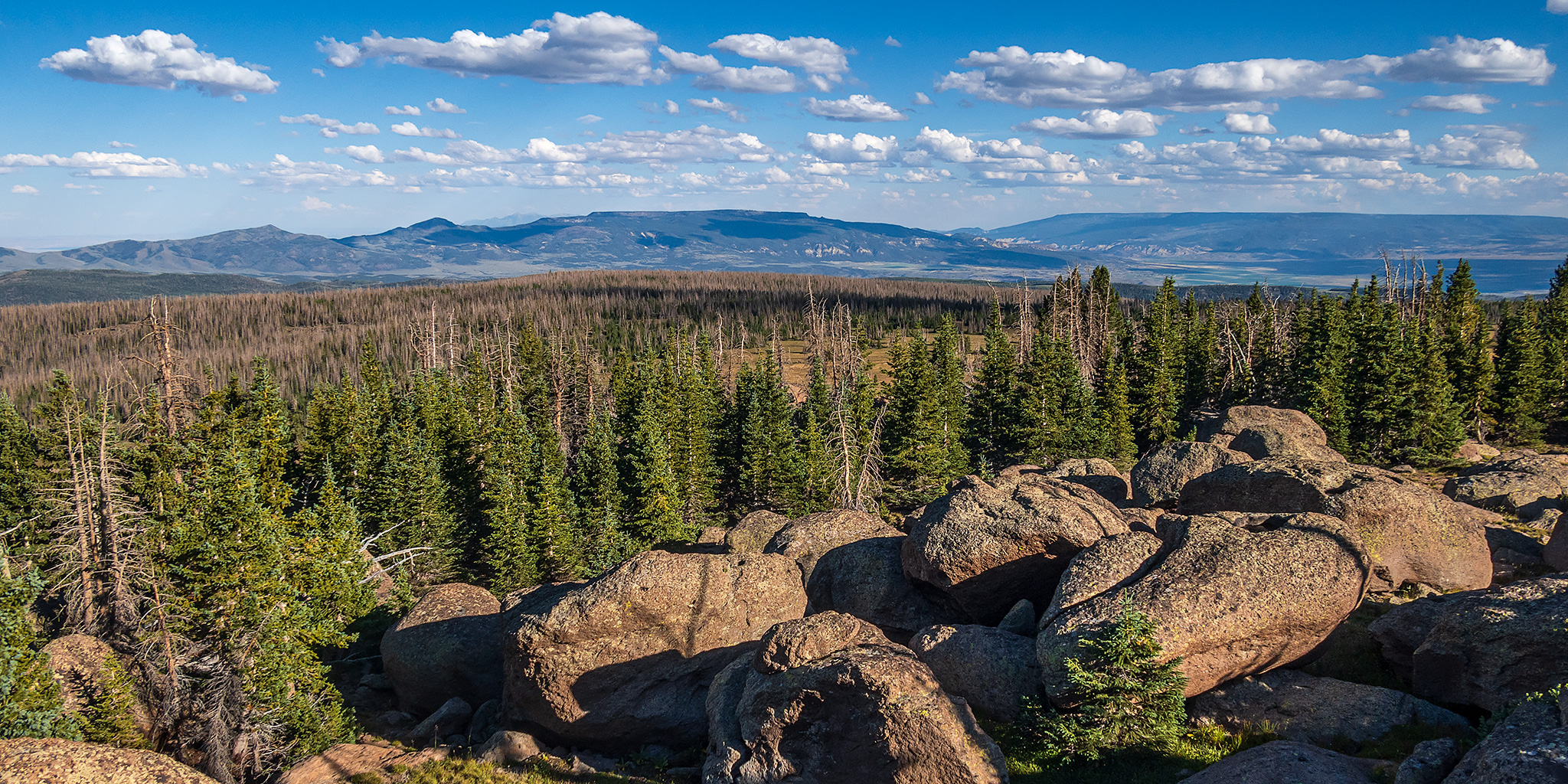
Despite the loftiness of their summits, the dominant visual character of the High Plateaus is horizontal rather than vertical, an effect of the level strata and the long mural walls that lead the gaze into the blue distance. It is a country of long views, a spacious country, yet the horizon, however distant, is always clearly defined, the ridgelines providing a proper edge to the immensity of the sky.
– Edward A. Geary
The High Plateaus of Utah are a group of elevated tablelands that form the boundary between the Colorado Plateau and the Great Basin in Central Utah and are what Wallace Stegner once described as “those remarkable mountains that are not mountains at all but greatly elevated rolling plains.” Although I have driven around and between the High Plateaus many times over the years, I have not spent very much time up on top of any of them and I wanted to change that this summer so I could see what they were all about. And what better way is there to get to know a new place than by driving the backroads and visiting the highpoints along the way! I figured that I would start at the northern end of the Wasatch Plateau and then work my way south, looping back around to finish up on Thousand Lake Mountain, where I could hop back on I-70 and head back home after a nice introduction to the area. That was the plan, and I thought it was a pretty good one, but as you will see, “the best laid plans of mice and men often go awry.”
I was originally going to head out on this journey after work on Wednesday afternoon, but the weather forecast starting on Friday morning and lasting throughout the holiday weekend was looking very wet and stormy, which wouldn’t leave me much time up in the high country, so I made a last-minute decision to leave on Wednesday morning instead so I could visit at least some of the highpoints before the moisture arrived.
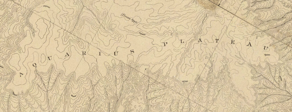
Map of the District of the High Plateaus of Utah
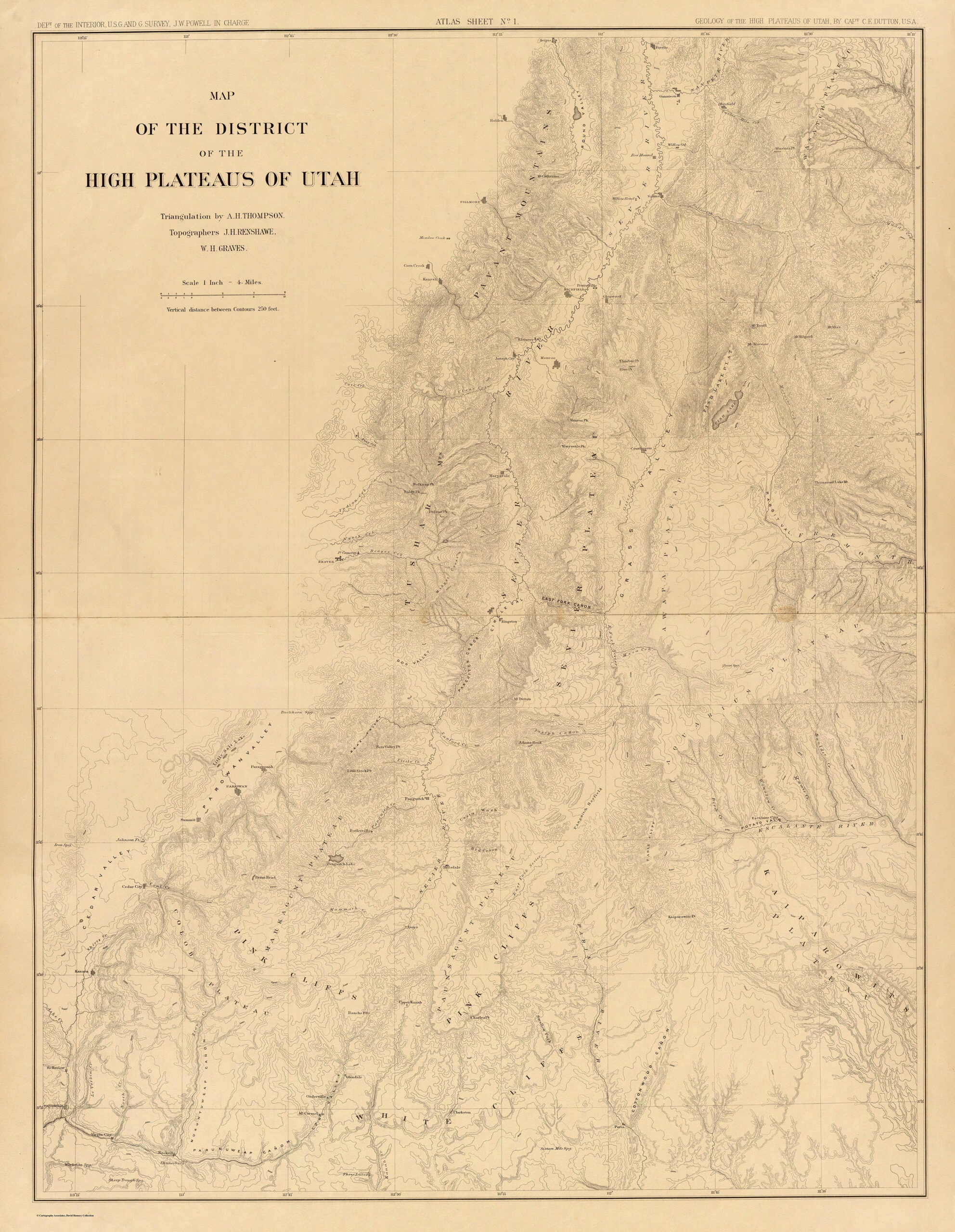
Click here to download a full resolution version of this map: 24MB
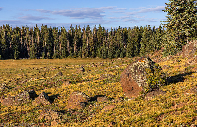
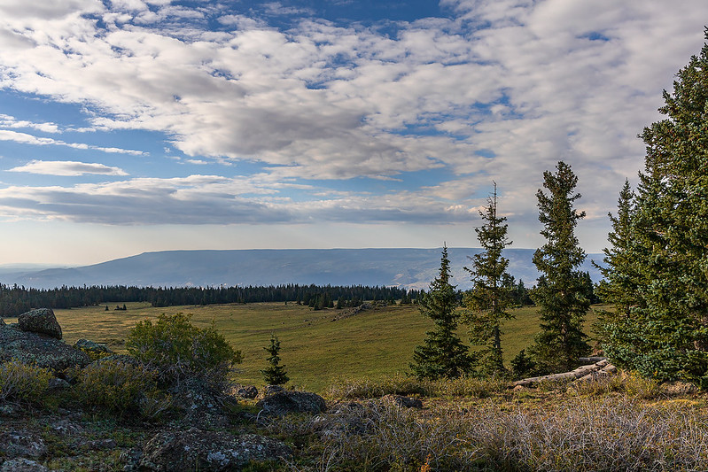
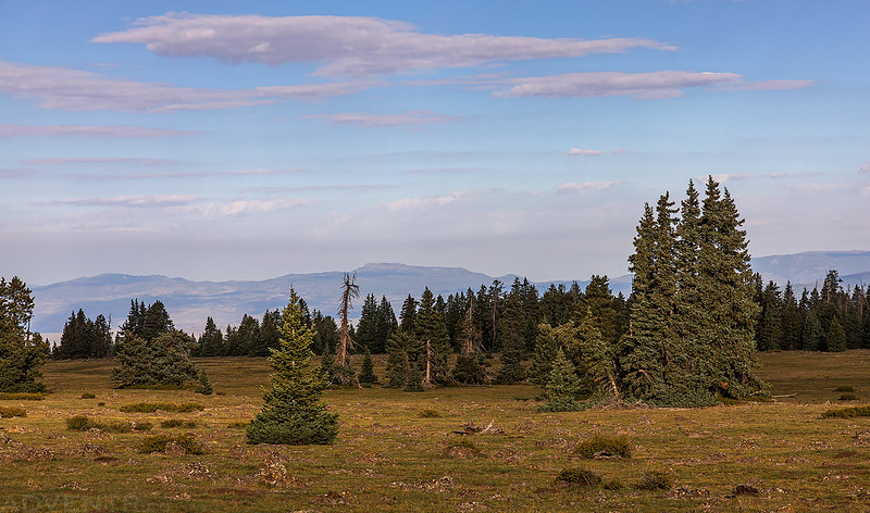
Skyline Drive: The Spine of the Wasatch Plateau
Originally built in the 1930’s by the Civilian Conservation Corps, Skyline Drive is surely one of the most remarkable roads in a region of scenic routes. It winds along the ridge for more than seventy miles, much of the way at elevations above ten thousand feet, affording spectacular vistas at every turn.
– Edward A. Geary
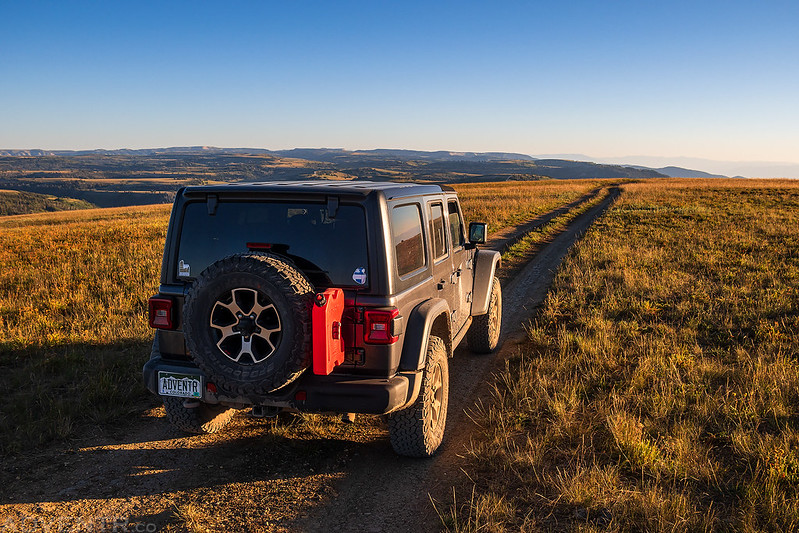
I left home on Wednesday morning and made my way over to Tucker, which is located near the head of Spanish Fork Canyon just on the other side of Soldier Summit, and started my journey from the northern end of Skyline Drive. I have wanted to drive the entire length of Skyline Drive for as long as I can remember, and almost did last year, but I was turned around by wet weather and muddy roads that time. This time the road was dry and dusty as I made my way to the spine of the Wasatch Plateau and headed south.
The views from the top were a bit smoky and hazy today.

Carbon County Highpoint: Monument Peak
Not long after reaching the top of the Wastach Plateau I went on a short detour and dropped down Flat Canyon into Upper Huntington Canyon where I drove past the top of Electric Lake on my way up to the summit of Monument Peak, which is the highest point in Carbon County.
Monument Peak

It was an easy drive all the way to the summit at the northern end of Trough Springs Ridge.
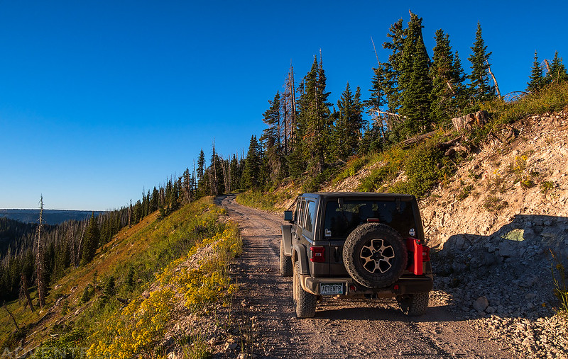
My Jeep on the summit of Monument Peak (10,452).
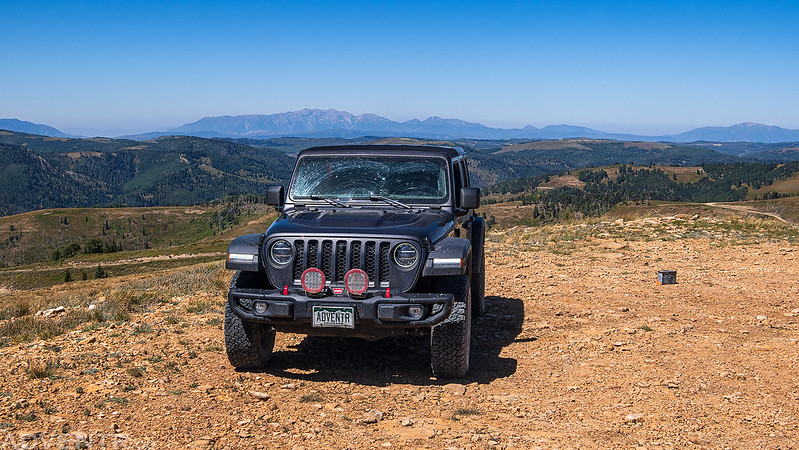
A view across the plateau from the summit.

After the detour to Monument Peak I returned to the top of the Wasatch Plateau and finished driving the northern section of Skyline Drive to paved State Highway 31. I had just started along the southern portion when I made a brief stop to walk up to the summit of Towhead.

From the summit of Towhead (10,270) I could see over to the Cleveland Reservoir.

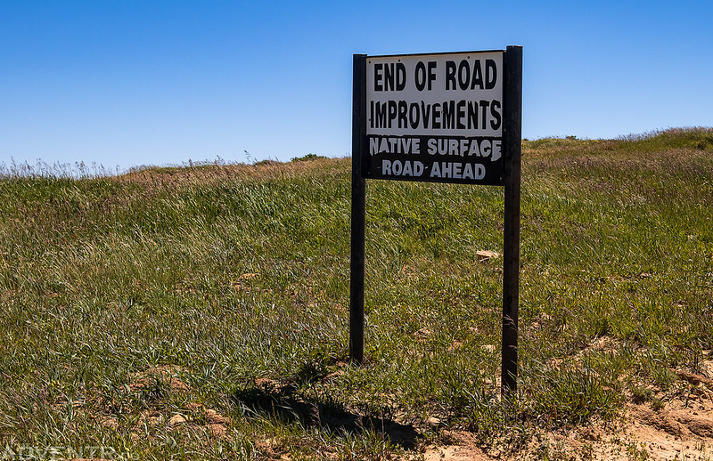
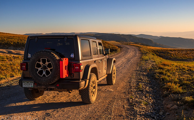
Skyline Drive up until this point is pretty well-maintained, but from here on out there were sections that had deep ruts from when the road was wet.
I took a second detour from Skyline Drive when I reached Potters Canyon Road since I was hoping to hike to the summit of East Mountain, which is the Emery County highpoint. Unfortunately, I ran into a locked gate on the way to the trailhead that I was planning to use, and with my tightened schedule I decided to skip it this time.

I stopped to walk along the shore of the Potters Ponds instead, since I was driving back by them.
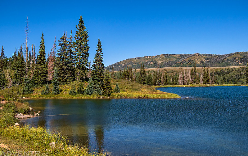
Potters Ponds

Back on Skyline Drive


Highpoint of the Wasatch Plateau: South Tent Mountain
Sanpete County Highpoint
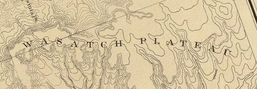
The third range of plateaus begins much farther north than the others. The northernmost member of it is the Wasatch Plateau, which overlaps the southern end of the Wasatch Mountain Range en echelon to the eastward. It is a noble structure, nearly as lofty as the summits of the Wasatch Mountains, but is a true plateau, or rather the remnant of one left by the erosion of the country to the east of it.
C.E. Dutton, 1880
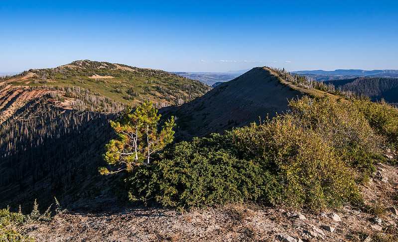
My third and final detour of the day was a short way down into the head of Reeder Canyon so I could hike up to the summit of South Tent Mountain, which is the highest point on the Wasatch Plateau and also the Sanpete County Highpoint.
It was a short but steep climb up to the ridge.
Then it was a nice easy ridge-walk to the summit.
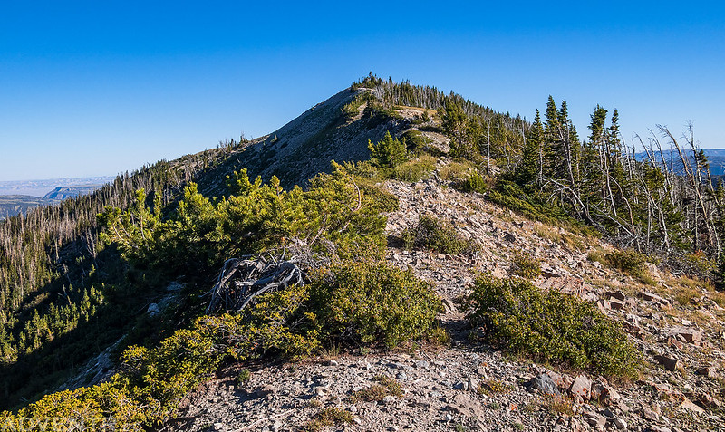
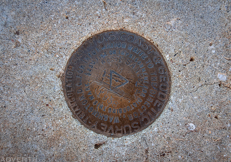
South Tent Mountain Summit (11,285)

South Tent, 1919

I walked a little further south from the summit for a better view.

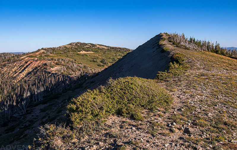
When I returned to the saddle, I decided to head up to the top of North Tent Mountain since I was already so close. Here’s a view looking back at South Tent Mountain.
Following the ridge to the summit.
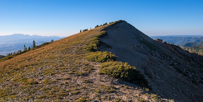
South Tent from North Tent
North Tent Mountain Summit (11,230)
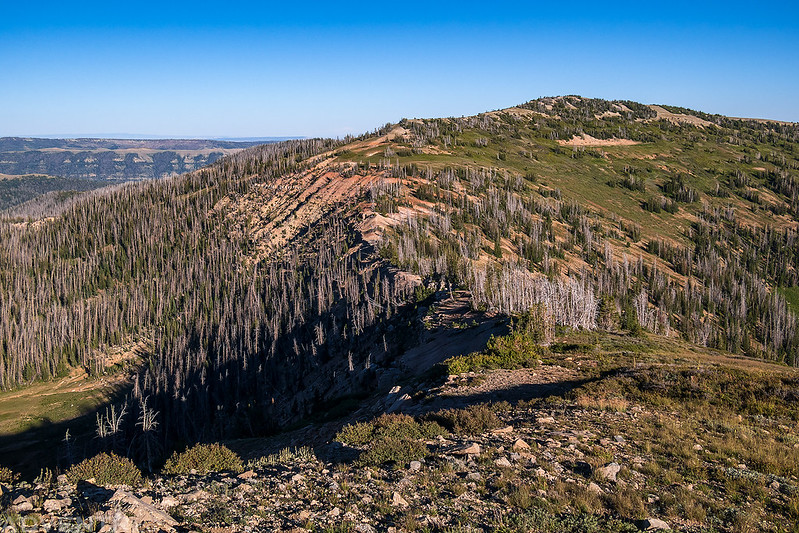
After my final detour to the highpoint of the Wasatch Plateau I continued on to Horseshoe Flat and arrived shortly before sunset where the views really opened up and I had a great view over the Wasatch Plateau.

I couldn’t help driving over to the summit of Horseshoe Mountain (10,988).

West Sanpete 2, 1938
A hazy view over the Little Horseshoe from the summit.
An evening view over the Sanpete Valley.
Horseshoe Mountain Two-Track
Looking back along the edge to the summit of Horseshoe Mountain.
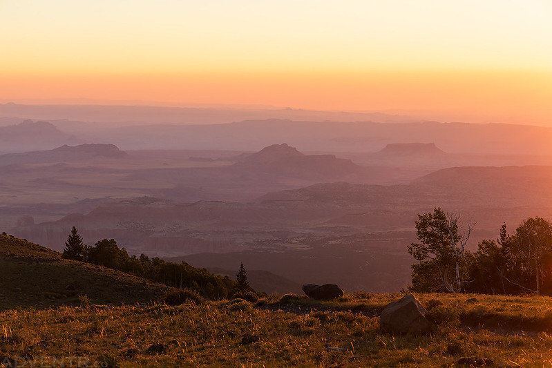
The smoke and haze in the air added some nice and interesting color to the light this evening as I continued driving south until dark.


Skyline Drive at Sunset

I passed by Snow Lake at dusk, followed by the Jet Fox Reservoir.

Shortly after passing by the Jet Fox Reservoir, I found a campsite off a side road above the South Fork of Manti Canyon and went to bed a little bit later after watching a very bright orange Full Moon rise from the east side of the plateau.

Thursday morning I was up and on the road early since I still had a lot of ground to cover and I wasn’t sure how rough the roads were going to be.

I watched the Super Blue Moon descend through the Earth’s shadow at dawn.

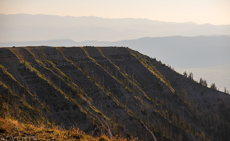
I also watched the sunrise from the edge of the Wasatch Plateau.
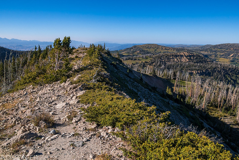
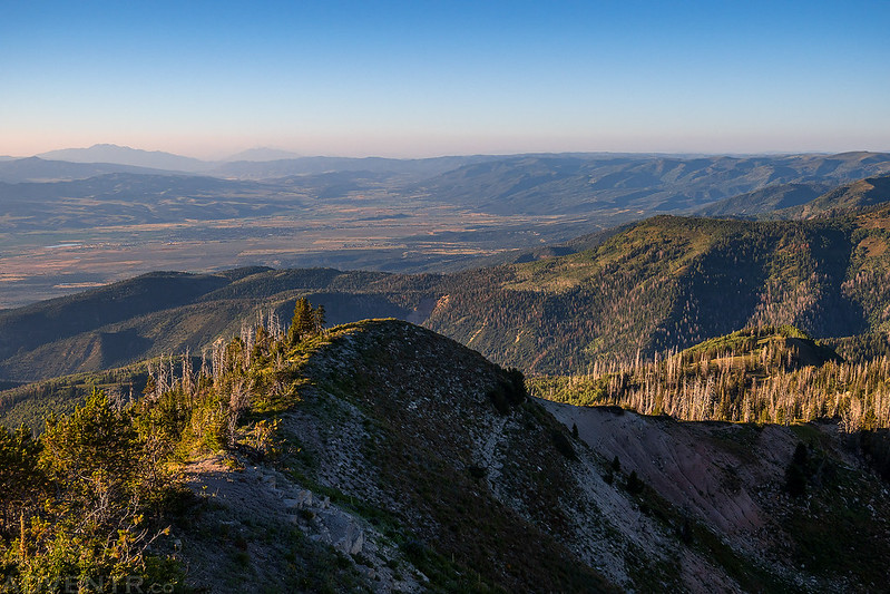
I reached High Top, the highest point on Skyline Drive, just after the sun had come up for the day.

Then I continued south on my way to meet up with I-70.


There was a great field of wildflowers as I drove around the head of the Gunnison Valley with Musinia Peak (Mollys Nipple) in the background.

From Gunnison Valley is was an easy drive off of the Wasatch Plateau into Salina Canyon where I hopped onto I-70 and made my way over to Richfield.
Highpoint of the Pahvant Range: Mine Camp Peak
Millard County Highpoint
The Pavant is a curious admixture of plateau and sierra, the eastern side being- tabular in form and detail, while the western side is a common mountain front, like many others found in the Great Basin.
C.E. Dutton, 1880
After grabbing an early lunch in Richfield I headed west out of town and started climbing up into the Pahvant Range via the Richfield CCC Trail. I met up with the Paiute ATV Trail and followed it to the pass between Mine Camp Peak and White Pine Peak.
Little Valley

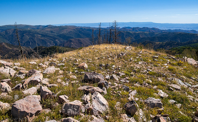
I went on a short hike from the pass to the top of Mine Camp Peak, which is the highpoint of the Pahvant Range and also the highest point in Millard County.

It was a short and easy hike up the ridge, after dropping down to the saddle from the road.

To the north was a good view of Mount Catherine & Pioneer Peak.

Mine Camp Peak Ridge

Mine Camp Peak Summit (10,222)

Here’s a view from the summit looking back toward the Wasatch Plateau before I hiked back down to my Jeep.
Before driving back down to Richfield, I made a quick drive to the summit of White Pine Peak (10,215) since there is a road to the top and it was right there. It also happens to be the second highest peak in the range.
Highpoint of the Sevier Plateau: Monroe Peak
The great amphitheater near Monroe has laid open the table to its foundation, but the promise of information conveyed by such a section is not fulfilled. It has revealed a bewildering maze of earlier rocks lying in all possible positions and having but few intelligible relations to each other. Upon them rest later floods in rather regular bedding, which succeed each other to the summit. I have revisited this locality repeatedly, but have generally found at each visit more questions than answers.
C.E. Dutton, 1880
I was originally planning on heading over into the Tushar Mountains next, but with the incoming storm system and the fact that I had already hiked Delano Peak, the highest point in the Tushar Mountains last year, I decided to skip them this time and move on to somewhere new. So I drove across the Sevier Valley to Monroe and followed the road up Monroe Canyon to the summit of Monroe Peak, which is the highest point on the Sevier Plateau.
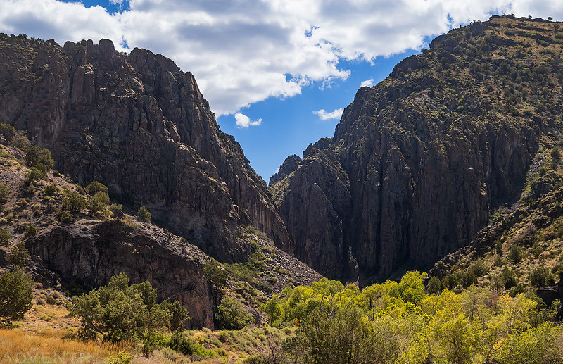
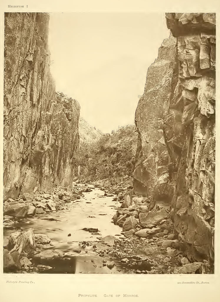
Shorty after leaving the town on Monroe, I entered the Gate of Monroe.
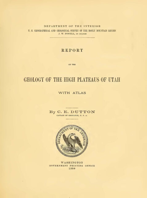
Here is a heliotype of the Gate of Monroe taken from Dutton’s 1880 ‘Report on the Geology of the High Plateaus of Utah.’ If you are interested in learning more, you can download a copy of that report at the bottom of this page.
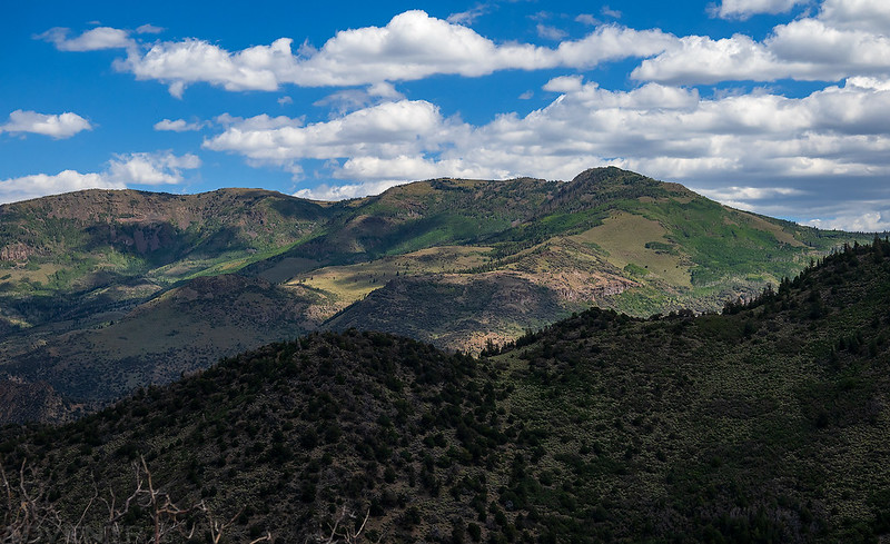
Glenwood Mountain & Signal Peak seen from the road up to Monroe Peak.
Monroe Peak Road

From the end of the road it was just a short walk to the summit.

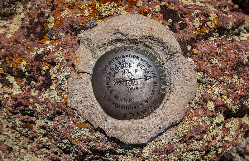
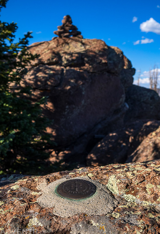
Although I didn’t find a benchmark anywhere around, I did spot this reference mark with the dates 1919 and 1968.
Monroe Peak Summit (11,227)

From the summit I drove down the east side of the Sevier Plateau into Koosharem and Grass Valley.
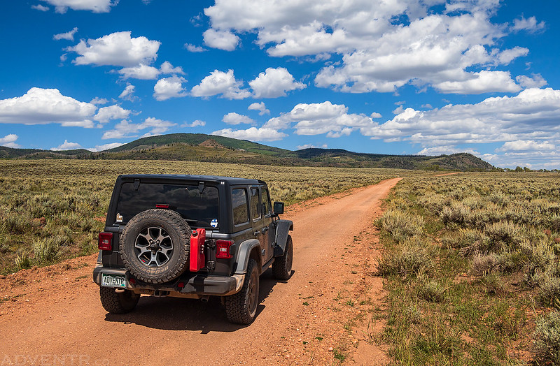
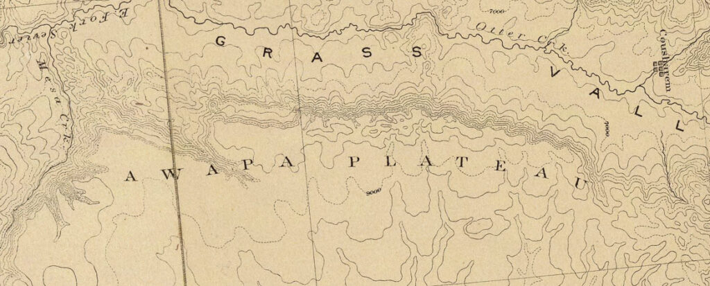
Highpoint of the Awapa Plateau: Parker Mountain
It is a dreary place. Upon its broad expanse scarcely a tree lifts its welcome green, save a few gnarled and twisted cedars. Its herbage consists only of the ubiquitous artemisia and long nodding grasses. Not a spring or stream of water is known upon all its area, except at the lowest part, where its slope merges into the floor of Rabbit Valley. And yet most of its surface is at an altitude where verdure and moisture abound, and where the summer is like the spring of more favored regions. But here the snows of winter are melted early, and the summers are nearly as hot and dry as those of the plains below.
C.E. Dutton, 1880
From the little town of Koosharem I drove straight up the Praetor Slopes onto the Awapa Plateau and then followed a couple different backroads to it’s highest point on the summit of Parker Mountain.
The roads started out good…

…but they became a bit rougher and less-used the closer I got to the summit.

From the end of the road it was a bit of a bushwhack to the top of Parker Mountain (9,900), which was situated in the trees with no view.

I walked a short distance from the summit to a little opening in the trees for this limited viewpoint.

Looking back toward Parker Mountain as I made my way east off of the Awapa Plateau to Loa in Rabbit Valley.

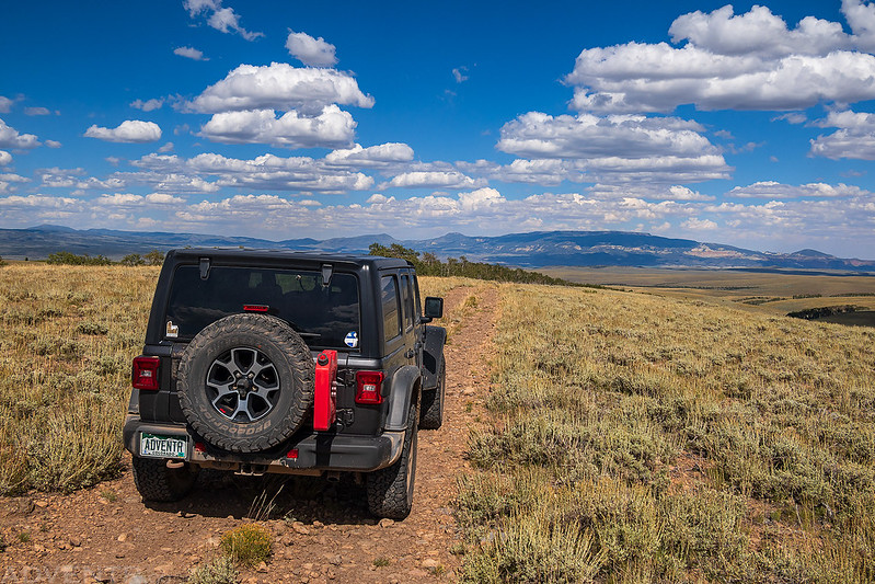
From the relatively low top of the Awapa, there are nice views of the surrounding plateaus rising high above the sage-covered plains including Thousand Lake Mountain and the Aquarius Plateau (Boulder Mountain).

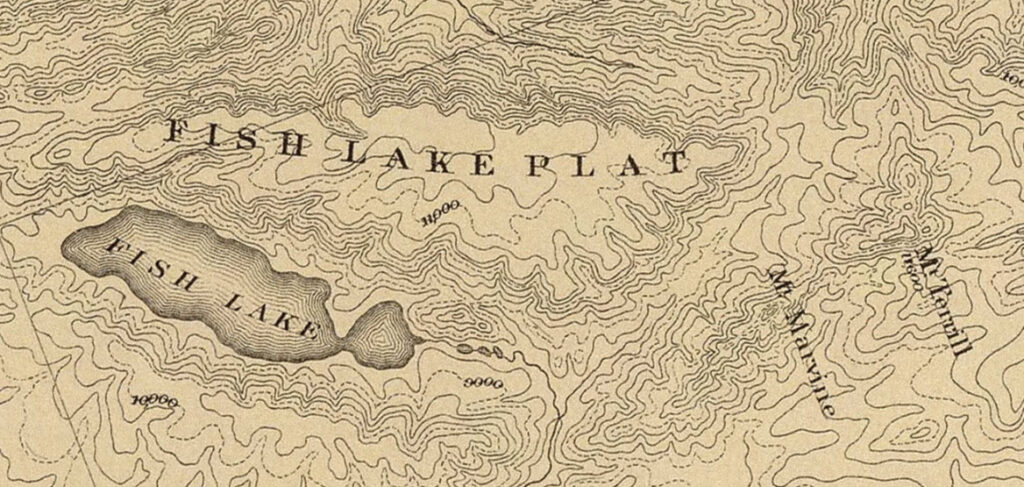
Highpoint of the Fish Lake Plateau: Fish Lake Hightop
Upon the very brink of this wall is the highest point of the plateau, from which, in a clear day, we may easily discern the peaks of the Wasatch around Salt Lake City and beyond. These are more than 150 miles distant. Mount Nebo, 70 miles northward, seems like a near neighbor, and the gray peaks of the Tushar are seen towering beyond the heights of the Sevier Plateau. To the southward looms up the grandest of all the plateaus — the Aquarius — its long straight crest-line stretched across the whole southern horizon, and seeming but a few hours’ ride away from us. Here we do not feel that sense of being upon a plain which impresses us while traveling upon the other plateaus, but we realize that this summit is at a great elevation; for we may look afar off in every direction to valleys and plains which lie thousands of feet below us, and beyond which we perceive other summits rising to altitudes nearly or quite equal to our own.
C.E. Dutton, 1880
After driving down from Parker Mountain into Loa, I topped off my gas tank and then headed up onto the Fish Lake Plateau so I could get one final highpoint in before sunset.
After driving up through Hancock Flat and then onto the top of Fish Lake Hightop Plateau, I pulled over near the highest point and started hiking the rest of the way to the summit.

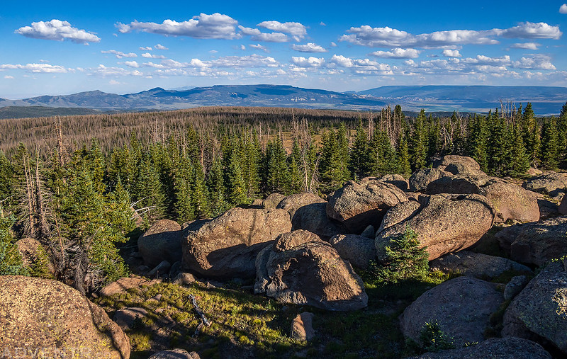
There were a lot of interesting large boulders on top that I had to scramble around and over.
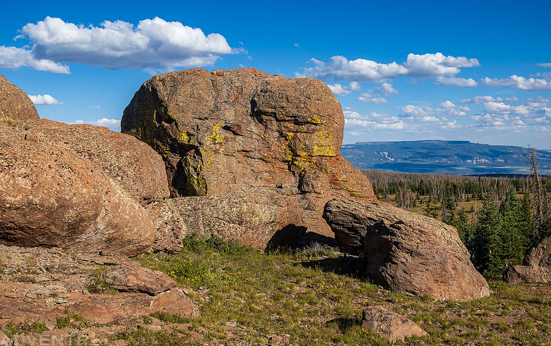
It wasn’t long until I was looking at the highpoint.
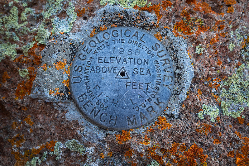
Fish Lake Hightop Summit (11,633)

Fish Lake, 1968
From the summit I had great views of Thousand Lake Mountain and Boulder Mountain, both of which I had hoped to visit the following day, but the weather would have other plans for me.

Driving across the Fish Lake Plateau.

The clouds were looking great this evening.

Hancock Flat

As I drove down, looking for a campsite along the way, there was a great view of Monroe Peak across Grass Valley at sunset.

The top of the Awapa Plateau was catching the light nicely, too!

I ended up finding a place to camp further down on the Awapa Plateau just in time to watch the colors fade into darkness and distant lightning shorty thereafter.

I woke up early on Friday morning with hopes of being able to squeeze something else in before the storms arrived, but it had been very windy all night with on and off rain and when I checked the forecast I found that a big storm system was headed right for the area, so I decided to call it a trip and head home, but I was determined to return the following weekend to finish what I had started, assuming the weather cooperated.
However, before actually heading home, I thought it would be a good time to drive through the Pando Clone and see Fish Lake, since I had never been to this area before.
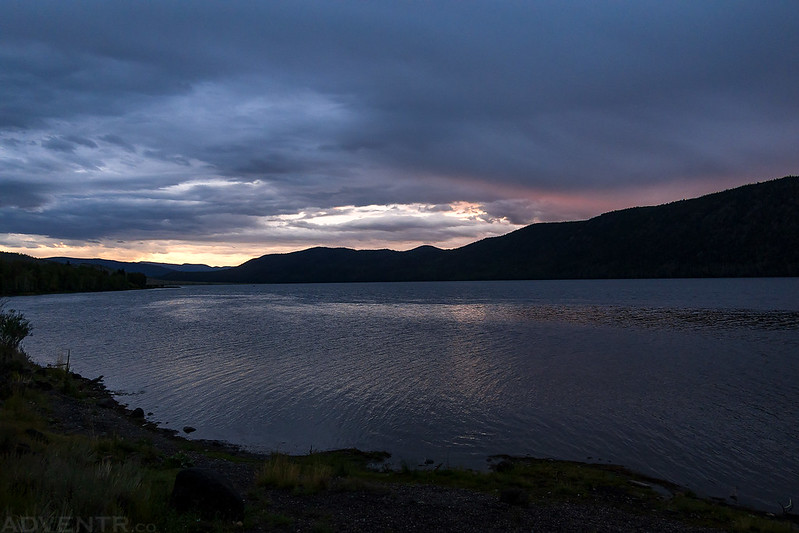
While I was walking along the shore of Fish Lake at dawn, the rain arrived…

I did have a great view from Hogan Pass toward the Henry Mountains as I made my way back to I-70.
Stairway to the Clouds: The High Plateaus of Utah
Part II
Friday – Saturday, September 8-9, 2023
Since my trip last week was cut short by the weather, I decided to return this weekend to finish what I had started in the High Plateaus of Utah. I think this might actually be the first time I have ever combined two separate weekend trips into one Trip Report, but since I was determined to complete this one as a whole and it made sense to just continue on, that’s what I’m going to do.
Of course, during the entire week leading up to this weekend there were no rain or storms in the forecast for the foreseeable future, but as soon as I started packing gear into the Jeep on Thursday afternoon there was a sudden change in the forecast that called for wet weather starting overnight on Saturday and lasting through Sunday and into the following week. Well, I figured I should be able to get what I wanted to all done on Saturday and I wasn’t going to be cancelling my plans again. Part II of the trip was still on!
Highpoint of Thousand Lake Mountain: Flat Top
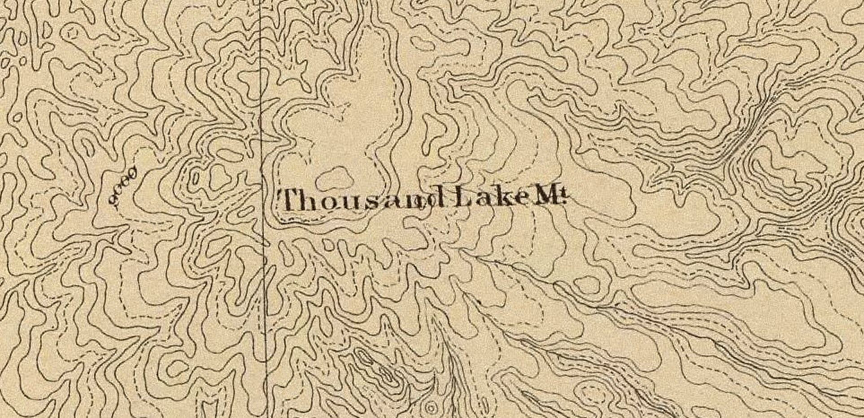
Thousand Lake Mountain is an exceedingly interesting object. The name was given by the Mormons who pasture flocks in the valley below. They derived it from a group of pools of glacial origin upon the summit. Structurally and morphologically it is a small plateau, in some respects very similar to the other and larger members of the district, but possessing, also, features peculiar to itself.
C.E. Dutton, 1880
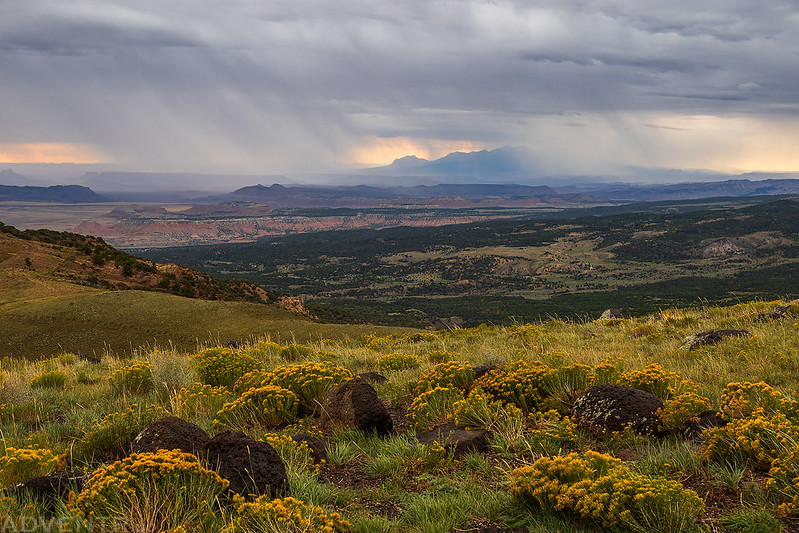
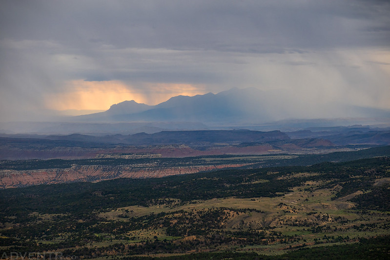
I left from work on Friday afternoon and headed west into Utah. After a quick stop for gas in Green River I drove across the San Rafael Swell and encountered some thick smoke near Emery that appeared to be coming from the base of the Wasatch Plateau, although I have not been able to figure out exactly where it was coming from?
You can see the smoke just above the ridge in this photo that was taken along the road up to Hogan Pass.

Hogan Pass View

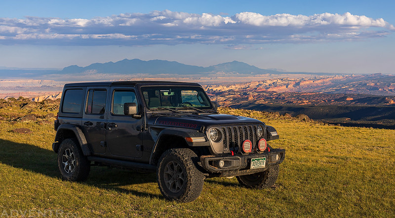
After passing by the Forsythe Reservoir I turned left and headed up onto Thousand Lake Mountain and found an awesome campsite on Deep Creek Ridge overlooking Capitol Reef Country.
There was a great view over Paradise Flats far below.
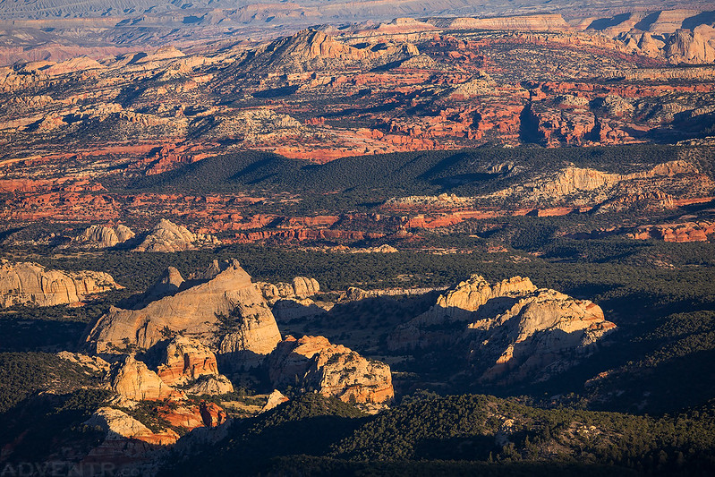
Capitol Reef Country

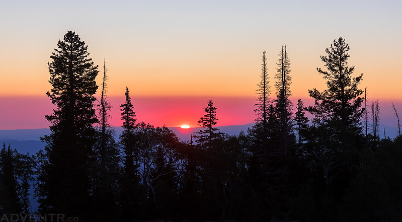
It’s too bad there was so much smoke in the air this evening, but even so, the view was spectacular at sunset!

It was pretty windy overnight, but I still slept very well and was up in time to watch the sun break free of the horizon.
The smoke added some nice colors at sunrise over the desert landscape below.
Henry Mountains through the Smoke

From my campsite it was a short drive over to the trailhead for the Flat Top Trail, which I followed up to the top of Flat Top.

Smoky Layers from the Edge

Once I was on top, it really was pretty flat and was easy hiking all the way to the highpoint.

The highpoint of Thousand Lake Mountain is on top of this rocky knob.

Thousand Lake Mountain Summit (11,306)

1000 Lake, 1919

From the summit there was a good view south to the Aquarius Plateau, which would be my next destination this morning.
I could also see Monroe Peak and Marysvale Peak over on the Sevier Plateau.
Another view of the smoke-filled landscape below before I hiked down off the rim.

Below The Rim

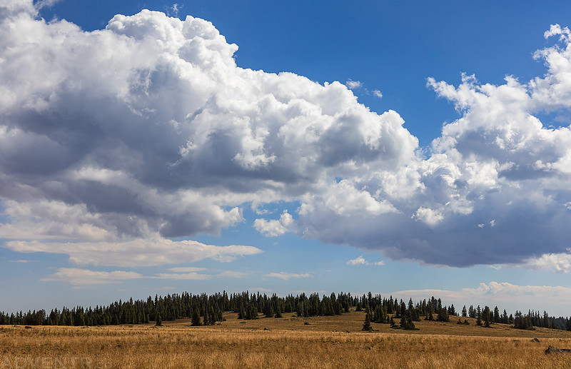
Highpoint of the Aquarius Plateau: Bluebell Knoll
Wayne County Highpoint
The Aquarius should be described in blank verse and illustrated upon canvas. The explorer who sits upon the brink of its parapet looking off into the southern and eastern haze, who skirts its lava- cap or clambers up and down its vast ravines, who builds his camp-fire by the borders of its snow-fed lakes or stretches himself beneath its giant pines and spruces, forgets that he is a geologist and feels himself a poet.
C.E. Dutton, 1880
After driving down off of Thousand Lake Mountain I headed over to Loa for gas and then started the drive up to the top of the Aquarius Plateau, which is more commonly known as Boulder Mountain or Boulder Top.
It wasn’t long until I was looking at Bluebell Knoll, the highest point on Boulder Mountain.
There’s even a sign to let you know you are in the right place.
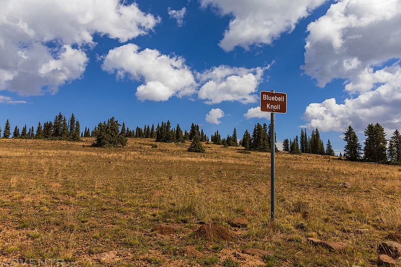
It was a short and easy walk to the summit of Bluebell Knoll (11,340).

I wasn’t expecting to find a benchmark up here, but then I came across this blank one. I don’t think I’ve ever seen a blank one on a summit before?

After returning to my Jeep I drove around to Raft Lake for a different view of Bluebell Knoll.

Boulder Top Road

Boulder Top definitely reminds me of the Grand Mesa near home.

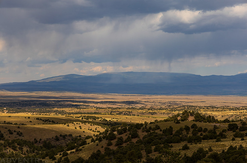
Looking out across the Awapa Plateau on the way back down.

I stopped for lunch and watched the rain come down over the southern end of the Fish Lake Plateau.
Tushar Mountains: A Short Scenic Drive
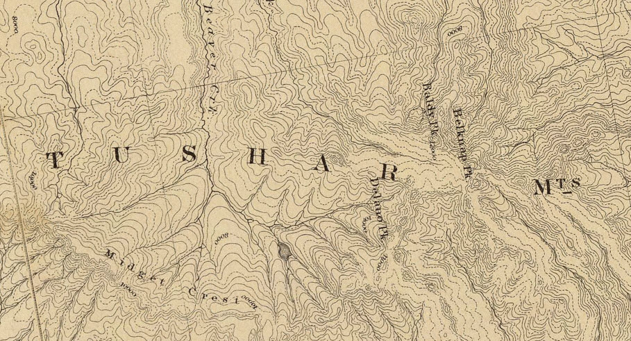
The loftiest, boldest, and most diversified portion of the Tushar fronts the Sevier Valley in the vicinity of a little hamlet called Marysvale, situated about 27 miles south of Richfield. The great mountain wall leaps at once from the narrow platform of the valley to nearly its greatest altitude. Immense ravines, rivaling those of the Wasatch in depth, but narrower and with steeper sides, have deeply cleft the great tabular mass, and subdivided it into huge pediments, which from below appear like individual mountains.
C.E. Dutton, 1880
Although there were storms popping up in the area this afternoon, I thought I’d be able to head up into the Tushar Mountains for at least one more highpoint that I hoped to be able to drive right up to. I decided to take the long way around to the other side of the Sevier Plateau and headed south through Grass Valley to Kingston Canyon (referred to as East Fork Canyon by Dutton in 1880), which follows the East Fork of the Sevier River as it cuts right through the Sevier Plateau and enters Marysvale Valley. Then I followed the Sevier River north past the Piute Reservoir and turned up the road following Cottonwood Creek into the Tushar Mountains.
As I drove up Cottonwood Road I caught a couple views of Delano Peak and East Delano.
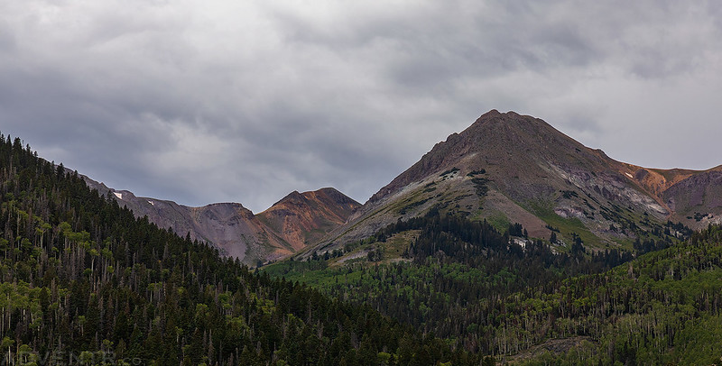
The road climbed up high onto the shoulder of Edna Peak.

Unfortunately, the two roads that lead to the summit of Edna Peak and Mount Brigham had locked gates across them with No Trespassing signs. I guess I wouldn’t be getting up to those peaks today after all…

There were some storms in the area, so I headed down to Miners Park in Bullion Canyon.

Marysvale Valley

At this time I had completed pretty much everything I wanted to and the weather forecast wasn’t looking great for Sunday, so I decided to grab dinner in Richfield and then head home.
Instead of taking the interstate through Salina Canyon, I got off on the side road at the Gooseberry exit and drove through the old railroad tunnels along the way.


After crossing over Emigrant Pass on the side road, I hopped back on I-70 and finished the rest of the drive home. I’ve had an amazing time on these two short trips into the High Plateaus of Utah and am looking forward to doing another similar trip next summer to the peaks and plateaus further south!
>> The High Plateaus of Utah Photo Gallery
>> The High Plateaus of Utah II Photo Gallery
Very cool adventure. Thanks
That’s a couple of excellent trips! I think I’ve been to all those places except the high point of Parker Mountain, which I was going to hike to in July but skipped it after the bushwhack getting to the nearby Cinco benchmark.
I’m curious where the locked gate was on the way to East Mountain?
Yeah, the summit of Parker Mountain was my least favorite of the trip.
As far as East Mountain, I may not have been going to the best place to start the hike (now that I’ve done some more research), but I was on Forest Service Road 0017 just north of the Indian Creek Campground. It was gated and locked to full-sized vehicles, but open to 50″ and narrower. It looks like there is a road above and to the east of that one that goes on top of the ridge which might be a better place to start the hike from anyway. Maybe I can get back there next summer.