Friday – Sunday, February 4-6, 2022
For the past two years I have spent the first weekend in February exploring the White Rim in Canyonlands National Park. You can find those two Trip Reports here: White Crack Trail to The Confluence & Airport Tower to Monument Basin. I’ve had good weather and great views on each of those trips so I decided to do it one more time this year and grabbed a camping permit for Gooseberry and Airport back in November before the prices of backcountry permits were raised, so this was going to be my last trip at the old price. I’ve spent a lot of time exploring from the White Rim Trail over the years and am actually running out of places I want to check out, but one place I’ve really wanted to hike down to for a long time is Monument Basin, so I figured this trip would be the perfect opportunity to finally give it a try. I knew Jared would be very interested in this hike, so I made sure to invite him along, too.
On Friday I worked a half a day and then grabbed an early lunch and drove over to Moab. I topped off my fuel tank in town and then followed the Colorado River to the Potash Boat Ramp where I met up with Jared in the early afternoon. Since the Shafer Trail is currently closed, we continued on along the Potash Road into Canyonlands on our way to Gooseberry, but we would not be making it all the way to our reserved campsite this evening…
Potash Road Petroglyphs

The Colorado River, Pyramid Butte and the La Sal Mountains from ‘Thelma and Louise Point’

We drove to the edge at the Colorado River Overlook.

A view over Little Bridge Canyon.

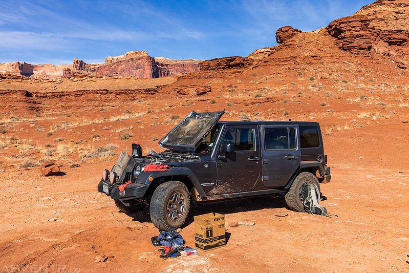
Shortly after passing the campsites at Airport Tower my Jeep lost all power as I was driving up a steep hill in Buck Canyon. I rolled my Jeep back to a flat spot and found that it had lost all its transmission fluid when a cooler line came undone. It would be easy enough to fix, but the big problem was that neither Jared or I carried any transmission fluid with us, and there was no way to get my Jeep up and running again without it. Since it was going to be dark soon and we were closest to the Airport Tower campsites, it seemed like the best idea was to get back there for the night since we were not going to be making it to Gooseberry. I had signal on my phone, so I checked on Rec.gov to see if any of the Airport sites had been reserved for the night, and none had been and I highly doubted there would be any walk-ups this late with the Shafer Trail closed, so I figured it would be OK to spend the night there.
Jared towed my Jeep back to the Airport Tower campsites for the night and we came up with a game-plan for the rest of the weekend while we ate dinner after sunset.
We got up early on Saturday morning so Jared could drive me back to Moab and I could buy transmission fluid and other parts necesary to get my Jeep working again. It was about a two hour drive each way and then took less than an hour for me to fix, so my Jeep was up and running again shortly after lunchtime. Unfortunately, by this time it was too late to start our originally planned hike into Monument Basin, so we drove back to the Walking Rocks so we could hike into Musselman Canyon and visit Musselman Arch from below. This was going to be a short hike on Sunday before heading home, so we just flipped the schedule around.
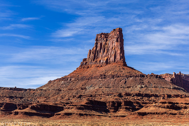
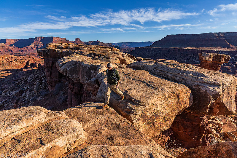
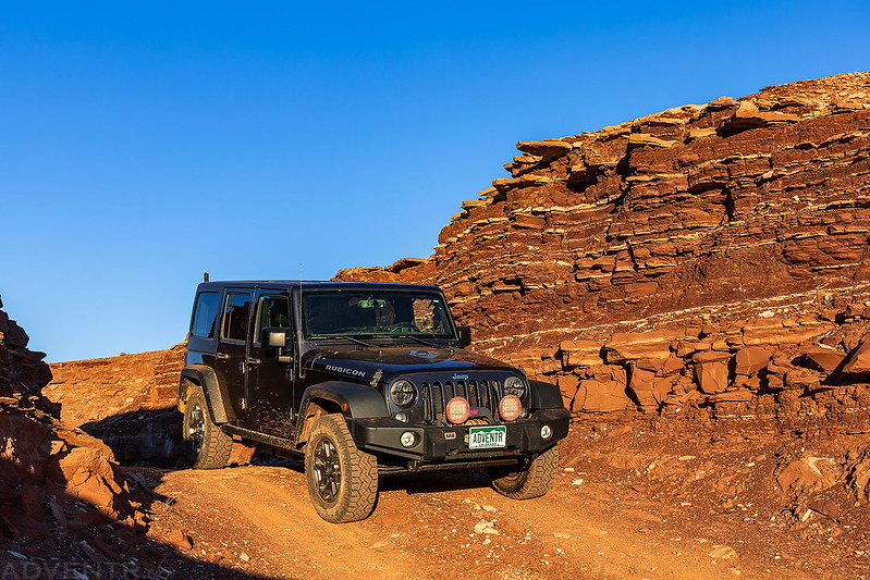
Airport Tower
Repairs in the Field
Back on the Road

Walking around the point into Musselman Canyon.
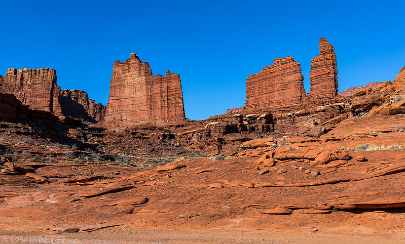
Twin Towers

Musselman Arch

Musselman Canyon

Climbing back out of the canyon below this hoodoo.

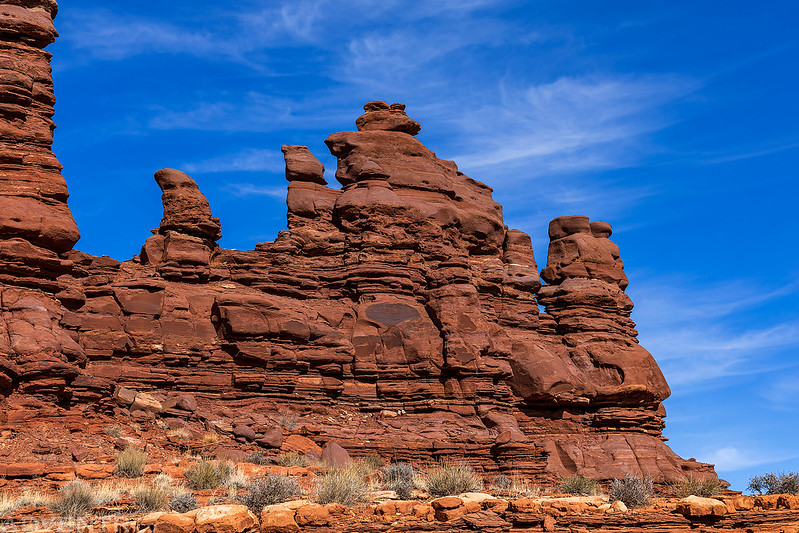
Jared and the Walking Rocks.
On our way back to camp we spotted a group of Desert Bighorn Sheep.
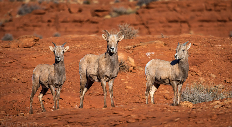
While I was taking photos near my Jeep, this one started coming right for me. As she got closer I was just about ready to hop into my Jeep, but she stopped to start eating right near the road. The rest followed suit and joined in. I guess they decided I wasn’t a threat and were tired of waiting for me to move so they could get to their meal.
This one stayed a little further behind and kept watch over the herd.

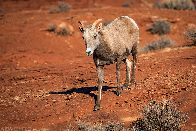
A little further down the road I stopped when I saw these two rams cross and then run right past me.
The United Nations Tablet over Little Bridge Canyon.
Stopped at the pass between Little Bridge Canyon and Lathrop Canyon.
Jared coming down the hill from the pass.


Last light on the rim of Lathrop Canyon.

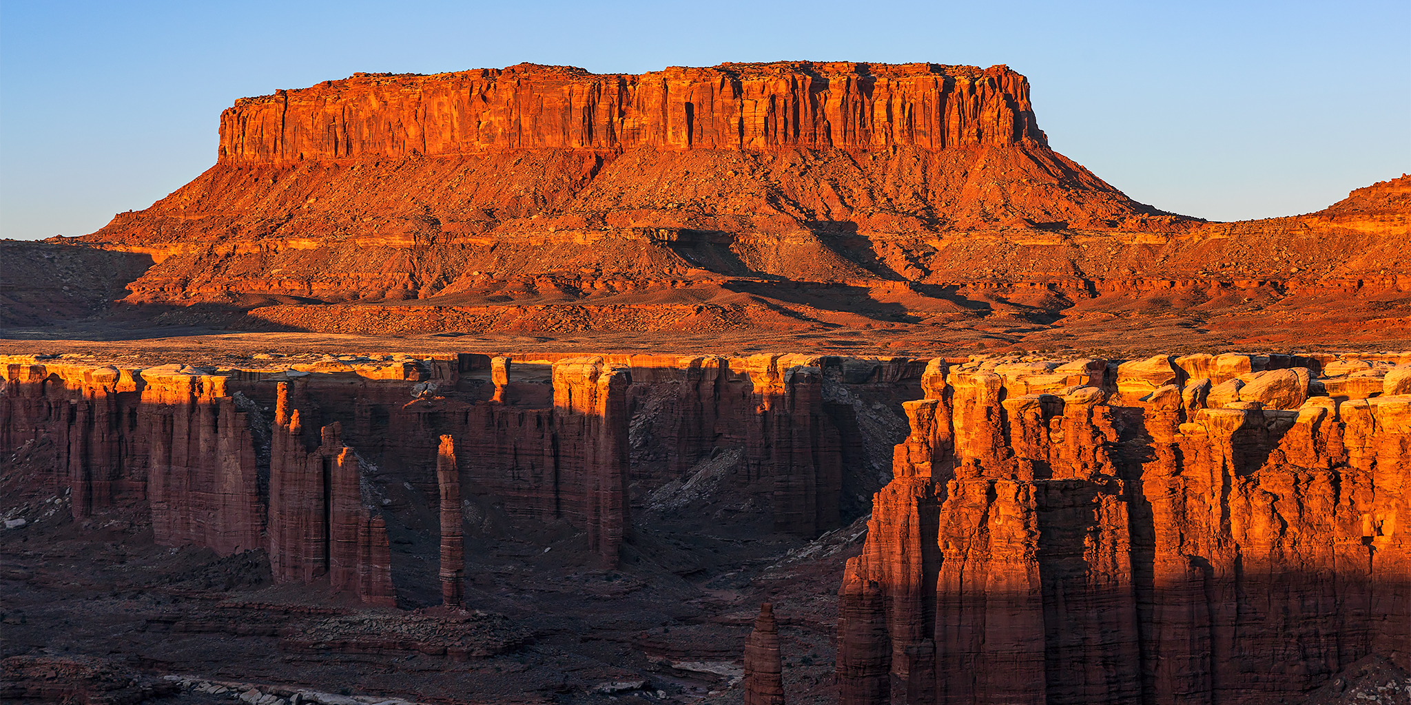
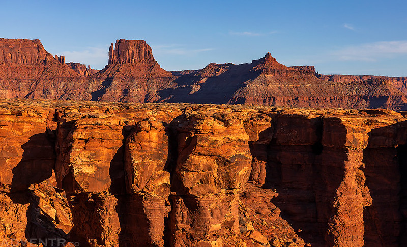
Island in the Sky

We woke up early again on Sunday so we could drive to the rim of Monument Basin and still get our main hike in. As we were driving in the dark, I wondered how many people up at Mesa Arch waiting for the sunrise could see our bright lights on the road below…
We arrived at the rim of Monument Basin just as the sun started to come up. It was perfect timing!

Junction Butte at Sunrise

Canyonlands Sunrise
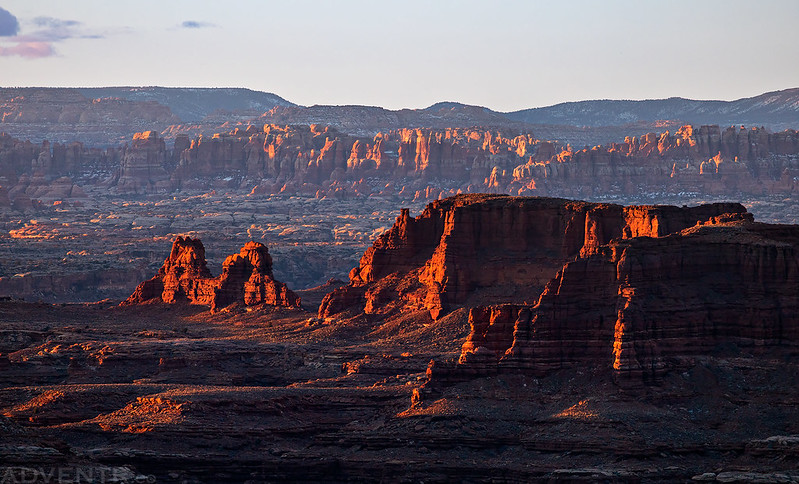
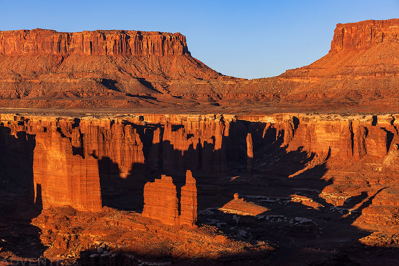
Monument Basin Sunrise

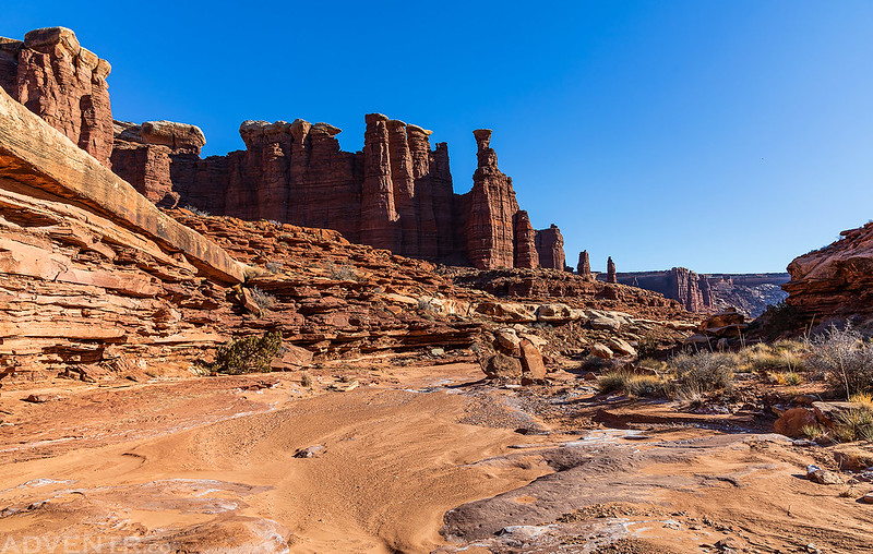
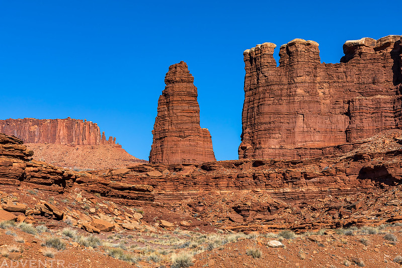
The views were spectacular as we walked the rim to the start of the Lathrop Sheep Trail.
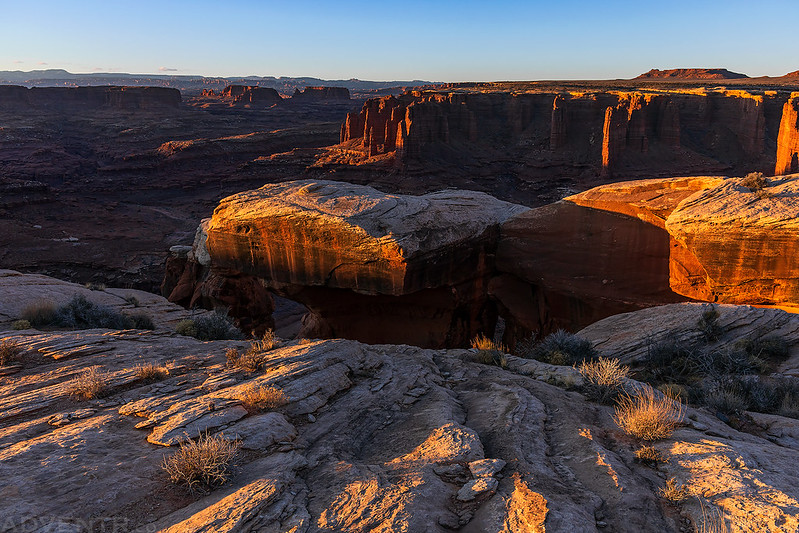
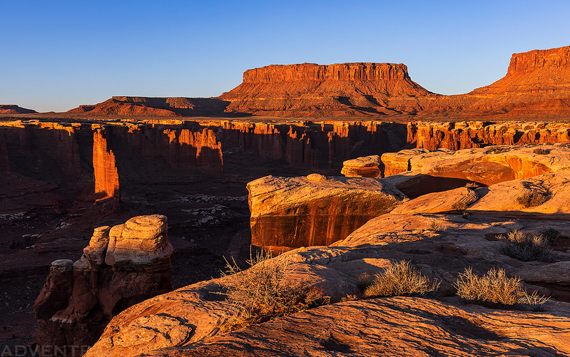
We stopped to take plenty of photos along the way….

Monument Basin Shadows
We spotted Monument Arch along the rim, too.

Once we found the beginning of the Lathrop Sheep Trail, which really isn’t much of a trail anymore, it was pretty easy to get down into the basin. The route was a little steep and loose in places, but it was much easier going than I thought it was going to be.
Here’s Jared at the bottom of the route.

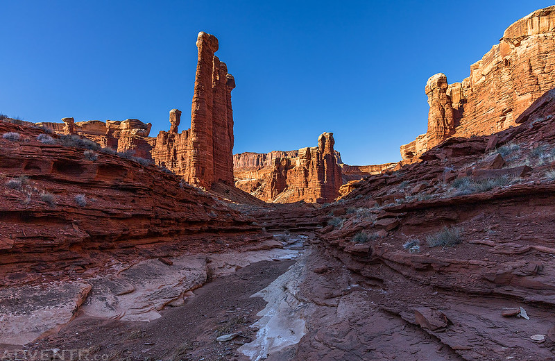
Once we reached the wash at the bottom we started hiking upstream so we could explore the upper reaches of the canyon and visit Standing Rock.

Soon we had a good view of Standing Rock, also known as the Totem Pole.

The Totem Pole. I’ve seen this amazing tower from above many times before, so it was pretty exciting to finally see it up close from below!

We continued further up the canyon a little ways…

Upper Monument Basin Canyon
Jared Below

Monument Basin Canyon

Totem Pole & Sunstar

Next we hiked down the canyon, past where we had entered, all the way to a pourover that stopped us. The scenery along the way was pretty grand!
The Meemohive
The Mock Turtle
Walking in the wash…

After turning around at the pourover we hiked back up the Lathrop Sheep Trail to the rim.

This is the top of the Lathrop Sheep Trail and the crack used to start the descent.

We followed the White Rim Sandstone back to our vehicles and then started the drive back out.

Although things may not have gone quite as planned on this visit to the White Rim, we still managed to have an amazing weekend! I arrived home later than I would have liked, but it was worth it to finally make it down into Monument Basin. I’d also like to send out a big THANKS to Jared for the ride back into town so I could get my Jeep up and running again!
Inspiring- another place to add too the list. Good thing that Jared could join you!, and brought his own vehicle!
Hi Randy,
Awesome trip report.. My son and I are spending a couple of days on the White Rim trail over Presidents Day weekend and I was wondering if you would share the location of the Lathrop Sheep trail where it breaks thru the white rim.
I have always wanted to hike into Monument Basin.
Regards,
Michael