Friday – Sunday, February 5-7, 2021
While I had an amazing time supporting Diane and Jared as they biked the White Rim Trail in Canyonlands National Park last October, I didn’t quite have enough time on that trip to get in all the hiking that I had wanted to do because they were riding faster than I had anticipated! Since I had a backpacking trip to The Needles last spring that was cancelled because of COVID and I needed to reschedule that permit or lose in the next few months, I thought it would be nice to head back on my own to the east side of the White Rim so I could make up the hikes I had skipped out on. Last year the weather for our hike from the White Crack to The Confluence in early February was very nice, so I thought I would head back the same weekend this year, too.
I only worked a half day on Friday and then left late in the morning to drive to Moab. I topped of my fuel tank in town and then headed down the Potash Road along the Colorado River to reach the White Rim since the Shafer Trail was closed. I stopped at a few overlooks and went on one short side trip along the way, but for the most part I took my time driving to the base of Airport Tower, where I had a permit to spend Friday night at the Airport A campsite. During the drive out to the White Crack last February I encountered a few patches of snow on the White Rim Road where it’s shaded on the north side of the cliffs between the Gooseneck Overlook and Colorado River Overlook, so I was surprised to find that section of the road free of snow and completely dry this time.
There were nice clouds above the canyon walls as I drove along the Colorado River this afternoon.

A view of Jackson Butte from the Potash Boat Ramp as it started getting cloudier out.

Since I had a little extra time today, I drove a short spur road below Pyramid Butte that went to an overlook of the Colorado River.
View from the Pyramid Butte Overlook.

Following the Pyramid Butte Road back to the Potash Road.
Pyramid Butte is visible in the distance from Thelma and Louise Point, which was previously known as Fossil Point.

I was sure hoping these clouds would clear out just a little bit before sunset.

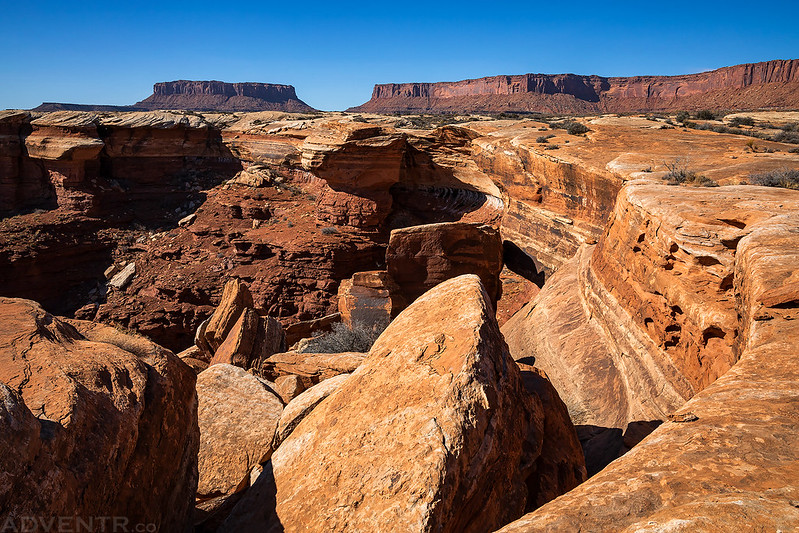
Once I reached the Airport campsites I drove down the road just a little bit further and started hiking out to the point located between Lathrop Canyon and Buck Canyon for sunset.

The clouds and light were looking nice as I followed the edge of the White Rim above Lathrop Canyon.

Wandering across an expanse of White Rim sandstone. About an hour before sunset it started to get pretty windy out.
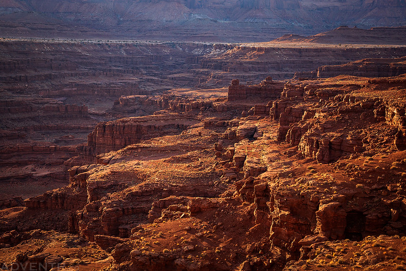
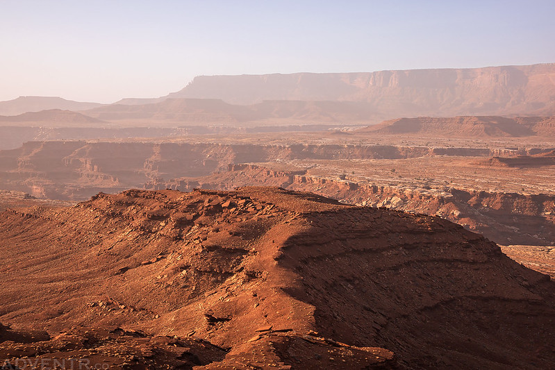
When I reached the point I had a great view over the rugged landscape to Hatch Point.

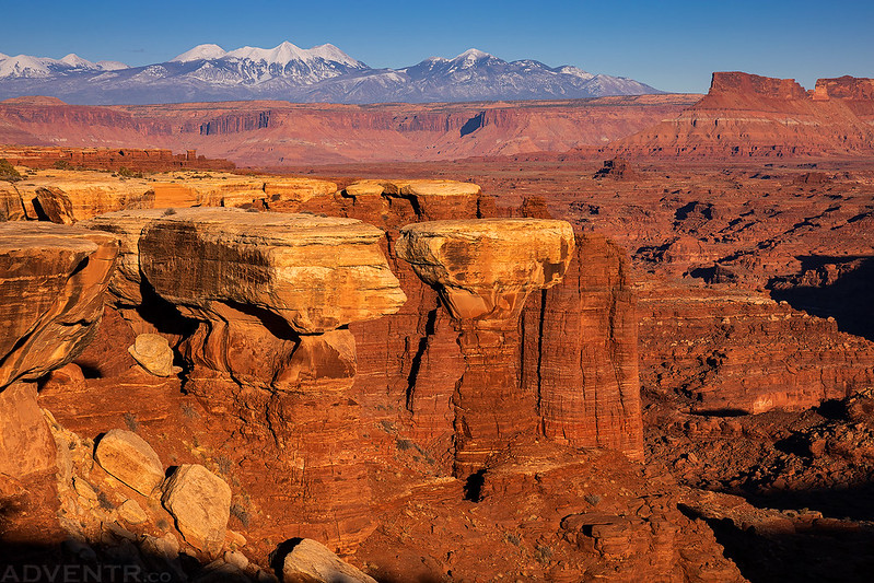
The view over Meander Canyon to the Abajo Mountains was outstanding!
Ledges in Buck Canyon.
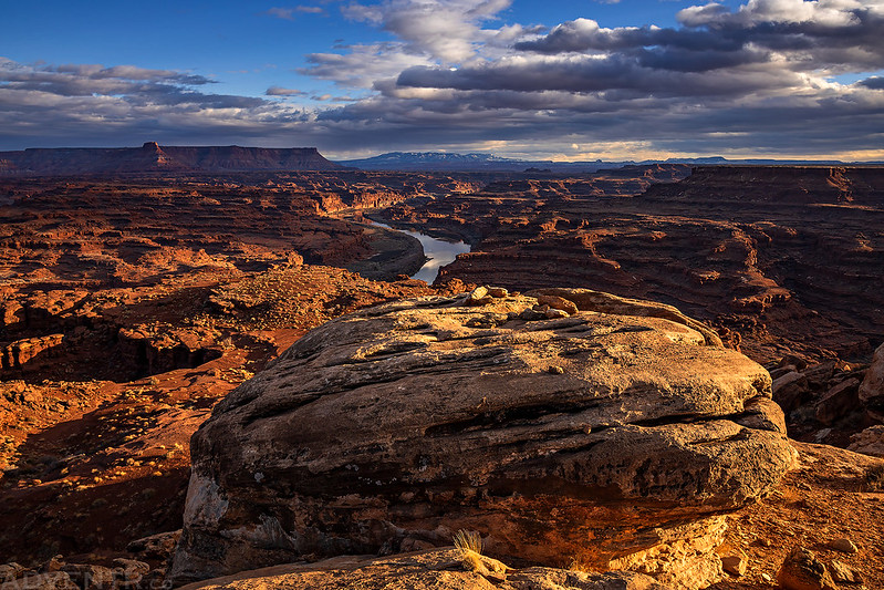
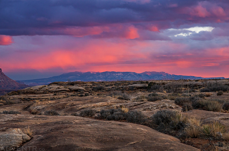
Just as I had hoped, the light and clouds were very nice this evening!

Canyonlands of Light
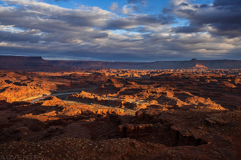

Although I couldn’t see the entire bend, you can still tell there’s a large bend in the river here.

Evening light over the Colorado River.
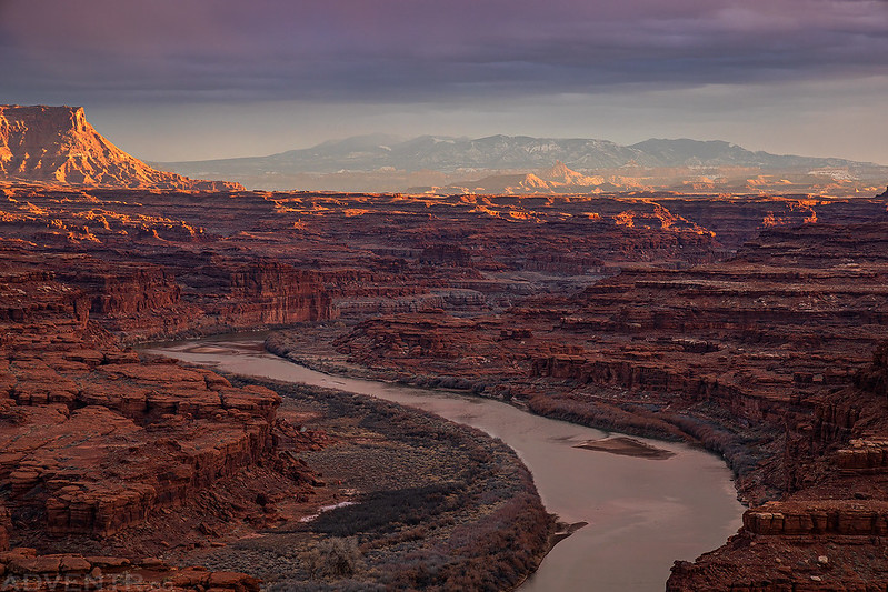
Meander Canyon Sunset

Last light on the Needles Overlook.

A bit of color over the Blue Mountains as I hiked back to my Jeep.
I returned to my Jeep and then drove back to Airport A for the night. I had dinner and then read for a while before going to sleep pretty early. The sky cleared up after dark and the stars were bright, but it also stayed pretty windy out until sometime after I had fallen asleep.
I wanted to get an early start hiking on Saturday morning, so I woke up about an hour before sunrise, got ready and then drove over to the trailhead for the Lathrop Trail. The temperature out was pretty nice as it had only dropped down to 33 degrees, but as it started to get a little lighter out I could tell that something in the sky wasn’t quite right. It turned out that I was right and it was actually foggy out this morning. It wasn’t a heavy thick fog, but more of a light fog that seemed like smoke in the air.
Hiking through the light fog up the Lathrop Trail before sunrise.

When the trail reached the top of the ridge, I walked to the other end and watched the sun come up.

Light Fog in Lathrop Canyon

That’s Airport Tower on the left and I planned to hike along an old mining track that follows below the base of it.

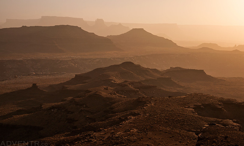
Hazy Canyon View
There were nice views from the old mining road, even through the light fog.


Lovely layers through the fog.

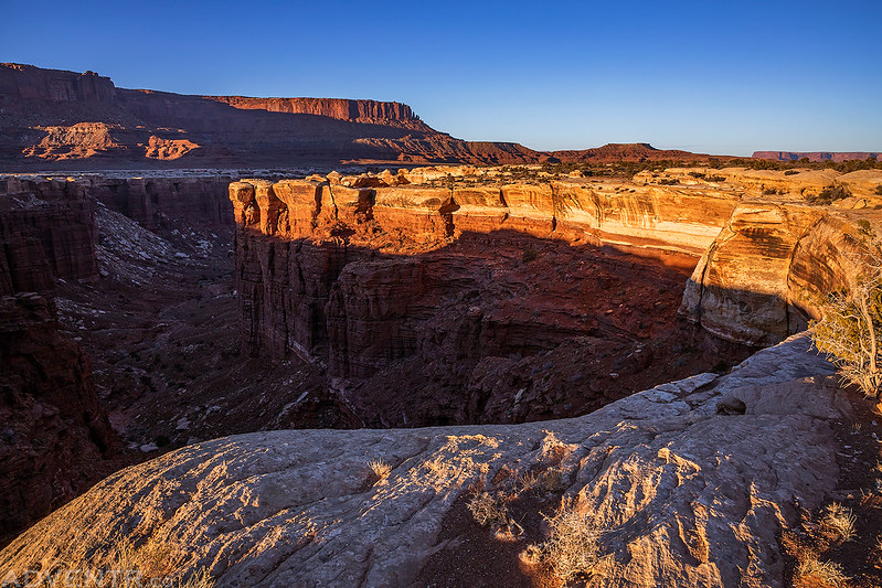
This is a view over the point I had hiked out to for sunset the night before.

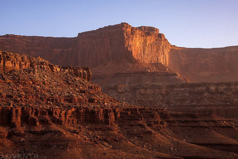
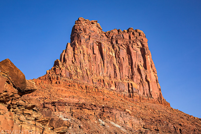
Looking up for a closer view of Airport Tower.
Hiking along the old mining road was a bit rougher than I had expected since there were a lot of rockfalls and washouts to cross. This washout was the end of the road for me.

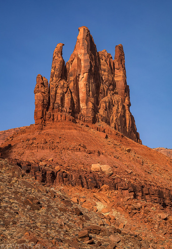
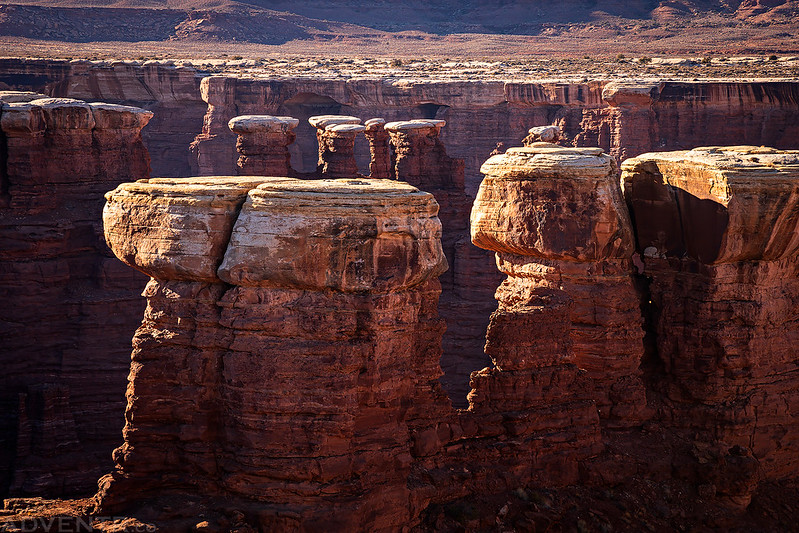
There was a good view of Monster Tower and Washer Woman through the fog from this spot, though.

Monster Rock
After returning to the trailhead I decided to take a quick drive down Lathrop Canyon to the Colorado River. It’s been a long time since I drove down this road.

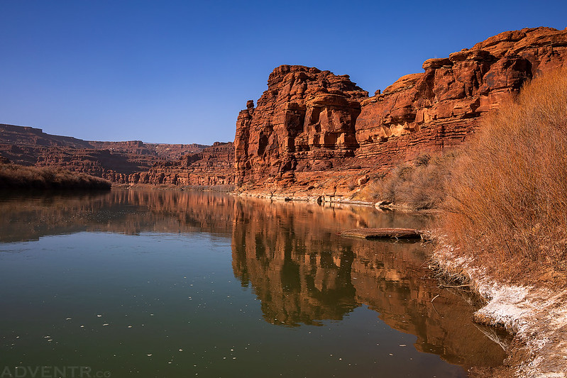
There was even a hazy view of Airport Tower from the mouth of the canyon.
It feels like just yesterday we were floating through here. I’m anxiously waiting to get back on the river in a few short months!
Looking up the river the other direction towards the sun you can see just how foggy it was down here. It kind of reminded me of the smoke we had over the summer.

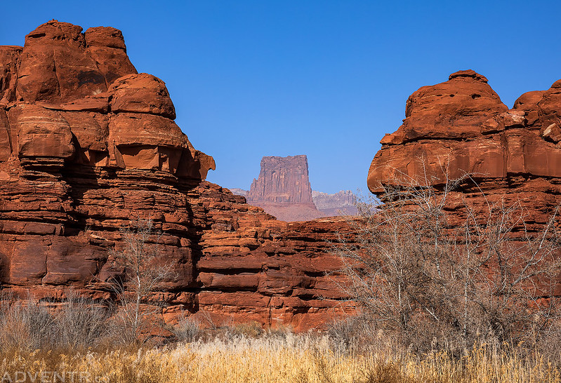
Next I hiked along an old faint road to the eastern edge of Monument Basin below Junction Butte and Grand View Point. The fog was finally clearing out by this point, but the wind had also picked up considerably.
On the rim across from me I spotted a herd of bighorn sheep. It’s too bad I didn’t have my long lens with me!

For sunset I drove around to the western edge of Monument Basin and then walked along the rim for a while.
Standing Rock

Here’s a cool hoodoo I walked by.

Monument Basin to the La Sal Mountains.
Following the rim back to my Jeep shortly before sunset.
I returned to my Jeep just after the sun dipped behind Junction Butte and then I drove back to the edge of Gooseberry Canyon since my permit for the second night was at the Gooseberry A campsite. Just like on Friday night, I had dinner, read for a while and then went to bed early. Thankfully the wind died down just after sunset this evening.
I woke up early again on Sunday morning and drove over to the head of the South Fork of Buck Canyon to watch the sunrise. The sky was clear this morning and the temperature had only dropped down to 32 degrees, so it never actually dropped down below freezing all weekend.
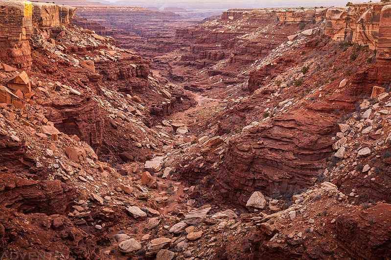
Looking down the South Fork of Buck Canyon.
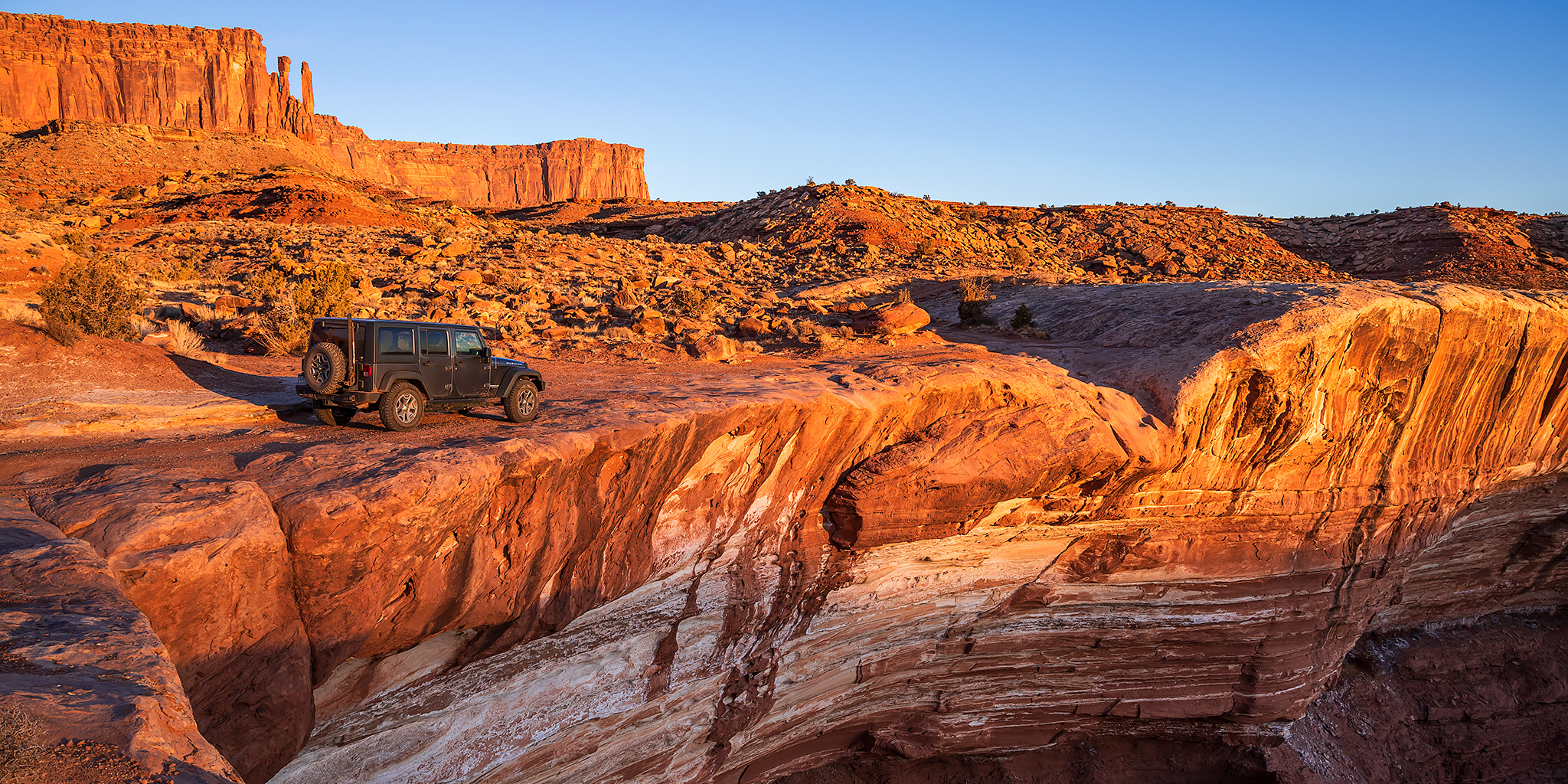
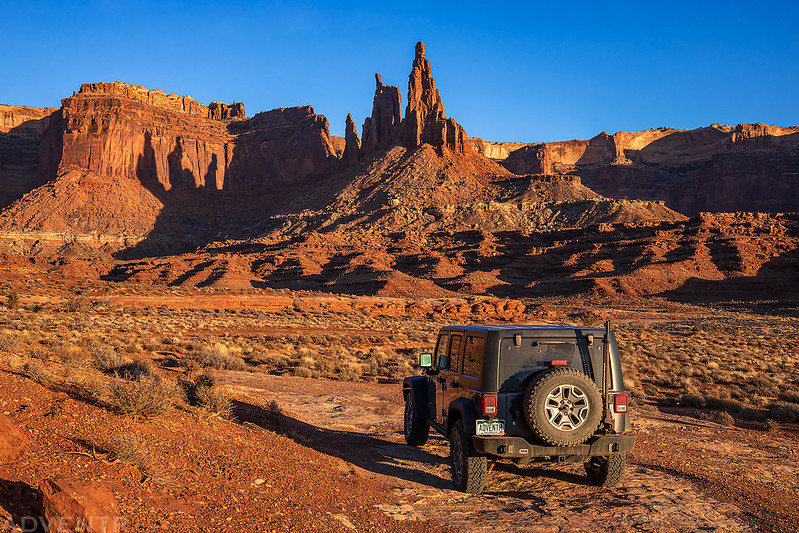
My Jeep on the White Rim Road as the sun illuminates the cliffs of the Island in the Sky.

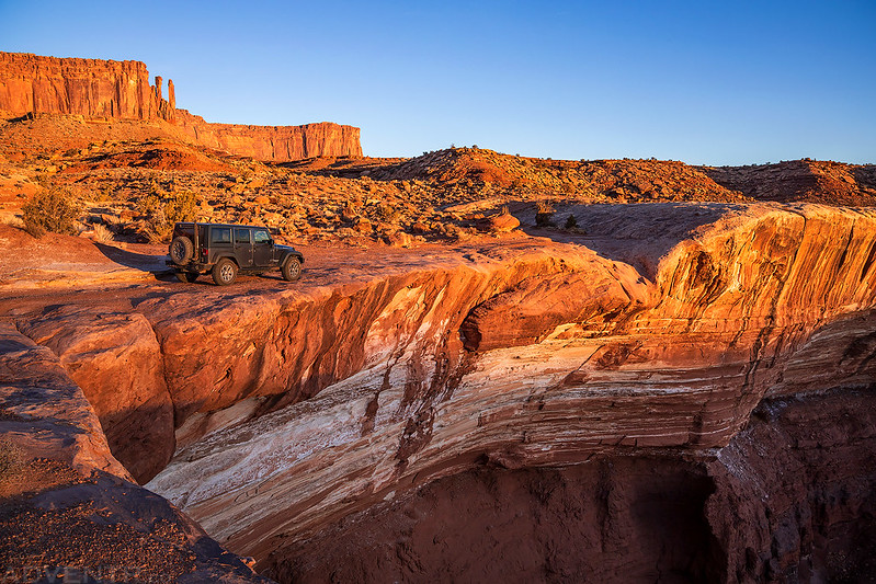
Driving on top of a massive overhang at the head of the South Fork of Buck Canyon at sunrise.
I pulled out my long lens for a view of Mesa Arch from below as I drove by. If you look closely you can see people through the arch.

I liked the three shadows cast onto the wall from Washer Woman and Monster Tower.
Of course I made an obligatory, but quick stop at Musselman Arch on the way out of the park.

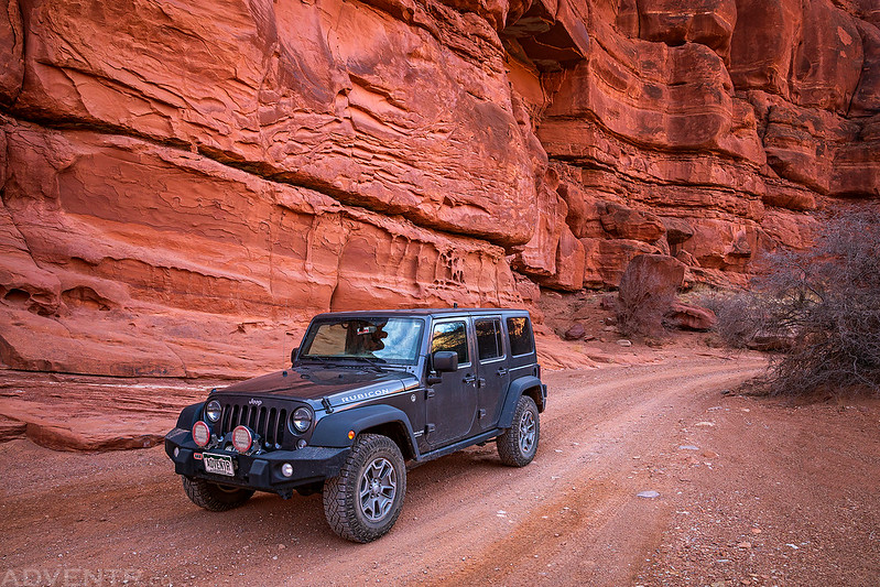
Driving through Shafer Canyon on the Potash Road after leaving Canyonlands.
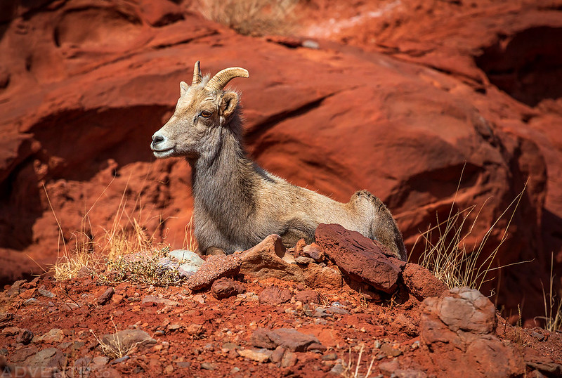
Shorty before reaching the pavement I spotted a couple more bighorn sheep right along the road and stopped to take a few photos. It was a good end to another nice weekend in Canyonlands National Park!


Nice set of images here dude, looks like a really fun trip!
Thanks Matt!