Friday – Sunday, May 4-6, 2018
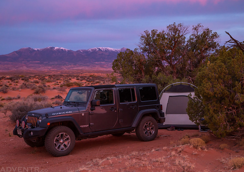
This weekend Diane and I headed back to the Glen Canyon National Recreation Area so we could hike to a few rock art sites that we didn’t have time to look for during our trip into The Maze last month. Then we spent the rest of the weekend exploring parts of North Wash and Cedar Point as we headed back toward the edge of the Henry Mountains south of Hanksville. We left after I got out of work on Friday afternoon and drove west into Utah, like we’ve done many times this year already. We stopped in Green River for dinner and fuel, which thankfully was not nearly as busy as the last time we tried to stop here! Then we continued south through Hanksville and followed North Wash into the Glen Canyon National Recreation Area near Hite. I made a left turn onto the road that leads to the Flint Trail and followed it around Rock Canyon to Andy Miller Flats where we found a nice campsite for the night. It had been dark for a while by the time we found a spot to setup our camp, so we had to put up our tent with some help from the headlights on my Jeep. Once the tent was setup we crawled inside and went right to bed, and Diane tells me that I fell asleep very quickly this night.
Our campsite near Andy Miller Flats on Saturday morning.

On a side note, as we were driving the road around Rock Canyon on Friday night, we both started to notice a few crumpled up papers laying in the road and spaced out around a couple hundred yards apart. After only noticing one or two of them we thought nothing of them, but after seeing more of them our curiosity was piqued and we stopped to see what they were. Unfortunately, they turned out to be propaganda left by someone who does not like Donald Trump very much (and might even have some mental health issues). I can understand that, but what I cannot understand is purposefully littering this beautiful desert landscape to try and spread your message. As we continued down the road we stopped to pick up all the rest of the balled-up papers that we saw so we could dispose of them properly. We picked up the few we had passed by earlier in the drive on our way back out on Saturday morning. In the end we picked up at least eight or nine of these papers and deposited them in a dumpster at the Hog Springs Rest Area. Enough about that, let’s get back to the trip report!
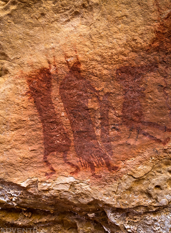
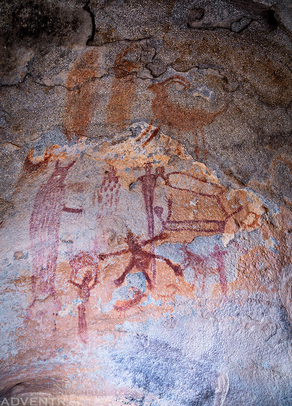
On Saturday morning we slept in late for a change and I didn’t even bother trying to get up in time to photograph the sunrise. With all my luck taking photos at sunrise and sunset this year, it was probably a good decision anyway! The low temperature overnight was about 50 degrees and I slept very well. Once we were up for the day, we went on a few hikes in search of a few Barrier Canyon Style pictograph panels in the general area. We easily found the panels we were looking for, and although most of them were flaking away, what was left was still very cool and interesting.
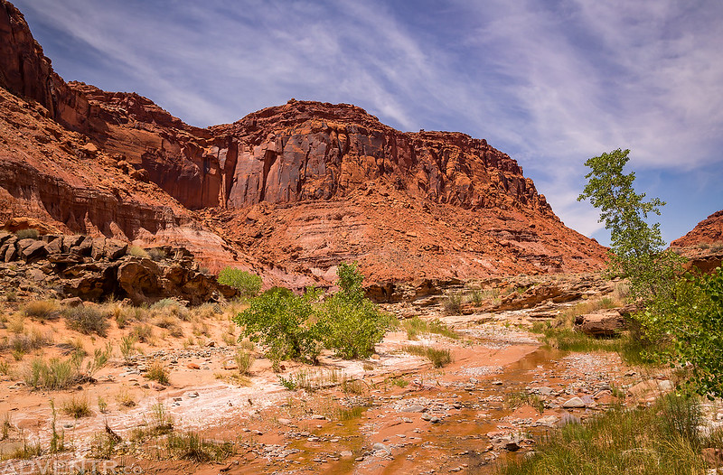
Hiking below The Block.
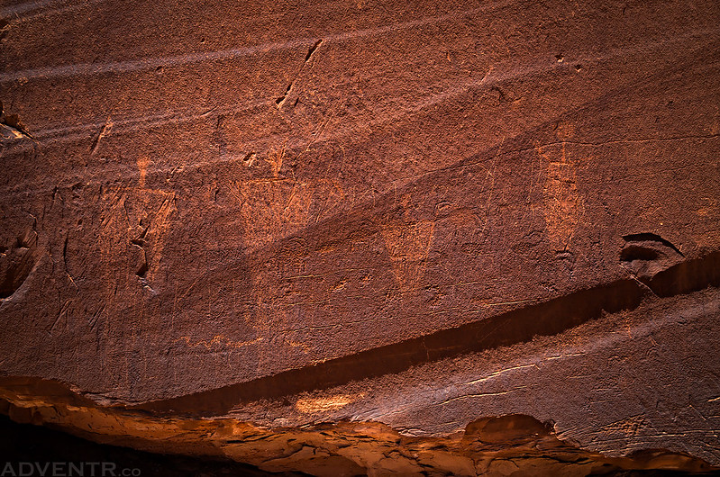
The first pictograph panel we visited was located on the ceiling of a low alcove had some very detailed figures. The location of these pictographs kind of reminded me of panels I have visited on The Esplanade. This was the better preserved part of the panel, but at one time there were probably a lot more here.

A closer look at the left side of the panel.
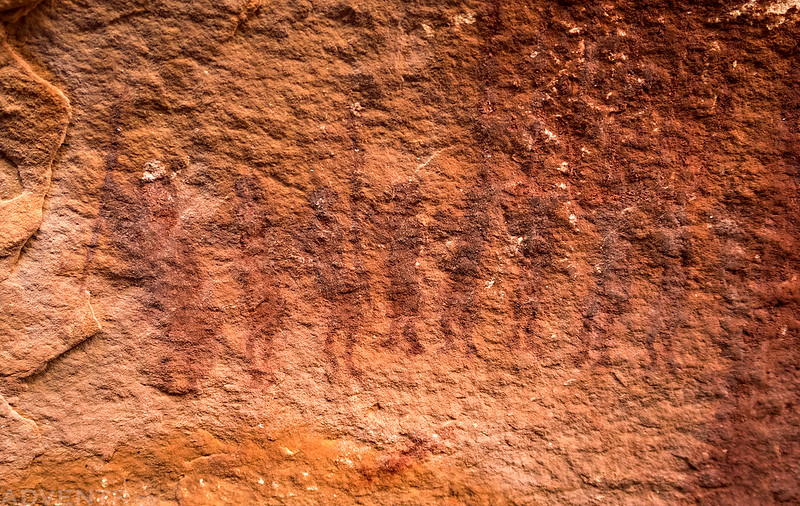
These tiny warriors were faded and hard to see, but very cool!
The second panel we found was in a more conventional location for Barrier Canyon Style sites and included this small figure.

This probably would have been a pretty nice painting at one time, but now the sandstone is flaking away and there’s not much left.

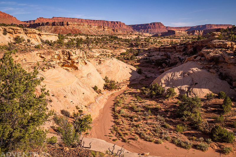
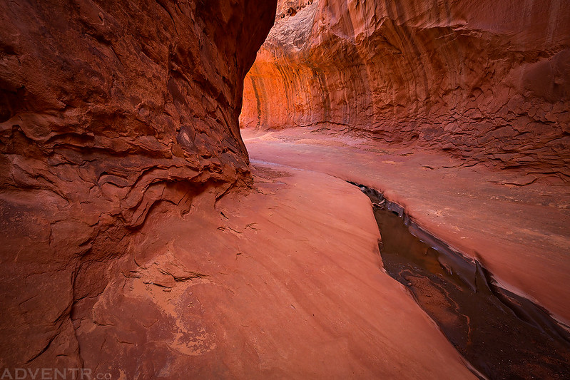
Hiking through a canyon to see some more rock art.

The last site we hiked to this morning was one we’ve been to before, but since the alcove was inaccessible to us, I didn’t get a good photo. This time I brought along my long lens to try and get a closer look.

After completing our morning hikes, we had an early lunch and then drove back out to Highway 95. As we followed North Wash back towards Hanksville, Diane spotted a large boulder with a few petroglyphs on it that I had been looking for.
There were a lot of these barrel cactus with purple flowers near Rock Canyon.

The Image Boulder in North Wash. Unfortunately, there was also a lot of graffitti on this one and it was very difficult to see the petroglyphs in the direct sunlight.
Hiking along North Wash.
Next we stopped near Hog Springs so we could visit The Moqui Queen and a few other petroglyphs nearby. It has been a long time since I’ve stopped over here and Diane had never been here before. By this time of the day it was starting to get pretty warm out and the temperature would eventually reach the mid to upper 80’s.
Striped Petroglyph

The Moqui Queen

Queen of The Alcove

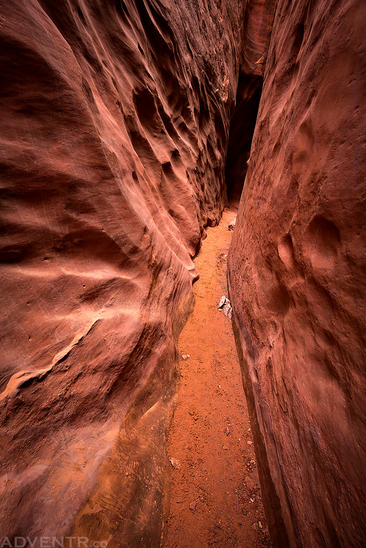
After leaving Hog Springs we went on a short hike into Leprechaun Canyon so we could check out the short section of the slot canyon that is accessible from the bottom. It was a nice little hike, but a little too crowded for our tastes. It’s not somewhere we would feel a need to return to again.
The very beginning of Leprechaun Canyon.

The first part of the canyon wasn’t very narrow, but it was pretty nice.
Soon we reached the dark and narrow slot canyon. It felt really nice in here since it was pretty warm outside.

This photo was taken pretty close to the point we turned around.
Just another shot of the narrowest part we hiked through.

Leprechaun Canyon Sunstar

Great light and stripes on the sandstone walls as we were leaving Leprechaun Canyon.

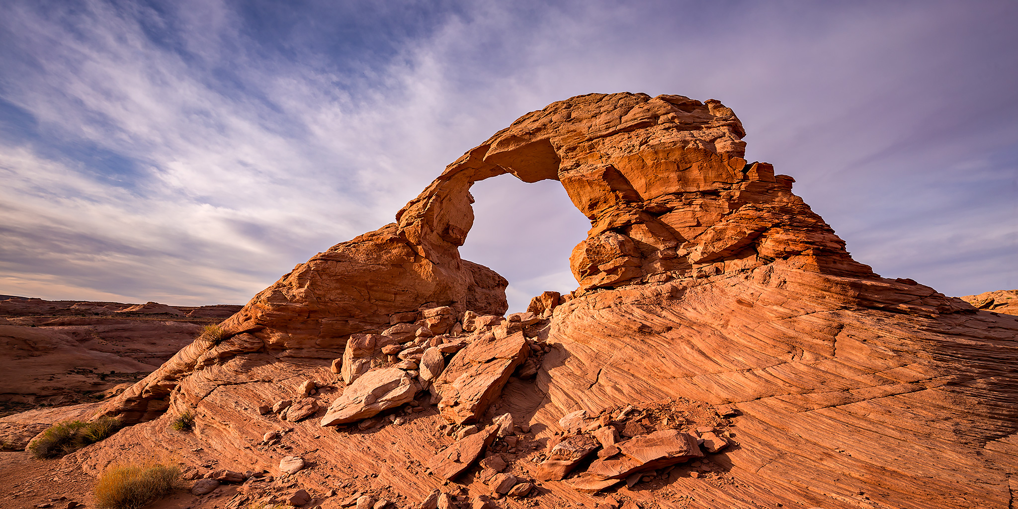
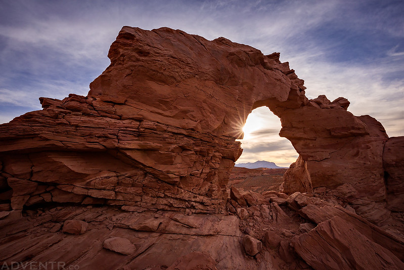
After returning to my Jeep from the canyon we finished driving back to Hanksville so I could top off the gas tank in my Jeep and so we could also grab a few burgers from Stan’s Burger Shack for an early dinner. Then we headed south again and drove up onto Cedar Point where we found a campsite for the night. We got everything set up and then rested in camp for a while before going on one final hike to Arsenic Arch for sunset. I have wanted to photograph this arch for a long time and was excited to finally get the chance. According to the weather forecast, the sky was supposed to be clear and sunny all weekend with warm temperatures, but apparently that really means it’s going to be almost completely overcast when I am planning on taking photos this year! While we were waiting for a sunset that never happened, the no-see-ums (gnats) were pretty bad in this area and Diane got bit up pretty good. We ended up hiking back to camp at dusk and made it just before it was too dark to see without headlamps. It had been a long day and we were ready for bed!
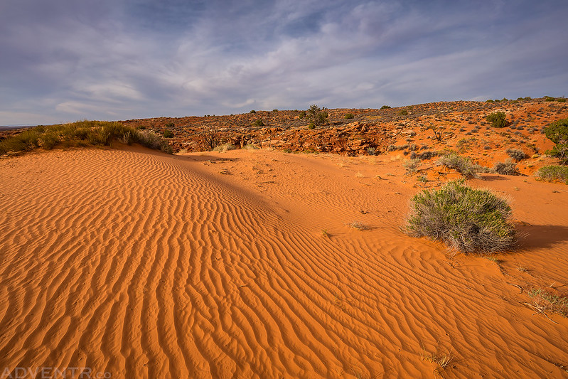
Rippled sand behind our campsite on Cedar Point.
Hiking down to Arsenic Arch which is located in a finger of Poison Spring Canyon. If you look closely, you can see the arch in the distance.

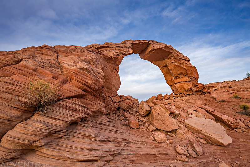
Arsenic Arch was looking pretty nice when we first arrived.

Here’s a sunstar from the other side.
One more angle of Arsenic Arch before the clouds really moved in and stayed that way.
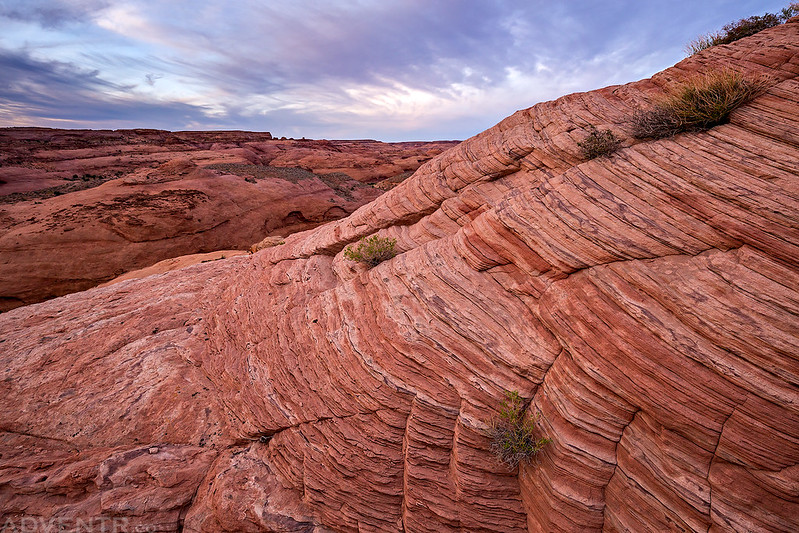
Nice striations in the sandstone below the arch.
I woke up on Sunday morning about a half hour before sunrise and didn’t even need to put on a jacket since it only got down to about 57 degrees overnight. I was hoping to catch a nice sunrise near camp and for a change, I wasn’t disappointed. While the sky was still pretty overcast when I got out of the tent, I could see that there was a gap on the eastern horizon that would probably let some light through. When the sun shone through that gap there was a fiery sunrise, but it only lasted for a few short minutes. Diane woke up shortly after the sun came up and we packed up our camp into the Jeep and headed out.
A colorful sunrise over the rippled sand near our camp.

Our camp on Cedar Point with the Henry Mountains in the background.
Morning color over the Cedar Point Road and the Henry Mountains.

Since we were pretty close to Little Egypt and Diane had never been there before, we stopped to hike around for a little bit.


After leaving Little Egypt we took a few back-roads around the perimeter of the Henry Mountains so I could revisit the Hollow Boulder Panel. It’s such an interesting pictograph panel in an unusual location!

The Hollow Boulder Panel

A closer look at the pictographs at the back of the boulder.
At this point we decided to call it a day and started the drive back home before it really started to get hot out, and so we could spend the rest of the afternoon and evening relaxing back at home. It had been another really nice weekend in southern Utah!
>> From the Colorado River to the Henry Mountains Photo Gallery
Beautiful arches, captures of light, and the awesome figure holding up something on the Hollow Boulder. Thanks!
Thanks Dianne!
Wonderful, thank you. The Hollow Boulder panel seems to have some pre-Hopi snake concepts. One more one the growing list.
Do you mind me asking if you have gps coordinates for Hollow Boulder Panel. If not, I understand. Thank you and enjoy following your travels.