Under The Ledge // Five Years In The Maze
Wednesday – Monday, April 4-9, 2018
For the past four years Diane and I have been spending our Memorial Day Weekends in late May exploring the Maze District of Canyonlands National Park and the Orange Cliffs Unit of Glen Canyon National Recreation Area, along with the greater Robbers Roost area to the west. The first two years were great, but the last two years were hotter and buggier than we would have liked which was not as much fun for us. I recalled that my very first trip into The Maze was in early April and that the temperature was much cooler out (we even had a little snow) and great for hiking, so this year we decided to move our trip up into early April so we would hopefully have cooler temperatures and no bugs to deal with. But as you might know, the conditions on the Colorado Plateau are never that predictable, especially in the spring.
As usual, Diane and I left after I got out of work on Wednesday evening and headed west into Utah. We stopped in Green River to top off my fuel tank and grab a quick dinner, but we were not prepared for the amount of people we would find there on a Wednesday evening! Apparently it was spring break week for northern Utah and everyone was on their way down to the warmer temperatures of southern Utah. The gas stations and restaurants were packed. We ended up changing plans and waiting too long to get two sandwiches from Subway before finally getting out of town. Thankfully, after leaving Green River behind we would also leave the spring break crowds behind for the remainder of out trip, too! Since we were planning on heading back into The Doll House again this year, I invited our friend Marty along and he was able to join us for the entire trip and we planned to meet up with him at the Flint Seep Camp after dark. He had been able to pick up our permit earlier in the day so we didn’t have to worry about making it to the Ranger Station before they closed. After reaching our designated campsite we quickly setup our tent by the light from the headlights of my Jeep and went right to bed.
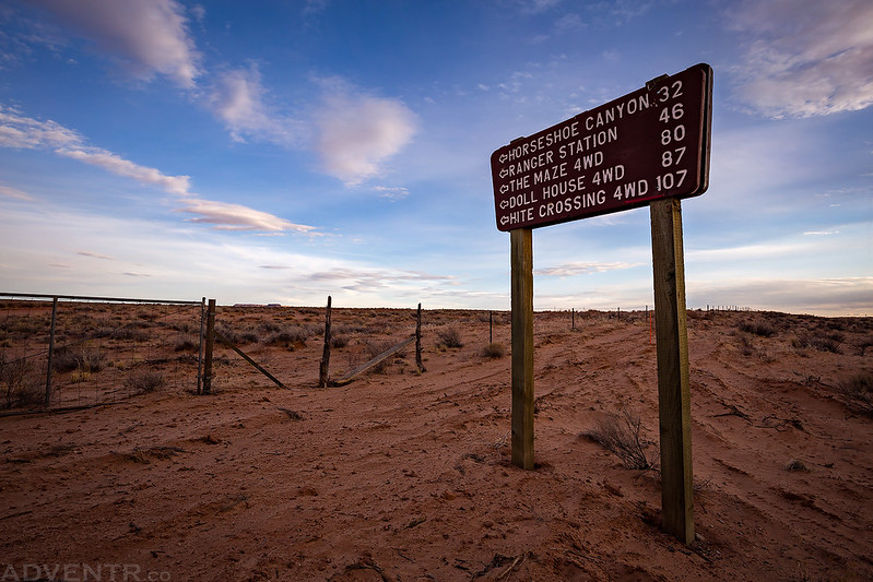
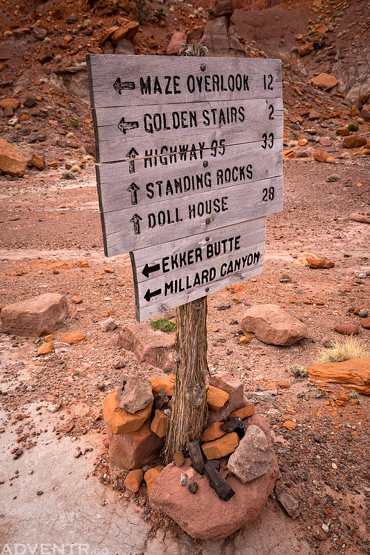
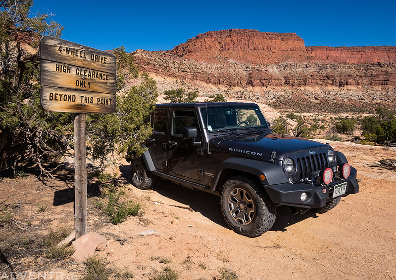
I think I’ve taken a photo of this sign at the start of every adventure I’ve taken into The Maze, and it’s at the beginning of most of the other trip reports, so why break the tradition now!
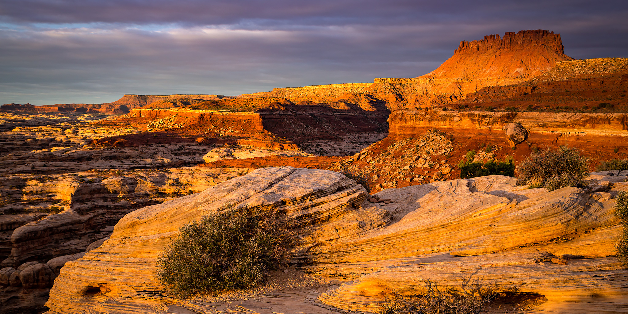
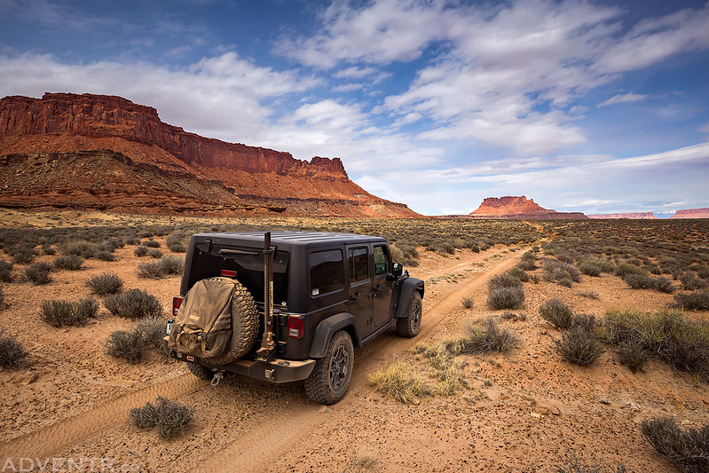
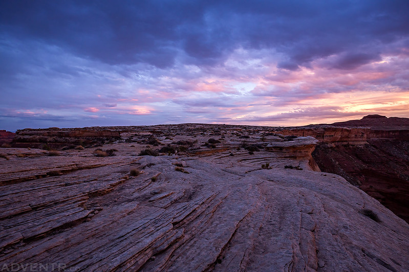
The clouds were looking pretty nice over Little Flat Top as we drove by.

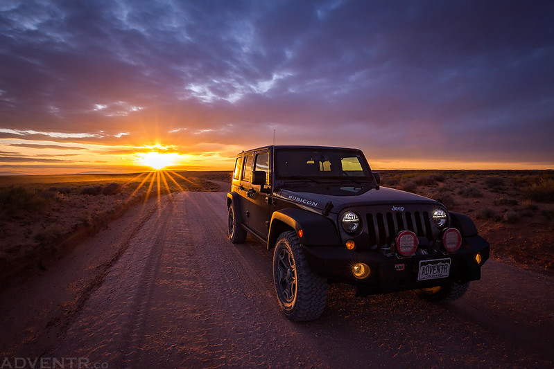
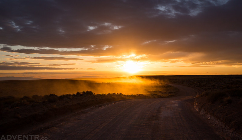
Of course, the best sunset of the entire trip happened while we were driving across the mostly-barren San Rafael Desert on our way to Hans Flat, so I had to put my Jeep in the foreground of the photos I took. I had a little fun with the sunstars in this one.
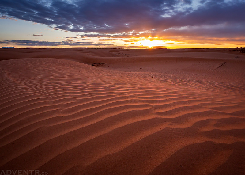
We did pass a couple of rippled sand dunes that looked nice under the setting sun.
My trail of dust catching the last light of the day.
One last photo of my Jeep on the Hans Flat Road before the sun disappeared below the horizon and we finished the drive to our campsite in the dark.

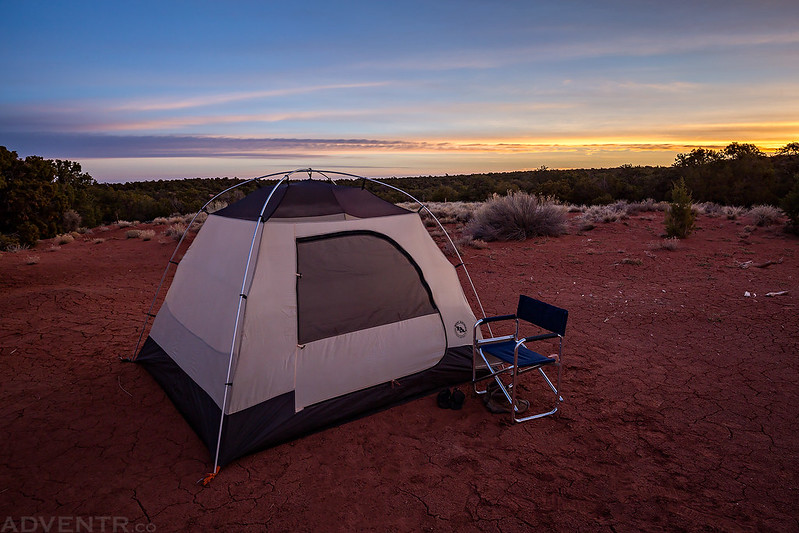
We woke up shortly before sunrise on Thursday morning and were able to see our campsite in the light for the first time. As I expected, the Flint Seep Camp is probably the least scenic campsite in the area. We stayed here because it is one of the very few sites that I had not been to yet, plus it was a great place to meetup after dark before descending the Flint Trail in the morning.
Here’s our tent at the Flint Seep Campsite.
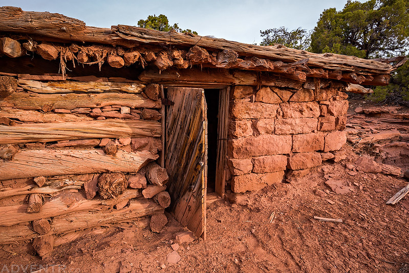
After packing up camp we all went on a short hike to see the nearby Flint Cabins (Wolverton Cabins) that were built by E.T. Wolverton in 1919 to serve as the base for the Nequoia Oil Company. The company never found oil and eventually ran out of money, but the cabins were used by cattlemen for many years after that. After visiting the cabins we also hiked over to Flint Seep and found it completely dry as expected.
Here’s one of the better preserved cabins with a door still on the hinges.
There’s not much left of this one except for the chimney and stonework.

A view from inside one of the cabins.

Diane found this old padlock nearby.

After hiking back to our vehicles from Flint Seep it was time to drive down the Flint Trail so we could spend the rest of the trip “Under The Ledge”
As we drove down the Flint Trail, we stopped to check out this inscription left by Mike Steel.

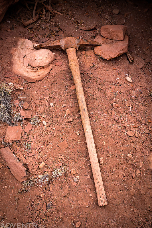
We also stopped to find this old pickaxe that my friend Dennis found last year.
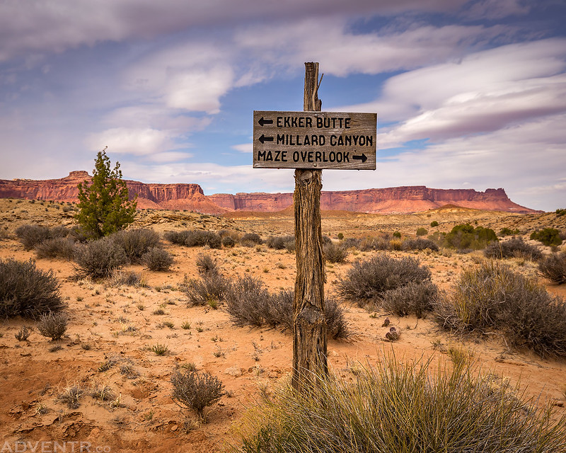
There are a lot of options once you reach the intersection at the bottom of the Flint Trail. We would be spending tonight at the campsite below Ekker Butte, so we headed that direction this time.
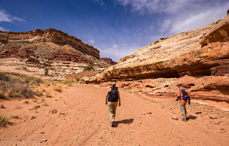
Before driving all the way out to our campsite we made a short detour so we could hike into the upper portion of Horse Canyon. This is the beginning of the trail that heads over to the rim of the canyon.
After following the rim of the canyon for a while we eventually reached the top of the old trail that descends into the canyon.
We passed through these narrows once we reached the main wash in Horse Canyon.

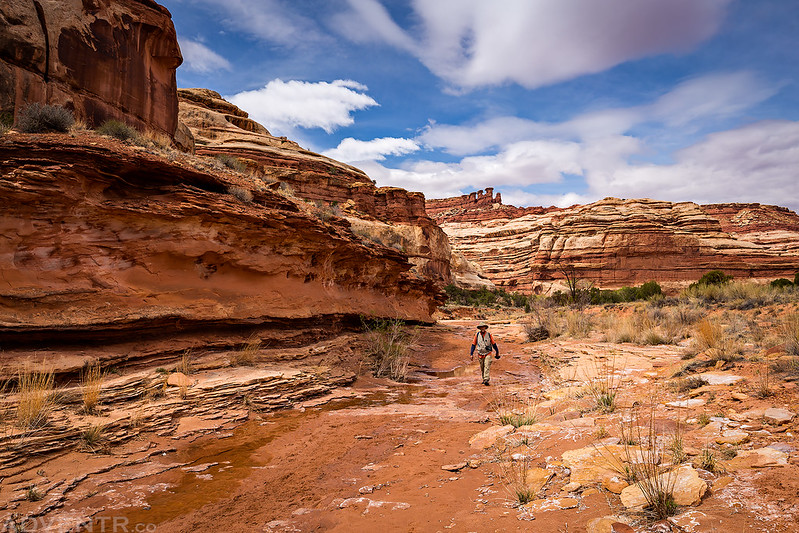
Diane and Marty hike ahead of me in the sandy wash bottom.
Here’s a view of Horse Canyon as we started climbing back out the way we had come in.

A view of Elaterite Butte in the distance from the rim of Horse Canyon in Elaterite Basin.
A view of North Point from the edge of Horse Canyon as we hiked back to our vehicles.

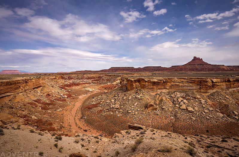
Continuing on to Ekker Butte…
We made another quick stop along the opposite rim of Horse Canyon so we could look down to where we had just hiked.
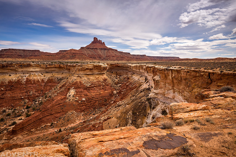
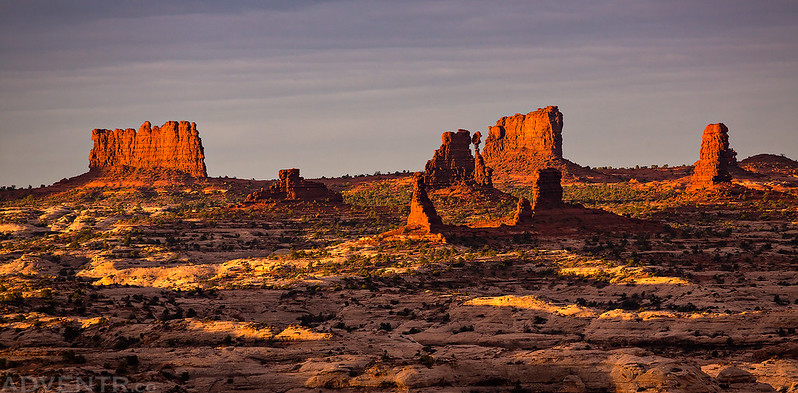
Ekker Butte straight ahead with Panorama Point on the left.
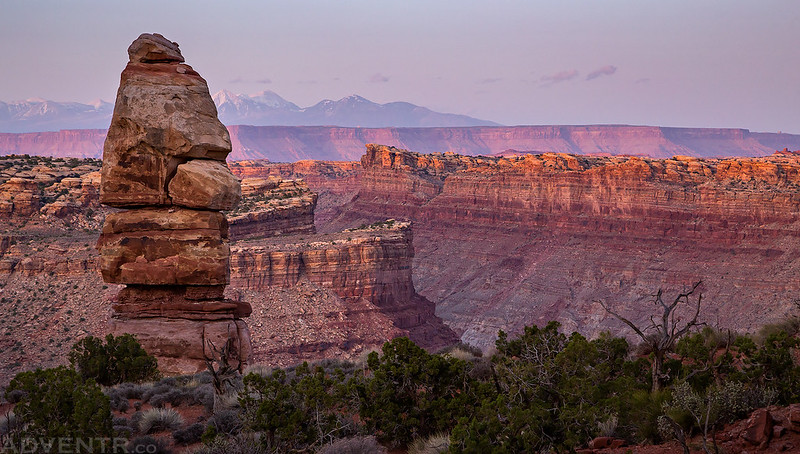
Here’s my Jeep at the Ekker Campsite with Candlestick Tower in the background. This would not be a great campsite in windy weather since it’s all on sandstone and exposed, but we had pretty calm conditions and it worked out nicely for us.

Our tent below Ekker Butte near the rim of an unnamed canyon as clouds started overtaking the sky.

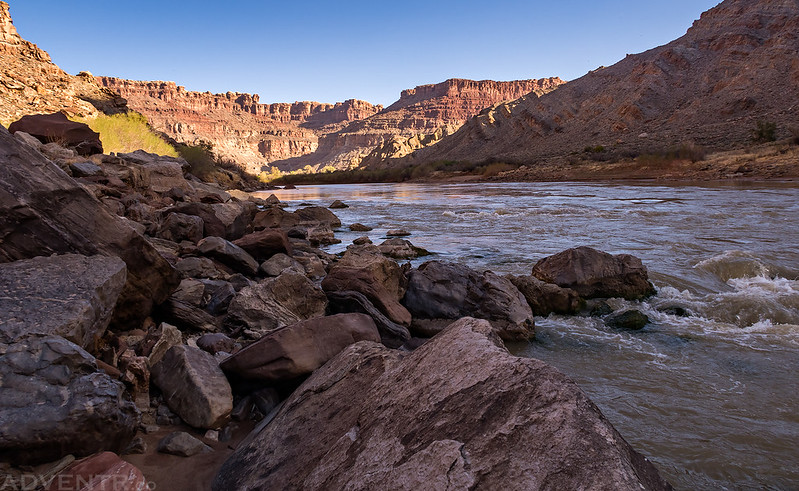
After dinner Marty and I went for a hike along the rim above Stillwater Canyon and the Green River in hopes of a nice sunset. At first it looked like it might be too cloudy for any kind of color this evening, but at least the views from the peninsula of sandstone we had hiked out to were pretty great!
Just before sunset there was a little light that broke through the clouds to the north over Stillwater Canyon.
Ekker Butte at sunset.
Pink clouds over white sandstone.
There was a little bit of alpenglow on the White Rim in the Island in the Sky on the other side of the river.

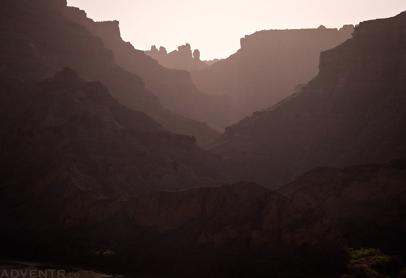
Canyonlands At Dusk
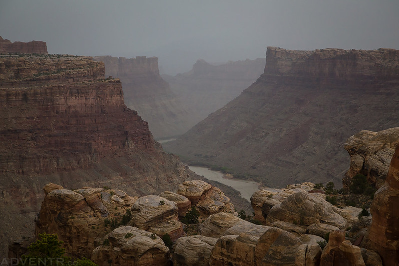
Unfortunately, the clouds that had come in for sunset the previous day decided to stick around for sunrise, too. I had hoped to photograph the early morning light illuminating the rim of the canyon near our camp, but that did not look like it was going to happen when I got up this morning. After waiting around to see if any light would slip through the clouds we had a little breakfast, packed up our camp and then drove back to the Maze Overlook, where we would be spending the night at campsite #1.
A gloomy view from our campsite on Friday morning.

On our way to the Maze Overlook, we made a quick stop at the bottom of the North Trail and hiked over to an old steam boiler that was once part of a drilling rig used by the Nequoia Oil Company in 1920 and 1921. After they had spent an entire year drilling the area and never striking oil the company went bankrupt.

A look inside the old steam boiler.

After setting up camp at the Maze Overlook it was time to hike down the Maze Overlook Trail so we could visit The Harvest Scene again and search for a new rock art panel. Here’s a view of Brimhall Point (Nuts & Bolts) as we descended into the South Fork of Horse Canyon.
Marty climbing down a crack along the Maze Overlook Trail.

Descending a few Moki Steps near the bottom of the trail.

Finally we are down in the heart of The Maze.
The Harvest Scene is an amazing Barrier Canyon Style panel of pictographs and Marty was pretty happy to finally see it in person.

This is our favorite little pictograph in the area.

There are a number of other smaller pictograph panels in the same area, too.
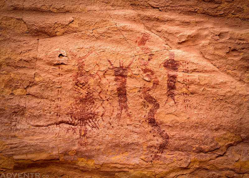
Up close and personal with The Harvest Scene.

After enjoying the view of The Harvest Scene for a while, Diane and I went to search for a petroglyph panel while Marty waited for us at the bottom of the Maze Overlook Trail.
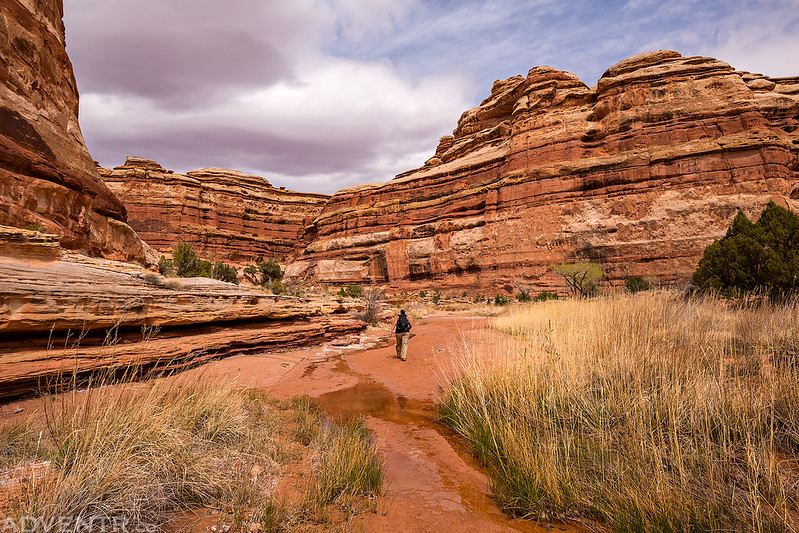
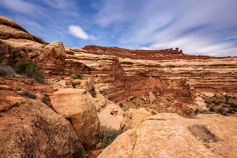
Canyon scenery in the depths of The Maze.
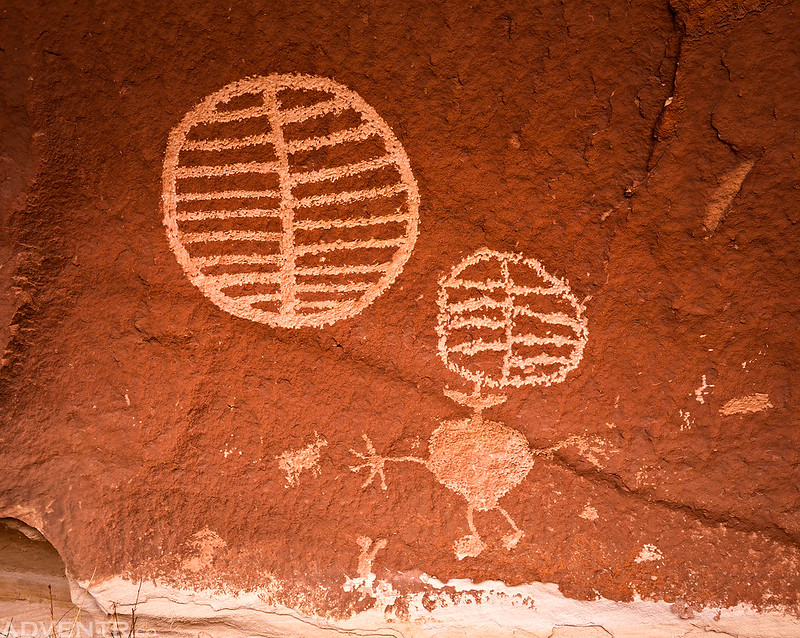
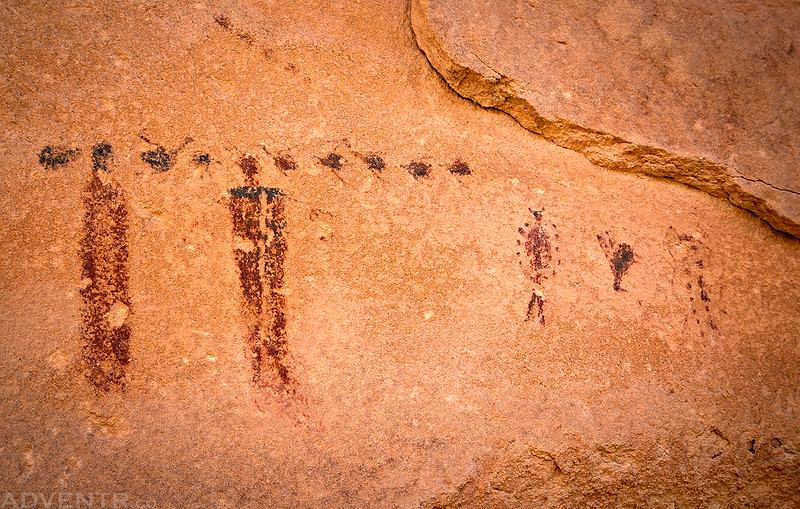
After a little exploration, Diane and I found the panel of petroglyphs we were looking for known as the Shield Site. I had only seen one old black and white photo of this panel, so I had assumed the petroglyphs were chalked since they were so white, but I was happy to find that they really are this vibrant!
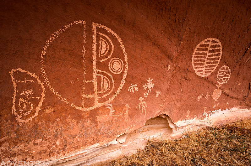
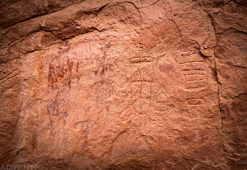
Here’s a closer look at the left side…

…and the right side. It was such a cool spot to visit.
On our way back to meet Marty I climbed up to one more panel of Barrier Canyon Style petroglyphs and pictographs that I had been to before.
After climbing back up the trail to our campsite we had some dinner and then tried to avoid the no-see-ums (gnats) for the rest of the evening when the wind wasn’t blowing hard enough to keep them away. Although we had tried to plan this trip early enough in the year to avoid the bugs, I guess the warmer temperatures this spring prevented that from working out for us. The gnats were definitely the worst at the Maze Overlook and at The Harvest Scene. It was yet another cloudy and overcast evening with no sunset light, which has sort of become a theme for all of my trips to Canyonlands this spring. The wind died down after sunset and we went to bed early.
There were a couple sprinkles of rain overnight, but not even enough to keep Marty from spending the night out under the stars without a tent. I woke up before sunrise with hopes of catching a little light and color over The Maze below. At first it looked like I was going to be stuck with overcast conditions again, but the clouds did start to clear out a little and let a little light through for a few minutes until it became overcast again.
Pastel colors dominate the sky over The Maze before the sunrise.

The sun did finally make an appearance over Petes Mesa.

Warm light on the edge of the Maze Overlook.
Elaterite Butte at sunrise.
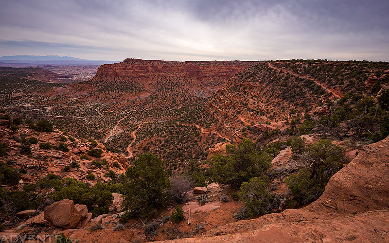
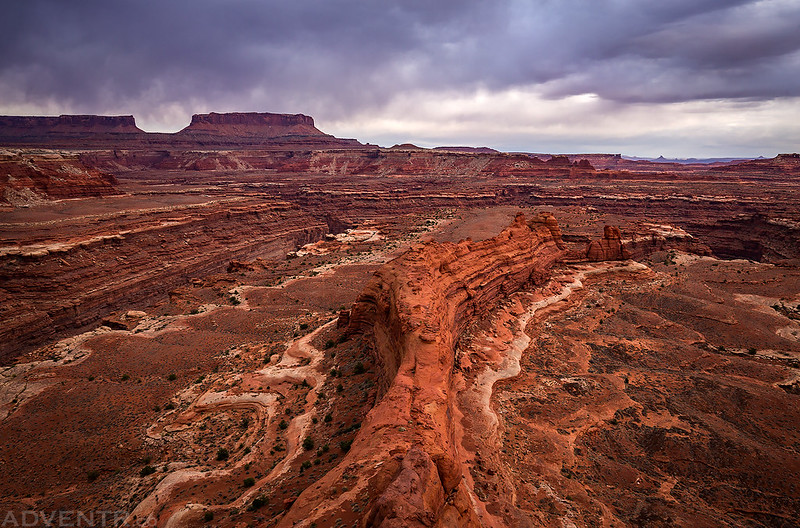
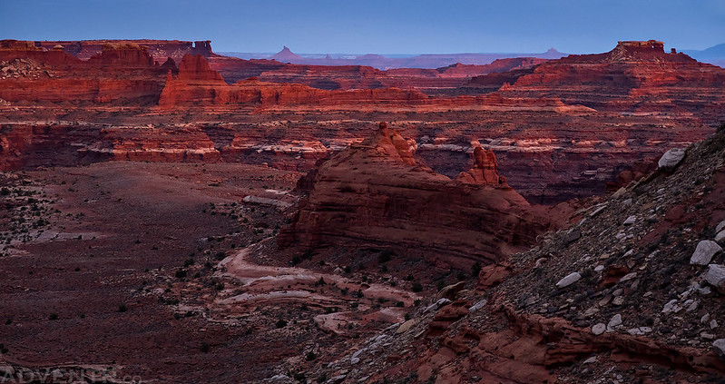
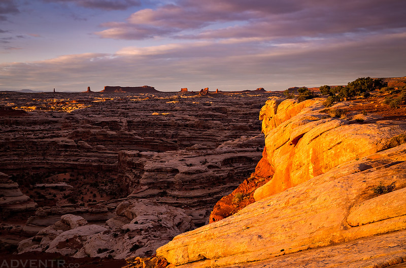
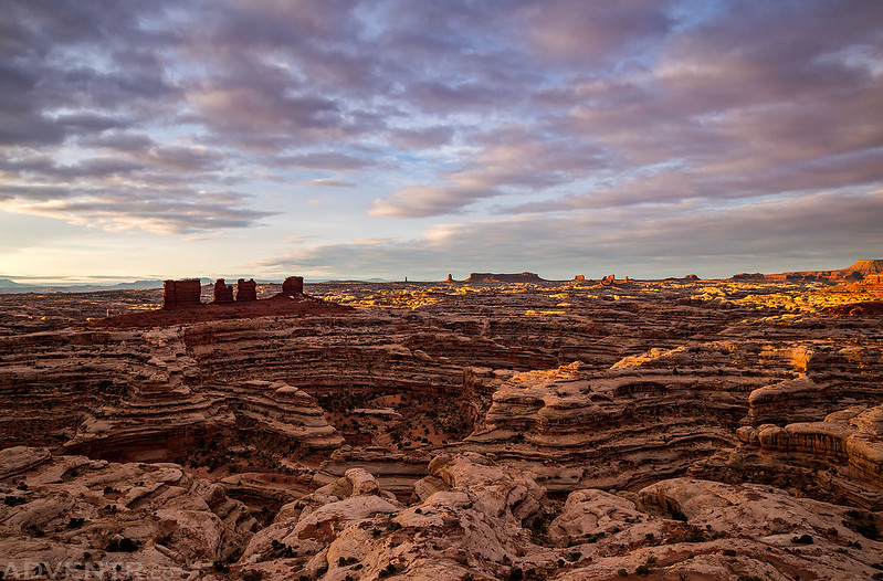
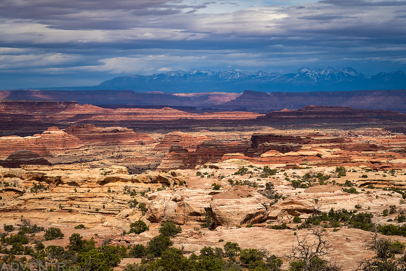
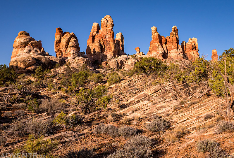
We would be driving through The Land of Standing Rocks later in the day, and it was looking pretty nice this morning.
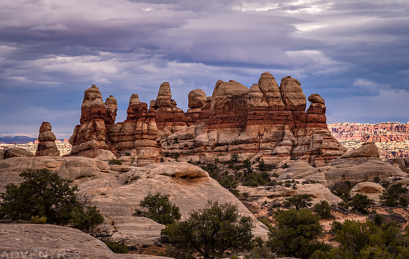
Nice clouds over the Chocolate Drops and the South Fork of Horse Canyon.
Looking down into the maze of canyons below.

When the sun disappeared behind the clouds again we packed up camp and started the long and bumpy drive out to The Doll House.
Driving below the Orange Cliffs on our way to Waterhole Flat.

Pretty soon we were making our way around the head of Teapot Canyon, which is the roughest part of the road.


Entering Canyonlands National Park again…

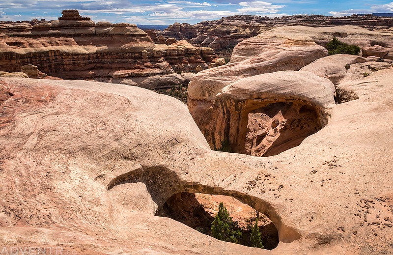
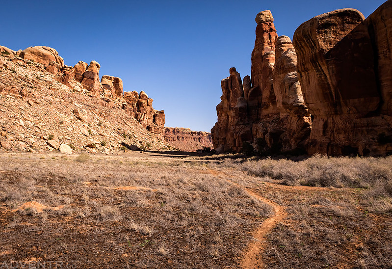
We stopped and had lunch below The Mother and Child and then continued on into The Land of Standing Rocks where we took a break from driving and hiked out to Parachute Arch. Getting to the arch was a little tricky because we had to route-find through a couple of cliff bands to get down to the right level, but the scrambling was worth it since there were a number of natural arches and bridges in this area with great views all around.
Drving past the impressive Standing Rock. I’d like to spend a few nights here again sometime.

Lizard Rock and The Plug in the distance as we searched for a route to Parachute Arch.

Here’s a view of Parachute Arch with an unnamed natural bridge in the foreground.
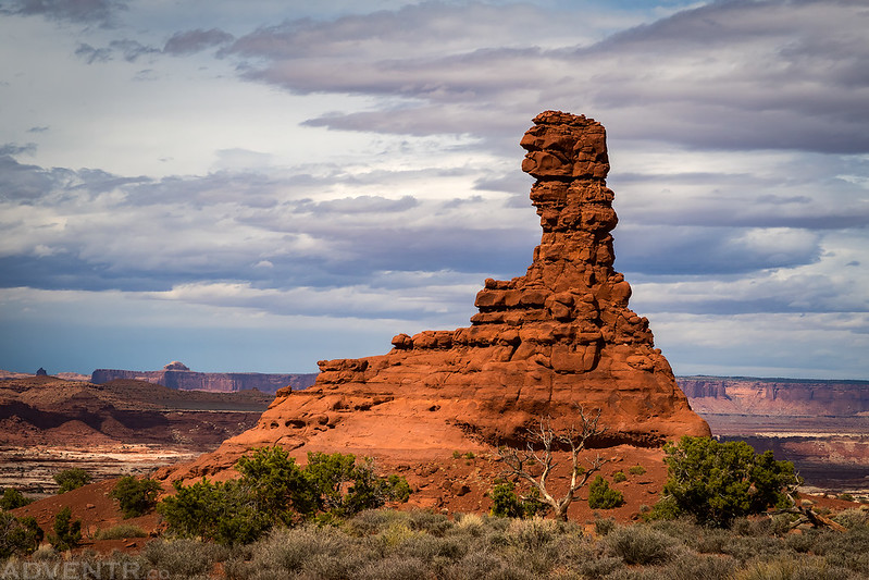
Chimney Rock was looking pretty nice as we drove past.
The view from Chimney Rock toward the La Sal Mountains was looking pretty good, too.
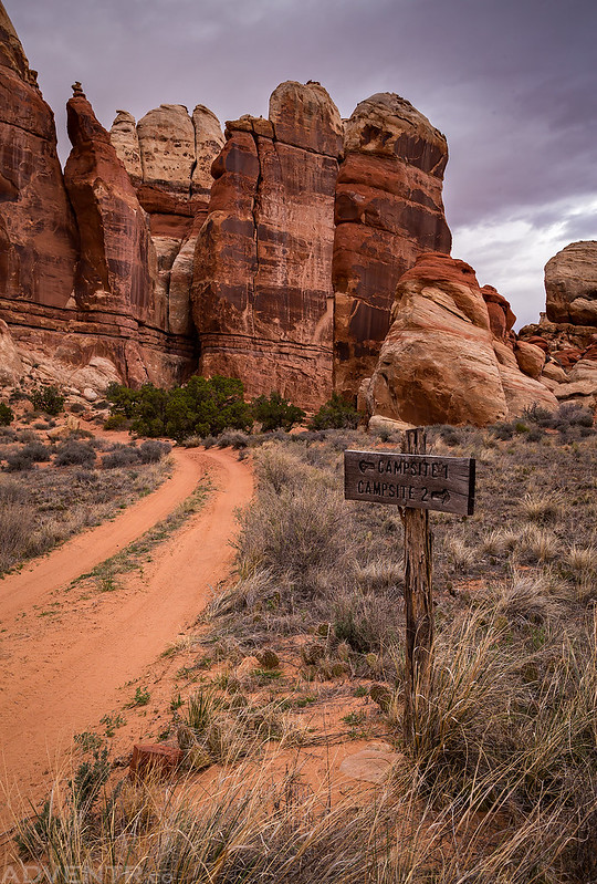
We finally made it to The Doll House in the late afternoon.
We took the left fork to Doll House #1 where we would be spending the next two nights. There would be no one at either campsite #2 and #3 while we were camped here, so we had the entire place to ourselves.
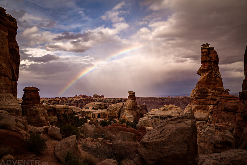
After setting up camp it was time for some dinner and while we were eating Marty spotted a rainbow in the distance. Of course, we stopped eating and grabbed our cameras for a photo! It seems that almost everytime we visit The Maze we see a rainbow.
It was very cloudy again this evening and it didn’t look like there was going to be any light at sunset again, but Diane and I still decided to hike the Granary Trail shortly before sunset, just in case. Shortly after starting the hike it started to rain a little on and off.
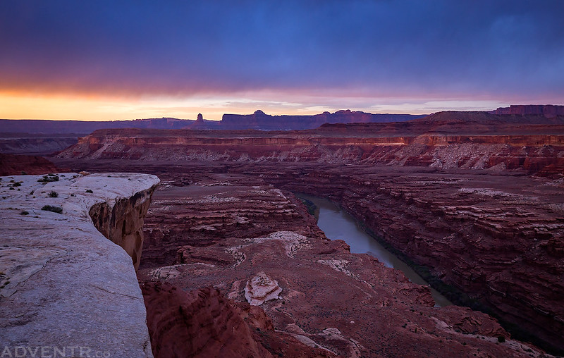
Here’s a view from the Surprise Valley Overlook near the end of the trail to the granaries.

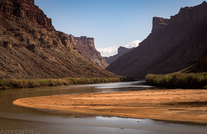
A photo through the rain over the Colorado River.
When we were near the granaries the rain started to come down pretty good, so we took shelter in an alcove for a while while we waited for it to slow a little. During our hike back to camp it was raining most of the time, but it really picked up near the end of our hike. We changed into dry clothes and then went to bed to the sound of rain falling on our tent. It rained pretty hard and steady for a couple of hours with a few distant rolls of thunder. When the rain did finally stop in the middle of the night, that’s when the wind picked up and was pretty noisy. I didn’t sleep very well at all this night.
On Sunday morning I woke up to mostly clear skies and a lot of humidity. I walked down the road from camp at sunrise to take a few photos.
The road near camp at dawn.

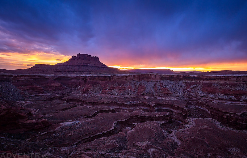
Sunrise from The Doll House.

Sunrise from camp.

Our tent at the Doll House 1 campsite with the moon above.

After the sun was up it was finally time for me to hike down to Spanish Bottom. This is a hike I’ve wanted to do for a long time and was looking forward to doing it during this trip. I couldn’t convince Diane or Marty to go with me on this one, so they stayed in camp to relax while I went on my own.
Starting the hike down to Spanish Bottom from the nearby trailhead.

Looking back up at The Doll House as I descended to the river.
A sign at the only intersection along the trail.

Looking down over Spanish Bottom from the steep trail.
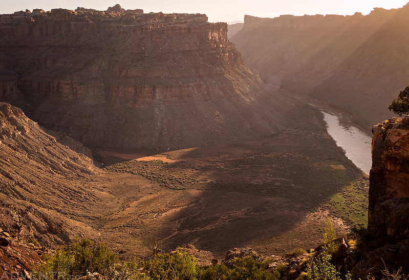
Hazy layers across the canyon in Lower Red Lake Canyon.
After reaching Spanish Bottom I continued downstream on a trail along the river through Cataract Canyon to Brown Betty Rapids. Here I sat on a boulder above the rapids and listened to the river while having a snack. The smell of the river reminded me that I currently don’t have any river trips planned for the year and I really need to change that, even if it’s only a day trip or two.
Before turning around and heading back, I hiked just a little further downstream to a large sandy beach that would make a great place to camp.

Looking up the Colorado River during my hike back upstream to Spanish Bottom.
During the 1,200 foot climb back up to The Doll House, I followed an old washed-out side trail that took me up into Surprise Valley and then I hiked through part of this graben before returning to the main trail.
My legs were pretty tired during the rest of the hike to the top, so I took it slow and stopped for plenty of rests along the way. I think the humidity from the rain the night before had really drained my energy this morning. When I returned to camp I had some lunch and then took a nap. Later in the afternoon we all went out to visit a few Barrier Canyon Style pictographs sites that Dennis had also found last year during his trip to The Maze.
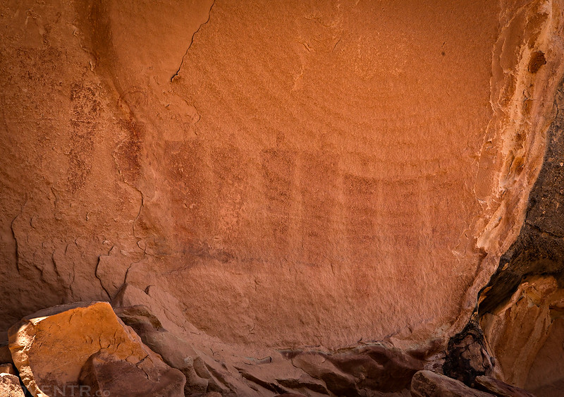
This was the largest panel we would see today, but also the most faded.
Here’s a panel of smaller figures with a rain cloud above.

A closer look at the right side of the panel.
The last panel we visited was also the best one featuring some very small, detailed and unusual figures.


We made it back to camp in time to photograph our first sunset of the trip without too many clouds blocking the light.

There was a pretty nice view across the river to The Needles and Chesler Park.

Light on the rim of the Colorado River Canyon with the La Sal Mountains in the distance taken from Doll House Campsite #2, since no one was there.
The Doll House at Dusk
Even with my nap I was still pretty tired, so I went to bed early and slept very well this night.
Monday was mostly a day for us to drive home, so we had no stops or hikes planned. We woke up with the sun to pack up camp and I didn’t even bother to try and take any photos of the sunrise. We had decided that since I had plenty of gas left we would head out through Hite and not take the Flint Trail back up to Hans Flat in order to avoid some of the bumpier roads on our way out and to reach the pavement sooner. Plus, Diane had actually never gone out this way before or been to Hite, so she got to see some new sights along the way.
One last photo of our campsite at Doll House 1 before taking it down and packing it up.
Leaving The Maze as we drove around the head of Teapot Canyon again.

The roughest of the roads are now behind us, so it’s mostly smooth sailing from here.
The drive out was uneventful as we stopped to briefly check out Hite since it had been a while since I’d been out this way. Then we circled back through Hanksville and Green River on our way back to Colorado. It was another great trip into The Maze and Canyonlands National Park!
Great report, Randy! I think you lucked out with some nice clouds for much of the trip–lots of great photos of the sky in there.
Thanks Dennis. It sure didn’t feel that way…seemed like there were too many clouds at sunrise and sunset and then it cleared up for a short time in the middle of the day!
great rock art pics
Amazingly rough territory. Geological features make it seem that man couldn’t penetrate,
yet you show that they did. I haven’t seen that area outside of the parks. The rock art is very interesting. One glyph was a spotted, four-legged animal. I’ve never seen such in this country. The tiny-figured glyph is very interesting, too. Thanks for documenting your journey with great photos and commentary. I really enjoyed reading about it.
Wonderful photos… great trip report… as always!
Thanks John!
Fantastic trip (fantastic photos, as always)! You really packed an amazing amount of stuff in. Those camp sites at the Doll House are just spectacular, wow.
Thanks David! I love camping in The Maze, it’s a great area to explore!
Questions: How much spare fuel did the trip require? How much water did you take? Is there enough deep sand to make a compressor essential? As far as gear goes, I have a 2019 Toyota Tacoma TRD Pro. What essential gear would you recommend? Thanks!
If I brought any extra gas on this trip, it was only one 5 gallon container. I can’t recall if I did, and I may not have used it if I did. Just a refrigerator full of water and other drinks. I always carry a small compressor in my Jeep, but I never air down my tires, so I never used it.
You don’t ever air down on these difficult of trails?? I gotta ask- what type tires and size are you using, and pressure?
I stopped airing down my tires a long time ago and keep them at street pressure all the time (37psi). I just run the stock BFG Mud Terrains that came on my Jeep which are around a 32” diameter.
Are these photos (specifically the rock art) okay to use for an educational video for K-12 students?
I just found your page and I am so inspired by you! I have a stock 2018 Jeep Sahara and noticed you have a Rubicon. Can I ask if your Rubicon is stock or do you have any lifts on it? I see the brief discussion above about your tires and pressure, but do you have any major upgrades on your Jeep that allow you to venture out to all these places? Or perhaps somewhere on your website where you talk about your Jeep? I from Denver and going on my first 10-day trip to Utah this weekend but I’m going to play it safe this round; but gosh am I inspired to do what you do! I plan to stay connected with your website and travels!
Hi Jacob, the Jeep in this Trip Report was a 2016 JK and I did have a 2″ lift on it with some additional skid plates (plus bumpers and winch), but that’s about all I added to it. My current 2022 JL only has an extra skid pate or two, but no additional lift. I buy the Rubicon model so I don’t have to add many modifications to it, as a stock Rubicon will pretty much get me anywhere I would want to go.