Maze Memorial Weekend IV | Memorial Day Weekend
Friday – Monday, May 26-29, 2017
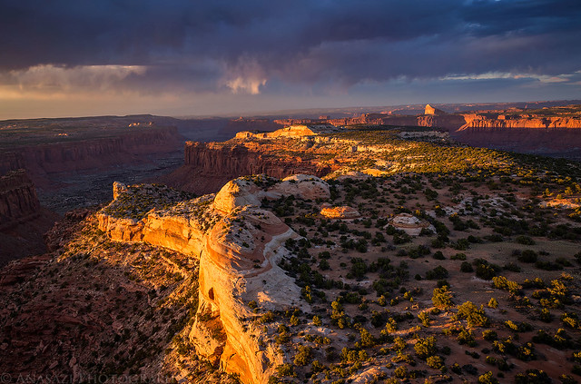
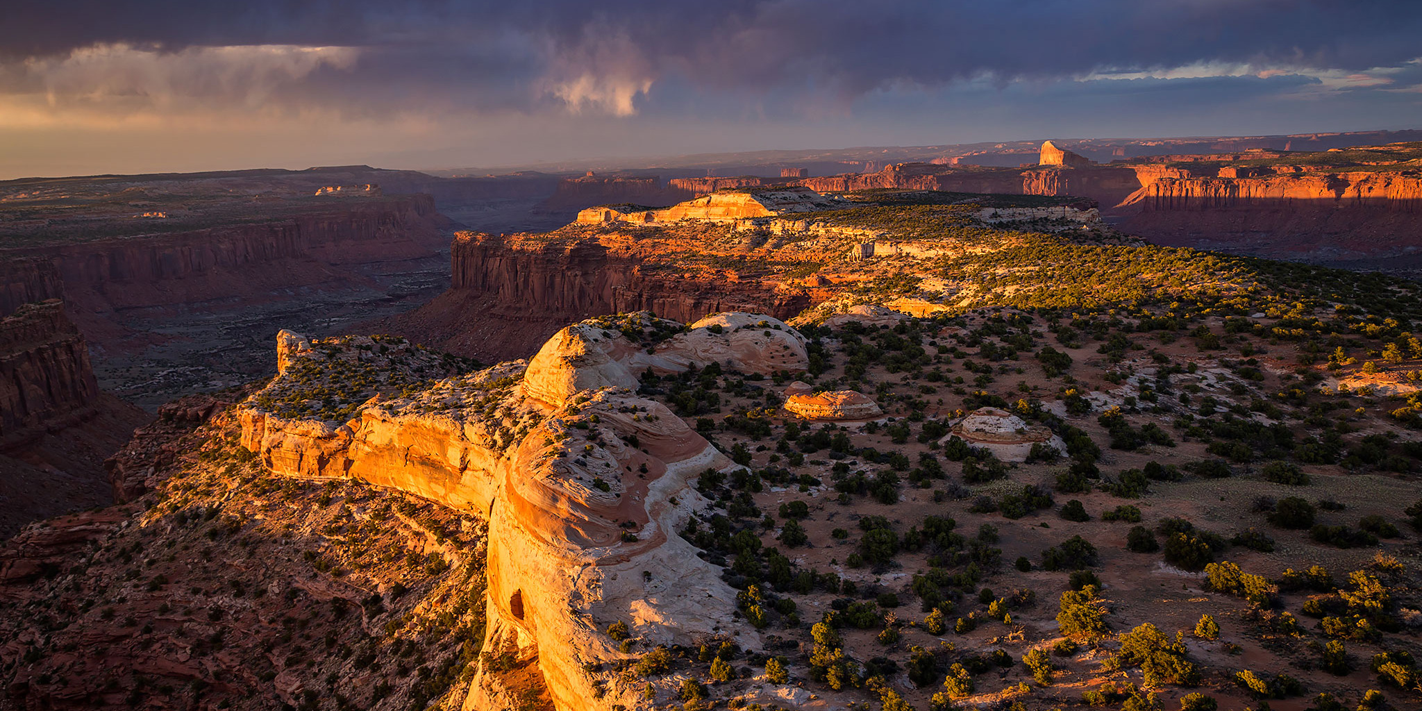
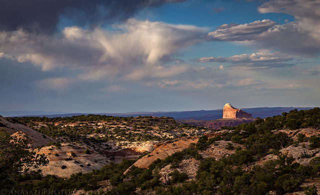
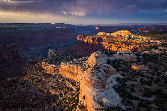
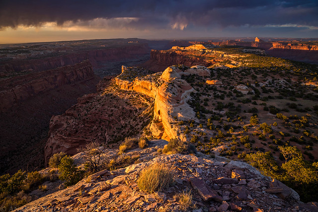
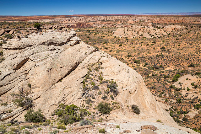
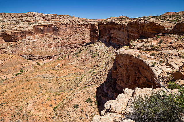
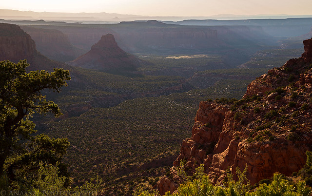
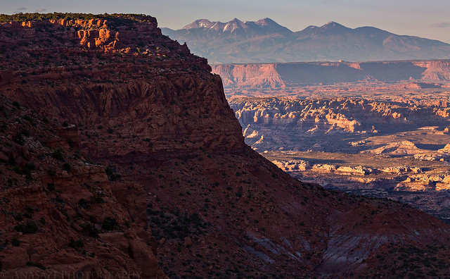
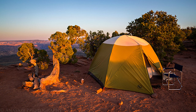
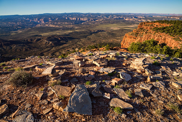
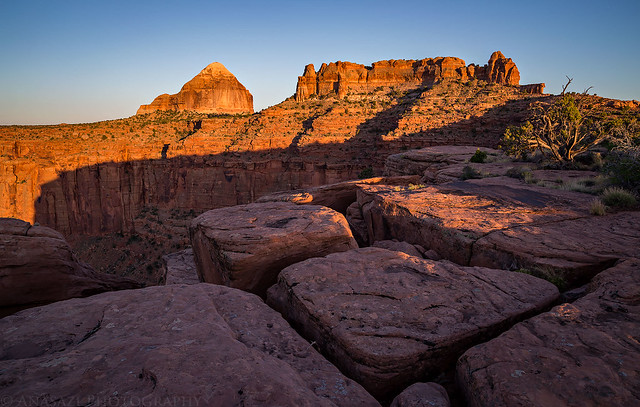
A beautiful sunset from the summit of Observation Rock along the edge of The Orange Cliffs.
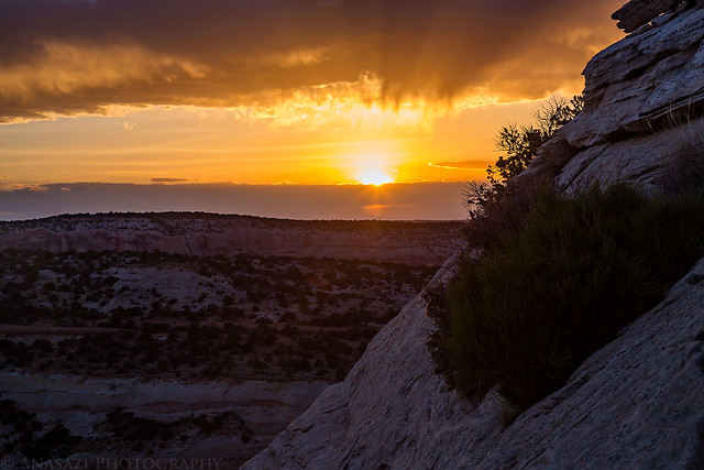
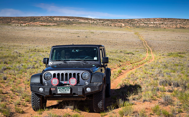
After spending the last three Memorial Day Weekends in and around The Maze District of Canyonlands National Park, this year we decided to skip visiting The Maze proper and stayed on top of The Orange Cliffs in Robbers Roost country. As usual, we left home after work on Friday evening and headed west into Utah. We stopped for a quick dinner and to fuel up the Jeep in Green River and then made our way to the Hans Flat Ranger Station to pickup our permit for the weekend. The wind was pretty brutal this evening and it really took a toll on my fuel mileage during the drive. There was a lot of sand blowing across the road to Hans Flat in places, but the sky and light was pretty nice during the drive. It looked like there was a good chance for one nice sunset before the clouds disappeared for the remainder of the weekend.
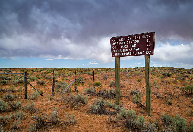
Since I always seem to post a photo of this sign when we head out into this area, I figured I’d keep up the tradition!
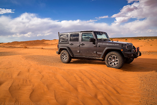
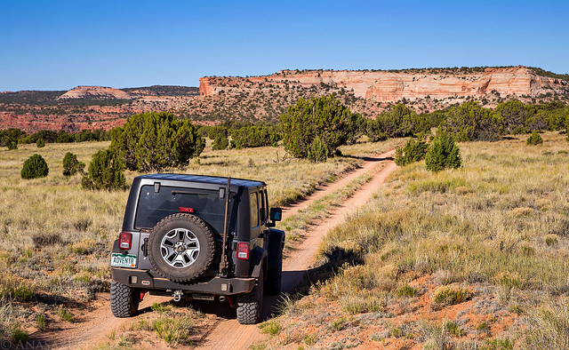
It’s hard to see in this photo, but there was a constant stream of sand blowing across the road under my Jeep here.

Nice light on Little Flat Top.
Sand dunes encroaching the road near the intersection with the Green River Road.
Since I’m working on staying at all the designated campsites within The Maze and Orange Cliffs Unit, and am getting pretty close to completing that goal, I made sure to secure our campsites early this year. Unfortunately, unlike the past couple of years where I was able to print the permit myself, the National Park Service is now requiring that you pickup your permits at the Hans Flat Ranger Station in person again. This would be a little troublesome for us since we would definitely be arriving after the Ranger Station closed at 4:30pm. Earlier in the morning I had called and spoke to a Ranger who said they would be able to leave the permit out for me. This would work out well since we could stop and pick it up on the way to our first campsite at North Point.
We arrived at the Ranger Station at around 6:30pm and checked the box for our permit. It was nowhere to be found. Since we were only scheduled to be camping three miles away this first night, I figured we’d just go camp there as planned and return in the morning for our permit when they were open again at 8:00am.
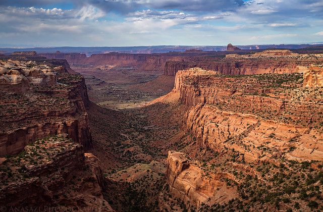
We stopped to taken in the view from the Millard Canyon Overlook as we drove to our campsite on North Point.
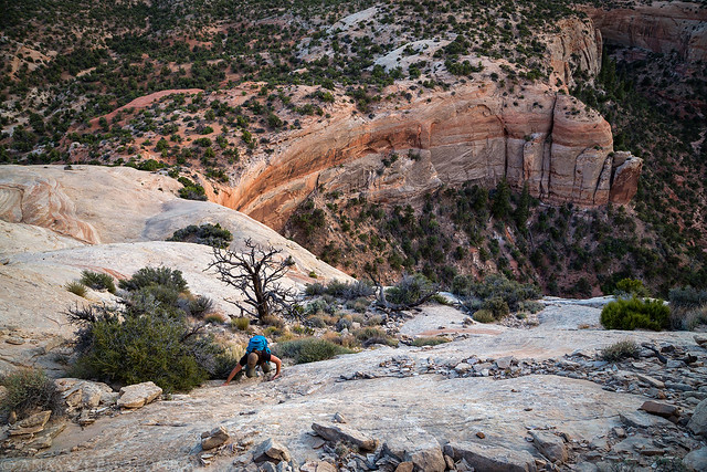
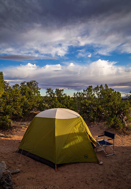
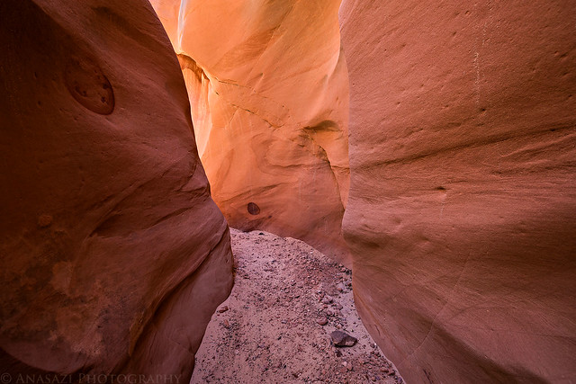
When we finally arrived at our campsite, it was still very windy out so we skipped putting up the tent right away and started on our first hike of the weekend. Our destination this evening was to try to reach the summit of Observation Rock (6,702) for sunset which was a little over a mile away. From a distance it looked like it might be too steep for us to climb, but we hoped that we would be able find a way to the top when we got closer. We followed the North Point Road a short distance and then dropped down into a wash which would take us most of the way to the base of the sandstone dome. Getting up the first half was not too steep and pretty easy, but as soon as we reached the base of the steep upper section it didn’t look very good for us. At first I found a way up that looked possible, but it was much too steep and exposed for me. Before giving up, I circled around to the north and found one chute that looked like it might be possible for us to get up. We attempted the climb here and were able to get to the top! The summit was much longer and flatter than we thought it would be, but the view from the opposite side was amazing and we had made it just in time to catch a beautiful sunset! It was a great way to start the weekend!
Our view of Observation Rock from camp as we started hiking to it.
Following the North Point Road for a short distance.
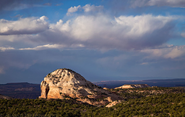
Cleopatra’s Chair lit up in the distance.
At the base of Observation Rock.
A view from the edge.
Diane climbing up the steep chute we took to the top.
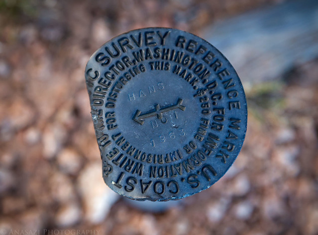
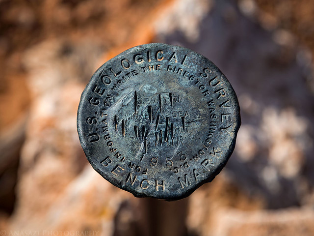
A bent reference mark we found on the summit.
What a view!
Diane enjoying the sunset.

Observation Rock Summit Sunset
The sun disappearing behind some clouds as we climbed back down.
We hiked back to camp and made it back just before the last light of dusk had disappeared and we never needed to use our headlamps. We quickly got our tent setup now that the wind had died down a little and tried to go to sleep. Unfortunately, the wind would continue on and off for much of the night which prevented me from sleeping well.
Our campsite at North Point on Saturday morning.
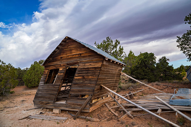
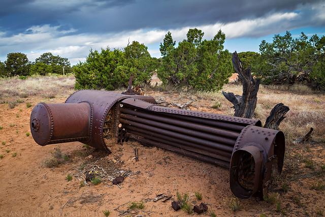
After waking up with the sun we packed up camp and headed off to the Ranger Station so we could get our permit when they opened. We had a little extra time to kill, so we stopped to visit French Cabin on the way.
The leaning French Cabin.
A large boiler found nearby.
When we arrived at the Hans Flat Ranger Station I explained what had happened the evening before and they apologized for forgetting to leave the permit out. They had printed it up but forgot it on the desk. With the permit in hand, we were now set for the rest of the weekend. From the Ranger Station we drove out across The Spur Road all the way to it’s end overlooking Labyrinth Canyon of the Green River. We didn’t really have a specific reason to go out this way aside from the fact that I always have wanted to drive this road out to the end and it seemed like a good time to do it. Along the way we made quick stop to hike to the high point of High Spur (6,267) which had a nice view.
The view from High Spur.
High Spur Benchmark
Following the two-track across The Spur to an overlook of the Green River.
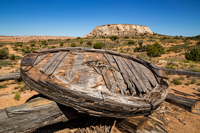
After returning from the end of The Spur, we took the east side road to the edge of Horseshoe Canyon and stopped to check out an old large wooden wheel at the old drill site near Sugarloaf Butte. Since we were here, we also took the opportunity to climb to the top of Sugarloaf Butte (5,460) and then hiked all the way around it’s edge.
Wooden Wheel & Sugarloaf Butte
From a distance it looked like Sugarloaf Butte might be too steep for us to climb, but as we got closer we found two chutes that we could’ve used to climb to the summit. This was the easier route and the one we used.
View from the top towards Horseshoe Canyon.
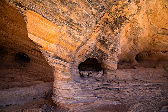
Just a small alcove I stopped to photograph on our way back down.
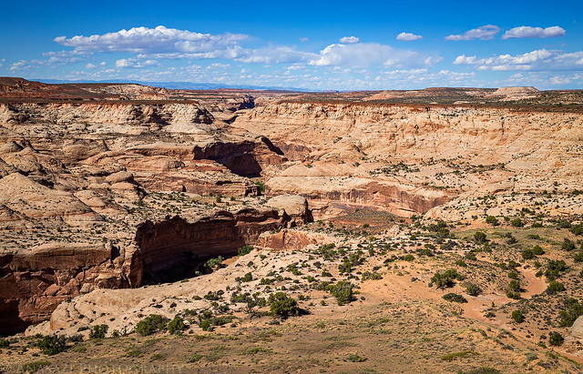
After returning to the Jeep we continued driving to the end of the road overlooking Horseshoe Canyon where we could see the main trailhead on the other side. After checking out the view from the edge we had lunch and then carried on back to the main road.
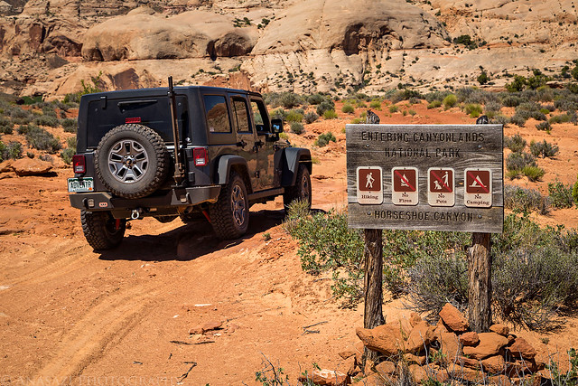
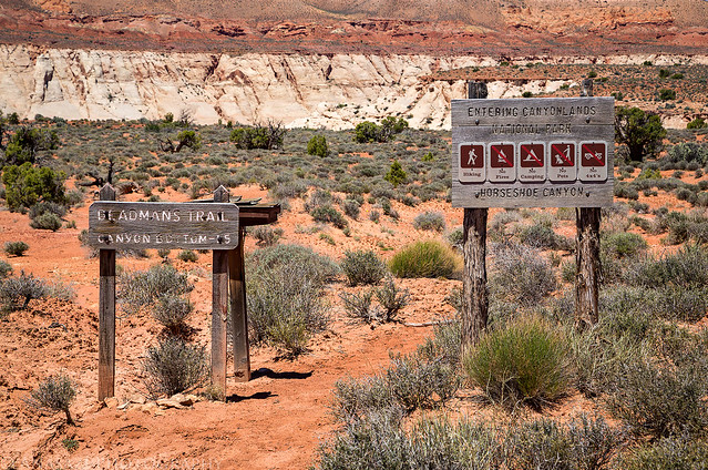
My favorite kind of entrance into a National Park.
The end of the road. I found Dennis’ signature in the nearby trail register box from the previous weekend.
Overlook of the old road into Horseshoe Canyon. You can see part of the main trail on the left side.
We opted not to hike down the old road into the canyon since we planned on hiking down the Deadmans Trail again this evening, which we had also hiked down on our very first Memorial Day weekend trip to The Maze. On that trip we had only visited The Great Gallery and Diane wanted to see the remainder of the sites in Horseshoe Canyon this time. Also, since I have always hiked into Horseshoe Canyon in the morning, most of my photos of the rock art were taken when they were in direct sunlight and I wanted to get some of them in the shade, so I made sure we did the hike later in the afternoon this time.
The start of the Deadmans Trail.
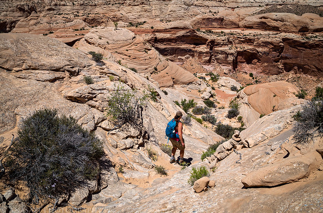
Diane descending into the canyon. There was more elevation loss than I remembered…maybe we would have been better off hiking down the old road?
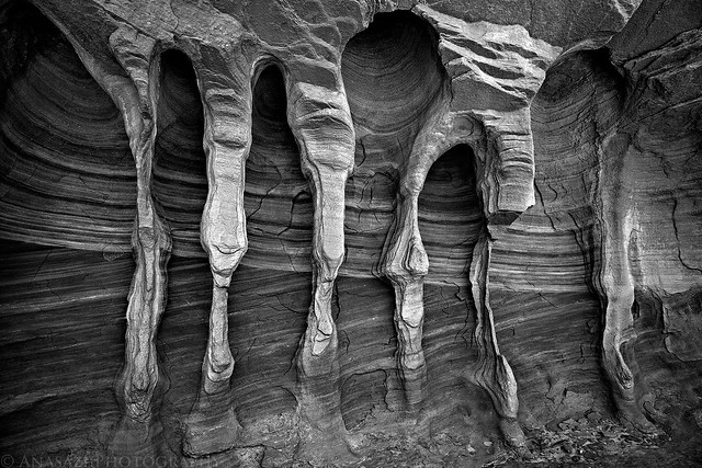
Since I already have a good photo of this little sandstone alcove in color, I thought I’d try a black and white image this time.
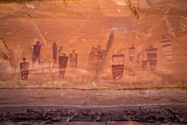
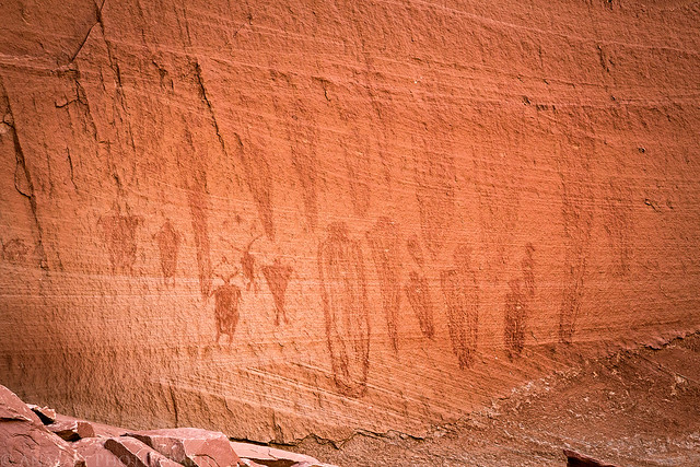
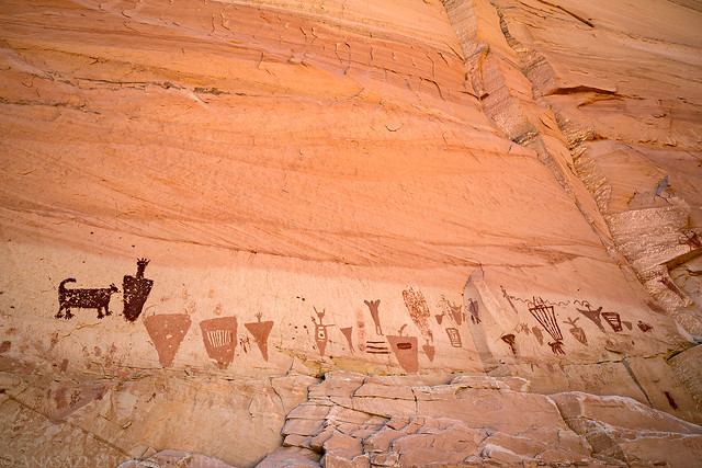
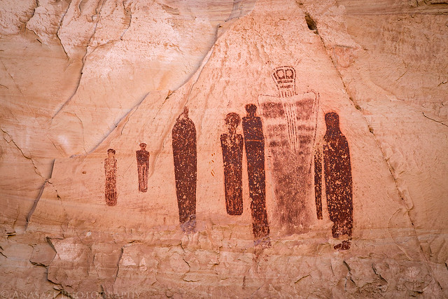
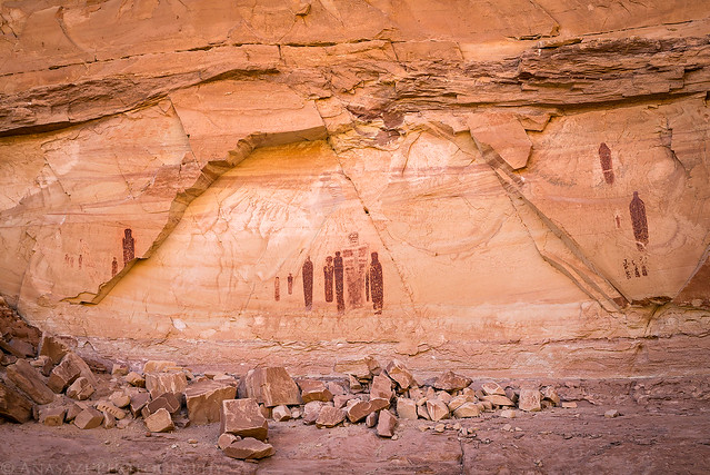
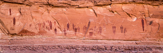
When we reached the canyon bottom we hiked along the wash all the way to the High Gallery visiting all of the rock art sites along the way and then returned the way we came, making sure to spend more time at The Great Gallery again on the way back. My plans had worked out and all of the sites I wanted to be in the shade were.
The Great Gallery
Faded pictographs in the Alcove Gallery.
The Horseshoe Shelter
The Great Ghost
The Great Gallery Panorama (Click on the image for a larger view)
Looking back over Horseshoe Canyon as we climbed back up the Deadmans Trail.
We returned to the Jeep and then needed to drive out to our next campsite at The Neck on The Big Ridge, a site we had checked out last year on our Maze Memorial Weekend trip with Dave and Marty. This campsite is perched on a narrow strip of land between Waterhole Flat and the South Fork of Happy Canyon, so I was a little worried about how windy this site was going to be. Thankfully, much of the wind had died down by the time we arrived, so we were able to get camp setup quickly, have a little dinner and then watch the sunset.
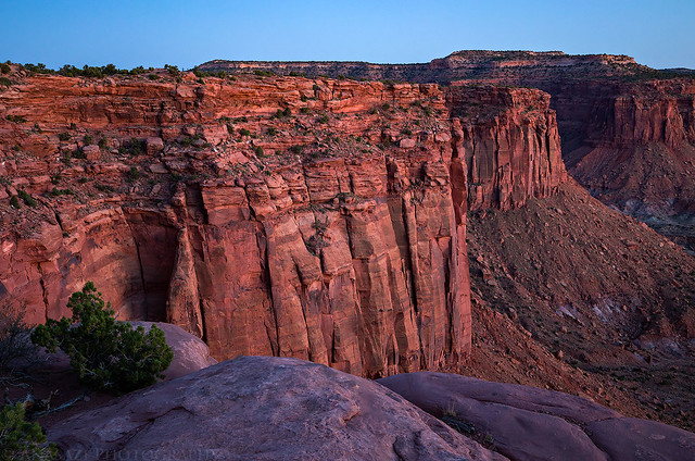
An evening view down into the South Fork of Happy Canyon from The Neck.
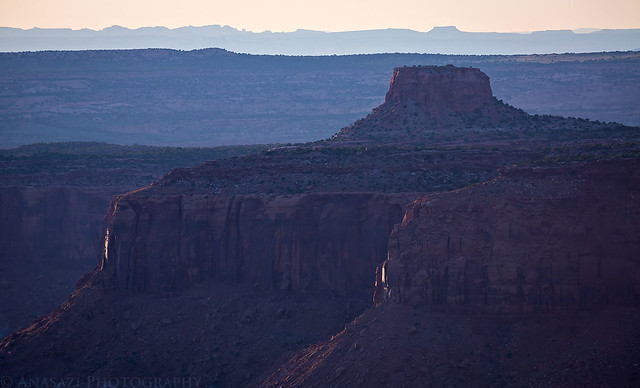
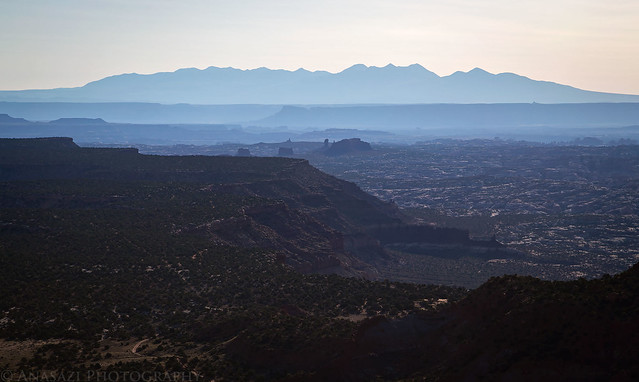
Another view from The Neck over Canyonlands to the La Sal Mountains.
The Hat
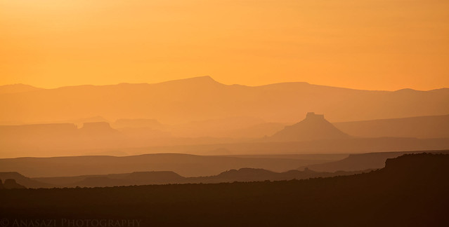
With my long lens I could make out Factory Butte out on the horizon shortly before sunset.
Looking to opposite direction to the confluence of Gypsum Canyon and Cataract Canyon.
The Neck Campsite
A sliver of a crescent moon over the Henry Mountains at dusk.
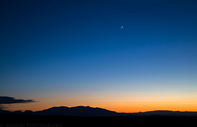
Even though it wasn’t windy at our campsite, aside from an occasional gust that would hit our tent, throughout much of the night I could hear the wind howling loudly in the canyons below us which kept me up. It was now two nights in a row that I didn’t sleep very well because of the wind. On Sunday morning I woke up before sunrise and took a few photos before we started to pack up camp.
Soft dawn light in Happy Canyon Country.
First light on The Big Ridge and Waterhole Flat.
Before leaving the area I stopped for a quick hike to the summit of Lands End Butte (7,151) so I could take in the view from one of the highest points around this area.
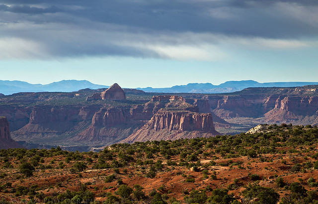
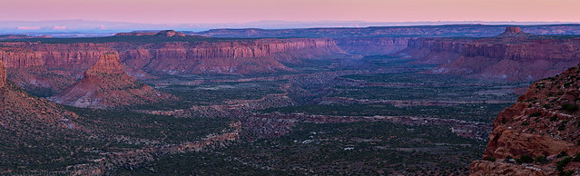
Morning haze over the Land of Standing Rocks.
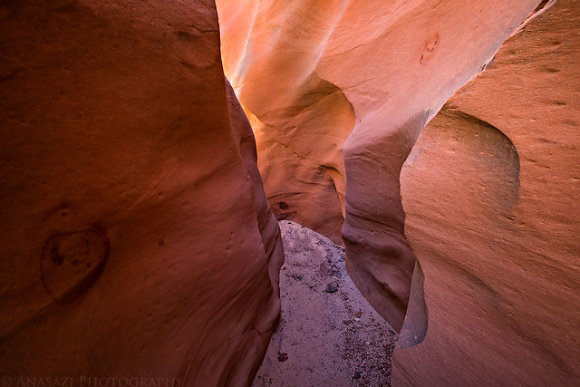
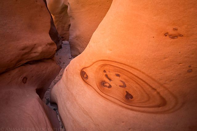
After the short morning hike we drove back over to The Spur so we could hike the High Spur Slot Canyon. This narrow slot has been on my to-do list for a long time and I hoped to finally check it out this year. I am not a technical canyoneer and knew we wouldn’t be able to complete the full canyon, but I had hoped we’d be able to hike a good portion of it before turning around and hiking back out the same way. Unfortunately, I was wrong and shortly after dropping into the upper section of the slot we ran into a drop in the canyon that we didn’t think we would be able to climb back up. The drop wasn’t very tall, maybe 6-8 feet, but it was overhanging and neither of us thought we’d be able to climb back up it, so we didn’t proceed. It was a bit of a disappointment having to turn back so quickly.
Here are a couple of photos I took from the very short section of the canyon we did hike through.
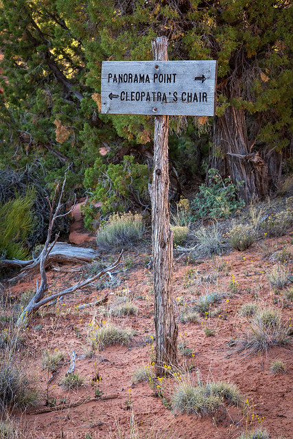
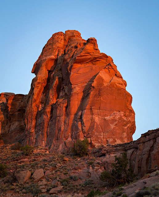
After hiking out of the slot canyon we returned to the Jeep so we could drive out to our last campsite of the weekend at the base of Cleopatra’s Chair on North Point. Diane has wanted to spend the night out at this campsite since the first time she saw Cleopatra’s Chair a few years back, so I made sure that we finally got out there this year. The road across North Point seemed a lot rougher than I recall from our last visit to Panorama Point a few years ago, but actually all the roads in this area seem to be getting rougher than they used to be just a few years ago. It’s not that they are difficult, but it definitely takes longer to get where you are going than it used to. I guess I have to keep that in mind as I plan future trips to the area.
The only intersection on North Point.
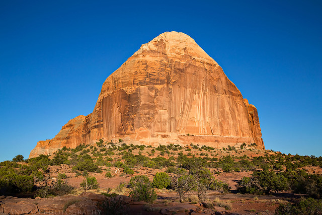
Up close and personal with Cleopatra’s Chair.
Up until this point in the trip we had not had any issues with bugs on this trip, unlike last year. However, as soon as we reached the Cleopatra’s Chair Campsite that would change as we found the gnats were out in full force and they were brutal! I’m glad we bought a screened-in bug tent last year after the issues we had with the gnats and no-see-ums in The Doll House, because it made things much better this time. We rested in the bug shelter for a while in the late afternoon and had a little dinner as we waited until closer to sunset to go on a hike. About an hour before sunset we started hiking around Cleopatra’s Chair on an old road to the end of the narrow sandstone peninsula we were on and made it to the point just before sunset.
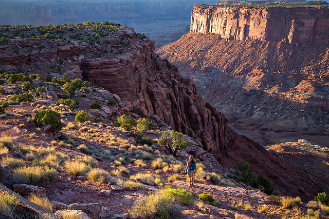
Diane hikes along the edge of the peninsula below me.
Looking back from near the point to Cleopatra’s Chair.
The last light of the day strikes the sandstone above us as we hiked back to camp.
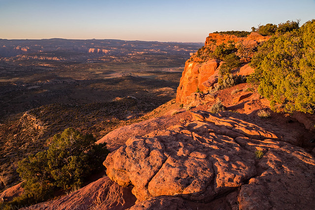
A different view into Millard Canyon.

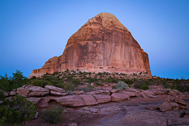
Cleopatra’s Chair at Dusk
The Orange Cliffs were still glowing a little orange when we returned to camp.
For the first night on our trip there was absolutely no wind and the temperature never dropped below the upper 50’s. It was great camping weather and I finally slept well all night! On Monday morning I woke up about 30 minutes before sunrise so I could take a few photos from around camp.
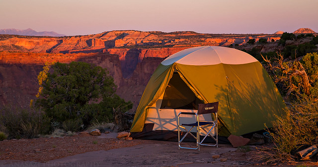
Cleopatra’s Chair Campsite
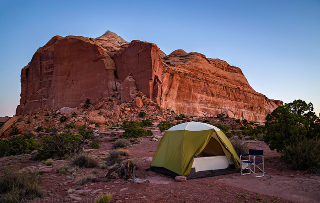
My Jeep at sunrise under Cleopatra’s Chair.
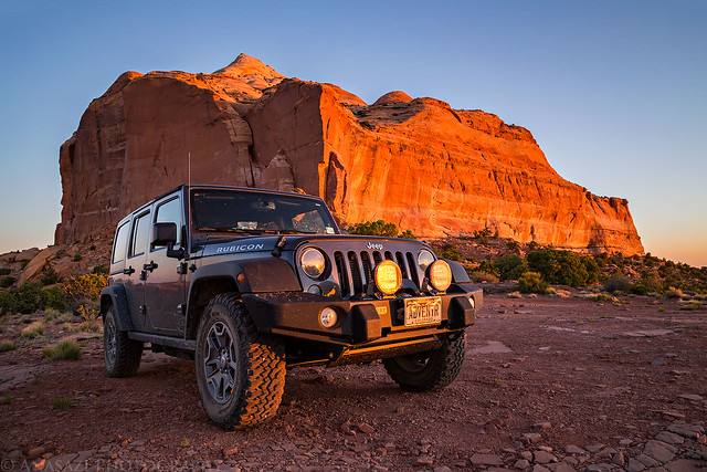
Looking the other direction.
Not a bad view from camp…
After packing up camp it was time to start driving back home.
At the last minute I decided to skip going on a longer hike this morning, but on our drive back across Robbers Roost Flats we did make a short detour to visit the top of Runts Knob (6,340) which is right off the road.
View from the top of Runts Knob.

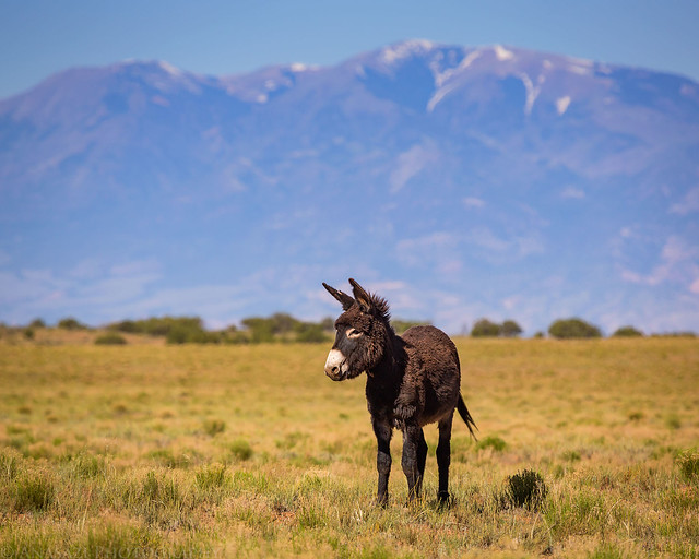
Before reaching the Green River Road intersection I took a photo of this wild burro below the Henry Mountains in the distance.
We turned off onto the Green River Road to head back and stopped at the Chaffin Ranch to see if the Champagne Geyser was erupting. There we found a group camped practically right next to the geyser and it was the driest I’ve ever seen it. It wasn’t even bubbling a little so we decided not to stick around and carried on to Green River. When we reached town we stopped for an early lunch at Ray’s Tavern before they started to really get busy and then we had an uneventful drive the rest of the way home. It was another nice Memorial Day Weekend!