Press "Enter" to skip to content

Tag: cimarron river

The Jackson Guard Station at Silver Jack Reservoir

New Years Weekend | Saturday & Sunday, December 30-31, 2023

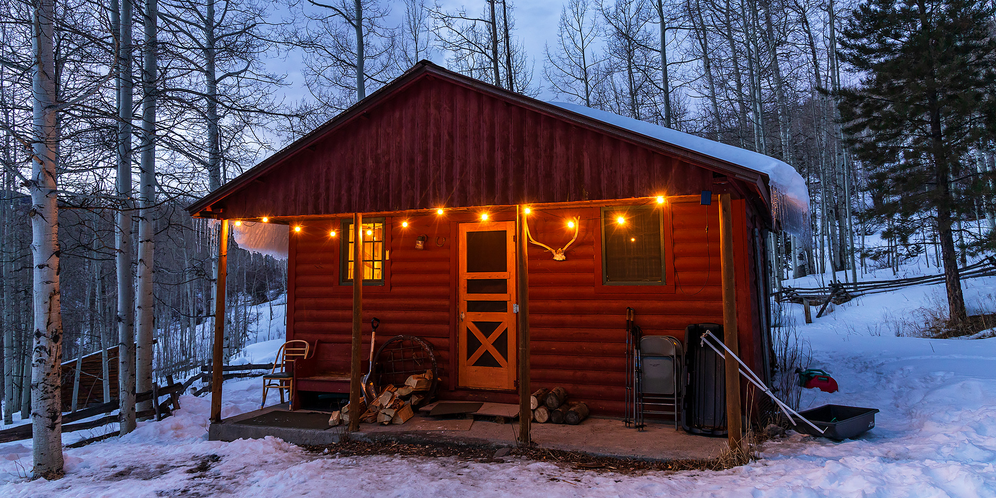
For the final weekend of 2023 Diane and I headed over to the northern end of the San Juan Mountains near the edge of the Uncompahgre Wilderness so we could snowshoe the road along the Cimarron River and spend a night at the Jackson Guard Station, which is located near the popular Silver Jack Reservoir. This historic cabin was originally used as a Forest Service Guard Station and housed Forest Service work crews. We left home on Saturday morning, drove south to Montrose then east over the Cerro Summit and soon arrived at the trailhead where we started hiking up the snow-covered road. Although we were planning for this to be a snowshoe trip, there really wasn’t very much snow on the ground yet and there were snowmobile tracks on the road to follow, so we ended up not needing to use our snowshoes for the hike.

1 Comment

Curecanti Trails in the Black Canyon of the Gunnison

Curecanti National Recreation Area | Saturday, May 13, 2023

After spending last weekend on the Yampa River, Jackson and I had already planned another river trip for this Sunday on the Colorado River near home, so today I wanted to find something a little more local to do. While looking over my maps trying to decide where to go, I eventually settled on hiking a couple of shorter trails in the Curecanti National Recreation Area (NRA) that are all located within the upper end of the Black Canyon of the Gunnison. Aside from an overnight backpacking trip down the Hermits Rest Trail a couple years ago, I have done no other hiking in the NRA even though I drive through it frequently in the summer. There are really only a handful of trails in Curecanti, so I thought this would be a good opportunity to start hiking them all.

Leave a Comment

The Cimarron Loop

East Fork & Middle Fork of The Cimarron River
Labor Day Weekend | Saturday – Monday, September 2-4, 2017

Labor Day weekend was upon us again, which meant it was time for another backpacking trip into the Uncompahgre Wilderness! This would be our fourth year in a row backpacking into the northern valleys of the wilderness area, starting with our Wetterhorn Basin (West Fork) trip back in 2014, then continuing with trips into Big Blue Creek and Fall Creek. Earlier this summer we were also able to go on a quick overnighter along the Little Cimarron River to make up for our failed loop last year. With only two remaining major valleys left, we planned to combine the East Fork and the Middle Fork of the Cimarron River into a two night trip that I’ve called The Cimarron Loop.

4 Comments

Mount Bierstadt to Owl Creek Pass

Friday & Saturday, September 30 – October 1, 2016

I left right after work on Friday afternoon to begin my annual week-long October trip. Typically, I spend the entire week on the Colorado Plateau in southern Utah or northern Arizona, but this year I decided to spend the first couple of days in the Rocky Mountains of Colorado to try and make up for my lack of climbing mountains over the summer and maybe photograph some of the leftover fall colors. I wanted to try and get one more 14er in this year and Mount Bierstadt (14,060) in the Front Range sounded like a good easy option to start with. After leaving work I made my way over to Dillon for dinner and then finished the drive on I-70 to Georgetown where I followed the road up to Guanella Pass. I found a spot to camp and pretty much fell right asleep so I could get an early start the following morning.

4 Comments

Courthouse Mountain

Fall Colors 2014
Saturday & Sunday, September 20-21, 2014

On Saturday, Diane and I headed back down to the San Juan Mountains again so we could climb to the top of Courthouse Mountain in the Cimarron’s . While this mountain is short compared to the surrounding peaks in the area at only 12,152 feet, it is uniquely shaped and has over 1,000 feet of vertical prominence. It’s also a very distinguishable peak near Owl Creek Pass that is often photographed, especially in the fall when the surrounding mountainsides are changing colors. I have seen this mountain in the skyline for many years when I would drive to Ouray and Silverton, and decided it was finally time to climb to the top a few weeks ago when I had a different view of it during our hike into Wetterhorn Basin. While there were afternoon storms predicted after 3:00pm today, we didn’t need to get too early of a start for this hike since it’s a relatively short trail, clocking in at just under 2 miles, but it climbs almost 2,000 feet of elevation in that short distance.

Leave a Comment