
South San Juan Wilderness | Thursday – Saturday, August 20-22, 2026
It’s been just over three years since my last visit to the South San Juan Mountains and I’ve been wanting to get back there for quite a while. Initially, I was going to attend the annual GIS Colorado Summer Meetup this week, which was supposed to be held at the Big Meadows Campground along the western edge of the Weminuche Wilderness, and then I was planning to spend the remainder of the weekend hiking in the South San Juans, but that event was recently cancelled. Since I had really been looking forward to returning to the South San Juans, I decided to carry on with my plans and started driving that way early on Thursday morning. I took the scenic route along the Silver Thread Scenic Byway through Lake City and Creede to South Fork and then followed the Lake Fork of the Rio Grande to the Big Meadows Reservoir and Shaw Lake so I could at least check them out, even though I wouldn’t be spending any time in that area now.
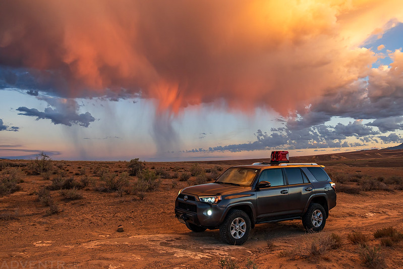
There were some nice storm clouds at sunrise this morning as I drove across the Stinking Desert to Delta, so I had to pull off the highway for a quick photo.
I made it to Big Meadows Reservoir in the late morning for a quick drive through of the area I was originally supposed to be spending a few days in, then I continued on into the South San Juans.

Along the Continental Divide: Bonito Pass
After leaving Big Meadows Reservoir I made my way up Pass Creek to the end of the road just below Bonito Pass. Even though storm clouds were building all around me, I knew the pass was still in the trees and decided to hike up to Bonito Pass to see how long the weather would hold out.
Following the Bonito Pass Trail up to the pass.

Bonito Pass

When I reached the pass I heard a few distant rumbles of thunder but the Continental Divide Trail was still in the trees, so I followed the trail to the west to see if I could make it up to the nearby Silver Benchmark.

I turned around at this small clearing just below the Silver Benchmark as the lightning and thunder started to get closer and rain began to fall.

It was raining pretty good when I returned to Bonito Pass.

With plenty of thunderstorms in the area I grabbed a late lunch at the Sky Line Lodge in Platoro and then spent the rest of the afternoon exploring some of the roads around the Platoro Reservoir. Later in the evening I found a campsite near the trailhead for Conejos Peak and settled in for the night.
I always enjoy this view of Lookout Mountain over Schinzel Flats.

Platoro Reservoir

One of the roads I followed ended at this locked gate with a sticker that says ‘Illegal Trail’ even though the road is numbered and shows up on the Travel Management Map beyond this point…

Later in the evening I followed the road up about Saddle Creek and found a campsite near the Tobacco Lake Trailhead.

Highest Point in Conejos County: Conejos Peak
I was up early on Friday morning so I could hike to the summit of Conejos Peak, which is the highest point in Conejos County. I started out by following the Tobacco Lake Trail at dawn and watched the sunrise as I entered the South San Juan Wilderness.
There was a little color in the sky this morning as I made my way to Tobacco Lake.


It’s always great watching the first light of the day strike the surrounding mountains.


Looking across the Saddle Creek drainage from the Tobacco Lake Trail.

I followed the faint trail around the north side of Tobacco Lake and climbed up to the ridge.

Tobacco Lake & Conejos Peak

That highpoint straight ahead is Conejos Peak.

I passed underneath North Conejos Peak as I ascended the ridge.

Following the faint trail along the ridge. The alpine tundra was already showing it’s fall colors.

When I reached the summit of Conejos Peak I had an outstanding view of the surrounding mountains.


Here’s the view looking down into Hansen Creek to the south.
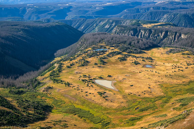
Looking towards the South Fork of the Conejos River.

Looking back over Tobacco Lake from the summit.

After enjoying the views from the summit for a little while, I returned to Tobacco Lake and continued down the trail back to the trailhead.

Along the Continental Divide: Summit Pass & PT 12010
After leaving Conejos Peak I drove back over to Elwood Pass so I could go on another short hike along the Continental Divide Trail to Summit Pass and PT 12010, assuming the weather would hold out long enough!
When I reached the Alamosa River I had a nice view of the Red Mountains just to the east of Lookout Mountain.

From Elwood Pass it was a short and easy walk over to Summit Pass.

From the pass it was a nice stroll along the Continental Divide Trail to PT 12010.

There were some nice views from this section of the trail.

Elwood Creek

I left the trail at this little grassy pass and made my way over to the highpoint. It appeared to be storming over the La Garita Mountains in the distance.

It was an easy walk up the gentle ridge to the summit.

Following the Continental Divide Trail back to Elwood Pass.

After my second hike of the day there were storms popping up all around me, so I decided to drive down to South Fork for an early dinner and then returned to explore a few more backroads in the area before finding a nice campsite just above Schinzel Flats.
There was a nice view over Iron Creek from the campsite.

Sheepshead

Lookout Mountain

Iron Creek Camp

Highest Point in Archuleta County: Summit Peak
I got another early start on Saturday morning so I could attempt to climb Summit Peak, which is the highest point in the South San Juan Mountains and also the highpoint of Archuleta County. I had actually tried to hike this mountain on my last visit to this area three years ago, but my legs were too tired that day and I turned around early, so I was looking forward to a little redemption this time. I started hiking up the Treasure Creek Trail at dawn on my way to meet up with the Continental Divide Trail yet again.
After about a mile I ran into a large flock of sheep on the trail that I had to hike right through. There was a sheepherder on horseback there, but he didn’t speak any English and we couldn’t communicate very effectively, but he motioned that it should be OK for me to hike through the flock. For the most part the sheep moved out of my way as I hiked through, but I was constantly barked and growled at by the sheepdogs the entire time. Two of the dogs followed me as I hiked through the flock, but they would stop making noises at me as soon as I turned around and looked right at them.

I was happy to leave the flock of sheep behind me as I climbed higher up the trail- but I was also happy to get up out of the trees where I had a better view of the surrounding mountains!

The Unicorn

Montezuma Peak

Looking across the upper reaches of Treasure Creek.

I liked the look of the clouds above this ridge as I passed below.

Once the trail turned south I had a great view of Summit Peak from the area I had turned around at the last time I was here.

I circled around to the south side of the peak and started climbing the steep grassy slope towards the summit.

I reached the ridge and followed it over to the summit.

The Ridge To the Summit

Summit Spires

Looking back down the ridge I was following.

Summit Peak Summit

Summit, 1936

Looking down along the crest of the Continental Divide.

Instead of returning down the steep grassy slopes I had climbed up, I followed the ridge further to the southwest and then found another area to descend.

Here’s one final look at Summit Peak as I passed below it on the Continental Divide Trail.

Upper Treasure Creek

Thankfully, the sheep were all gone as I followed the Treasure Creek Trail back down to the trailhead.

Beautiful photos and great descriptions. Thank you!
Thanks Nancy!
As always, beautiful photography. Thanks for sharing!
Thank you, Judy!
Love that wide open Colorado high country! Gotta return sometime. Fine photos as always.
Thanks Steve!