
Flaming Gorge Dam to the Swinging Bridge | High CFS: 1,870 – Low CFS: 1,240
Saturday – Tuesday, September 18-21, 2021
The river is running to the south; the mountains have an easterly and westerly trend directly athwart its course, yet it glides on in a quiet way as if it thought a mountain range no formidable obstruction. It enters the range by a flaring, brilliant red gorge, that may be seen from the north a score of miles away. The great mass of the mountain ridge through which the gorge is cut is composed of bright vermilion rocks; but they are surmounted by broad bands of mottled buff and gray, and these bands come down with a gentle curve to the water’s edge on the nearer slope of the mountain. This is the head of the first of the canyons we are about to explore—an introductory one to a series made by the river through this range. We name it Flaming Gorge.
Major John Wesley Powell,
May 26, 1869
The middle and latter part of September is probably my favorite time of the year to go on a nice relaxing river trip. The heat of summer is starting to diminish, but it’s still usually warm enough to go for a swim. The rivers are lower and slower making a more enjoyable trip for those of us who aren’t really into the swift water and big rapids. The low water also means there are a lot of sandbars for camping on, which is my favorite kind of camping. The nights are beginning to to get longer and cooler and most of the bugs are usually gone! What more could you ask for? After spending a few days on the Colorado River in Canyonlands National Park last September, this year Jackson, Chris and I decided to follow in the footsteps of John Wesley Powell again and check out the Green River just below the Flaming Gorge Dam from Red Canyon to Browns Park. This segment of the Green River is known as the ‘ABC’ section because it is divided into three different sections; Section A from the Flaming Gorge Dam to Little Hole is about 7 miles, Section B from Little Hole to Indian Crossing is about 8 miles, and Section C from Indian Crossing to Swinging Bridge is about 15 miles- for a total of about 30 miles. We planned to do the whole stretch.
I’ve spent plenty of time exploring the canyons of the Green River around the Canyonlands and Dinosaur regions, so I was looking forward to seeing more of this amazing river further upstream, especially since Diane and I had just spent a few days near the headwaters in the Wind Rivers just last month. When we started planning this trip earlier in the summer I was a little concerned about making the miles in three days, especially through Section C which is the slowest and longest, because we knew that water levels would usually be low at this time of the year, but thanks to the current drought that has been plaguing the southwest the Bureau of Reclamation announced in July that they would be releasing more water from the Flaming Gorge Reservoir than normal to help keep Lake Powell from getting too low. At least one thing was certain, with the higher release from the dam we would have no problems making the miles, so I guess that worked out for us!
Roaming Around Browns Park
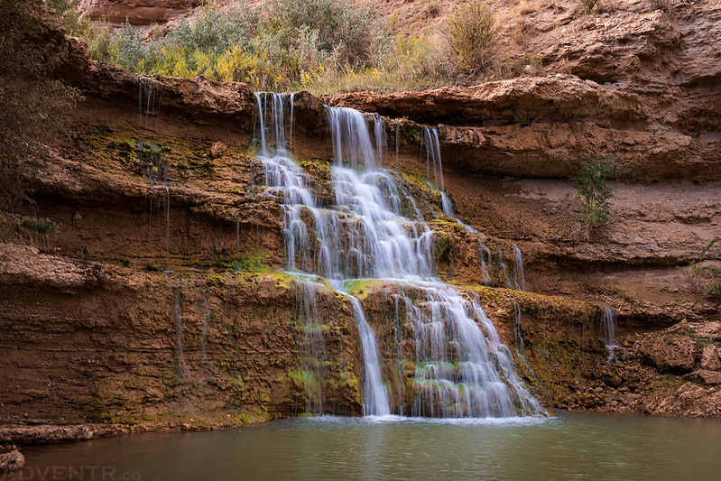
Since our first and only reserved campsite would be in Section B on Sunday night, we wouldn’t be getting on the river until Sunday morning this weekend so we all planned to meet up later on Saturday evening in Browns Park. This would give me plenty of time to explore the Browns Park area earlier in the day on my own, which is something that I’ve wanted to do for quite a while! I left home early on Saturday morning and headed north to Browns Park via Rifle and Meeker. I topped off my fuel tank in Maybell since it would be the last gas station I would see until we reached the Flaming Gorge on Sunday morning and then I finished the drive to Vermillion Creek where I stopped to check out a small waterfall.
I took a short walk over to the Vermillion Falls from the highway since the road to the falls is currently closed to vehicles.
After following some backroads in my Jeep I stopped to visit this possible Medicine Wheel on my way to find some petroglyphs.
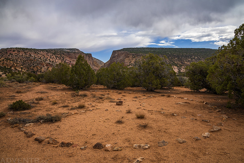
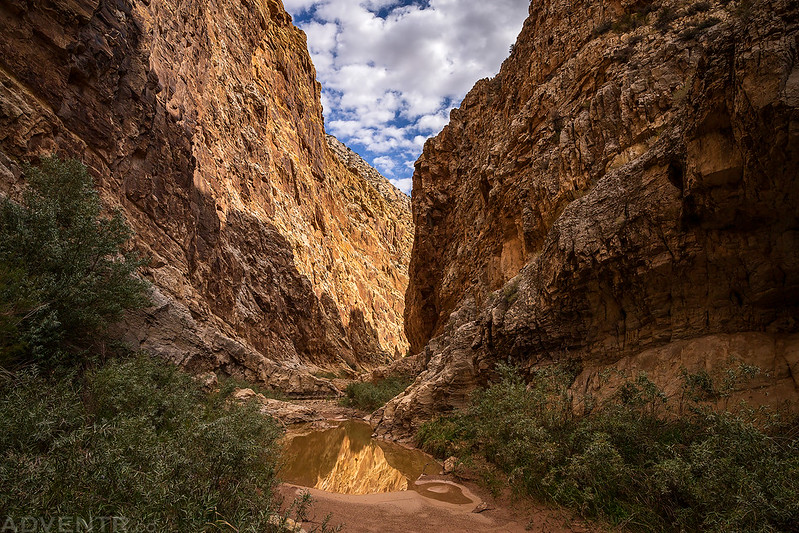
Then I followed a trail into the mouth of the canyon.

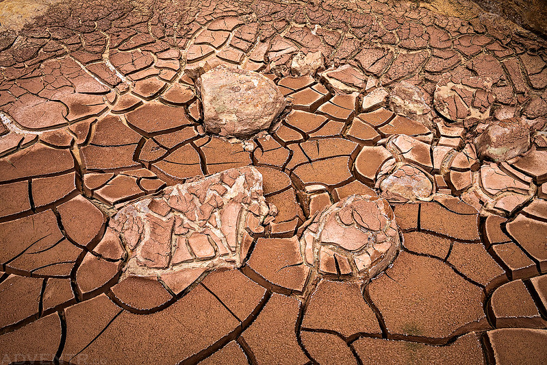
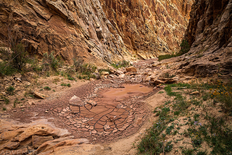
The creek was not flowing and the canyon was mostly dry, but there were a couple of muddy pools and plenty of mud cracks.

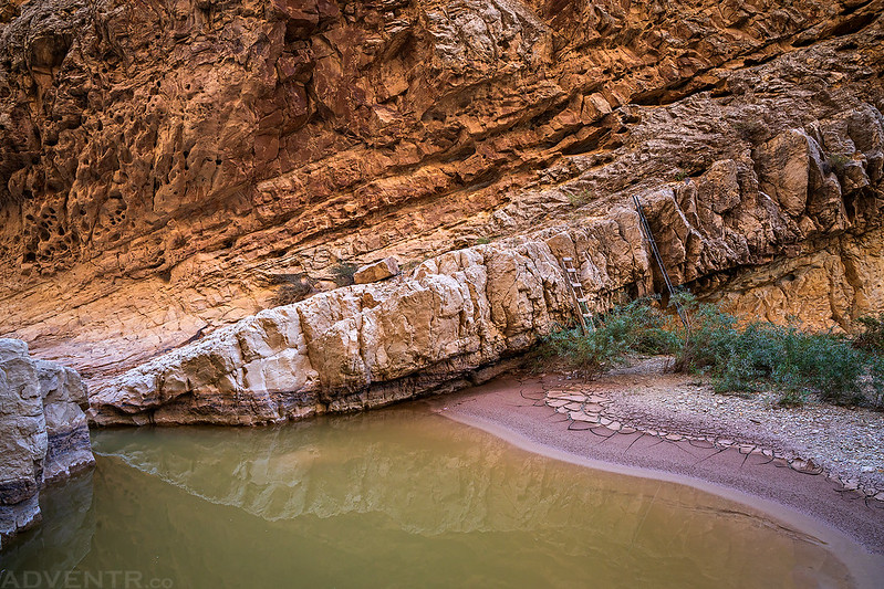
This was the largest pool in the canyon with your choice of ladders to get up and over the only obstacle on this hike.
Mud Crack Canyon


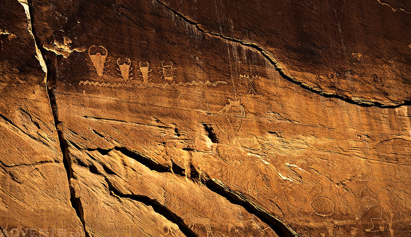
I soon spotted the large Fremont petroglyph panel I was looking for. It was high on the canyon wall, but I was able to climb to a ledge on the opposite side of the canyon for a view directly across from it.

There were a number of other petroglyph panels in the area, but many were hard to see and photograph.


Vermillion Creek Canyon

Mud Cracks

Headed back down the canyon after thoroughly exploring the area.

As you might be able to tell, I had a lot of fun photographing the mud cracks in this canyon.
Canyon Notch

This short hike reminded me that although I enjoy spending time above treeline in the mountains during the summer, the desert will always be my home ad I’m really looking forward to returning in just a few short weeks!
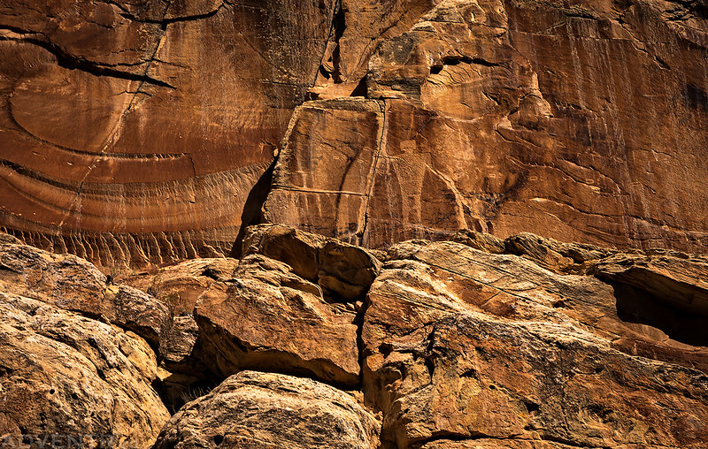
Colorful Canyon Wall

Looking back toward the canyon as I hiked back up to my Jeep.

Before finishing the drive into Browns Park I made one last stop at the Irish Canyon Petroglyphs.
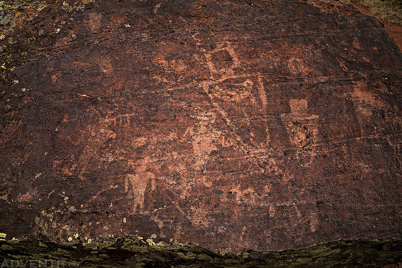
The Keymaster

Of course, I took the scenic drive through Irish Canyon while I was there.


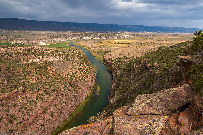
I finally made it to the Browns Park National Wildlife Refuge in the early afternoon and grabbed us a campsite along the Green River at the Crook Campground.

After having lunch in camp, I followed the River’s Edge Wildlife Drive all the way to the Swinging Bridge so I could check out the boat ramp. I also made sure to stop at all the viewpoints along the way and even spotted a pair of moose in the river, but they were too far away to get a photo.
Once I finished checking out the boat ramp that we would be using on Tuesday, I finally got my chance to drive over the Swinging Bridge! The last time I was here it had just been closed by a heavy tractor that had broken through and I wasn’t able to drive over it. It was actually closed for quite a while after that incident.

I followed the road on the other side of the river to an overlook of Swallow Canyon before turning around and heading back to camp. We would be floating through that canyon in just a couple of days, too.

A view of Browns Park from the rim of Swallow Canyon.
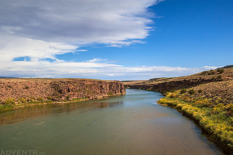
Looking downstream from the Swinging Bridge when I drove back over.
Warning Signs

The Green River in Browns Park during my drive back to camp.

When I returned to camp I found that Jackson and Chris had arrived and were setting up their tents. Shortly after they had everything set up, a strong but short-lived storm system with gusty winds and some rain blew through the area and chased us into our tents and vehicles for a bit.

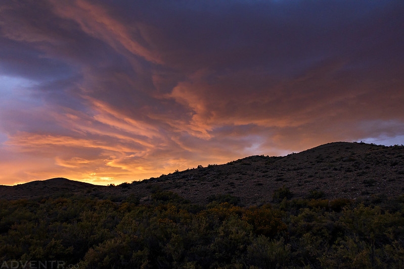
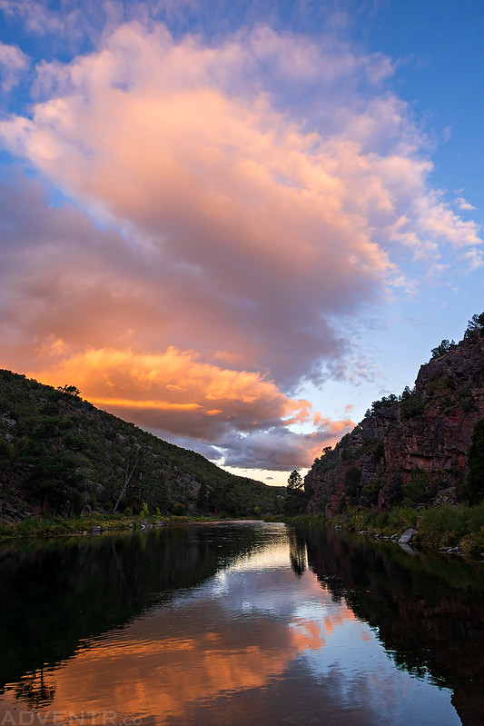
After the storm passed, the sun came out again and the light was looking nice, so I bushwhacked over to the edge of the river from camp for this view.

The clouds were looking good, too.
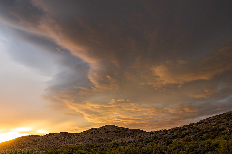
It was a great sunset to end my day in Browns Park!
When the sun had disappeared behind the hills to the west we tried to sit around outside and chat for a bit, but the mosquitoes were pretty terrible and chased us into our tents early. It wasn’t a big deal since we needed to get to bed for an early start on Sunday morning anyway.
The Green River: Red Canyon to Browns Park
Near the lower end of this canyon, to which we have given the name of Red Canyon, is a little park, where streams come down from the distant mountain summits and enter the river on either side; and here we camp for the night under two stately pines.
Major John Wesley Powell,
June 2, 1869
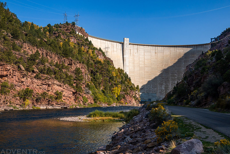
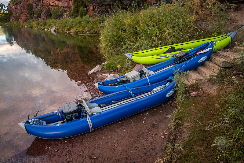
We woke up early on Sunday morning to load up our gear into my Jeep in the dark. We were going to leave Chris’ vehicle at Swinging Bridge and only take my vehicle to the put-in, so we had to fit all our gear and three people in my Jeep. We were able to made it work. While we were loading the Jeep up we found that the mosquitoes were even more horrendous in the morning. Seriously, they were some of the worst I have ever encountered, so we hurried as quickly as we could. Once everything was loaded into my Jeep we drove over to the Swinging Bridge, dropped off Chris’ vehicle and then made our way over into the Flaming Gorge National Recreation Area. After driving over the dam we stopped at the Flaming Gorge Resort to work out the details of our drop-off and shuttle. Since we didn’t have a trailer we were going to have them drop our boats off at the ramp below the dam and then they would shuttle my Jeep over to the Swinging Bridge so we wouldn’t have to come back this way after getting off the river. We rigged our boats in their parking lot and then they brought them down to the boat ramp below the dam. This ended up working out well for us and the price was very reasonable, so I would definitely use them again for shuttle services in the future.
Down below the Flaming Gorge Dam.
We met up with our boats at the ramp and finished getting them ready before getting on the water.

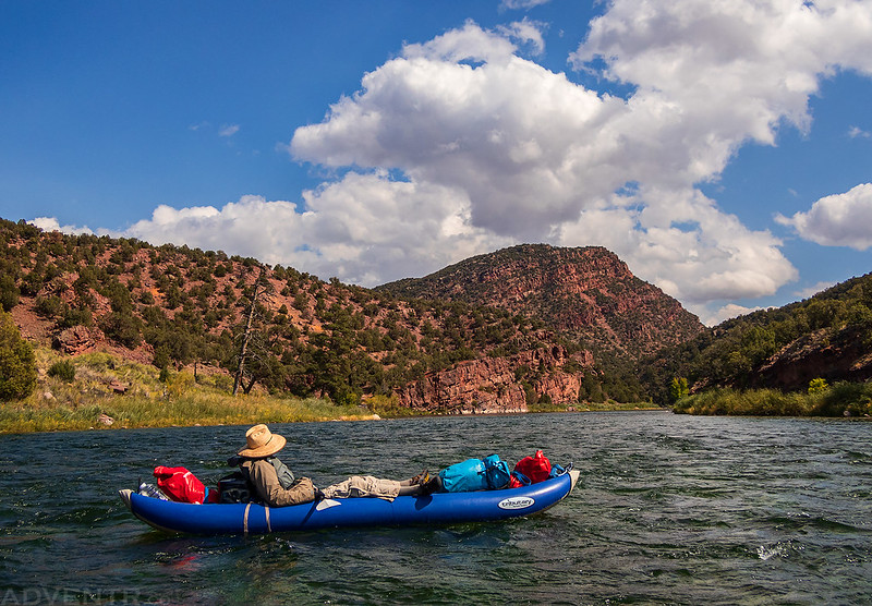
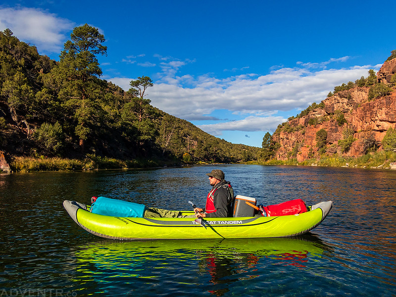
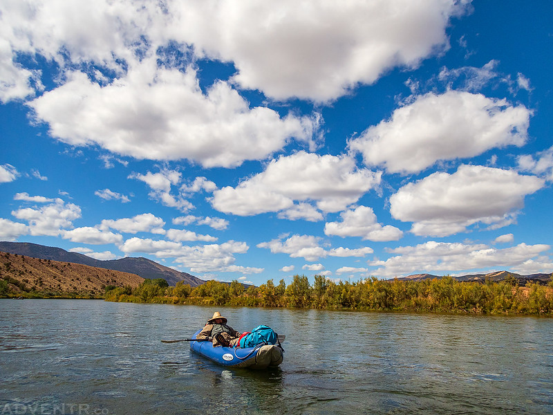
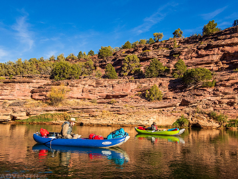
Soon we were floating down Section A on the Green River. This section of the river was moving pretty quickly with a bunch of riffles and small rapids along the way.
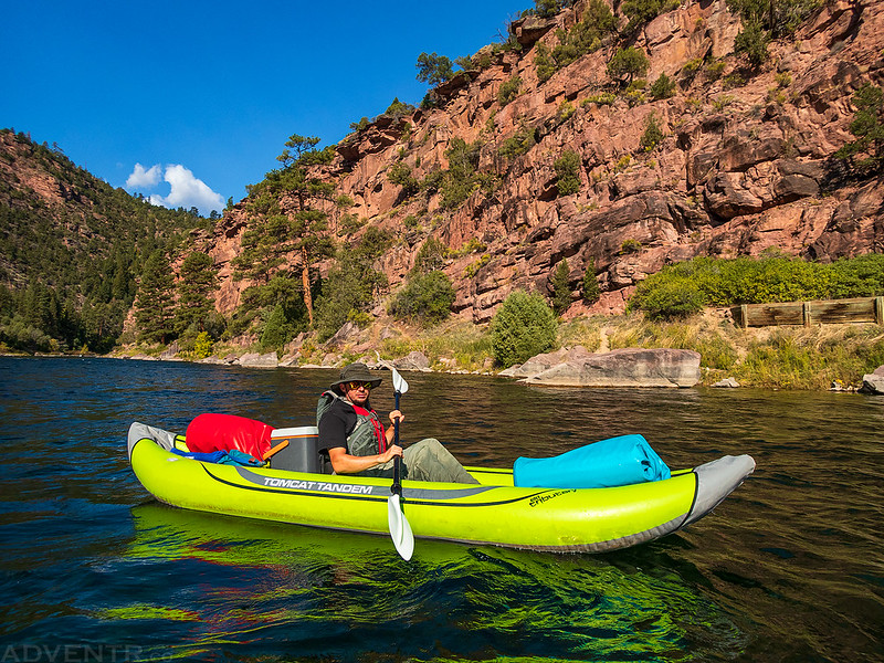
The water was cold and crystal clear since it was coming out of the bottom of the reservoir, which was quite an unusual experience for me since I am used to floating dirty desert rivers at this time of the year. We could also see plenty of fish through the clear water.

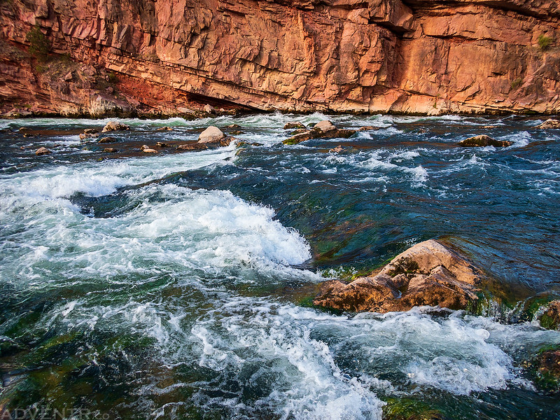
Red Canyon lived up to its name…

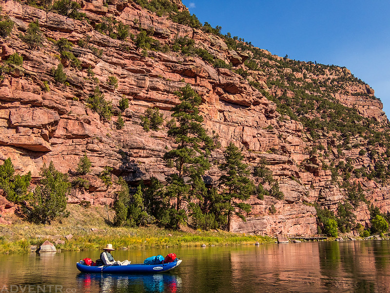


We stopped to have lunch at Little Hole, which is the end of Section A, and then we continued down Section B for a few more miles to our reserved campsite at Big Pine.

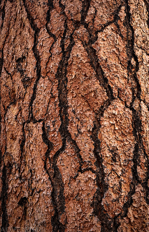
After about four hours on the water we reached the Big Pine II campsite that we had reserved in advance. You can see the bottom of the ‘big pine’ behind the sign. I wasn’t expecting the two sites to be so close together, so I was glad when no one else showed up to the other campsite and we had the place to ourselves.

There were some steps leading up out of the water to the campsites.

I didn’t bring a wide angle lens with me on this trip and couldn’t fit the entire ‘big pine’ into a photo, so here’s close look at the bark on the tree.
While the campsite was mostly pretty nice, there was one major issue; there were anthills and ants everywhere! You can see a lot of anthills in the photo below, but there were a ton of them all over the place. They were pretty annoying, but thankfully they were mostly black ants and there were only a few red ants around. This is what happens when people don’t keep a clean camp…

Jackson’s site was a little closer to the river and further away from the ants.
After we ate dinner the wind started to pick up and there was a little bit of rain. We heard some rumbles of thunder coming from the Browns Park area, but never actually saw any lightning. The temperature also cooled down very quickly, which was expected since we knew a strong cold front was moving into the area. The rest of the trip was going to be much cooler than we would have liked for this time of the year.
After the storm passed, the sun did come out for a little bit before sunset.
Rays of sun over the Green River.

We went to bed early again and even though it was pretty windy for the first half of the night, I slept pretty well. I woke up just in time to catch the sunrise on Monday morning, which was a good one!
Green River Sunrise

As you can see, the water level dropped overnight and our boats were now sitting on dry land. The Bureau of Reclamation releases more water during the day to generate electricity than they do overnight, so the river fluctuates throughout the day.
Although it was much cooler this morning and the high was only supposed to be in the 60’s, the canyon was still looking good.
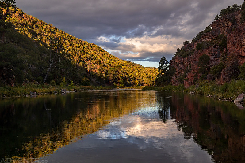

We packed up camp and were on the river by 9:30am, just as the sun was coming up over the canyon wall. We wore our rain gear this morning to keep dry and warm since we were going to be running the biggest rapid of the trip right away- Red Creek Rapids.
We stopped to scout Red Creek Rapids before proceeding.
Here’s a video I took of Jackson going through Red Creek Rapids…
…and here’s a video he took of me. Red Creek rapids was not as difficult as I was expecting, but I did get wet and was glad I had chosen to wear my rain gear.
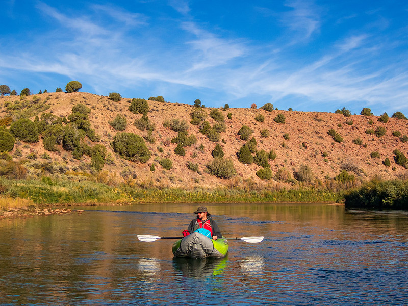
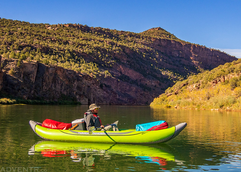
After Red Creek Rapids the river was slower and calmer for the rest of the trip. It was still a bit breezy out today, but thankfully it was mostly a tailwind.

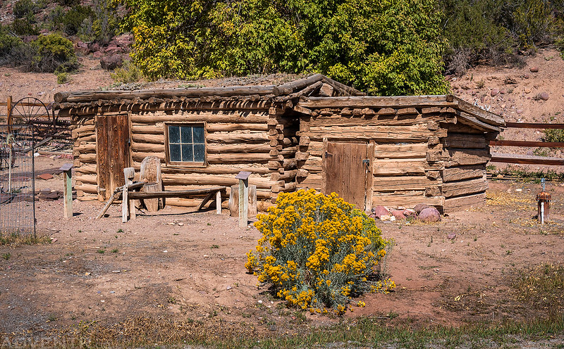
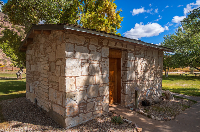
We stopped for lunch at the John Jarvie Historical Site and checked out all the historic buildings and structures while we were there.

Chicken Coop & Ice House
Water Wheel

Stone Building
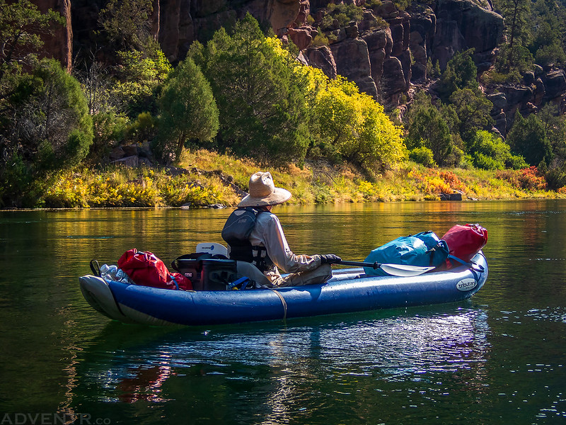
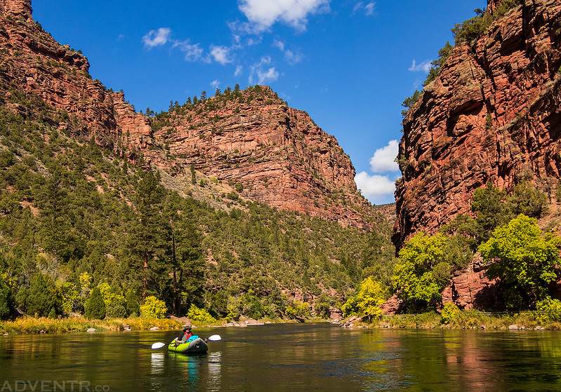
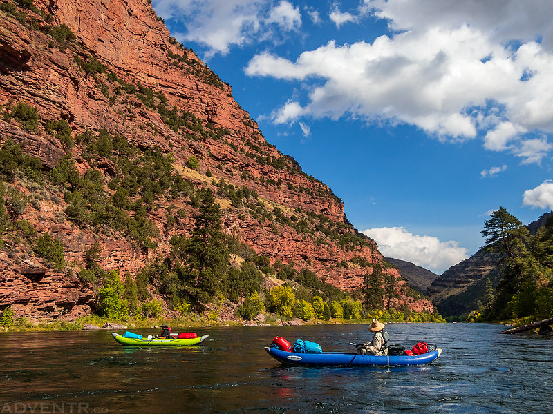
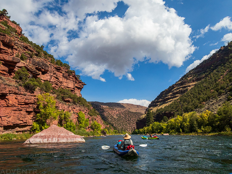
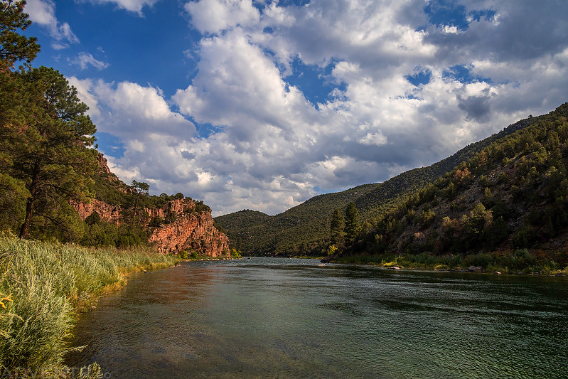
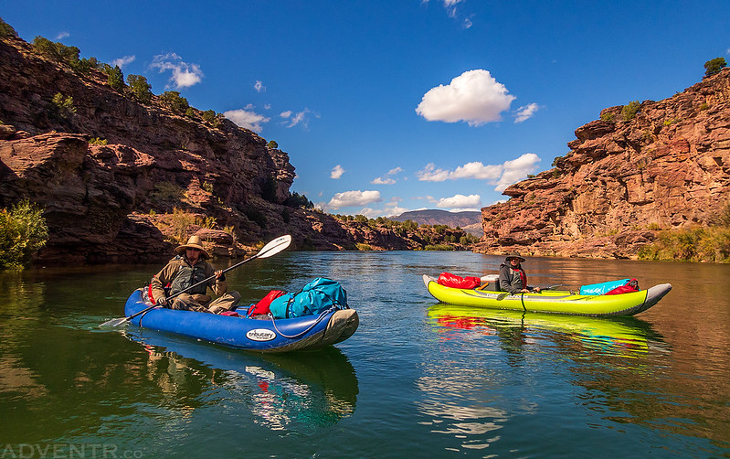
After lunch it was back on the water as we started down Section C through Browns Park.
The rest of the day was a nice relaxing float through Browns Park under puffy white clouds.

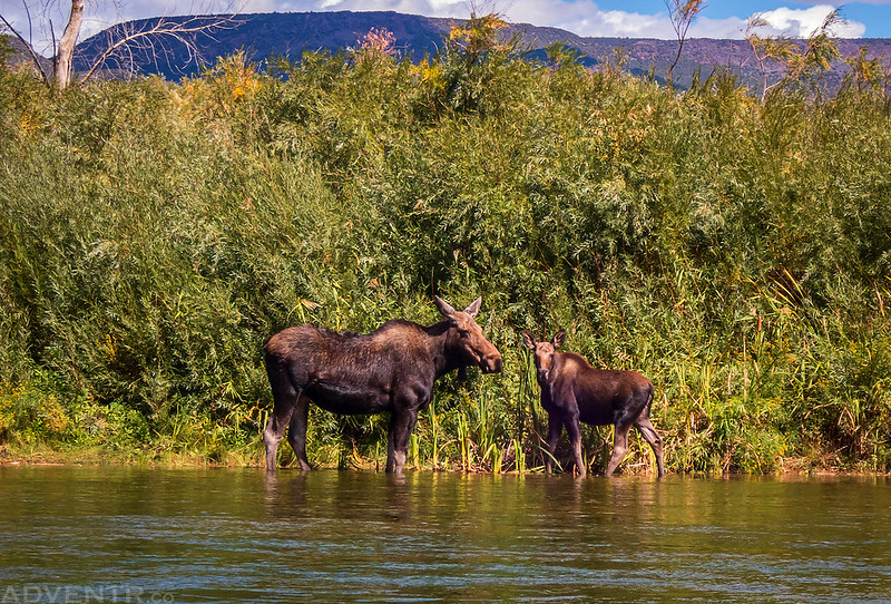
We passed another pair of moose in the river and they just watched us float by.
Floating through Little Swallow Canyon
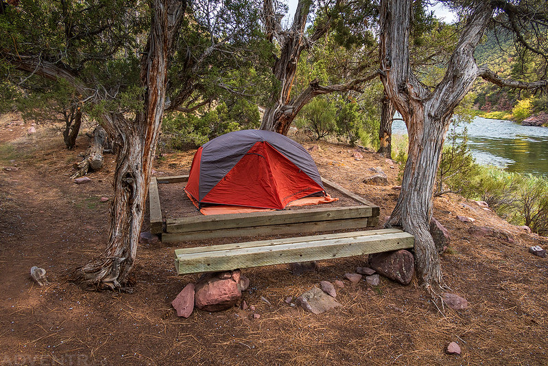
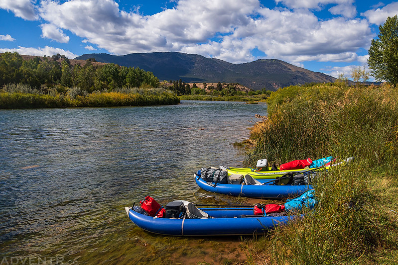
Shortly before entering Swallow Canyon we found a nice campsite on an island that was about as close to sandbar camping as we were going to get on this trip. It was a bit more gravel than sand, but still a good spot to spend the night.

In my opinion, this was by far the best campsite of the entire trip since there were no ants and minimal mosquitoes.

The evening view from camp wasn’t too bad, either!

We start early and run through Brown’s Park. Halfway down the valley, a spur of a red mountain stretches across the river, which cuts a canyon through it. Here the walls are comparatively low, but vertical. A vast number of swallows have built their adobe houses on the face of the cliffs, on either side of the river. The waters are deep and quiet, but the swallows are swift and noisy enough, sweeping by in their curved paths through the air or chattering from the rocks, while the young one stretch their little heads on naked necks through the doorways of their mud houses and clamor for food. They are noisy people. We call this Swallow Canyon.
Major John Wesley Powell,
June 4, 1869
After a cold night that got down into the mid 30’s we woke up with the sunrise and found our gear was covered with frost. It was a bit cold while taking down camp this morning.

Since it was cold out, I wore my rain gear again today and added neoprene socks to help keep my feet warm for our last morning on the river.
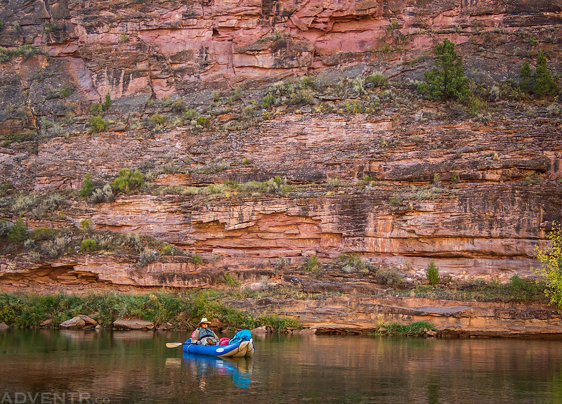
After rounding the bend downstream from camp we entered Swallow Canyon.

I believe Jackson and Chris were looking for fish in the water when I took this shot.
It was a quiet and slow float through Swallow Canyon.

Swallow’s Nests in Swallow Canyon

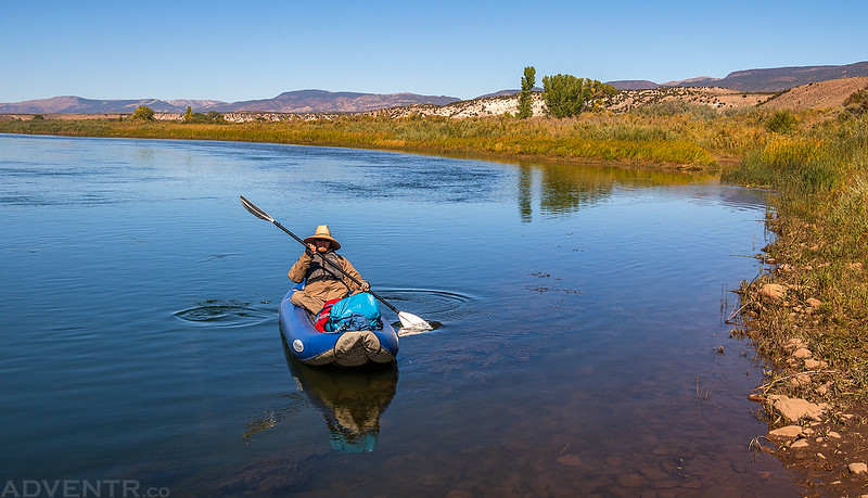
Just a relaxing Tuesday morning float…
Swallow Canyon Reflection

After leaving Swallow Canyon it was only a few more miles of flatwater through Browns Park to reach the Swinging Bridge.
We arrived at the Swinging Bridge Boat Ramp around 11:30am and thankfully my Jeep was there waiting. We loaded up and headed home. It was another nice September trip on the Green River!
Randy, you are the master of landscapes and petroglyphs. I loved all of these plus the moose
mom and calf. Lovely outings I am sure. You really do get out there!
Hi Randy! I recently discovered your trip reports, and they are fantastic!! I live in Rangely, and have really enjoyed learning about amazing things in our area that I have not been aware of before.
I am enamored of the part of this trip report where you hike into Vermillion Canyon. I’m having trouble finding directions to the trail you used…would you be able to help me?
Thanks so much, and enjoy your day!!