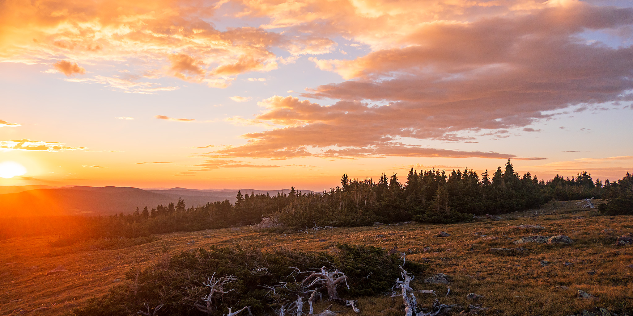
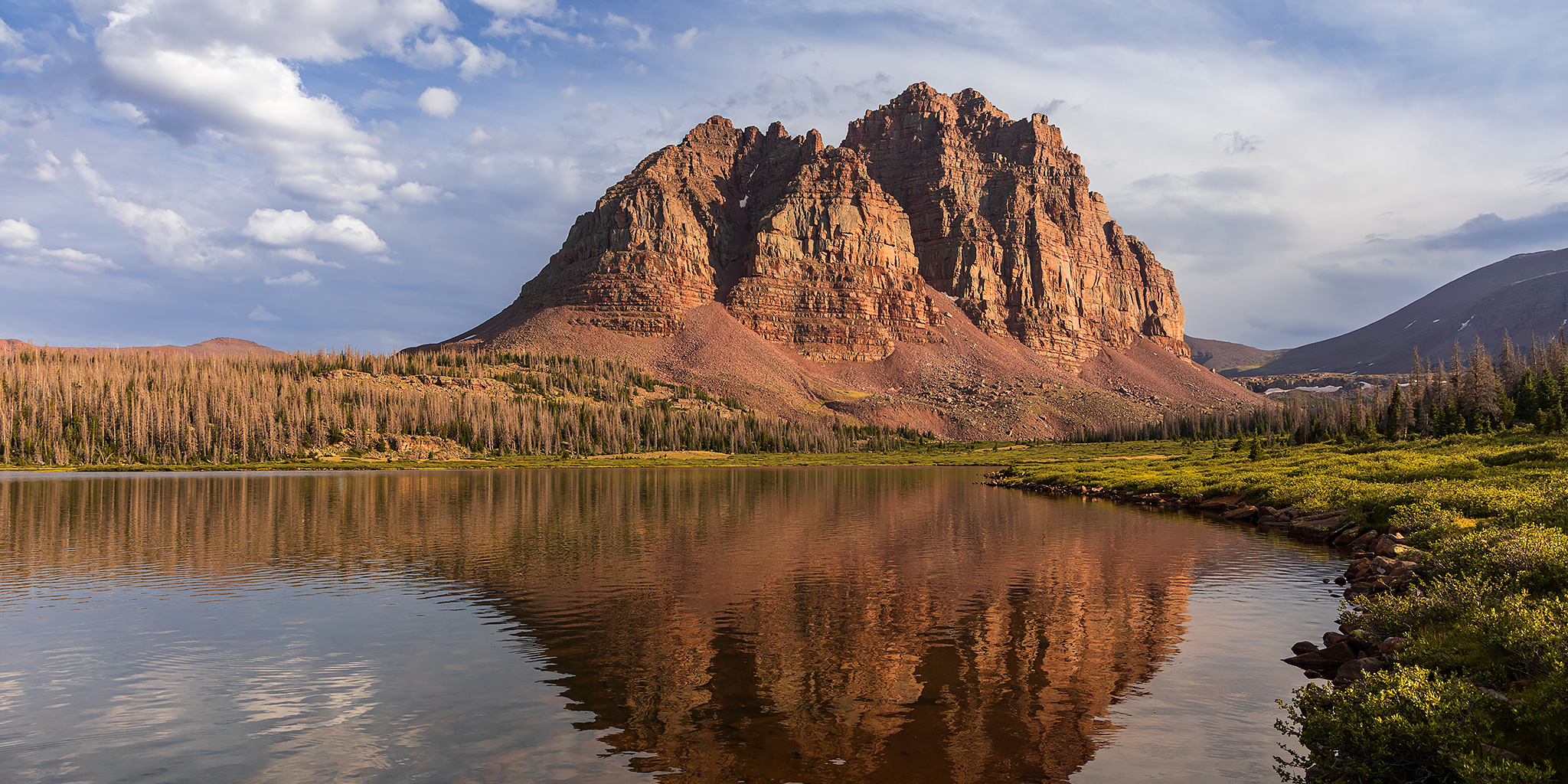
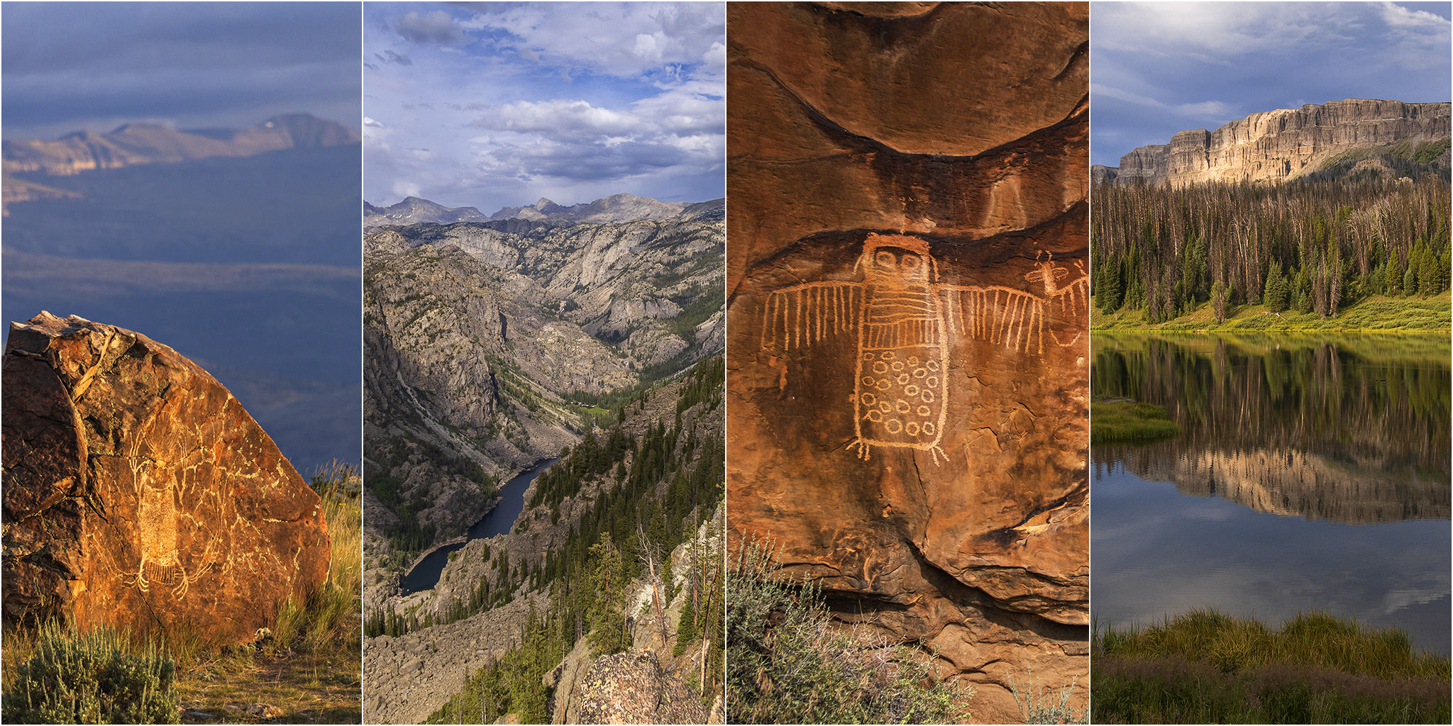
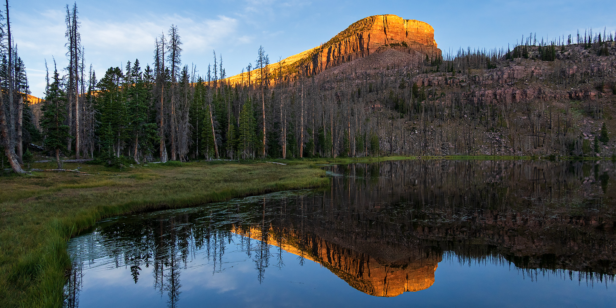
Press "Enter" to skip to content

Tag: uinta mountains

Wind River Country and the Absaroka Range

Encircling the Wind River Range: Rock Art of the Wind River & Bighorn Basin
Tuesday – Sunday, August 15-20, 2023

After spending the past three days on the Ruby – Horsethief section of the Colorado River it was time for our biennial return to the Wind River Range in Wyoming to begin. Ever since our first trip in 2017 to see the Great American Eclipse, we’ve made it our goal to try and return every other year, which so far we have been able to keep up. Although we have typically gone on a longer backpacking trip during each visit, this year I was more interested in visiting some rock art sites near the Wind River and in the Bighorn Basin that I’ve wanted to see for a long time. So with limited time preventing a longer backpacking trip, we instead looked into going on some shorter day hikes and even branched out into visiting the nearby Absaroka Range for the first time.

2 Comments

ABC’s of the Green River: Red Canyon to Browns Park

Flaming Gorge Dam to the Swinging Bridge | High CFS: 1,870 – Low CFS: 1,240
Saturday – Tuesday, September 18-21, 2021

The middle and latter part of September is probably my favorite time of the year to go on a nice relaxing river trip. The heat of summer is starting to diminish, but it’s still usually warm enough to go for a swim. The rivers are lower and slower making a more enjoyable trip for those of us who aren’t really into the swift water and big rapids. The low water also means there are a lot of sandbars for camping on, which is my favorite kind of camping. The nights are beginning to to get longer and cooler and most of the bugs are usually gone! What more could you ask for? After spending a few days on the Colorado River in Canyonlands National Park last September, this year Jackson, Chris and I decided to follow in the footsteps of John Wesley Powell again and check out the Green River just below the Flaming Gorge Dam from Red Canyon to Browns Park. This segment of the Green River is known as the ‘ABC’ section because it is divided into three different sections; Section A from the Flaming Gorge Dam to Little Hole is about 7 miles, Section B from Little Hole to Indian Crossing is about 8 miles, and Section C from Indian Crossing to Swinging Bridge is about 15 miles- for a total of about 30 miles. We planned to do the whole stretch.

2 Comments

Top of Utah: Kings Peak via Henrys Fork

Labor Day Weekend | Thursday – Sunday, August 30 – September 2, 2018

Last August when Diane and I were driving home through the eastern edge of the Uinta Mountains from our first backpacking trip in the Wind River Range in Wyoming, I mentioned that we needed to go on a backpacking trip into the High Uintas Wilderness in 2018, so I put it on our calendar for Labor Day weekend when I got back home. Fast forward a few months and it was time to start figuring out more specific plans for the trip. After looking at maps and our options, I figured that we might as well go all out and hike to the summit of Kings Peak which is the highest point in Utah. There are a couple of ways to get there, but Henrys Fork looked like the easiest and most popular way to go, so we thought it would be a good introduction to hiking in the High Uintas. Since I knew this was going to be a popular spot, especially during a holiday weekend, we took off Friday from work in hopes of getting a little bit of a head start. We left right after work on Thursday and drove over Douglas Pass and through the Book Cliffs to Vernal, where we stopped for a quick dinner. We almost hit a deer as we were driving through Manila, but other than that the drive was pretty uneventful. We arrived at the Henrys Fork Trailhead in the dark around 10:00pm and found a great spot to camp nearby. We quickly setup our tent and went right to bed. The sky was very clear and the stars and milky way were bright tonight!

Leave a Comment

Geostash Challenge 2009

Friday – Sunday, August 14-16, 2009

After being home for only 4 days (all of which I had to work) from my 9 day Colorado Adventure, I headed to northern Utah to spend the weekend at the NAXJA Intermountain Chapter’s Geostash Challenge. I’ve wanted to attend this event the last two years it was held, and finally decided I would drive up for it this year, even if I could not stay longer than a standard weekend (I didn’t want to take any more time off because of my previous week off). For those that are not familiar with this event, it’s basically like a poker run. In order to get your cards you need to find hidden geocaches that you are given the coordinates for. You need to find at least five of the hidden geocaches to get one poker hand. When you get back to camp for the dinner, the hands are analyzed and the best hands win some prizes. Since it’s put on by a Jeep club, the caches are hidden along 4×4 roads with some short hiking required to reach some.

Leave a Comment